Castell

Community in Glamorgan

Wales

Castell

Castle Square Swansea Castle Square Swansea the fountain
Castle Square Swansea Credit: Colin Prosser

Castell, Glamorgan is a small community located in the county of Glamorgan in South Wales, United Kingdom. It is situated on the southern coast of Wales, near the popular seaside town of Barry. The community is known for its picturesque landscapes, historic sites, and vibrant community spirit.

One of the main attractions in Castell is the historic Castell Castle, which dates back to the 12th century. The castle is a significant landmark in the area and offers visitors a glimpse into the rich history of the region. The surrounding area is also home to several other historic sites, including ancient burial mounds and standing stones, showcasing the area's ancient past.

In addition to its historical significance, Castell is also renowned for its natural beauty. The community is surrounded by stunning coastline and rolling hills, making it a popular destination for nature lovers and outdoor enthusiasts. There are numerous walking trails and cycling routes in the area, allowing visitors to explore the scenic landscapes at their own pace.

Despite its small size, Castell has a close-knit and welcoming community. The residents take great pride in their community and often organize various events and festivals throughout the year. These events provide an opportunity for locals and visitors to come together and celebrate the vibrant culture and heritage of the area.

Overall, Castell, Glamorgan is a charming community with a rich history, beautiful landscapes, and a strong sense of community spirit. It offers visitors a perfect blend of history, natural beauty, and a warm Welsh welcome.

If you have any feedback on the listing, please let us know in the comments section below.
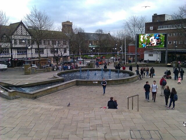
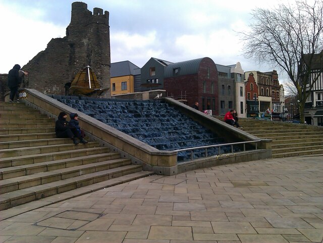
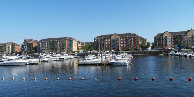
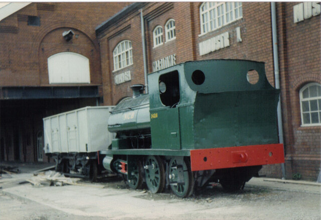
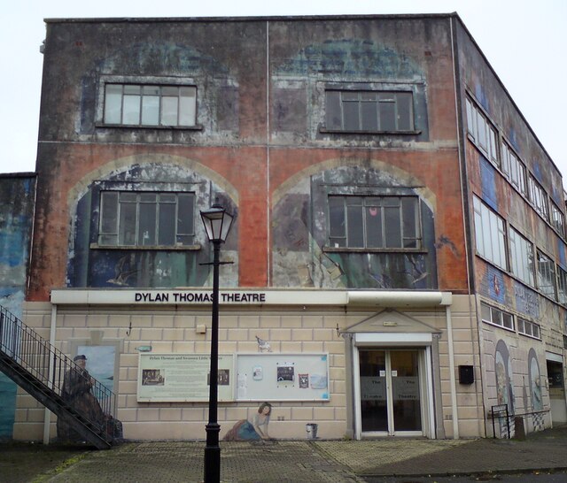
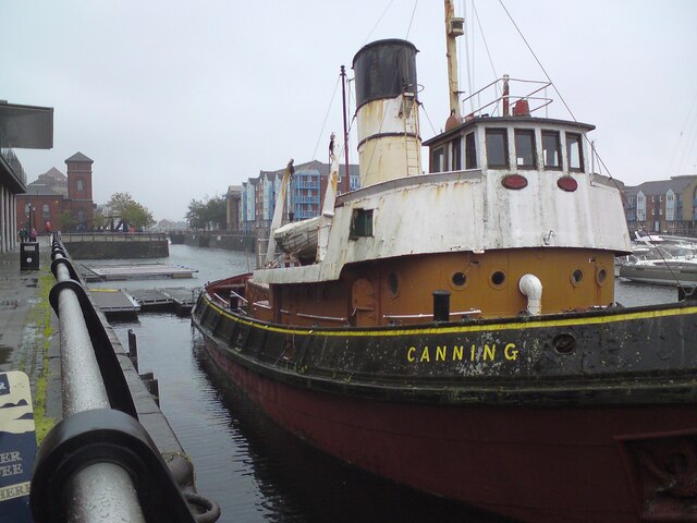
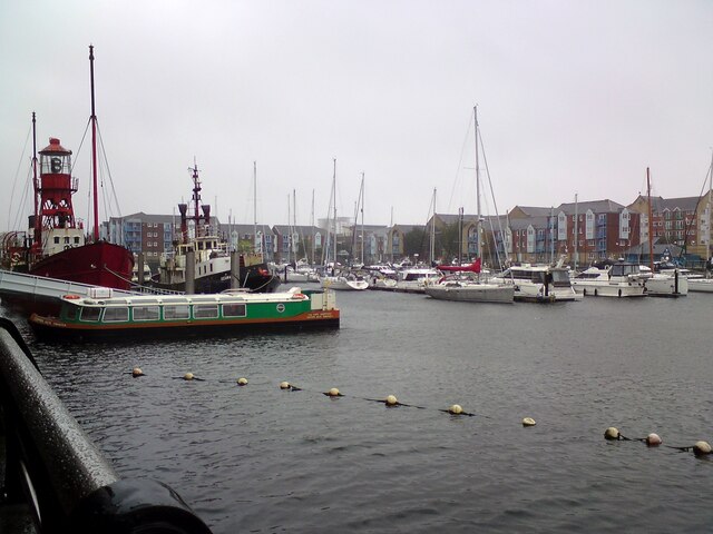
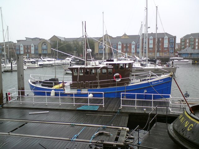
Castell Images

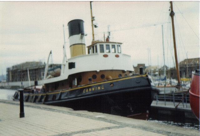
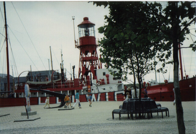
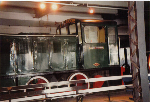
Images are sourced within 2km of 51.61871/-3.944708 or Grid Reference SS6592. Thanks to Geograph Open Source API. All images are credited.

Castle Square Swansea Castle Square Swansea the fountain
Castle Square Swansea
Castle Square Swansea the fountain
Swansea Castle Square Swansea Castle Square water feature
Swansea Castle Square
Swansea Castle Square water feature
Swansea Swansea Marina
Swansea
Swansea Marina
Swansea Swansea Maritime Museum, with NCB loco 1426
Swansea
Swansea Maritime Museum, with NCB loco 1426
Swansea Swansea Maritime Museum, with one of the older sea rescue boats Canning
Swansea
Swansea Maritime Museum, with one of the older sea rescue boats Canning
Swansea Swansea Maritime Museum, with one of the older rescue boats
Swansea
Swansea Maritime Museum, with one of the older rescue boats
Swansea Swansea Maritime Museum, with loco Dylan Thomas
Swansea
Swansea Maritime Museum, with loco Dylan Thomas
Ordnance Survey Cut Mark This OS cut mark can be found on the wall in front of No15 Harbour View. It marks a point 56.294m above mean sea level.
Ordnance Survey Cut Mark
This OS cut mark can be found on the wall in front of No15 Harbour View. It marks a point 56.294m above mean sea level.
Swansea museum Swansea museum
Swansea museum
Swansea museum
Swansea museum Swansea museum
Swansea museum
Swansea museum
Swansea museum Swansea museum, with and old peddle bike
Swansea museum
Swansea museum, with and old peddle bike
Swansea museum Swansea museum, with an Oystermouth tram on display
Swansea museum
Swansea museum, with an Oystermouth tram on display
Swansea museum Swansea museum, with and old motorbike
Swansea museum
Swansea museum, with and old motorbike
Swansea South Dock Outside the  National Waterfront Museum.
Swansea South Dock
Outside the National Waterfront Museum.
Dylan Thomas Theatre, Swansea Located on the corner of Dylan Thomas Square and Gloucester Place in Swansea's Maritime Quarter, the Dylan Thomas Theatre has been the home of the Swansea Little Theatre since 1979.
Dylan Thomas Theatre, Swansea
Located on the corner of Dylan Thomas Square and Gloucester Place in Swansea's Maritime Quarter, the Dylan Thomas Theatre has been the home of the Swansea Little Theatre since 1979.
Canning at Swansea Tug boat "Canning" was built in Liverpool in 1954. She is an oil-burning steam tug who worked out of Swansea Docks from 1966. She retired to Swansea Waterfront Museum in 1975.
Canning at Swansea
Tug boat "Canning" was built in Liverpool in 1954. She is an oil-burning steam tug who worked out of Swansea Docks from 1966. She retired to Swansea Waterfront Museum in 1975.
Swansea South Dock Marina 
South Dock was opened in 1859, seven years after construction had begun. It handled commercial shipping for well over a century, and was famous for its thriving fishmarket, which was established in 1905, and for the export of coal. It closed in 1971 but, within a few years, it had been acquired by the City Council and was being developed as the Marina we see today. <span class="nowrap"><a title="http://www.swanseadocks.co.uk/docksnewsite/southdock.html" rel="nofollow ugc noopener" href="http://www.swanseadocks.co.uk/docksnewsite/southdock.html">Link</a><img style="margin-left:2px;" alt="External link" title="External link - shift click to open in new window" src="https://s1.geograph.org.uk/img/external.png" width="10" height="10"/></span>

Moored outside the National Waterfront Museum on the left is Lightship Helwick No 91. Lightships are known by a number, rather than a name, because they are often moved between stations. Lightship No:91 was built in 1937. She began her working life on the Humber Station, but spent her last six years on active service marking the Helwick sand bank which lies in the Bristol Channel, ten miles off Mumbles Head. Like most lightships, LV91 could not move independently, she had to be towed to her station by tugs. Her diesel engines were used to compress air to sound the foghorn and to generate electricity to power the light.

LV91 was acquired by the museum for preservation on 1977, when she came out of service having been replaced by a vessel fitted with a helicopter landing pad. By 1987, the last lightship on Helwick Station was replaced by a LANBY (Light Aid to Navigation Buoy). She is included on the Historic Ships Committee’s Core Collection list mainly because she still has many of her original fittings and is generally considered to be the best example of a preserved lightship in Britain today.
Swansea South Dock Marina
South Dock was opened in 1859, seven years after construction had begun. It handled commercial shipping for well over a century, and was famous for its thriving fishmarket, which was established in 1905, and for the export of coal. It closed in 1971 but, within a few years, it had been acquired by the City Council and was being developed as the Marina we see today. LinkExternal link Moored outside the National Waterfront Museum on the left is Lightship Helwick No 91. Lightships are known by a number, rather than a name, because they are often moved between stations. Lightship No:91 was built in 1937. She began her working life on the Humber Station, but spent her last six years on active service marking the Helwick sand bank which lies in the Bristol Channel, ten miles off Mumbles Head. Like most lightships, LV91 could not move independently, she had to be towed to her station by tugs. Her diesel engines were used to compress air to sound the foghorn and to generate electricity to power the light. LV91 was acquired by the museum for preservation on 1977, when she came out of service having been replaced by a vessel fitted with a helicopter landing pad. By 1987, the last lightship on Helwick Station was replaced by a LANBY (Light Aid to Navigation Buoy). She is included on the Historic Ships Committee’s Core Collection list mainly because she still has many of her original fittings and is generally considered to be the best example of a preserved lightship in Britain today.
Radiant Queen 
Moored outside the National Waterfront Museum, Swansea South Dock Marina.
Radiant Queen
Moored outside the National Waterfront Museum, Swansea South Dock Marina.
Show me another place!

Castell is located at Grid Ref: SS6592 (Lat: 51.61871, Lng: -3.944708)

Unitary Authority: Swansea

Police Authority: South Wales

Also known as: Castle

What 3 Words

///guises.chain.green. Near Swansea

Nearby Locations

Castle Castell

Related Wikis

Quadrant Shopping Centre

The Quadrant Shopping Centre is the principal under-cover shopping centre in Swansea, Wales. The centre opened in 1979. From the 1980s to 2019 it was...

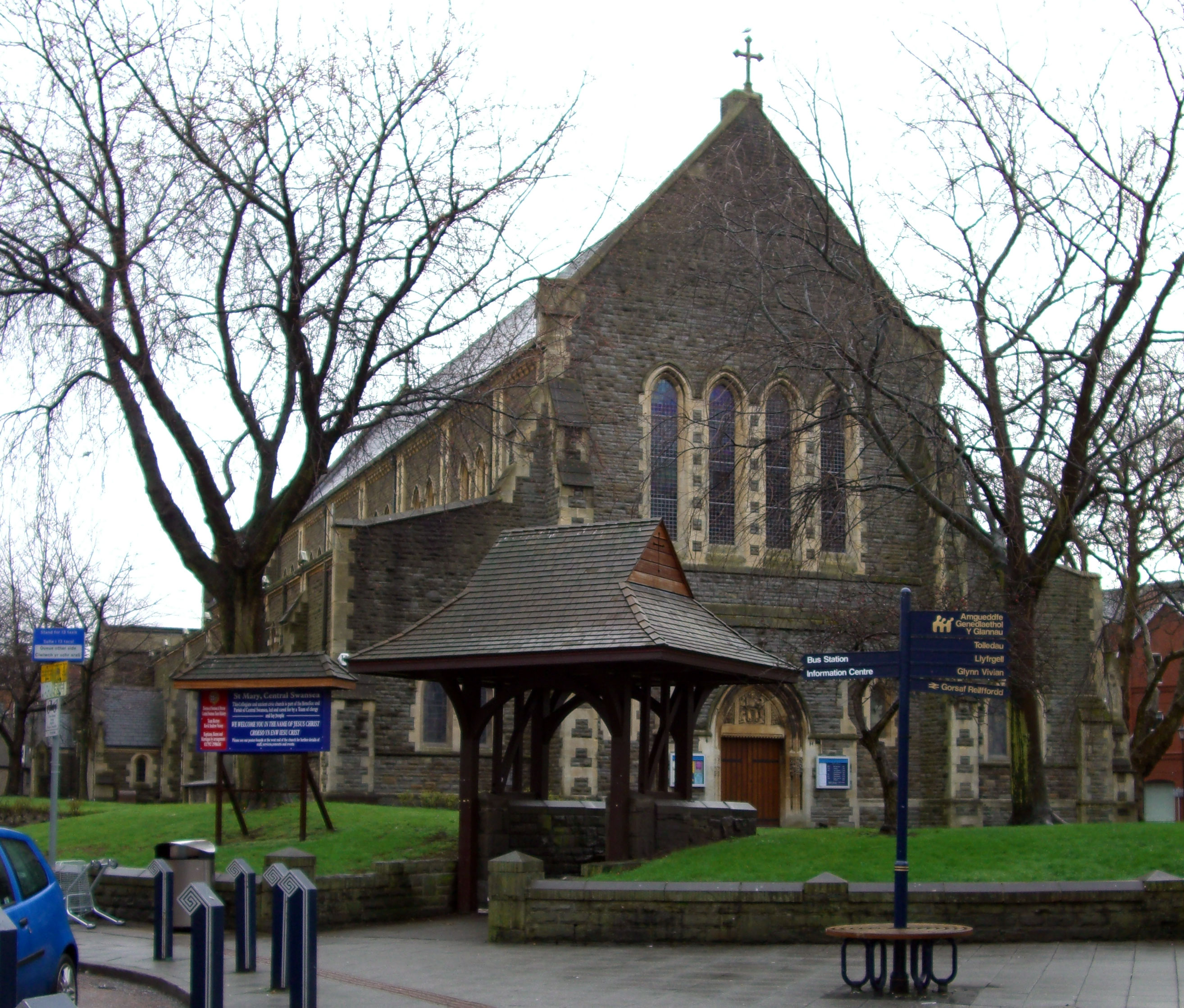
St Mary's Church, Swansea

St Mary's Collegiate and Parish Church is an Anglican church in the centre of Swansea, Wales, UK. It is considered the Civic Church of Swansea. There was...

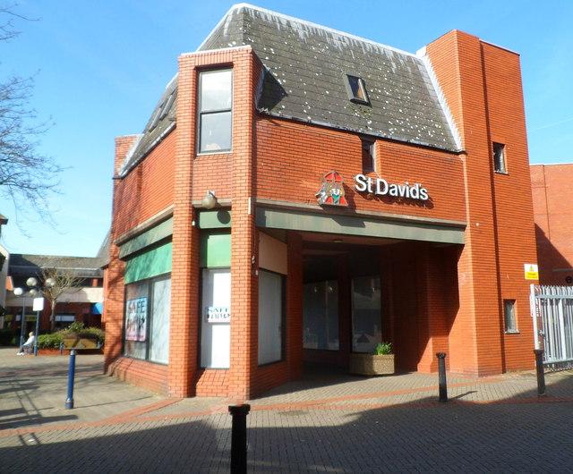
St. David's Shopping Centre (Swansea)

St. David's Shopping Centre is a shopping complex in Swansea, south Wales. The complex is located adjacent to the Quadrant Shopping Centre and opposite...

Swansea bus station

Swansea City bus station is a bus station serving Swansea, Wales. It lies immediately to the west of the Quadrant Shopping Centre. The station has 20 stands...

Nearby Amenities

Located within 500m of 51.61871,-3.944708
Swansea
Is In: Wales,UK
Is In Country: United Kingdom
Is In Historic County: Glamorganshire
Is In Preserved County: West Glamorgan
Name Br: Abertawe
Name Cy: Abertawe
Name El: Σουάνση
Name En: Swansea
Name Ga: Abertawe
Name Hu: Swansea
Name Ja: スウォンジ
Name Ko: 스완지
Name Lt: Svonsis
Name Mk: Свонзи
Name Ru: Суонси
Name Sr: Свонзи
Name Uk: Свонсі
Name Ur: سوانزی
Nat Name: Abertawe
Place: city
Population: 239000
Wikidata: Q23051
Wikipedia: en:Swansea
Lat/Long: 51.6195955/-3.9459248
Atm
Cash In: no
Check Date: 2022-08-14
Drive Through: no
Operator: Tesco Bank
Wheelchair: yes
Lat/Long: 51.6169105/-3.9447822
Traffic Signals
Traffic Signals Direction: forward
Lat/Long: 51.622175/-3.9465284
Crossing
Crossing: traffic_signals
Lat/Long: 51.6220856/-3.946328
Traffic Signals
Lat/Long: 51.6216678/-3.9422221
Traffic Signals
Button Operated: yes
Crossing: traffic_signals
Crossing Island: no
Traffic Signals: pedestrian_crossing
Traffic Signals Direction: both
Lat/Long: 51.6206255/-3.9418106
Give Way
Lat/Long: 51.6180636/-3.9491414
Crossing
Bicycle: yes
Button Operated: yes
Crossing: traffic_signals
Crossing Ref: toucan
Tactile Paving: no
Traffic Signals Sound: no
Traffic Signals Vibration: no
Lat/Long: 51.618048/-3.9489044
Traffic Signals
Crossing: no
Lat/Long: 51.6156935/-3.9457408
Mini Roundabout
Direction: clockwise
Lat/Long: 51.6196183/-3.9425934
Traffic Signals
Crossing: no
Lat/Long: 51.615504/-3.9451118
Traffic Signals
Lat/Long: 51.6204484/-3.94667
Crossing
Crossing: uncontrolled
Lat/Long: 51.6212538/-3.9475263
Crossing
Crossing: marked
Crossing Markings: yes
Tactile Paving: yes
Lat/Long: 51.6189249/-3.9484034
Crossing
Crossing: unmarked
Crossing Island: no
Crossing Markings: no
Kerb: flush
Tactile Paving: yes
Lat/Long: 51.6195204/-3.9380646
Crossing
Crossing: unmarked
Crossing Markings: no
Lat/Long: 51.6169385/-3.941744
Noexit: yes
Lat/Long: 51.6161186/-3.9463292
Noexit: yes
Lat/Long: 51.6157779/-3.9461292
Pub
Eli Jenkins
Addr Housenumber: 24-25
Addr Postcode: SA1 3AQ
Addr Street: Oxford Street
Fhrs Id: 65884
Operator: Stonegate
Operator Wikidata: Q7619176
Source Addr: FHRS Open Data
Website: https://www.greatukpubs.co.uk/eli-jenkins-swansea
Wikidata: Q80585373
Lat/Long: 51.6190239/-3.9476967
Pub
The Hanbury
Addr Housenumber: 43
Addr Postcode: SA1 5HG
Addr Street: The Kingsway
Fhrs Id: 442811
Source Addr: FHRS Open Data
Wikidata: Q80859768
Lat/Long: 51.6211365/-3.9440272
Traffic Signals
Crossing: no
Lat/Long: 51.6146921/-3.9475048
Barrier: hampshire_gate
Lat/Long: 51.6186852/-3.9427811
Courthouse
Swansea Civil Justice Centre
Name Cy: Canolfan Llysoedd Sifil Abertawe
Lat/Long: 51.620252/-3.937913
Entrance: main
Lat/Long: 51.622067/-3.9454728
Bank
Halifax
Addr City: Swansea
Addr Country: GB
Addr Housenumber: 22-23
Addr Postcode: SA1 5TX
Addr Street: Union Street
Atm: yes
Brand: Halifax
Brand Wikidata: Q3310164
Brand Wikipedia: en:Halifax (bank)
Check Date: 2023-08-02
Operator: Lloyds
Lat/Long: 51.6202684/-3.9467601
Restaurant
Vojon
Addr Housenumber: 13
Addr Postcode: SA1 4AW
Addr Street: St Helens Road
Cuisine: indian
Fhrs Id: 135700
Source Addr: FHRS Open Data
Lat/Long: 51.6187252/-3.9513865
Restaurant
Wagamama
Addr Postcode: SA1 1EE
Addr Street: Wind Street
Brand: Wagamama
Brand Wikidata: Q503715
Check Date: 2024-02-23
Cuisine: asian
Level: 0
Opening Hours: Mo-Th,Su 11:00-22:00; Fr-Sa 11:00-23:00
Website: https://wagamama.com/restaurants/swansea/swansea
Lat/Long: 51.61883/-3.9383114
Restaurant
TGI Fridays
Addr Housename: The City Gates
Addr Housenumber: 39-40
Addr Postcode: SA1 1EE
Addr Street: Wind Street
Brand: TGI Fridays
Brand Wikidata: Q1524184
Brand Wikipedia: en:TGI Fridays
Cuisine: american
Fhrs Id: 61228
Source Addr: FHRS Open Data
Wheelchair: yes
Lat/Long: 51.6189585/-3.9386485
Premier Inn
Addr City: Swansea
Addr Housename: The City Gates
Addr Postcode: SA1 1EE
Addr Street: Wind Street
Brand: Premier Inn
Brand Wikidata: Q2108626
Brand Wikipedia: en:Premier Inn
Fhrs Id: 51622
Internet Access: wlan
Internet Access Fee: customers
Internet Access Operator: Virgin Media
Internet Access Ssid: Premier Inn Free Wi-Fi
Operator: Whitbread
Source Addr: FHRS Open Data
Tourism: hotel
Lat/Long: 51.6188197/-3.9386825
Eddie Rocket's
Addr Housename: York Chambers
Addr Postcode: SA1 3LZ
Addr Street: York Street
Disused Amenity: restaurant
Fhrs Id: 63095
Source Addr: FHRS Open Data
Wheelchair: limited
Lat/Long: 51.6182533/-3.9390448
Bar
Bunkers
Leisure: miniature_golf
Level: 1
Lat/Long: 51.6187932/-3.9383035
Chiquitos
Addr Housename: The City Gates
Addr Postcode: SA1 1ED
Addr Street: Little Wind Street
Check Date: 2022-07-16
Disused Amenity: restaurant
Fhrs Id: 61601
Source Addr: FHRS Open Data
Wheelchair: yes
Lat/Long: 51.6186279/-3.9383677
Bierkeller
Disused Amenity: pub
Lat/Long: 51.618371/-3.9385779
Fiction
Addr City: Swansea
Addr Postcode: SA1 1ED
Addr Street: Little Wind Street
Disused Amenity: nightclub
Lat/Long: 51.6187143/-3.9387477
Check Date: 2022-07-16
Disused Amenity: pub
Disused Name: The Pit
Lat/Long: 51.6196391/-3.938907
Traffic Signals
Crossing: no
Lat/Long: 51.615557/-3.9451467
Crossing
Crossing: traffic_signals
Tactile Paving: yes
Lat/Long: 51.6156621/-3.9458894
Traffic Signals
Lat/Long: 51.6152983/-3.9455208
Traffic Signals
Lat/Long: 51.6154465/-3.945975
Post Box
Check Date: 2021-12-18
Collection Times: Mo-Fr 17:00; Sa 10:45
Ref: SA1 4
Royal Cypher: EIIR
Royal Cypher Wikidata: Q33102113
Lat/Long: 51.620878/-3.9454884
Addr City: Swansea
Addr Country: GB
Addr Housenumber: 62
Addr Postcode: SA1 5HN
Addr Street: Kingsway
Lat/Long: 51.6204791/-3.9459871
Addr City: Swansea
Addr Country: GB
Addr Housenumber: 61
Addr Postcode: SA1 5HN
Addr Street: Kingsway
Lat/Long: 51.620503/-3.9459033
Cafe
The Cwtch
Addr City: Swansea
Addr Country: GB
Addr Housenumber: 9
Addr Postcode: SA1 3PP
Addr Street: Caer Street
Lat/Long: 51.6198267/-3.9421513
Fast Food
Subway
Addr City: Swansea
Addr Country: GB
Addr Housenumber: 21
Addr Postcode: SA1 3EH
Addr Street: Union Street
Brand: Subway
Brand Wikidata: Q244457
Brand Wikipedia: en:Subway (restaurant)
Contact Website: https://restaurants.subway.com/united-kingdom/wa/swansea/21-union-street
Cuisine: sandwich
Delivery: no
Drive Through: no
Fhrs Id: 61138
Seating: indoor
Smoking: no
Takeaway: yes
Wheelchair: yes
Lat/Long: 51.6202115/-3.9465731
El Greco's Dance Club
Sport: dancing
Lat/Long: 51.6203096/-3.9463223
Post Office
The City Of Swansea Post Office
Addr City: Swansea
Addr Country: GB
Addr Place: The Quadrant Shopping Centre
Addr Postcode: SA1 3QW
Addr Unit: 37
Brand: Post Office
Brand Wikidata: Q1783168
Check Date: 2023-04-02
Level: 1
Name Cy: Swyddfa'r Post Dinas Abertawe
Opening Hours: Mo-Sa 09:00-17:00
Operator: WHSmith
Ref Pol Id: 89470
Website: https://www.postoffice.co.uk/branch-finder/1956426/the-city-of-swansea
Wheelchair: yes
Lat/Long: 51.6185898/-3.9456456
Cafe
Kardomah
Addr City: Swansea
Addr Country: GB
Addr Housenumber: 11
Addr Postcode: SA1 3DH
Addr Street: Portland Street
Fhrs Id: 132748
Note: This isn't the 'Kardomah' frequented by Dylan Thomas and his gang. That was on Castle Bailey Street, and flattened by the Luftwaffe in 1941
Opening Hours: Mo-Fr 07:30-16:30, Su 07:30-16:30
Phone: +44 1792 652336
Smoking: no
Website: http://www.kardomahcoffeeshop.co.uk/
Lat/Long: 51.6204817/-3.9451641
Cafe
O'Briens Sandwich Bar
Indoor: area
Indoor Level: 0
Wheelchair: yes
Lat/Long: 51.6183441/-3.9450406
Cafe
The Gallery
Indoor: amenity
Indoor Level: 1
Level: 1
Wheelchair: yes
Lat/Long: 51.6183738/-3.9448267
Cafe
Costa
Addr City: Swansea
Addr Housenumber: 37
Addr Postcode: SA1 3QW
Addr Street: The Quadrant Shopping Centre
Branch: at W H Smiths
Brand: Costa
Brand Wikidata: Q608845
Cuisine: coffee_shop
Delivery: no
Level: 1
Operator: Costa
Outdoor Seating: no
Smoking: no
Takeaway: yes
Wheelchair: yes
Lat/Long: 51.6186466/-3.9456003
Access: permissive
Entrance: main
Level: 0
Lat/Long: 51.6186965/-3.945493
Barrier: bollard
Bollard: fixed
Material: metal
Lat/Long: 51.6175095/-3.9421652
Bus Stop
Picton Arcade
Bus: yes
Departures Board: no
Local Ref: a
Naptan AtcoCode: 5810AWC50002
Naptan Bearing: W
Naptan CommonName: Picton Arcade (a)
Naptan Crossing: Dilwyn Street
Naptan NaptanCode: swajdmw
Naptan PlusbusZoneRef: SWANSEA
Naptan Street: Oxford Street
Naptan Verified: no
Network: First Cymru
Public Transport: platform
Shelter: no
Source: naptan_import
Lat/Long: 51.6188236/-3.9485294
Bus Stop
Quaker Meeting House
Bench: no
Bin: no
Bus: yes
Lit: yes
Naptan AtcoCode: 5810AWC50015
Naptan Bearing: NE
Naptan CommonName: Quaker Meeting House
Naptan Crossing: Nicholl Street
Naptan Landmark: Quaker Meeting House
Naptan NaptanCode: swadgwt
Naptan PlusbusZoneRef: SWANSEA
Naptan Street: St Helen`s Road
Public Transport: platform
Shelter: no
Source: naptan_import
Tactile Paving: no
Lat/Long: 51.6189952/-3.9511949
Kingsway
Disused Highway: bus_stop
Local Ref: e
Naptan AtcoCode: 5810AWC50315
Naptan Bearing: SW
Naptan CommonName: Kingsway (e)
Naptan Crossing: Dynevor Place
Naptan Landmark: Mount Pleasant Church
Naptan NaptanCode: swamtdg
Naptan PlusbusZoneRef: SWANSEA
Naptan ShortCommonName: Mount Pleasant Church
Naptan Street: The Kingsway
Naptan Verified: no
Source: naptan_import
Lat/Long: 51.6211475/-3.9443921
Kingsway
Disused Highway: bus_stop
Local Ref: d
Naptan AtcoCode: 5810AWC50316
Naptan Bearing: SW
Naptan CommonName: Kingsway (d)
Naptan Crossing: Dynevor Place
Naptan Landmark: Motorworld
Naptan NaptanCode: swamtdj
Naptan PlusbusZoneRef: SWANSEA
Naptan ShortCommonName: Motorworld
Naptan Street: The Kingsway
Naptan Verified: no
Source: naptan_import
Lat/Long: 51.6211272/-3.9444565
Kingsway
Disused Highway: bus_stop
Local Ref: c
Naptan AtcoCode: 5810AWC50317
Naptan Bearing: SW
Naptan CommonName: Kingsway (c)
Naptan Crossing: Park Street
Naptan Landmark: McDonalds
Naptan NaptanCode: swamtdm
Naptan PlusbusZoneRef: SWANSEA
Naptan ShortCommonName: McDonalds
Naptan Street: The Kingsway
Naptan Verified: no
Source: naptan_import
Lat/Long: 51.6206309/-3.9458331
Kingsway
Disused Highway: bus_stop
Local Ref: b
Naptan AtcoCode: 5810AWC50318
Naptan Bearing: SW
Naptan CommonName: Kingsway (b)
Naptan Crossing: Park Street
Naptan Landmark: Pizza Hut
Naptan NaptanCode: swamtdp
Naptan PlusbusZoneRef: SWANSEA
Naptan ShortCommonName: Pizza Hut
Naptan Street: The Kingsway
Naptan Verified: no
Source: naptan_import
Lat/Long: 51.6205557/-3.9460321
Kingsway
Disused Highway: bus_stop
Local Ref: a
Naptan AtcoCode: 5810AWC50319
Naptan Bearing: SW
Naptan CommonName: Kingsway (a)
Naptan Crossing: Union Street
Naptan Landmark: Optic Shop
Naptan NaptanCode: swamtdt
Naptan PlusbusZoneRef: SWANSEA
Naptan ShortCommonName: Optic Shop
Naptan Street: The Kingsway
Naptan Verified: no
Source: naptan_import
Lat/Long: 51.6204991/-3.9461886
Bus Stop
Christina Street (b)
Bench: yes
Bus: yes
Local Ref: Ea
Naptan AtcoCode: 5810AWC50320
Naptan Bearing: NW
Naptan CommonName: Christina Street (b)
Naptan NaptanCode: swampja
Naptan PlusbusZoneRef: SWANSEA
Naptan Street: Christina Street
Naptan Verified: no
Public Transport: platform
Shelter: yes
Source: naptan_import
Lat/Long: 51.6200324/-3.949116
Bus Stop
High Street
Bench: no
Bin: no
Bus: yes
Flag: no
Lit: no
Local Ref: Hc
Naptan AtcoCode: 5810AWC50323
Naptan Bearing: N
Naptan CommonName: High Street 1
Naptan Landmark: Swansea Argos
Naptan NaptanCode: swampda
Naptan PlusbusZoneRef: SWANSEA
Naptan ShortCommonName: Swansea Argos
Naptan Street: High Street
Naptan Verified: no
Public Transport: platform
Shelter: no
Source: naptan_import
Lat/Long: 51.6219923/-3.9423663
Bus Stop
High Street
Bench: no
Bin: no
Bus: yes
Flag: yes
Lit: no
Local Ref: Hb
Naptan AtcoCode: 5810AWC50324
Naptan Bearing: N
Naptan CommonName: High Street 2
Naptan Landmark: Swansea Unitarian Church
Naptan NaptanCode: swampdg
Naptan PlusbusZoneRef: SWANSEA
Naptan ShortCommonName: Swansea Unitarian Church
Naptan Street: High Street
Naptan Verified: no
Public Transport: platform
Shelter: no
Source: naptan_import
Lat/Long: 51.6221004/-3.9423565
Bus Stop
Swansea Sainsbury
Bench: yes
Bin: yes
Bus: yes
Naptan AtcoCode: 5810AWC50328
Naptan Bearing: SW
Naptan CommonName: Swansea Sainsbury SW
Naptan NaptanCode: swamjpw
Naptan PlusbusZoneRef: SWANSEA
Naptan Street: Quay Parade
Public Transport: platform
Shelter: yes
Source: naptan_import
Tactile Paving: no
Lat/Long: 51.6193352/-3.937568
Bus Stop
St Mary's Church
Bus: yes
Local Ref: Sb
Naptan AtcoCode: 5810AWC50333
Naptan Bearing: NW
Naptan CommonName: St Mary`s Church 1
Naptan Crossing: St Mary`s Square
Naptan NaptanCode: swajdpt
Naptan PlusbusZoneRef: SWANSEA
Naptan ShortCommonName: Princess Way
Naptan Street: Princess Way
Naptan Verified: yes
Note: Previously stop D until late 2018
Public Transport: platform
Ref: B
Source: naptan_import
Lat/Long: 51.6192742/-3.9423809
St Mary's Church
Bus: yes
Disused Highway: bus_stop
Disused Public Transport: platform
Local Ref: Sc
Naptan AtcoCode: 5810AWC50334
Naptan Bearing: NW
Naptan CommonName: St Mary's Church 2
Naptan Crossing: St Mary's Square
Naptan NaptanCode: swajdpw
Naptan PlusbusZoneRef: SWANSEA
Naptan ShortCommonName: Princess Way
Naptan Street: Princess Way
Naptan Verified: yes
Source: naptan_import
Lat/Long: 51.6192348/-3.9422961
St Mary's Church
Bus: yes
Disused Highway: bus_stop
Disused Public Transport: platform
Local Ref: Sb
Naptan AtcoCode: 5810AWC50335
Naptan Bearing: NW
Naptan CommonName: St Mary's Church 3
Naptan Crossing: St Mary's Square
Naptan NaptanCode: swajdta
Naptan PlusbusZoneRef: SWANSEA
Naptan ShortCommonName: Princess Way
Naptan Street: Princess Way
Naptan Verified: yes
Source: naptan_import
Lat/Long: 51.6193398/-3.9423997
Bus Stop
Swansea Leisure Centre
Bus: yes
Naptan AtcoCode: 5810AWC50336
Naptan Bearing: SW
Naptan CommonName: Swansea Leisure Centre
Naptan Crossing: Princess Way
Naptan Landmark: Swansea Leisure Centre
Naptan NaptanCode: swamjpj
Naptan PlusbusZoneRef: SWANSEA
Naptan Street: Oystermouth Road
Naptan Verified: no
Public Transport: platform
Source: naptan_import
Lat/Long: 51.6172909/-3.9411065
Bus Stop
Swansea Civic Centre 1
Bench: yes
Bin: no
Bus: yes
Lit: yes
Local Ref: Mk
Naptan AtcoCode: 5810AWC50337
Naptan Bearing: E
Naptan CommonName: Swansea Civic Centre 1
Naptan Landmark: Swansea Civic Centre
Naptan NaptanCode: swadgma
Naptan PlusbusZoneRef: SWANSEA
Naptan Street: Private Road
Public Transport: platform
Shelter: yes
Source: naptan_import
Tactile Paving: yes
Lat/Long: 51.6146546/-3.9477137
Quadrant Bay V
Naptan AtcoCode: 5810AWC50338
Naptan CommonName: Quadrant Bay 1
Naptan Crossing: Plymouth Street
Naptan Landmark: Swansea Quadrant Bus Station
Naptan NaptanCode: swamtpw
Naptan PlusbusZoneRef: SWANSEA
Naptan Street: West Way
Network: First Cymru
Note: Legacy stop details from before bus station was refurbished
Operator: Swansea Council
Source: naptan_import
Lat/Long: 51.618118/-3.9468384
Quadrant Bay I
Naptan AtcoCode: 5810AWK65002
Naptan CommonName: Quadrant Bay 14
Naptan Crossing: Plymouth Street
Naptan Landmark: Swansea Quadrant Bus Station
Naptan NaptanCode: swamtwa
Naptan PlusbusZoneRef: SWANSEA
Naptan Street: West Way
Network: First Cymru
Note: Legacy stop details from before bus station was refurbished
Operator: Swansea Council
Source: naptan_import
Lat/Long: 51.6176521/-3.9462216
Quadrant Bay H
Naptan AtcoCode: 5810AWK65003
Naptan CommonName: Quadrant Bay 15
Naptan Crossing: Plymouth Street
Naptan Landmark: Swansea Quadrant Bus Station
Naptan NaptanCode: swamtwd
Naptan PlusbusZoneRef: SWANSEA
Naptan Street: West Way
Network: First Cymru
Note: Legacy stop details from before bus station was refurbished
Operator: Swansea Council
Source: naptan_import
Lat/Long: 51.617603/-3.94619
Quadrant Bay G
Departures Board: realtime
Naptan AtcoCode: 5810AWK65004
Naptan CommonName: Quadrant Bay 16
Naptan Crossing: Plymouth Street
Naptan Landmark: Swansea Quadrant Bus Station
Naptan NaptanCode: swamtwg
Naptan PlusbusZoneRef: SWANSEA
Naptan Street: West Way
Network: First Cymru
Note: Legacy stop details from before bus station was refurbished
Operator: Swansea Council
Source: naptan_import
Lat/Long: 51.6175567/-3.9461622
Quadrant Bay F
Naptan AtcoCode: 5810AWK65005
Naptan CommonName: Quadrant Bay 17
Naptan Crossing: Wellington Street
Naptan Landmark: Swansea Quadrant Bus Station
Naptan NaptanCode: swamtwj
Naptan PlusbusZoneRef: SWANSEA
Naptan Street: West Way
Network: First Cymru
Note: Legacy stop details from before bus station was refurbished
Operator: Swansea Council
Source: naptan_import
Lat/Long: 51.6175117/-3.9461476
Quadrant Bay E
Naptan AtcoCode: 5810AWK65007
Naptan CommonName: Quadrant Bay 18
Naptan Crossing: Wellington Street
Naptan Landmark: Swansea Quadrant Bus Station
Naptan NaptanCode: swamtwm
Naptan PlusbusZoneRef: SWANSEA
Naptan Street: West Way
Network: First Cymru
Note: Legacy stop details from before bus station was refurbished
Operator: Swansea Council
Source: naptan_import
Lat/Long: 51.6174668/-3.9461255
Quadrant Bay D
Naptan AtcoCode: 5810AWK65008
Naptan CommonName: Quadrant Bay 19
Naptan Crossing: Wellington Street
Naptan Landmark: Swansea Quadrant Bus Station
Naptan NaptanCode: swamtwp
Naptan PlusbusZoneRef: SWANSEA
Naptan Street: West Way
Network: First Cymru
Note: Legacy stop details from before bus station was refurbished
Operator: Swansea Council
Source: naptan_import
Lat/Long: 51.6174171/-3.9461163
Quadrant Bay C
Naptan AtcoCode: 5810AWK65009
Naptan CommonName: Quadrant Bay 20
Naptan Crossing: Wellington Street
Naptan Landmark: Swansea Quadrant Bus Station
Naptan NaptanCode: swamtwt
Naptan PlusbusZoneRef: SWANSEA
Naptan Street: West Way
Network: First Cymru
Note: Legacy stop details from before bus station was refurbished
Operator: Swansea Council
Source: naptan_import
Lat/Long: 51.6173692/-3.9461055
Quadrant Bay U
Naptan AtcoCode: 5810AWK66035
Naptan CommonName: Quadrant Bay 2
Naptan Crossing: Plymouth Street
Naptan Landmark: Swansea Quadrant Bus Station
Naptan NaptanCode: swamwat
Naptan PlusbusZoneRef: SWANSEA
Naptan Street: West Way
Network: First Cymru
Note: Legacy stop details from before bus station was refurbished
Operator: Swansea Council
Source: naptan_import
Lat/Long: 51.6180949/-3.9467832
Quadrant Bay T
Naptan AtcoCode: 5810AWK66036
Naptan CommonName: Quadrant Bay 3
Naptan Crossing: Plymouth Street
Naptan Landmark: Swansea Quadrant Bus Station
Naptan NaptanCode: swamwaw
Naptan PlusbusZoneRef: SWANSEA
Naptan Street: West Way
Network: First Cymru
Note: Legacy stop details from before bus station was refurbished
Operator: Swansea Council
Source: naptan_import
Lat/Long: 51.6180661/-3.9467229
Quadrant Bay R
Naptan AtcoCode: 5810AWK66038
Naptan CommonName: Quadrant Bay 5
Naptan Crossing: Plymouth Street
Naptan Landmark: Swansea Quadrant Bus Station
Naptan NaptanCode: swamwdg
Naptan PlusbusZoneRef: SWANSEA
Naptan Street: West Way
Network: First Cymru
Note: Legacy stop details from before bus station was refurbished
Operator: Swansea Council
Source: naptan_import
Lat/Long: 51.6180048/-3.946613
Quadrant Bay Q
Naptan AtcoCode: 5810AWK66039
Naptan CommonName: Quadrant Bay 6
Naptan Crossing: Plymouth Street
Naptan Landmark: Swansea Quadrant Bus Station
Naptan NaptanCode: swamwdj
Naptan PlusbusZoneRef: SWANSEA
Naptan Street: West Way
Network: First Cymru
Note: Legacy stop details from before bus station was refurbished
Operator: Swansea Council
Source: naptan_import
Lat/Long: 51.6179701/-3.9465515
Quadrant Bay P
Naptan AtcoCode: 5810AWK66040
Naptan CommonName: Quadrant Bay 7
Naptan Crossing: Plymouth Street
Naptan Landmark: Swansea Quadrant Bus Station
Naptan NaptanCode: swamwdm
Naptan PlusbusZoneRef: SWANSEA
Naptan Street: West Way
Network: First Cymru
Note: Legacy stop details from before bus station was refurbished
Operator: Swansea Council
Source: naptan_import
Lat/Long: 51.6179373/-3.9465098
Quadrant Bay O
Naptan AtcoCode: 5810AWK66041
Naptan CommonName: Quadrant Bay 8
Naptan Crossing: Plymouth Street
Naptan Landmark: Swansea Quadrant Bus Station
Naptan NaptanCode: swamwdp
Naptan PlusbusZoneRef: SWANSEA
Naptan Street: West Way
Network: First Cymru
Note: Legacy stop details from before bus station was refurbished
Operator: Swansea Council
Source: naptan_import
Lat/Long: 51.6178973/-3.946458
Quadrant Bay N
Naptan AtcoCode: 5810AWK66042
Naptan CommonName: Quadrant Bay 9
Naptan Crossing: Plymouth Street
Naptan Landmark: Swansea Quadrant Bus Station
Naptan NaptanCode: swamwdt
Naptan PlusbusZoneRef: SWANSEA
Naptan Street: West Way
Network: First Cymru
Note: Legacy stop details from before bus station was refurbished
Operator: Swansea Council
Source: naptan_import
Lat/Long: 51.6178493/-3.9464063
Quadrant Bay M
Naptan AtcoCode: 5810AWK66043
Naptan CommonName: Quadrant Bay 10
Naptan Crossing: Plymouth Street
Naptan Landmark: Swansea Quadrant Bus Station
Naptan NaptanCode: swamwdw
Naptan PlusbusZoneRef: SWANSEA
Naptan Street: West Way
Network: First Cymru
Note: Legacy stop details from before bus station was refurbished
Operator: Swansea Council
Source: naptan_import
Lat/Long: 51.6178122/-3.9463621
Quadrant Bay L
Naptan AtcoCode: 5810AWK66044
Naptan CommonName: Quadrant Bay 11
Naptan Crossing: Plymouth Street
Naptan Landmark: Swansea Quadrant Bus Station
Naptan NaptanCode: swamwga
Naptan PlusbusZoneRef: SWANSEA
Naptan Street: West Way
Network: First Cymru
Note: Legacy stop details from before bus station was refurbished
Operator: Swansea Council
Source: naptan_import
Lat/Long: 51.6177697/-3.9463187
Quadrant Bay K
Naptan AtcoCode: 5810AWK66045
Naptan Bearing: SE
Naptan CommonName: Quadrant Bay 12
Naptan Crossing: Plymouth Street
Naptan Landmark: Swansea Quadrant Bus Station
Naptan NaptanCode: swamwgd
Naptan PlusbusZoneRef: SWANSEA
Naptan Street: West Way
Network: First Cymru
Note: Legacy stop details from before bus station was refurbished
Operator: Swansea Council
Source: naptan_import
Lat/Long: 51.6177275/-3.9462853
Quadrant Bay J
Naptan AtcoCode: 5810AWK66046
Naptan CommonName: Quadrant Bay 13
Naptan Crossing: Plymouth Street
Naptan Landmark: Swansea Quadrant Bus Station
Naptan NaptanCode: swamwgj
Naptan PlusbusZoneRef: SWANSEA
Naptan Street: West Way
Network: First Cymru
Note: Legacy stop details from before bus station was refurbished
Operator: Swansea Council
Source: naptan_import
Lat/Long: 51.6176954/-3.9462529
Bus Stop
St Mary's Church
Bus: yes
Local Ref: Sa
Naptan AtcoCode: 5810WDB21729
Naptan Bearing: NW
Naptan CommonName: St Mary's Church 4
Naptan Crossing: St Mary's Square
Naptan NaptanCode: swapwag
Naptan PlusbusZoneRef: SWANSEA
Naptan ShortCommonName: Princess Way
Naptan Street: Princess Way
Naptan Verified: yes
Public Transport: platform
Ref: A
Source: naptan_import
Lat/Long: 51.6194315/-3.9425312
Bus Stop
Castle Square
Bus: yes
Local Ref: Ca
Naptan AtcoCode: 5810WDB21999
Naptan Bearing: NE
Naptan CommonName: Castle Square (c)
Naptan Crossing: Wind Street
Naptan Landmark: Yates'
Naptan NaptanCode: swapwjm
Naptan PlusbusZoneRef: SWANSEA
Naptan ShortCommonName: Caer Street
Naptan Street: Caer Street
Naptan Verified: no
Public Transport: platform
Source: naptan_import
Lat/Long: 51.6200285/-3.9418294
Bus Stop
Wellington Street
Bench: no
Bin: yes
Bus: yes
Lit: yes
Local Ref: c
Naptan AtcoCode: 5810WDB23557
Naptan Bearing: NE
Naptan CommonName: Wellington Street
Naptan Landmark: Quadrant Tesco
Naptan NaptanCode: swapwmg
Naptan PlusbusZoneRef: SWANSEA
Naptan Street: Wellington Street
Naptan Verified: no
Public Transport: platform
Shelter: yes
Source: naptan_import
Tactile Paving: yes
Lat/Long: 51.6171845/-3.9449759
Quadrant Centre
Disused Highway: bus_stop
Local Ref: Mh
Naptan AtcoCode: 5810WDB47289
Naptan Bearing: N
Naptan CommonName: Quadrant Centre (se)
Naptan Indicator: road island
Naptan NaptanCode: swapwta
Naptan ShortCommonName: West Way Metro 1
Naptan Street: West Way
Naptan Verified: no
Note: Disused from 01-NOV-2015
Source: naptan_import
Lat/Long: 51.6172178/-3.9470893
Quadrant Centre
Disused Highway: bus_stop
Local Ref: Mh
Naptan AtcoCode: 5810WDB47290
Naptan Bearing: N
Naptan CommonName: Quadrant Centre (nw)
Naptan Indicator: road island
Naptan NaptanCode: swapwtd
Naptan ShortCommonName: West Way Metro 2
Naptan Street: West Way
Naptan Verified: no
Note: Disused from 01-NOV-2015
Source: naptan_import
Lat/Long: 51.6173614/-3.9472747
Kingsway
Disused Highway: bus_stop
Local Ref: f
Naptan AtcoCode: 5810WDB47832
Naptan Bearing: SW
Naptan CommonName: Kingsway (f)
Naptan Crossing: Dynevor Place
Naptan Landmark: Mount Pleasant Church
Naptan NaptanCode: swatamp
Naptan ShortCommonName: Mount Pleasant Church
Naptan Street: The Kingsway
Naptan Verified: no
Source: naptan_import
Lat/Long: 51.6211677/-3.9443346
Bus Stop
Belle Vue Way
Bus: yes
Local Ref: a
Naptan AtcoCode: 5810WDB47834
Naptan Bearing: NW
Naptan CommonName: Belle Vue Way (a)
Naptan Crossing: Grove Place
Naptan Landmark: Magistrates' Court
Naptan NaptanCode: swatamw
Naptan Street: Belle Vue Way
Naptan Verified: no
Public Transport: platform
Source: naptan_import
Lat/Long: 51.6220145/-3.9450581
Bus Stop
Castle Square
Bus: yes
Local Ref: Cb
Naptan AtcoCode: 5810WDB47839
Naptan Bearing: NE
Naptan CommonName: Castle Square (d)
Naptan NaptanCode: swatapm
Naptan Street: Caer Street
Naptan Verified: no
Public Transport: platform
Source: naptan_import
Lat/Long: 51.6199749/-3.9420358
Bus Stop
Oxford Street
Bus: yes
Local Ref: b
Naptan AtcoCode: 5810WDB47840
Naptan Bearing: SW
Naptan CommonName: Oxford Street (b)
Naptan Crossing: Plymouth Street
Naptan NaptanCode: swatapt
Naptan Street: Oxford Street
Naptan Verified: no
Public Transport: platform
Source: naptan_import
Lat/Long: 51.6190806/-3.9476737
Bus Stop
Albert Row
Bus: yes
Local Ref: a
Naptan AtcoCode: 5810WDB47841
Naptan Bearing: SE
Naptan CommonName: Albert Row (a)
Naptan Crossing: Oystermouth Road
Naptan NaptanCode: swatapw
Naptan Street: Albert Row
Naptan Verified: no
Public Transport: platform
Source: naptan_import
Lat/Long: 51.6171078/-3.9429955
Bus Stop
Albert Row
Bus: yes
Local Ref: b
Naptan AtcoCode: 5810WDB47842
Naptan Bearing: SE
Naptan CommonName: Albert Row (b)
Naptan NaptanCode: swatata
Naptan Street: Albert Row
Naptan Verified: no
Public Transport: platform
Source: naptan_import
Lat/Long: 51.6172726/-3.9433637
Bus Stop
Wellington Street
Bench: no
Bin: yes
Bus: yes
Lit: yes
Local Ref: a
Naptan AtcoCode: 5810WDB47858
Naptan Bearing: NE
Naptan CommonName: Wellington Street (a)
Naptan Indicator: o/s
Naptan Landmark: Carpark
Naptan NaptanCode: swatawt
Naptan Street: Wellington Street
Public Transport: platform
Shelter: yes
Source: naptan_import
Tactile Paving: yes
Lat/Long: 51.6173089/-3.944735
Bus Stop
Wellington Street
Bench: no
Bin: yes
Bus: yes
Lit: yes
Local Ref: b
Naptan AtcoCode: 5810WDB47859
Naptan Bearing: NE
Naptan CommonName: Wellington Street (b)
Naptan Indicator: o/s
Naptan Landmark: Carpark
Naptan NaptanCode: swatawp
Naptan Street: Wellington Street
Public Transport: platform
Shelter: yes
Source: naptan_import
Tactile Paving: yes
Lat/Long: 51.6173629/-3.9445813
Crossing
Bicycle: yes
Button Operated: yes
Crossing: traffic_signals
Flashing Lights: no
Tactile Paving: yes
Traffic Signals Sound: no
Traffic Signals Vibration: yes
Lat/Long: 51.6157076/-3.9453397
Access: private
Barrier: lift_gate
Lat/Long: 51.6188802/-3.9452208
Crossing
Crossing: zebra
Tactile Paving: yes
Lat/Long: 51.6171125/-3.9451098
Post Box
Brand: Royal Mail
Brand Wikidata: Q638098
Collection Times: Mo-Fr 18:00; Sa 10:30
Note: franked mail only
Operator: Royal Mail
Operator Wikidata: Q638098
Ref: SA1 82
Royal Cypher: GR
Royal Cypher Wikidata: Q33102273
Lat/Long: 51.6197844/-3.9460483
Post Box
Brand: Royal Mail
Brand Wikidata: Q638098
Brand Wikipedia: en:Royal Mail
Collection Times: Mo-Fr 17:30; Sa 10:30
Operator: Royal Mail
Operator Wikidata: Q638098
Ref: SA1 90
Royal Cypher: GVIR
Royal Cypher Wikidata: Q33102169
Lat/Long: 51.6190967/-3.9438661
College
Swansea College, Kingsway Centre
Lat/Long: 51.6210002/-3.9457054
LC Waterpark
Addr Postcode: SA1 3ST
Addr Street: Oystermouth Road
Leisure: water_park
Website: https://www.thelcswansea.com/
Lat/Long: 51.616752/-3.9409731
Crossing
Crossing Ref: zebra
Lat/Long: 51.6194126/-3.9401741
Give Way
Lat/Long: 51.6170184/-3.9467665
Crossing
Crossing: marked
Crossing Markings: yes
Tactile Paving: yes
Lat/Long: 51.6174975/-3.9477729
Swansea City Bus Station
Bus: yes
Local Ref: A
Operator: Swansea Council
Public Transport: stop_position
Wheelchair: yes
Lat/Long: 51.6171996/-3.9461846
Swansea City Bus Station
Bus: yes
Local Ref: K
Network: First Cymru
Operator: Swansea Council
Public Transport: stop_position
Wheelchair: yes
Lat/Long: 51.6176318/-3.9463194
Swansea City Bus Station
Bus: yes
Local Ref: H
Network: First Cymru
Operator: Swansea Council
Public Transport: stop_position
Wheelchair: yes
Lat/Long: 51.6175476/-3.9462706
Swansea City Bus Station
Bus: yes
Local Ref: F
Network: First Cymru
Operator: Swansea Council
Public Transport: stop_position
Wheelchair: yes
Lat/Long: 51.6174621/-3.9462247
Swansea City Bus Station
Bus: yes
Local Ref: B
Operator: Swansea Council
Public Transport: stop_position
Wheelchair: yes
Lat/Long: 51.6172569/-3.9461821
Swansea City Bus Station
Bus: yes
Departures Board: realtime
Local Ref: C
Operator: Swansea Council
Public Transport: stop_position
Shelter: yes
Wheelchair: yes
Lat/Long: 51.6173158/-3.9461898
Swansea City Bus Station
Bus: yes
Local Ref: L
Network: First Cymru
Operator: Swansea Council
Public Transport: stop_position
Wheelchair: yes
Lat/Long: 51.6176746/-3.9463458
Swansea City Bus Station
Bus: yes
Local Ref: G
Network: First Cymru
Operator: Swansea Council
Public Transport: stop_position
Wheelchair: yes
Lat/Long: 51.617507/-3.9462471
Swansea City Bus Station
Bus: yes
Local Ref: J
Network: First Cymru
Operator: Swansea Council
Public Transport: stop_position
Wheelchair: yes
Lat/Long: 51.6175891/-3.9462921
Swansea City Bus Station
Bus: yes
Local Ref: D
Network: First Cymru
Operator: Swansea Council
Public Transport: stop_position
Wheelchair: yes
Lat/Long: 51.6173712/-3.9461951
Swansea City Bus Station
Bus: yes
Local Ref: E
Network: First Cymru
Operator: Swansea Council
Public Transport: stop_position
Wheelchair: yes
Lat/Long: 51.6174192/-3.946207
Barrier: bollard
Bicycle: yes
Bollard: rising
Foot: yes
Motor Vehicle: permissive
Lat/Long: 51.6186855/-3.9466086
Swansea City Bus Station
Bus: yes
Local Ref: N
Network: First Cymru
Operator: Swansea Council
Public Transport: stop_position
Wheelchair: yes
Lat/Long: 51.6177503/-3.9464194
Swansea City Bus Station
Bus: yes
Local Ref: T
Network: First Cymru
Operator: Swansea Council
Public Transport: stop_position
Wheelchair: yes
Lat/Long: 51.6179672/-3.9466765
Swansea City Bus Station
Bus: yes
Local Ref: P
Network: First Cymru
Operator: Swansea Council
Public Transport: stop_position
Wheelchair: yes
Lat/Long: 51.6178226/-3.9464896
Swansea City Bus Station
Bus: yes
Local Ref: V
Network: First Cymru
Operator: Swansea Council
Public Transport: stop_position
Wheelchair: yes
Lat/Long: 51.6180204/-3.9467764
Swansea City Bus Station
Bus: yes
Local Ref: R
Network: First Cymru
Operator: Swansea Council
Public Transport: stop_position
Wheelchair: yes
Lat/Long: 51.6179001/-3.9465837
Swansea City Bus Station
Bus: yes
Local Ref: M
Network: First Cymru
Operator: Swansea Council
Public Transport: stop_position
Wheelchair: yes
Lat/Long: 51.6177135/-3.9463843
Swansea City Bus Station
Bus: yes
Local Ref: S
Network: First Cymru
Operator: Swansea Council
Public Transport: stop_position
Wheelchair: yes
Lat/Long: 51.6179321/-3.9466297
Swansea City Bus Station
Bus: yes
Local Ref: O
Network: First Cymru
Operator: Swansea Council
Public Transport: stop_position
Wheelchair: yes
Lat/Long: 51.6177898/-3.9464566
Swansea City Bus Station
Bus: yes
Local Ref: U
Network: First Cymru
Operator: Swansea Council
Public Transport: stop_position
Wheelchair: yes
Lat/Long: 51.6179919/-3.9467299
Swansea City Bus Station
Bus: yes
Local Ref: Q
Network: First Cymru
Operator: Swansea Council
Public Transport: stop_position
Wheelchair: yes
Lat/Long: 51.6178653/-3.9465336
Post Box
Ref: SA1 21
Lat/Long: 51.6143709/-3.9442902
Crossing
Button Operated: yes
Crossing: traffic_signals
Tactile Paving: yes
Traffic Signals Sound: no
Traffic Signals Vibration: yes
Lat/Long: 51.6149221/-3.947567
Addr Housenumber: 60-73
Addr Street: Meridian Bay
Lat/Long: 51.6150728/-3.9404998
Barrier: block
Foot: yes
Material: concrete
Lat/Long: 51.6182933/-3.9391427
Barrier: block
Bicycle: yes
Foot: yes
Material: stone
Motor Vehicle: no
Lat/Long: 51.6196774/-3.9486916
Crossing
Crossing: unmarked
Crossing Markings: no
Tactile Paving: yes
Lat/Long: 51.6180152/-3.9492292
Ferry Terminal
Tawe River Cruises
Ferry: yes
Operator: SCBT
Public Transport: station
Lat/Long: 51.6157506/-3.9399385
Crossing
Crossing: traffic_signals
Crossing Ref: pelican
Lat/Long: 51.6177601/-3.9408113
Traffic Signals
Traffic Signals: traffic_lights
Lat/Long: 51.6176249/-3.9407573
Traffic Signals
Button Operated: yes
Crossing: traffic_signals
Tactile Paving: yes
Traffic Signals: pedestrian_crossing
Traffic Signals Sound: no
Lat/Long: 51.6176159/-3.9402464
Crossing
Bicycle: yes
Button Operated: yes
Crossing: traffic_signals
Crossing Ref: pelican
Tactile Paving: yes
Lat/Long: 51.6177427/-3.9403573
Traffic Signals
Traffic Signals: pedestrian_crossing
Lat/Long: 51.6178151/-3.9406739
Kindergarten
Schoolhouse City Day Nursery
Addr City: Swansea
Addr Housenumber: 2
Addr Postcode: SA1 5JQ
Addr Street: The Kingsway
Fhrs Id: 577241
Lat/Long: 51.6193877/-3.9505205
Cafe
Café @Swansea YMCA
Addr City: Swansea
Addr Housenumber: 2
Addr Postcode: SA1 5JQ
Addr Street: The Kingsway
Internet Access: yes
Website: https://www.ymcaswansea.org.uk
Wheelchair: limited
Lat/Long: 51.6193369/-3.9506103
Traffic Signals
Crossing: no
Lat/Long: 51.6163661/-3.9463872
Traffic Signals
Crossing: no
Lat/Long: 51.616738/-3.9465275
Crossing
Bicycle: yes
Button Operated: yes
Crossing: traffic_signals
Crossing Ref: toucan
Tactile Paving: no
Traffic Signals Sound: no
Traffic Signals Vibration: yes
Lat/Long: 51.6180167/-3.9490385
Traffic Signals
Button Operated: no
Crossing: traffic_signals
Tactile Paving: yes
Traffic Signals: traffic_lights
Traffic Signals Sound: no
Traffic Signals Vibration: no
Lat/Long: 51.6186816/-3.9492903
Traffic Signals
Button Operated: yes
Crossing: traffic_signals
Tactile Paving: incorrect
Traffic Signals: pedestrian_crossing
Traffic Signals Direction: forward
Traffic Signals Sound: no
Traffic Signals Vibration: yes
Lat/Long: 51.6187553/-3.9494849
Crossing
Bicycle: yes
Button Operated: yes
Crossing: traffic_signals
Crossing Island: no
Crossing Ref: toucan
Kerb: lowered
Note: no idea why this is a toucan, given that there is only cycle-prohibited pavement at either end
Tactile Paving: yes
Traffic Signals Sound: yes
Traffic Signals Vibration: yes
Lat/Long: 51.6190736/-3.9508773
Barrier: bollard
Bicycle: yes
Bollard: rising
Foot: yes
Motor Vehicle: permissive
Lat/Long: 51.6195218/-3.944118
Traffic Signals
Button Operated: yes
Crossing: traffic_signals
Traffic Signals Countdown: yes
Traffic Signals Direction: backward
Lat/Long: 51.6208438/-3.9494417
Traffic Signals
Traffic Signals Direction: forward
Lat/Long: 51.6215873/-3.9433659
Traffic Signals
Traffic Signals Direction: forward
Lat/Long: 51.6218289/-3.9435256
Traffic Signals
Traffic Signals Direction: forward
Lat/Long: 51.6219293/-3.9464255
Oxfam Bookshop
Brand: Oxfam Bookshop
Brand Wikidata: Q7115196
Second Hand: only
Shop: books
Website: https://www.oxfam.org.uk/shops/oxfam-books-music-swansea/
Lat/Long: 51.6210261/-3.9418585
Atm
Drive Through: no
Wheelchair: yes
Lat/Long: 51.6181452/-3.9446986
Fast Food
Subway
Addr Housenumber: 4
Addr Postcode: SA1 4AN
Addr Street: St Helen's Road
Brand: Subway
Brand Wikidata: Q244457
Brand Wikipedia: en:Subway (restaurant)
Contact Website: https://restaurants.subway.com/united-kingdom/wa/swansea/4-st-helens-road
Cuisine: sandwich
Fhrs Id: 65477
Source: http://www.subway.co.uk/business/storefinder/store-detail.aspx?id=453055329
Takeaway: yes
Lat/Long: 51.6191252/-3.9504269
Cafe
Starvin' Jacks
Addr City: Swansea
Addr Country: GB
Addr Housenumber: 5
Addr Postcode: SA1 3DH
Addr Street: Portland Street
Cuisine: sandwich
Fhrs Id: 54665
Website: https://www.starvinjacks.co.uk/
Lat/Long: 51.6201275/-3.9453066
Pharmacy
Well Pharmacy
Addr City: Swansea
Addr Housenumber: 165
Addr Postcode: SA1 4DQ
Addr Street: St Helen's Road
Brand: Well Pharmacy
Brand Wikidata: Q7726524
Dispensing: yes
Drive Through: yes
Healthcare: pharmacy
Opening Hours: Mo-Fr 08:30-18:00
Website: https://finder.well.co.uk/store/swansea-st-helens-road
Wheelchair: yes
Lat/Long: 51.6190814/-3.9514454
Crossing
Button Operated: yes
Crossing: traffic_signals
Tactile Paving: yes
Traffic Signals Sound: no
Traffic Signals Vibration: yes
Lat/Long: 51.6147244/-3.9474343
Blue Banana
Addr City: Swansea
Addr Country: GB
Addr Housenumber: 38
Addr Postcode: SA1 3DZ
Addr Street: Union Street
Check Date: 2023-04-02
Shop: clothes
Lat/Long: 51.6190784/-3.9455798
claire's
Addr City: Swansea
Addr Country: GB
Addr Housenumber: 37
Addr Postcode: SA1 3DZ
Addr Street: Union Street
Brand: claire's
Brand Wikidata: Q2974996
Brand Wikipedia: en:Claire's
Contact Website: https://stores.claires.com/gb-swa/swansea/144.html
Shop: fashion_accessories
Lat/Long: 51.6191338/-3.9456057
Addr City: Swansea
Addr Country: GB
Addr Housenumber: 35
Addr Postcode: SA1 3DZ
Addr Street: Union Street
Lat/Long: 51.6192273/-3.9456477
Modelzone
Addr City: Swansea
Addr Country: GB
Addr Housenumber: 7
Addr Postcode: SA1 3EE
Addr Street: Union Street
Shop: toys
Lat/Long: 51.6193255/-3.9459873
Rowberry
Addr City: Swansea
Addr Country: GB
Addr Housenumber: 33-34
Addr Postcode: SA1 3DZ
Addr Street: Union Street
Shop: shoes
Lat/Long: 51.6192979/-3.9456787
Bank
Yorkshire Building Society
Addr City: Swansea
Addr Country: GB
Addr Housenumber: 36
Addr Postcode: SA1 3DZ
Addr Street: Union Street
Atm: no
Brand: Yorkshire Building Society
Brand Wikidata: Q12073381
Brand Wikipedia: en:Yorkshire Building Society
Check Date: 2023-04-02
Lat/Long: 51.6191801/-3.9456278
Cancer Research UK
Addr City: Swansea
Addr Country: GB
Addr Housenumber: 19
Addr Postcode: SA1 3EH
Addr Street: Union Street
Brand: Cancer Research UK
Brand Wikidata: Q326079
Brand Wikipedia: en:Cancer Research UK
Opening Hours: Mo-Sa 09:00-17:30
Shop: charity
Lat/Long: 51.6201142/-3.946514
Bank
TSB
Addr City: Swansea
Addr Country: GB
Addr Housenumber: 11
Addr Postcode: SA1 3EF
Addr Street: Union Street
Atm: no
Brand: TSB
Brand Wikidata: Q7671560
Brand Wikipedia: en:TSB Bank (United Kingdom)
Old Name: Cheltenham & Gloucester
Lat/Long: 51.6197352/-3.9462203
Clive Ranger
Addr City: Swansea
Addr Country: GB
Addr Street: Oxford Street
Shop: jewelry
Wheelchair: yes
Lat/Long: 51.6196486/-3.9462569
Coral
Addr City: Swansea
Addr Country: GB
Addr Housenumber: 17
Addr Postcode: SA1 3EH
Addr Street: Union Street
Brand: Coral
Brand Wikidata: Q54621344
Brand Wikipedia: en:Coral (bookmaker)
Opening Hours: Mo-Fr 08:00-22:00; Sa 07:30-22:00; Su 09:30-21:00
Shop: bookmaker
Lat/Long: 51.620023/-3.9464513
Holland & Barrett
Addr City: Swansea
Addr Country: GB
Addr Housename: Ye Olde Wine Shoppe
Addr Housenumber: 10
Addr Postcode: SA1 3EF
Addr Street: Union Street
Brand: Holland & Barrett
Brand Wikidata: Q5880870
Brand Wikipedia: en:Holland & Barrett
Shop: health_food
Lat/Long: 51.6196903/-3.9461863
Addr City: Swansea
Addr Country: GB
Addr Housenumber: 12
Addr Postcode: SA1 3EF
Addr Street: Union Street
Note: Gamestation, recently closed as of 2012-04-12
Lat/Long: 51.619787/-3.9462601
Ladbrokes
Addr City: Swansea
Addr Country: GB
Addr Housenumber: 20
Addr Postcode: SA1 3EH
Addr Street: Union Street
Brand: Ladbrokes
Brand Wikidata: Q1799875
Brand Wikipedia: en:Ladbrokes Coral
Check Date: 2023-08-02
Shop: bookmaker
Lat/Long: 51.6201618/-3.9465443
Bank
Leeds Building Society
Addr City: Swansea
Addr Country: GB
Addr Housenumber: 16
Addr Postcode: SA1 3EH
Addr Street: Union Street
Atm: no
Brand: Leeds Building Society
Brand Wikidata: Q6515848
Brand Wikipedia: en:Leeds Building Society
Lat/Long: 51.619973/-3.9464085
Bank
Monmouthshire Building Society
Addr City: Swansea
Addr Country: GB
Addr Housenumber: 18
Addr Postcode: SA1 3EH
Addr Street: Union Street
Atm: no
Brand Wikidata: Q6901159
Lat/Long: 51.6200665/-3.9464852
Oxfam
Addr City: Swansea
Addr Country: GB
Addr Housenumber: 14
Addr Postcode: SA1 3EF
Addr Street: Union Street
Brand: Oxfam
Brand Wikidata: Q267941
Brand Wikipedia: en:Oxfam
Contact Website: https://www.oxfam.org.uk/shops/oxfam-shop-union-street/
Shop: charity
Lat/Long: 51.6198786/-3.9463391
Ramsdens
Addr City: Swansea
Addr Country: GB
Addr Housenumber: 13
Addr Postcode: SA1 3EF
Addr Street: Union Street
Brand: Ramsdens
Brand Wikidata: Q99938502
Shop: pawnbroker
Lat/Long: 51.6198314/-3.9462985
Bank
Santander
Addr City: Swansea
Addr Country: GB
Addr Housenumber: 15
Addr Postcode: SA1 3EQ
Addr Street: Union Street
Atm: yes
Brand: Santander
Brand Wikidata: Q7420065
Brand Wikipedia: en:Santander UK
Lat/Long: 51.6199244/-3.9463716
Post Box
Brand: Royal Mail
Brand Wikidata: Q638098
Check Date: 2021-12-18
Collection Times: Mo-Fr 18:00; Sa 12:30
Operator: Royal Mail
Operator Wikidata: Q638098
Ref: SA1 86
Royal Cypher: GR
Royal Cypher Wikidata: Q33102273
Lat/Long: 51.6198176/-3.9460694
British Red Cross
Addr City: Swansea
Addr Country: GB
Addr Housenumber: 29
Addr Postcode: SA1 3DW
Addr Street: Union Street
Brand: British Red Cross
Brand Wikidata: Q4970966
Brand Wikipedia: en:British Red Cross
Shop: charity
Lat/Long: 51.6199395/-3.9460755
Cafe
Holbrook's
Addr City: Swansea
Addr Country: GB
Addr Postcode: SA1 3DW
Addr Street: Union Street
Lat/Long: 51.619972/-3.9460983
Addr City: Swansea
Addr Country: GB
Addr Housename: Union Chambers
Addr Postcode: SA1 3DW
Addr Street: Union Street
Lat/Long: 51.6199967/-3.946119
We Buy Gold
Addr City: Swansea
Addr Country: GB
Addr Postcode: SA1 3DW
Addr Street: Union Street
Lat/Long: 51.6199037/-3.9460482
Amplifon
Addr City: Swansea
Addr Country: GB
Addr Housenumber: 14
Addr Postcode: SA1 3DH
Addr Street: Portland Street
Brand: Amplifon
Brand Wikidata: Q477222
Brand Wikipedia: en:Amplifon
Shop: hearing_aids
Lat/Long: 51.6206507/-3.9452953
Pub
Bucca's
Addr City: Swansea
Addr Country: GB
Addr Housenumber: 63
Addr Postcode: SA1 5HN
Addr Street: Kingsway
Lat/Long: 51.6204534/-3.9460888
Addr City: Swansea
Addr Country: GB
Addr Housenumber: 260-261
Addr Postcode: SA1 3BR
Addr Street: Oxford Street
Lat/Long: 51.6199229/-3.9453574
Addr City: Swansea
Addr Country: GB
Addr Housenumber: 1-2
Addr Postcode: SA1 3DH
Addr Street: Portland Street
Lat/Long: 51.6202718/-3.9454223
Addr City: Swansea
Addr Country: GB
Addr Housenumber: 21
Addr Postcode: SA1 3DJ
Addr Street: Park Street
Lat/Long: 51.6202367/-3.9461189
James Allan
Addr City: Swansea
Addr Country: GB
Addr Housenumber: 22
Addr Postcode: SA1 3DJ
Addr Street: Park Street
Shop: jewelry
Lat/Long: 51.6202916/-3.9460093
Simply Pleasure
Addr City: Swansea
Addr Country: GB
Addr Housenumber: 18
Addr Postcode: SA1 3DJ
Addr Street: Park Street
Check Date: 2023-08-02
Shop: erotic
Lat/Long: 51.6201012/-3.9461378
Stephen Hughes
Addr City: Swansea
Addr Country: GB
Addr Housenumber: 3-4
Addr Postcode: SA1 3DH
Addr Street: Portland Street
Shop: jewelry
Lat/Long: 51.6202013/-3.9453666
The Gower Butcher
Addr City: Swansea
Addr Country: GB
Addr Housenumber: 12
Addr Postcode: SA1 3DH
Addr Street: Portland Street
Fhrs Id: 62415
Shop: butcher
Lat/Long: 51.6205327/-3.9452044
The Travel House
Addr City: Swansea
Addr Country: GB
Addr Housenumber: 26
Addr Postcode: SA1 3DJ
Addr Street: Park Street
Shop: travel_agency
Lat/Long: 51.6203755/-3.9457449
Atm
Addr City: Swansea
Addr Country: GB
Addr Housenumber: 1a
Addr Postcode: SA1 3AE
Addr Street: Oxford Street
Lat/Long: 51.620147/-3.943428
Addr City: Swansea
Addr Country: GB
Addr Housenumber: 265
Addr Postcode: SA1 3BS
Addr Street: Oxford Street
Lat/Long: 51.6200908/-3.9447197
Cranes Music Store
Addr City: Swansea
Addr Country: GB
Addr Housename: Saint David's Centre
Addr Housenumber: Unit 9-11
Addr Postcode: SA1 3LG
Addr Street: Saint David's Square
Check Date: 2022-07-16
Disused Shop: music
Lat/Long: 51.618359/-3.9426226
Addr City: Swansea
Addr Country: GB
Addr Housename: Saint David's Centre
Addr Housenumber: Unit 12
Addr Postcode: SA1 3LG
Addr Street: Saint David's Square
Lat/Long: 51.6182067/-3.9421517
Sir Henry Hussey Vivian
Historic: memorial
Memorial: statue
Lat/Long: 51.6184819/-3.943174
AT Computers
Addr City: Swansea
Addr Country: GB
Addr Housename: Pearl House
Addr Housenumber: 33
Addr Postcode: SA1 5HF
Addr Street: Princess Way
Shop: computer
Lat/Long: 51.621008/-3.9435624
Allison Jayne Bridal
Addr City: Swansea
Addr Country: GB
Addr Housenumber: 5
Addr Postcode: SA1 3PP
Addr Street: Caer Street
Disused Shop: clothes
Lat/Long: 51.6198873/-3.9418581
Addr City: Swansea
Addr Country: GB
Addr Housenumber: 10
Addr Postcode: SA1 3PP
Addr Street: Caer Street
Lat/Long: 51.6197998/-3.9421945
Addr City: Swansea
Addr Country: GB
Addr Housenumber: 6-7
Addr Postcode: SA1 3PP
Addr Street: Caer Street
Lat/Long: 51.6198735/-3.941907
Roksport
Addr City: Swansea
Addr Country: GB
Addr Housenumber: 8
Addr Postcode: SA1 3PP
Addr Street: Caer Street
Shop: sports
Lat/Long: 51.6198419/-3.9420189
Urban Cyclery
Addr City: Swansea
Addr Country: GB
Addr Housenumber: 11
Addr Postcode: SA1 3PP
Addr Street: Caer Street
Shop: bicycle
Lat/Long: 51.6197539/-3.9422254
Wales Air Ambulance
Addr City: Swansea
Addr Country: GB
Addr Housename: Pearl House
Addr Housenumber: 35
Addr Postcode: SA1 5HF
Addr Street: Princess Way
Shop: charity
Lat/Long: 51.6210578/-3.943589
Swansea City Bus Station
Bus: yes
Local Ref: W
Network: First Cymru
Operator: Swansea Council
Public Transport: stop_position
Wheelchair: yes
Lat/Long: 51.6180503/-3.9468405
Windsor Lodge Hotel
Addr Postcode: SA1 6EG
Addr Street: Mount Pleasant
Fhrs Id: 80468
Source: Local knowledge
Source Addr: FHRS Open Data
Tourism: hotel
Lat/Long: 51.6226881/-3.9475769
Crossing
Bicycle: yes
Button Operated: yes
Crossing: traffic_signals
Flashing Lights: no
Tactile Paving: yes
Traffic Signals Sound: no
Traffic Signals Vibration: yes
Lat/Long: 51.615617/-3.9453211
Crossing
Crossing: unmarked
Crossing Markings: no
Kerb: lowered
Tactile Paving: incorrect
Lat/Long: 51.6147259/-3.9472168
Crossing
Bicycle: yes
Button Operated: yes
Crossing: traffic_signals
Flashing Lights: no
Tactile Paving: yes
Traffic Signals Sound: no
Traffic Signals Vibration: yes
Lat/Long: 51.6154792/-3.9452039
Crossing
Crossing: unmarked
Crossing Markings: no
Kerb: lowered
Tactile Paving: incorrect
Lat/Long: 51.614749/-3.9471114
Crossing
Bicycle: yes
Button Operated: yes
Crossing: traffic_signals
Flashing Lights: no
Tactile Paving: yes
Traffic Signals Sound: no
Traffic Signals Vibration: yes
Lat/Long: 51.6155267/-3.9452444
Traffic Signals
Lat/Long: 51.6166788/-3.9423977
Swansea City Bus Station
Bus: yes
Local Ref: X
Network: First Cymru
Operator: Swansea Council
Public Transport: stop_position
Wheelchair: yes
Lat/Long: 51.61808/-3.9468928
Crossing
Bicycle: yes
Crossing: unmarked
Crossing Island: no
Crossing Markings: no
Tactile Paving: yes
Lat/Long: 51.6180536/-3.9382275
Crossing
Crossing: unmarked
Crossing Island: no
Crossing Markings: no
Tactile Paving: yes
Lat/Long: 51.61898/-3.9375716
Shop: convenience
Lat/Long: 51.6208953/-3.9418136
Cafe
Jacks
Addr Housenumber: 5-6
Addr Postcode: SA1 1LE
Addr Street: High Street
Fhrs Id: 740869
Lat/Long: 51.6217979/-3.9424622
Jenkins Bakery
Addr Housenumber: 231
Addr Postcode: SA1 3BJ
Addr Street: Oxford Street
Fhrs Id: 129829
Shop: bakery
Source Addr: FHRS Open Data
Website: https://jenkinsbakery.co.uk
Lat/Long: 51.6192094/-3.9478248
Spencer Morgan
Shop: jewelry
Wheelchair: limited
Lat/Long: 51.6196067/-3.9464229
Cafe
Quadrant coffee house
Internet Access: wired
Lat/Long: 51.618615/-3.9461073
Shop: hairdresser
Lat/Long: 51.6187425/-3.946772
Restaurant
Raj Kitchen
Addr Housenumber: 40-41
Addr Postcode: SA1 1HZ
Addr Street: Castle Street
Bar: yes
Check Date: 2024-03-09
Lat/Long: 51.6207507/-3.9416547
Swansea Carpets
Shop: carpet
Lat/Long: 51.6215948/-3.9420058
Attica
Shop: clothes
Wheelchair: no
Lat/Long: 51.6188224/-3.9475304
Cafe
Tiffany's
Addr Housename: 57-58
Addr Postcode: SA1 3QQ
Addr Street: Plymouth Street
Cuisine: coffee_shop
Fhrs Id: 745768
Shop: pastry
Lat/Long: 51.6187155/-3.9469863
British Heart Foundation
Brand: British Heart Foundation
Brand Wikidata: Q4970039
Opening Hours: Mo-Sa 09:00-17:30; Su 10:00-16:00
Shop: charity
Website: https://www.bhf.org.uk/what-we-do/find-bhf-near-you/swansea-bhf-shop
Lat/Long: 51.6193056/-3.9474464
Bonmarché
Brand: Bonmarché
Brand Wikidata: Q4942146
Brand Wikipedia: en:Bonmarché
Shop: clothes
Lat/Long: 51.6191754/-3.9471951
Peacocks
Brand: Peacocks
Brand Wikidata: Q7157762
Brand Wikipedia: en:Peacocks (clothing)
Contact Website: https://www.peacocks.co.uk/store-finder/index/storeDetail/id/8/
Shop: clothes
Lat/Long: 51.6193567/-3.9472707
Fast Food
Greggs
Addr Housenumber: 241
Addr Postcode: SA1 3BL
Addr Street: Oxford Street
Brand: Greggs
Brand Wikidata: Q3403981
Brand Wikipedia: en:Greggs
Contact Website: https://www.greggs.co.uk/shop-finder?shop-code=1724
Cuisine: sandwich;bakery
Fhrs Id: 63067
Source Addr: FHRS Open Data
Takeaway: yes
Lat/Long: 51.619403/-3.947095
Pharmacy
Kingsway Pharmacy
Dispensing: yes
Healthcare: pharmacy
Lat/Long: 51.6210323/-3.9456023
Living Concept
Shop: furniture
Lat/Long: 51.6209177/-3.9459333
Restaurant
Rendezvous
Addr Postcode: SA1 3LW
Addr Street: Princess Way
Cuisine: chinese
Fhrs Id: 458028
Source Addr: FHRS Open Data
Lat/Long: 51.6186443/-3.9419287
Restaurant
Buchon du Rossi
Addr Housenumber: 217
Addr Postcode: SA1 3BG
Addr Street: Oxford Street
Cuisine: french
Fhrs Id: 61265
Wheelchair: limited
Lat/Long: 51.6188936/-3.9489556
Cafe
Addr Postcode: SA1 3QJ
Addr Street: Singleton Street
Fhrs Id: 40198
Lat/Long: 51.6182165/-3.948238
Best Sellers
Shop: mobile_phone
Lat/Long: 51.6191305/-3.9473913
Barrier: lift_gate
Lift Gate Type: single
Lat/Long: 51.6178188/-3.9481487
Crossing
Lat/Long: 51.6170472/-3.9458358
Barrier: lift_gate
Lift Gate Type: single
Lat/Long: 51.6177684/-3.9478872
Cafe
Museum Cafe
Addr Housename: National Waterfront Museum
Addr Postcode: SA1 3RD
Addr Street: Oystermouth Road
Fhrs Id: 61689
Wheelchair: yes
Lat/Long: 51.6162872/-3.938605
Cafe
Poolside Cafe
Addr Postcode: SA1 3ST
Addr Street: Oystermouth Road
Fhrs Id: 63501
Wheelchair: yes
Lat/Long: 51.6166226/-3.9404556
Cafe
Tesco Café
Addr Postcode: SA1 3RA
Addr Street: Albert Row
Brand: Tesco
Brand Wikidata: Q487494
Check Date: 2023-04-02
Cuisine: coffee_shop
Fhrs Id: 51724
Takeaway: yes
Wheelchair: yes
Lat/Long: 51.6170132/-3.9446629
Cafe
Swigg
Addr Housename: National Waterfront Museum
Addr Postcode: SA1 3RD
Addr Street: Oystermouth Road
Addr Unit: 1b
Fhrs Id: 893694
Source Addr: FHRS Open Data
Lat/Long: 51.6162203/-3.9392583
Toilets
Access: customers
Changing Table: yes
Charge: 0.3 GBP
Fee: yes
Opening Hours: Mo-Su 05:30-23:30
Operator: Swansea Council
Payment Coins: yes
Toilets Disposal: flush
Toilets Wheelchair: yes
Unisex: yes
Wheelchair: yes
Lat/Long: 51.617346/-3.9458687
Crossing
Crossing: marked
Crossing Markings: yes
Tactile Paving: yes
Lat/Long: 51.617422/-3.9478601
Restaurant
Wild Swan
Addr Housenumber: 14-16
Addr Postcode: SA1 5AG
Addr Street: Orchard Street
Cuisine: chinese
Fhrs Id: 134797
Source Addr: FHRS Open Data
Lat/Long: 51.6220963/-3.9431193
Carol Watts
Addr Housename: Swansea Indoor Market
Addr Postcode: SA1 3PE
Addr Street: Oxford Street
Addr Unit: Cockle Rotunda 1 - 2
Fhrs Id: 53292
Shop: seafood
Lat/Long: 51.6192424/-3.9449202
Entrance: main
Lat/Long: 51.6190411/-3.9455951
Entrance: main
Lat/Long: 51.6193916/-3.9441737
Entrance: main
Lat/Long: 51.6198106/-3.9449179
Atm
Barclays
Brand: Barclays
Brand Wikidata: Q245343
Brand Wikipedia: en:Barclays
Level: 0
Operator: Barclays
Operator Wikidata: Q245343
Wheelchair: yes
Lat/Long: 51.6192534/-3.9390212
Atm
HSBC UK
Brand: HSBC UK
Brand Wikidata: Q64767453
Level: 0
Operator: HSBC UK
Operator Wikidata: Q64767453
Lat/Long: 51.6203639/-3.9451242
Restaurant
Panshee
Addr Housenumber: 29
Addr Postcode: SA1 3QN
Addr Street: Singleton Street
Cuisine: indian
Email: pansheeswansea@yahoo.co.uk
Name En: Panshee
Phone: +44 1792 456780
Website: https://pansheeswansea.co.uk/
Lat/Long: 51.6184958/-3.9479765
Noexit: yes
Lat/Long: 51.6149763/-3.9458555
Noexit: yes
Lat/Long: 51.6142587/-3.945394
Noexit: yes
Lat/Long: 51.614935/-3.9460739
Noexit: yes
Lat/Long: 51.6148909/-3.9462904
Noexit: yes
Lat/Long: 51.6148457/-3.946507
Noexit: yes
Lat/Long: 51.6148005/-3.94672
Noexit: yes
Lat/Long: 51.614758/-3.9469365
Noexit: yes
Lat/Long: 51.6144175/-3.946704
Swistun's Seafoods
Addr Housename: Swansea Indoor Market
Addr Postcode: SA1 3PE
Addr Street: Oxford Street
Addr Unit: Cockle Rotunda 6
Fhrs Id: 145433
Shop: seafood
Lat/Long: 51.6192528/-3.9448646
Entrance: main
Note: Pearl house entrance
Lat/Long: 51.621193/-3.9437971
Crossing
Button Operated: yes
Crossing: traffic_signals
Crossing Island: no
Tactile Paving: yes
Traffic Signals Sound: no
Traffic Signals Vibration: yes
Lat/Long: 51.6215073/-3.9437011
Crossing
Button Operated: yes
Crossing: traffic_signals
Crossing Island: no
Tactile Paving: yes
Traffic Signals Sound: no
Traffic Signals Vibration: yes
Lat/Long: 51.6217691/-3.9435465
Traffic Signals
Bicycle: no
Button Operated: yes
Crossing: traffic_signals
Crossing Island: no
Tactile Paving: yes
Traffic Signals Sound: no
Traffic Signals Vibration: yes
Lat/Long: 51.6216768/-3.9438233
Crossing
Button Operated: yes
Crossing: traffic_signals
Crossing Island: no
Tactile Paving: yes
Lat/Long: 51.6215959/-3.9434193
Crossing
Crossing: pedestrian_signals
Tactile Paving: yes
Lat/Long: 51.6167316/-3.9464251
Crossing
Button Operated: yes
Crossing: traffic_signals
Tactile Paving: yes
Traffic Signals Sound: no
Traffic Signals Vibration: yes
Lat/Long: 51.6167038/-3.9464915
Crossing
Button Operated: yes
Crossing: traffic_signals
Tactile Paving: yes
Traffic Signals Sound: no
Traffic Signals Vibration: yes
Lat/Long: 51.6166376/-3.9466747
Traffic Signals
Lat/Long: 51.6170842/-3.9469307
Crossing
Crossing: unmarked
Crossing Markings: no
Tactile Paving: yes
Lat/Long: 51.6170888/-3.9467322
Crossing
Crossing: unmarked
Crossing Markings: no
Lat/Long: 51.6170345/-3.9465725
Entrance: yes
Lat/Long: 51.6186418/-3.9454917
Entrance: yes
Lat/Long: 51.618571/-3.9454259
Entrance: yes
Lat/Long: 51.6183829/-3.9452744
Entrance: yes
Lat/Long: 51.6182181/-3.9458643
Entrance: yes
Lat/Long: 51.6181707/-3.9459951
Entrance: yes
Lat/Long: 51.6181187/-3.9461394
Entrance: yes
Lat/Long: 51.6180885/-3.9462236
Atm
Brand: Cashzone
Brand Wikidata: Q110738461
Cash In: no
Check Date: 2023-04-02
Currency GBP: yes
Drive Through: no
Network: Allpoint
Network Wikidata: Q4733264
Operator: Cash Zone
Wheelchair: yes
Lat/Long: 51.6186128/-3.9454652
Access: private
Entrance: yes
Lat/Long: 51.6184961/-3.9449012
Entrance: yes
Lat/Long: 51.6184218/-3.9451626
Entrance: yes
Lat/Long: 51.6185988/-3.9453547
Entrance: yes
Lat/Long: 51.6186529/-3.9454042
Entrance: yes
Lat/Long: 51.6186954/-3.9454424
Access: private
Entrance: yes
Lat/Long: 51.6186711/-3.9450461
Entrance: yes
Lat/Long: 51.6184911/-3.9452565
Entrance: yes
Lat/Long: 51.6185462/-3.945307
Entrance: yes
Lat/Long: 51.6189311/-3.9442844
Access: private
Barrier: lift_gate
Lat/Long: 51.6180806/-3.9437718
Crossing
Crossing: marked
Crossing Markings: yes
Tactile Paving: no
Lat/Long: 51.6180092/-3.9438688
Barrier: bollard
Bollard: removable
Lat/Long: 51.6181284/-3.942257
Access: yes
Door: automatic
Entrance: main
Level: 0
Lat/Long: 51.6180445/-3.946248
Victorias Bridal
Shop: clothes
Lat/Long: 51.6219118/-3.9439331
Wales Air Ambulance Charity Shop
Shop: department_store
Lat/Long: 51.6217453/-3.9430125
Crossing
Button Operated: yes
Crossing: traffic_signals
Tactile Paving: yes
Traffic Signals Sound: no
Lat/Long: 51.6188869/-3.9377281
Crossing
Button Operated: yes
Crossing: traffic_signals
Tactile Paving: yes
Traffic Signals Sound: no
Lat/Long: 51.6188958/-3.9379664
Waste Basket
Colour: silver
Material: metal
Operator: Swansea City Council
Waste: trash;recycling;cigarettes
Lat/Long: 51.6182621/-3.9468632
Traffic Signals
Button Operated: yes
Crossing: traffic_signals
Crossing Ref: pelican
Tactile Paving: yes
Traffic Signals Direction: both
Lat/Long: 51.6198144/-3.9424744
Access: yes
Door: automatic
Entrance: secondary
Level: 0
Lat/Long: 51.617507/-3.9457616
Access: permissive
Entrance: garage
Level: 0
Lat/Long: 51.6179503/-3.9445704
Entrance: yes
Lat/Long: 51.6182686/-3.9453089
Entrance: yes
Lat/Long: 51.6181709/-3.9456456
Entrance: yes
Lat/Long: 51.6181678/-3.9457881
Entrance: yes
Lat/Long: 51.6181415/-3.9459207
Entrance: yes
Lat/Long: 51.6180946/-3.9460519
Entrance: yes
Lat/Long: 51.6180464/-3.9461878
Door: sliding
Entrance: main
Level: 1
Lat/Long: 51.6182253/-3.9450503
Door: hinged
Entrance: secondary
Lat/Long: 51.6180477/-3.9447056
Entrance: yes
Lat/Long: 51.6184134/-3.9449119
Entrance: yes
Lat/Long: 51.6184982/-3.9447405
Entrance: yes
Lat/Long: 51.6185138/-3.9448501
Entrance: yes
Lat/Long: 51.6185445/-3.9447639
Entrance: yes
Lat/Long: 51.6185907/-3.9446353
Entrance: yes
Lat/Long: 51.6185687/-3.9445432
Entrance: yes
Lat/Long: 51.6186326/-3.9443627
Entrance: yes
Lat/Long: 51.6186668/-3.9445332
Entrance: yes
Lat/Long: 51.6187469/-3.9444966
Entrance: yes
Lat/Long: 51.6187406/-3.9443526
Entrance: yes
Lat/Long: 51.6188412/-3.9444535
Entrance: yes
Lat/Long: 51.6188226/-3.9443389
Entrance: yes
Lat/Long: 51.6189395/-3.9444119
Entrance: yes
Lat/Long: 51.6189926/-3.9444118
Entrance: yes
Lat/Long: 51.619028/-3.9443359
Access: permissive
Door: hinged
Entrance: secondary
Level: 0
Lat/Long: 51.6190705/-3.9444043
Restaurant
Gigi Gao‘s Favourite Authentic Chinese
Cuisine: chinese
Name De: Chinesisches Restaurant
Lat/Long: 51.616004/-3.9399788
Camera Direction: 75
Camera Mount: wall
Camera Type: dome
Man Made: surveillance
Surveillance Type: camera
Lat/Long: 51.6159155/-3.9408725
Camera Direction: 75
Camera Mount: ceiling
Camera Type: dome
Man Made: surveillance
Surveillance Type: camera
Lat/Long: 51.6156026/-3.9413683
Entrance: yes
Lat/Long: 51.6196592/-3.9440967
Entrance: yes
Lat/Long: 51.6199691/-3.9442704
Entrance: yes
Lat/Long: 51.6200346/-3.9440359
Entrance: yes
Lat/Long: 51.6200835/-3.9438255
Entrance: yes
Lat/Long: 51.6201342/-3.9436065
Entrance: yes
Lat/Long: 51.6201844/-3.9433892
Entrance: yes
Lat/Long: 51.6202325/-3.9430633
Entrance: yes
Lat/Long: 51.6199867/-3.9428563
Doctors
Kingsway Surgery
Addr City: Swansea
Addr Housename: Kingsway Surgery
Addr Housenumber: 37
Addr Postcode: SA1 5LF
Addr Street: The Kingsway
Healthcare: doctor
Wikidata: Q91200306
Lat/Long: 51.6210727/-3.9456394
Bar
Kon-Tiki
Addr City: Swansea
Addr Housenumber: 10
Addr Postcode: SA1 2AE
Addr Street: The Strand
Check Date Opening Hours: 2022-12-10
Opening Hours Signed: no
Wikidata: Q80859632
Lat/Long: 51.6200174/-3.9400683
Bar
The Perch
Wikidata: Q80859672
Lat/Long: 51.6196112/-3.9411859
Bar
Hogarths
Wikidata: Q80585197
Lat/Long: 51.6194491/-3.9414601
Wind Street Stores
Shop: convenience
Lat/Long: 51.6193137/-3.9402032
Bar
Bambu Beach Bar
Lat/Long: 51.6192655/-3.9400279
Pub
Railmens Club
Lat/Long: 51.6190858/-3.9391598
The Smoke Haus
Check Date: 2024-02-23
Cuisine: american
Diet Gluten Free: yes
Diet Vegan: yes
Diet Vegetarian: yes
Disused Amenity: restaurant
Food: yes
Level: 0
Lat/Long: 51.6190295/-3.9389228
Bar
Peppermint
Wikidata: Q80585175
Lat/Long: 51.6193862/-3.9396128
Fast Food
Chick O Land
Lat/Long: 51.6194786/-3.9408699
Entrance: main
Lat/Long: 51.6196853/-3.9408076
Taxi
Caer Street Taxi Rank
Lat/Long: 51.6200438/-3.94177
Wind Street Junction
Railway: junction
Lat/Long: 51.6192356/-3.9382446
Swansea Victoria
Abandoned Railway: station
Railway: site
Wikidata: Q7653720
Wikipedia: en:Swansea Victoria railway station
Lat/Long: 51.6174201/-3.9397932
Specsavers
Addr City: Swansea
Addr Housenumber: 394-396
Addr Postcode: SA1 5LQ
Addr Street: The Kingsway
Brand: Specsavers
Brand Wikidata: Q2000610
Brand Wikipedia: en:Specsavers
Check Date: 2023-08-04
Opening Hours: Mo 08:45-18:00; Tu 08:45-18:00; We 08:45-17:30; Th 08:45-18:00; Fr 08:45-18:00; Sa 08:30-17:00; Su 10:00-16:00
Phone: +44 1792 474 426
Shop: optician
Website: https://www.specsavers.co.uk/stores/swansea
Lat/Long: 51.6213165/-3.9446877
Cafe
Waterstones Cafe
Cuisine: coffee_shop
Name En: Waterstones Coffee
Lat/Long: 51.6192241/-3.946502
Addr City: Swansea
Addr Housename: Siop Tŷ Tawe
Addr Housenumber: 9
Addr Postcode: SA1 4EW
Addr Street: Christina Street
Email: siop@sioptytawe.co.uk
Opening Hours: Tu-Fr 10:00-14:00,14:30-17:00; Sa 10:00-14:00
Operator: Ty Tawe
Payment Cards: yes
Payment Cash: yes
Phone: +44 1792 456856
Shop: Cymraeg_/_Welsh-language
Website: https://www.sioptytawe.co.uk/
Wheelchair: yes
Lat/Long: 51.620482/-3.9495882
Menter Iaith Abertawe
Addr City: Swansea
Addr Housename: Menter Iaith Abertawe, Tŷ Tawe
Addr Housenumber: 9
Addr Postcode: SA1 4EW
Addr Street: Christina Street
Description: Swyddfa Menter Iaith Abertawe Office Yn hyrwyddo'r Gymraeg yn lleol Promoting the Welsh language locally
Email: swyddfa@menterabertawe.org
Office: company
Opening Hours: Mo-Fr 09:00-17:00
Phone: +44 1792 460906
Wheelchair: limited
Lat/Long: 51.620487/-3.9496767
Coach Bay C
Note: Legacy stop details from before bus station was refurbished
Operator: Swansea Council
Lat/Long: 51.6173175/-3.9461019
Coach Bay B
Note: Legacy stop details from before bus station was refurbished
Operator: Swansea Council
Lat/Long: 51.6172525/-3.9460943
Coach Bay A
Note: Legacy stop details from before bus station was refurbished
Operator: Swansea Council
Lat/Long: 51.6171968/-3.9461019
Quadrant Bay S
Network: First Cymru
Note: Legacy stop details from before bus station was refurbished
Operator: Swansea Council
Lat/Long: 51.618035/-3.9466652
Atm
Santander
Brand: Santander
Brand Wikidata: Q7420065
Brand Wikipedia: en:Santander UK
Cash In: yes
Currency GBP: yes
Drive Through: no
Indoor: no
Operator: Santander
Operator Wikidata: Q7420065
Wheelchair: yes
Lat/Long: 51.6188614/-3.9457356
Crossing
Crossing: zebra
Crossing Island: yes
Kerb: flush
Tactile Paving: no
Lat/Long: 51.6190627/-3.9498634
Crossing
Crossing: zebra
Crossing Island: yes
Kerb: flush
Tactile Paving: no
Lat/Long: 51.6190987/-3.9496949
Crossing
Bicycle: yes
Crossing: uncontrolled
Crossing Island: yes
Crossing Markings: dots
Tactile Paving: yes
Lat/Long: 51.6194712/-3.9495254
Crossing
Bicycle: yes
Crossing: uncontrolled
Crossing Island: yes
Crossing Markings: dots
Tactile Paving: yes
Lat/Long: 51.6195506/-3.9496168
Traffic Signals
Crossing Island: no
Tactile Paving: no
Traffic Signals: pedestrian_crossing
Traffic Signals Direction: both
Lat/Long: 51.6192466/-3.9504386
Traffic Signals
Traffic Signals: pedestrian_crossing
Lat/Long: 51.6179793/-3.9490035
Vending Machine
Check Date: 2022-08-14
Currency GBP: yes
Vending: food
Lat/Long: 51.6172699/-3.9459018
Bureau De Change
Currency GBP: yes
Payment Coins: yes
Lat/Long: 51.6173059/-3.9458912
Information: terminal
Operator: Swansea Bus Station
Tourism: information
Lat/Long: 51.6172012/-3.9458963
Waste Basket
Operator: Swansea Bus Station
Waste: trash
Lat/Long: 51.617235/-3.9459013
Access: yes
Door: automatic
Entrance: entrance
Level: 0
Lat/Long: 51.6171579/-3.9459529
Access: permissive
Barrier: lift_gate
Bicycle: no
Foot: no
Horse: no
Motor Vehicle: permissive
Lat/Long: 51.6175578/-3.9440348
Recycling
Collection Times: Mo-Su
Colour: yellow
Note: collection is daily
Operator: Swansea Council
Recycling Cans: yes
Recycling Glass: no
Recycling Glass Bottles: yes
Recycling Plastic Bottles: yes
Recycling Type: container
Lat/Long: 51.6202571/-3.943076
Access: customers
Door: automatic
Entrance: main
Lat/Long: 51.6180704/-3.9464467
Access: customers
Door: shutter
Entrance: main
Lat/Long: 51.6179939/-3.9463295
Access: permissive
Door: hinged
Entrance: main
Lat/Long: 51.6176407/-3.9460201
Access: permissive
Door: automatic
Entrance: main
Lat/Long: 51.6174723/-3.9457801
Waste Basket
Colour: silver
Material: metal
Operator: Swansea City Council
Waste: trash;recycling;cigarettes
Lat/Long: 51.6171365/-3.9459013
Bicycle Parking
Access: yes
Bicycle Parking: loops
Capacity: 3
Covered: yes
Lat/Long: 51.6171106/-3.9460252
Access: permissive
Door: automatic
Entrance: main
Level: 0
Lat/Long: 51.6190274/-3.944142
Entrance: yes
Lat/Long: 51.61898/-3.9439505
Entrance: yes
Lat/Long: 51.6181168/-3.9446724
Access: yes
Door: automatic
Entrance: main
Level: 0
Lat/Long: 51.6182146/-3.946776
Traffic Signals
Traffic Signals: traffic_lights
Lat/Long: 51.6168424/-3.9426306
Crossing
Crossing: unmarked
Crossing Markings: no
Tactile Paving: no
Lat/Long: 51.6166967/-3.9423207
Traffic Signals
Traffic Signals: traffic_lights
Lat/Long: 51.6168563/-3.9426021
Traffic Signals
Traffic Signals: traffic_lights
Lat/Long: 51.6167538/-3.9426726
Traffic Signals
Traffic Signals: traffic_lights
Lat/Long: 51.6167144/-3.9426275
Barrier: bollard
Bollard: fixed
Height: 1
Material: concrete
Width: 20
Lat/Long: 51.6175267/-3.9401742
Door: hinged
Entrance: secondary
Lat/Long: 51.6176989/-3.9460652
Entrance: garage
Level: 1
Lat/Long: 51.6177972/-3.9450014
Entrance: yes
Lat/Long: 51.6180141/-3.9445764
Bench
Backrest: no
Material: metal
Lat/Long: 51.6190819/-3.9440107
Bench
Backrest: no
Material: metal
Lat/Long: 51.6190479/-3.943993
Gorseinon Line Junction
Railway: junction
Lat/Long: 51.6169501/-3.9395725
Post Box
Collection Times: Mo-Fr 09:00; Sa 07:00
Ref: SA1 3D
Royal Cypher: EIIR
Royal Cypher Wikidata: Q33102113
Lat/Long: 51.6198745/-3.9490143
Crossing
Bicycle: yes
Button Operated: yes
Crossing: traffic_signals
Crossing Island: yes
Crossing Markings: dots
Crossing Ref: toucan
Tactile Paving: yes
Lat/Long: 51.6198491/-3.9489798
Bus Stop
Christina Street
Bench: yes
Bus: yes
Naptan AtcoCode: 5810WDB48105
Naptan NaptanCode: swatmtw
Operator: First Cymru;N.A.T.
Public Transport: platform
Ref: SE
Shelter: no
Lat/Long: 51.6201348/-3.9490052
Entrance: main
Lat/Long: 51.6193392/-3.9394121
Access: private
Addr Flats: 4-9
Addr Housename: Llys Ariandy
Addr Street: Wind Street
Entrance: main
Lat/Long: 51.6191933/-3.9387763
ComputerAid
Level: 4
Office: company
Lat/Long: 51.61942/-3.9394281
Smith Llewellyn Solicitors
Level: 3
Office: lawyer
Lat/Long: 51.6194071/-3.9396051
Brilliant Group
Level: 2
Office: financial_advisor
Lat/Long: 51.6194138/-3.9396554
Julie James
Level: 1
Office: political_party
Wheelchair: yes
Lat/Long: 51.6195021/-3.9398566
Access: permissive
Door: automatic
Entrance: yes
Lat/Long: 51.6194929/-3.9396565
Access: private
Door: hinged
Entrance: main
Exit: yes
Lat/Long: 51.6194578/-3.9397782
Entrance: main
Lat/Long: 51.6194741/-3.940124
Traffic Signals
Button Operated: yes
Crossing: traffic_signals
Traffic Signals Countdown: yes
Traffic Signals Direction: forward
Lat/Long: 51.6207751/-3.9498807
Traffic Signals
Button Operated: yes
Crossing: traffic_signals
Traffic Signals Countdown: yes
Traffic Signals Direction: forward
Lat/Long: 51.6206852/-3.9495425
Atm
Lat/Long: 51.6186302/-3.9386979
Entrance: main
Ref: 1
Lat/Long: 51.618695/-3.9384728
Entrance: main
Lat/Long: 51.6188062/-3.9386354
Bar
Old Havana
Level: 1
Lat/Long: 51.6181323/-3.9393577
Bar
Juniper Place
Food: yes
Level: 0
Lat/Long: 51.618029/-3.9392155
Atm
Lat/Long: 51.6192722/-3.9398866
Bar
Flickering Light
Wikidata: Q80585285
Lat/Long: 51.6192972/-3.9401094
Entrance: yes
Lat/Long: 51.6192871/-3.9418737
Entrance: main
Lat/Long: 51.6200129/-3.9415111
Entrance: exit
Lat/Long: 51.6199575/-3.9417556
Life Ring
Emergency: life_ring
Ref: Marina 13
Lat/Long: 51.6145191/-3.9437994
Life Ring
Emergency: life_ring
Ref: Marina 14
Lat/Long: 51.6150373/-3.9438043
Addr Flats: 14-19
Entrance: main
Lat/Long: 51.6155511/-3.9416888
Addr Flats: 7-12
Entrance: main
Lat/Long: 51.6154985/-3.9419192
Addr Flats: 1-6
Entrance: main
Lat/Long: 51.6154459/-3.9421499
Leisure: amusement_arcade
Lat/Long: 51.6159081/-3.9402361
Cafe
The Anchor Cafe
Lat/Long: 51.6158673/-3.9404131
Bicycle Rental
Santander Cycles
Brand: Santander Cycles
Brand Wikidata: Q807961
Brand Wikipedia: en:Santander Cycles
Capacity: 22
Network: nextbike
Operator: nextbike
Operator Wikidata: Q2351279
Ref: 8765
Lat/Long: 51.6165449/-3.9394472
Bus Stop
Kingsway
Bench: yes
Bin: yes
Bus: yes
Lit: yes
Local Ref: Kb
Public Transport: platform
Shelter: yes
Tactile Paving: no
Lat/Long: 51.6206486/-3.9460994
Crossing
Bicycle: yes
Crossing: zebra
Crossing Island: no
Tactile Paving: yes
Lat/Long: 51.6205133/-3.9464612
Crossing
Crossing: zebra
Crossing Island: no
Crossing Markings: zebra
Crossing Ref: zebra
Tactile Paving: yes
Lat/Long: 51.6200782/-3.9478124
Traffic Signals
Crossing: no
Traffic Signals Direction: forward
Lat/Long: 51.6197689/-3.9490513
Crossing
Bicycle: yes
Button Operated: yes
Crossing: traffic_signals
Crossing Island: yes
Crossing Markings: dots
Crossing Ref: toucan
Tactile Paving: yes
Lat/Long: 51.6198811/-3.9488092
Crossing
Crossing: zebra
Crossing Island: no
Tactile Paving: yes
Lat/Long: 51.6208551/-3.9453938
Barrier: lift_gate
Lat/Long: 51.6178137/-3.944001
Crossing
Crossing: unmarked
Crossing Island: yes
Crossing Markings: no
Tactile Paving: yes
Lat/Long: 51.6182424/-3.9411569
Bar
Savana
Food: yes
Outdoor Seating: yes
Wikidata: Q80585288
Lat/Long: 51.6195391/-3.9410341
Entrance: yes
Lat/Long: 51.6181514/-3.9393544
Entrance: main
Lat/Long: 51.6179928/-3.9392254
Entrance: yes
Lat/Long: 51.6180623/-3.9390144
Traffic Signals
Lat/Long: 51.618825/-3.9379717
Traffic Signals
Crossing: no
Lat/Long: 51.6191794/-3.9376136
Bus: yes
Public Transport: stop_position
Lat/Long: 51.619333/-3.9376009
Traffic Signals
Traffic Signals Direction: backward
Lat/Long: 51.6189762/-3.9375052
Traffic Signals
Crossing: no
Lat/Long: 51.6191827/-3.9377262
Entrance: yes
Lat/Long: 51.6198518/-3.9381065
Entrance: main
Lat/Long: 51.6202289/-3.9378955
Cafe
The V Hub
Addr Street: Cradock Street
Contact Phone: +44 7929 203653
Contact Website: https://www.coolbeans-wales.co.uk/
Craft: caterer
Diet Vegan: only
Diet Vegetarian: yes
Healthcare: counselling
Healthcare Counselling: nutrition
Level: 0
Opening Hours: We-Fr 09:00-17:00
Smoking: no
Takeaway: yes
Lat/Long: 51.621023/-3.9470643
Bus Stop
Swansea City Bus Station
Bench: yes
Bin: yes
Bus: yes
Lit: yes
Local Ref: X
Naptan AtcoCode: 5810WDB48092
Naptan NaptanCode: swatmjt
Public Transport: platform
Shelter: yes
Tactile Paving: no
Lat/Long: 51.6181115/-3.9468612
Bus Stop
Swansea City Bus Station
Bench: yes
Bin: yes
Bus: yes
Lit: yes
Local Ref: W
Naptan AtcoCode: 5810WDB48091
Naptan NaptanCode: swatmjp
Public Transport: platform
Shelter: yes
Tactile Paving: no
Lat/Long: 51.6180815/-3.9467894
Bus Stop
Swansea City Bus Station
Bench: yes
Bin: yes
Bus: yes
Lit: yes
Local Ref: V
Naptan AtcoCode: 5810WDB48090
Naptan NaptanCode: swatmjm
Public Transport: platform
Shelter: yes
Tactile Paving: no
Lat/Long: 51.6180519/-3.9467344
Bus Stop
Swansea City Bus Station
Bench: yes
Bin: yes
Bus: yes
Lit: yes
Local Ref: U
Naptan AtcoCode: 5810WDB48089
Naptan NaptanCode: swatmjg
Public Transport: platform
Shelter: yes
Tactile Paving: no
Lat/Long: 51.6180228/-3.9466795
Bus Stop
Swansea City Bus Station
Bench: yes
Bin: yes
Bus: yes
Lit: yes
Local Ref: T
Naptan AtcoCode: 5810WDB48088
Naptan NaptanCode: swatmjd
Public Transport: platform
Shelter: yes
Tactile Paving: no
Lat/Long: 51.6179912/-3.9466184
Bus Stop
Swansea City Bus Station
Bench: yes
Bin: no
Bus: yes
Lit: yes
Local Ref: S
Naptan AtcoCode: 5810WDB48087
Naptan NaptanCode: swatmja
Public Transport: platform
Shelter: yes
Tactile Paving: no
Lat/Long: 51.6179612/-3.9465715
Bus Stop
Swansea City Bus Station
Bench: yes
Bin: yes
Bus: yes
Lit: yes
Local Ref: R
Naptan AtcoCode: 5810WDB48086
Naptan NaptanCode: swatmgw
Public Transport: platform
Shelter: yes
Tactile Paving: no
Lat/Long: 51.6179258/-3.9465232
Bus Stop
Swansea City Bus Station
Bench: yes
Bin: yes
Bus: yes
Lit: yes
Local Ref: Q
Naptan AtcoCode: 5810WDB48085
Naptan NaptanCode: swatmgt
Public Transport: platform
Shelter: yes
Tactile Paving: no
Lat/Long: 51.6178912/-3.9464796
Bus Stop
Swansea City Bus Station
Bench: yes
Bin: yes
Bus: yes
Lit: yes
Local Ref: P
Naptan AtcoCode: 5810WDB48084
Naptan NaptanCode: swatmgp
Public Transport: platform
Shelter: yes
Tactile Paving: no
Lat/Long: 51.6178513/-3.946436
Bus Stop
Swansea City Bus Station
Bench: yes
Bin: yes
Bus: yes
Lit: yes
Local Ref: O
Public Transport: platform
Shelter: yes
Tactile Paving: no
Lat/Long: 51.6178204/-3.9463972
Bus Stop
Swansea City Bus Station
Bench: yes
Bin: yes
Bus: yes
Lit: yes
Local Ref: N
Naptan AtcoCode: 5810WDB48082
Naptan NaptanCode: swatmgj
Public Transport: platform
Shelter: yes
Tactile Paving: no
Lat/Long: 51.6177784/-3.9463583
Bus Stop
Swansea City Bus Station
Bench: yes
Bin: yes
Bus: yes
Lit: yes
Local Ref: M
Public Transport: platform
Shelter: yes
Tactile Paving: no
Lat/Long: 51.6177418/-3.9463247
Bus Stop
Swansea City Bus Station
Bench: yes
Bin: yes
Bus: yes
Lit: yes
Local Ref: L
Public Transport: platform
Shelter: yes
Tactile Paving: no
Lat/Long: 51.6177001/-3.9462885
Bus Stop
Swansea City Bus Station
Bench: yes
Bin: yes
Bus: yes
Lit: yes
Local Ref: K
Naptan AtcoCode: 5810WDB48080
Naptan NaptanCode: swatmga
Public Transport: platform
Shelter: yes
Tactile Paving: no
Lat/Long: 51.6176589/-3.946261
Bus Stop
Swansea City Bus Station
Bench: yes
Bin: yes
Bus: yes
Lit: yes
Local Ref: J
Naptan AtcoCode: 5810WDB48079
Naptan NaptanCode: swatmdw
Public Transport: platform
Shelter: yes
Tactile Paving: no
Lat/Long: 51.6176173/-3.9462342
Bus Stop
Swansea City Bus Station
Bench: yes
Bin: yes
Bus: yes
Lit: yes
Local Ref: H
Public Transport: platform
Shelter: yes
Tactile Paving: no
Lat/Long: 51.6175765/-3.9462081
Bus Stop
Swansea City Bus Station
Bench: yes
Bin: yes
Bus: yes
Lit: yes
Local Ref: G
Public Transport: platform
Shelter: yes
Tactile Paving: no
Lat/Long: 51.6175319/-3.9461866
Bus Stop
Swansea City Bus Station
Bench: yes
Bin: yes
Bus: yes
Lit: yes
Local Ref: F
Public Transport: platform
Shelter: yes
Tactile Paving: no
Lat/Long: 51.6174903/-3.9461645
Bus Stop
Swansea City Bus Station
Bench: yes
Bin: yes
Bus: yes
Lit: yes
Local Ref: E
Public Transport: platform
Shelter: yes
Tactile Paving: no
Lat/Long: 51.6174432/-3.9461531
Bus Stop
Swansea City Bus Station
Bench: yes
Bin: yes
Bus: yes
Lit: yes
Local Ref: D
Public Transport: platform
Shelter: yes
Tactile Paving: no
Lat/Long: 51.6173991/-3.946141
Bus Stop
Swansea City Bus Station
Bench: yes
Bin: yes
Bus: yes
Lit: yes
Local Ref: C
Public Transport: platform
Shelter: yes
Tactile Paving: no
Lat/Long: 51.6173475/-3.9461263
Bus Stop
Swansea City Bus Station
Bench: yes
Bin: yes
Bus: yes
Lit: yes
Local Ref: B
Public Transport: platform
Shelter: yes
Tactile Paving: no
Lat/Long: 51.6172871/-3.9461216
Bus Stop
Swansea City Bus Station
Bench: yes
Bin: yes
Bus: yes
Lit: yes
Local Ref: A
Public Transport: platform
Shelter: yes
Tactile Paving: no
Lat/Long: 51.6172259/-3.9461222
Entrance: main
Lat/Long: 51.6230235/-3.9434233
Traffic Signals
Bicycle: yes
Button Operated: yes
Crossing: traffic_signals
Tactile Paving: yes
Traffic Signals Sound: no
Traffic Signals Vibration: yes
Lat/Long: 51.6198216/-3.9485347
Crossing
Bicycle: yes
Button Operated: yes
Crossing: traffic_signals
Crossing Island: yes
Crossing Markings: dots
Crossing Ref: toucan
Tactile Paving: yes
Traffic Signals Sound: no
Traffic Signals Vibration: yes
Lat/Long: 51.6198506/-3.9486213
Traffic Signals
Crossing: no
Traffic Signals Direction: forward
Lat/Long: 51.6197217/-3.9490327
Traffic Signals
Bicycle: no
Button Operated: yes
Crossing: traffic_signals
Crossing Island: no
Traffic Signals Direction: both
Lat/Long: 51.6214282/-3.9473966
Crossing
Bicycle: no
Button Operated: yes
Crossing: traffic_signals
Lat/Long: 51.6219544/-3.946363
Fixme: continue
Lat/Long: 51.6219134/-3.946597
Fixme: continue
Lat/Long: 51.6221882/-3.9463663
Traffic Signals
Bicycle: yes
Button Operated: yes
Crossing: traffic_signals
Crossing Island: no
Traffic Signals Direction: backward
Lat/Long: 51.6220583/-3.9460488
Traffic Signals
Bicycle: yes
Button Operated: yes
Crossing: traffic_signals
Crossing Island: no
Traffic Signals Direction: forward
Lat/Long: 51.6222988/-3.9452966
Bench: no
Bin: no
Disused Bus: yes
Disused Highway: bus_stop
Disused Public Transport: platform
Lit: yes
Old Name: Kingsway
Shelter: no
Tactile Paving: no
Lat/Long: 51.6198509/-3.9483223
Barrier: bollard
Bicycle: yes
Bollard: removable
Foot: yes
Lat/Long: 51.6203458/-3.9465912
Swansea Hackspace
Addr Housenumber: 21
Addr Street: Park Street
Check Date: 2023-10-16
Fee: yes
Internet Access: wlan
Internet Access Fee: customers
Leisure: hackerspace
Opening Hours: Mo 19:00-21:00
Website: http://swansea.hackspace.org.uk
Wheelchair: no
Lat/Long: 51.6202294/-3.9461542
Crossing
Crossing: pedestrian_signals
Tactile Paving: yes
Lat/Long: 51.618716/-3.9495978
Crossing
Crossing: traffic_signals
Tactile Paving: yes
Lat/Long: 51.6156603/-3.9457203
Parking Space
Capacity: 1
Parking Space: delivery
Lat/Long: 51.6230628/-3.9437136
Parking Space
Capacity: 1
Parking Space: disabled
Lat/Long: 51.6228753/-3.9438777
Parking Space
Access: private
Capacity: 1
Vehicle: emergency
Lat/Long: 51.6227633/-3.9442122
Parking Space
Capacity: 1
Parking: street_side
Parking Space: disabled;taxi
Lat/Long: 51.6218142/-3.9441993
Parking Space
Capacity: 1
Parking Space: delivery;taxi
Lat/Long: 51.6218559/-3.9442873
Parking Space
Access: private
Capacity: 1
Private: police
Lat/Long: 51.6218137/-3.9450552
Parking Space
Capacity: 1
Parking Space: delivery
Lat/Long: 51.6215531/-3.9441253
Bus Stop
The Kingsway
Bench: no
Bin: yes
Bus: yes
Lit: yes
Naptan AtcoCode: 5810WDB47578
Naptan Bearing: SW
Naptan CommonName: The Kingsway (SW)
Naptan Crossing: College Street
Naptan Indicator: opposite
Naptan Landmark: Hotel
Naptan NaptanCode: swatagd
Naptan ShortCommonName: The Kingsway
Naptan Street: The Kingsway
Naptan Verified: no
Public Transport: platform
Shelter: no
Source: naptan_import
Tactile Paving: no
Lat/Long: 51.621187/-3.9442779
Parking Space
Capacity: 1
Parking Space: delivery
Lat/Long: 51.6211182/-3.9446276
Parking Space
Capacity: 1
Parking Space: delivery
Lat/Long: 51.6210025/-3.9449672
Swansea Wind Street
Abandoned Railway: station
Railway: site
Wikidata: Q110129304
Lat/Long: 51.6185867/-3.9383488
Stainless steel columns
Artist Name: David Mackie, Andrew Rowe and Heather Parnell
Artwork Type: installation
Material: steel
Start Date: 2006
Tourism: artwork
Website: http://www.swanseacitycentre.com/wp-content/uploads/2013/03/Boulevard_and_Waterfront_Connections_Public_Art_Framework_MARCH_2013_LR.pdf
Wikidata: Q6635635
Wikipedia: en:List of public art in Swansea
Lat/Long: 51.6183713/-3.940961
Entrance: yes
Lat/Long: 51.619342/-3.9417983
Entrance: yes
Lat/Long: 51.6193941/-3.9420424
Indycube Swansea Central
Addr City: Swansea
Addr Housenumber: 11
Addr Postcode: SA1 1DP
Addr Street: Wind Street
Email: hello@indycube.community
Internet Access: yes
Internet Access Fee: customers
Name Cy: Indycube Canolog Abertawe
Office: coworking
Opening Hours: Mo-Su 24/7
Operator: Indycube
Phone: +44 2921 690 023
Website: https://www.indycube.community/index.php/zoo-zoo/item/swansea-central
Lat/Long: 51.6194566/-3.9397361
Bar
Founders & Co.
Addr City: Swansea
Addr Housenumber: 24
Addr Postcode: SA1 1DY
Addr Street: Wind Street
Bar: yes
Brewery: yes
Contact Facebook: https://www.facebook.com/foundersandcoswansea/
Delivery: no
Email: contactus@foundersandco.uk
Internet Access: yes
Level: 0
Opening Hours: Mo-Th 08:30-24:00; Fr 08:30-00:00; Sa 00:00-01:00,08:30-00:00; Su 00:00-01:00,08:30-24:00
Outdoor Seating: yes
Smoking: outside
Website: https://foundersandco.uk/
Wheelchair: yes
Lat/Long: 51.6192334/-3.9388982
Events Venue
The Potting Shed
Addr City: Swansea
Addr Housenumber: 24
Addr Postcode: SA1 1DY
Addr Street: Wind Street
Bar: yes
Brewery: yes
Delivery: no
Email: contactus@foundersandco.uk
Internet Access: yes
Operator: Founders & Co.
Outdoor Seating: yes
Reservation: required
Smoking: outside
Website: https://foundersandco.uk/booking/
Wheelchair: yes
Lat/Long: 51.6193428/-3.9388797
Cafe
Little Man Coffee
Addr City: Swansea
Addr Housenumber: 24
Addr Postcode: SA1 1DY
Addr Street: Wind Street
Bar: yes
Brewery: yes
Cuisine: coffee_shop
Delivery: no
Email: bookings@littlemancoffee.co.uk
Opening Hours: Mo-Su 08:15-16:30
Opening Hours Covid19: Mo-Su 09:00-16:30
Outdoor Seating: yes
Phone: +44 7933 844 234
Reservation: yes
Smoking: outside
Takeaway: yes
Website: https://www.instagram.com/littlemanswansea/
Wheelchair: yes
Lat/Long: 51.6192615/-3.9387662
Restaurant
The Pizza Boyz
Addr City: Swansea
Addr Housenumber: 24
Addr Postcode: SA1 1DY
Addr Street: Wind Street
Bar: no
Brewery: yes
Cuisine: pizza
Delivery: no
Email: getstuffed@pizzaboyz.co.uk
Opening Hours: Mo Off; Tu-Fr 16:30-21:00; Sa 13:00-21:00; Su 16:30-21:00
Outdoor Seating: yes
Phone: +44 1792 413 973
Smoking: outside
Takeaway: yes
Website: https://pizzaboyz.co.uk/the-gaff/
Wheelchair: yes
Lat/Long: 51.6195819/-3.9387659
Restaurant
Tukka Tuk
Addr City: Swansea
Addr Housenumber: 24
Addr Postcode: SA1 1DY
Addr Street: Wind Street
Bar: yes
Brewery: yes
Cuisine: indian
Delivery: no
Opening Hours: Mo-Tu 12:00-21:00; We off; Th-Su 12:00-21:00
Opening Hours Covid19: Mo-Tu 12:00-21:00; We Off; Th-Su 12:00-21:00
Outdoor Seating: yes
Phone: +44 7500 407 787
Reservation: yes
Smoking: outside
Takeaway: yes
Website: https://www.facebook.com/AGTukkaTuk/
Wheelchair: yes
Lat/Long: 51.6195661/-3.9386766
Direction: SSE
Generator Method: photovoltaic
Generator Output Electricity: yes
Generator Solar Modules: 6
Generator Source: solar
Generator Type: solar_photovoltaic_panel
Location: roof
Power: generator
Lat/Long: 51.6176485/-3.9508563
Direction: SSE
Generator Method: photovoltaic
Generator Output Electricity: yes
Generator Solar Modules: 6
Generator Source: solar
Generator Type: solar_photovoltaic_panel
Location: roof
Power: generator
Lat/Long: 51.617606/-3.9510065
Direction: 185
Generator Method: photovoltaic
Generator Output Electricity: yes
Generator Solar Modules: 14
Generator Source: solar
Generator Type: solar_photovoltaic_panel
Location: roof
Power: generator
Lat/Long: 51.622761/-3.9419621
Direction: 185
Generator Method: photovoltaic
Generator Output Electricity: yes
Generator Solar Modules: 20
Generator Source: solar
Generator Type: solar_photovoltaic_panel
Location: roof
Power: generator
Lat/Long: 51.6226644/-3.9419159
Direction: 175
Generator Method: photovoltaic
Generator Output Electricity: yes
Generator Solar Modules: 41
Generator Source: solar
Generator Type: solar_photovoltaic_panel
Location: roof
Power: generator
Lat/Long: 51.6226611/-3.9415115
Direction: SSE
Generator Method: photovoltaic
Generator Output Electricity: yes
Generator Solar Modules: 7
Generator Source: solar
Generator Type: solar_photovoltaic_panel
Location: roof
Power: generator
Lat/Long: 51.621913/-3.9484853
Direction: WSW
Generator Method: photovoltaic
Generator Output Electricity: yes
Generator Solar Modules: 9
Generator Source: solar
Generator Type: solar_photovoltaic_panel
Location: roof
Power: generator
Lat/Long: 51.6220016/-3.9485469
Elevator
Indoor: no
Level: 0;2
Lat/Long: 51.6165401/-3.9419876
Access: customers
Entrance: yes
Level: 1
Ref: A-F
Lat/Long: 51.6163237/-3.9420936
Elevator
Indoor: no
Lat/Long: 51.6161646/-3.942752
Bicycle Parking
Bicycle Parking: stands
Capacity: 4
Covered: no
Opening Hours: 24/7
Operator: Swansea Council
Lat/Long: 51.62005/-3.9427623
Bicycle Parking
Cycle Hub
Name Cy: Hwb Beicio
Opening Hours: 24/7
Lat/Long: 51.6199172/-3.9426808
Bicycle Parking
Bicycle Parking: stands
Capacity: 4
Covered: no
Opening Hours: 24/7
Operator: Swansea Council
Lat/Long: 51.6201616/-3.9428484
Bicycle Parking
Bicycle Parking: stands
Capacity: 4
Covered: no
Opening Hours: 24/7
Operator: Swansea Council
Lat/Long: 51.6202593/-3.9428404
Traffic Signals
Traffic Signals Direction: backward
Lat/Long: 51.6214885/-3.9437203
Parking Entrance
Orchard Street
Maxheight: 1.98
Operator: NCP
Parking: multi-storey
Lat/Long: 51.6221349/-3.9435963
Crossing
Crossing: unmarked
Crossing Markings: no
Tactile Paving: no
Lat/Long: 51.6166702/-3.9423909
Entrance: yes
Lat/Long: 51.6161199/-3.9431853
Cafe
Green Room Bar and Kitchen
Layer: 2
Lat/Long: 51.6158629/-3.9431165
Entrance: yes
Lat/Long: 51.6158989/-3.9437598
Access: no
Barrier: bollard
Bicycle: yes
Bollard: rising
Foot: yes
Material: metal
Lat/Long: 51.6152775/-3.9451996
Defibrillator
Access: yes
Defibrillator Location: Outside main entrance
Emergency: defibrillator
Indoor: no
Level: 0
Lat/Long: 51.6167429/-3.9400886
Entrance: main
Lat/Long: 51.6168052/-3.9399582
Bicycle Parking
Access: yes
Bicycle Parking: stands
Capacity: 6
Lat/Long: 51.6173471/-3.9400363
Barrier: bollard
Bollard: rising
Lat/Long: 51.6166001/-3.9413982
Barrier: bollard
Bollard: rising
Lat/Long: 51.6165158/-3.9416354
Crossing
Crossing: unmarked
Crossing Markings: no
Lat/Long: 51.6168504/-3.9419554
Crossing
Button Operated: yes
Crossing: traffic_signals
Tactile Paving: yes
Traffic Signals Sound: no
Traffic Signals Vibration: yes
Lat/Long: 51.6166517/-3.9462128
Traffic Signals
Lat/Long: 51.6166617/-3.9461839
Crossing
Crossing: unmarked
Crossing Markings: no
Lat/Long: 51.6175576/-3.9474009
Give Way
Lat/Long: 51.6174412/-3.9475934
Traffic Signals
Crossing: no
Lat/Long: 51.6180882/-3.948958
Crossing
Crossing: unmarked
Crossing Island: no
Crossing Markings: no
Tactile Paving: yes
Lat/Long: 51.6163972/-3.9468824
Crossing
Button Operated: yes
Crossing: traffic_signals
Tactile Paving: yes
Traffic Signals Sound: no
Traffic Signals Vibration: yes
Lat/Long: 51.6167086/-3.9462683
Traffic Signals
Crossing: no
Lat/Long: 51.6157166/-3.9454476
Crossing
Crossing: marked
Crossing Markings: yes
Lat/Long: 51.6160848/-3.9456361
Crossing
Crossing: marked
Crossing Island: no
Crossing Markings: yes
Crossing Ref: zebra
Tactile Paving: yes
Lat/Long: 51.616705/-3.9447127
Give Way
Lat/Long: 51.6170831/-3.9451325
Traffic Signals
Lat/Long: 51.6150327/-3.9471349
Traffic Signals
Lat/Long: 51.6150091/-3.9477195
Crossing
Button Operated: yes
Crossing: traffic_signals
Tactile Paving: yes
Traffic Signals Sound: no
Traffic Signals Vibration: yes
Lat/Long: 51.6150377/-3.9476028
Traffic Signals
Crossing: no
Lat/Long: 51.6146785/-3.9471764
Traffic Signals
Crossing: no
Lat/Long: 51.6149492/-3.9470577
Traffic Signals
Crossing: no
Lat/Long: 51.6168615/-3.9421747
Crossing
Crossing: unmarked
Crossing Markings: no
Lat/Long: 51.6221282/-3.9435287
Crossing
Crossing: unmarked
Crossing Markings: no
Tactile Paving: yes
Lat/Long: 51.6195864/-3.9491109
Crossing
Crossing: unmarked
Crossing Markings: no
Tactile Paving: yes
Lat/Long: 51.6197103/-3.9487203
Crossing
Crossing: unmarked
Crossing Island: no
Crossing Markings: no
Tactile Paving: yes
Lat/Long: 51.6199864/-3.9478687
Crossing
Crossing: unmarked
Crossing Markings: no
Tactile Paving: yes
Lat/Long: 51.620242/-3.9471072
Crossing
Crossing: unmarked
Crossing Island: no
Crossing Markings: no
Tactile Paving: yes
Lat/Long: 51.620392/-3.9466248
Crossing
Crossing: unmarked
Crossing Island: no
Crossing Markings: no
Tactile Paving: yes
Lat/Long: 51.6207277/-3.9455915
Crossing
Crossing: unmarked
Crossing Markings: no
Kerb: flush
Tactile Paving: yes
Lat/Long: 51.618145/-3.9488282
Crossing
Crossing: unmarked
Crossing Markings: no
Tactile Paving: yes
Lat/Long: 51.6176871/-3.9480221
Name En: Booze & News
Shop: convenience
Lat/Long: 51.618816/-3.946682
Fountain
Lat/Long: 51.6202065/-3.9422101
Restaurant
Belle Vue Bistro
Lat/Long: 51.6219924/-3.9442208
Cake Box
Brand: Cake Box
Brand Wikidata: Q110057905
Diet Lacto Vegetarian: yes
Diet Vegetarian: yes
Shop: pastry
Lat/Long: 51.6214799/-3.9430394
Restaurant
Turkish Kitchen
Lat/Long: 51.6228243/-3.9424622
Restaurant
Name En: La Toscana
Lat/Long: 51.6227183/-3.9421045
Traffic Signals
Button Operated: yes
Crossing: traffic_signals
Tactile Paving: yes
Traffic Signals: traffic_lights
Traffic Signals Sound: no
Traffic Signals Vibration: yes
Lat/Long: 51.6185317/-3.9494589
Bicycle Repair Station
Description: - many allen keys & tools to switch tub - pump might be broken
Lat/Long: 51.6211225/-3.9433893
Gentlemens Choice
Addr City: Swansea
Addr Housenumber: 24
Addr Postcode: SA1 1DY
Addr Street: Wind Street
Opening Hours: Mo-Su 12:00-21:00
Shop: hairdresser
Website: https://www.gentlemenschoice.co.uk
Wheelchair: yes
Lat/Long: 51.6194575/-3.9388959
Restaurant
Cwtchitas
Addr City: Swansea
Addr Housenumber: 24
Addr Postcode: SA1 1DY
Addr Street: Wind Street
Cuisine: mexican
Opening Hours: Mo-Sa 12:00-21:00; Su 09:00-18:00
Outdoor Seating: yes
Smoking: outside
Takeaway: yes
Website: https://www.cwtchitas.com
Lat/Long: 51.6195181/-3.938853
Fast Food
Bwyta Burgers
Addr City: Swansea
Addr Housenumber: 24
Addr Postcode: SA1 1DY
Addr Street: Wind Street
Cuisine: burger
Opening Hours: Mo-Sa 12:00-21:00; Su 09:00-18:00
Outdoor Seating: yes
Smoking: outside
Takeaway: yes
Lat/Long: 51.6195642/-3.9388335
Access: yes
Addr City: Swansea
Addr Postcode: SA1 3BX
Addr Street: Oystermouth Road
Covered: no
Fee: no
Indoor: no
Leisure: pitch
Lit: yes
Sport: table_tennis
Lat/Long: 51.6159128/-3.9434928
Urban Zen Yoga Studio
Addr City: Swansea
Addr Housename: Urban Zen Yoga Studio
Addr Housenumber: 2
Addr Postcode: SA1 3HY
Addr Street: Little Gam Street
Leisure: fitness_centre
Sport: yoga
Website: https://www.urbanzenyogastudio.co.uk/
Lat/Long: 51.6179784/-3.9503637
Access: yes
Drinking Water: yes
Man Made: water_tap
Lat/Long: 51.6156661/-3.9433726
Bench
Access: yes
Backrest: no
Material: wood
Seats: 4
Lat/Long: 51.615414/-3.9446313
Street Lamp
Lamp Mount: straight_mast
Lamp Type: led
Support: pole
Lat/Long: 51.6155017/-3.9444796
Street Lamp
Lamp Mount: straight_mast
Lamp Type: led
Support: pole
Lat/Long: 51.6156661/-3.9441336
Street Lamp
Lamp Mount: straight_mast
Lamp Type: led
Support: pole
Lat/Long: 51.6157321/-3.9437145
Street Lamp
Lamp Mount: straight_mast
Lamp Type: led
Support: pole
Lat/Long: 51.6158383/-3.9434039
Street Lamp
Lamp Mount: straight_mast
Lamp Type: led
Support: pole
Lat/Long: 51.616013/-3.94311
Camera Mount: pole
Camera Type: dome
Man Made: surveillance
Surveillance: outdoor
Surveillance Type: camera
Surveillance Zone: area
Lat/Long: 51.6157981/-3.9434956
Bench
Access: yes
Backrest: no
Material: wood
Seats: 4
Lat/Long: 51.6155729/-3.94439
Bench
Access: yes
Backrest: no
Material: wood
Seats: 4
Lat/Long: 51.6156972/-3.9440356
Bicycle Parking
Access: yes
Bicycle Parking: stands
Capacity: 5
Colour: silver
Covered: no
Fee: no
Indoor: no
Level: 1
Lit: yes
Lat/Long: 51.6157684/-3.9435207
Waste Basket
Colour: black
Material: metal
Waste: trash
Lat/Long: 51.6157528/-3.9435749
Board Type: tourism
Direction: 250
Information: board
Tourism: information
Lat/Long: 51.6157528/-3.9432225
Binoculars
Access: yes
Colour: gold
Covered: no
Direction: 340
Indoor: no
Lit: yes
Lat/Long: 51.615771/-3.9432121
Waste Basket
Colour: black
Material: metal
Waste: trash
Lat/Long: 51.6158719/-3.9432288
Bicycle Parking
Access: yes
Bicycle Parking: stands
Capacity: 2
Colour: silver
Covered: no
Fee: no
Indoor: no
Level: 1
Lit: yes
Lat/Long: 51.616026/-3.9430224
Waste Basket
Colour: black
Material: metal
Waste: trash
Lat/Long: 51.6164643/-3.9422452
Vending Machine
Llaeth Beynon Dairy
Covered: yes
Indoor: no
Operator: Llaeth Beynon Dairy
Vending: milkshake;milk
Lat/Long: 51.6180458/-3.9433265
Bench
Backrest: yes
Material: metal
Lat/Long: 51.6166432/-3.9502629
Bench
Backrest: yes
Material: metal
Lat/Long: 51.6165315/-3.9503771
Bench
Backrest: yes
Material: wood
Seats: 4
Lat/Long: 51.6193829/-3.9458389
Bicycle Parking
Lat/Long: 51.6197943/-3.9461144
Toilets
Fee: no
Opening Hours: Mo-Sa 09:00-16:30
Wheelchair: limited
Lat/Long: 51.6192134/-3.944357
Bench
Backrest: yes
Material: wood
Lat/Long: 51.6185602/-3.9446878
Bicycle Parking
Lat/Long: 51.6200149/-3.9462862
Bicycle Parking
Access: yes
Bicycle Parking: building
Covered: yes
Fee: yes
Indoor: yes
Level: 0
Lit: yes
Opening Hours: Mo-Su 24/7
Operator: Swansea Council
Operator Type: council
Website: https://swansea.gov.uk/cyclehubs
Lat/Long: 51.6174676/-3.945222
Charging Station
Access: yes
Capacity: 2
Covered: yes
Fee: yes
Opening Hours: Mo-Su 24/7
Operator: Swansea Council
Lat/Long: 51.617577/-3.9449102
Construction
Construction: bicycle_parking
Covered: yes
Description: Planned cycle hub indoor parking on ground floor of Arena site
Fee: yes
Indoor: yes
Level: 0
Lit: yes
Operator: Swansea Arena
Operator Type: business
Website: https://coprbayswansea.com/leasing/cycle-hub/
Lat/Long: 51.6165173/-3.942148
Bus Stop
Swansea (Flixbus)
Bus: yes
Departures Board: yes
Network: Flixbus
Network Wikidata: Q15712258
Operator: Flixbus
Public Transport: platform
Shelter: yes
Lat/Long: 51.6177315/-3.9460604
St Mary's Church
Bus: yes
Public Transport: stop_position
Ref: A
Lat/Long: 51.6194139/-3.9423829
St Mary's Church
Bus: yes
Public Transport: stop_position
Ref: B
Lat/Long: 51.619306/-3.9422715
Bank
Swansea Bay Credit Union
Addr City: Swansea
Addr Housenumber: 13
Addr Postcode: SA1 3DH
Addr Street: Portland Street
Lat/Long: 51.620593/-3.945247
Swansea Acupuncture
Addr City: Swansea
Addr Housename: Pagefield House
Addr Postcode: SA1 4EZ
Addr Street: Page Street
Healthcare: alternative
Healthcare Speciality: acupuncture
Lat/Long: 51.6193652/-3.9512385
Chaps Barber
Addr City: Swansea
Addr Housenumber: 164
Addr Street: Saint Helen's Road
Male: yes
Shop: hairdresser
Lat/Long: 51.6190429/-3.9516012
Swansea Tattoo Lab
Shop: tattoo
Lat/Long: 51.6187887/-3.949324
Dave Barbers
Male: yes
Shop: hairdresser
Lat/Long: 51.6188651/-3.9493853
Nisa Local
Brand: Nisa Local
Brand Wikidata: Q16999069
Shop: convenience
Lat/Long: 51.6190556/-3.9505758
Fast Food
Topoli's
Cuisine: pizza;kebab
Lat/Long: 51.6190889/-3.9504851
Restaurant
Banana Leaf
Cuisine: sri_lankan
Lat/Long: 51.6190236/-3.9506483
Fast Food
Oasis
Cuisine: kebab
Lat/Long: 51.6190057/-3.950737
Fast Food
Favorite Chicken & Ribs
Brand: Favorite Chicken & Ribs
Brand Wikidata: Q120070660
Cuisine: chicken
Takeaway: yes
Lat/Long: 51.6189784/-3.9508127
Middle East
Shop: convenience
Lat/Long: 51.6190381/-3.9500895
Giovanni's Barbers
Male: yes
Shop: hairdresser
Lat/Long: 51.6190786/-3.9501201
Fast Food
Shawarma Palace
Cuisine: kebab
Lat/Long: 51.6191284/-3.950154
Crossing
Crossing: uncontrolled
Crossing Island: yes
Crossing Markings: zebra
Crossing Ref: zebra
Tactile Paving: yes
Lat/Long: 51.6195625/-3.9495741
Crossing
Crossing: uncontrolled
Crossing Island: yes
Crossing Markings: zebra
Crossing Ref: zebra
Tactile Paving: yes
Lat/Long: 51.6194889/-3.9494806
Cycleway: asl
Direction: forward
Lat/Long: 51.6198982/-3.9488303
Traffic Signals
Traffic Signals: signal
Traffic Signals Direction: forward
Lat/Long: 51.619922/-3.9488611
Cycleway: asl
Direction: forward
Lat/Long: 51.6198028/-3.9490142
Cycleway: asl
Direction: forward
Lat/Long: 51.619741/-3.9489719
Crossing
Bicycle: yes
Crossing: traffic_signals
Crossing Island: yes
Crossing Markings: dots
Crossing Ref: toucan
Tactile Paving: yes
Lat/Long: 51.6198035/-3.9485854
Pub
Wind Street Sports Bar
Lat/Long: 51.6191258/-3.9393577
Cafe
Social Dice
Cafe: board_games
Lat/Long: 51.619108/-3.939261
Social Bean
Shop: coffee
Lat/Long: 51.6186879/-3.9425475
Castle Square Convenience Store
Brand: Spar
Brand Wikidata: Q610492
Shop: convenience
Lat/Long: 51.6197531/-3.9423028
Defibrillator
Access: yes
Emergency: defibrillator
Indoor: no
Level: 0
Lat/Long: 51.6193569/-3.9420505
Bar
Copper
Brewery: yes
Check Date: 2024-03-13
Name Cy: Copr
Name En: Copper
Outdoor Seating: yes
Payment Cash: yes
Payment Credit Cards: yes
Payment Debit Cards: yes
Lat/Long: 51.6207871/-3.9417436
The data included in this document is from www.openstreetmap.org. The data is made available under ODbL.

Have you been to Castell?

Leave your review of Castell below (or comments, questions and feedback).