Buckley

Community in Flintshire

Wales

Buckley

A55, North Wales Expressway near Ewloe The A55, also known as the North Wales Expressway (Gwibffordd Gogledd Cymru), is the major road in North Wales running for 88 miles between Chester and Holyhead via Conwy and Bangor. 

The A55 is a very high quality road, much of it rebuilt since the 1970s in response to traffic problems in Colwyn Bay, Colwyn and Llandudno caused by traffic having to pass through town centres on totally unsuitable streets, (especially in Conwy where lorries often scraped their paintwork as they passed through 12th century arches in the town's walls), leading to the construction of an east-west expressway bypassing the urban centres. It is a dual carriageway primary route for its entire length with the exception of the point where it crosses the Britannia Bridge over the Menai Strait. All of its junctions are grade separated except for two roundabouts; one east of Penmaenmawr and one in Llanfairfechan. The road originally ran from Chester to Bangor but was extended parallel to the A5 across Anglesey right into Holyhead Docks in 2001.

<span class="nowrap"><a title="http://www.sabre-roads.org.uk/wiki/index.php?title=A55" rel="nofollow ugc noopener" href="http://www.sabre-roads.org.uk/wiki/index.php?title=A55">Link</a><img style="margin-left:2px;" alt="External link" title="External link - shift click to open in new window" src="https://s1.geograph.org.uk/img/external.png" width="10" height="10"/></span>  SABRE
A55, North Wales Expressway near Ewloe Credit: David Dixon

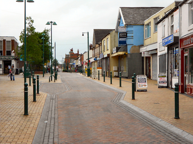
Buckley is a community located in Flintshire, Wales. It is situated in the northeastern part of the country, near the border with England. The town has a population of around 15,000 people and is known for its industrial history, particularly in the coal mining and pottery industries.

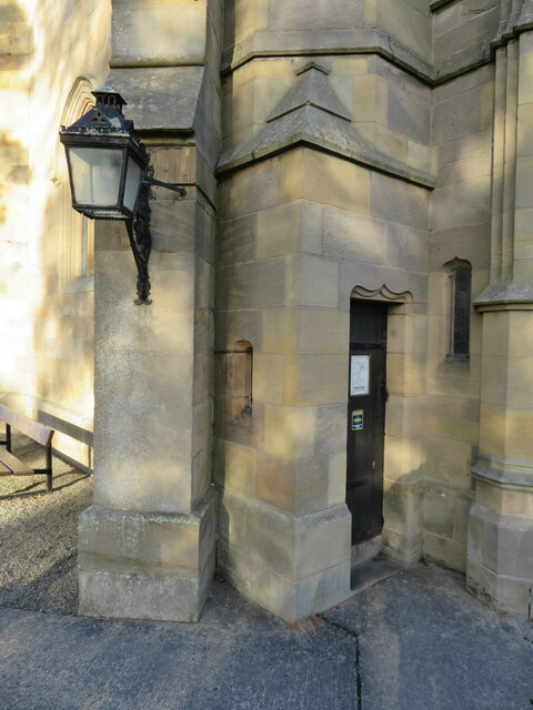
Buckley has a rich cultural heritage, with several historic buildings and landmarks that reflect its past. The town is home to St. Matthew's Church, a Grade II listed building that dates back to the 19th century. Buckley also has several parks and green spaces, including the Elfed sports complex and Buckley Common.

The town has a range of amenities and facilities for residents, including shops, schools, and healthcare services. There are also a number of community events and activities that take place throughout the year, such as the Buckley Jubilee, a traditional fair that has been held in the town since the 19th century.

Overall, Buckley is a vibrant and diverse community with a strong sense of pride in its history and heritage.

If you have any feedback on the listing, please let us know in the comments section below.
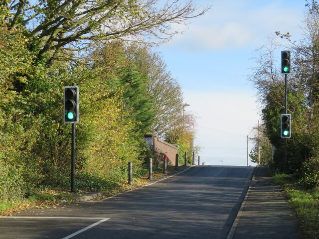
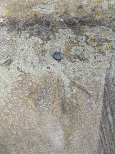
Buckley Images

Images are sourced within 2km of 53.169468/-3.076907 or Grid Reference SJ2864. Thanks to Geograph Open Source API. All images are credited.

A55, North Wales Expressway near Ewloe The A55, also known as the North Wales Expressway (Gwibffordd Gogledd Cymru), is the major road in North Wales running for 88 miles between Chester and Holyhead via Conwy and Bangor. 

The A55 is a very high quality road, much of it rebuilt since the 1970s in response to traffic problems in Colwyn Bay, Colwyn and Llandudno caused by traffic having to pass through town centres on totally unsuitable streets, (especially in Conwy where lorries often scraped their paintwork as they passed through 12th century arches in the town's walls), leading to the construction of an east-west expressway bypassing the urban centres. It is a dual carriageway primary route for its entire length with the exception of the point where it crosses the Britannia Bridge over the Menai Strait. All of its junctions are grade separated except for two roundabouts; one east of Penmaenmawr and one in Llanfairfechan. The road originally ran from Chester to Bangor but was extended parallel to the A5 across Anglesey right into Holyhead Docks in 2001.

<span class="nowrap"><a title="http://www.sabre-roads.org.uk/wiki/index.php?title=A55" rel="nofollow ugc noopener" href="http://www.sabre-roads.org.uk/wiki/index.php?title=A55">Link</a><img style="margin-left:2px;" alt="External link" title="External link - shift click to open in new window" src="https://s1.geograph.org.uk/img/external.png" width="10" height="10"/></span>  SABRE
A55, North Wales Expressway near Ewloe
The A55, also known as the North Wales Expressway (Gwibffordd Gogledd Cymru), is the major road in North Wales running for 88 miles between Chester and Holyhead via Conwy and Bangor. The A55 is a very high quality road, much of it rebuilt since the 1970s in response to traffic problems in Colwyn Bay, Colwyn and Llandudno caused by traffic having to pass through town centres on totally unsuitable streets, (especially in Conwy where lorries often scraped their paintwork as they passed through 12th century arches in the town's walls), leading to the construction of an east-west expressway bypassing the urban centres. It is a dual carriageway primary route for its entire length with the exception of the point where it crosses the Britannia Bridge over the Menai Strait. All of its junctions are grade separated except for two roundabouts; one east of Penmaenmawr and one in Llanfairfechan. The road originally ran from Chester to Bangor but was extended parallel to the A5 across Anglesey right into Holyhead Docks in 2001. LinkExternal link SABRE
Ewloe Interchange (Junction 34), North Wales Expressway (A55) The A55, also known as the North Wales Expressway (Gwibffordd Gogledd Cymru), is the major road in North Wales running for 88 miles between Chester and Holyhead via Conwy and Bangor. 

The A55 is a very high quality road, much of it rebuilt since the 1970s in response to traffic problems in Colwyn Bay, Colwyn and Llandudno caused by traffic having to pass through town centres on totally unsuitable streets, (especially in Conwy where lorries often scraped their paintwork as they passed through 12th century arches in the town's walls), leading to the construction of an east-west expressway bypassing the urban centres. It is a dual carriageway primary route for its entire length with the exception of the point where it crosses the Britannia Bridge over the Menai Strait. All of its junctions are grade separated except for two roundabouts; one east of Penmaenmawr and one in Llanfairfechan. The road originally ran from Chester to Bangor but was extended parallel to the A5 across Anglesey right into Holyhead Docks in 2001.

<span class="nowrap"><a title="http://www.sabre-roads.org.uk/wiki/index.php?title=A55" rel="nofollow ugc noopener" href="http://www.sabre-roads.org.uk/wiki/index.php?title=A55">Link</a><img style="margin-left:2px;" alt="External link" title="External link - shift click to open in new window" src="https://s1.geograph.org.uk/img/external.png" width="10" height="10"/></span>  SABRE
Ewloe Interchange (Junction 34), North Wales Expressway (A55)
The A55, also known as the North Wales Expressway (Gwibffordd Gogledd Cymru), is the major road in North Wales running for 88 miles between Chester and Holyhead via Conwy and Bangor. The A55 is a very high quality road, much of it rebuilt since the 1970s in response to traffic problems in Colwyn Bay, Colwyn and Llandudno caused by traffic having to pass through town centres on totally unsuitable streets, (especially in Conwy where lorries often scraped their paintwork as they passed through 12th century arches in the town's walls), leading to the construction of an east-west expressway bypassing the urban centres. It is a dual carriageway primary route for its entire length with the exception of the point where it crosses the Britannia Bridge over the Menai Strait. All of its junctions are grade separated except for two roundabouts; one east of Penmaenmawr and one in Llanfairfechan. The road originally ran from Chester to Bangor but was extended parallel to the A5 across Anglesey right into Holyhead Docks in 2001. LinkExternal link SABRE
Benchmark on Bannel Bridge, Bannel Lane, Buckley Ordnance Survey benchmark on the north parapet of Bannel Bridge, which carries Bannel Lane over the Wrexham to Bidston railway line. Levelled at 127.202m above Newlyn Datum, verified 1959. For a view of the bridge see <a href="https://www.geograph.org.uk/photo/7516810">SJ2963 : Railway Bridge on Bannel Lane, Buckley</a>                                     <span class="nowrap"><a title="https://www.bench-marks.org.uk/bm195190" rel="nofollow ugc noopener" href="https://www.bench-marks.org.uk/bm195190">Link</a><img style="margin-left:2px;" alt="External link" title="External link - shift click to open in new window" src="https://s1.geograph.org.uk/img/external.png" width="10" height="10"/></span>
Benchmark on Bannel Bridge, Bannel Lane, Buckley
Ordnance Survey benchmark on the north parapet of Bannel Bridge, which carries Bannel Lane over the Wrexham to Bidston railway line. Levelled at 127.202m above Newlyn Datum, verified 1959. For a view of the bridge see SJ2963 : Railway Bridge on Bannel Lane, Buckley LinkExternal link
Railway Bridge on Bannel Lane, Buckley Bannel Lane is very busy so the hump back railway bridge is controlled by traffic lights. There is an Ordnance Survey benchmark on the left/north parapet <a href="https://www.geograph.org.uk/photo/7499864">SJ2963 : Benchmark on Bannel Bridge, Bannel Lane, Buckley</a>
Railway Bridge on Bannel Lane, Buckley
Bannel Lane is very busy so the hump back railway bridge is controlled by traffic lights. There is an Ordnance Survey benchmark on the left/north parapet SJ2963 : Benchmark on Bannel Bridge, Bannel Lane, Buckley
Benchmark on Bistre Methodist Chapel, Spon Green, Buckley Ordnance Survey benchmark on the northeast corner of Bistre Methodist Chapel, Spon Green, Buckley. Levelled at 142.055m above Newlyn Datum, verified 1959. For a view of the chapel from the opposite side see <a href="https://www.geograph.org.uk/photo/7517001">SJ2863 : Bistre Methodist Chapel, Spon Green, Buckley</a>                
Benchmark database: <span class="nowrap"><a title="https://www.bench-marks.org.uk/bm195201" rel="nofollow ugc noopener" href="https://www.bench-marks.org.uk/bm195201">Link</a><img style="margin-left:2px;" alt="External link" title="External link - shift click to open in new window" src="https://s1.geograph.org.uk/img/external.png" width="10" height="10"/></span>
Benchmark on Bistre Methodist Chapel, Spon Green, Buckley
Ordnance Survey benchmark on the northeast corner of Bistre Methodist Chapel, Spon Green, Buckley. Levelled at 142.055m above Newlyn Datum, verified 1959. For a view of the chapel from the opposite side see SJ2863 : Bistre Methodist Chapel, Spon Green, Buckley Benchmark database: LinkExternal link
Bistre Methodist Chapel, Spon Green, Buckley Looking across Spon Green towards the Bistre Methodist Chapel. There is an Ordnance Survey benchmark on the other side of the building, on the far right hand corner <a href="https://www.geograph.org.uk/photo/7516911">SJ2863 : Benchmark on Bistre Methodist Chapel, Spon Green, Buckley</a>   In 2023 the chapel has closed its doors and a planning application has been made to convert it into living accommodation.
Bistre Methodist Chapel, Spon Green, Buckley
Looking across Spon Green towards the Bistre Methodist Chapel. There is an Ordnance Survey benchmark on the other side of the building, on the far right hand corner SJ2863 : Benchmark on Bistre Methodist Chapel, Spon Green, Buckley In 2023 the chapel has closed its doors and a planning application has been made to convert it into living accommodation.
Benchmark by Drury Lane, Drury near Buckley Ordnance Survey benchmark on the north side of Drury Lane, Drury. Levelled at 122.008m above Newlyn Datum, verified 1959. For a view of the road see <a href="https://www.geograph.org.uk/photo/7517148">SJ2964 : Drury Lane at its junction with Bank Lane, Drury</a> 
Benchmark database: <span class="nowrap"><a title="https://www.bench-marks.org.uk/bm195202" rel="nofollow ugc noopener" href="https://www.bench-marks.org.uk/bm195202">Link</a><img style="margin-left:2px;" alt="External link" title="External link - shift click to open in new window" src="https://s1.geograph.org.uk/img/external.png" width="10" height="10"/></span>
Benchmark by Drury Lane, Drury near Buckley
Ordnance Survey benchmark on the north side of Drury Lane, Drury. Levelled at 122.008m above Newlyn Datum, verified 1959. For a view of the road see SJ2964 : Drury Lane at its junction with Bank Lane, Drury Benchmark database: LinkExternal link
Drury Lane at its junction with Bank Lane, Drury There is an Ordnance Survey benchmark on the stone wall close to the speed-calming pads on the road <a href="https://www.geograph.org.uk/photo/7517127">SJ2964 : Benchmark by Drury Lane, Drury near Buckley</a>
Drury Lane at its junction with Bank Lane, Drury
There is an Ordnance Survey benchmark on the stone wall close to the speed-calming pads on the road SJ2964 : Benchmark by Drury Lane, Drury near Buckley
Benchmark in Mount Pleasant Road, Burntwood Pentre Ordnance Survey benchmark on an old bridge abutment, which is no longer a bridge, in Mount Pleasant Road, Burntwood Pentre. Levelled at 141.830m above Newlyn Datum. For a wider view see <a href="https://www.geograph.org.uk/photo/7517250">SJ2864 : Bridge abutment in Mount Pleasant Road, Burntwood Pentre</a> 
Benchmark database: <span class="nowrap"><a title="https://www.bench-marks.org.uk/bm195205" rel="nofollow ugc noopener" href="https://www.bench-marks.org.uk/bm195205">Link</a><img style="margin-left:2px;" alt="External link" title="External link - shift click to open in new window" src="https://s1.geograph.org.uk/img/external.png" width="10" height="10"/></span>
Benchmark in Mount Pleasant Road, Burntwood Pentre
Ordnance Survey benchmark on an old bridge abutment, which is no longer a bridge, in Mount Pleasant Road, Burntwood Pentre. Levelled at 141.830m above Newlyn Datum. For a wider view see SJ2864 : Bridge abutment in Mount Pleasant Road, Burntwood Pentre Benchmark database: LinkExternal link
Bridge abutment in Mount Pleasant Road, Burntwood Pentre The brick abutment is the only sign that there was ever a railway bridge crossing the road here. In times past this area was a hive of activity with brick and tile works as well as coal mines to power the furnaces, all long gone. There is an Ordnance Survey benchmark low down on the corner of the abutment, but it is partly hidden by ivy <a href="https://www.geograph.org.uk/photo/7517223">SJ2864 : Benchmark in Mount Pleasant Road, Burntwood Pentre</a>
Bridge abutment in Mount Pleasant Road, Burntwood Pentre
The brick abutment is the only sign that there was ever a railway bridge crossing the road here. In times past this area was a hive of activity with brick and tile works as well as coal mines to power the furnaces, all long gone. There is an Ordnance Survey benchmark low down on the corner of the abutment, but it is partly hidden by ivy SJ2864 : Benchmark in Mount Pleasant Road, Burntwood Pentre
Rivet benchmark on St Matthew's parish church tower, Buckley Ordnance Survey rivet benchmark on the south west buttress of  the tower of St Matthew's parish church, Buckley. Levelled at 160.413m above Newlyn Datum, verified 1959. For a view of the buttress see <a href="https://www.geograph.org.uk/photo/7518145">SJ2864 : Tower door of St Matthew's parish church, Buckley</a>                             
Benchmark database: <span class="nowrap"><a title="https://www.bench-marks.org.uk/bm102814" rel="nofollow ugc noopener" href="https://www.bench-marks.org.uk/bm102814">Link</a><img style="margin-left:2px;" alt="External link" title="External link - shift click to open in new window" src="https://s1.geograph.org.uk/img/external.png" width="10" height="10"/></span>
Rivet benchmark on St Matthew's parish church tower, Buckley
Ordnance Survey rivet benchmark on the south west buttress of the tower of St Matthew's parish church, Buckley. Levelled at 160.413m above Newlyn Datum, verified 1959. For a view of the buttress see SJ2864 : Tower door of St Matthew's parish church, Buckley Benchmark database: LinkExternal link
Tower door of St Matthew's parish church, Buckley There is an Ordnance Survey rivet benchmark on the angled buttress below the lamp <a href="https://www.geograph.org.uk/photo/7518130">SJ2864 : Rivet benchmark on St Matthew's parish church tower, Buckley</a>
Tower door of St Matthew's parish church, Buckley
There is an Ordnance Survey rivet benchmark on the angled buttress below the lamp SJ2864 : Rivet benchmark on St Matthew's parish church tower, Buckley
Benchmark on the Horse & Jockey in Drury Lane, Buckley Ordnance Survey benchmark on the side wall of the Horse & Jockey public house in Drury Lane, Buckley. Levelled at 157.070m above Newlyn Datum. For a wider view see <a href="https://www.geograph.org.uk/photo/7518246">SJ2864 : The side wall of the Horse & Jockey, Drury Lane, Buckley</a>                          
Benchmark database: <span class="nowrap"><a title="https://www.bench-marks.org.uk/bm195298" rel="nofollow ugc noopener" href="https://www.bench-marks.org.uk/bm195298">Link</a><img style="margin-left:2px;" alt="External link" title="External link - shift click to open in new window" src="https://s1.geograph.org.uk/img/external.png" width="10" height="10"/></span>
Benchmark on the Horse & Jockey in Drury Lane, Buckley
Ordnance Survey benchmark on the side wall of the Horse & Jockey public house in Drury Lane, Buckley. Levelled at 157.070m above Newlyn Datum. For a wider view see SJ2864 : The side wall of the Horse & Jockey, Drury Lane, Buckley Benchmark database: LinkExternal link
The side wall of the Horse & Jockey, Drury Lane, Buckley The side wall of the Horse & Jockey in Drury Lane has an Ordnance Survey benchmark <a href="https://www.geograph.org.uk/photo/7518234">SJ2864 : Benchmark on the Horse & Jockey in Drury Lane, Buckley</a>
The side wall of the Horse & Jockey, Drury Lane, Buckley
The side wall of the Horse & Jockey in Drury Lane has an Ordnance Survey benchmark SJ2864 : Benchmark on the Horse & Jockey in Drury Lane, Buckley
Buckley Station
Buckley Station
Buckley Station
Buckley Station
Buckley Fire Station
Brunswick Road, Buckley
Show me another place!

Buckley is located at Grid Ref: SJ2864 (Lat: 53.169468, Lng: -3.076907)

Unitary Authority: Flintshire

Police Authority: North Wales

Also known as: Bwcle

What 3 Words

///unpainted.inkjet.hotels. Near Buckley, Flintshire

Nearby Locations

Buckley Bwcle Knowl Hill

Related Wikis

District of Alyn and Deeside

Alyn and Deeside (Welsh: Alun a Glannau Dyfrdwy) was one of six local government districts in the county of Clwyd, north-east Wales from 1974 to 1996....

Elfed High School

Elfed High School (Welsh: Ysgol Uwchradd Elfed) is an 11–16 mixed, English-medium community secondary school in Buckley, Flintshire, Wales. == History... ==

St Matthew's Church, Buckley

St Matthew's Church, is in the town of Buckley, Flintshire, Wales. It is an active Anglican parish church in the Borderlands Mission Area, the archdeaconry...

Buckley, Flintshire

Buckley (Welsh: Bwcle [ˈbʊklɛ]) is a town and community in Flintshire, north-east Wales, two miles (3 km) from the county town of Mold and contiguous with...

Nearby Amenities

Located within 500m of 53.169468,-3.076907
Buckley
Is In: Flintshire, Wales, United Kingdom
Is In Country: United Kingdom
Is In County: Flintshire
Is In Nation: Wales
Name Cy: Bwcle
Place: town
Population: 19639
Wikidata: Q2019227
Wikipedia: en:Buckley
Lat/Long: 53.1702261/-3.0799874
Traffic Signals
Traffic Signals: signal
Lat/Long: 53.1694006/-3.0806997
Traffic Signals
Lat/Long: 53.1682492/-3.0809262
Barrier: bollard
Bicycle: yes
Bollard: fixed
Foot: yes
Lat/Long: 53.1718741/-3.0738287
Barrier: bollard
Bicycle: yes
Bollard: fixed
Foot: yes
Lat/Long: 53.1712193/-3.0741098
Crossing
Crossing: traffic_signals
Crossing Island: no
Crossing Ref: puffin
Tactile Paving: yes
Lat/Long: 53.1687943/-3.0787641
Place Of Worship
Saint Johns URC
Addr Postcode: CH7 3HR
Addr Street: Hawkesbury Road
Denomination: united_reformed
Fhrs Id: 855864
Religion: christian
Source Addr: FHRS Open Data
Lat/Long: 53.1714593/-3.0783666
Pub
The Horse and Jockey
Addr Housenumber: 66
Addr Postcode: CH7 3JQ
Addr Street: Church Road
Fhrs Id: 998002
Opening Hours: Mo-Fr 16:00-23:00+; Sa 11:30-23:00+; Su 11:00-23:00+
Source Addr: FHRS Open Data
Wikidata: Q80855052
Lat/Long: 53.171158/-3.0706094
Pharmacy
Rowlands Pharmacy
Brand: Rowlands Pharmacy
Brand Wikidata: Q62663235
Healthcare: pharmacy
Opening Hours: Mo-Fr 21:00-18:00, Sa 21:00-15:00; PH,Su off
Website: https://rowlandspharmacy.co.uk/find-local-pharmacy#!/l/buckley/12-brunswick-road/1051
Lat/Long: 53.1680118/-3.0799656
Library
Buckley
Lat/Long: 53.1673745/-3.0794485
Barrier: bollard
Bicycle: yes
Bollard: fixed
Foot: yes
Lat/Long: 53.1651956/-3.0765521
Pub
The Black Horse
Addr Postcode: CH7 2JB
Addr Street: Mold Road
Fhrs Id: 1196996
Source Addr: FHRS Open Data
Wikidata: Q80855058
Lat/Long: 53.1685805/-3.0830591
Barrier: bollard
Bollard: fixed
Lat/Long: 53.1681634/-3.0790054
Toilets
Check Date: 2021-09-06
Fee: no
Wheelchair: yes
Lat/Long: 53.1671645/-3.0795114
Police
Disused: yes
Lat/Long: 53.168523/-3.0823294
Place Of Worship
Buckly Methodist Church
Check Date: 2024-03-23
Denomination: methodist
Religion: christian
Lat/Long: 53.1676384/-3.0804547
Crossing
Crossing: zebra
Crossing Island: no
Tactile Paving: yes
Lat/Long: 53.1658874/-3.0785788
Disused Shop: yes
Lat/Long: 53.1679911/-3.0802014
Fire Station
Buckley Fire Station
Lat/Long: 53.1677286/-3.0769929
Buckley War Memorial
Historic: memorial
Lat/Long: 53.1666131/-3.0792365
Barrier: cycle_barrier
Foot: yes
Lat/Long: 53.1688772/-3.0787184
Direction: 185
Generator Method: photovoltaic
Generator Output Electricity: yes
Generator Solar Modules: 10
Generator Source: solar
Generator Type: solar_photovoltaic_panel
Location: roof
Power: generator
Lat/Long: 53.168986/-3.0716844
Direction: SSW
Generator Method: photovoltaic
Generator Output Electricity: yes
Generator Solar Modules: 10
Generator Source: solar
Generator Type: solar_photovoltaic_panel
Location: roof
Power: generator
Lat/Long: 53.169077/-3.0719389
Direction: WSW
Generator Method: photovoltaic
Generator Output Electricity: yes
Generator Solar Modules: 13
Generator Source: solar
Generator Type: solar_photovoltaic_panel
Location: roof
Power: generator
Lat/Long: 53.1693809/-3.070352
Direction: SE
Generator Method: photovoltaic
Generator Output Electricity: yes
Generator Solar Modules: 13
Generator Source: solar
Generator Type: solar_photovoltaic_panel
Location: roof
Power: generator
Lat/Long: 53.1699292/-3.0711503
Direction: 165
Fixme: module count approximate (assumed 8 x 2, could be 5 by 3 or 4)
Generator Method: photovoltaic
Generator Output Electricity: yes
Generator Solar Modules: 16
Generator Source: solar
Generator Type: solar_photovoltaic_panel
Location: roof
Power: generator
Lat/Long: 53.1700707/-3.0717458
Direction: WSW
Generator Method: photovoltaic
Generator Output Electricity: yes
Generator Solar Modules: 16
Generator Source: solar
Generator Type: solar_photovoltaic_panel
Location: roof
Power: generator
Lat/Long: 53.1705949/-3.0723775
Direction: 125
Generator Method: photovoltaic
Generator Output Electricity: yes
Generator Solar Modules: 18
Generator Source: solar
Generator Type: solar_photovoltaic_panel
Location: roof
Power: generator
Lat/Long: 53.1688962/-3.0733517
Direction: 195
Generator Method: photovoltaic
Generator Output Electricity: yes
Generator Solar Modules: 16
Generator Source: solar
Generator Type: solar_photovoltaic_panel
Location: roof
Power: generator
Lat/Long: 53.1694227/-3.075464
Direction: 235
Generator Method: photovoltaic
Generator Output Electricity: yes
Generator Solar Modules: 15
Generator Source: solar
Generator Type: solar_photovoltaic_panel
Location: roof
Power: generator
Lat/Long: 53.1730137/-3.0744434
Direction: SE
Generator Method: photovoltaic
Generator Output Electricity: yes
Generator Solar Modules: 14
Generator Source: solar
Generator Type: solar_photovoltaic_panel
Location: roof
Power: generator
Lat/Long: 53.1662837/-3.0741063
Direction: 125
Generator Method: photovoltaic
Generator Output Electricity: yes
Generator Solar Modules: 16
Generator Source: solar
Generator Type: solar_photovoltaic_panel
Location: roof
Power: generator
Lat/Long: 53.1661997/-3.0741867
Direction: E
Generator Method: photovoltaic
Generator Output Electricity: yes
Generator Solar Modules: 8
Generator Source: solar
Generator Type: solar_photovoltaic_panel
Location: roof
Power: generator
Lat/Long: 53.1662437/-3.0749082
Direction: W
Generator Method: photovoltaic
Generator Output Electricity: yes
Generator Solar Modules: 8
Generator Source: solar
Generator Type: solar_photovoltaic_panel
Location: roof
Power: generator
Lat/Long: 53.1662443/-3.0749581
Direction: 185
Generator Method: photovoltaic
Generator Output Electricity: yes
Generator Solar Modules: 16
Generator Source: solar
Generator Type: solar_photovoltaic_panel
Location: roof
Power: generator
Lat/Long: 53.165179/-3.0782281
Turning Loop
Lat/Long: 53.1699116/-3.081612
Bus Stop
Buckley, Brunswick Road / Tivoli
Bus: yes
Naptan AtcoCode: 5120AWD71403
Naptan Bearing: NW
Naptan CommonName: Tivoli
Naptan Crossing: Windmill Road
Naptan Indicator: o/s
Naptan Landmark: Tivoli
Naptan LocalityName: Buckley
Naptan NaptanCode: fliagtw
Naptan ShortCommonName: Buckley Fire Station
Naptan Street: Brunswick Road
Naptan Verified: no
Public Transport: platform
Public Transport Version: 2
Source: naptan_import
Lat/Long: 53.1677266/-3.0760015
Bus Stop
Buckley, Brunswick Road / Coppa View
Bench: no
Bin: yes
Bus: yes
Naptan AtcoCode: 5120WDB22315
Naptan Bearing: NW
Naptan CommonName: Coppa View
Naptan Crossing: Daisy Hill Road
Naptan Indicator: before
Naptan Landmark: Central Buildings
Naptan LocalityName: Buckley
Naptan NaptanCode: flimgjd
Naptan ShortCommonName: Daisy Hill
Naptan Street: Brunswick Road
Naptan Verified: no
Public Transport: platform
Shelter: no
Source: naptan_import
Lat/Long: 53.1671879/-3.0709483
Bus Stop
Buckley, Drury Lane / Horse and Jockey
Bench: no
Bin: no
Bus: yes
Lit: yes
Naptan AtcoCode: 5120AWF80586
Naptan Bearing: NE
Naptan CommonName: Horse and Jockey
Naptan Crossing: Church Road
Naptan Indicator: opp
Naptan Landmark: Horse and Jockey PH
Naptan LocalityName: Buckley
Naptan NaptanCode: fliagmw
Naptan Street: Drury Lane
Naptan Verified: no
Public Transport: platform
Shelter: no
Source: naptan_import
Tactile Paving: no
Lat/Long: 53.171407/-3.0705661
Bus Stop
Buckley, Drury Lane / Horse and Jockey
Bench: no
Bin: yes
Bus: yes
Lit: yes
Naptan AtcoCode: 5120WDB22063
Naptan Bearing: SW
Naptan CommonName: Horse and Jockey
Naptan Crossing: Church Road
Naptan Indicator: o/s
Naptan Landmark: Horse and Jockey PH
Naptan LocalityName: Buckley
Naptan NaptanCode: flijptd
Naptan Street: Drury Lane
Naptan Verified: no
Public Transport: platform
Shelter: yes
Source: naptan_import
Tactile Paving: no
Lat/Long: 53.1713844/-3.0701932
Bus Stop
Buckley, Brunswick Road / Black Lion
Bench: yes
Bin: yes
Bus: yes
Naptan AtcoCode: 5120AWD71402
Naptan Bearing: W
Naptan CommonName: Black Lion
Naptan Crossing: Mill Lane
Naptan Indicator: o/s
Naptan Landmark: Black Lion PH
Naptan LocalityName: Buckley
Naptan NaptanCode: flidjmj
Naptan ShortCommonName: Buckley Cross
Naptan Street: Brunswick Road
Naptan Verified: no
Public Transport: platform
Public Transport Version: 2
Shelter: yes
Source: naptan_import
Tactile Paving: yes
Lat/Long: 53.1683394/-3.0825986
Bus Stop
Buckley, Brunswick Road / Tivoli
Bus: yes
Naptan AtcoCode: 5120WDB22067
Naptan Bearing: SE
Naptan CommonName: Tivoli
Naptan Crossing: Windmill Road
Naptan Indicator: opp
Naptan Landmark: Tivoli
Naptan LocalityName: Buckley
Naptan NaptanCode: flijptp
Naptan ShortCommonName: Buckley Fire Station
Naptan Street: Brunswick Road
Naptan Verified: no
Public Transport: platform
Public Transport Version: 2
Source: naptan_import
Lat/Long: 53.1678207/-3.0759452
Bus Stop
Buckley, Brunswick Road / Buckley Police Station
Bench: yes
Bin: yes
Bus: yes
Naptan AtcoCode: 5120AWD71401
Naptan Bearing: E
Naptan CommonName: Buckley Police Station
Naptan Crossing: Mill Lane
Naptan Indicator: after
Naptan Landmark: Buckley Police Station
Naptan LocalityName: Buckley
Naptan NaptanCode: flidjmg
Naptan ShortCommonName: Buckley Cross
Naptan Street: Brunswick Road
Naptan Verified: no
Public Transport: platform
Public Transport Version: 2
Shelter: yes
Source: naptan_import
Tactile Paving: yes
Lat/Long: 53.168447/-3.0821601
Bus Stop
Central Precinct
Bus: yes
Naptan AtcoCode: 5120WDB22008
Naptan Bearing: S
Naptan CommonName: Central Precinct
Naptan Crossing: Brunswick Road
Naptan Landmark: Central Precinct
Naptan NaptanCode: flijmwm
Naptan Street: The Precinct Way
Naptan Verified: no
Public Transport: platform
Public Transport Version: 2
Shelter: yes
Source: naptan
Lat/Long: 53.166913/-3.0780427
Bus Stop
Central Precinct
Bench: yes
Bin: yes
Bus: yes
Naptan AtcoCode: 5120AWF80577
Naptan Bearing: N
Naptan CommonName: Central Precinct
Naptan Crossing: Brunswick Road
Naptan Landmark: Central Precinct
Naptan NaptanCode: fliagtd
Naptan Street: The Precinct Way
Naptan Verified: no
Public Transport: platform
Public Transport Version: 2
Shelter: yes
Source: naptan
Lat/Long: 53.1669596/-3.0784209
Bus Stop
Buckley, Mill Lane / Mill Lane Surgery
Bus: yes
Naptan AtcoCode: 5120WDB22064
Naptan Bearing: NE
Naptan CommonName: Mill Lane Surgery
Naptan Crossing: Linthorpe Road
Naptan Indicator: nr
Naptan LocalityName: Buckley
Naptan NaptanCode: flijptg
Naptan Street: Mill Lane
Naptan Verified: no
Public Transport: platform
Public Transport Version: 2
Source: naptan_import
Lat/Long: 53.171021/-3.0804536
Bus Stop
Buckley, Liverpool Road / Buckley Medical Centre
Bus: yes
Naptan AtcoCode: 5120WDB47578
Naptan Bearing: N
Naptan CommonName: Buckly Medical Centre
Naptan Indicator: o/s
Naptan LocalityName: Buckley
Naptan NaptanCode: flimwjp
Naptan Street: Liverpool Road
Naptan Verified: no
Public Transport: platform
Public Transport Version: 2
Source: naptan_import
Lat/Long: 53.1731224/-3.0794482
Coppa View
Place: neighbourhood
Lat/Long: 53.1660677/-3.0743107
The Cross
Note: Marked as such by OS
Place: neighbourhood
Source: local knowledge
Lat/Long: 53.1683727/-3.0811085
Direction: SE
Generator Method: photovoltaic
Generator Output Electricity: yes
Generator Solar Modules: 12
Generator Source: solar
Generator Type: solar_photovoltaic_panel
Location: roof
Power: generator
Lat/Long: 53.1715517/-3.0723336
Direction: WSW
Generator Method: photovoltaic
Generator Output Electricity: yes
Generator Solar Modules: 2
Generator Source: solar
Generator Type: solar_photovoltaic_panel
Location: roof
Power: generator
Lat/Long: 53.1707667/-3.0726696
Direction: SSE
Generator Method: photovoltaic
Generator Output Electricity: yes
Generator Solar Modules: 6
Generator Source: solar
Generator Type: solar_photovoltaic_panel
Location: roof
Power: generator
Lat/Long: 53.1707542/-3.0727239
Direction: SSE
Generator Method: photovoltaic
Generator Output Electricity: yes
Generator Solar Modules: 4
Generator Source: solar
Generator Type: solar_photovoltaic_panel
Location: roof
Power: generator
Lat/Long: 53.1707815/-3.0727346
Direction: 260
Generator Method: photovoltaic
Generator Output Electricity: yes
Generator Solar Modules: 4
Generator Source: solar
Generator Type: solar_photovoltaic_panel
Location: roof
Power: generator
Lat/Long: 53.1672217/-3.0738457
Direction: 260
Generator Method: photovoltaic
Generator Output Electricity: yes
Generator Solar Modules: 12
Generator Source: solar
Generator Type: solar_photovoltaic_panel
Location: roof
Power: generator
Lat/Long: 53.1671839/-3.0738665
Direction: SW
Generator Method: photovoltaic
Generator Output Electricity: yes
Generator Solar Modules: 16
Generator Source: solar
Generator Type: solar_photovoltaic_panel
Location: roof
Power: generator
Lat/Long: 53.170312/-3.0720761
Crossing
Crossing: traffic_signals
Crossing Island: no
Crossing Ref: puffin
Tactile Paving: yes
Lat/Long: 53.1726206/-3.0798693
Crossing
Crossing: zebra
Crossing Island: no
Tactile Paving: yes
Lat/Long: 53.1673025/-3.0780934
Bus Stop
Buckley, Liverpool Road / Buckley Medical Centre
Bus: yes
Naptan AtcoCode: 5120WDB47581
Naptan Bearing: S
Naptan CommonName: Buckley Medical Centre
Naptan Indicator: opp
Naptan LocalityName: Buckley
Naptan NaptanCode: flimwmd
Naptan Street: Liverpool Road
Public Transport: platform
Source: naptan_import
Lat/Long: 53.1730792/-3.0792273
Bus Stop
Buckley, Liverpool Road / Belmont Crescent
Bus: yes
Naptan AtcoCode: 5120WDB22066
Naptan Bearing: SW
Naptan CommonName: Belmont Crescent
Naptan Crossing: Belmont Crescent
Naptan Indicator: after
Naptan LocalityName: Buckley
Naptan NaptanCode: flijptm
Naptan Street: Liverpool Road
Public Transport: platform
Source: naptan_import
Lat/Long: 53.1737528/-3.0786093
Bus Stop
Buckley, Liverpool Road / Belmont Crescent
Bus: yes
Naptan AtcoCode: 5120AWF80969
Naptan Bearing: NE
Naptan CommonName: Belmont Crescent
Naptan Crossing: Belmont Crescent
Naptan Indicator: before
Naptan LocalityName: Buckley
Naptan NaptanCode: flidjgw
Naptan Street: Liverpool Road
Public Transport: platform
Source: naptan_import
Lat/Long: 53.1737929/-3.0787813
Bus Stop
Buckley, Mill Lane / Mill Lane Surgery
Bus: yes
Naptan AtcoCode: 5120AWF80970
Naptan Bearing: SW
Naptan CommonName: Mill Lane Surgery
Naptan Crossing: Linthorpe Road
Naptan Indicator: nr
Naptan LocalityName: Buckley
Naptan NaptanCode: flidjpa
Naptan Street: Mill Lane
Public Transport: platform
Source: naptan_import
Lat/Long: 53.171016/-3.080314
Bus Stop
Buckley, Liverpool Road / Hawkesbury Road
Bus: yes
Naptan AtcoCode: 5120WDB22065
Naptan Bearing: NE
Naptan CommonName: Hawkesbury Road
Naptan Crossing: Hawkesbury Road
Naptan Indicator: after
Naptan LocalityName: Buckley
Naptan NaptanCode: flijptj
Naptan Street: Liverpool Road
Public Transport: platform
Source: naptan_import
Lat/Long: 53.1725923/-3.0800071
Bus Stop
Buckley, Liverpool Road / Hawkesbury Road
Bus: yes
Naptan AtcoCode: 5120FLX17117
Naptan Bearing: SW
Naptan CommonName: Hawkesbury Road
Naptan Crossing: Hawkesbury Road
Naptan Indicator: before
Naptan LocalityName: Buckley
Naptan NaptanCode: flidjpd
Naptan Street: Liverpool Road
Public Transport: platform
Source: naptan_import
Lat/Long: 53.1725565/-3.0798724
Bus Stop
Buckley, Brunswick Road / Coppa View
Bus: yes
Naptan AtcoCode: 5120AWD71404
Naptan Bearing: SE
Naptan CommonName: Coppa View
Naptan Crossing: Daisy Hill Road
Naptan Indicator: after
Naptan Landmark: Central Buildings
Naptan LocalityName: Buckley
Naptan NaptanCode: fliagmt
Naptan ShortCommonName: Daisy Hill
Naptan Street: Brunswick Road
Public Transport: platform
Source: naptan_import
Lat/Long: 53.1673045/-3.0713411
Bus Stop
Buckley, Knowle Lane / Oak Tree Close
Bus: yes
Naptan AtcoCode: 5120FLX17070
Naptan Bearing: NE
Naptan CommonName: Oak Tree Close
Naptan Crossing: Oak Tree Close
Naptan Indicator: before
Naptan LocalityName: Buckley
Naptan NaptanCode: fliagpj
Naptan Street: Knowle Lane
Public Transport: platform
Source: naptan_import
Lat/Long: 53.1709614/-3.072402
Bus Stop
Buckley, Knowle Lane / Oak Tree Close
Bus: yes
Naptan AtcoCode: 5120WDB22007
Naptan Bearing: SW
Naptan BusStopType: CUS
Naptan CommonName: Oak Tree Close
Naptan Crossing: Oak Tree Close
Naptan Indicator: before
Naptan LocalityName: Buckley
Naptan NaptanCode: flijmwj
Naptan Street: Knowle Lane
Public Transport: platform
Source: naptan_import
Lat/Long: 53.1709522/-3.0721142
Iceland
Addr Housename: Central Parade
Addr Postcode: CH7 2EF
Addr Street: Brunswick Road
Addr Unit: Unit 22
Brand: Iceland
Brand Wikidata: Q721810
Shop: frozen_food
Website: https://www.iceland.co.uk/store-finder/store?StoreID=1351&StoreName=BUCKLEY
Lat/Long: 53.1673455/-3.0792269
Post Office
Addr City: Buckley
Addr Housename: Inside Spar
Addr Housenumber: 11
Addr Postcode: CH7 2ED
Addr Street: Brunswick Road
Brand: Post Office
Brand Wikidata: Q1783168
Opening Hours: Mo-Su 08:00-20:00
Lat/Long: 53.168304/-3.0797487
Barrier: cycle_barrier
Cycle Barrier: double
Cycle Barrier Installation: fixed
Lat/Long: 53.1680711/-3.0773961
Barrier: cycle_barrier
Cycle Barrier: double
Cycle Barrier Installation: fixed
Lat/Long: 53.1703967/-3.0806021
The data included in this document is from www.openstreetmap.org. The data is made available under ODbL.

Have you been to Buckley?

Leave your review of Buckley below (or comments, questions and feedback).