Bretherton

Settlement in Lancashire Chorley

England

Bretherton

156427 departing Croston for Preston
156427 departing Croston for Preston Credit: Peter Moore

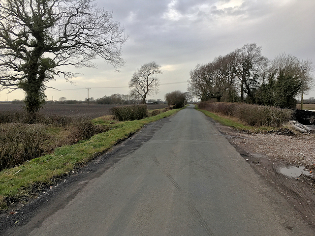
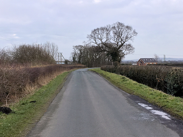
Bretherton is a small village located in Lancashire, England. It is situated approximately 6 miles south west of the town of Leyland and 7 miles north east of the city of Southport. The village is surrounded by beautiful countryside and is known for its picturesque landscapes and rural charm.

Bretherton has a long history, with evidence of human habitation dating back to the Bronze Age. The village is home to a number of historic buildings, including the Grade II listed All Saints Church, which dates back to the 13th century. The village also has a strong community spirit, with a range of local amenities including a primary school, village hall, and several pubs and shops.

The village is popular with walkers and cyclists, with a number of scenic routes and footpaths crisscrossing the surrounding countryside. Bretherton is also well connected by road, with easy access to the nearby towns of Leyland and Southport, as well as the larger cities of Preston and Liverpool. Overall, Bretherton is a charming and peaceful village, perfect for those looking to escape the hustle and bustle of city life.

If you have any feedback on the listing, please let us know in the comments section below.

Bretherton Images

Images are sourced within 2km of 53.677925/-2.801473 or Grid Reference SD4720. Thanks to Geograph Open Source API. All images are credited.

156427 departing Croston for Preston
Tarleton Bridge Carrying the A59 (Liverpool Road) over the River Asland or Douglas.
Tarleton Bridge
Carrying the A59 (Liverpool Road) over the River Asland or Douglas.
One time gate house to Bank Hall On the A59 outside Tarleton.
One time gate house to Bank Hall
On the A59 outside Tarleton.
St Mary's, Tarleton
St Mary's, Tarleton
Footbridge over the Leeds - Liverpool Canal (Rufford Branch) at Plox Lane
Leeds - Liverpool Canal (Rufford branch) at Plox Brow
Spellbinder narrowboat at Tarleton Lock On the Rufford Branch of the Leeds - Liverpool Canal
Spellbinder narrowboat at Tarleton Lock
On the Rufford Branch of the Leeds - Liverpool Canal
Rufford Branch from Tarleton Lock
Tarleton Lock Where the Rufford branch of the Leeds - Liverpool Canal meets the River Douglas
Tarleton Lock
Where the Rufford branch of the Leeds - Liverpool Canal meets the River Douglas
The River Douglas at Tarleton Lock
The River Douglas just north of Tarleton Lock
Doles Lane
Doles Lane
Bretherton, Doles Lane
St Mary's Church by the A59 St Mary's Church is a redundant Anglican church.
St Mary's Church by the A59
St Mary's Church is a redundant Anglican church.
Old Boundary Marker by the A59, Liverpool Road, Tarleton Bridge Parish Boundary Marker by the A59, in parish of Tarleton (West Lancashire District), Tarleton Bridge, Liverpool Road, at East end of Southern bridge wall, almost completely slipped down steep bank away from road.

Surveyed

Milestone Society National ID: LA_TARBRE01pb
Old Boundary Marker by the A59, Liverpool Road, Tarleton Bridge
Parish Boundary Marker by the A59, in parish of Tarleton (West Lancashire District), Tarleton Bridge, Liverpool Road, at East end of Southern bridge wall, almost completely slipped down steep bank away from road. Surveyed Milestone Society National ID: LA_TARBRE01pb
Carr House Lane towards Bretherton
Old Wayside Cross Bretherton Cross, a Central Cross consisting of an old base. Set on the south side of South Road, opposite the church, and on the east side of the drive to Church House Farm in Bretherton parish. Grade II Listed <span class="nowrap"><a title="https://historicengland.org.uk/listing/the-list/list-entry/1072571" rel="nofollow ugc noopener" href="https://historicengland.org.uk/listing/the-list/list-entry/1072571">Link</a><img style="margin-left:2px;" alt="External link" title="External link - shift click to open in new window" src="https://s1.geograph.org.uk/img/external.png" width="10" height="10"/></span>. 

Milestone Society National ID: LACH_BRE
Old Wayside Cross
Bretherton Cross, a Central Cross consisting of an old base. Set on the south side of South Road, opposite the church, and on the east side of the drive to Church House Farm in Bretherton parish. Grade II Listed LinkExternal link. Milestone Society National ID: LACH_BRE
Barn and Cottage At the end of Back Lane, on the outskirts of Bretherton
Barn and Cottage
At the end of Back Lane, on the outskirts of Bretherton
Show me another place!

Bretherton is located at Grid Ref: SD4720 (Lat: 53.677925, Lng: -2.801473)

Administrative County: Lancashire

District: Chorley

Police Authority: Lancashire

What 3 Words

///beans.declines.laugh. Near Tarleton, Lancashire

Nearby Locations

Bretherton Bretherton

Related Wikis

Bretherton

Bretherton is a small village and civil parish in the Borough of Chorley, Lancashire, England, situated to the south west of Leyland and east of Tarleton...

St John the Baptist's Church, Bretherton

St John the Baptist's Church is in the village of Bretherton, Lancashire, England. It is an active Anglican parish church in the deanery of Chorley, the...
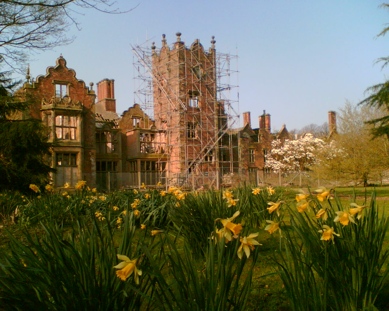
Bank Hall

Bank Hall is a Jacobean mansion in Bretherton, Lancashire, England. It is a Grade II* listed building and is at the centre of a private estate, surrounded...
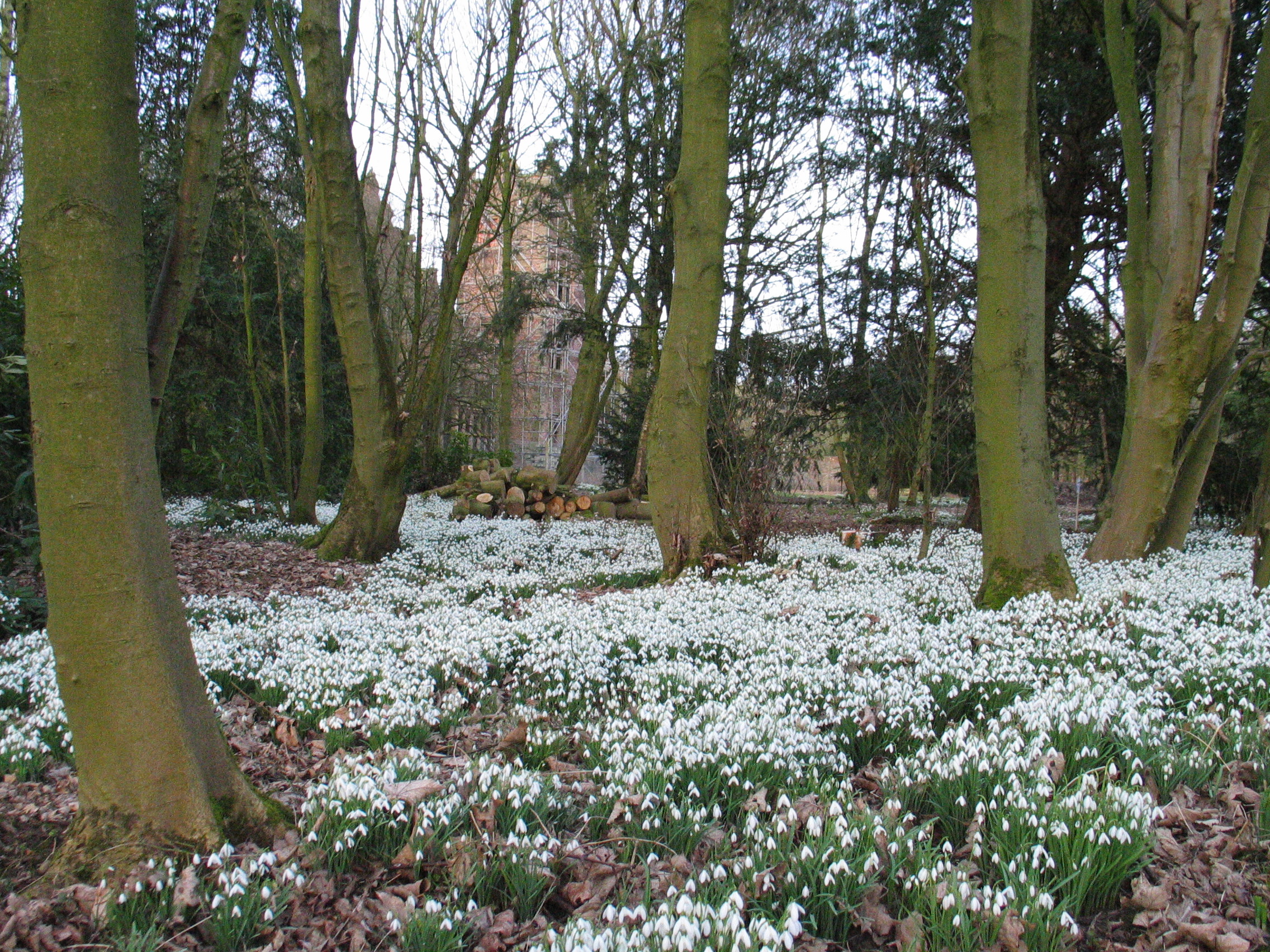
Bank Hall Gardens

Bank Hall Gardens comprise 18 acres (73,000 m2) of curtilage at Bank Hall, in Bretherton, Lancashire, England. The gardens contain specimen trees including...

Nearby Amenities

Located within 500m of 53.677925,-2.801473
Bretherton
Place: village
Source: npe
Lat/Long: 53.6780647/-2.7999158
Place Of Worship
Bretherton Congregational Church
Denomination: congregational
Node Id: 760612047
Religion: christian
Source: OS OpenData StreetView
Source Name: OS Open Local Important Buildings Layer
Lat/Long: 53.6780649/-2.7989051
Bench
Lat/Long: 53.6778496/-2.8012068
Public Bookcase
Eric's Phone Box
Booth: K6
Disused Amenity: telephone
Man Made: telephone_box
Name Etymology: Eric Dewhurst
Public Bookcase Type: phone_box
Lat/Long: 53.6810106/-2.8003471
Post Box
Post Box Type: lamp
Royal Cypher: EIIR
Royal Cypher Wikidata: Q33102113
Lat/Long: 53.6809957/-2.8002388
Bench
Lat/Long: 53.6780827/-2.8014528
Historic: monument
Inscription: Jeremiah Horrocks Transit of Venus
Lat/Long: 53.6780636/-2.8013429
Heritage: 2
Heritage Category: Listed Building
Heritage Operator: Historic England
Historic: heritage
Listed Status: Grade II
Memorial: war_memorial
Ref GB Nhle: 1454872
Start Date: 1921
Website: https://historicengland.org.uk/listing/the-list/list-entry/1454872
Lat/Long: 53.6779326/-2.8015863
Rose Grove Farm
Place: farm
Lat/Long: 53.6774441/-2.8017283
Ashcrofts Farm
Place: farm
Lat/Long: 53.6770945/-2.8032517
Highfield Farm
Place: farm
Lat/Long: 53.6820861/-2.7989388
Brookfield Farm
Place: farm
Lat/Long: 53.681994/-2.8001002
Ryding's Farm
Place: farm
Lat/Long: 53.6817954/-2.8021199
Welsby Farm
Place: farm
Lat/Long: 53.6816842/-2.8030694
Pompian Brow Farm
Place: farm
Lat/Long: 53.6799193/-2.8011543
Bus Stop
by St Johns Church
Bus: yes
Naptan AtcoCode: 2500LAA16786
Naptan Bearing: E
Naptan CommonName: St Johns Church
Naptan Indicator: by
Naptan Landmark: St Johns Church
Naptan NaptanCode: lanpawap
Naptan Verified: no
Public Transport: platform
Lat/Long: 53.6774559/-2.7951213
Bus Stop
opp Pompian Brow
Bus: yes
Naptan AtcoCode: 25001463
Naptan Bearing: W
Naptan CommonName: Pompian Brow
Naptan Indicator: opp
Naptan Landmark: Pompian Brow
Naptan NaptanCode: lanamwjd
Naptan Verified: no
Public Transport: platform
Lat/Long: 53.6779353/-2.8003021
Bus Stop
by Pompian Brow
Bus: yes
Naptan AtcoCode: 2500LAA15968
Naptan Bearing: E
Naptan CommonName: Pompian Brow
Naptan Indicator: by
Naptan Landmark: Pompian Brow
Naptan NaptanCode: lanjtwgj
Naptan Verified: no
Public Transport: platform
Lat/Long: 53.6779958/-2.8007452
The data included in this document is from www.openstreetmap.org. The data is made available under ODbL.

Have you been to Bretherton?

Leave your review of Bretherton below (or comments, questions and feedback).