Bro Machno

Community in Merionethshire

Wales

Bro Machno

Ruins at old slate workings below Manod Mawr, Blaenau Ffestiniog
Ruins at old slate workings below Manod Mawr, Blaenau Ffestiniog Credit: Colin Park

Bro Machno is a community located in the county of Merionethshire, Wales. It is situated in the Snowdonia National Park, surrounded by stunning natural landscapes and picturesque views. The community covers an area of approximately 14 square miles.

Bro Machno is primarily a rural community, with a small population scattered across several villages and hamlets. The largest settlement within the community is the village of Penmachno, which serves as its administrative center. Other notable settlements include Cwm Penmachno, Dolwyddelan, and Capel Curig.

The area is renowned for its outdoor recreational opportunities, attracting visitors from all over. The nearby Snowdonia National Park offers a multitude of activities, such as hiking, mountain biking, and rock climbing. The community is also bisected by the River Machno, which provides opportunities for fishing and kayaking.

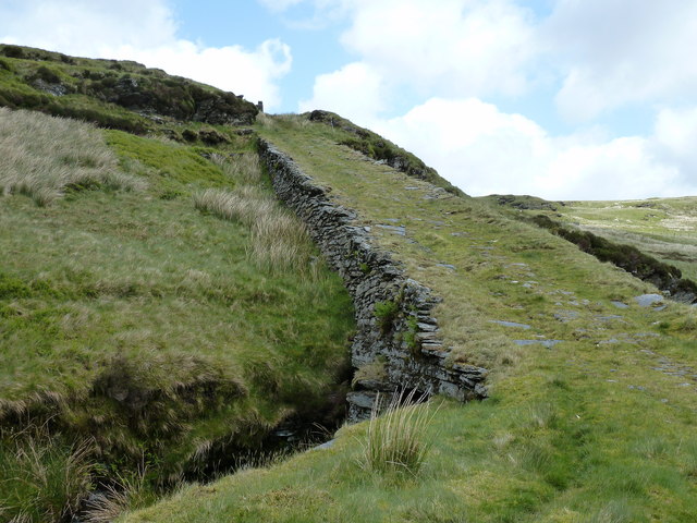
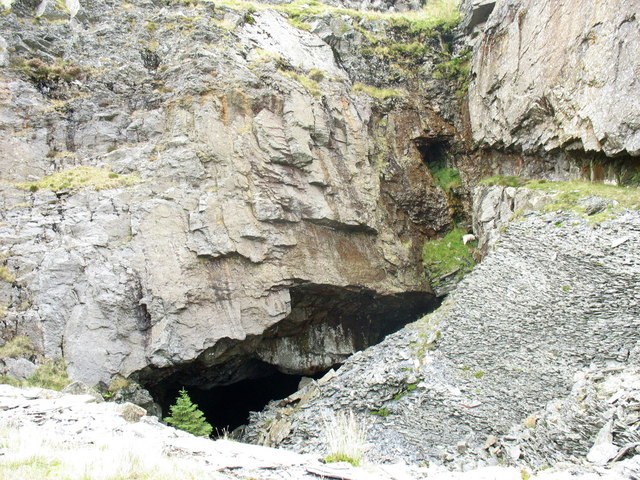
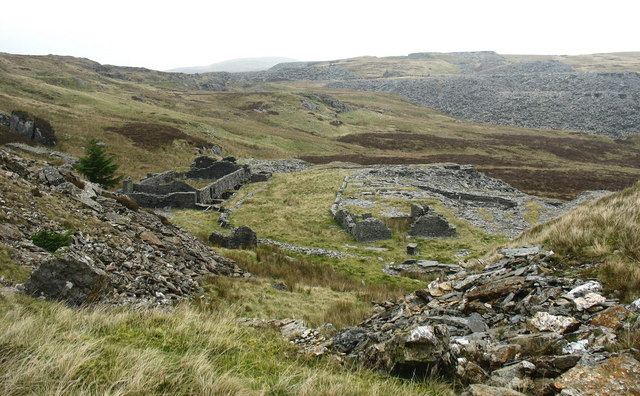
Historically, Bro Machno was known for its slate industry, which thrived during the 19th and early 20th centuries. The remnants of this industry can still be seen in the form of abandoned quarries and industrial buildings scattered throughout the area.

In terms of amenities, Bro Machno offers a range of services to its residents and visitors. These include a primary school, a post office, a village hall, and a few local shops and cafes. However, for more extensive facilities and services, residents often travel to nearby towns such as Betws-y-Coed or Llanrwst.

Overall, Bro Machno is a charming and picturesque community nestled within the stunning natural beauty of Snowdonia National Park, offering a tranquil and idyllic lifestyle for its residents and a haven for outdoor enthusiasts.

If you have any feedback on the listing, please let us know in the comments section below.

Bro Machno Images

Images are sourced within 2km of 53.001489/-3.892441 or Grid Reference SH7346. Thanks to Geograph Open Source API. All images are credited.

Ruins at old slate workings below Manod Mawr, Blaenau Ffestiniog
Manod Mawr North summit cairn Even though Manod Mawr North summit is relatively close to Manod Mawr South summit as the crow flies, the Graig Ddu Slate Quarry which is active with no access means a lenghty and difficult walk around the western slopes with much height loss.
Manod Mawr North summit cairn
Even though Manod Mawr North summit is relatively close to Manod Mawr South summit as the crow flies, the Graig Ddu Slate Quarry which is active with no access means a lenghty and difficult walk around the western slopes with much height loss.
Old tramway beside Llyn Bowydd - view WNW
Old tram causeway at Llyn Bowydd
Moorland between Moel Penamnen and Foel-fras On the high bwlch between the two hills.
Moorland between Moel Penamnen and Foel-fras
On the high bwlch between the two hills.
Approaching Foel-fras from the west The summit of the hill is pretty indistinct; it lies somewhere in front, near to or just beyond  the fenceline.
Approaching Foel-fras from the west
The summit of the hill is pretty indistinct; it lies somewhere in front, near to or just beyond the fenceline.
Foel-fras summit... probably It's rather unclear exactly where the highest point of the hill actually is; it may vary from year to year depending which tussock of grass grows best. But the rucksack on the grass is pretty near the top.
Foel-fras summit... probably
It's rather unclear exactly where the highest point of the hill actually is; it may vary from year to year depending which tussock of grass grows best. But the rucksack on the grass is pretty near the top.
Old wall and a sheepfold On the south side of Foel-fras, this dilapidated wall runs downhill from a small crag, and then develops into a sheepfold, described at <span class="nowrap"><a title="https://coflein.gov.uk/en/site/65775/" rel="nofollow ugc noopener" href="https://coflein.gov.uk/en/site/65775/">Link</a><img style="margin-left:2px;" alt="External link" title="External link - shift click to open in new window" src="https://s1.geograph.org.uk/img/external.png" width="10" height="10"/></span> as having some orthostats in its construction. One of these upright stones is just about visible in this photo, forming the left side of the entranceway.
Old wall and a sheepfold
On the south side of Foel-fras, this dilapidated wall runs downhill from a small crag, and then develops into a sheepfold, described at LinkExternal link as having some orthostats in its construction. One of these upright stones is just about visible in this photo, forming the left side of the entranceway.
Disused sheepfold on the south side of Foel-fras This is the sheepfold described briefly at <span class="nowrap"><a title="https://coflein.gov.uk/en/site/65775/" rel="nofollow ugc noopener" href="https://coflein.gov.uk/en/site/65775/">Link</a><img style="margin-left:2px;" alt="External link" title="External link - shift click to open in new window" src="https://s1.geograph.org.uk/img/external.png" width="10" height="10"/></span> and seen from above in <a href="https://www.geograph.org.uk/photo/7484518">SH7247 : Old wall and a sheepfold</a>. Its appearance suggests 18th or 19th century, but it's no longer in use as all the walls have pretty much collapsed into loose boulder piles.
Disused sheepfold on the south side of Foel-fras
This is the sheepfold described briefly at LinkExternal link and seen from above in SH7247 : Old wall and a sheepfold. Its appearance suggests 18th or 19th century, but it's no longer in use as all the walls have pretty much collapsed into loose boulder piles.
A pond Well, the map marks it as a pond. I'd describe it more as a very wet bit of marsh, and it's certainly been fenced off, presumably to try and prevent too many of the sheep from getting stuck and drowning in it. The hills in the background are the southern slopes of Foel-fras.
A pond
Well, the map marks it as a pond. I'd describe it more as a very wet bit of marsh, and it's certainly been fenced off, presumably to try and prevent too many of the sheep from getting stuck and drowning in it. The hills in the background are the southern slopes of Foel-fras.
Rocky outcrop in the bog The grass and rock outcrop in the foreground is a small rib of rock protruding above the extensive surrounding bog here to the south of Moel Penamnen. It made for a brief section of much easier walking than the peat all around, before plunging back into the marsh (literally, in fact, as I went thigh-deep into the water shortly before this point)
Rocky outcrop in the bog
The grass and rock outcrop in the foreground is a small rib of rock protruding above the extensive surrounding bog here to the south of Moel Penamnen. It made for a brief section of much easier walking than the peat all around, before plunging back into the marsh (literally, in fact, as I went thigh-deep into the water shortly before this point)
Large sheepfold in the cwm Built into the southern flank of <a href="https://www.geograph.org.uk/photo/7484533">SH7247 : Rocky outcrop in the bog</a>, this large triple-chambered sheepfold was surveyed and recorded by the Gwynedd Archaeological Trust in 1999 or 2000, at <span class="nowrap"><a title="https://archwilio.org.uk/arch/query/page.php?watprn=GAT14752&dbname=gat&tbname=core" rel="nofollow ugc noopener" href="https://archwilio.org.uk/arch/query/page.php?watprn=GAT14752&dbname=gat&tbname=core">Link</a><img style="margin-left:2px;" alt="External link" title="External link - shift click to open in new window" src="https://s1.geograph.org.uk/img/external.png" width="10" height="10"/></span> The third chamber is out of sight around the corner.
Large sheepfold in the cwm
Built into the southern flank of SH7247 : Rocky outcrop in the bog, this large triple-chambered sheepfold was surveyed and recorded by the Gwynedd Archaeological Trust in 1999 or 2000, at LinkExternal link The third chamber is out of sight around the corner.
Peaty bog overlooked by Moel Penamnen Part of the extensive peaty bog and marsh in the flat cwm to the south of Moel Penamnen. It's tough country to walk through, and you're very likely to get wet feet (or more) on account of the frequent deep pools.
Peaty bog overlooked by Moel Penamnen
Part of the extensive peaty bog and marsh in the flat cwm to the south of Moel Penamnen. It's tough country to walk through, and you're very likely to get wet feet (or more) on account of the frequent deep pools.
Manod Mawr The twin peaks (L to R) Manod Bach (511m) and Manod Mawr (661m), above Blaenau Ffestiniog, Gwynedd. 
Philbhu image ref: P8040340ag.
Manod Mawr
The twin peaks (L to R) Manod Bach (511m) and Manod Mawr (661m), above Blaenau Ffestiniog, Gwynedd. Philbhu image ref: P8040340ag.
Carreg y Frân The rounded peak Manod Mawr (661m) and the rocky ridge outcrop Craig y Garreg-lwyd, with in the distance in between (Centre) the rocky ridge outcrops of Carreg y Frân. Located to the north-west of Llan Ffestiniog, Gwynedd. In the Eryri (Snowdonia) National Park). Philbhu image ref: P8040335ag.
Carreg y Frân
The rounded peak Manod Mawr (661m) and the rocky ridge outcrop Craig y Garreg-lwyd, with in the distance in between (Centre) the rocky ridge outcrops of Carreg y Frân. Located to the north-west of Llan Ffestiniog, Gwynedd. In the Eryri (Snowdonia) National Park). Philbhu image ref: P8040335ag.
Maen-offeren quarries
Disused No 3 incline on the Rhiwbach tramroad
Disused drum house at the top of No 3 incline
Show me another place!

Bro Machno is located at Grid Ref: SH7346 (Lat: 53.001489, Lng: -3.892441)

Unitary Authority: Conwy

Police Authority: North Wales

What 3 Words

///grace.leads.pizzeria. Near Blaenau-Ffestiniog, Gwynedd

Nearby Locations

Bro Machno

Related Wikis

Cwt y Bugail quarry

The Cwt y Bugail quarry is a former slate quarry located east of Blaenau Ffestiniog in Wales. It was first worked as a trial pit around 1840. Continuous...

Blaen y Cwm quarry

The Blaen y Cwm quarry was a slate quarry located east of Blaenau Ffestiniog in Wales. It was first worked in some time between 1813 and 1818 and sporadically...

Rhiwbach Tramway

The Rhiwbach Tramway was a Welsh industrial, 1 ft 11+1⁄2 in (597 mm) narrow gauge railway connecting the remote slate quarries east of Blaenau Ffestiniog...
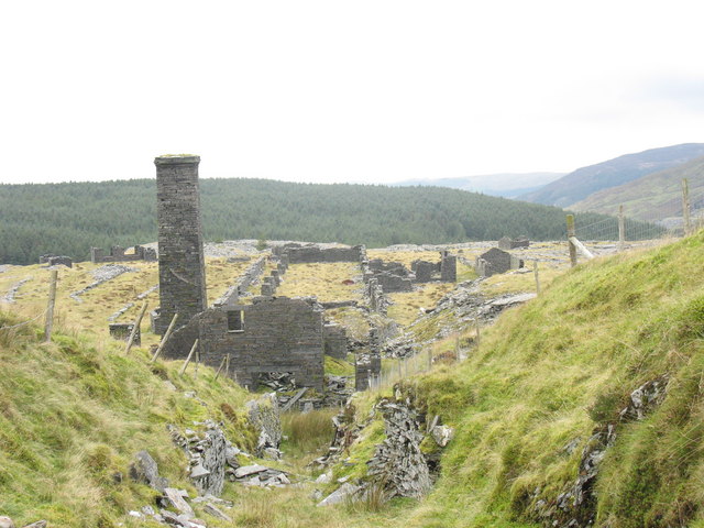
Rhiwbach quarry

Rhiwbach quarry (also known as Rhiw-bach quarry) was a slate quarry located to the east of Blaenau Ffestiniog in North Wales. The quarry was a remote site...

Nearby Amenities

Located within 500m of 53.001489,-3.892441
Barrier: stile
Lat/Long: 53.0003732/-3.8933894
Barrier: stile
Lat/Long: 53.0029101/-3.892938
The data included in this document is from www.openstreetmap.org. The data is made available under ODbL.

Have you been to Bro Machno?

Leave your review of Bro Machno below (or comments, questions and feedback).