Blaenrheidol

Community in Cardiganshire

Wales

Blaenrheidol

Approaching the summit cairn of Y Garn 2244' / 684m
Approaching the summit cairn of Y Garn 2244' / 684m Credit: John H Darch

Blaenrheidol is a rural community located in the county of Cardiganshire, Wales. Situated in the stunning countryside, the community is known for its picturesque landscapes and tranquil environment.

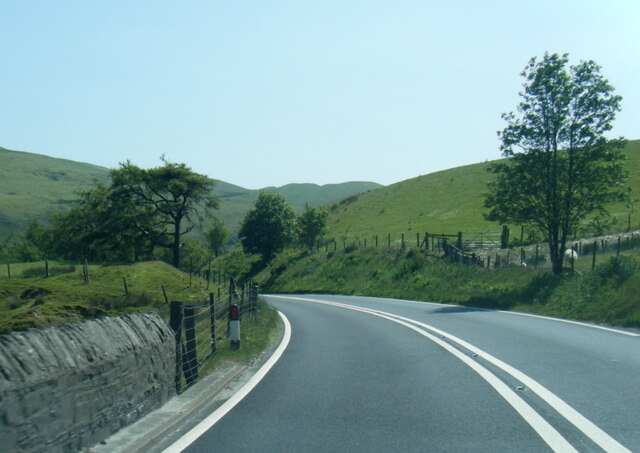
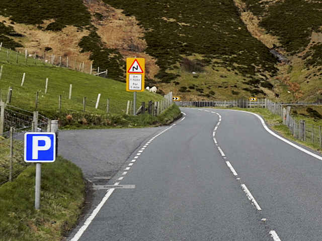
The community is primarily composed of small villages and hamlets, surrounded by rolling hills, lush green fields, and meandering rivers. It is a haven for nature enthusiasts and those seeking a peaceful retreat away from the bustling cities.

The main settlement within Blaenrheidol is the village of Penrhyncoch, which serves as a hub for local services and amenities. The village features a few shops, a primary school, a pub, and a community center. It also boasts a football club, which plays a significant role in the community's social life.

Agriculture plays a vital role in the local economy, with many residents engaged in farming and livestock rearing. The fertile land and favorable climate make it ideal for cultivating crops and rearing animals.

Blaenrheidol is also renowned for its rich history and cultural heritage. The area is dotted with ancient monuments, such as burial mounds and standing stones, which provide insights into the community's past. The local museum in Penrhyncoch offers visitors a chance to delve deeper into the region's history.

Recreational activities in Blaenrheidol revolve around the great outdoors. The community is surrounded by numerous walking trails, cycling routes, and fishing spots, attracting outdoor enthusiasts from near and far.

Overall, Blaenrheidol is a charming and idyllic community that showcases the natural beauty and historical significance of Cardiganshire.

If you have any feedback on the listing, please let us know in the comments section below.

Blaenrheidol Images

Images are sourced within 2km of 52.43716/-3.813538 or Grid Reference SN7683. Thanks to Geograph Open Source API. All images are credited.

Approaching the summit cairn of Y Garn 2244' / 684m
Across the hillside towards Nant y Moch
A44 at Pont Nant Lladron
Much water in the Hirnant
Y Garn viewed from Plynlimon Y Garn = 684 metres, Plynlimon = 752 metres.
Y Garn viewed from Plynlimon
Y Garn = 684 metres, Plynlimon = 752 metres.
Layby on the A44 Mountain Road The stretch of the A44 between Capel Bangor and Llangurig is hilly with many bends as it climbs over/through part of the Cambrian Mountains.
Layby on the A44 Mountain Road
The stretch of the A44 between Capel Bangor and Llangurig is hilly with many bends as it climbs over/through part of the Cambrian Mountains.
Bridge over Nant Coch Mawr The A44 is a major road in the United Kingdom that runs for 155 miles from Oxford in southern England to Aberystwyth in west Wales.
<span class="nowrap"><a title="http://www.sabre-roads.org.uk/wiki/index.php?title=A44" rel="nofollow ugc noopener" href="http://www.sabre-roads.org.uk/wiki/index.php?title=A44">Link</a><img style="margin-left:2px;" alt="External link" title="External link - shift click to open in new window" src="https://s1.geograph.org.uk/img/external.png" width="10" height="10"/></span>  SABRE
<span class="nowrap"><a title="https://en.wikipedia.org/wiki/A44_road" rel="nofollow ugc noopener" href="https://en.wikipedia.org/wiki/A44_road">Link</a><img style="margin-left:2px;" alt="External link" title="External link - shift click to open in new window" src="https://s1.geograph.org.uk/img/external.png" width="10" height="10"/></span>  Wikipedia
Bridge over Nant Coch Mawr
The A44 is a major road in the United Kingdom that runs for 155 miles from Oxford in southern England to Aberystwyth in west Wales. LinkExternal link SABRE LinkExternal link Wikipedia
Grazing by the Hirnant Improved grazing being enjoyed by a number of sheep. In the background, Disgwylfa Fawr rises up, with the vegetation showing an autumn feel.
Grazing by the Hirnant
Improved grazing being enjoyed by a number of sheep. In the background, Disgwylfa Fawr rises up, with the vegetation showing an autumn feel.
Looking down on Aber-Peithnant farm The small farmhouse, close to the Afon Rheidol, is almost lost in the landscape. Disgwylfa Fawr rises up behind; the bridleway ascending across its slopes is an ancient route linking the Wye valley with the lower Rheidol valley.
Looking down on Aber-Peithnant farm
The small farmhouse, close to the Afon Rheidol, is almost lost in the landscape. Disgwylfa Fawr rises up behind; the bridleway ascending across its slopes is an ancient route linking the Wye valley with the lower Rheidol valley.
View towards Nant-y-moch dam Taken on a mild but very dull day in early Spring.
View towards Nant-y-moch dam
Taken on a mild but very dull day in early Spring.
Spring light on Y Garn Soft lighting with clouds and a trace of sun on the western slopes of the mountain.
Spring light on Y Garn
Soft lighting with clouds and a trace of sun on the western slopes of the mountain.
Upper Rheidol valley A view over the valley from north of Hirnant. The tree clad hill in the distance is Bryn Gwyn.
Upper Rheidol valley
A view over the valley from north of Hirnant. The tree clad hill in the distance is Bryn Gwyn.
Milestone - Aberystwyth 15 There is an OS pivot on the top of the stone. <a title="https://www.geograph.org.uk/photo/5566018" href="https://www.geograph.org.uk/photo/5566018">Link</a>
Milestone - Aberystwyth 15
There is an OS pivot on the top of the stone. Link
Ordnance Survey Pivot This OS pivot can be found on the top of the milestone. <a title="https://www.geograph.org.uk/photo/5566016" href="https://www.geograph.org.uk/photo/5566016">Link</a>
Ordnance Survey Pivot
This OS pivot can be found on the top of the milestone. Link
Old Milestone by the A44, Dyffryn Castell, Blaenrheidol Parish Aberystwyth tombstone by the A44, in parish of Blaenrheidol (Ceredigion District), Padell Nant Wyddon, on verge, back to wire fence.

Inscription reads:-
ABERYSTWYTH
15
Miles 

Grade II listed by Cadw.
Reference Number: 83334 <span class="nowrap"><a title="https://cadwpublic-api.azurewebsites.net/reports/listedbuilding/FullReport?lang=&id=83334" rel="nofollow ugc noopener" href="https://cadwpublic-api.azurewebsites.net/reports/listedbuilding/FullReport?lang=&id=83334">Link</a><img style="margin-left:2px;" alt="External link" title="External link - shift click to open in new window" src="https://s1.geograph.org.uk/img/external.png" width="10" height="10"/></span>

Surveyed

Milestone Society National ID: CRD_AYLG15
Old Milestone by the A44, Dyffryn Castell, Blaenrheidol Parish
Aberystwyth tombstone by the A44, in parish of Blaenrheidol (Ceredigion District), Padell Nant Wyddon, on verge, back to wire fence. Inscription reads:- ABERYSTWYTH 15 Miles Grade II listed by Cadw. Reference Number: 83334 LinkExternal link Surveyed Milestone Society National ID: CRD_AYLG15
Old fields near Hirnant With Disgwylfa Fawr rising in the background.
Old fields near Hirnant
With Disgwylfa Fawr rising in the background.
Y Garn seen from Bryn y Beddau Looking across the dense tussocks of Bryn yr Hydd to the hill.
Y Garn seen from Bryn y Beddau
Looking across the dense tussocks of Bryn yr Hydd to the hill.
By Bryn Llwyd Approaching the Ponterwyd road on the descent from Plynlimon.
By Bryn Llwyd
Approaching the Ponterwyd road on the descent from Plynlimon.
Show me another place!

Blaenrheidol is located at Grid Ref: SN7683 (Lat: 52.43716, Lng: -3.813538)

Unitary Authority: Ceredigion

Police Authority: Dyfed-Powys

What 3 Words

///outfit.inflates.watch. Near Cwmystwyth, Ceredigion

Nearby Locations

Bryn Llwyd Blaenrheidol

Related Wikis

Blaenrheidol

Blaenrheidol is a community in the county of Ceredigion, North Wales. It lies in the Cambrian Mountains of Mid Wales, approximately 12 miles (19 km) east...

Y Garn (Plynlimon)

Y Garn is a subsidiary summit of Pen Pumlumon Fawr and the fourth highest peak on the Plynlimon massif, a part of the Cambrian Mountains in the county...

Eisteddfa Gurig

Eisteddfa Gurig is a hamlet located in Ceredigion on its border with Powys and situated along the A44. Its name comes from the Welsh word eisteddfa, meaning...

Elvis Rock

The Elvis Rock is a rock alongside the A44 in Powys, Wales, near its border with Ceredigion. It is one of the most well known pieces of graffiti in Wales...

Nearby Amenities

Located within 500m of 52.43716,-3.813538
Power: pole
Source: Bing
Lat/Long: 52.4410319/-3.8133527
Power: pole
Source: Bing
Lat/Long: 52.4364323/-3.8200126
Power: pole
Source: Bing
Lat/Long: 52.4371894/-3.8192375
Power: pole
Source: Bing
Lat/Long: 52.4384648/-3.817942
Power: pole
Source: Bing
Lat/Long: 52.4394982/-3.8168986
Power: pole
Source: Bing
Lat/Long: 52.4406182/-3.8147796
Power: pole
Source: Bing
Lat/Long: 52.4378795/-3.8185347
Power: pole
Source: Bing
Lat/Long: 52.4414522/-3.8118429
Power: pole
Source: Bing
Lat/Long: 52.4389979/-3.8173894
Power: pole
Source: Bing
Lat/Long: 52.4402324/-3.8161371
Bryn Llwyd
Natural: peak
Lat/Long: 52.4390929/-3.8199784
The data included in this document is from www.openstreetmap.org. The data is made available under ODbL.

Have you been to Blaenrheidol?

Leave your review of Blaenrheidol below (or comments, questions and feedback).