Blackwood
Community in Monmouthshire
Wales
Blackwood

Blackwood is a community located in the county of Monmouthshire, Wales. It is situated in the southeastern part of the county, bordering the county borough of Caerphilly. With a population of approximately 10,000 residents, Blackwood is a thriving town that offers a range of amenities and recreational opportunities for its inhabitants.
The town of Blackwood has a rich history, with its roots dating back to the Roman era. It was primarily a coal mining town during the 19th and 20th centuries, which greatly contributed to its growth and development. Although the coal industry has declined over the years, Blackwood still retains remnants of its industrial past.
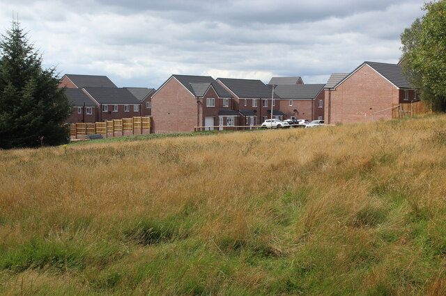
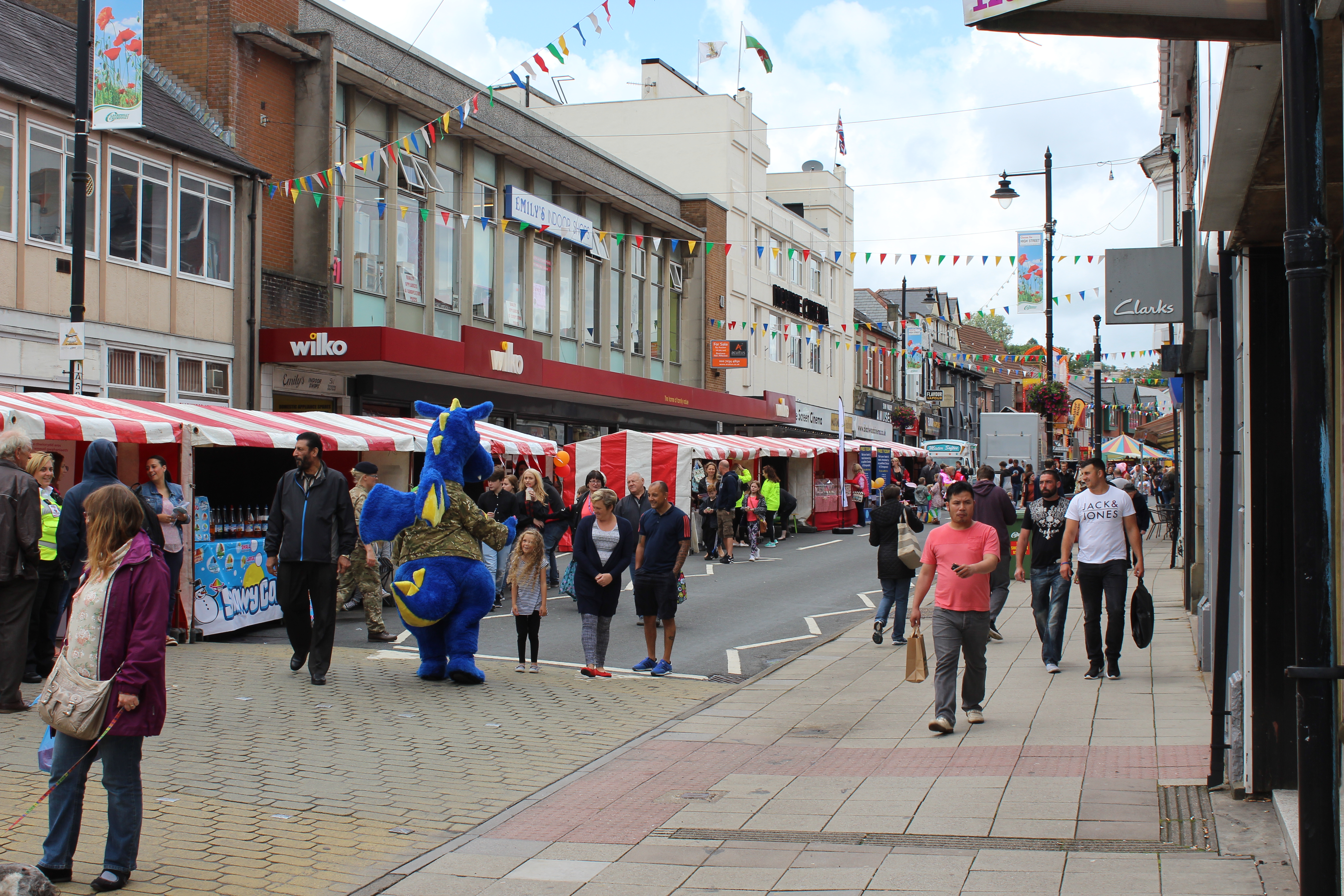
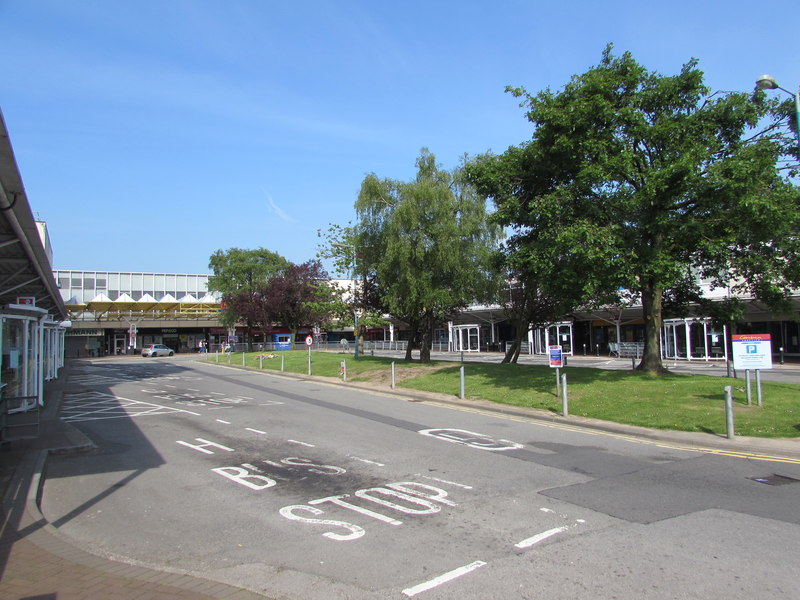
Today, Blackwood is a bustling community with a vibrant town center. It features a variety of shops, supermarkets, and local businesses, providing residents with convenient access to everyday necessities. The town also boasts several schools, healthcare facilities, and recreational spaces, ensuring that the needs of its residents are well catered for.
For those seeking outdoor activities, Blackwood offers a number of parks and green spaces. The nearby Sirhowy Valley Country Park is a popular destination, providing opportunities for walking, cycling, and picnicking. The area is known for its natural beauty and picturesque landscapes, attracting visitors from the surrounding areas.
Blackwood is well-connected to other parts of Monmouthshire and beyond, with good transportation links. The town has its own railway station, providing access to Cardiff and other major cities in South Wales. Additionally, the nearby A4048 road connects Blackwood to the wider road network, making it easily accessible by car.
In summary, Blackwood is a thriving community in Monmouthshire, Wales, with a rich history and a range of amenities. Its industrial past, coupled with its natural beauty, makes it an attractive place to live and visit.
If you have any feedback on the listing, please let us know in the comments section below.
Blackwood Images
Images are sourced within 2km of 51.675137/-3.199983 or Grid Reference ST1798. Thanks to Geograph Open Source API. All images are credited.


Blackwood is located at Grid Ref: ST1798 (Lat: 51.675137, Lng: -3.199983)
Unitary Authority: Caerphilly
Police Authority: Gwent
Also known as: Coed Duon
What 3 Words
///hunt.magazines.intestine. Near Blackwood, Caerphilly
Related Wikis
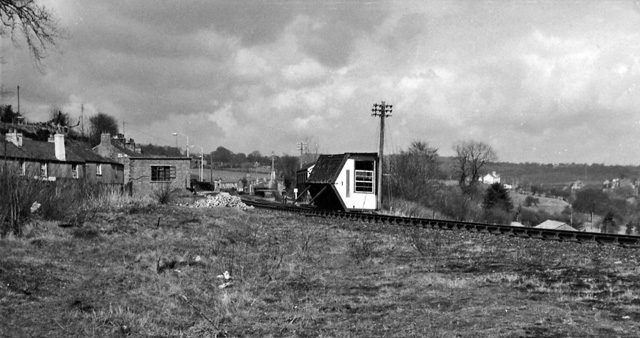
Blackwood railway station (Wales)
Blackwood railway station (Welsh: Y Coed Duon) was a station on the Sirhowy Railway. It served the town of Blackwood, Caerphilly. == History == The station...
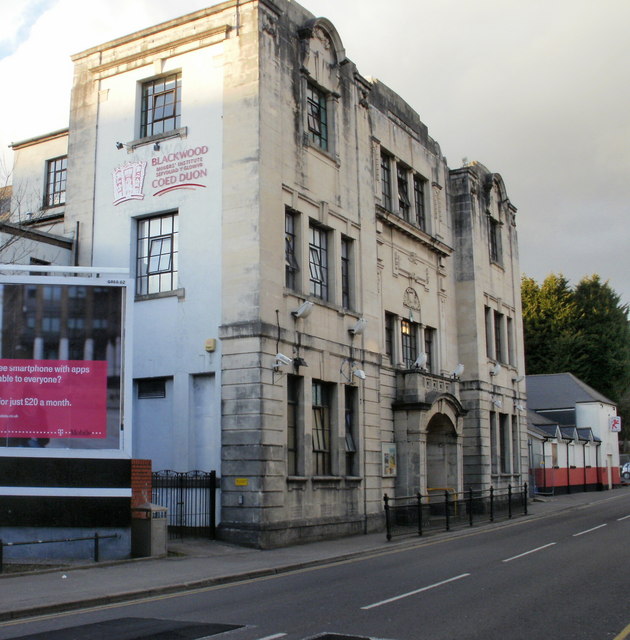
Blackwood Miners Welfare Institute
The Blackwood Miners Welfare Institute (Welsh: Sefydliad y Glowyr Coed Duon) is a Grade II* listed building located at the north end of Blackwood High...

Maes Manor
Maes Manor is a country house near Blackwood, Caerphilly, Wales. It dates mainly from the early 20th century and is notable for its gardens, designed by...

Cefn Fforest
Cefn Fforest is a community and an electoral ward in Caerphilly County Borough, Wales. A wholly urbanized community, it forms the western fringes of the...
Blackwood, Caerphilly
Blackwood (Welsh: Coed Duon) is a town, community and an electoral ward on the Sirhowy River in the South Wales Valleys administered as part of Caerphilly...
Oakdale Comprehensive School
Oakdale Comprehensive School was a comprehensive school located in the village of Oakdale, Caerphilly Oakdale in Caerphilly county, Wales. The total enrollment...
Cwmbran bus station
Cwmbran bus station (Welsh: Gorsaf bws Cwmbrân) is a bus terminus and interchange located in the town centre of Cwmbran, South Wales. == Background... ==
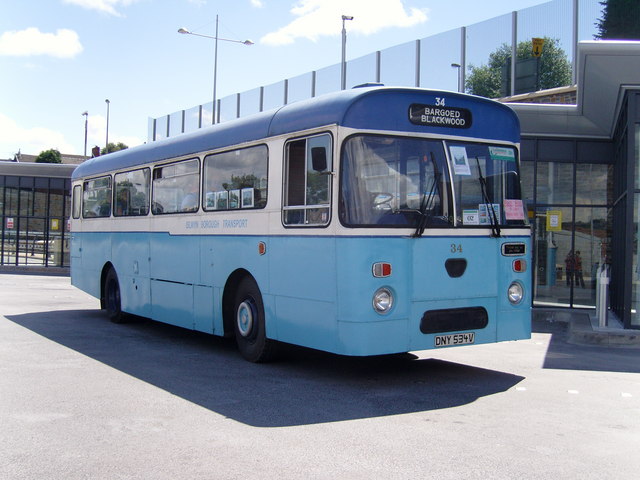
Blackwood Interchange
Blackwood Interchange (Welsh: Cyfnewidfa Coed Duon) is a bus station located in the town centre of Blackwood, Caerphilly, South Wales. It is situated on...
Nearby Amenities
Located within 500m of 51.675137,-3.199983Have you been to Blackwood?
Leave your review of Blackwood below (or comments, questions and feedback).