Coed Duon
Community in Monmouthshire
Wales
Coed Duon

Coed Duon is a small community located in the county of Monmouthshire, Wales. Situated in the eastern part of the county, it lies approximately 5 miles northwest of the town of Abergavenny. The community covers an area of about 3 square miles and is nestled within the picturesque Usk Valley.
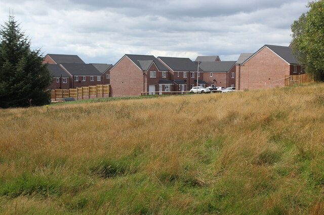
Coed Duon is primarily a rural area characterized by rolling hills, lush green fields, and dense woodlands. The community is home to a small population, with a mix of residential properties and agricultural land. The landscape offers stunning views of the surrounding countryside, making it an attractive place for nature lovers and outdoor enthusiasts.
The community benefits from its proximity to the Brecon Beacons National Park, which lies to the west. This provides residents and visitors with ample opportunities for hiking, biking, and exploring the natural beauty of the area. The nearby River Usk also offers recreational activities such as fishing and boating.
Although Coed Duon is predominantly rural, it is conveniently located near the town of Abergavenny, which provides essential amenities and services. Abergavenny offers a range of shops, schools, healthcare facilities, and leisure activities, ensuring that residents have access to everything they need.
Overall, Coed Duon offers a peaceful and idyllic lifestyle in a stunning natural setting. Its close proximity to both the Brecon Beacons National Park and Abergavenny makes it an ideal location for those seeking a balance between rural tranquility and urban convenience.
If you have any feedback on the listing, please let us know in the comments section below.
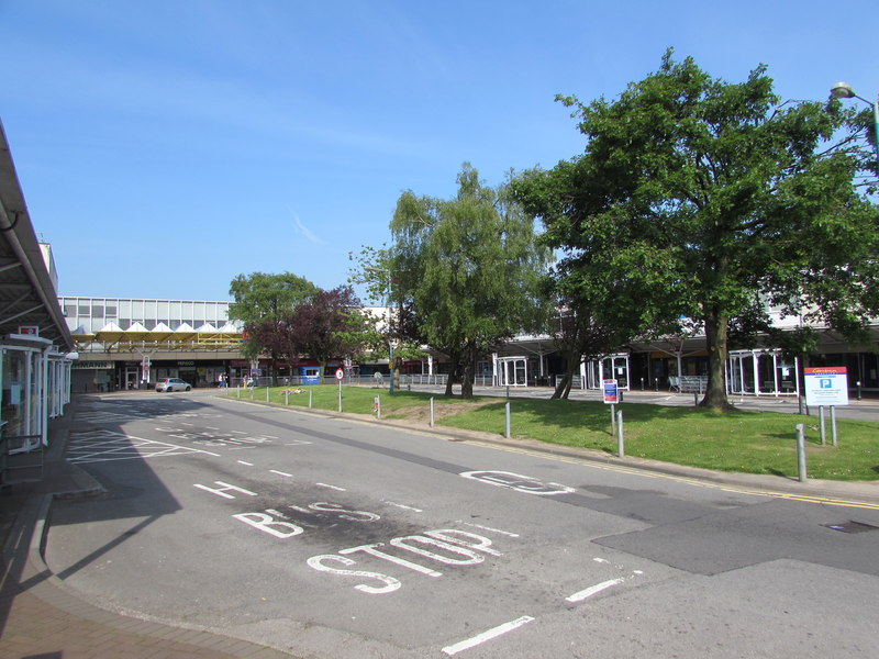
Coed Duon Images
Images are sourced within 2km of 51.675137/-3.199983 or Grid Reference ST1798. Thanks to Geograph Open Source API. All images are credited.


Coed Duon is located at Grid Ref: ST1798 (Lat: 51.675137, Lng: -3.199983)
Unitary Authority: Caerphilly
Police Authority: Gwent
Also known as: Blackwood
What 3 Words
///hunt.magazines.intestine. Near Blackwood, Caerphilly
Related Wikis
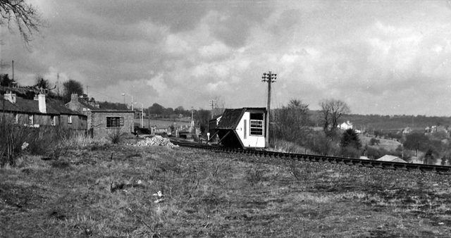
Blackwood railway station (Wales)
Blackwood railway station (Welsh: Y Coed Duon) was a station on the Sirhowy Railway. It served the town of Blackwood, Caerphilly. == History == The station...
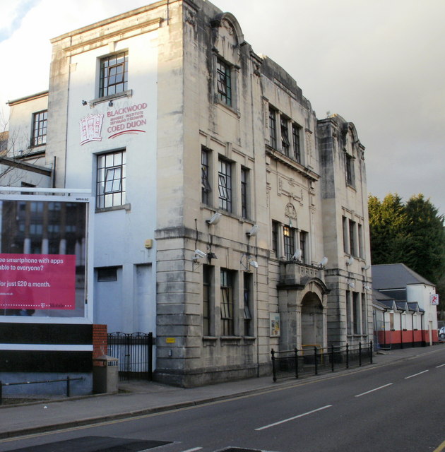
Blackwood Miners Welfare Institute
The Blackwood Miners Welfare Institute (Welsh: Sefydliad y Glowyr Coed Duon) is a Grade II* listed building located at the north end of Blackwood High...

Maes Manor
Maes Manor is a country house near Blackwood, Caerphilly, Wales. It dates mainly from the early 20th century and is notable for its gardens, designed by...

Cefn Fforest
Cefn Fforest is a community and an electoral ward in Caerphilly County Borough, Wales. A wholly urbanized community, it forms the western fringes of the...
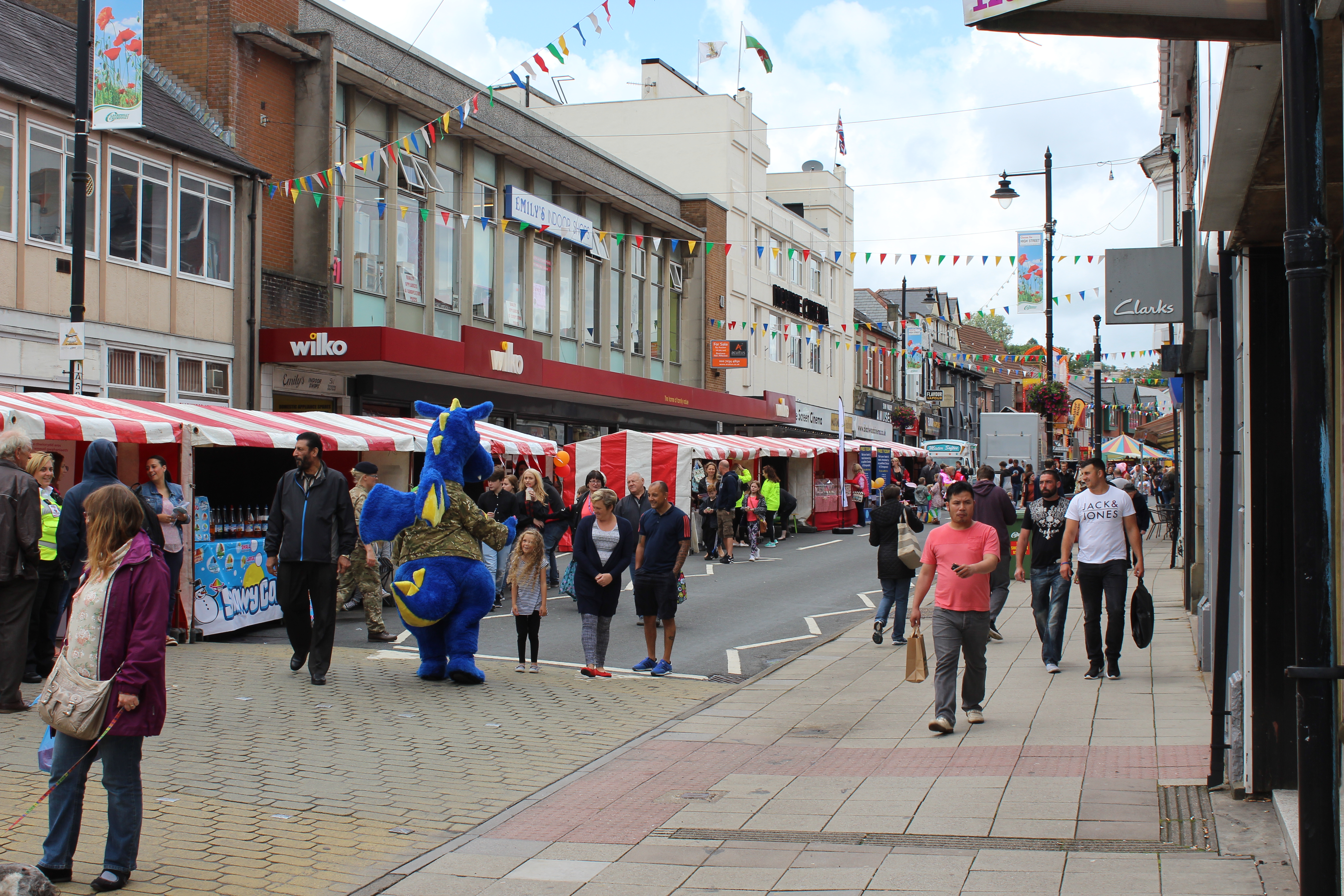
Blackwood, Caerphilly
Blackwood (Welsh: Coed Duon) is a town, community and an electoral ward on the Sirhowy River in the South Wales Valleys administered as part of Caerphilly...
Oakdale Comprehensive School
Oakdale Comprehensive School was a comprehensive school located in the village of Oakdale, Caerphilly Oakdale in Caerphilly county, Wales. The total enrollment...
Cwmbran bus station
Cwmbran bus station (Welsh: Gorsaf bws Cwmbrân) is a bus terminus and interchange located in the town centre of Cwmbran, South Wales. == Background... ==
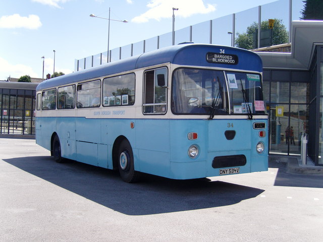
Blackwood Interchange
Blackwood Interchange (Welsh: Cyfnewidfa Coed Duon) is a bus station located in the town centre of Blackwood, Caerphilly, South Wales. It is situated on...
Nearby Amenities
Located within 500m of 51.675137,-3.199983Have you been to Coed Duon?
Leave your review of Coed Duon below (or comments, questions and feedback).