Beulah

Community in Cardiganshire

Wales

Beulah

The road up to Brongwyn This steep narrow lane almost overgrown with vegetation in places leads from the B4570 to the B4333.
The road up to Brongwyn Credit: Nigel Mykura

Beulah is a small community located in the county of Cardiganshire, Wales. Situated in the picturesque countryside, it is surrounded by rolling hills and lush green fields, providing residents with beautiful scenic views. The community is nestled in the upper Teifi Valley, near the towns of Llanddewi Brefi and Tregaron.

Beulah is known for its tranquility and peaceful atmosphere, making it a popular destination for those seeking a quiet and idyllic lifestyle. The community primarily consists of residential properties, with a few local businesses catering to the needs of the residents.

The village has a close-knit community, where residents often engage in various social activities. The annual Beulah Carnival is a highlight of the community calendar, bringing together locals and visitors for a day of fun-filled festivities. The carnival features a parade, games, food stalls, and live entertainment, fostering a sense of community spirit.

The area is also renowned for its natural beauty, with many outdoor activities available for residents and visitors alike. The nearby Cors Caron Nature Reserve offers stunning walking trails, allowing nature enthusiasts to explore the diverse flora and fauna of the region. Additionally, the Teifi Pools, a series of picturesque lakes, provide opportunities for fishing and boating.

Overall, Beulah is a charming and peaceful community that offers a serene and picturesque setting for its residents. With its close-knit community, beautiful surroundings, and access to outdoor activities, it is an ideal place for those seeking a tranquil lifestyle in the heart of the Welsh countryside.

If you have any feedback on the listing, please let us know in the comments section below.
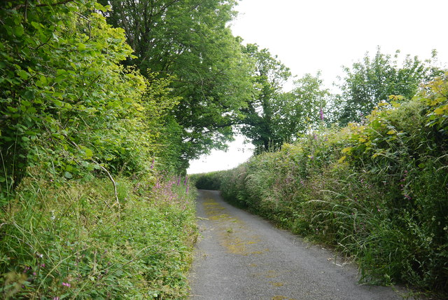
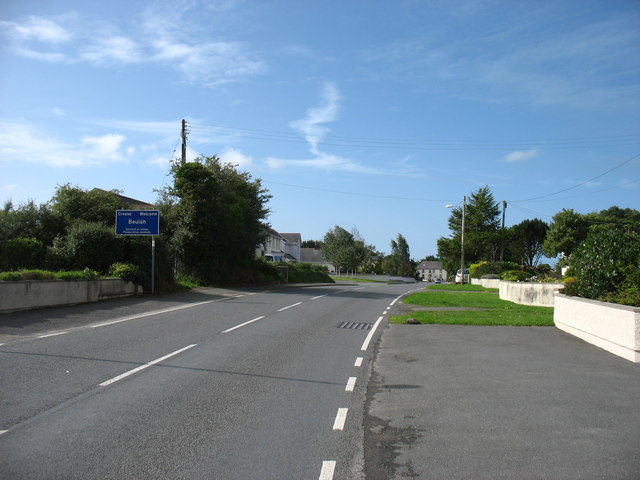
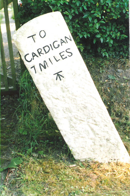
Beulah Images

Images are sourced within 2km of 52.077023/-4.514433 or Grid Reference SN2745. Thanks to Geograph Open Source API. All images are credited.

The road up to Brongwyn This steep narrow lane almost overgrown with vegetation in places leads from the B4570 to the B4333.
The road up to Brongwyn
This steep narrow lane almost overgrown with vegetation in places leads from the B4570 to the B4333.
Entering Beulah On the B4333.
Entering Beulah
On the B4333.
Old Milestone by the B4570, south east of Capel Tygwydd Cardigan tombstone by the B4570, in parish of Beulah (Ceredigion District), by "Milestone", South East of Capel Tygwydd, in front of domestic hedge.

Inscription reads:-
TO
CARDIGAN
7 MILES
Carved bench mark below inscription.

Grade II listed by Cadw. Reference Number: 16822
<span class="nowrap"><a title="https://cadwpublic-api.azurewebsites.net/reports/listedbuilding/FullReport?lang=&id=16822" rel="nofollow ugc noopener" href="https://cadwpublic-api.azurewebsites.net/reports/listedbuilding/FullReport?lang=&id=16822">Link</a><img style="margin-left:2px;" alt="External link" title="External link - shift click to open in new window" src="https://s1.geograph.org.uk/img/external.png" width="10" height="10"/></span>

Surveyed

Milestone Society National ID: CRD_CALA07.
Old Milestone by the B4570, south east of Capel Tygwydd
Cardigan tombstone by the B4570, in parish of Beulah (Ceredigion District), by "Milestone", South East of Capel Tygwydd, in front of domestic hedge. Inscription reads:- TO CARDIGAN 7 MILES Carved bench mark below inscription. Grade II listed by Cadw. Reference Number: 16822 LinkExternal link Surveyed Milestone Society National ID: CRD_CALA07.
Old Milestone by the B4570, Nantgwgan, Beulah parish Cardigan tombstone by the B4570, in parish of Beulah (Ceredigion District), Nantgwgan, South of Ponthirwaun, on verge.

Inscription reads:-
TO
CARDIGAN
6 MILES
Carved bench mark middle face.

Grade II listed by Cadw.
Reference Number: 17974 <span class="nowrap"><a title="https://cadwpublic-api.azurewebsites.net/reports/listedbuilding/FullReport?lang=&id=17974" rel="nofollow ugc noopener" href="https://cadwpublic-api.azurewebsites.net/reports/listedbuilding/FullReport?lang=&id=17974">Link</a><img style="margin-left:2px;" alt="External link" title="External link - shift click to open in new window" src="https://s1.geograph.org.uk/img/external.png" width="10" height="10"/></span>

Surveyed

Milestone Society National ID: CRD_CALA06
Old Milestone by the B4570, Nantgwgan, Beulah parish
Cardigan tombstone by the B4570, in parish of Beulah (Ceredigion District), Nantgwgan, South of Ponthirwaun, on verge. Inscription reads:- TO CARDIGAN 6 MILES Carved bench mark middle face. Grade II listed by Cadw. Reference Number: 17974 LinkExternal link Surveyed Milestone Society National ID: CRD_CALA06
Ordnance Survey Cut Mark This OS cut mark can be found on the wall at the gate leading to St Mary's Church. It marks a point 89.555m above mean sea level.
Ordnance Survey Cut Mark
This OS cut mark can be found on the wall at the gate leading to St Mary's Church. It marks a point 89.555m above mean sea level.
Ordnance Survey 1GL Bolt This OS Bolt can be found on the SE angle of St Mary's Church. It marks a point 88.9135m above mean sea level.
Ordnance Survey 1GL Bolt
This OS Bolt can be found on the SE angle of St Mary's Church. It marks a point 88.9135m above mean sea level.
Ordnance Survey Cut Mark This OS cut mark can be found on the stone NE side of the road. It marks a point 127.373m above mean sea level.
Ordnance Survey Cut Mark
This OS cut mark can be found on the stone NE side of the road. It marks a point 127.373m above mean sea level.
Ordnance Survey Cut Mark This OS cut mark can be found on the water tap at the road junction. It marks a point 118.909m above mean sea level.
Ordnance Survey Cut Mark
This OS cut mark can be found on the water tap at the road junction. It marks a point 118.909m above mean sea level.
Ordnance Survey Cut Mark This hidden and damaged OS cut mark can be found on the gatepost east side of the road. It marks a point 101.517m above mean sea level.
Ordnance Survey Cut Mark
This hidden and damaged OS cut mark can be found on the gatepost east side of the road. It marks a point 101.517m above mean sea level.
Ordnance Survey Cut Mark This OS cut mark can be found on Pant Glas Cottage. It marks a point 68.753m above mean sea level.
Ordnance Survey Cut Mark
This OS cut mark can be found on Pant Glas Cottage. It marks a point 68.753m above mean sea level.
Ordnance Survey 1GL Bolt This OS bolt can be found on the SW angle of the chapel. It marks a point 56.6178m above mean sea level.
Ordnance Survey 1GL Bolt
This OS bolt can be found on the SW angle of the chapel. It marks a point 56.6178m above mean sea level.
Ordnance Survey Cut Mark This OS cut mark can be found on the boulder NW side of the road. It marks a point 124.633m above mean sea level.
Ordnance Survey Cut Mark
This OS cut mark can be found on the boulder NW side of the road. It marks a point 124.633m above mean sea level.
Ordnance Survey Cut Mark This OS cut mark can be found on the NW angle of the chapel. It marks a point 180.325m above mean sea level.
Ordnance Survey Cut Mark
This OS cut mark can be found on the NW angle of the chapel. It marks a point 180.325m above mean sea level.
Llwybr ceffyl Coedycwm / Coedycwm bridleway Llwybr ceffyl yn gadael heol fach ger Ffarm Coedycwm.

A public footpath exiting a minor road near Coedycwm Farm (trans. valley wood).
Llwybr ceffyl Coedycwm / Coedycwm bridleway
Llwybr ceffyl yn gadael heol fach ger Ffarm Coedycwm. A public footpath exiting a minor road near Coedycwm Farm (trans. valley wood).
Llwybr Coedycwm / Coedycwm path Llwybr ceffyl yn dringo'r allt uwchben Ffarm Coedybryn.

A bridleway ascending the hill near Coedybryn Farm (trans. valley wood).
Llwybr Coedycwm / Coedycwm path
Llwybr ceffyl yn dringo'r allt uwchben Ffarm Coedybryn. A bridleway ascending the hill near Coedybryn Farm (trans. valley wood).
Llwybr ger Penwern Fach / A path near Penwern Fach Llwybr yn mynd i lawr y waered tuag at Cwm Hirwaun.

A public right of way descends towards Cwm Hirwaun (trans. long meadow / fen valley).
Llwybr ger Penwern Fach / A path near Penwern Fach
Llwybr yn mynd i lawr y waered tuag at Cwm Hirwaun. A public right of way descends towards Cwm Hirwaun (trans. long meadow / fen valley).
B4570 southeast of Neuadd Cross
B4570 passes through Pont-Hirwaun
Show me another place!

Beulah is located at Grid Ref: SN2745 (Lat: 52.077023, Lng: -4.514433)

Unitary Authority: Ceredigion

Police Authority: Dyfed-Powys

What 3 Words

///unites.comedy.oblige. Near Newcastle Emlyn, Ceredigion

Nearby Locations

Beulah

Related Wikis

Beulah, Ceredigion

Beulah (Welsh: Bwla) is a small village, wider community and electoral ward located halfway between the market town of Newcastle Emlyn and the seaside...

Ponthirwaun

Ponthirwaun is a hamlet in the community of Beulah, Ceredigion, Wales, which is 71.3 miles (114.8 km) from Cardiff and 192.5 miles (309.7 km) from London...

Capel Tygwydd

Capel Tygwydd is a hamlet in the community of Beulah, Ceredigion, Wales, which is 70.3 miles (113.1 km) from Cardiff and 191.7 miles (308.5 km) from London...

Brongwyn

Brongwyn is a hamlet in the community of Beulah, Ceredigion, Wales, which is 69.5 miles (111.9 km) from Cardiff and 190.7 miles (306.9 km) from London...

Have you been to Beulah?

Leave your review of Beulah below (or comments, questions and feedback).