Barmouth
Community in Merionethshire
Wales
Barmouth

Barmouth is a charming coastal town nestled on the west coast of Wales, in the county of Merionethshire. It is located at the mouth of the River Mawddach, where it meets Cardigan Bay. With a population of approximately 2,500 residents, Barmouth is a popular tourist destination due to its stunning natural beauty and historical significance.
The town boasts a picturesque sandy beach, known for its cleanliness and excellent water quality, making it an ideal spot for sunbathing, swimming, and various water sports. The beach is backed by a promenade, lined with cafes, shops, and amusement arcades, providing a vibrant and lively atmosphere during the summer months.
Barmouth's history is rich, and evidence of its past can be seen in the town's architecture. The iconic Barmouth Bridge, built in the late 19th century, is a testament to the town's industrial heritage. This railway viaduct spans the river and connects Barmouth to the nearby town of Fairbourne, offering breathtaking views of the estuary and surrounding mountains.
Outdoor enthusiasts are drawn to Barmouth for its proximity to Snowdonia National Park. The park's rugged mountains and stunning landscapes provide ample opportunities for hiking, mountain biking, and climbing. The popular Mawddach Trail, a scenic walking and cycling path, starts in Barmouth and follows the old railway line along the estuary towards Dolgellau.
In addition to its natural beauty, Barmouth hosts a variety of events and festivals throughout the year, including the Barmouth Carnival and the Barmouth Comedy Festival, attracting visitors from far and wide.
Overall, Barmouth is a charming coastal town that offers a perfect combination of natural beauty, historical landmarks, and outdoor activities, making it an appealing destination for both locals and tourists alike.
If you have any feedback on the listing, please let us know in the comments section below.
Barmouth Images
Images are sourced within 2km of 52.73084/-4.055823 or Grid Reference SH6116. Thanks to Geograph Open Source API. All images are credited.


![St Bodfan's & St Mary's, Llanaber The church, seen from near the entrance to the churchyard on Llanaber Road [A496].](https://s0.geograph.org.uk/geophotos/02/30/26/2302620_279350d6.jpg)


Barmouth is located at Grid Ref: SH6116 (Lat: 52.73084, Lng: -4.055823)
Unitary Authority: Gwynedd
Police Authority: North Wales
Also known as: Bermo
What 3 Words
///bounding.flattery.baked. Near Barmouth, Gwynedd
Related Wikis

Plas Mynach
Plas Mynach is a large country house in Barmouth, Gwynedd, Wales. It is designated by Cadw as a Grade II* listed building, and stands in a prominent position...

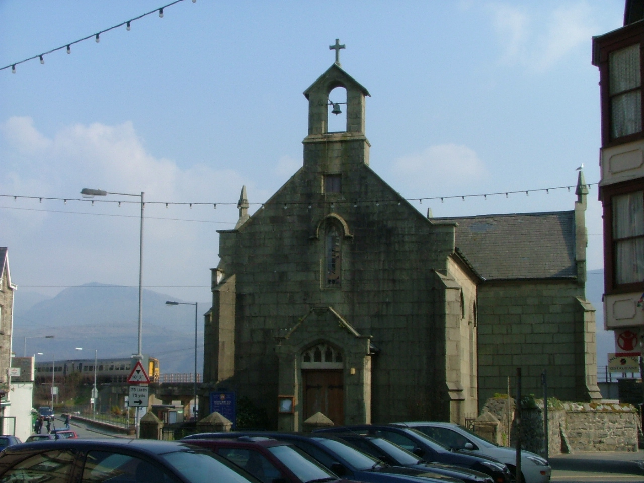
St Tudwal's Church, Barmouth
St Tudwal's Church is a Roman Catholic parish church in Barmouth, Gwynedd. It is situated on the King Edward Road leading from Barmouth to Llanaber. It...
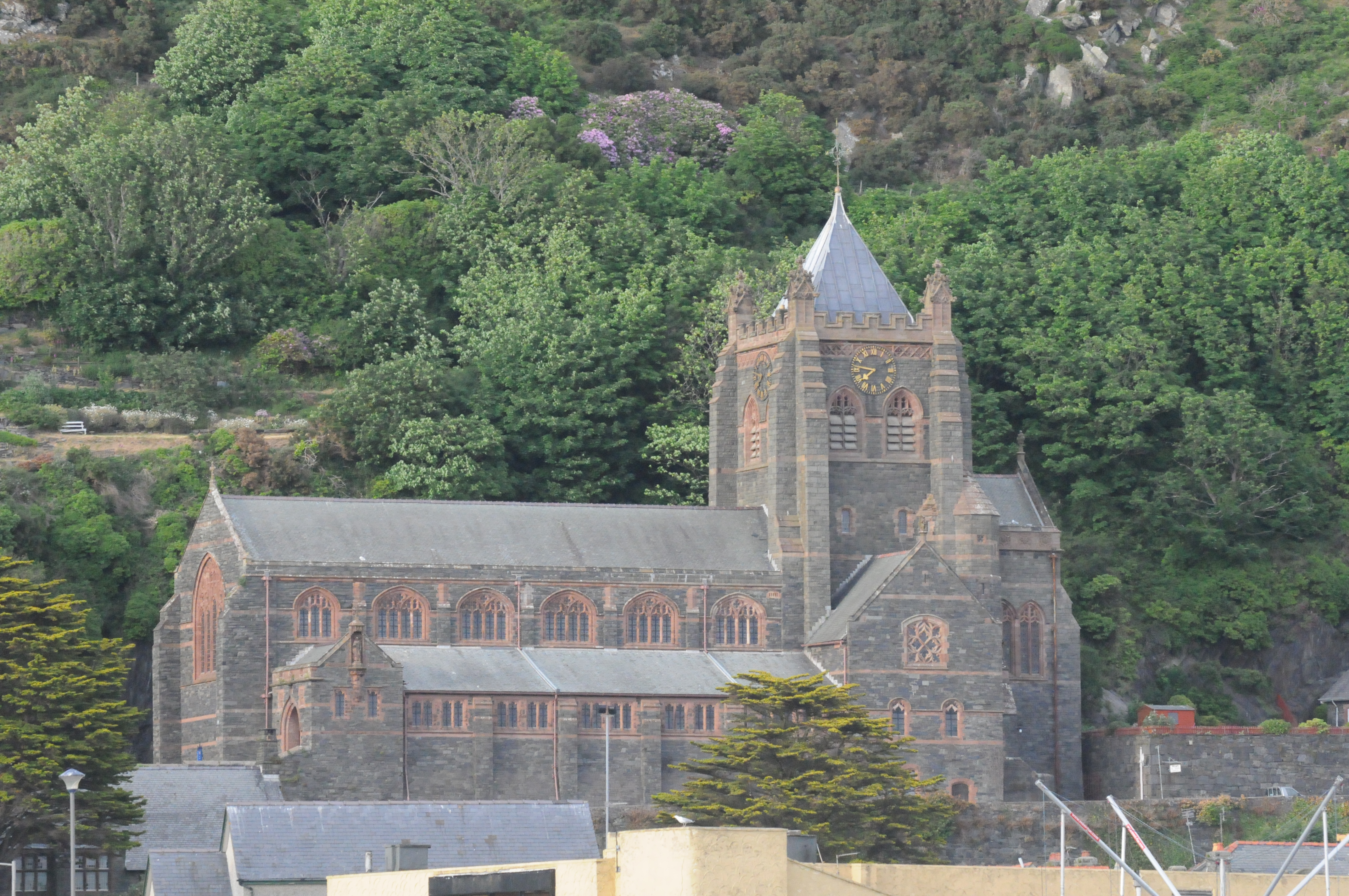
St John's Church, Barmouth
St John's Church, Barmouth, Gwynedd, Wales was built between 1889 and 1895 and designed by the Chester architects Douglas and Fordham. The foundation stone...

Barmouth railway station
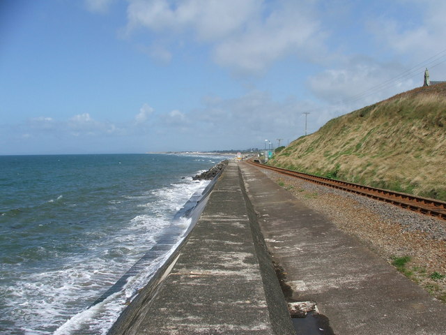
Barmouth railway station serves the seaside town of Barmouth in Gwynedd, Wales. The station is on the Cambrian Coast Railway with passenger services to...

Barmouth
Barmouth (Welsh: Abermaw (formal); Y Bermo (colloquial)) is a seaside town and community in the county of Gwynedd, north-west Wales; it lies on the estuary...

Barmouth Lifeboat Station
Barmouth Lifeboat Station, based in Barmouth, Gwynedd, Wales, was established in the 1820s and the first lifeboat station was constructed in 1828 at a...
St David's Church, Barmouth
St David's Church is a Church in Wales church by the harbour of Barmouth, Gwynedd, west Wales. It is part of the Bro Ardudwy Ministry Area. == History... ==

Llanaber
Llanaber is a linear coastal village in north west Wales, about 0.7 miles (1.1 km) north of Barmouth on the A496 road. The Irish Sea lies directly to the...
Nearby Amenities
Located within 500m of 52.73084,-4.055823Have you been to Barmouth?
Leave your review of Barmouth below (or comments, questions and feedback).