Aberedw

Community in Radnorshire

Wales

Aberedw

Cefnhinog Farm on a January evening After some 7 to 8 hours walking on the surrounding hills I am glad to reach the valley bottom farms and cottages again.
Cefnhinog Farm on a January evening Credit: Jeremy Bolwell

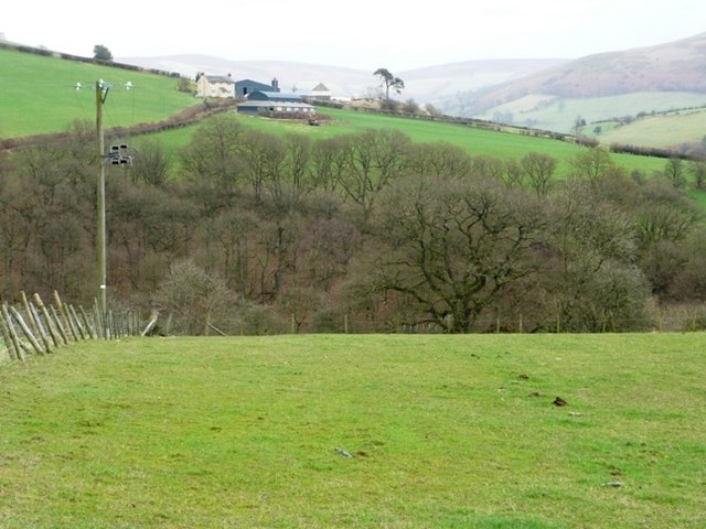
Aberedw is a small community located in the county of Radnorshire, Wales. Situated in the picturesque Wye Valley, it is surrounded by rolling hills and stunning natural landscapes. The community is part of the larger administrative area of Powys.

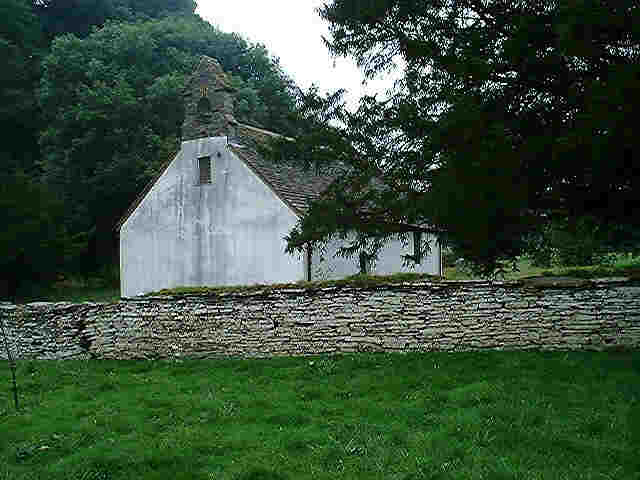
Aberedw is known for its rich history, with evidence of human settlement dating back thousands of years. The area is home to several ancient monuments and archaeological sites, including the remnants of a Roman fort. The community also boasts a charming village, characterized by traditional Welsh architecture and a close-knit community spirit.

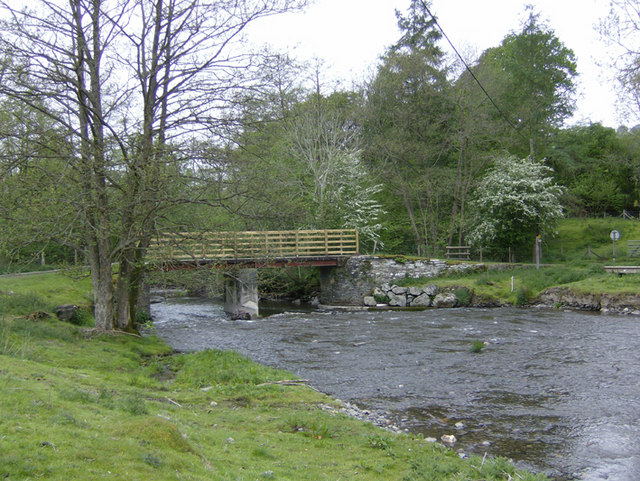
Nature enthusiasts are drawn to Aberedw for its abundant wildlife and scenic beauty. The River Wye, one of the UK's most renowned rivers, flows through the community, offering opportunities for fishing and water-based activities. The surrounding countryside provides ample space for hiking, cycling, and exploring the great outdoors.

Aberedw is also a popular destination for those seeking tranquility and peace. The community offers a range of accommodation options, including cozy bed and breakfasts and self-catering cottages, allowing visitors to immerse themselves in the rural charm of the area.

Despite its small size, Aberedw is well-served by amenities and facilities. The community has a primary school, a village hall, and a local pub, providing a hub for socializing and community events.

Overall, Aberedw is a hidden gem in Radnorshire, offering a perfect blend of history, natural beauty, and a warm community atmosphere.

If you have any feedback on the listing, please let us know in the comments section below.

Aberedw Images

Images are sourced within 2km of 52.133077/-3.312771 or Grid Reference SO1049. Thanks to Geograph Open Source API. All images are credited.

Cefnhinog Farm on a January evening After some 7 to 8 hours walking on the surrounding hills I am glad to reach the valley bottom farms and cottages again.
Cefnhinog Farm on a January evening
After some 7 to 8 hours walking on the surrounding hills I am glad to reach the valley bottom farms and cottages again.
View over the hedge to Court Farm on a January evening The farm looks warm and welcoming on a cool January evening.
View over the hedge to Court Farm on a January evening
The farm looks warm and welcoming on a cool January evening.
Above Pen-blaen The edge of enclosed land on the southern side of Aberedw Hill.
Above Pen-blaen
The edge of enclosed land on the southern side of Aberedw Hill.
Green lane, Llatho. A green lane, now bridleway running up on to the common grazings of Aberedw Hill. These routes, now adapted for tractors and all terrain vehicles are often gently graded running at an angle across steep hillsides.
Green lane, Llatho.
A green lane, now bridleway running up on to the common grazings of Aberedw Hill. These routes, now adapted for tractors and all terrain vehicles are often gently graded running at an angle across steep hillsides.
Abandoned sheep dip, Pen Blaen There is a saying. "Look up the river for a wife, and down the river for a farm."
It was the ambition of a tenant farmer to move to better land down stream on lower ground, especially the richer lands in England. My own family took this route out of Radnorshire.
This illustrates a trend for if there is a net loss of people living off the land the higher farms are abandoned. 
This is quite a modern looking sheepdip, now the descendants of the sheep that went through here are  farmed from a far bigger enterprise in the valley, a consolidation of many small units that once grazed a few sheep on the common.
Abandoned sheep dip, Pen Blaen
There is a saying. "Look up the river for a wife, and down the river for a farm." It was the ambition of a tenant farmer to move to better land down stream on lower ground, especially the richer lands in England. My own family took this route out of Radnorshire. This illustrates a trend for if there is a net loss of people living off the land the higher farms are abandoned. This is quite a modern looking sheepdip, now the descendants of the sheep that went through here are farmed from a far bigger enterprise in the valley, a consolidation of many small units that once grazed a few sheep on the common.
Little road bridge over the Aber Edw On a minor road in the beautiful old county of Radnorshire.
Little road bridge over the Aber Edw
On a minor road in the beautiful old county of Radnorshire.
Llandeilo Hill and the Edw valley The north-western slopes of Llandeilo Hill. The River Edw flows through the valley in the background.
Llandeilo Hill and the Edw valley
The north-western slopes of Llandeilo Hill. The River Edw flows through the valley in the background.
Access land above Blaenmilo-uchaf A tongue of access land south-east of Aberedw Hill covers the western half of this square.  This is moorland sheep grazing land with easy walking but very strong westerly winds.
Access land above Blaenmilo-uchaf
A tongue of access land south-east of Aberedw Hill covers the western half of this square. This is moorland sheep grazing land with easy walking but very strong westerly winds.
Just below the moorland Behind is the wall and stile leading onto the open moorland.  In front is the ever steepening slope towards the Edw valley.  This is the top of the enclosed fields, mainly sheep pasture although evidence here of possible planting as this old machine appears to be a seed drill (further suggestions welcome).
Just below the moorland
Behind is the wall and stile leading onto the open moorland. In front is the ever steepening slope towards the Edw valley. This is the top of the enclosed fields, mainly sheep pasture although evidence here of possible planting as this old machine appears to be a seed drill (further suggestions welcome).
Looking across to Rhyscog The hill farm of Rhyscog is seen across pasture land and a deep, wooded side valley of the Edw, Milo Brook.
Looking across to Rhyscog
The hill farm of Rhyscog is seen across pasture land and a deep, wooded side valley of the Edw, Milo Brook.
Towards Pen-y-bryn A footpath heads north across sheep pasture towards a modern house marked on the 1:25K maps as Pen-y-bryn.
Towards Pen-y-bryn
A footpath heads north across sheep pasture towards a modern house marked on the 1:25K maps as Pen-y-bryn.
Bridge over the Edw The river Edw is in flood but the bridge is high enough above to give a dry crossing.
Bridge over the Edw
The river Edw is in flood but the bridge is high enough above to give a dry crossing.
House next to the Edw The house lies on a minor road from Rhulen to Aberedw, sufficiently far above the river not to risk flooding and in the lee of Llandeilo Hill.
House next to the Edw
The house lies on a minor road from Rhulen to Aberedw, sufficiently far above the river not to risk flooding and in the lee of Llandeilo Hill.
Moorland pool On the open access moorland section this pool has formed in a shallow dip.  The ground around is surprisingly dry; presumably it runs off quickly into the pool.
Moorland pool
On the open access moorland section this pool has formed in a shallow dip. The ground around is surprisingly dry; presumably it runs off quickly into the pool.
River Edw The river just clips the south-east corner of this square, parallel to a minor road up the valley.
River Edw
The river just clips the south-east corner of this square, parallel to a minor road up the valley.
Path to Rhyscog This path climbs from the bridge over the Edw towards Rhyscog.  Looking back, the track is not always as clear as marked on the 1:25K map.  Often it is a stream.
Path to Rhyscog
This path climbs from the bridge over the Edw towards Rhyscog. Looking back, the track is not always as clear as marked on the 1:25K map. Often it is a stream.
Farmland south of Rhyscog The fields between the river and the moorland are mainly sheep pasture.
Farmland south of Rhyscog
The fields between the river and the moorland are mainly sheep pasture.
Path to Rhyscog The path is not always as clear as on the 1:25K map.  Here the mud takes over around a sheep feeder.
Path to Rhyscog
The path is not always as clear as on the 1:25K map. Here the mud takes over around a sheep feeder.
Show me another place!

Aberedw is located at Grid Ref: SO1049 (Lat: 52.133077, Lng: -3.312771)

Unitary Authority: Powys

Police Authority: Dyfed Powys

What 3 Words

///reserves.funny.albums. Near Builth Wells, Powys

Nearby Locations

Aberedw Pen-y-berth Wood

Related Wikis

Llanbadarn y Garreg

Llanbadarn-y-Garreg is a village in the community of Aberedw, Powys, Wales. It is 45.1 miles (72.6 km) from Cardiff and 141.9 miles (228.4 km) from London...
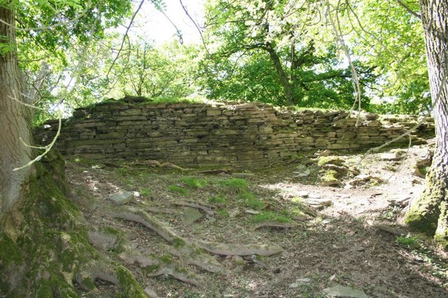
Aberedw Castle

The remains of Aberedw Castle, also known as 'Castle in Elfael Uwch Mynydd', are located at the small village of Aberedw in the county of Powys, Mid-Wales...

Aberedw railway station

Aberedw railway station served the village of Aberedw in Powys, Wales. Aberedw Castle was demolished to build the station and some of the stone from the...

Aberedw

Aberedw is a village and community in Radnorshire, Powys, Wales. The community covers an area of 3,055 hectares (11.80 sq mi). Its population was 229,...

Alltmawr

Alltmawr is a village in the community of Erwood, Powys, Wales, which is 44 miles (71 km) from Cardiff and 144 miles (232 km) from London. St Mauritius...

Llanfaredd Halt railway station

Llanfaredd Halt railway station was an unstaffed railway station opened by the Great Western Railway on 7 May 1934 on the old Mid-Wales line between Builth...

District of Radnorshire

The District of Radnorshire (Welsh: Maesyfed) was one of three local government districts of the county of Powys, Wales, from 1974 until 1996. The district...

Colwyn Castle

Colwyn Castle was a medieval castle near Llansantffraed in Wales. In the Manor of Glascwm, in the county of Radnorshire.It was built on the site of a Roman...

Have you been to Aberedw?

Leave your review of Aberedw below (or comments, questions and feedback).