Yorkletts

Settlement in Kent Canterbury

England

Yorkletts

Holiday Park at Seasalter There are many chalet and caravan parks along this shore, this one, near the Blue Anchor pub, is right on the beach, separated only by a lowish sea wall and the Saxon Shore Way. Looking east towards Whitstable.
Holiday Park at Seasalter Credit: Penny Mayes

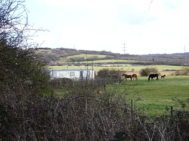
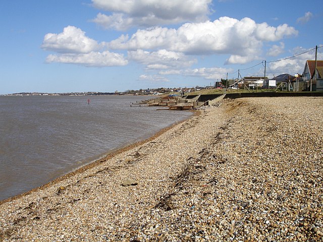
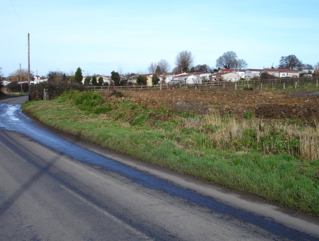
Yorkletts is a small village located in the county of Kent, in southeastern England. Situated along the coast, it lies on the northeastern outskirts of the larger seaside town of Whitstable. With a population of approximately 1,000 residents, it is known for its picturesque rural setting and tranquil atmosphere.

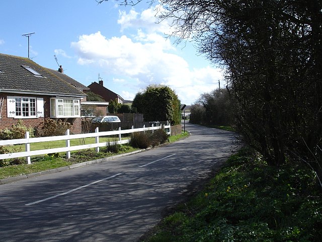
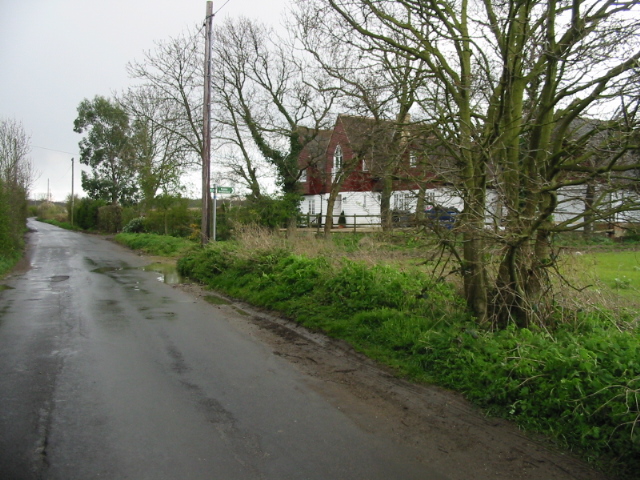
The village is characterized by its charming traditional cottages and historic buildings, many of which date back to the 18th and 19th centuries. The local architecture reflects the area's rich heritage and adds to the village's quaint and idyllic appeal.

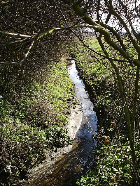
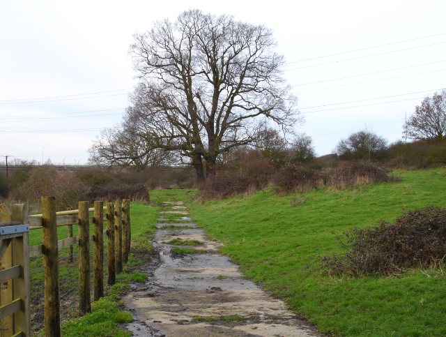
Yorkletts is surrounded by stunning natural landscapes, including vast fields and farmland. The area is particularly famous for its beautiful orchards and fruit farms, which contribute to the local economy and provide a scenic backdrop for visitors and residents alike.

Despite its small size, Yorkletts boasts a strong sense of community and offers a range of amenities to its residents. These include a local primary school, a village hall, a post office, and a few small shops and businesses. The village also benefits from its proximity to Whitstable, where residents can access a wider range of facilities, including supermarkets, restaurants, and leisure activities.

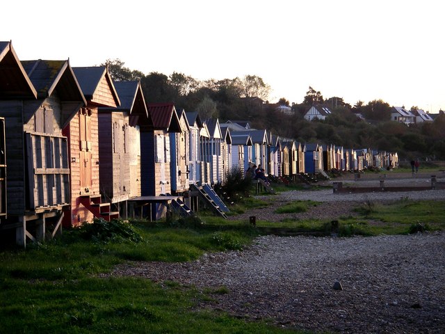
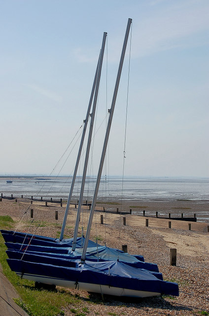
For those seeking outdoor activities, Yorkletts is conveniently located near the coast and various nature reserves. The nearby Oare Marshes Nature Reserve and Blean Woods provide opportunities for walking, birdwatching, and exploring the local flora and fauna.

Overall, Yorkletts is a charming and peaceful village, offering a serene retreat for those seeking a slower pace of life in the heart of the Kent countryside.

If you have any feedback on the listing, please let us know in the comments section below.
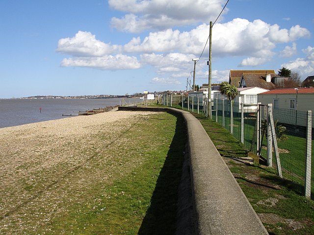
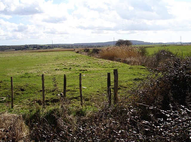
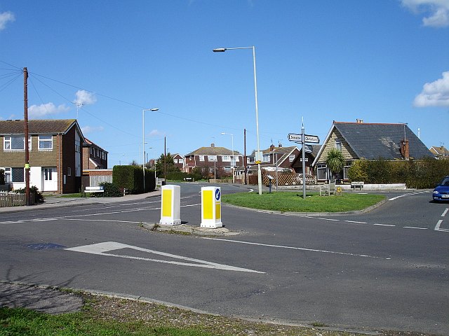
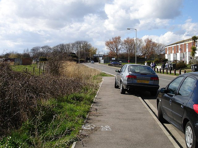
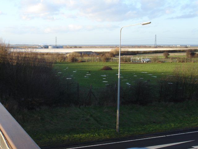
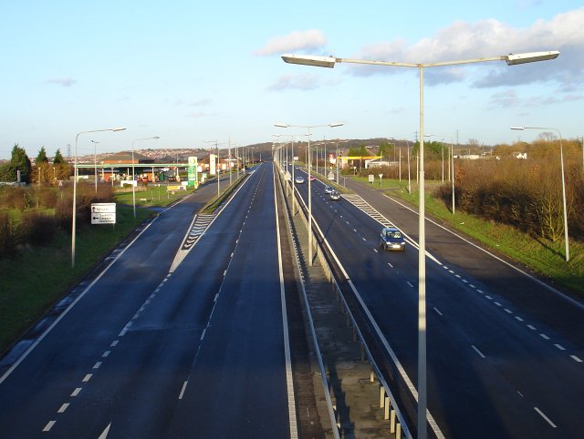
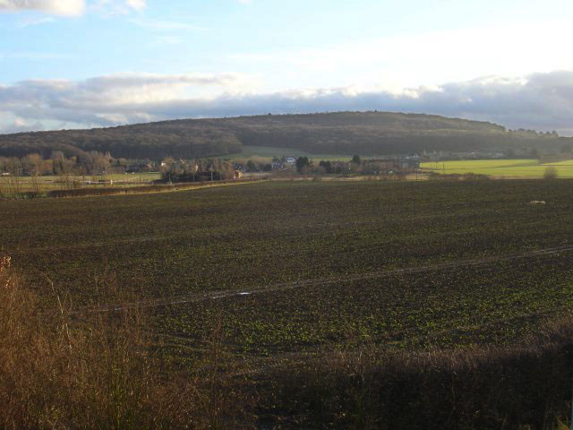
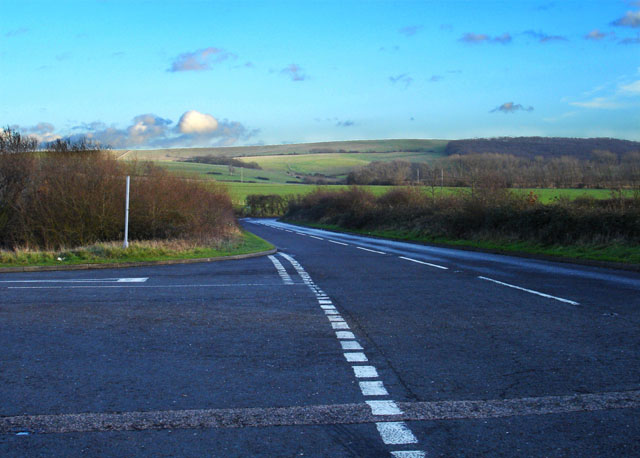
Yorkletts Images

Images are sourced within 2km of 51.330395/1.002081 or Grid Reference TR0963. Thanks to Geograph Open Source API. All images are credited.

Holiday Park at Seasalter There are many chalet and caravan parks along this shore, this one, near the Blue Anchor pub, is right on the beach, separated only by a lowish sea wall and the Saxon Shore Way. Looking east towards Whitstable.
Holiday Park at Seasalter
There are many chalet and caravan parks along this shore, this one, near the Blue Anchor pub, is right on the beach, separated only by a lowish sea wall and the Saxon Shore Way. Looking east towards Whitstable.
Seasalter Levels Marked on the map as a nature reserve and bordered by caravan parks the marsh (along with Graveney, Cleve and Nagden Marshes to the west) covers an area of about eleven square kilometres between here and Faversham Creek. It has been drained since the sea wall was built in the 14th century and is grazed by sheep and cattle. The feathery tops of the reeds show the positions of the drainage dykes. Looking south from Faversham Road, the pylons are in TR0863.
Seasalter Levels
Marked on the map as a nature reserve and bordered by caravan parks the marsh (along with Graveney, Cleve and Nagden Marshes to the west) covers an area of about eleven square kilometres between here and Faversham Creek. It has been drained since the sea wall was built in the 14th century and is grazed by sheep and cattle. The feathery tops of the reeds show the positions of the drainage dykes. Looking south from Faversham Road, the pylons are in TR0863.
Seasalter Cross Not a stone cross but a cross roads on the south western edge of this ancient borough, first recorded in an Anglo Saxon charter of 785 CE. Faversham Road is now the 'through' road, left for the Blue Anchor pub and the road along the sea wall  to Faversham, straight on for Joy Lane and eventually Whitstable. Church Lane runs right and was the road to Canterbury in Roman times but now runs up to the slip road from the east-bound Thanet Way. The fourth road, beside which I stood, is Seasalter Lane which runs south and under the Thanet Way to Yorkletts.
Seasalter Cross
Not a stone cross but a cross roads on the south western edge of this ancient borough, first recorded in an Anglo Saxon charter of 785 CE. Faversham Road is now the 'through' road, left for the Blue Anchor pub and the road along the sea wall to Faversham, straight on for Joy Lane and eventually Whitstable. Church Lane runs right and was the road to Canterbury in Roman times but now runs up to the slip road from the east-bound Thanet Way. The fourth road, beside which I stood, is Seasalter Lane which runs south and under the Thanet Way to Yorkletts.
The Blue Anchor, Seasalter Surrounded by caravan holiday parks this pub does a good trade in the summer. It stands near the point where the Faversham Road turns west to follow the sea wall along the Swale coast.
The Blue Anchor, Seasalter
Surrounded by caravan holiday parks this pub does a good trade in the summer. It stands near the point where the Faversham Road turns west to follow the sea wall along the Swale coast.
Railway bridge on Faversham Road, Seasalter The North Kent Coast line crosses the marshes between Faversham and Seasalter heading north towards the coast at this point, then runs along the shore until it enters Whitstable proper. Looking NW with Seasalter Level on the left.
Railway bridge on Faversham Road, Seasalter
The North Kent Coast line crosses the marshes between Faversham and Seasalter heading north towards the coast at this point, then runs along the shore until it enters Whitstable proper. Looking NW with Seasalter Level on the left.
The edge of the marsh, Seasalter A small caravan park and some horses on the north eastern edge of Seasalter Levels. The rising ground in the background is Wralk Hill in TR0963.
The edge of the marsh, Seasalter
A small caravan park and some horses on the north eastern edge of Seasalter Levels. The rising ground in the background is Wralk Hill in TR0963.
Seasalter Beach Looking east with Whitstable beyond and Herne Bay on the left.
Seasalter Beach
Looking east with Whitstable beyond and Herne Bay on the left.
Holiday Park, Seasalter One of the several caravan parks in this area. Looking south.
Holiday Park, Seasalter
One of the several caravan parks in this area. Looking south.
Seasalter Waterski Club On the seafront at the point where the Faversham Road turns sharp left to follow the coast. Looking west, the water is The Oaze, part of The Swale with the Isle of Sheppey visible to the north.
Seasalter Waterski Club
On the seafront at the point where the Faversham Road turns sharp left to follow the coast. Looking west, the water is The Oaze, part of The Swale with the Isle of Sheppey visible to the north.
Ditch by Seasalter Lane Looking south down the eastern edge of Seasalter Levels.
Ditch by Seasalter Lane
Looking south down the eastern edge of Seasalter Levels.
Seasalter Lane Running south from <a href="https://www.geograph.org.uk/photo/145412">TR0964 : Seasalter Cross</a> towards Yorkletts.
Seasalter Lane
Running south from TR0964 : Seasalter Cross towards Yorkletts.
Beach huts - Seasalter Beach huts between the sea and the (historic) railway.
Beach huts - Seasalter
Beach huts between the sea and the (historic) railway.
Seasalter Yachts
Seasalter Yachts
Nursery at Waterham The greenhouses of this huge plant nursery straddle the northern grid line of this square - the cylindrical structures are in <a href="https://www.geograph.org.uk/gridref/TR0763">TR0763</a>. Viewed from the bridge which crosses the Thanet Way which gives one of the few high vantage points in the area. Land to the left on the horizon is the Isle of Sheppey.
Nursery at Waterham
The greenhouses of this huge plant nursery straddle the northern grid line of this square - the cylindrical structures are in TR0763. Viewed from the bridge which crosses the Thanet Way which gives one of the few high vantage points in the area. Land to the left on the horizon is the Isle of Sheppey.
Services on the Thanet Way The A299 Thanet Way has been greatly improved in recent years and in this area has been transformed from a suicidal three-lane road to dual-carriageway. This has reduced accidents and traffic hold-ups on sunny summer weekends. Whitstable is visible on the left.
Services on the Thanet Way
The A299 Thanet Way has been greatly improved in recent years and in this area has been transformed from a suicidal three-lane road to dual-carriageway. This has reduced accidents and traffic hold-ups on sunny summer weekends. Whitstable is visible on the left.
Looking towards Dargate With Holly Hill (at 108 metres, a prominent feature hereabouts) in the background.
Looking towards Dargate
With Holly Hill (at 108 metres, a prominent feature hereabouts) in the background.
New road from Plumpudding Lane Local lanes which used to make dangerous junctions with the A299 Thanet Way now cross it via bridges with a complex network of slip roads. Plumpudding Lane, just visible, runs from the hamlet of Highstreet to Dargate but if you want to get to either place from Waterham you must use this road. Clay Hill in the background.
New road from Plumpudding Lane
Local lanes which used to make dangerous junctions with the A299 Thanet Way now cross it via bridges with a complex network of slip roads. Plumpudding Lane, just visible, runs from the hamlet of Highstreet to Dargate but if you want to get to either place from Waterham you must use this road. Clay Hill in the background.
Caravan Park on Seasalter Lane
Show me another place!

Yorkletts is located at Grid Ref: TR0963 (Lat: 51.330395, Lng: 1.002081)

Administrative County: Kent

District: Canterbury

Police Authority: Kent

What 3 Words

///majoring.shift.avid. Near Whitstable, Kent

Related Wikis

Foxes Cross Bottom

Foxes Cross Bottom is a 4-hectare (9.9-acre) Local Nature Reserve north-west of Whitstable in Kent. It is owned and managed by Canterbury City Council...

Yorkletts

Yorkletts is a settlement two miles south of Whitstable in Kent in South East England. At the 2011 Census the settlement was included in the Seasalter...

Duncan Down

Duncan Down is an open, public, area to the south west of Whitstable and is the largest village green in the United Kingdom. It is a 21 hectare (52 acre...

Seasalter Levels

Seasalter Levels is a 71.4-hectare (176-acre) Local Nature Reserve in Seasalter, on the western outskirts of Whitstable in Kent. It is owned and managed...

Ellenden Wood

Ellenden Wood is a 90.6-hectare (224-acre) biological Site of Special Scientific Interest south of Whitstable in Kent. It is a Nature Conservation Review...

Seasalter

Seasalter is a village (and district council ward) in the Canterbury District of Kent, England. Seasalter is on the north coast of Kent, between the towns...

Denstroude

Denstroude is a dispersed hamlet located to the west of the A290 road north of Canterbury in Kent, England. It is a collection of houses and farms, one...

Black Mill, Whitstable

Black Mill, or Borstal Hill Mill is a smock mill in Whitstable, Kent, England that was built in 1815. It is now a part of a private residence at the end...

Nearby Amenities

Located within 500m of 51.330395,1.002081
Power: tower
Source: Bing
Lat/Long: 51.333248/0.9998067
Post Box
Brand: Royal Mail
Brand Wikidata: Q638098
Collection Times: Mo-Fr 09:00; Sa 07:00
Operator: Royal Mail
Operator Wikidata: Q638098
Post Box Mounting: metal_post
Post Box Type: lamp
Postal Code: CT5
Ref: CT5 298
Royal Cypher: EIIR
Royal Cypher Wikidata: Q33102113
Source: survey
Lat/Long: 51.3281613/0.9995053
Bus Stop
Barn Close
Flag: no
Naptan AtcoCode: 2400A038590A
Naptan Bearing: SW
Naptan BusStopType: CUS
Naptan CommonName: Barn Close
Naptan Indicator: opp
Naptan Landmark: Barn Close
Naptan NaptanCode: kntdpgpw
Naptan Street: Dargate Road
Naptan Verified: no
Public Transport: platform
Source: naptan_import
Lat/Long: 51.3282337/0.9996921
Bus Stop
Barn Close
Flag: no
Naptan AtcoCode: 2400A038600A
Naptan Bearing: NE
Naptan BusStopType: CUS
Naptan CommonName: Barn Close
Naptan Indicator: adj
Naptan Landmark: Barn Close
Naptan NaptanCode: kntdpgta
Naptan Street: Dargate Road
Naptan Verified: no
Public Transport: platform
Source: naptan_import
Lat/Long: 51.3283118/0.9994531
Power: tower
Source: Bing
Lat/Long: 51.3322815/1.0073426
Power: tower
Source: Bing
Lat/Long: 51.3326611/1.0044006
Barrier: stile
Foot: yes
Motor Vehicle: no
Lat/Long: 51.3332175/0.9973787
Barrier: stile
Lat/Long: 51.331737/1.0078483
Generator Method: photovoltaic
Generator Output Electricity: yes
Generator Source: solar
Generator Type: solar_photovoltaic_panel
Location: roof
Power: generator
Lat/Long: 51.3311814/0.9998202
Generator Method: photovoltaic
Generator Output Electricity: yes
Generator Source: solar
Generator Type: solar_photovoltaic_panel
Location: roof
Power: generator
Lat/Long: 51.3310206/1.0006785
Generator Method: photovoltaic
Generator Output Electricity: yes
Generator Source: solar
Generator Type: solar_photovoltaic_panel
Location: roof
Power: generator
Lat/Long: 51.3309787/1.0004988
Generator Method: photovoltaic
Generator Output Electricity: yes
Generator Source: solar
Generator Type: solar_photovoltaic_panel
Location: roof
Power: generator
Lat/Long: 51.3309317/1.0002252
Generator Method: photovoltaic
Generator Output Electricity: yes
Generator Source: solar
Generator Type: solar_photovoltaic_panel
Location: roof
Power: generator
Lat/Long: 51.3309301/0.9998819
Generator Method: photovoltaic
Generator Output Electricity: yes
Generator Source: solar
Generator Type: solar_photovoltaic_panel
Location: roof
Power: generator
Lat/Long: 51.3309401/0.9995601
Generator Method: photovoltaic
Generator Output Electricity: yes
Generator Source: solar
Generator Type: solar_photovoltaic_panel
Location: roof
Power: generator
Lat/Long: 51.3308932/0.9992489
Generator Method: photovoltaic
Generator Output Electricity: yes
Generator Source: solar
Generator Type: solar_photovoltaic_panel
Location: roof
Power: generator
Lat/Long: 51.3306904/1.0002977
Generator Method: photovoltaic
Generator Output Electricity: yes
Generator Source: solar
Generator Type: solar_photovoltaic_panel
Location: roof
Power: generator
Lat/Long: 51.3307072/1.0003996
Generator Method: photovoltaic
Generator Output Electricity: yes
Generator Source: solar
Generator Type: solar_photovoltaic_panel
Location: roof
Power: generator
Lat/Long: 51.330739/1.0018051
Generator Method: photovoltaic
Generator Output Electricity: yes
Generator Source: solar
Generator Type: solar_photovoltaic_panel
Location: roof
Power: generator
Lat/Long: 51.3306619/0.9999879
Generator Method: photovoltaic
Generator Output Electricity: yes
Generator Source: solar
Generator Type: solar_photovoltaic_panel
Location: roof
Power: generator
Lat/Long: 51.3306468/1.0000978
The data included in this document is from www.openstreetmap.org. The data is made available under ODbL.

Have you been to Yorkletts?

Leave your review of Yorkletts below (or comments, questions and feedback).