Bardsey Island

Island in Caernarfonshire

Wales

Bardsey Island

Landing on Bardsey There was a transfer to a smaller boat for the landing. The crossing was by a larger fast catamaran, similar to the one used for trips out of Crinan  to Jura, Scarab etc.  The boat is heading for the inlet of 
Cafn Enlli where there is a slip.
Landing on Bardsey Credit: Richard Webb

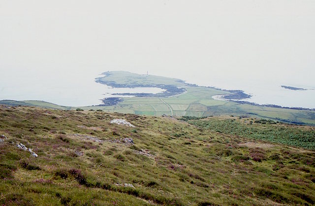
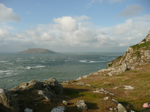
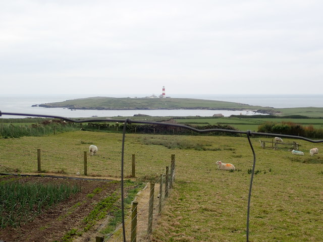
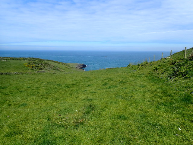
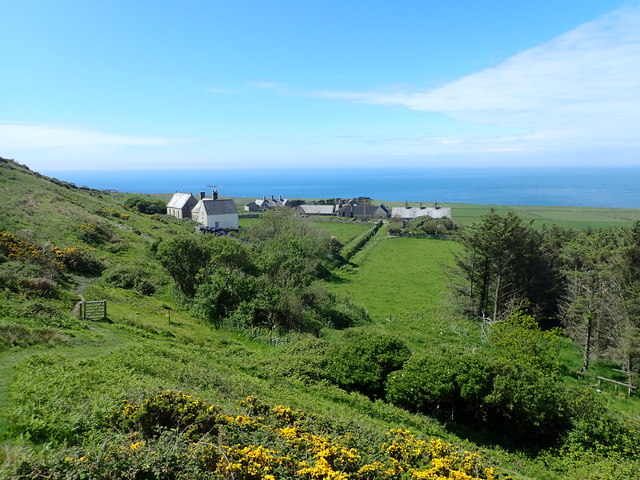
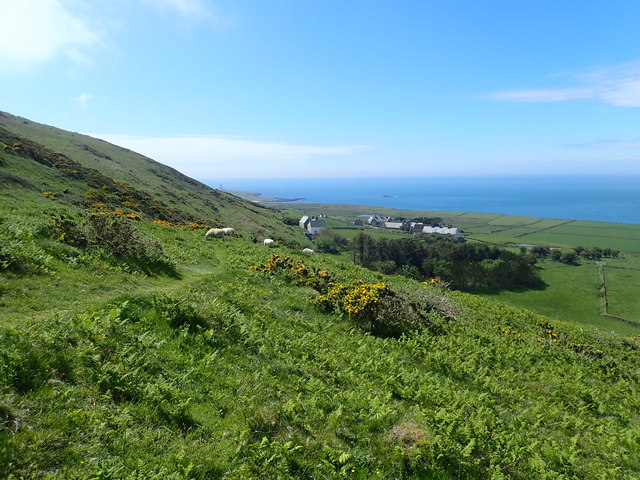
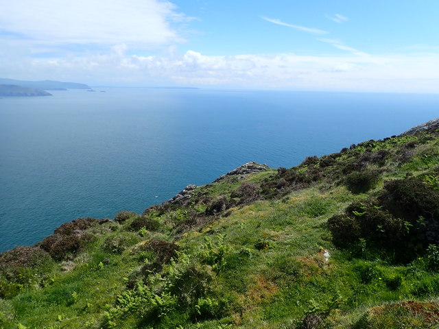
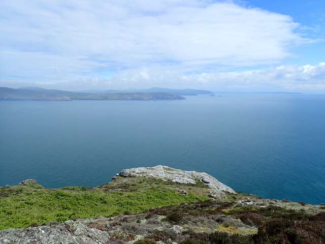
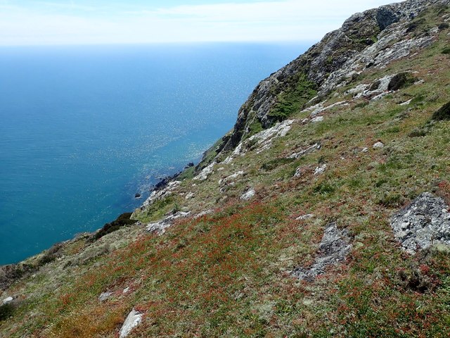
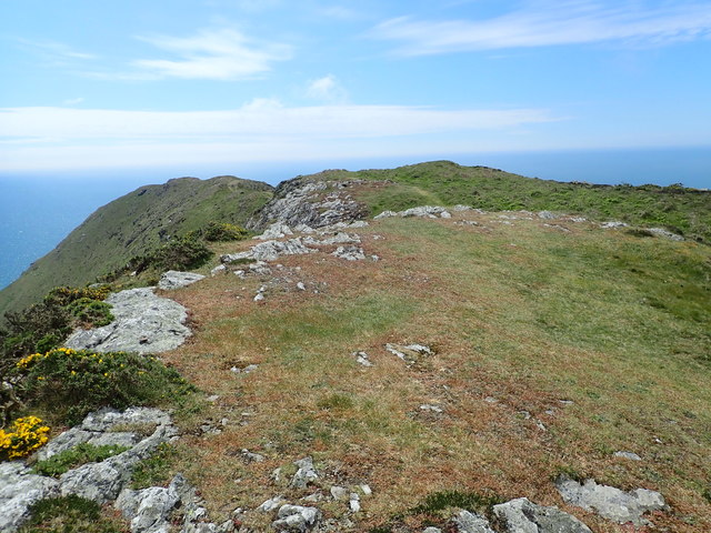
Bardsey Island, also known as Ynys Enlli in Welsh, is a small island off the coast of Caernarfonshire in northwest Wales. Situated in the Irish Sea, it lies approximately 2 miles off the Llŷn Peninsula. Covering an area of about 180 acres, the island boasts a rugged and picturesque landscape.

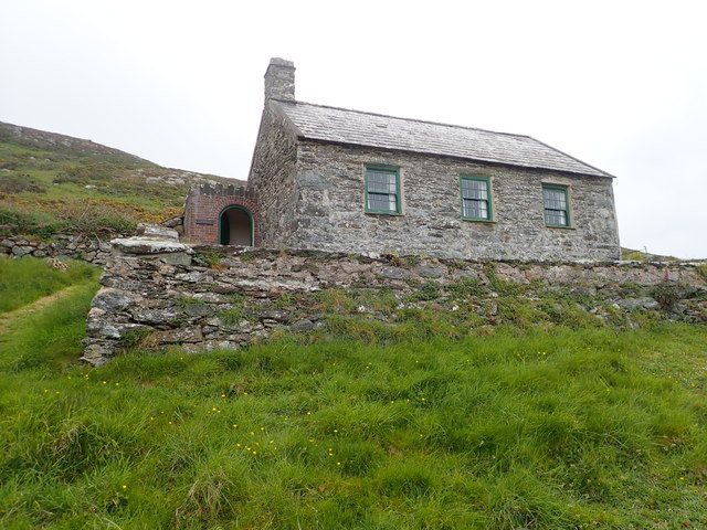
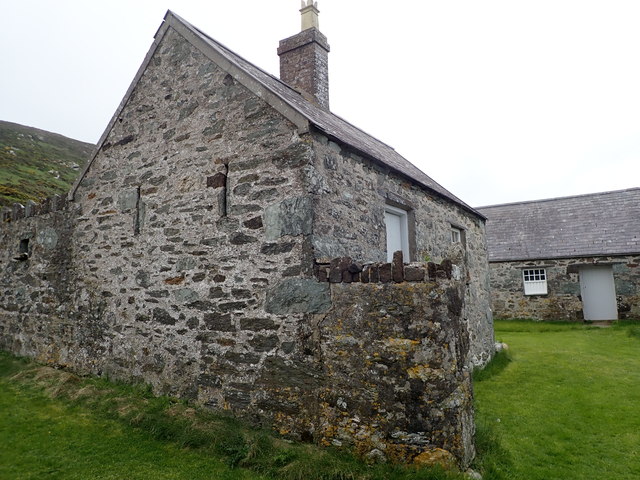
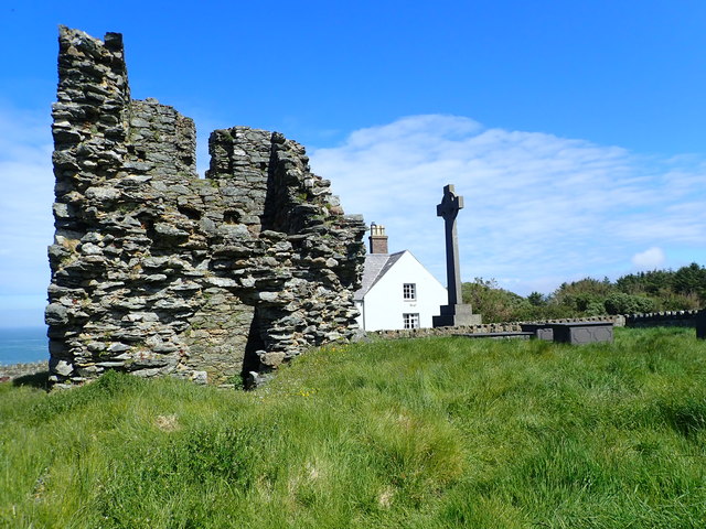
Bardsey Island has a rich and fascinating history. It has been inhabited since prehistoric times and has served as a site of religious pilgrimage for centuries. According to legend, it is the burial place of 20,000 saints. In the past, it was home to a monastic community and a prominent center of learning.

The island's wildlife is diverse and abundant, making it an important nature reserve. It is particularly renowned for its birdlife, with thousands of breeding seabirds, including puffins, razorbills, and guillemots. The surrounding waters are also home to seals, dolphins, and porpoises.

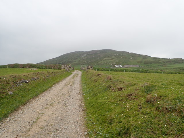
Visitors to Bardsey Island can explore its beautiful coastline, walk along its cliffs, and enjoy breathtaking views of the surrounding sea. The island offers a tranquil and peaceful atmosphere, making it a popular destination for nature lovers, birdwatchers, and those seeking a remote escape from the mainland.

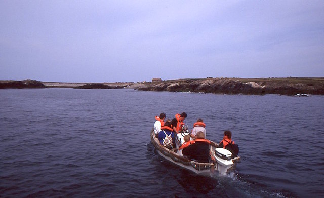
Access to Bardsey Island is limited, with a small number of boats providing transportation to and from the island during the summer months. There are no permanent residents on the island, although a small number of visitors can stay overnight in the former lighthouse keeper's cottage, which has been converted into accommodation.

If you have any feedback on the listing, please let us know in the comments section below.

Bardsey Island Images

Images are sourced within 2km of 52.7611/-4.7866 or Grid Reference SH1221. Thanks to Geograph Open Source API. All images are credited.

Landing on Bardsey There was a transfer to a smaller boat for the landing. The crossing was by a larger fast catamaran, similar to the one used for trips out of Crinan  to Jura, Scarab etc.  The boat is heading for the inlet of 
Cafn Enlli where there is a slip.
Landing on Bardsey
There was a transfer to a smaller boat for the landing. The crossing was by a larger fast catamaran, similar to the one used for trips out of Crinan to Jura, Scarab etc. The boat is heading for the inlet of Cafn Enlli where there is a slip.
View from Mynydd Enlli The mountain on Ynys Enlli / Bardsey with a view to the south of the island. The small inlet of Cafn Enlli is visible in front of the bigger bay on the left. This is where boats land or leave from.
View from Mynydd Enlli
The mountain on Ynys Enlli / Bardsey with a view to the south of the island. The small inlet of Cafn Enlli is visible in front of the bigger bay on the left. This is where boats land or leave from.
The misty isle The title might suggest the Isle of Skye, but this is Ynys Enlli [Bardsey] shrouded in sea mist on a warm September day.
The misty isle
The title might suggest the Isle of Skye, but this is Ynys Enlli [Bardsey] shrouded in sea mist on a warm September day.
Bardsey Island from Pen y Cil Bardsey Island is known as the Island of 20,000 saints whilst its Welsh name, Ynys Enlli, refers to it as the Island of Currents. The English name refers to bards or chieftains.
Bardsey has a bird observatory, a lighthouse and was made a National Nature Reserve in 1986.
In the midground the shallow rocky outcrop in the sea is Carreg Ddu or Black stone.
Bardsey Island from Pen y Cil
Bardsey Island is known as the Island of 20,000 saints whilst its Welsh name, Ynys Enlli, refers to it as the Island of Currents. The English name refers to bards or chieftains. Bardsey has a bird observatory, a lighthouse and was made a National Nature Reserve in 1986. In the midground the shallow rocky outcrop in the sea is Carreg Ddu or Black stone.
The main - and only - road on Bardsey Island
Bardsey view From the farm buildings towards the lighthouse
Bardsey view
From the farm buildings towards the lighthouse
The Old School, Bardsey Island The School House was originally the 'old chapel' building for islanders until a more formal school was established in 1875 for the twelve students on the island at the time.
The Old School, Bardsey Island
The School House was originally the 'old chapel' building for islanders until a more formal school was established in 1875 for the twelve students on the island at the time.
Plas Bach, Ynys Enlli These buildings are now used to house the tourists who come to Bardsey Island on vacation
Plas Bach, Ynys Enlli
These buildings are now used to house the tourists who come to Bardsey Island on vacation
Bardsey Abbey The fragmentary remains of the thirteenth century Augustinian abbey who took over from the ancient Celtic foundation of the sixth century. Nearby a Celtic cross stands commemorating the now mostly Christian religious past and very numerous, 20,000, saints reputed to have been buried in or near the site.
Bardsey Abbey
The fragmentary remains of the thirteenth century Augustinian abbey who took over from the ancient Celtic foundation of the sixth century. Nearby a Celtic cross stands commemorating the now mostly Christian religious past and very numerous, 20,000, saints reputed to have been buried in or near the site.
On the slopes of Mynydd Enlli Looking north towards Bae'r Nant
On the slopes of Mynydd Enlli
Looking north towards Bae'r Nant
Bardsey Island Looking down on the hamlet from the slopes of Mynydd Enlli
Bardsey Island
Looking down on the hamlet from the slopes of Mynydd Enlli
Maen Bugail Maen Bugail is a small rock, which lies about 0.3 mile N of the N end of Bardsey Island. A heavy tide race extends nearly 0.5 mile N from this rock.
Maen Bugail
Maen Bugail is a small rock, which lies about 0.3 mile N of the N end of Bardsey Island. A heavy tide race extends nearly 0.5 mile N from this rock.
Bardsey Island Looking down on the main centre of the island from Mynydd Enlli
Bardsey Island
Looking down on the main centre of the island from Mynydd Enlli
Swnt Enlli - Bardsey Sound The area of the Irish Sea between the island and the mainland, from the mountaintop
Swnt Enlli - Bardsey Sound
The area of the Irish Sea between the island and the mainland, from the mountaintop
View east from the top of Bardsey Mountain
The steep eastern side of Bardsey Mountain
On top of Mynydd Enlli Over Bardsey Sound is the tip of the Lleyn Peninsula; the two peaks on the left are Mynydd Mawr and Mynydd Anelog.
On top of Mynydd Enlli
Over Bardsey Sound is the tip of the Lleyn Peninsula; the two peaks on the left are Mynydd Mawr and Mynydd Anelog.
Faint path along the ridge of Mynydd Enlli
Show me another place!

Bardsey Island is located at Grid Ref: SH1221 (Lat: 52.7611, Lng: -4.7866)

Unitary Authority: Gwynedd

Police Authority: North Wales

Also known as: Ynys Enlli

What 3 Words

///enclosing.spring.overture. Near Nefyn, Gwynedd

Related Wikis

Bardsey Bird and Field Observatory

Bardsey Bird and Field Observatory is a bird observatory on Bardsey Island, off the Welsh coast. It was founded in 1953 by a group of ornithologists from...

Bardsey Island

Bardsey Island (Welsh: Ynys Enlli), known as the legendary "Island of 20,000 Saints", is located 1.9 miles (3.1 km) off the Llŷn Peninsula in the Welsh...

Bardsey Lighthouse

Bardsey Lighthouse stands on the southerly tip of Bardsey Island, off the Llŷn Peninsula in Gwynedd, Wales, and guides vessels passing through St George...

St Hywyn's Church, Aberdaron

The Church of St Hywyn, Aberdaron, Gwynedd, Wales, is a parish church dating from the 12th century. Its origins are earlier, as a clas church from the...

Nearby Amenities

Located within 500m of 52.7611,-4.7866
Cristin
Created By: Potlatch 0.10
Place: locality
Lat/Long: 52.7586213/-4.7875702
Tynacoch
Created By: Potlatch 0.10
Place: locality
Source: npe
Lat/Long: 52.7567513/-4.7876561
Y Gareg Fawr
Created By: Potlatch 0.10
Place: locality
Source: npe
Lat/Long: 52.7621532/-4.7899735
Mynydd Enlli
Ele: 167
Natural: peak
Place: locality
Source: npe
Lat/Long: 52.7622918/-4.782963
Ogof Morlo
Natural: cave_entrance
Lat/Long: 52.762476/-4.780879
Bae Felen
Natural: bay
Lat/Long: 52.7627988/-4.7802991
Direction: 165
Generator Method: photovoltaic
Generator Output Electricity: yes
Generator Solar Modules: 16
Generator Source: solar
Generator Type: solar_photovoltaic_panel
Location: roof
Power: generator
Lat/Long: 52.7640733/-4.7880757
The data included in this document is from www.openstreetmap.org. The data is made available under ODbL.

Have you been to Bardsey Island?

Leave your review of Bardsey Island below (or comments, questions and feedback).