Breedon on the Hill

Settlement in Leicestershire North West Leicestershire

England

Breedon on the Hill

Farmyard, Brandgate Farm
Farmyard, Brandgate Farm Credit: Jonathan Thacker

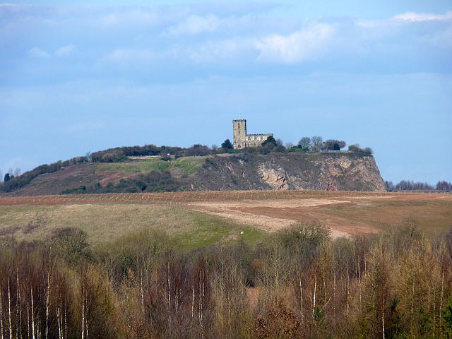
Breedon on the Hill is a small village located in the county of Leicestershire, England. Situated on a hilltop, the village offers picturesque views of the surrounding countryside. It is approximately 8 miles southwest of the city of Derby and 12 miles southeast of the city of Derby.

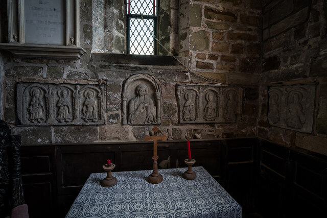
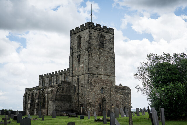
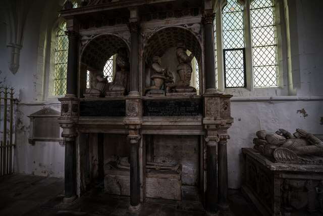
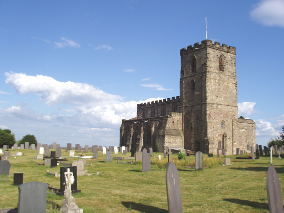
The village is known for its historic significance, as it is home to the ruins of Breedon Priory, an ancient religious site dating back to the 7th century. The priory was founded by Saint Hardulph and was an important place of worship during the medieval period. Today, the ruins are a popular tourist attraction and provide insight into the region's rich history.

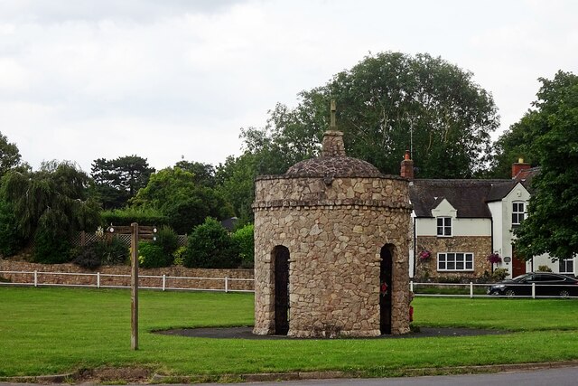
Breedon on the Hill also boasts a close-knit community and a range of amenities. The village has a primary school, a village hall, and a local pub, the Hollybush Inn, which serves as a gathering place for residents and visitors alike. The village is surrounded by beautiful countryside, making it an ideal location for outdoor enthusiasts to explore the nearby woodlands and walking trails.

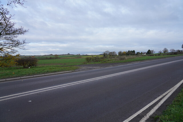
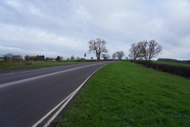
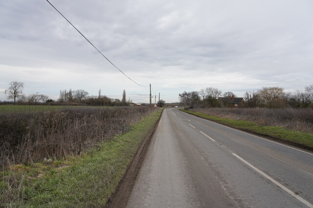
In addition to its historical and natural attractions, Breedon on the Hill is conveniently located near major transport links. The village is easily accessible via the A42 and A511 roads, and the nearby East Midlands Airport provides convenient air travel options for residents and visitors.

Overall, Breedon on the Hill offers a tranquil and scenic setting, a rich history, and a warm community atmosphere, making it a charming place to live or visit in Leicestershire.

If you have any feedback on the listing, please let us know in the comments section below.

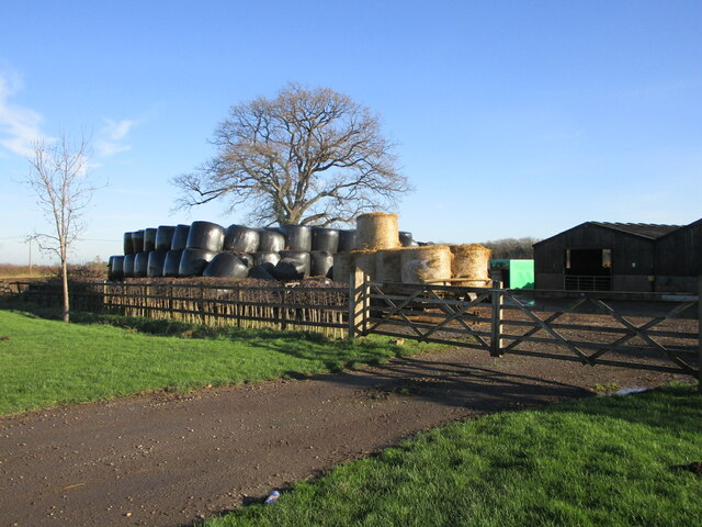
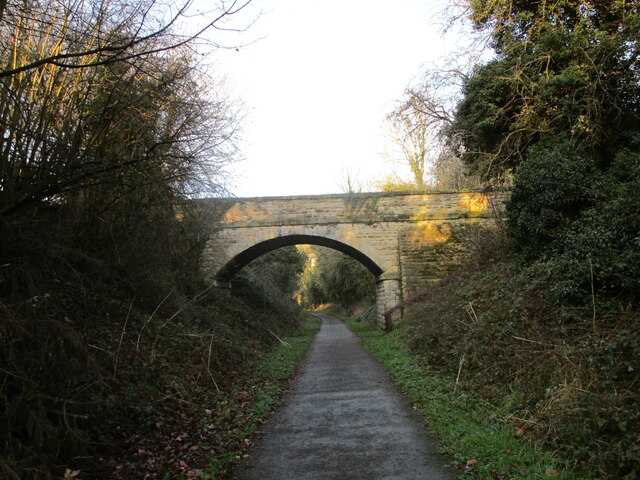
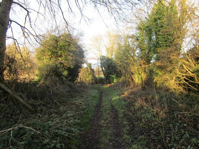
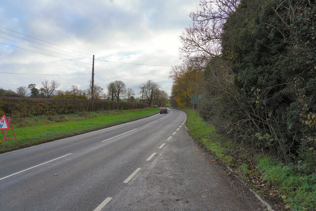
Breedon on the Hill Images

Images are sourced within 2km of 52.802053/-1.398325 or Grid Reference SK4022. Thanks to Geograph Open Source API. All images are credited.

Farmyard, Brandgate Farm
Bridge over the Cloud Trail The Cloud Trail follows the course of the former Ashby de la Zouch to Derby railway.
Bridge over the Cloud Trail
The Cloud Trail follows the course of the former Ashby de la Zouch to Derby railway.
Field Lane near Tonge
Towards Breedon on the Hill A handy laybay allowed me to take this photo without partly blocking the road. The view is towards Breedon on the Hill
Towards Breedon on the Hill
A handy laybay allowed me to take this photo without partly blocking the road. The view is towards Breedon on the Hill
Lush green fields in the distance Looking across the A453 Moor Lane to fields with what might be a winter planted cereal crop.
Lush green fields in the distance
Looking across the A453 Moor Lane to fields with what might be a winter planted cereal crop.
Moor Lane Looking along the A453 Moor Lane on a fairly dull morning.
Moor Lane
Looking along the A453 Moor Lane on a fairly dull morning.
Doctor's Lane Looking a little east of south along Doctor's Lane which connects Breedon on the Hill to a road called Top Brand.
Doctor's Lane
Looking a little east of south along Doctor's Lane which connects Breedon on the Hill to a road called Top Brand.
Close to Cloud Hill Quarry The road surface and the leafless bushes at the roadside are all covered in dirt containing a lot of limestone from the quarry to the right of the road. In the short time I took to take the photo at least 5 lorries entered or left the quarry.
Close to Cloud Hill Quarry
The road surface and the leafless bushes at the roadside are all covered in dirt containing a lot of limestone from the quarry to the right of the road. In the short time I took to take the photo at least 5 lorries entered or left the quarry.
Top Brand Top Brand seems a very unusual name for this road.
Top Brand
Top Brand seems a very unusual name for this road.
Breedon On The Hill War Memorial On The Village Green.
Breedon On The Hill War Memorial
On The Village Green.
Breedon Beacon for the Queen's Golden Jubilee 2002 The first lighting of the beacon was for the Queen's Golden Jubilee June 2002

Full list:

Queen's Golden Jubilee June 2002
200th Anniversary of the death of Nelson 2005
Queen's Diamond Jubilee June 2012
70th Anniversary of V.E Day May 2015
Queen's Platinum Jubilee  June 2022
Breedon Beacon for the Queen's Golden Jubilee 2002
The first lighting of the beacon was for the Queen's Golden Jubilee June 2002 Full list: Queen's Golden Jubilee June 2002 200th Anniversary of the death of Nelson 2005 Queen's Diamond Jubilee June 2012 70th Anniversary of V.E Day May 2015 Queen's Platinum Jubilee June 2022
St Mary and St Hardulph Church, Breedon on the Hill The present church, which had been preceded by a minster (an Anglo-Saxon monastery) from the 7th century, contains the largest collection, and some of the finest examples, of Anglo-Saxon sculptures. It also contains a notable family pew and Renaissance-era church monuments to the Shirley family, who bought the manor of Breedon after it was surrendered to the Crown in 1539 during the Dissolution of the Monasteries.

The church stands on the top of Breedon Hill, within the remains of an Iron Age hill fort called The Bulwarks.

The priory fell into some disrepair by the 16th century, but a local family in the form of Francis Shirley Esq of Staunton Harold Hall purchased the priory from King Henry VIII after the Reformation as a burial place for himself and his successors. The local villagers also petitioned that the building should become their parish church (as the village church was ruinous) and the rooms above the south porch could be used as a school – this was accepted. They pulled down the old buildings to the west of the tower but removed the Saxon carvings which they placed in the south porch. In 1784 the church was again in a bad state of repair, there were plans to spend £3,340 on the rebuild but this sum was never reached, however the church was repaired and this is what we can see today. Some further restoration took place in the 19th and 20th centuries, and in 1937 the Saxon carvings were moved from the south porch and placed in the main part of the church. The present church consists of a west tower, south porch (with vestry over), nave, north aisle (Shirley aisle), south aisle with Lady Chapel and a Sanctuary.
St Mary and St Hardulph Church, Breedon on the Hill
The present church, which had been preceded by a minster (an Anglo-Saxon monastery) from the 7th century, contains the largest collection, and some of the finest examples, of Anglo-Saxon sculptures. It also contains a notable family pew and Renaissance-era church monuments to the Shirley family, who bought the manor of Breedon after it was surrendered to the Crown in 1539 during the Dissolution of the Monasteries. The church stands on the top of Breedon Hill, within the remains of an Iron Age hill fort called The Bulwarks. The priory fell into some disrepair by the 16th century, but a local family in the form of Francis Shirley Esq of Staunton Harold Hall purchased the priory from King Henry VIII after the Reformation as a burial place for himself and his successors. The local villagers also petitioned that the building should become their parish church (as the village church was ruinous) and the rooms above the south porch could be used as a school – this was accepted. They pulled down the old buildings to the west of the tower but removed the Saxon carvings which they placed in the south porch. In 1784 the church was again in a bad state of repair, there were plans to spend £3,340 on the rebuild but this sum was never reached, however the church was repaired and this is what we can see today. Some further restoration took place in the 19th and 20th centuries, and in 1937 the Saxon carvings were moved from the south porch and placed in the main part of the church. The present church consists of a west tower, south porch (with vestry over), nave, north aisle (Shirley aisle), south aisle with Lady Chapel and a Sanctuary.
Slate Sundial 1749, Breedon on the Hill Church
Breedon on The Hill, Anglo Saxon Carvings (8th-10th Century) The church contains a series of very important Saxon relief sculptures, some of which may be amongst the earliest to survive in England. They fall into four groups.

The first two groups comprise some 63 feet of wall frieze, intended originally to run parallel in bands around both the inside and outside of the Saxon Minster Church. These are now built into the interior in scattered lengths. The carvings are dated to the 9th century and include Celtic patterns, lions, people, cocks and other birds that are pecking at vines.

The third group is a series of figure panels set in arches and comprising mainly of saints and the unique Breedon Angel. This is not available to view without an appointment as it is situated in the bell ringing tower, but a copy can be seen on the wall of the south aisle. The Angel is one of the finest surviving examples of Saxon figure sculpting and perhaps the earliest carved angel in England.

The final group is a small collection of freestanding decorated cross fragments. These date back to the 9th-10th century when the place of worship was re-established again.

Pictured is a collection of individual human figure sculpture set in architectural decorative frames. The largest behind the altar is a half figure holding a book in the left hand and giving a Byzantine blessing with the other. This helps to date the sculptures to the circa 8th-9th century. The figure's hair is covered, which lends itself to the suggestion of being female. The drilled hole staring eyes and stiff formal robes are typical of the formal figurework found in illuminated manuscripts of the period. Flanking the central figure are two sets of three saints in their arcades with a further two immediately to the right on the south wall. Their haloed heads have the same drilled eyes and stiff drapery. They carry books, scrolls that probably once bore their unknown names and another, doll-like small figure at waist level.  

<span class="nowrap"><a title="https://breedonpriorychurch.org/unlocking-the-past/" rel="nofollow ugc noopener" href="https://breedonpriorychurch.org/unlocking-the-past/">Link</a><img style="margin-left:2px;" alt="External link" title="External link - shift click to open in new window" src="https://s1.geograph.org.uk/img/external.png" width="10" height="10"/></span>
Breedon on The Hill, Anglo Saxon Carvings (8th-10th Century)
The church contains a series of very important Saxon relief sculptures, some of which may be amongst the earliest to survive in England. They fall into four groups. The first two groups comprise some 63 feet of wall frieze, intended originally to run parallel in bands around both the inside and outside of the Saxon Minster Church. These are now built into the interior in scattered lengths. The carvings are dated to the 9th century and include Celtic patterns, lions, people, cocks and other birds that are pecking at vines. The third group is a series of figure panels set in arches and comprising mainly of saints and the unique Breedon Angel. This is not available to view without an appointment as it is situated in the bell ringing tower, but a copy can be seen on the wall of the south aisle. The Angel is one of the finest surviving examples of Saxon figure sculpting and perhaps the earliest carved angel in England. The final group is a small collection of freestanding decorated cross fragments. These date back to the 9th-10th century when the place of worship was re-established again. Pictured is a collection of individual human figure sculpture set in architectural decorative frames. The largest behind the altar is a half figure holding a book in the left hand and giving a Byzantine blessing with the other. This helps to date the sculptures to the circa 8th-9th century. The figure's hair is covered, which lends itself to the suggestion of being female. The drilled hole staring eyes and stiff formal robes are typical of the formal figurework found in illuminated manuscripts of the period. Flanking the central figure are two sets of three saints in their arcades with a further two immediately to the right on the south wall. Their haloed heads have the same drilled eyes and stiff drapery. They carry books, scrolls that probably once bore their unknown names and another, doll-like small figure at waist level. LinkExternal link
Former Breedon Priory Site What would have been a central tower; you can still see the bricked up Norman arch (and roof scar) that would have led to the now demolished nave. 

Whilst occupation on the hill dates back from the late Bronze Age to the early Iron Age (c800 – 450BC) and the site was defended by a substantial wooden palisade probably constructed during the 2nd or 3rd century BC. There has been a monastery on the hill since 675AD and whilst we will never know what the site at Breedon was called, the name we know it by is of interest in its own right. Being derived from the Celtic word ‘bre’ for hill, and the old English ‘dun’ also meaning hill, the name essentially translates as ‘Hill-Hill on the Hill’.

After the Norman Conquest in 1066, Breedon, together with Wilson and Tonge, was granted to Robert de Ferrers by William the Conqueror. Subsequently, some time between 1109 and 1122, Robert gave the Parish Church to the Augustinian Priory of Nostell in Yorkshire. The endowment also included Breedon Market which was situated on the hilltop, although now quarried away. This period saw the church expanded by the canons to include cloisters and other domestic quarters. These former buildings begin to explain the various roof pitch marks on three sides of the present tower.

In 1223, Nostell introduced Prior Gervase to Breedon, who tried to make the priory independent. During the next 50 years, the church was remodelled with lancet windows extending to a more decorative style and vaulted aisles added.

Skipping ahead to 1441, Bishop Alnwick visited to find the priory in debt and the buildings dilapidated. He suspended one of the canons with another one finding himself in jail a few years later and awaiting trial at Leicester.

By 1518, Breedon Parish Church once again had become run down but this time responsibility probably rested with the parishioners, not the canons of the priory. By 1539, the priory was surrendered by Nostell and the parishioners found themselves with a dilapidated Parish Church and a deserted Priory Church. Perhaps in answer to a prayer, a local in the form of Francis Shirley of Staunton Harold stepped in and purchased the Priory Church from King Henry VIII after the monastic suppression. This was to be a burial place for himself and his successors and with this, parishioners petitioned for it also to serve as the Parish Church, all of which was granted. Francis Shirley took the present North Aisle for his family mortuary.

<span class="nowrap"><a title="https://breedonpriorychurch.org/history/" rel="nofollow ugc noopener" href="https://breedonpriorychurch.org/history/">Link</a><img style="margin-left:2px;" alt="External link" title="External link - shift click to open in new window" src="https://s1.geograph.org.uk/img/external.png" width="10" height="10"/></span>
Former Breedon Priory Site
What would have been a central tower; you can still see the bricked up Norman arch (and roof scar) that would have led to the now demolished nave. Whilst occupation on the hill dates back from the late Bronze Age to the early Iron Age (c800 – 450BC) and the site was defended by a substantial wooden palisade probably constructed during the 2nd or 3rd century BC. There has been a monastery on the hill since 675AD and whilst we will never know what the site at Breedon was called, the name we know it by is of interest in its own right. Being derived from the Celtic word ‘bre’ for hill, and the old English ‘dun’ also meaning hill, the name essentially translates as ‘Hill-Hill on the Hill’. After the Norman Conquest in 1066, Breedon, together with Wilson and Tonge, was granted to Robert de Ferrers by William the Conqueror. Subsequently, some time between 1109 and 1122, Robert gave the Parish Church to the Augustinian Priory of Nostell in Yorkshire. The endowment also included Breedon Market which was situated on the hilltop, although now quarried away. This period saw the church expanded by the canons to include cloisters and other domestic quarters. These former buildings begin to explain the various roof pitch marks on three sides of the present tower. In 1223, Nostell introduced Prior Gervase to Breedon, who tried to make the priory independent. During the next 50 years, the church was remodelled with lancet windows extending to a more decorative style and vaulted aisles added. Skipping ahead to 1441, Bishop Alnwick visited to find the priory in debt and the buildings dilapidated. He suspended one of the canons with another one finding himself in jail a few years later and awaiting trial at Leicester. By 1518, Breedon Parish Church once again had become run down but this time responsibility probably rested with the parishioners, not the canons of the priory. By 1539, the priory was surrendered by Nostell and the parishioners found themselves with a dilapidated Parish Church and a deserted Priory Church. Perhaps in answer to a prayer, a local in the form of Francis Shirley of Staunton Harold stepped in and purchased the Priory Church from King Henry VIII after the monastic suppression. This was to be a burial place for himself and his successors and with this, parishioners petitioned for it also to serve as the Parish Church, all of which was granted. Francis Shirley took the present North Aisle for his family mortuary. LinkExternal link
Sir George Shirley Tomb 1622, Breedon on the Hill The largest monument dominating the inside of the church is that dedicated to Sir George Shirley. It was made over 20 years before Shirley died in 1622. It is dated 1598 and consists of three storeys. On the bottom storey is a realistic skeleton carved from alabaster and showing the mortality of those portrayed above. The inclusion of this cadaver in the design was unusual for the time.

The second storey is supported on six pillars and the space is divided into two arched spaces. To the right, and facing right in prayer, is Sir George Shirley with his two sons behind him. All three figures are dressed in brightly painted period dress and the clothes include details in gold. In the left arch is his wife (d. 1595), daughter, and two babies.  According to the Latin inscription, Shirley’s wife died aged 29 whilst giving birth.

The third storey, again supported by six more pillars, is a canopy made in stone and incorporating a large, central carved coat of arms. The monument was constructed from large blocks of alabaster. It was rebuilt in the 19th century by the stonemason, Thomas Allt, who added his signature to the work.

<span class="nowrap"><a title="https://breedonpriorychurch.org/unlocking-the-past/" rel="nofollow ugc noopener" href="https://breedonpriorychurch.org/unlocking-the-past/">Link</a><img style="margin-left:2px;" alt="External link" title="External link - shift click to open in new window" src="https://s1.geograph.org.uk/img/external.png" width="10" height="10"/></span>
Sir George Shirley Tomb 1622, Breedon on the Hill
The largest monument dominating the inside of the church is that dedicated to Sir George Shirley. It was made over 20 years before Shirley died in 1622. It is dated 1598 and consists of three storeys. On the bottom storey is a realistic skeleton carved from alabaster and showing the mortality of those portrayed above. The inclusion of this cadaver in the design was unusual for the time. The second storey is supported on six pillars and the space is divided into two arched spaces. To the right, and facing right in prayer, is Sir George Shirley with his two sons behind him. All three figures are dressed in brightly painted period dress and the clothes include details in gold. In the left arch is his wife (d. 1595), daughter, and two babies. According to the Latin inscription, Shirley’s wife died aged 29 whilst giving birth. The third storey, again supported by six more pillars, is a canopy made in stone and incorporating a large, central carved coat of arms. The monument was constructed from large blocks of alabaster. It was rebuilt in the 19th century by the stonemason, Thomas Allt, who added his signature to the work. LinkExternal link
A distant view of the church at Breedon on the Hill This picture was taken from near Worthington.
A distant view of the church at Breedon on the Hill
This picture was taken from near Worthington.
The Cloud Trail near Worthington A footpath from the village of Worthington meets the Cloud Trail at the signpost.
The Cloud Trail near Worthington
A footpath from the village of Worthington meets the Cloud Trail at the signpost.
Show me another place!

Breedon on the Hill is located at Grid Ref: SK4022 (Lat: 52.802053, Lng: -1.398325)

Administrative County: Leicestershire

District: North West Leicestershire

Police Authority: Leicestershire

What 3 Words

///each.caused.often. Near Melbourne, Derbyshire

Nearby Locations

Breedon on the Hill

Related Wikis

Breedon on the Hill

Breedon on the Hill is a village and civil parish about 5 miles (8 km) north of Ashby-de-la-Zouch in North West Leicestershire, England. The parish adjoins...
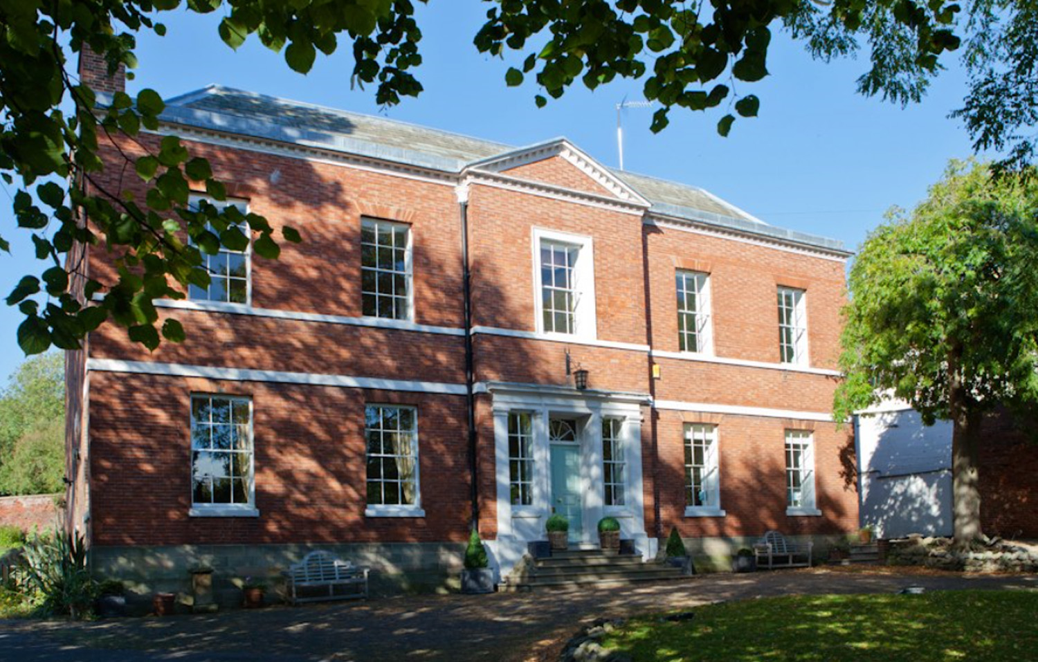
Breedon Hall

Breedon Hall, Breedon on the Hill in north-west Leicestershire, is a house of historical significance and is listed on the English Heritage Register. In...

Breedon Hill

Breedon Hill is a 5.3-hectare (13-acre) biological Site of Special Scientific Interest on the northern outskirts of Breedon on the Hill in Leicestershire...

Church of St Mary and St Hardulph, Breedon on the Hill

The Priory Church of St Mary and St Hardulph is the Church of England parish church of Breedon on the Hill, Leicestershire, England. The church has also...

Nearby Amenities

Located within 500m of 52.802053,-1.398325
Breedon on the Hill
Is In County: Leicestershire
Is In District: North West Leicestershire
Place: village
Wikidata: Q769580
Wikipedia: en:Breedon on the Hill
Lat/Long: 52.8013972/-1.4001818
Bus Stop
Ashby Road
Bench: no
Bin: no
Bus: yes
Lit: yes
Naptan AtcoCode: 260013500
Naptan Bearing: SW
Naptan CommonName: Ashby Road
Naptan Indicator: outside
Naptan Landmark: 7 Ashby Road
Naptan NaptanCode: leijdtpw
Naptan Notes: Non-Hourly - County
Naptan Street: Ashby Road
Naptan Verified: no
Public Transport: platform
Shelter: yes
Source: naptan_import
Tactile Paving: no
Lat/Long: 52.8012201/-1.4047579
Bus Stop
The Green
Bench: yes
Bin: yes
Bus: yes
Lit: no
Naptan AtcoCode: 260013501
Naptan Bearing: NE
Naptan CommonName: The Green
Naptan Indicator: outside
Naptan Landmark: Memorial (bus turning circle)
Naptan NaptanCode: leijdtwa
Naptan Notes: Non-Hourly - County
Naptan Street: The Green
Naptan Verified: no
Public Transport: platform
Shelter: yes
Source: naptan_import
Tactile Paving: no
Lat/Long: 52.8021744/-1.4032467
Bus Stop
Cross Street
Bus: yes
Naptan AtcoCode: 260013502
Naptan Bearing: E
Naptan CommonName: Cross Street
Naptan Indicator: opposite
Naptan Landmark: 12 Main Street
Naptan NaptanCode: leijdtwd
Naptan Notes: Non-Hourly - County
Naptan Street: Main Street
Naptan Verified: no
Public Transport: platform
Source: naptan_import
Lat/Long: 52.8017935/-1.4008045
Bus Stop
Tonge Lane
Bus: yes
Naptan AtcoCode: 260013503
Naptan Bearing: N
Naptan CommonName: Tonge Lane
Naptan Indicator: 10m before
Naptan Landmark: Tonge Lane
Naptan NaptanCode: leijdtwg
Naptan Notes: Non-Hourly - County
Naptan Street: Main Street
Naptan Verified: no
Public Transport: platform
Source: naptan_import
Lat/Long: 52.8056495/-1.3953517
Bus Stop
Worthington Lane
Bus: yes
Naptan AtcoCode: 260013504
Naptan Bearing: W
Naptan CommonName: Worthington Lane
Naptan Indicator: outside
Naptan Landmark: 24 Main Street
Naptan NaptanCode: leijdtwj
Naptan Notes: Non-Hourly - County
Naptan Street: Main Street
Naptan Verified: no
Public Transport: platform
Source: naptan_import
Lat/Long: 52.8017334/-1.399589
Post Box
Collection Times: Mo-Fr 16:15; Sa 10:30
Operator: Royal Mail
Operator Wikidata: Q638098
Post Box Manufacturer: Machan, Scotland
Post Box Type: lamp
Ref: DE73 294
Royal Cypher: EIIR
Royal Cypher Wikidata: Q33102113
Lat/Long: 52.8030396/-1.3964969
Post Box
Collection Times: Mo-Fr 16:15; Sa 10:30
Operator: Royal Mail
Operator Wikidata: Q638098
Post Box Type: lamp
Ref: DE74 368
Royal Cypher: EIIR
Royal Cypher Wikidata: Q33102113
Lat/Long: 52.8016171/-1.4012854
S.L. & V.G. Fisher
Addr City: Derby
Addr Postcode: DE73 8AX
Addr Street: Cross Street
Addr Village: Breedon on the Hill
Old Fhrs Id: 900
Shop: butcher
Source: survey
Source Addr: FHRS open data
Lat/Long: 52.8018651/-1.4003759
Defibrillator
Access: yes
Booth: K6
Covered: booth
Defibrillator Location: inside red phone box, Main Street, Breedon on the Hill
Disused Amenity: telephone
Emergency: defibrillator
Listed Status: Grade II
Man Made: telephone_box
Ref: CHT-14-1071
Ref GB The Circuit: 82BA12D8-E0C6-4E94-BE72-AED6009E30A7
Source: survey
Lat/Long: 52.801604/-1.4013013
Advertising: board
Lat/Long: 52.8016186/-1.4012544
Bench
Backrest: yes
Source: survey
Lat/Long: 52.8023775/-1.4028999
Entrance: main
Lat/Long: 52.8030168/-1.4024175
Post Office
Breedon on the Hill Post Office
Addr City: Derby
Addr Postcode: DE73 8AN
Addr Street: Main Street
Addr Village: Breedon on the Hill
Brand: Post Office
Brand Wikidata: Q1783168
Ref Pol Id: 4804
Source: survey
Website: https://www.postoffice.co.uk/branch-finder/1742078/breedon-on-the-hill
Lat/Long: 52.8030845/-1.3965713
Mini Roundabout
Lat/Long: 52.8032758/-1.3973103
Man Made: beacon
Source: survey
Lat/Long: 52.8057535/-1.3990161
Barrier: kissing_gate
Lat/Long: 52.8023975/-1.394255
Barrier: stile
Material: wood
Source: survey;gps
Stile: stepover
Lat/Long: 52.7985389/-1.398487
Bench
Backrest: yes
Source: survey;gps
Lat/Long: 52.8043886/-1.3998757
Barrier: kissing_gate
Source: survey;gps
Lat/Long: 52.8044042/-1.3999841
Barrier: kissing_gate
Source: survey;gps
Lat/Long: 52.8044349/-1.3999956
Breedon on the Hill Iron Age Hillfort
Board Type: history
Check Date: 2023-11-19
Information: board
Tourism: information
Lat/Long: 52.8044936/-1.4000023
Breedon on the Hill Iron Age Hillfort
Board Type: history
Information: board
Tourism: information
Lat/Long: 52.8055048/-1.3994187
HE Ref: 1099110
Description: Nottingham 14, Tamworth 21
Historic: milepost
Inscription: Breedon on the Hill Parish / Tamworth 18 miles / Nottingham 17 miles
Listed Status: Grade II
Manufacturer: Wootton Bros Ironworks, Coalville
Source Listed Status: Historic England
Lat/Long: 52.8016897/-1.4038674
Breedon Hill
Ele: 127
Natural: peak
Lat/Long: 52.805773/-1.4006064
Bench
Backrest: yes
Material: metal
Seats: 6
Lat/Long: 52.8022531/-1.4027175
Crossing
Lat/Long: 52.803049/-1.3976295
Crossing
Lat/Long: 52.8030135/-1.3975111
Generator Method: photovoltaic
Generator Output Electricity: yes
Generator Source: solar
Generator Type: solar_photovoltaic_panel
Location: roof
Power: generator
Lat/Long: 52.8012045/-1.4020028
Generator Method: photovoltaic
Generator Output Electricity: yes
Generator Source: solar
Generator Type: solar_photovoltaic_panel
Location: roof
Power: generator
Lat/Long: 52.8008072/-1.4048768
Generator Method: photovoltaic
Generator Output Electricity: yes
Generator Source: solar
Generator Type: solar_photovoltaic_panel
Location: roof
Power: generator
Lat/Long: 52.8001229/-1.4023931
Generator Method: photovoltaic
Generator Output Electricity: yes
Generator Source: solar
Generator Type: solar_photovoltaic_panel
Location: roof
Power: generator
Lat/Long: 52.7999461/-1.4020202
Generator Method: photovoltaic
Generator Output Electricity: yes
Generator Source: solar
Generator Type: solar_photovoltaic_panel
Location: roof
Power: generator
Lat/Long: 52.7999461/-1.4018781
Generator Method: photovoltaic
Generator Output Electricity: yes
Generator Source: solar
Generator Type: solar_photovoltaic_panel
Location: roof
Power: generator
Lat/Long: 52.7999331/-1.4017493
Generator Method: photovoltaic
Generator Output Electricity: yes
Generator Source: solar
Generator Type: solar_photovoltaic_panel
Location: roof
Power: generator
Lat/Long: 52.7999307/-1.4016152
Generator Method: photovoltaic
Generator Output Electricity: yes
Generator Source: solar
Generator Type: solar_photovoltaic_panel
Location: roof
Power: generator
Lat/Long: 52.8005883/-1.4020417
Generator Method: photovoltaic
Generator Output Electricity: yes
Generator Source: solar
Generator Type: solar_photovoltaic_panel
Location: roof
Power: generator
Lat/Long: 52.8026234/-1.3981552
Generator Method: photovoltaic
Generator Output Electricity: yes
Generator Source: solar
Generator Type: solar_photovoltaic_panel
Location: roof
Power: generator
Lat/Long: 52.8011567/-1.4026841
Generator Method: photovoltaic
Generator Output Electricity: yes
Generator Source: solar
Generator Type: solar_photovoltaic_panel
Location: roof
Power: generator
Lat/Long: 52.7998577/-1.4041244
Generator Method: photovoltaic
Generator Output Electricity: yes
Generator Source: solar
Generator Type: solar_photovoltaic_panel
Location: roof
Power: generator
Lat/Long: 52.7995853/-1.4043658
Generator Method: photovoltaic
Generator Output Electricity: yes
Generator Source: solar
Generator Type: solar_photovoltaic_panel
Location: roof
Power: generator
Lat/Long: 52.7996923/-1.4044758
Generator Method: photovoltaic
Generator Output Electricity: yes
Generator Source: solar
Generator Type: solar_photovoltaic_panel
Location: roof
Power: generator
Lat/Long: 52.7998561/-1.4043873
Stop
Direction: backward
Stop: minor
Lat/Long: 52.8017244/-1.3990377
The data included in this document is from www.openstreetmap.org. The data is made available under ODbL.

Have you been to Breedon on the Hill?

Leave your review of Breedon on the Hill below (or comments, questions and feedback).