Yanworth
Settlement in Gloucestershire Cotswold
England
Yanworth
![A walk around the Fosse Way [33] Another minor road crosses the Salt Way. This is the minor road heading southwest towards Yarnworth.
The Salt Way is an old British trackway, which runs from Droitwich through Worcestershire, and into Gloucestershire near Ashton-under‑Hill. It then runs past Hawling, Salperton, and Hazleton to cross the Fosse Way between Northleach and Stowell Park. It then proceeds by Crickley Barrow to Coln St. Aldwyns, where it crosses Ikenild Street and leaves Gloucestershire at Lechlade on its way to the coast of Hampshire.
Starting at Fossebridge, where the Fosse Way descends precipitously to cross the River Coln, the walk gently ascends on a road and then a bridleway to meet a minor road which is part of the Salt Way. After using the Salt Way to cross the Fosse Way the route descends on footpaths and minor roads via Oxpens Farm and Stowell Mill to return to Fossebridge.](https://s2.geograph.org.uk/geophotos/06/99/66/6996698_a48181d0.jpg)
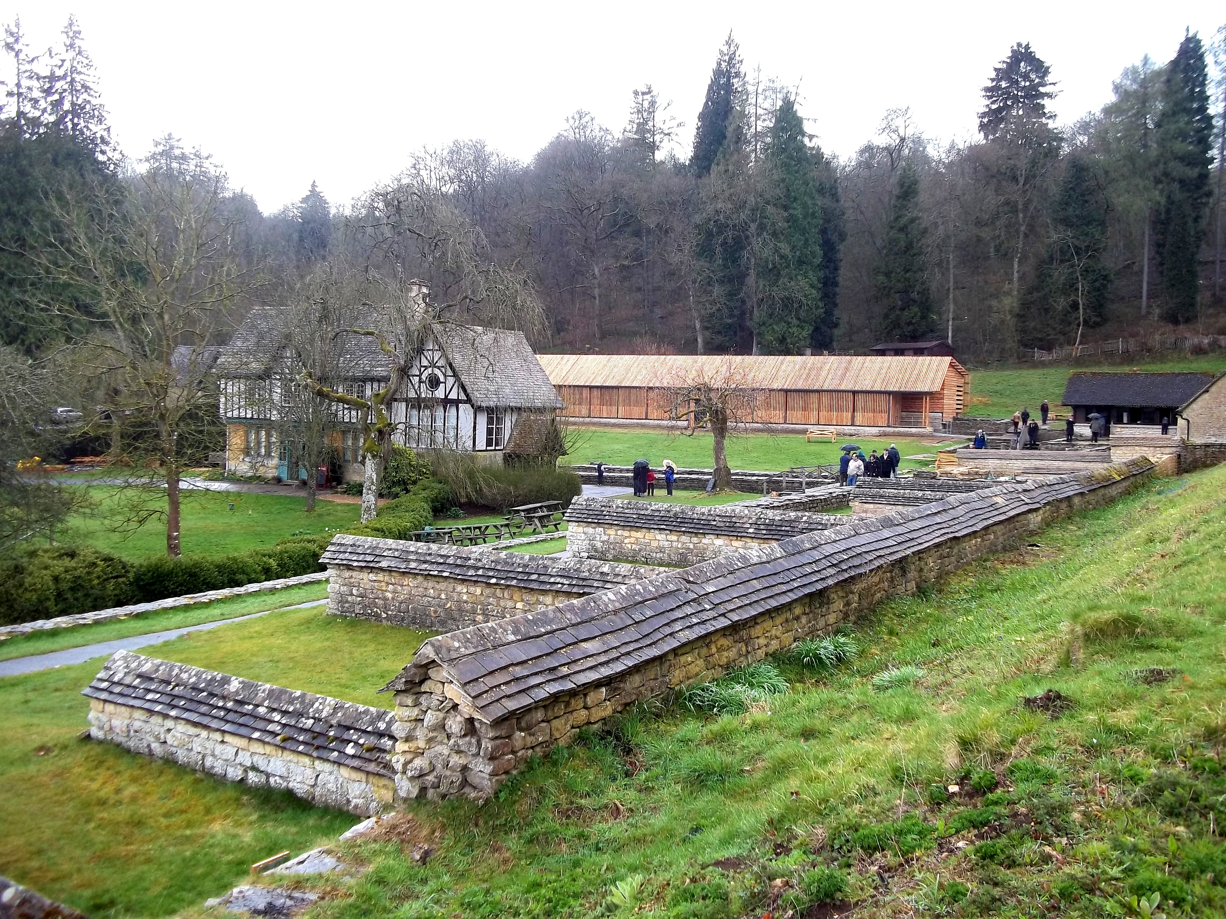
Yanworth is a small village located in the county of Gloucestershire, England. Situated in the picturesque Cotswolds, it is surrounded by rolling hills and stunning countryside. The village is part of the Cotswold District and falls within the administrative region of South West England.
With a population of around 200 inhabitants, Yanworth is a close-knit community that exudes charm and tranquility. The village is characterized by its traditional Cotswold stone cottages, which add to its idyllic and quintessentially English atmosphere.
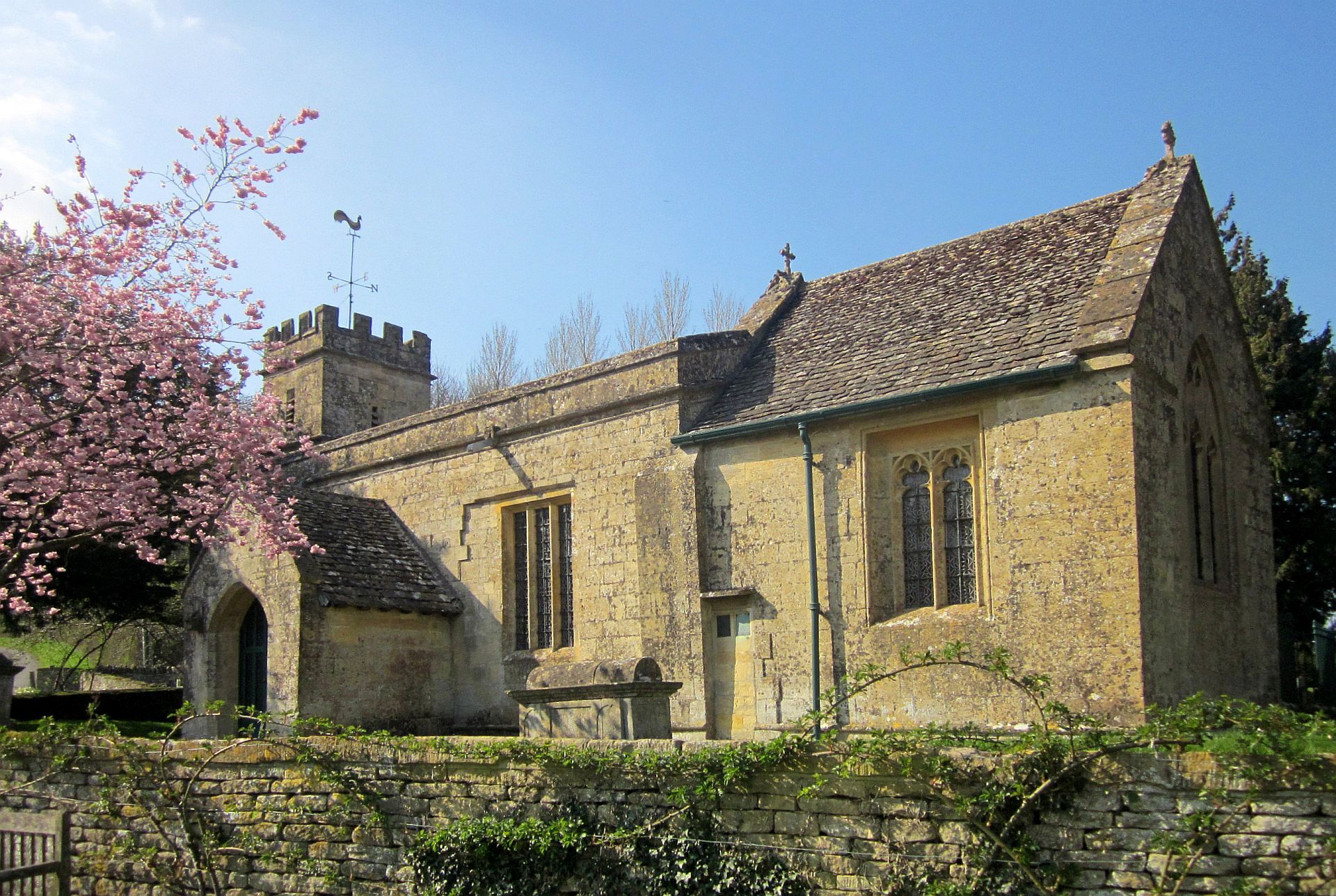
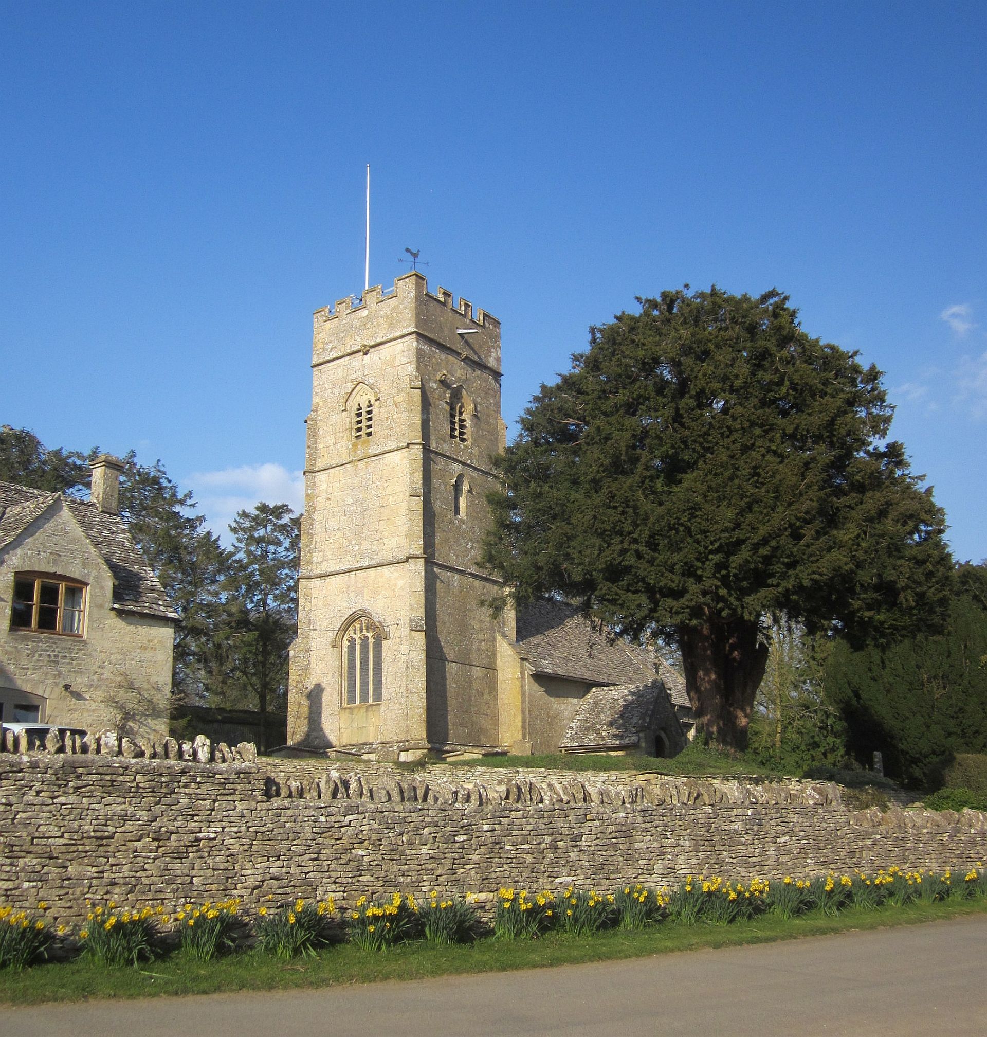
Yanworth is rich in history, with evidence of human settlement dating back to the Roman period. The village is home to a historic church, St. Michael and All Angels, which dates back to the 12th century. The church's architecture showcases different styles from various periods, including Norman, Gothic, and Victorian.
Nature enthusiasts are drawn to Yanworth for its scenic beauty and the abundance of walking and cycling trails in the surrounding area. The village is a gateway to the Cotswolds Area of Outstanding Natural Beauty, offering visitors breathtaking landscapes and opportunities for outdoor activities.
While Yanworth may be small, it benefits from its proximity to larger towns and cities. The market town of Cirencester is only a short drive away, providing residents with access to a range of amenities, including shops, restaurants, and cultural attractions.
In conclusion, Yanworth is a charming village in Gloucestershire, England, offering residents and visitors a peaceful and picturesque setting, rich in history and natural beauty.
If you have any feedback on the listing, please let us know in the comments section below.
Yanworth Images
Images are sourced within 2km of 51.823175/-1.8892058 or Grid Reference SP0713. Thanks to Geograph Open Source API. All images are credited.
![A walk around the Fosse Way [36] Here another minor road crosses the Salt Way. This is the Salt Way heading northwest towards Andoversford.
The Salt Way is an old British trackway, which runs from Droitwich through Worcestershire, and into Gloucestershire near Ashton-under‑Hill. It then runs past Hawling, Salperton, and Hazleton to cross the Fosse Way between Northleach and Stowell Park. It then proceeds by Crickley Barrow to Coln St. Aldwyns, where it crosses Ikenild Street and leaves Gloucestershire at Lechlade on its way to the coast of Hampshire.
Starting at Fossebridge, where the Fosse Way descends precipitously to cross the River Coln, the walk gently ascends on a road and then a bridleway to meet a minor road which is part of the Salt Way. After using the Salt Way to cross the Fosse Way the route descends on footpaths and minor roads via Oxpens Farm and Stowell Mill to return to Fossebridge.](https://s3.geograph.org.uk/geophotos/06/99/67/6996703_fa9179c9.jpg)
![A walk around the Fosse Way [37] A large covered reservoir is seen from the minor road that is the Salt Way.
The Salt Way is an old British trackway, which runs from Droitwich through Worcestershire, and into Gloucestershire near Ashton-under‑Hill. It then runs past Hawling, Salperton, and Hazleton to cross the Fosse Way between Northleach and Stowell Park. It then proceeds by Crickley Barrow to Coln St. Aldwyns, where it crosses Ikenild Street and leaves Gloucestershire at Lechlade on its way to the coast of Hampshire.
Starting at Fossebridge, where the Fosse Way descends precipitously to cross the River Coln, the walk gently ascends on a road and then a bridleway to meet a minor road which is part of the Salt Way. After using the Salt Way to cross the Fosse Way the route descends on footpaths and minor roads via Oxpens Farm and Stowell Mill to return to Fossebridge.](https://s0.geograph.org.uk/geophotos/06/99/67/6996704_b8072565.jpg)
![A walk around the Fosse Way [38] Problems with a lorry on the minor road.
Starting at Fossebridge, where the Fosse Way descends precipitously to cross the River Coln, the walk gently ascends on a road and then a bridleway to meet a minor road which is part of the Salt Way. After using the Salt Way to cross the Fosse Way the route descends on footpaths and minor roads via Oxpens Farm and Stowell Mill to return to Fossebridge.](https://s1.geograph.org.uk/geophotos/06/99/67/6996705_d1ce9739.jpg)
![A walk around the Fosse Way [39] A pylon on the bridleway.
Starting at Fossebridge, where the Fosse Way descends precipitously to cross the River Coln, the walk gently ascends on a road and then a bridleway to meet a minor road which is part of the Salt Way. After using the Salt Way to cross the Fosse Way the route descends on footpaths and minor roads via Oxpens Farm and Stowell Mill to return to Fossebridge.](https://s2.geograph.org.uk/geophotos/06/99/67/6996706_ff897873.jpg)
![A walk around the Fosse Way [40] From the bridleway this path runs through the crop towards Oxpens Farm.
Starting at Fossebridge, where the Fosse Way descends precipitously to cross the River Coln, the walk gently ascends on a road and then a bridleway to meet a minor road which is part of the Salt Way. After using the Salt Way to cross the Fosse Way the route descends on footpaths and minor roads via Oxpens Farm and Stowell Mill to return to Fossebridge.](https://s3.geograph.org.uk/geophotos/06/99/67/6996707_177b6924.jpg)
![A walk around the Fosse Way [41] The path through the crop heads towards the gap in the trees on the skyline.
Starting at Fossebridge, where the Fosse Way descends precipitously to cross the River Coln, the walk gently ascends on a road and then a bridleway to meet a minor road which is part of the Salt Way. After using the Salt Way to cross the Fosse Way the route descends on footpaths and minor roads via Oxpens Farm and Stowell Mill to return to Fossebridge.](https://s2.geograph.org.uk/geophotos/06/99/67/6996726_9a1adfd1.jpg)
![A walk around the Fosse Way [42] An 'island' of trees in the fields of crops. Seen from the path.
Starting at Fossebridge, where the Fosse Way descends precipitously to cross the River Coln, the walk gently ascends on a road and then a bridleway to meet a minor road which is part of the Salt Way. After using the Salt Way to cross the Fosse Way the route descends on footpaths and minor roads via Oxpens Farm and Stowell Mill to return to Fossebridge.](https://s3.geograph.org.uk/geophotos/06/99/67/6996727_f9a88998.jpg)
![A walk around the Fosse Way [43] The path near the gap in the trees.
Starting at Fossebridge, where the Fosse Way descends precipitously to cross the River Coln, the walk gently ascends on a road and then a bridleway to meet a minor road which is part of the Salt Way. After using the Salt Way to cross the Fosse Way the route descends on footpaths and minor roads via Oxpens Farm and Stowell Mill to return to Fossebridge.](https://s1.geograph.org.uk/geophotos/06/99/67/6996729_0a7cab98.jpg)
![A walk around the Fosse Way [44] The two paths (seen at <a href="https://www.geograph.org.uk/photo/6996707">SP0914 : A walk around the Fosse Way [40]</a> and at <a href="https://www.geograph.org.uk/photo/6996726">SP0914 : A walk around the Fosse Way [41]</a>) have merged and crest the slight ridge before starting to descent towards Oxpen Farm. The path is now part of the long distance Monarch&#039;s Way.
Starting at Fossebridge, where the Fosse Way descends precipitously to cross the River Coln, the walk gently ascends on a road and then a bridleway to meet a minor road which is part of the Salt Way. After using the Salt Way to cross the Fosse Way the route descends on footpaths and minor roads via Oxpens Farm and Stowell Mill to return to Fossebridge.](https://s3.geograph.org.uk/geophotos/06/99/67/6996731_7572dab5.jpg)
![A walk around the Fosse Way [45] A crop of linseed alongside the path.
Starting at Fossebridge, where the Fosse Way descends precipitously to cross the River Coln, the walk gently ascends on a road and then a bridleway to meet a minor road which is part of the Salt Way. After using the Salt Way to cross the Fosse Way the route descends on footpaths and minor roads via Oxpens Farm and Stowell Mill to return to Fossebridge.](https://s1.geograph.org.uk/geophotos/06/99/67/6996733_77a555d7.jpg)
![A walk around the Fosse Way [46] The path rises gently before starting to descend towards Oxpens Farm. The path is now part of the long distance Monarch&#039;s Way.
Starting at Fossebridge, where the Fosse Way descends precipitously to cross the River Coln, the walk gently ascends on a road and then a bridleway to meet a minor road which is part of the Salt Way. After using the Salt Way to cross the Fosse Way the route descends on footpaths and minor roads via Oxpens Farm and Stowell Mill to return to Fossebridge.](https://s0.geograph.org.uk/geophotos/06/99/74/6997444_34332ebc.jpg)
![A walk around the Fosse Way [47] Now a track, the route continues towards Oxpens Farm which is seen in the distance. The path is now part of the long distance Monarch&#039;s Way.
Starting at Fossebridge, where the Fosse Way descends precipitously to cross the River Coln, the walk gently ascends on a road and then a bridleway to meet a minor road which is part of the Salt Way. After using the Salt Way to cross the Fosse Way the route descends on footpaths and minor roads via Oxpens Farm and Stowell Mill to return to Fossebridge.](https://s1.geograph.org.uk/geophotos/06/99/74/6997445_c03717e8.jpg)
![A walk around the Fosse Way [48] Some buildings of Oxpens Farm, seen from the track that is part of the long distance Monarch&#039;s Way.
Starting at Fossebridge, where the Fosse Way descends precipitously to cross the River Coln, the walk gently ascends on a road and then a bridleway to meet a minor road which is part of the Salt Way. After using the Salt Way to cross the Fosse Way the route descends on footpaths and minor roads via Oxpens Farm and Stowell Mill to return to Fossebridge.](https://s2.geograph.org.uk/geophotos/06/99/74/6997446_f89a367b.jpg)
![A walk around the Fosse Way [49] Oxpens farm Cottages, seen from the path that is part of the long distance Monarch&#039;s Way.
Starting at Fossebridge, where the Fosse Way descends precipitously to cross the River Coln, the walk gently ascends on a road and then a bridleway to meet a minor road which is part of the Salt Way. After using the Salt Way to cross the Fosse Way the route descends on footpaths and minor roads via Oxpens Farm and Stowell Mill to return to Fossebridge.](https://s3.geograph.org.uk/geophotos/06/99/74/6997447_f342e931.jpg)
![A walk around the Fosse Way [50] Although there is no sign of the path on the ground, it runs parallel to the woods of Stowell Grove.
Starting at Fossebridge, where the Fosse Way descends precipitously to cross the River Coln, the walk gently ascends on a road and then a bridleway to meet a minor road which is part of the Salt Way. After using the Salt Way to cross the Fosse Way the route descends on footpaths and minor roads via Oxpens Farm and Stowell Mill to return to Fossebridge.](https://s0.geograph.org.uk/geophotos/06/99/74/6997448_f923dbf3.jpg)
![A walk around the Fosse Way [51] The line of the path, part of the long distance Monarch&#039;s Way, continues to run parallel to the woodland of Stowell Grove.
Starting at Fossebridge, where the Fosse Way descends precipitously to cross the River Coln, the walk gently ascends on a road and then a bridleway to meet a minor road which is part of the Salt Way. After using the Salt Way to cross the Fosse Way the route descends on footpaths and minor roads via Oxpens Farm and Stowell Mill to return to Fossebridge.](https://s1.geograph.org.uk/geophotos/06/99/74/6997449_9cfc2483.jpg)
![A walk around the Fosse Way [52] The path, part of the long distance Monarch&#039;s Way, passes into the next field.
Starting at Fossebridge, where the Fosse Way descends precipitously to cross the River Coln, the walk gently ascends on a road and then a bridleway to meet a minor road which is part of the Salt Way. After using the Salt Way to cross the Fosse Way the route descends on footpaths and minor roads via Oxpens Farm and Stowell Mill to return to Fossebridge.](https://s2.geograph.org.uk/geophotos/06/99/74/6997450_3c159803.jpg)
Yanworth is located at Grid Ref: SP0713 (Lat: 51.823175, Lng: -1.8892058)
Administrative County: Gloucestershire
District: Cotswold
Police Authority: Gloucestershire
What 3 Words
///venturing.tricky.whimpered. Near Northleach, Gloucestershire
Nearby Locations
Related Wikis


Related Videos

Early Morning Walk During Heavy Rainfall in the Village of Compton Abdale
So, today we are out and about walking in the Cotswold village and parish of Compton Abdale which is located in Gloucestershire ...

A Breezy & Solitary Walk in the Cotswold Village of Yanworth
So, today we are out and about walking in the Cotswold village and parish of Yanworth, which is located in the county of ...

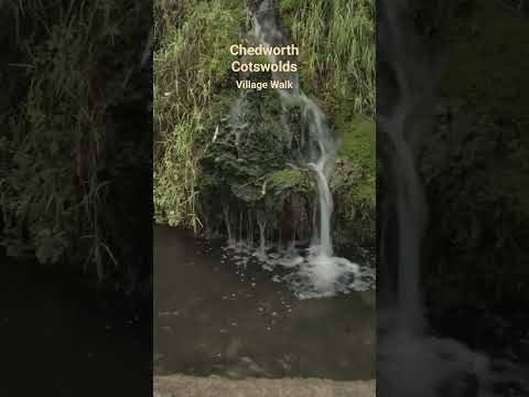
A Quiet Afternoon Walk in a Cotswold Village
Out and about Walking in Chedworth So, for today's walk I tried something slightly different, walking on an afternoon instead of the ...
Chedworth, Cotswolds, Village walking Tour
Welcome to Chedworth, English village walking tour on a very rainy day in 4K. Today I'm taking you on a walking tour of ...
Nearby Amenities
Located within 500m of 51.823175,-1.8892058Have you been to Yanworth?
Leave your review of Yanworth below (or comments, questions and feedback).