Yafforth

Settlement in Yorkshire Hambleton

England

Yafforth

Level crossing for footpath over railway lines north of Northallerton Station
Level crossing for footpath over railway lines north of Northallerton Station Credit: Luke Shaw

Yafforth is a small village located in the Hambleton district of North Yorkshire, England. Situated approximately 3 miles northeast of Northallerton, it is nestled in the picturesque countryside of the Yorkshire Dales. Yafforth is a rural community with a population of around 400 residents.

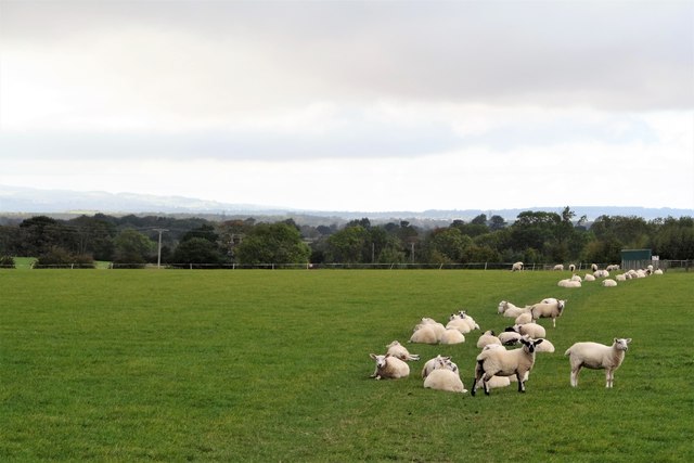
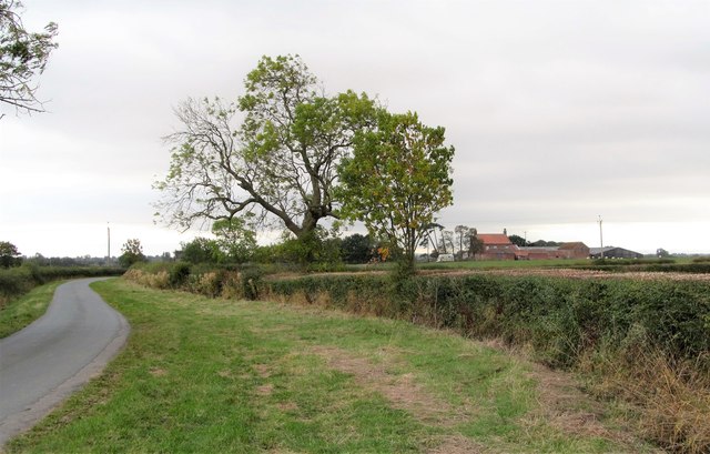
The village is characterized by its charming mix of traditional stone-built cottages and modern houses. The surrounding landscape is dominated by rolling hills, green pastures, and farmland, offering breathtaking views of the countryside. Yafforth benefits from its proximity to the North York Moors National Park, which attracts outdoor enthusiasts with its extensive walking trails and cycling routes.

Although Yafforth is primarily a residential area, it does have a few amenities to cater to its residents' needs. The village boasts a local pub, The Grey Horse Inn, which serves as a social hub for the community. Additionally, there is a primary school, ensuring that young families have access to education within the village.

For more extensive services and amenities, residents can conveniently access the nearby town of Northallerton, which offers a wider range of shops, supermarkets, restaurants, and leisure facilities.

Yafforth's tranquil setting and close-knit community make it an ideal place for those seeking a peaceful and rural lifestyle, while still being within easy reach of larger towns and cities. Its natural beauty and friendly atmosphere make it an attractive destination for visitors looking to explore the stunning Yorkshire countryside.

If you have any feedback on the listing, please let us know in the comments section below.

Yafforth Images

Images are sourced within 2km of 54.345125/-1.4738445 or Grid Reference SE3494. Thanks to Geograph Open Source API. All images are credited.

Level crossing for footpath over railway lines north of Northallerton Station
Castle Hill An Ordnance Survey triangulation station was levelled at 175.577 feet above Liverpool Datum during the 1842-1845 Selby to Newcastle-upon-Tyne 1GL Survey at this location. The surveyor's description was: 'Branch Levelling from No. 102. Castle Hill triangulation station, 32 chains west of Northallerton Church. Centre stone ; 1.50 ft. below surface'
Castle Hill
An Ordnance Survey triangulation station was levelled at 175.577 feet above Liverpool Datum during the 1842-1845 Selby to Newcastle-upon-Tyne 1GL Survey at this location. The surveyor's description was: 'Branch Levelling from No. 102. Castle Hill triangulation station, 32 chains west of Northallerton Church. Centre stone ; 1.50 ft. below surface'
Stile on footpath west of Castle Hill
Level crossing on Dolly Lane The road here is unclassified but busy with traffic avoiding Northallerton town centre, whereas the level crossing is rarely used, being on the Wensleydale Railway which normally doesn't operate trains on this section.
Level crossing on Dolly Lane
The road here is unclassified but busy with traffic avoiding Northallerton town centre, whereas the level crossing is rarely used, being on the Wensleydale Railway which normally doesn't operate trains on this section.
Benchmark Yafforth Church Very well cut, very clear!
Benchmark Yafforth Church
Very well cut, very clear!
Industrial estate, Northallerton
Bridge Abutment The former South Curve of the Northallerton-Hawes-Gargrave Line, built in 1848 but closed in the 1960's, and abandoned ever since. The Wensleydale Railway is now a Heritage Line, and a proposal has been made to reopen this stretch of the line, and build a new station on the main line, but it has been ruled out in the short-term after surveys suggested the work would cost about £6m.
Bridge Abutment
The former South Curve of the Northallerton-Hawes-Gargrave Line, built in 1848 but closed in the 1960's, and abandoned ever since. The Wensleydale Railway is now a Heritage Line, and a proposal has been made to reopen this stretch of the line, and build a new station on the main line, but it has been ruled out in the short-term after surveys suggested the work would cost about £6m.
Railway Bridge over Springwell Lane This bridge was built in 1846-7 by the Great North of England Railway Co. It carries the main East Coast Line from London Kings Cross to Edinburgh Waverley. 
Springwell Lane is little more than an unmade access road to the small number of houses along here, and is riddled with pot-holes. 
The concrete top was added when the line was widened in the 1960's. It was electrified in 1990.
Railway Bridge over Springwell Lane
This bridge was built in 1846-7 by the Great North of England Railway Co. It carries the main East Coast Line from London Kings Cross to Edinburgh Waverley. Springwell Lane is little more than an unmade access road to the small number of houses along here, and is riddled with pot-holes. The concrete top was added when the line was widened in the 1960's. It was electrified in 1990.
New House Building at Mowbray Park
New Housing Development at Mowbray Park
New Housing off Yafforth Road
Milepost beside A167 (Darlington Road) north of Northallerton The post is recorded on the Milestone Society database with identifier YN_NADL01. See also <span class="nowrap"><a title="http://www.bench-marks.org.uk/bm78793" rel="nofollow ugc noopener" href="http://www.bench-marks.org.uk/bm78793">Link</a><img style="margin-left:2px;" alt="External link" title="External link - shift click to open in new window" src="https://s1.geograph.org.uk/img/external.png" width="10" height="10"/></span> for details of an Ordnance Survey benchmark on a milestone previously at this location.
Milepost beside A167 (Darlington Road) north of Northallerton
The post is recorded on the Milestone Society database with identifier YN_NADL01. See also LinkExternal link for details of an Ordnance Survey benchmark on a milestone previously at this location.
Milepost on verge of A167 1 mile north of Northallerton There is a closeup of the post at <a href="https://www.geograph.org.uk/photo/5364949">SE3595 : Milepost beside A167 (Darlington Road) north of Northallerton</a>
Milepost on verge of A167 1 mile north of Northallerton
Zetland Bridge, Yafforth Road (B6271)
East Coast Main line under Zetland Bridge There was an Ordnance Survey benchmark on an earlier (1840s) bridge at this site, see <span class="nowrap"><a title="http://www.bench-marks.org.uk/bm84781" rel="nofollow ugc noopener" href="http://www.bench-marks.org.uk/bm84781">Link</a><img style="margin-left:2px;" alt="External link" title="External link - shift click to open in new window" src="https://s1.geograph.org.uk/img/external.png" width="10" height="10"/></span> for details
East Coast Main line under Zetland Bridge
There was an Ordnance Survey benchmark on an earlier (1840s) bridge at this site, see LinkExternal link for details
All Saints church, Yafforth
Sheep pasture, Yafforth Moor Curiously, most of the flock have all decided to settle along the same central strip of the field.
Sheep pasture, Yafforth Moor
Curiously, most of the flock have all decided to settle along the same central strip of the field.
Thrintoft Moor Lane Looking along the lane in the direction of Thrintoft, with Moor House farm visible in the middle distance.
Thrintoft Moor Lane
Looking along the lane in the direction of Thrintoft, with Moor House farm visible in the middle distance.
Show me another place!

Yafforth is located at Grid Ref: SE3494 (Lat: 54.345125, Lng: -1.4738445)

Division: North Riding

Administrative County: North Yorkshire

District: Hambleton

Police Authority: North Yorkshire

What 3 Words

///sandbags.dragons.tumblers. Near Northallerton, North Yorkshire

Nearby Locations

Yafforth

Related Wikis

Yafforth

Yafforth is a village and civil parish in North Yorkshire, England about 1 mile (1.6 km) west of Northallerton. The village lies on the B6271 road between...

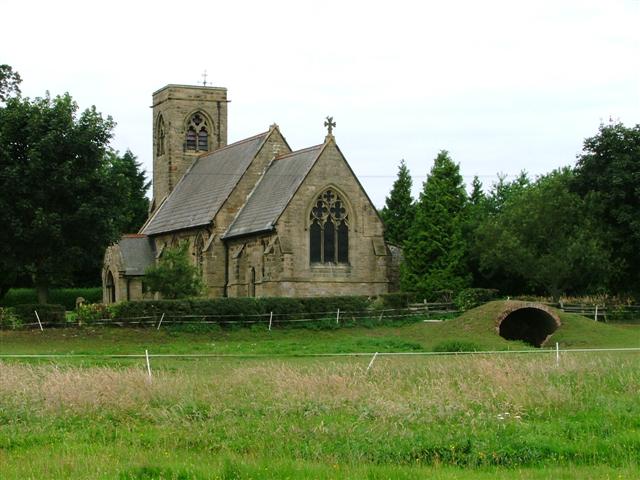
All Saints' Church, Yafforth

All Saints’ Church, Yafforth, is a Grade II listed parish church in the Church of England: 405  in Yafforth, North Yorkshire. == History == The church...

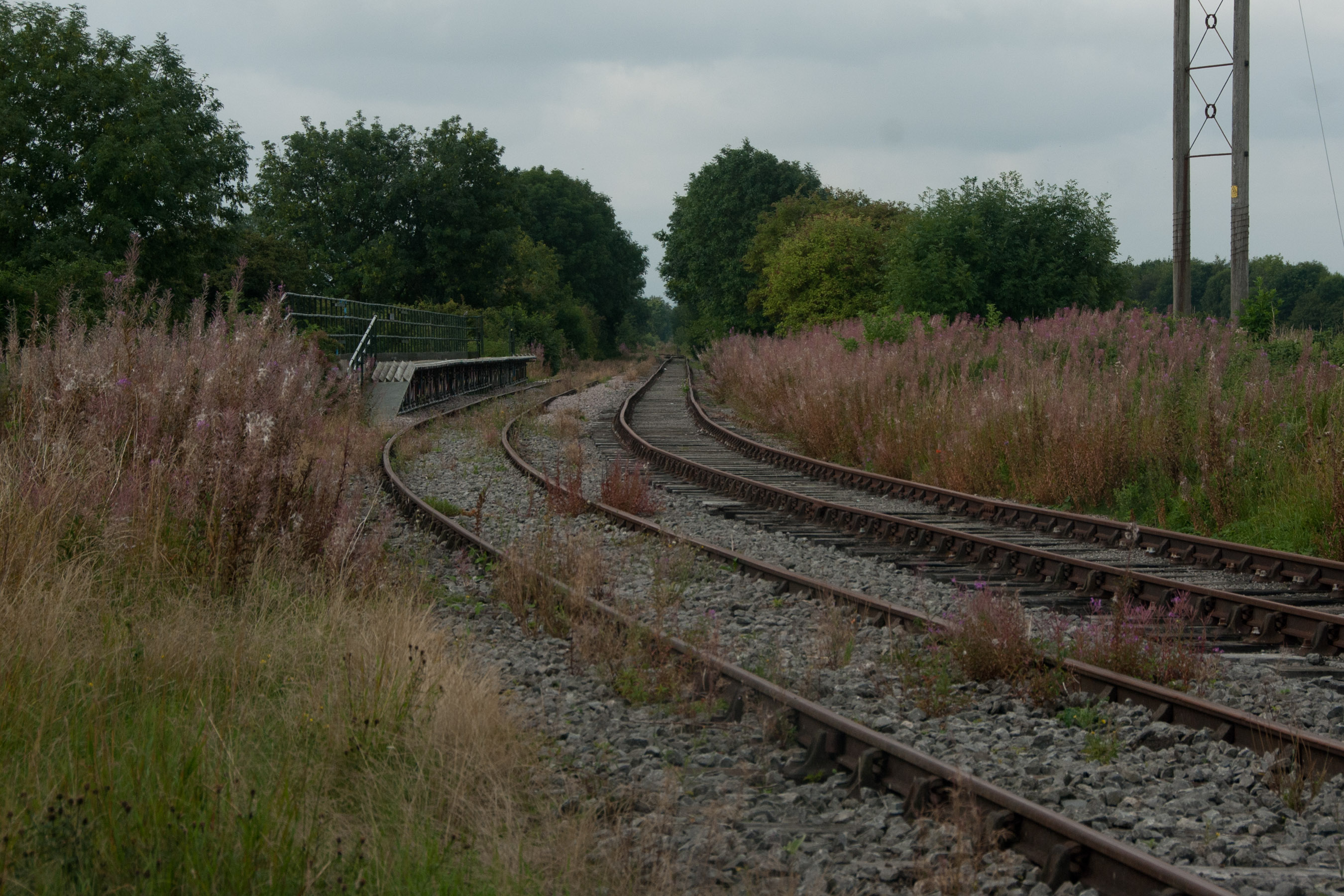
Northallerton West railway station

Northallerton West is a temporary station built by the Wensleydale Railway as part of plans to link the railway with Northallerton, North Yorkshire, England...
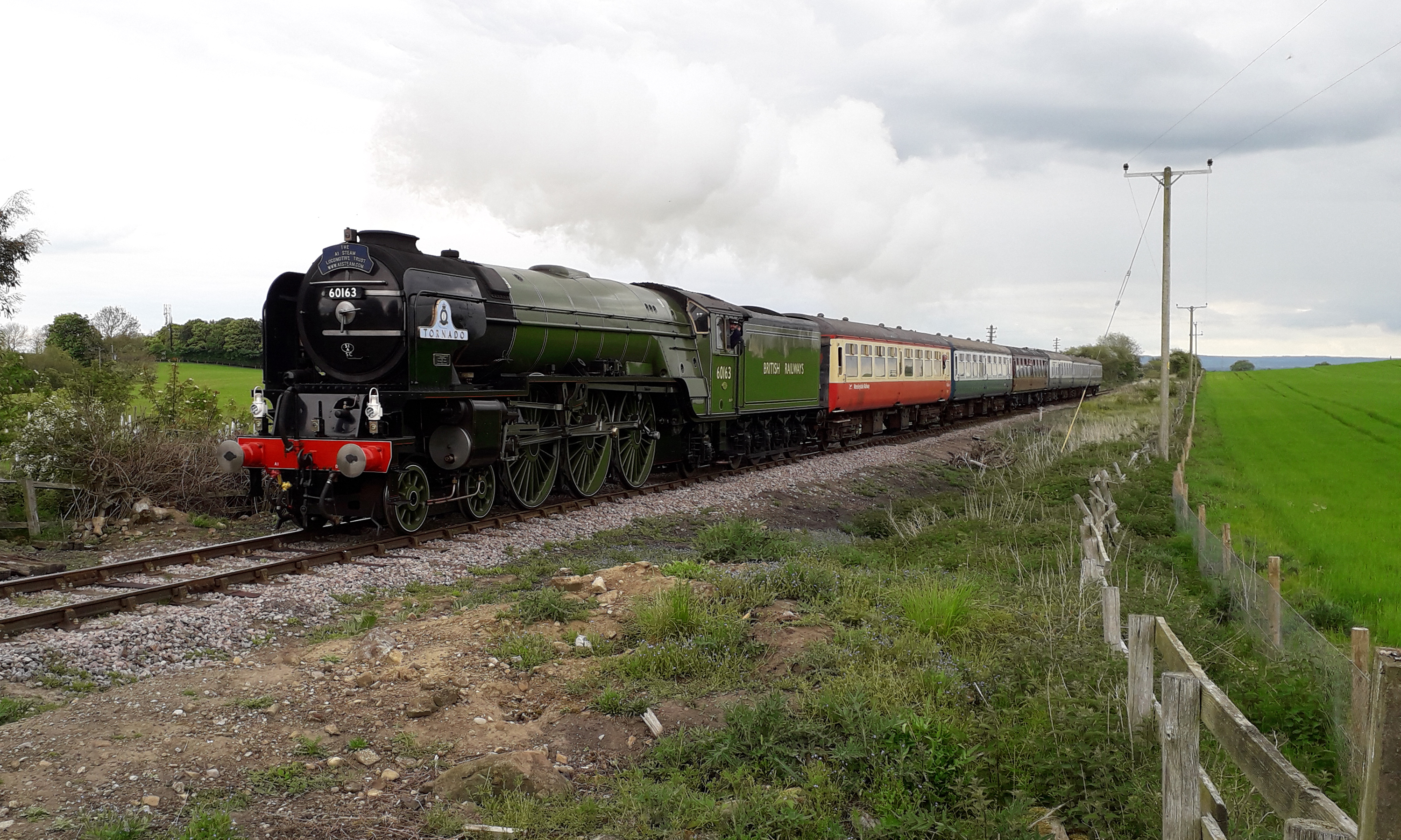
Wensleydale Railway

The Wensleydale Railway is a heritage railway in Wensleydale and Lower Swaledale in North Yorkshire, England. It was built in stages by different railway...

Nearby Amenities

Located within 500m of 54.345125,-1.4738445
Yafforth
Place: village
Source: npe
Lat/Long: 54.3447199/-1.4734945
Post Box
Post Box Type: lamp
Ref: DL7 9
Royal Cypher: EIIR
Royal Cypher Wikidata: Q33102113
Lat/Long: 54.3454475/-1.4736935
Telephone
Booth: KX100
Covered: booth
Lat/Long: 54.3455205/-1.4734601
Power: pole
Lat/Long: 54.34587/-1.4666346
Power: pole
Lat/Long: 54.3465313/-1.4681071
Power: pole
Lat/Long: 54.3468206/-1.4687964
Power: pole
Lat/Long: 54.3468425/-1.4702636
Power: pole
Lat/Long: 54.3468534/-1.4717737
Power: pole
Lat/Long: 54.3468581/-1.4732355
Power: pole
Lat/Long: 54.3468581/-1.4748797
Power: pole
Lat/Long: 54.3473834/-1.4688581
Power: pole
Lat/Long: 54.347299/-1.4701751
Power: pole
Lat/Long: 54.3471927/-1.471602
Power: pole
Lat/Long: 54.3470848/-1.4731658
Power: pole
Lat/Long: 54.3469753/-1.4748824
Power: pole
Lat/Long: 54.344982/-1.4753464
Power: pole
Lat/Long: 54.3448835/-1.4760947
Power: pole
Lat/Long: 54.3447818/-1.4767706
Power: pole
Lat/Long: 54.3451242/-1.4789486
Power: pole
Lat/Long: 54.3432793/-1.4777282
Power: pole
Lat/Long: 54.3437468/-1.47838
Power: pole
Lat/Long: 54.3443065/-1.47908
Power: pole
Lat/Long: 54.3448757/-1.4798257
Power: pole
Lat/Long: 54.3444848/-1.4812043
Power: pole
Lat/Long: 54.3453384/-1.4809442
Power: pole
Lat/Long: 54.3474991/-1.4800912
Power: pole
Lat/Long: 54.3471317/-1.4796433
Power: pole
Lat/Long: 54.3415797/-1.4702609
Power: pole
Lat/Long: 54.3419706/-1.4714894
Power: pole
Lat/Long: 54.3423474/-1.4727286
Power: pole
Lat/Long: 54.3427258/-1.4740214
Bench
Bench: yes
Lat/Long: 54.3454218/-1.4734558
The data included in this document is from www.openstreetmap.org. The data is made available under ODbL.

Have you been to Yafforth?

Leave your review of Yafforth below (or comments, questions and feedback).