Wyke

Settlement in Yorkshire

England

Wyke

Disused viaduct
Disused viaduct Credit: SMJ

Wyke is a small town located in the metropolitan borough of Bradford, in West Yorkshire, England. Situated approximately four miles south of Bradford city center, it falls within the commuter belt of both Bradford and Leeds. The town, with a population of around 14,000 people, is primarily residential and boasts a close-knit community atmosphere.

Wyke has a rich history dating back to the 13th century when it was known for its agricultural heritage. Over the years, it has evolved into a thriving industrial center, thanks to its proximity to Bradford's textile mills. Today, remnants of this industrial past can still be seen in the form of old mill buildings and warehouses.

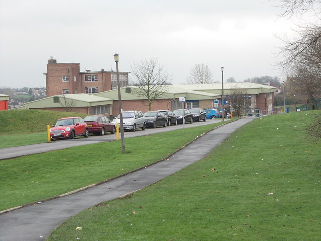
Despite its industrial roots, Wyke offers a range of amenities and facilities for its residents. The town has several primary schools, secondary schools, and a well-regarded further education college. It also has a variety of local shops, supermarkets, and healthcare services, ensuring the needs of its population are met.

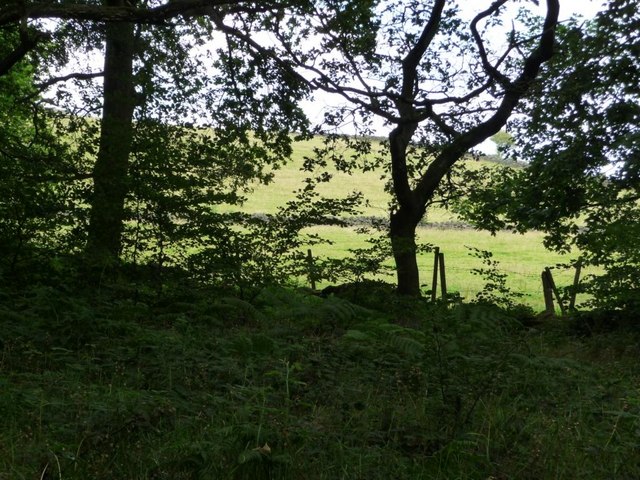
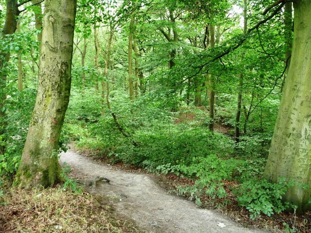
For leisure and recreation, Wyke benefits from its proximity to the beautiful Yorkshire countryside. The town provides easy access to scenic walking and cycling routes, including the nearby Wyke Beck Valley, which offers stunning natural landscapes. Additionally, sports enthusiasts can enjoy the local cricket, football, and rugby clubs within the town.

Overall, Wyke is a charming town with a rich history, a strong sense of community, and convenient access to both urban and rural amenities.

If you have any feedback on the listing, please let us know in the comments section below.
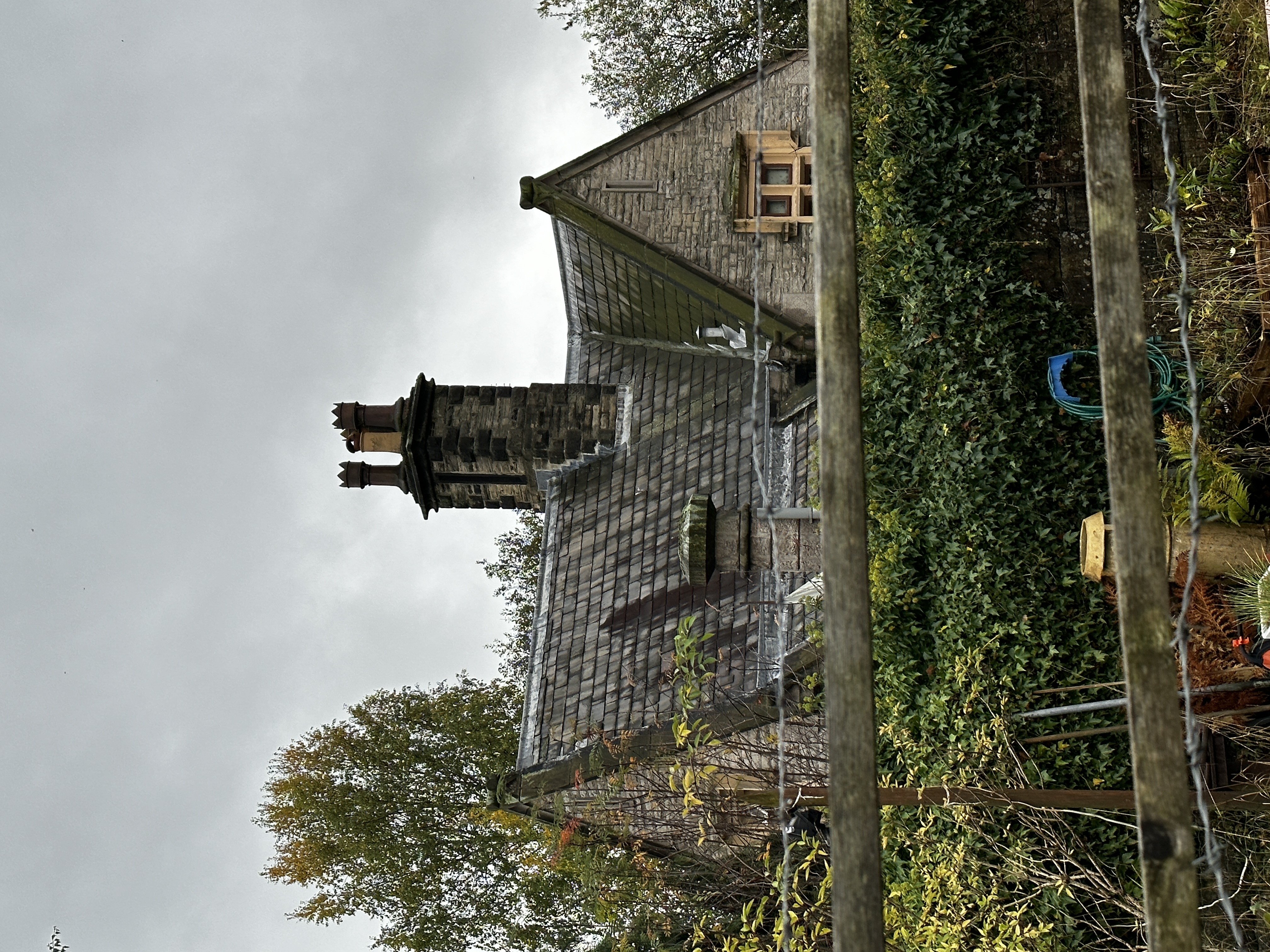
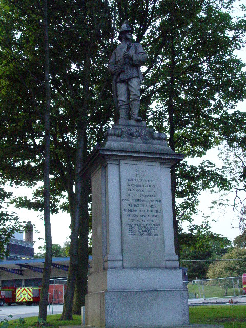
Wyke Images

Images are sourced within 2km of 53.736208/-1.7661878 or Grid Reference SE1526. Thanks to Geograph Open Source API. All images are credited.

Disused viaduct
Disused viaduct
Lay-by Whitehall Road,
Nord Nurseries, Whitehall Road
Access for All path, Judy Woods Judy Woods comprises several individual woods, including this one, Doctor Wood. For more information see <span class="nowrap"><a title="www.judywoods.org.uk" rel="nofollow ugc noopener" href="http://www.judywoods.org.uk">Link</a><img style="margin-left:2px;" alt="External link" title="External link - shift click to open in new window" src="https://s1.geograph.org.uk/img/external.png" width="10" height="10"/></span> .
Access for All path, Judy Woods
Judy Woods comprises several individual woods, including this one, Doctor Wood. For more information see LinkExternal link .
Coppiced oak, Judy Woods Judy Wood comprises several individual woods, including this one, Doctor Wood. The ring of oak trees are the result of an older central tree being coppiced. For more information see <span class="nowrap"><a title="www.judywoods.org.uk" rel="nofollow ugc noopener" href="http://www.judywoods.org.uk">Link</a><img style="margin-left:2px;" alt="External link" title="External link - shift click to open in new window" src="https://s1.geograph.org.uk/img/external.png" width="10" height="10"/></span> .
Coppiced oak, Judy Woods
Judy Wood comprises several individual woods, including this one, Doctor Wood. The ring of oak trees are the result of an older central tree being coppiced. For more information see LinkExternal link .
Access for All path, Judy Woods For more information, see <span class="nowrap"><a title="www.judywoods.org.uk" rel="nofollow ugc noopener" href="http://www.judywoods.org.uk">Link</a><img style="margin-left:2px;" alt="External link" title="External link - shift click to open in new window" src="https://s1.geograph.org.uk/img/external.png" width="10" height="10"/></span> .
Access for All path, Judy Woods
For more information, see LinkExternal link .
Small stream in Judy Woods Below the Access for All path in Doctor Wood. For more information, see <span class="nowrap"><a title="www.judywoods.org.uk" rel="nofollow ugc noopener" href="http://www.judywoods.org.uk">Link</a><img style="margin-left:2px;" alt="External link" title="External link - shift click to open in new window" src="https://s1.geograph.org.uk/img/external.png" width="10" height="10"/></span>
Small stream in Judy Woods
Below the Access for All path in Doctor Wood. For more information, see LinkExternal link
Woodland edge, Judy Woods Judy Woods comprises several individual woods, of which this is one, Low Wood. For more information see <span class="nowrap"><a title="www.judywoods.org.uk" rel="nofollow ugc noopener" href="http://www.judywoods.org.uk">Link</a><img style="margin-left:2px;" alt="External link" title="External link - shift click to open in new window" src="https://s1.geograph.org.uk/img/external.png" width="10" height="10"/></span>
Woodland edge, Judy Woods
Judy Woods comprises several individual woods, of which this is one, Low Wood. For more information see LinkExternal link
Woodside Farm and fields, from the woods Judy Woods comprises several individual woods, of which this is one, Low Wood. For more information see <span class="nowrap"><a title="www.judywoods.org.uk" rel="nofollow ugc noopener" href="http://www.judywoods.org.uk">Link</a><img style="margin-left:2px;" alt="External link" title="External link - shift click to open in new window" src="https://s1.geograph.org.uk/img/external.png" width="10" height="10"/></span>
Woodside Farm and fields, from the woods
Judy Woods comprises several individual woods, of which this is one, Low Wood. For more information see LinkExternal link
Path at the former Wood Colliery, Judy Woods The pit was operated in the 1770s in Low  Wood, one of several woods which form Judy Woods. For more information see <span class="nowrap"><a title="www.judywoods.org.uk" rel="nofollow ugc noopener" href="http://www.judywoods.org.uk">Link</a><img style="margin-left:2px;" alt="External link" title="External link - shift click to open in new window" src="https://s1.geograph.org.uk/img/external.png" width="10" height="10"/></span>
Path at the former Wood Colliery, Judy Woods
The pit was operated in the 1770s in Low Wood, one of several woods which form Judy Woods. For more information see LinkExternal link
Field east of Low Wood Agriculture on the edge of former woodland industry.
Field east of Low Wood
Agriculture on the edge of former woodland industry.
Archaeological investigation, Judy Woods Survey of the site of a dam connected with the old mineral line in Low Wood [part of Judy Woods]. A demonstration for the Archaeology Walk hosted by the Friends of Judy Woods, as part of the Festival of British Archaeology. For more information, see <span class="nowrap"><a title="www.judywoods.org.uk" rel="nofollow ugc noopener" href="http://www.judywoods.org.uk">Link</a><img style="margin-left:2px;" alt="External link" title="External link - shift click to open in new window" src="https://s1.geograph.org.uk/img/external.png" width="10" height="10"/></span>
Archaeological investigation, Judy Woods
Survey of the site of a dam connected with the old mineral line in Low Wood [part of Judy Woods]. A demonstration for the Archaeology Walk hosted by the Friends of Judy Woods, as part of the Festival of British Archaeology. For more information, see LinkExternal link
Participants on the Archaeology Walk, Judy Woods Learning about the rope-hauled mineral line in Low Wood [part of Judy Woods]. The walk was hosted by the Friends of Judy Woods, as part of the Festival of British Archaeology. For more information, see <span class="nowrap"><a title="www.judywoods.org.uk" rel="nofollow ugc noopener" href="http://www.judywoods.org.uk">Link</a><img style="margin-left:2px;" alt="External link" title="External link - shift click to open in new window" src="https://s1.geograph.org.uk/img/external.png" width="10" height="10"/></span>
Participants on the Archaeology Walk, Judy Woods
Learning about the rope-hauled mineral line in Low Wood [part of Judy Woods]. The walk was hosted by the Friends of Judy Woods, as part of the Festival of British Archaeology. For more information, see LinkExternal link
Archaeology Walk, Judy Woods Denis Waudby, the walk leader, explaining how archaeologists survey in Low Wood with staff and tripod. The walk was hosted by the Friends of Judy Woods, as part of the Festival of British Archaeology. For more information, see <span class="nowrap"><a title="www.judywoods.org.uk" rel="nofollow ugc noopener" href="http://www.judywoods.org.uk">Link</a><img style="margin-left:2px;" alt="External link" title="External link - shift click to open in new window" src="https://s1.geograph.org.uk/img/external.png" width="10" height="10"/></span>
Archaeology Walk, Judy Woods
Denis Waudby, the walk leader, explaining how archaeologists survey in Low Wood with staff and tripod. The walk was hosted by the Friends of Judy Woods, as part of the Festival of British Archaeology. For more information, see LinkExternal link
Footpath footbridge, Judy Woods Judy Woods comprises several individual woods, including this one, Low Wood. For more information, see <span class="nowrap"><a title="www.judywoods.org.uk" rel="nofollow ugc noopener" href="http://www.judywoods.org.uk">Link</a><img style="margin-left:2px;" alt="External link" title="External link - shift click to open in new window" src="https://s1.geograph.org.uk/img/external.png" width="10" height="10"/></span>
Footpath footbridge, Judy Woods
Judy Woods comprises several individual woods, including this one, Low Wood. For more information, see LinkExternal link
Under the beeches, Judy Woods Beeches apparently produce an enzyme which inhibits plant growth under their canopy. Judy Woods comprises several individual woods, including this one, Low Wood. For more information, see <span class="nowrap"><a title="www.judywoods.org.uk" rel="nofollow ugc noopener" href="http://www.judywoods.org.uk">Link</a><img style="margin-left:2px;" alt="External link" title="External link - shift click to open in new window" src="https://s1.geograph.org.uk/img/external.png" width="10" height="10"/></span>
Under the beeches, Judy Woods
Beeches apparently produce an enzyme which inhibits plant growth under their canopy. Judy Woods comprises several individual woods, including this one, Low Wood. For more information, see LinkExternal link
High Fernley Road, Judy Woods The drystone wall has been dated to 1831, from a clay pipe buried in it. Judy Woods comprises several individual woods, including Old Hanna Wood [left] and Low Wood [right]. For more information, see <span class="nowrap"><a title="www.judywoods.org.uk" rel="nofollow ugc noopener" href="http://www.judywoods.org.uk">Link</a><img style="margin-left:2px;" alt="External link" title="External link - shift click to open in new window" src="https://s1.geograph.org.uk/img/external.png" width="10" height="10"/></span>
High Fernley Road, Judy Woods
The drystone wall has been dated to 1831, from a clay pipe buried in it. Judy Woods comprises several individual woods, including Old Hanna Wood [left] and Low Wood [right]. For more information, see LinkExternal link
Path into Old Hanna Wood Judy Woods comprises several individual woods, including this one, Old Hanna Wood. For more information, see <span class="nowrap"><a title="www.judywoods.org.uk" rel="nofollow ugc noopener" href="http://www.judywoods.org.uk">Link</a><img style="margin-left:2px;" alt="External link" title="External link - shift click to open in new window" src="https://s1.geograph.org.uk/img/external.png" width="10" height="10"/></span>
Path into Old Hanna Wood
Judy Woods comprises several individual woods, including this one, Old Hanna Wood. For more information, see LinkExternal link
Show me another place!

Wyke is located at Grid Ref: SE1526 (Lat: 53.736208, Lng: -1.7661878)

Division: West Riding

Unitary Authority: Bradford

Police Authority: West Yorkshire

What 3 Words

///lies.dozen.scarcely. Near Cleckheaton, West Yorkshire

Nearby Locations

Wyke Wyke Common

Related Wikis

Wyke, Bradford

Wyke (population 14,180 – 2001 UK census) is a ward within the City of Bradford Metropolitan District Council in the county of West Yorkshire, England...

Appleton Academy

Appleton Academy is a mixed all-through school for pupils aged 3 to 16. It is located in Wyke in the City of Bradford, in the English county of West Yorkshire...

Wyke and Norwood Green railway station

Wyke and Norwood Green railway station served the villages of Wyke and Norwood Green in West Yorkshire, England. == History == Originally situated a little...

Low Moor Explosion

The Low Moor Explosion was a fire and a series of explosions at a munitions factory in Low Moor, Bradford, West Riding of Yorkshire in August 1916. The...

Nearby Amenities

Located within 500m of 53.736208,-1.7661878
Wyke
Created By: Potlatch 0.5a
Place: village
Source: npe
Lat/Long: 53.7398844/-1.7657321
Traffic Signals
Lat/Long: 53.7342298/-1.7601732
Cycleway: asl
Lat/Long: 53.7342813/-1.7597916
Bus Stop
Westfield Lane Greenacre Avenue
Local Ref: 45014222
Naptan AtcoCode: 450014222
Naptan Bearing: SE
Naptan CommonName: Westfield Lane Greenacre Avenue
Naptan Crossing: Greenacre Avenue
Naptan Indicator: Stop 45014222
Naptan Notes: OSR taken place 171005
Naptan PlusbusZoneRef: LEEDS
Naptan ShortCommonName: Greenacre Avenue
Naptan Street: Westfield Lane
Naptan Verified: no
Source: naptan_import
Lat/Long: 53.7351547/-1.7618091
Bus Stop
Westfield Lane Sellerdale Avenue
Local Ref: 45014223
Naptan AtcoCode: 450014223
Naptan Bearing: SE
Naptan CommonName: Westfield Lane Sellerdale Avenue
Naptan Crossing: Sellerdale Avenue
Naptan Indicator: Stop 45014223
Naptan Landmark: Westfield United Reformed Church
Naptan Notes: OSR taken place 060905
Naptan PlusbusZoneRef: LEEDS
Naptan ShortCommonName: Sellerdale Avenue
Naptan Street: Westfield Lane
Naptan Verified: no
Source: naptan_import
Lat/Long: 53.7354593/-1.7628047
Bus Stop
Westfield Lane Norham Grove
Local Ref: 45014224
Naptan AtcoCode: 450014224
Naptan Bearing: NW
Naptan CommonName: Westfield Lane Norham Grove
Naptan Crossing: Norman Grove
Naptan Indicator: Stop 45014224
Naptan Landmark: Westfield United Reformed Church
Naptan Notes: OSR taken place 060905
Naptan PlusbusZoneRef: LEEDS
Naptan ShortCommonName: Norham Grove
Naptan Street: Westfield Lane
Naptan Verified: no
Source: naptan_import
Lat/Long: 53.7353948/-1.7633729
Bus Stop
Westfield Lane Wyke Lane
Local Ref: 45014225
Naptan AtcoCode: 450014225
Naptan Bearing: SE
Naptan CommonName: Westfield Lane Wyke Lane
Naptan Crossing: Wyke Lane
Naptan Indicator: Stop 45014225
Naptan Notes: OSR taken place 060905
Naptan PlusbusZoneRef: LEEDS
Naptan ShortCommonName: Wyke Lane
Naptan Street: Westfield Lane
Naptan Verified: no
Source: naptan_import
Lat/Long: 53.7360076/-1.7649505
Bus Stop
Westfield Lane Wyke Lane
Local Ref: 45014226
Naptan AtcoCode: 450014226
Naptan Bearing: NW
Naptan CommonName: Westfield Lane Wyke Lane
Naptan Crossing: Wyke Lane
Naptan Indicator: Stop 45014226
Naptan Notes: OSR taken place 060905
Naptan PlusbusZoneRef: LEEDS
Naptan ShortCommonName: Wyke Lane
Naptan Street: Westfield Lane
Naptan Verified: no
Source: naptan_import
Lat/Long: 53.7361282/-1.7661128
Bus Stop
Westfield Lane Aysgarth Close
Local Ref: 45014227
Naptan AtcoCode: 450014227
Naptan Bearing: SE
Naptan CommonName: Westfield Lane Aysgarth Close
Naptan Crossing: Aysgarth Close
Naptan Indicator: Stop 45014227
Naptan Notes: OSR taken place 060905
Naptan PlusbusZoneRef: LEEDS
Naptan ShortCommonName: Aysgarth Close
Naptan Street: Westfield Lane
Naptan Verified: no
Source: naptan_import
Lat/Long: 53.7366519/-1.7673227
Bus Stop
Westfield Lane Towngate
Local Ref: 45014228
Naptan AtcoCode: 450014228
Naptan Bearing: NW
Naptan CommonName: Westfield Lane Towngate
Naptan Crossing: Mistral Close
Naptan Indicator: Stop 45014228
Naptan Notes: OSR taken place 060905
Naptan PlusbusZoneRef: LEEDS
Naptan ShortCommonName: Mistral Close
Naptan Street: Westfield Lane
Naptan Verified: no
Source: naptan_import
Lat/Long: 53.7367252/-1.7680196
Bus Stop
Wyke Lane Silver Birch Avenue
Local Ref: 45014231
Naptan AtcoCode: 450014231
Naptan Bearing: SW
Naptan CommonName: Wyke Lane Silver Birch Avenue
Naptan Crossing: Silver Birch Avenue
Naptan Indicator: Stop 45014231
Naptan Landmark: Worthinghead Primary School
Naptan PlusbusZoneRef: LEEDS
Naptan ShortCommonName: Silver Birch Avenue
Naptan Street: Wyke Lane
Naptan Verified: no
Source: naptan_import
Lat/Long: 53.7391451/-1.7611911
Bus Stop
Wyke Lane Hobson Fold
Local Ref: 45014232
Naptan AtcoCode: 450014232
Naptan Bearing: SW
Naptan CommonName: Wyke Lane Hobson Fold
Naptan Crossing: Hobson Fold
Naptan Indicator: Stop 45014232
Naptan Notes: OSR taken place 171005
Naptan PlusbusZoneRef: LEEDS
Naptan ShortCommonName: Wyke Crescent
Naptan Street: Wyke Lane
Naptan Verified: no
Source: naptan_import
Lat/Long: 53.7365915/-1.7645041
Bus Stop
Wyke Lane Westfield Lane
Local Ref: 45014233
Naptan AtcoCode: 450014233
Naptan Bearing: NE
Naptan CommonName: Wyke Lane Westfield Lane
Naptan Crossing: Westfield Lane
Naptan Indicator: Stop 45014233
Naptan Notes: OSR taken place 171005
Naptan PlusbusZoneRef: LEEDS
Naptan ShortCommonName: Westfield Lane
Naptan Street: Wyke Lane
Naptan Verified: no
Source: naptan_import
Lat/Long: 53.7363021/-1.7653109
Bus Stop
Whitehall Road Westfield Lane
Local Ref: 45014234
Naptan AtcoCode: 450014234
Naptan Bearing: SW
Naptan CommonName: Whitehall Road Westfield Lane
Naptan Crossing: Westfield Lane
Naptan Indicator: Stop 45014234
Naptan PlusbusZoneRef: LEEDS
Naptan ShortCommonName: Westfield Lane
Naptan Street: Whitehall Road
Naptan Verified: no
Source: naptan_import
Lat/Long: 53.7339074/-1.7612135
Bus Stop
Whitehall Road Corrance Road
Local Ref: 45014235
Naptan AtcoCode: 450014235
Naptan Bearing: SW
Naptan CommonName: Whitehall Road Corrance Road
Naptan Crossing: Corrance Road
Naptan Indicator: Stop 45014235
Naptan PlusbusZoneRef: LEEDS
Naptan ShortCommonName: Corrance Road
Naptan Street: Whitehall Road
Naptan Verified: no
Source: naptan_import
Lat/Long: 53.7328177/-1.7646759
Bus Stop
Whitehall Road Corrance Road
Local Ref: 45014236
Naptan AtcoCode: 450014236
Naptan Bearing: NE
Naptan CommonName: Whitehall Road Corrance Road
Naptan Crossing: Corrance Road
Naptan Indicator: Stop 45014236
Naptan PlusbusZoneRef: LEEDS
Naptan ShortCommonName: Corrance Road
Naptan Street: Whitehall Road
Naptan Verified: no
Source: naptan_import
Lat/Long: 53.7328811/-1.7649181
Bus Stop
Whitehall Road Lower Wyke Lane
Local Ref: 45014237
Naptan AtcoCode: 450014237
Naptan Bearing: W
Naptan CommonName: Whitehall Road Lower Wyke Lane
Naptan Crossing: Lower Wyke Lane
Naptan Indicator: Stop 45014237
Naptan PlusbusZoneRef: LEEDS
Naptan ShortCommonName: Greengates Avenue
Naptan Street: Whitehall Road
Naptan Verified: no
Source: naptan_import
Lat/Long: 53.7321222/-1.7675144
Bus Stop
Whitehall Road Griffe Road
Local Ref: 45014238
Naptan AtcoCode: 450014238
Naptan Bearing: E
Naptan CommonName: Whitehall Road Griffe Road
Naptan Crossing: Griffe Road
Naptan Indicator: Stop 45014238
Naptan Notes: OSR taken place 060905
Naptan PlusbusZoneRef: LEEDS
Naptan ShortCommonName: Griffe Road
Naptan Street: Whitehall Road
Naptan Verified: no
Source: naptan_import
Lat/Long: 53.7321951/-1.7680597
Bus Stop
Griffe Head Road Blackstone Avenue
Local Ref: 45014240
Naptan AtcoCode: 450014240
Naptan Bearing: E
Naptan CommonName: Griffe Head Road Blackstone Avenue
Naptan Crossing: Blackstone Avenue
Naptan Indicator: Stop 45014240
Naptan PlusbusZoneRef: LEEDS
Naptan ShortCommonName: Blackstone Avenue
Naptan Street: Griffe Head Road
Naptan Verified: no
Source: naptan_import
Lat/Long: 53.7349175/-1.7721681
Bus Stop
Whitehall Avenue Blackstone Avenue
Local Ref: 45014241
Naptan AtcoCode: 450014241
Naptan Bearing: SW
Naptan CommonName: Whitehall Avenue Blackstone Avenue
Naptan Crossing: Blackstone Avenue
Naptan Indicator: Stop 45014241
Naptan Notes: OSR taken place 171005
Naptan PlusbusZoneRef: LEEDS
Naptan ShortCommonName: Blackstone Avenue
Naptan Street: Whitehall Avenue
Naptan Verified: no
Source: naptan_import
Lat/Long: 53.7346487/-1.7726244
Bus Stop
Griffe Road Villa Mount
Local Ref: 45014244
Naptan AtcoCode: 450014244
Naptan Bearing: S
Naptan CommonName: Griffe Road Villa Mount
Naptan Crossing: Villa Mount
Naptan Indicator: Stop 45014244
Naptan Notes: OSR taken place 181005
Naptan PlusbusZoneRef: LEEDS
Naptan ShortCommonName: Villa Mount
Naptan Street: Griffe Road
Naptan Verified: no
Source: naptan_import
Lat/Long: 53.7330848/-1.767979
Bus Stop
Griffe Road Griffe Drive
Local Ref: 45014245
Naptan AtcoCode: 450014245
Naptan Bearing: N
Naptan CommonName: Griffe Road Griffe Drive
Naptan Crossing: Griffe Drive
Naptan Indicator: Stop 45014245
Naptan Notes: OSR taken place 181005
Naptan PlusbusZoneRef: LEEDS
Naptan ShortCommonName: Griffe Drive
Naptan Street: Griffe Road
Naptan Verified: no
Source: naptan_import
Lat/Long: 53.7332738/-1.7680993
Bus Stop
Griffe Road Wyke Lane
Local Ref: 45014246
Naptan AtcoCode: 450014246
Naptan Bearing: N
Naptan CommonName: Griffe Road Wyke Lane
Naptan Crossing: Wyke Lane
Naptan Indicator: Stop 45014246
Naptan Notes: OSR taken place 070905
Naptan PlusbusZoneRef: LEEDS
Naptan ShortCommonName: Robin Hood Wyke
Naptan Street: Griffe Road
Naptan Verified: no
Source: naptan_import
Lat/Long: 53.735746/-1.7683131
Bus Stop
Griffe Road Wyke Lane
Local Ref: 45014247
Naptan AtcoCode: 450014247
Naptan Bearing: S
Naptan CommonName: Griffe Road Wyke Lane
Naptan Crossing: Wyke Lane
Naptan Indicator: Stop 45014247
Naptan Landmark: Robin Hood Inn
Naptan PlusbusZoneRef: LEEDS
Naptan ShortCommonName: Wyke Lane
Naptan Street: Griffe Road
Naptan Verified: no
Source: naptan_import
Lat/Long: 53.7358401/-1.7680661
Bus Stop
Town Gate Clare Road
Local Ref: 45014248
Naptan AtcoCode: 450014248
Naptan Bearing: S
Naptan CommonName: Town Gate Clare Road
Naptan Crossing: Clare Road
Naptan Indicator: Stop 45014248
Naptan Landmark: Westfield Garage
Naptan Notes: OSR taken place 070905
Naptan PlusbusZoneRef: LEEDS
Naptan ShortCommonName: Clare Road
Naptan Street: Town Gate
Naptan Verified: no
Source: naptan_import
Lat/Long: 53.7378556/-1.7690703
Bus Stop
Town Gate Albert Street
Local Ref: 45014249
Naptan AtcoCode: 450014249
Naptan Bearing: NW
Naptan CommonName: Town Gate Albert Street
Naptan Crossing: Albert Street
Naptan Indicator: Stop 45014249
Naptan Landmark: C&A Carr Garage
Naptan Notes: OSR taken place 070905
Naptan PlusbusZoneRef: LEEDS
Naptan ShortCommonName: Albert Street
Naptan Street: Town Gate
Naptan Verified: no
Source: naptan_import
Lat/Long: 53.7372754/-1.7690323
Bus Stop
Town Gate Oakenshaw Court
Local Ref: 45014250
Naptan AtcoCode: 450014250
Naptan Bearing: S
Naptan CommonName: Town Gate Oakenshaw Court
Naptan Crossing: Oakenshaw Court
Naptan Indicator: Stop 45014250
Naptan Landmark: Brown Cow PH
Naptan PlusbusZoneRef: LEEDS
Naptan ShortCommonName: Oakenshaw Court
Naptan Street: Town Gate
Naptan Verified: no
Source: naptan_import
Lat/Long: 53.7391983/-1.7687186
Bus Stop
Town Gate Wilkinson Fold
Local Ref: 45014251
Naptan AtcoCode: 450014251
Naptan Bearing: N
Naptan CommonName: Town Gate Wilkinson Fold
Naptan Crossing: Wilkinson Fold
Naptan Indicator: Stop 45014251
Naptan Landmark: Brown Cow PH
Naptan Notes: OSR taken place 191005
Naptan PlusbusZoneRef: LEEDS
Naptan ShortCommonName: Wilkinson Fold
Naptan Street: Town Gate
Naptan Verified: no
Source: naptan_import
Lat/Long: 53.7392794/-1.7688394
Bus Stop
Huddersfield Road West Croft
Local Ref: 45014281
Naptan AtcoCode: 450014281
Naptan Bearing: NE
Naptan CommonName: Huddersfield Road West Croft
Naptan Crossing: Nr-Opp West Croft
Naptan Indicator: Stop 45014281
Naptan Landmark: Halfway House PH
Naptan Notes: OSR taken place 181005
Naptan PlusbusZoneRef: LEEDS
Naptan ShortCommonName: Hind Street
Naptan Street: Huddersfield Road
Naptan Verified: no
Source: naptan_import
Lat/Long: 53.7390776/-1.7713724
Bus Stop
Huddersfield Road Hind Street
Local Ref: 45014282
Naptan AtcoCode: 450014282
Naptan Bearing: SW
Naptan CommonName: Huddersfield Road Hind Street
Naptan Crossing: Hind Street
Naptan Indicator: Stop 45014282
Naptan Landmark: Halfway House PH
Naptan Notes: OSR taken place 191005
Naptan PlusbusZoneRef: LEEDS
Naptan ShortCommonName: Hind Street
Naptan Street: Huddersfield Road
Naptan Verified: no
Source: naptan_import
Lat/Long: 53.7387723/-1.7715408
Bus Stop
Whitehall Road Sellerdale Way
Local Ref: 45024154
Naptan AtcoCode: 450024154
Naptan Bearing: NE
Naptan CommonName: Whitehall Road Sellerdale Way
Naptan Crossing: Sellerdale Way
Naptan Indicator: Stop 45024154
Naptan PlusbusZoneRef: LEEDS
Naptan ShortCommonName: Sellerdale Way
Naptan Street: Whitehall Road
Naptan Verified: no
Source: naptan_import
Lat/Long: 53.7335957/-1.7626402
Bus Stop
Whitehall Road Sellerdale Way
Local Ref: 45024155
Naptan AtcoCode: 450024155
Naptan Bearing: SW
Naptan CommonName: Whitehall Road Sellerdale Way
Naptan Crossing: Sellerdale Way
Naptan Indicator: Stop 45024155
Naptan PlusbusZoneRef: LEEDS
Naptan ShortCommonName: Sellerdale Way
Naptan Street: Whitehall Road
Naptan Verified: no
Source: naptan_import
Lat/Long: 53.7332375/-1.7633396
Bus Stop
Westfield Lane Greenacre Avenue
Local Ref: 45024757
Naptan AtcoCode: 450024757
Naptan Bearing: NW
Naptan CommonName: Westfield Lane Greenacre Avenue
Naptan Crossing: Greenacre Avenue
Naptan Indicator: Stop 45024757
Naptan Notes: OSR taken place 060905
Naptan PlusbusZoneRef: LEEDS
Naptan ShortCommonName: Greenacre Avenue
Naptan Street: Westfield Lane
Naptan Verified: no
Source: naptan_import
Lat/Long: 53.7349064/-1.7618294
Post Office
Wyke Post Office
Addr City: Bradford
Addr Housenumber: 48
Addr Postcode: BD12 9JA
Addr Street: Towngate
Addr Village: Wyke
Brand: Post Office
Brand Wikidata: Q1783168
Fhrs Id: 326440
Opening Hours: Mo-Th 08:30-17:30; Fr 09:00-17:30; Sa 09:00-17:00
Ref Pol Id: 11133
Source: OS OpenData StreetView
Website: https://www.postoffice.co.uk/branch-finder/2783061/wyke
Lat/Long: 53.7397403/-1.7687367
Turning Circle
Lat/Long: 53.7327599/-1.7665056
Turning Circle
Lat/Long: 53.7342069/-1.765658
Turning Circle
Lat/Long: 53.7340213/-1.772586
Barrier: bollard
Lat/Long: 53.7383762/-1.7721409
Turning Circle
Lat/Long: 53.7374766/-1.772538
Turning Circle
Lat/Long: 53.7372086/-1.767026
Place Of Worship
Westfield United Reform Church
Religion: christian
Wikidata: Q26426570
Lat/Long: 53.7356837/-1.7629297
Turning Circle
Lat/Long: 53.7362718/-1.7636778
Turning Circle
Lat/Long: 53.7347626/-1.7659753
Turning Circle
Lat/Long: 53.7401346/-1.7693679
Turning Circle
Lat/Long: 53.7396055/-1.7699258
Turning Circle
Lat/Long: 53.7393001/-1.7696147
Noexit: yes
Lat/Long: 53.7398699/-1.7641193
Turning Circle
Lat/Long: 53.7369997/-1.7734985
Turning Circle
Lat/Long: 53.7391351/-1.7618309
Turning Circle
Lat/Long: 53.7398238/-1.7618095
Turning Circle
Lat/Long: 53.7396713/-1.7625015
Turning Circle
Lat/Long: 53.7349581/-1.769293
Generator Method: photovoltaic
Generator Output Electricity: yes
Generator Source: solar
Generator Type: solar_photovoltaic_panel
Location: roof
Power: generator
Lat/Long: 53.73272/-1.7641719
Generator Method: photovoltaic
Generator Output Electricity: yes
Generator Source: solar
Generator Type: solar_photovoltaic_panel
Location: roof
Power: generator
Lat/Long: 53.7327358/-1.7699897
Generator Method: photovoltaic
Generator Output Electricity: yes
Generator Source: solar
Generator Type: solar_photovoltaic_panel
Location: roof
Power: generator
Lat/Long: 53.7329135/-1.7690053
Generator Method: photovoltaic
Generator Output Electricity: yes
Generator Source: solar
Generator Type: solar_photovoltaic_panel
Location: roof
Power: generator
Lat/Long: 53.7340242/-1.7697107
Generator Method: photovoltaic
Generator Output Electricity: yes
Generator Source: solar
Generator Type: solar_photovoltaic_panel
Location: roof
Power: generator
Lat/Long: 53.7340131/-1.7697804
Generator Method: photovoltaic
Generator Output Electricity: yes
Generator Source: solar
Generator Type: solar_photovoltaic_panel
Location: roof
Power: generator
Lat/Long: 53.7349063/-1.763783
Noexit: yes
Lat/Long: 53.7391795/-1.7658154
Morrisons Daily
Addr City: Bradford
Addr Housenumber: 35
Addr Postcode: BD12 9JS
Addr Street: Griffe Road
Addr Suburb: Wyke
Brand: Morrisons Daily
Brand Wikidata: Q99752411
Fhrs Id: 325173
Operator: McColl's
Operator Wikidata: Q16997477
Shop: convenience
Website: https://my.morrisons.com/storefinder/61184/morrisons-daily-bradford-wyke-griffe-rd
Lat/Long: 53.7347051/-1.7677233
Cycleway: asl
Lat/Long: 53.7340697/-1.7599167
Cycleway: asl
Lat/Long: 53.7343727/-1.7604826
Cycleway: asl
Lat/Long: 53.7341482/-1.7605752
Atm
Lat/Long: 53.7380493/-1.7676762
Fast Food
Lucky Garden
Addr City: Bradford
Addr Housenumber: 27
Addr Postcode: BD12 9NT
Addr Street: Town Gate
Addr Suburb: Wyke
Fhrs Id: 326435
Lat/Long: 53.7401166/-1.7682672
Restaurant
Fratelli
Addr City: Bradford
Addr Housename: Units 1-3, 28 Town Gate, Wyke, Bradford, BD12 9NT
Addr Housenumber: Units 1-3, 28
Addr Postcode: BD12 9PT
Addr Street: Town Gate
Addr Suburb: Wyke
Fhrs Id: 325655
Lat/Long: 53.7404514/-1.7683637
Fast Food
Chi Chini
Addr City: Bradford
Addr Housenumber: 23
Addr Postcode: BD12 9NT
Addr Street: Town Gate
Addr Suburb: Wyke
Fhrs Id: 326434
Lat/Long: 53.7402816/-1.7682216
Fast Food
Kash Kashmiri Indian Takeaway
Addr City: Bradford
Addr Housenumber: 32
Addr Postcode: BD12 9NT
Addr Street: Town Gate
Addr Suburb: Wyke
Cuisine: indian
Fhrs Id: 326437
Lat/Long: 53.74015/-1.7685274
Fast Food
The Village Fish and Chip Shop
Addr City: Bradford
Addr Housenumber: 34
Addr Postcode: BD12 9NT
Addr Street: Town Gate
Addr Suburb: Wyke
Cuisine: fish_and_chips
Fhrs Id: 326436
Lat/Long: 53.7400627/-1.7685676
The Sweetie People
Addr City: Bradford
Addr Housenumber: 36-38
Addr Postcode: BD12 9NT
Addr Street: Town Gate
Addr Suburb: Wyke
Craft: confectionery
Fhrs Id: 326438
Lat/Long: 53.7399532/-1.7686159
Restaurant
Towngate Kitchen
Addr City: Bradford
Addr Housenumber: 46
Addr Postcode: BD12 9NT
Addr Street: Town Gate
Addr Suburb: Wyke
Fhrs Id: 326439
Lat/Long: 53.7398518/-1.7686642
Access: no
Barrier: block
Bicycle: no
Foot: yes
Horse: no
Motor Vehicle: no
Lat/Long: 53.7382829/-1.7677088
Post Box
Operator: Royal Mail
Operator Wikidata: Q638098
Post Box Type: pillar
Lat/Long: 53.7397502/-1.7686383
Crossing
Crossing: zebra
Crossing Markings: zebra
Tactile Paving: yes
Lat/Long: 53.7395618/-1.7685995
Waste Basket
Material: metal
Waste: trash
Lat/Long: 53.7395728/-1.7686941
Barrier: bollard
Bollard: fixed
Colour: #b0b0b0
Material: plastic
Motor Vehicle: no
Lat/Long: 53.7380934/-1.772161
Public Bookcase
Public Bookcase Type: wooden_cabinet
Lat/Long: 53.7401633/-1.7686089
The data included in this document is from www.openstreetmap.org. The data is made available under ODbL.

Have you been to Wyke?

Leave your review of Wyke below (or comments, questions and feedback).