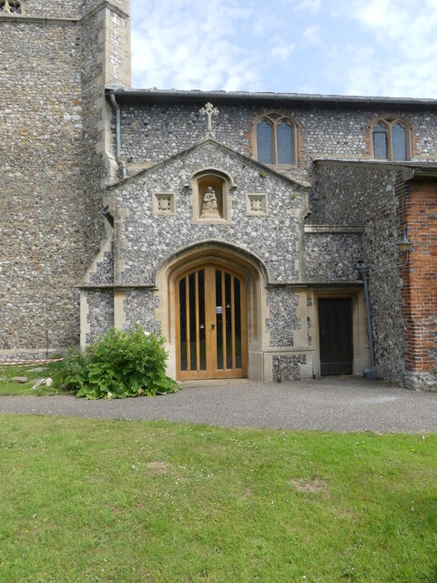
Wroxham

Settlement in Norfolk Broadland

England

Wroxham

Wroxham's new village sign Topped by a representation of a wherry it is constructed of solid marble and the base is decorated with water and reed symbols and an inscription proclaims Wroxham's ancient title as the 'Capital of the Norfolk Broads'. The sign was commissioned by Wroxham Parish Council and was unveiled by Norfolk's Lord Lieutenant, Lady Philippa Dannatt on the 16th July 2021.
Wroxham's new village sign Credit: Jane Rackham

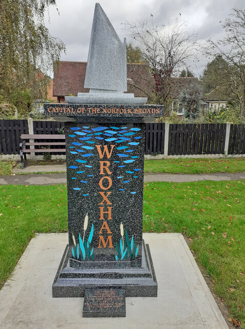
Wroxham is a small village located in the county of Norfolk, England. Situated on the banks of the River Bure, it is often referred to as the "capital of the Norfolk Broads." With a population of around 1,400 residents, it is a popular tourist destination known for its stunning natural beauty and picturesque landscapes.

The village is famous for its connection to the Norfolk Broads, a network of navigable lakes and rivers that attract boaters and water sports enthusiasts from all over the country. Wroxham is a hub for boating activities, offering a wide range of boat hire options, including motorboats, canoes, and sailing boats. Visitors can explore the expansive waterways, enjoy the tranquil surroundings, and observe the diverse wildlife that inhabits the area.

Wroxham is also home to the Bure Valley Railway, a narrow-gauge steam railway that runs for 15 miles to the town of Aylsham. This heritage railway attracts both tourists and railway enthusiasts, offering scenic trips through the Norfolk countryside.

In addition to its natural attractions, Wroxham boasts a selection of shops, cafes, and pubs, making it a popular destination for those seeking a relaxing day out or a short break. The village has a vibrant community spirit and hosts various events throughout the year, including the annual Wroxham Week sailing regatta, which draws competitors and spectators alike.

Overall, Wroxham offers a charming and idyllic experience for visitors, combining natural beauty, leisure activities, and a warm community atmosphere.

If you have any feedback on the listing, please let us know in the comments section below.
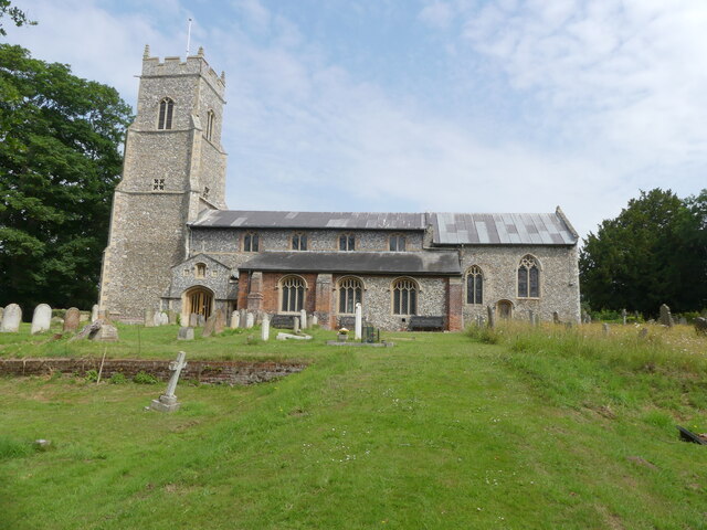
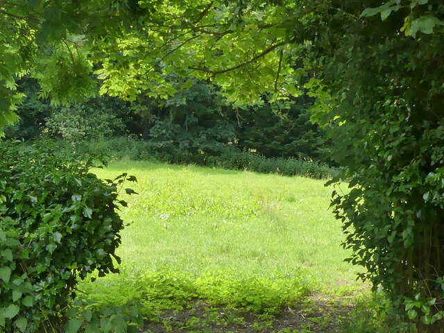
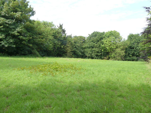
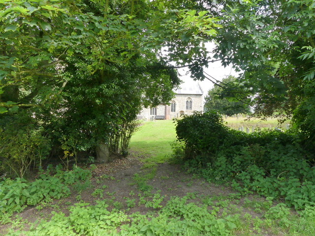
Wroxham Images

Images are sourced within 2km of 52.706585/1.401582 or Grid Reference TG2917. Thanks to Geograph Open Source API. All images are credited.

Wroxham's new village sign Topped by a representation of a wherry it is constructed of solid marble and the base is decorated with water and reed symbols and an inscription proclaims Wroxham's ancient title as the 'Capital of the Norfolk Broads'. The sign was commissioned by Wroxham Parish Council and was unveiled by Norfolk's Lord Lieutenant, Lady Philippa Dannatt on the 16th July 2021.
Wroxham's new village sign
Topped by a representation of a wherry it is constructed of solid marble and the base is decorated with water and reed symbols and an inscription proclaims Wroxham's ancient title as the 'Capital of the Norfolk Broads'. The sign was commissioned by Wroxham Parish Council and was unveiled by Norfolk's Lord Lieutenant, Lady Philippa Dannatt on the 16th July 2021.
Belaugh: Cereal crop
St Mary's Close
St Mary's Close
Looking towards junction with Nobel Crescent
St Mary's Church noticeboard
Entrance gates and drive to St Mary's Church
St Mary's Church Wroxham
Churchyard conservation area
Looking north to St Mary's Church
View through hedge to grassy area
Grassy area adjacent to churchyard
Church as seen from grassy area
Church entrance porch
Memorial benches
Memorial benches
Mausoleum at St Mary's Church Wroham It was designed by Anthony Salvin in 1827 for the Trafford family of Wroxham Hall
Mausoleum at St Mary's Church Wroham
It was designed by Anthony Salvin in 1827 for the Trafford family of Wroxham Hall
Mausoleum at St Mary's Church Wroxham It was designed by Anthony Salvin in 1827 for the Trafford family of Wroxham Hall
Mausoleum at St Mary's Church Wroxham
It was designed by Anthony Salvin in 1827 for the Trafford family of Wroxham Hall
St Mary's Church Wroxham
St Mary's Church and Trafford Mausoleum
Show me another place!

Wroxham is located at Grid Ref: TG2917 (Lat: 52.706585, Lng: 1.401582)

Administrative County: Norfolk

District: Broadland

Police Authority: Norfolk

What 3 Words

///repeating.waving.plan. Near Hoveton, Norfolk

Nearby Locations

Wroxham Belaugh Broad

Related Wikis

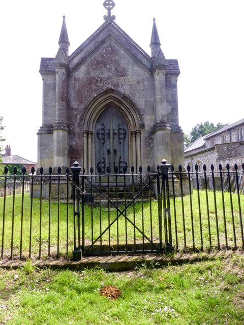
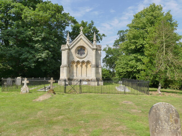
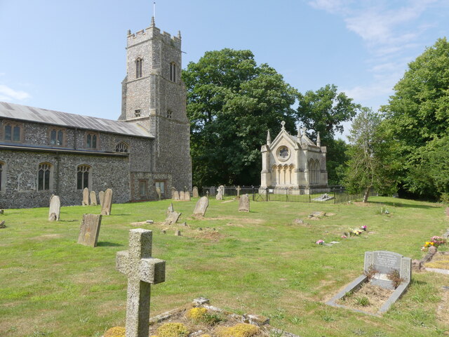
Trafford Mausoleum, Wroxham

The Trafford Mausoleum, is a memorial in Wroxham, Norfolk, England. Commissioned after the death of Sigismund Trafford Southwell in 1827, the mausoleum...

Barton House Railway

The Barton House Railway (BHR) is a miniature railway in Wroxham, Norfolk; it is open on the third Sunday of each month from April until October, plus...

Wroxham F.C.

Wroxham Football Club is a football club based in Wroxham, Norfolk, England. They are currently members of the Isthmian League North Division and play...
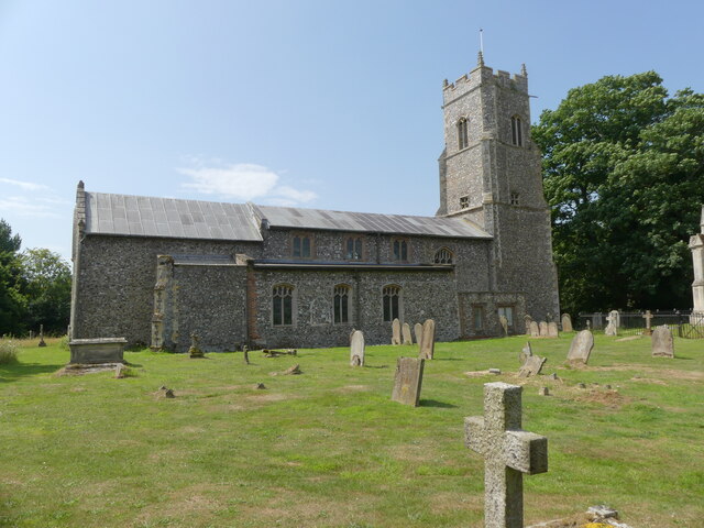
Wroxham

Wroxham is a village and civil parish in the English county of Norfolk. The civil parish of Wroxham has an area of 6.21 square kilometres, and in 2001...

Roys of Wroxham

Roys of Wroxham is a family owned group of general stores based in Hoveton, Norfolk. The store after winning a competition in the early 1930s uses the...

Hoveton

Hoveton is a village and civil parish in the English county of Norfolk. It is located within the Norfolk Broads, and immediately across the River Bure...

Hoveton & Wroxham railway station

Hoveton & Wroxham railway station is on the Bittern Line in Norfolk, England, serving the village of Hoveton and the adjacent village of Wroxham (the two...

Bure Valley Railway

The Bure Valley Railway is a 15 in (381 mm) minimum gauge visitors' attraction in Norfolk, England. It was created on the original disused full-gauge bed...

Nearby Amenities

Located within 500m of 52.706585,1.401582
Wroxham
Place: village
Source: npe
Wikidata: Q478666
Wikipedia: en:Wroxham
Lat/Long: 52.7065382/1.4036015
Bus Stop
Social Club, adj
Bench: no
Bin: no
Lit: no
Naptan AtcoCode: 2900W551
Naptan Bearing: NE
Naptan CommonName: Social Club
Naptan Indicator: adj
Naptan Locality: Wroxham
Naptan NaptanCode: nfogjata
Naptan Street: Norwich Road
Naptan Verified: no
Public Transport: platform
Shelter: no
Source: naptan_import
Tactile Paving: yes
Lat/Long: 52.7086292/1.4023268
Bus Stop
No 86
Bench: no
Bin: no
Naptan AtcoCode: 2900W552
Naptan Bearing: SW
Naptan CommonName: Social Club
Naptan Indicator: opp
Naptan Locality: Wroxham
Naptan NaptanCode: nfogjatd
Naptan Street: Norwich Road
Public Transport: platform
Shelter: no
Source: naptan_import
Tactile Paving: yes
Lat/Long: 52.7092853/1.4032812
Bus Stop
The Avenues, opp
Bench: yes
Naptan AtcoCode: 2900W553
Naptan Bearing: N
Naptan CommonName: The Avenues
Naptan Indicator: opp
Naptan Landmark: Masonic Hall
Naptan Locality: Wroxham
Naptan NaptanCode: nfogjatg
Naptan Street: Norwich Road
Naptan Verified: no
Public Transport: platform
Shelter: yes
Source: naptan_import
Lat/Long: 52.7070582/1.4015973
Bus Stop
The Avenues, adj
Bench: no
Bin: no
Naptan AtcoCode: 2900W554
Naptan Bearing: S
Naptan CommonName: The Avenues
Naptan Indicator: adj
Naptan Landmark: The Avenues
Naptan Locality: Wroxham
Naptan NaptanCode: nfogjatj
Naptan Street: Norwich Road
Naptan Verified: no
Public Transport: platform
Shelter: no
Source: naptan_import
Lat/Long: 52.7063847/1.4015597
Bus Stop
Park Road
Bench: no
Bin: no
Naptan AtcoCode: 2900W557
Naptan Bearing: NE
Naptan CommonName: Park Road
Naptan Indicator: opp
Naptan Landmark: Park Road
Naptan Locality: Wroxham
Naptan NaptanCode: nfogpmpt
Naptan Street: Norwich Road
Public Transport: platform
Shelter: no
Source: naptan_import
Lat/Long: 52.7035306/1.4005273
Bus Stop
Park Lane
Bench: no
Bin: no
Naptan AtcoCode: 2900W558
Naptan Bearing: S
Naptan CommonName: Park Lane
Naptan Indicator: adj
Naptan Landmark: Park Lane
Naptan Latitude: 52.7040608
Naptan Locality: Wroxham
Naptan Longitude: 1.401053
Naptan NaptanCode: nfogpmpw
Naptan Street: Norwich Road
Public Transport: platform
Shelter: no
Source: naptan_import
Lat/Long: 52.7039548/1.4009671
Turning Circle
Lat/Long: 52.7073178/1.3997498
Barrier: bollard
Lat/Long: 52.7038055/1.398346
Coach House Bed & Breakfast
Tourism: guest_house
Lat/Long: 52.7078974/1.4015329
The Florist
Shop: florist
Lat/Long: 52.7045381/1.4012151
Man Made: tower
Material: metal
Operator: Norfolk Fire & Rescue
Tower Construction: lattice
Tower Type: communication
Lat/Long: 52.7021405/1.401366
Post Box
Collection Times: Mo-Fr 09:00; Sa 07:00
Operator: Royal Mail
Post Box Type: lamp
Ref: NR12 1265D
Royal Cypher: EIIR
Royal Cypher Wikidata: Q33102113
Lat/Long: 52.7046299/1.401011
Crossing
Crossing: traffic_signals
Crossing Island: no
Crossing Ref: pelican
Tactile Paving: yes
Lat/Long: 52.7047905/1.4011563
Post Box
Collection Times: Mo-Fr 09:00; Sa 07:00
Operator: Royal Mail
Post Box Mounting: pier
Post Box Type: lamp
Ref: NR12 1264D
Royal Cypher: EIIR
Royal Cypher Wikidata: Q33102113
Lat/Long: 52.7061107/1.4067715
Barrier: fence
Lat/Long: 52.7066756/1.4075503
Waste Basket
Waste: dog_excrement
Lat/Long: 52.708292/1.4057858
Grit Bin
Lat/Long: 52.7082977/1.4057563
Waste Basket
Waste: dog_excrement
Lat/Long: 52.7088003/1.4029032
Historic: memorial
Memorial: war_memorial
Lat/Long: 52.7066901/1.401387
Power: pole
Lat/Long: 52.7035469/1.3995941
Power: pole
Lat/Long: 52.7033007/1.3993272
Entrance: yes
Lat/Long: 52.7067613/1.3982088
Entrance: main
Lat/Long: 52.7067363/1.3978829
Give Way
Lat/Long: 52.7065556/1.3993149
Give Way
Lat/Long: 52.706406/1.3993821
Give Way
Lat/Long: 52.7061341/1.4066992
Give Way
Lat/Long: 52.7061662/1.4068375
Give Way
Lat/Long: 52.7038147/1.398546
Waste Basket
Waste: dog_excrement
Lat/Long: 52.7038955/1.3984884
Waste Basket
Waste: litter
Lat/Long: 52.703902/1.3984944
Grit Bin
Colour: yellow
Lat/Long: 52.7038809/1.3984756
Post Office
Lower Wroxham Post Office
Addr City: Norwich
Addr Housename: Village Hall
Addr Postcode: NR12 8RY
Addr Street: Norwich Road
Addr Village: Lower Wroxham
Brand: Post Office
Brand Wikidata: Q1783168
Fixme: check location
Opening Hours: We 11:45-12:45
Ref Pol Id: 140825
Source: pol_branch_list_2018-01
Lat/Long: 52.706848/1.4012441
Wroxham
Artist Name: Nick Hindle (of Wroxham village)
Description: 2.1 m high, plinth topped by granite wherry boat sculpture
Inscription: Capital of the Norfolk Broads / This village sign commisioned by Wroxham Parish Council was unveiled on July 16, 2021 by The Lord Lieutenant of Norfolk The Lady Dannatt MBE
Man Made: village_sign
Material: granite
Start Date: 2021-07-16
Lat/Long: 52.7067998/1.401703
Bench
Backrest: yes
Inscription: no
Material: wood
Lat/Long: 52.7068274/1.4017747
Waste Basket
Colour: red
Waste: dog_excrement
Lat/Long: 52.7065353/1.4018941
Waste Basket
Waste: trash
Lat/Long: 52.7065308/1.4018847
Crossing
Crossing: unmarked
Tactile Paving: no
Lat/Long: 52.7066154/1.4020068
Crossing
Crossing: unmarked
Crossing Island: no
Tactile Paving: yes
Lat/Long: 52.7066268/1.4014509
Give Way
Lat/Long: 52.7066344/1.4016125
Give Way
Lat/Long: 52.7066299/1.4015005
Crossing
Crossing: unmarked
Tactile Paving: no
Lat/Long: 52.7063146/1.4014985
Power: pole
Lat/Long: 52.7104537/1.402566
Power: pole
Lat/Long: 52.7096599/1.4019826
Power: pole
Lat/Long: 52.7086995/1.4012597
Power: pole
Lat/Long: 52.7078163/1.4006147
Power: pole
Lat/Long: 52.7078545/1.4005114
Power: pole
Lat/Long: 52.7087198/1.4011618
Power: pole
Lat/Long: 52.7096883/1.4018619
Power: pole
Lat/Long: 52.7104773/1.402452
Communication Mobile Phone: yes
Man Made: mast
Material: metal
Operator: O2-UK
Tower Construction: freestanding
Tower Type: communication
Lat/Long: 52.7075042/1.4012068
The data included in this document is from www.openstreetmap.org. The data is made available under ODbL.

Have you been to Wroxham?

Leave your review of Wroxham below (or comments, questions and feedback).