Worminghall

Settlement in Buckinghamshire

England

Worminghall

Ickford church - north side St. Nicholas's is a grade I listed building, mostly 13th century.
Ickford church - north side Credit: Robin Webster

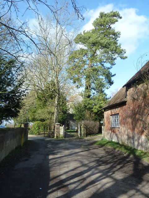
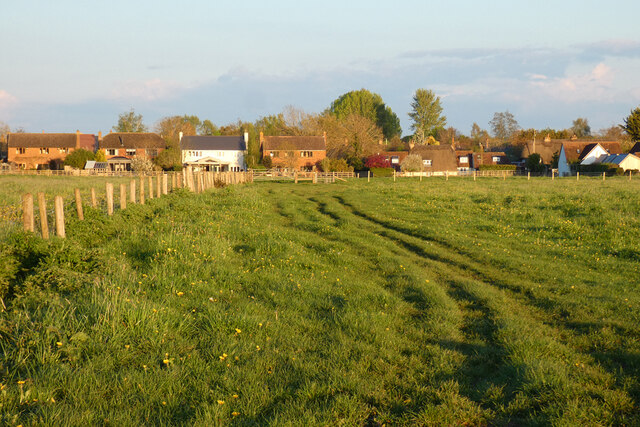
Worminghall is a small village located in the county of Buckinghamshire, England. Situated approximately 10 miles northwest of the town of Aylesbury, it is nestled in a rural setting surrounded by picturesque countryside.

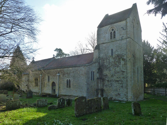
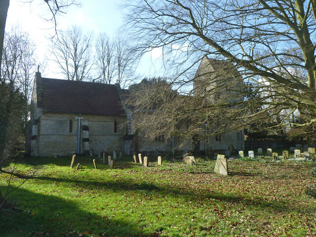
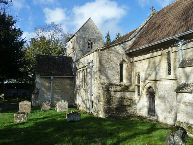
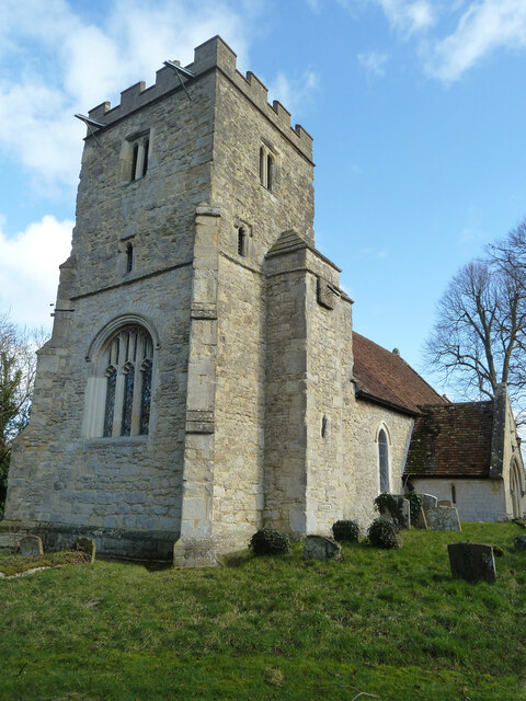
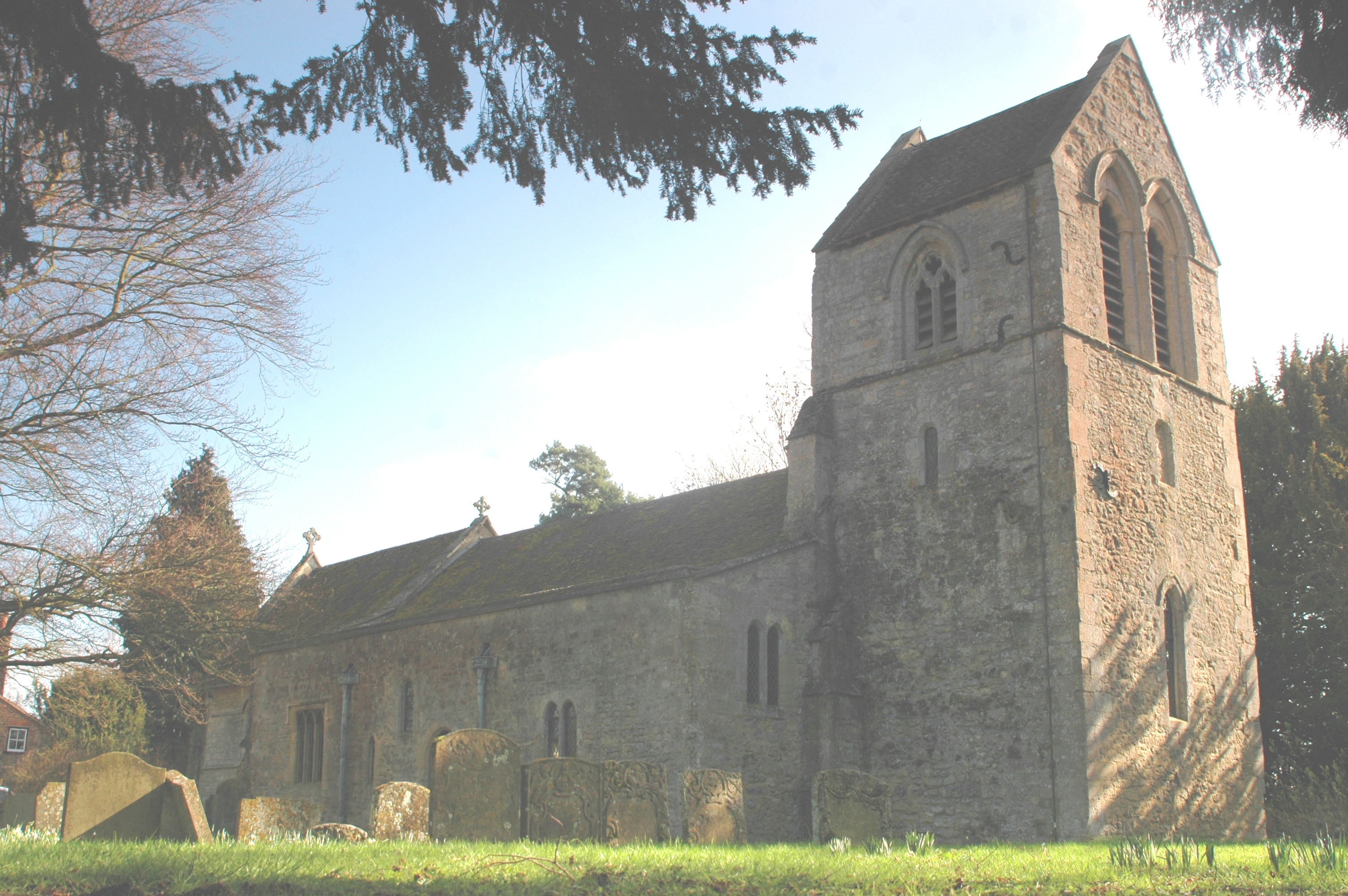
The village itself is characterized by its quaint and traditional charm, with a scattering of cottages and small houses that showcase the architectural style of the region. The village church, St. Peter and St. Paul, stands as a prominent feature, dating back to the 13th century and adding to the historical ambiance of Worminghall.

Despite its small size, Worminghall boasts a strong sense of community, with various community events and gatherings organized throughout the year. The village hall serves as a central meeting point for locals, hosting activities such as art exhibitions, fitness classes, and social events.

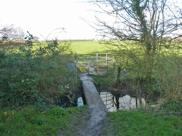
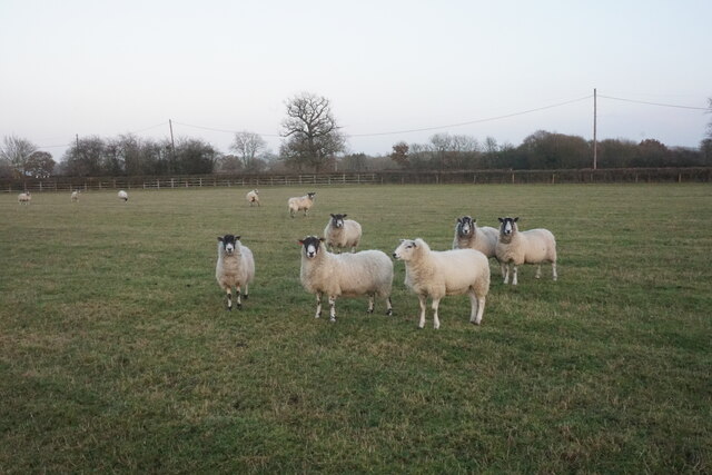
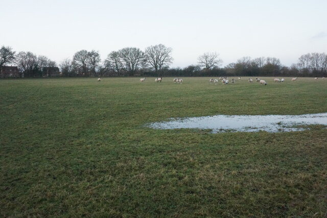
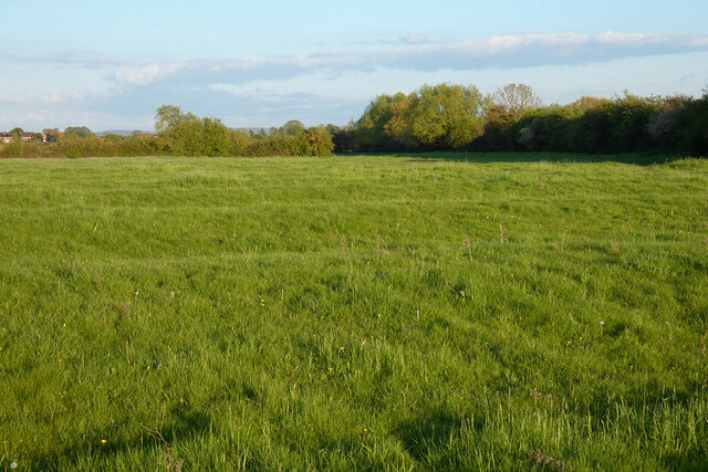
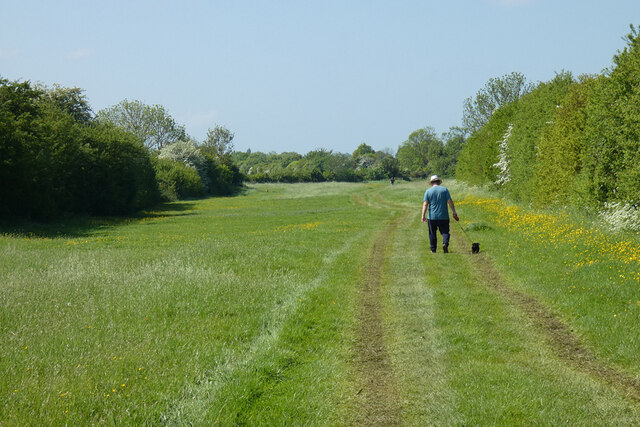
The surrounding countryside offers ample opportunities for outdoor enthusiasts, with walking and cycling trails weaving through the beautiful landscape. The nearby Bernwood Forest is a popular destination for nature lovers, offering a tranquil retreat for wildlife spotting and enjoying the splendor of the natural environment.

Worminghall benefits from its proximity to larger towns and cities, with easy access to amenities and services. The city of Oxford is approximately 12 miles away, providing cultural and educational opportunities, while Aylesbury offers a range of shopping, dining, and entertainment options.

In summary, Worminghall is a charming village in Buckinghamshire, offering a peaceful and idyllic rural lifestyle while remaining well-connected to nearby towns and cities.

If you have any feedback on the listing, please let us know in the comments section below.
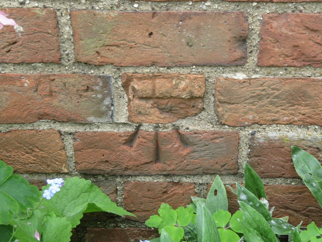
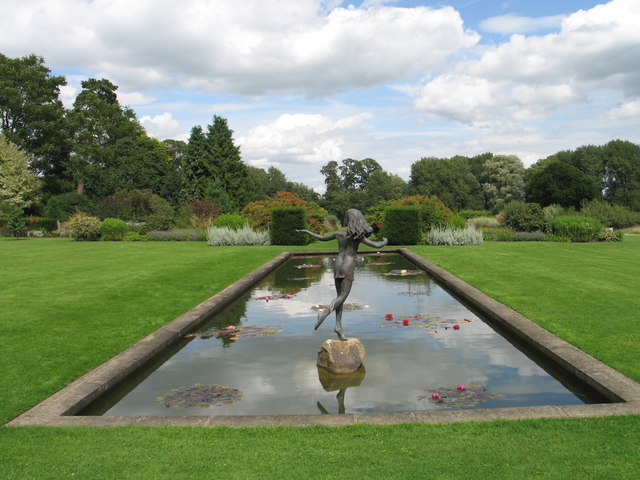
Worminghall Images

Images are sourced within 2km of 51.770334/-1.0734229 or Grid Reference SP6408. Thanks to Geograph Open Source API. All images are credited.

Ickford church - north side St. Nicholas's is a grade I listed building, mostly 13th century.
Ickford church - north side
St. Nicholas's is a grade I listed building, mostly 13th century.
Footbridge and gate leaving Ickford churchyard On a footpath to Worminghall.
Footbridge and gate leaving Ickford churchyard
On a footpath to Worminghall.
Ickford church - north side St. Nicholas's is a grade I listed building, mostly 13th century.
Ickford church - north side
St. Nicholas's is a grade I listed building, mostly 13th century.
Ickford churchyard Snowdrops and crocuses, a bit early for daffodils.
Ickford churchyard
Snowdrops and crocuses, a bit early for daffodils.
Ickford church - south side St. Nicholas's is a grade I listed building, mostly 13th century.
Ickford church - south side
St. Nicholas's is a grade I listed building, mostly 13th century.
End of Church Road and churchyard gate, Ickford
Worminghall church The church of St Peter and St Paul is a grade II*(star) listed building, originally Norman, but much tinkered with and rebuilt over the years.
Worminghall church
The church of St Peter and St Paul is a grade II*(star) listed building, originally Norman, but much tinkered with and rebuilt over the years.
Sheep near Catsbrain Farm A footpath crosses the middle of this field.
Sheep near Catsbrain Farm
A footpath crosses the middle of this field.
Footpath across a field Not a clearly defined route. There is some normal winter flooding.
Footpath across a field
Not a clearly defined route. There is some normal winter flooding.
Worminghall Road A less sightly part of the road, seen at dusk. The buildings ahead belong to a recycling business.
Worminghall Road
A less sightly part of the road, seen at dusk. The buildings ahead belong to a recycling business.
Pasture, Ickford A footpath from Worminghall approaches the northern end of the village.
Pasture, Ickford
A footpath from Worminghall approaches the northern end of the village.
Pasture, Ickford Ridge and furrow survives in many of the fields around here.  Houses in Shabbington can be seen in the background.
Pasture, Ickford
Ridge and furrow survives in many of the fields around here. Houses in Shabbington can be seen in the background.
Track in pasture, Ickford The bridleway north of Peacehaven Farm makes its way down a very narrow field (or is it just a very wide track?).
Track in pasture, Ickford
The bridleway north of Peacehaven Farm makes its way down a very narrow field (or is it just a very wide track?).
Road from Worminghall to Oakley
Emerging crop near Meads Farm A view at dusk from a footpath crossing the field.
Emerging crop near Meads Farm
A view at dusk from a footpath crossing the field.
Bench mark on St Nicholas' church tower, Ickford This slightly damaged Ordnance Survey bench mark is on the west face of the tower of St Nicholas', Ickford.  See also <a href="https://www.geograph.org.uk/photo/4970326">SP6407 : The tower of St Nicholas', Ickford</a>
Bench mark on St Nicholas' church tower, Ickford
This slightly damaged Ordnance Survey bench mark is on the west face of the tower of St Nicholas', Ickford. See also SP6407 : The tower of St Nicholas', Ickford
The tower of St Nicholas', Ickford Looking towards the tower of St Nicholas', Ickford.  There is an Ordnance Survey bench mark on the west face of the tower - <a href="https://www.geograph.org.uk/photo/4970319">SP6407 : Bench mark on St Nicholas' church tower, Ickford</a>
The tower of St Nicholas', Ickford
Looking towards the tower of St Nicholas', Ickford. There is an Ordnance Survey bench mark on the west face of the tower - SP6407 : Bench mark on St Nicholas' church tower, Ickford
Damaged bench mark in Clifden Road, Worminghall This Ordnance Survey bench mark is on the north west face of a small building/garage alongside Clifden Road. The mark is no longer recorded on the O.S. database, and it looks as though it might have been cancelled.  See also <a href="https://www.geograph.org.uk/photo/4970370">SP6408 : Small building in Clifden Road, Worminghall</a>
Damaged bench mark in Clifden Road, Worminghall
This Ordnance Survey bench mark is on the north west face of a small building/garage alongside Clifden Road. The mark is no longer recorded on the O.S. database, and it looks as though it might have been cancelled. See also SP6408 : Small building in Clifden Road, Worminghall
Show me another place!

Worminghall is located at Grid Ref: SP6408 (Lat: 51.770334, Lng: -1.0734229)

Unitary Authority: Buckinghamshire

Police Authority: Thames Valley

What 3 Words

///unroll.clean.cropping. Near Oakley, Buckinghamshire

Nearby Locations

Worminghall Worminghall

Related Wikis

Worminghall

Worminghall is a village and civil parish in the Buckinghamshire district of the ceremonial county of Buckinghamshire, England. The village is beside a...

Waterperry with Thomley

Waterperry with Thomley is a civil parish in the South Oxfordshire district, in the county of Oxfordshire, England. It includes the village of Waterperry...

RAF Oakley

RAF Oakley is a former Royal Air Force satellite station between Oakley and Worminghall, Buckinghamshire, England. It was located in a flat, damp wooded...

Ickford

Ickford is a village and civil parish in the unitary authority area of Buckinghamshire, England. It is on the boundary with Oxfordshire, about 4 miles...

Waterstock

Waterstock is a village and civil parish on the River Thame about 4.5 miles (7 km) west of the market town of Thame in Oxfordshire. The parish is bounded...

Hundred of Hormer

Hormer was an ancient hundred of Berkshire, England. It consisted of the area immediately west of Oxford within the bend of the River Thames, all of which...

Waterperry

Waterperry is a village and former civil parish, now in the parish of Waterperry with Thomley, in the South Oxfordshire district, in Oxfordshire and close...

Waterperry Gardens

Waterperry Gardens are gardens with a museum in the village of Waterperry, near Wheatley, east of Oxford in Oxfordshire, England. == Description == Beatrix...

Nearby Amenities

Located within 500m of 51.770334,-1.0734229
Barrier: stile
Foot: yes
Lat/Long: 51.7703572/-1.0759158
Worminghall
Place: village
Source: npe
Lat/Long: 51.7718926/-1.0724678
Barrier: kissing_gate
Foot: yes
Source: gps_survey
Lat/Long: 51.7688706/-1.0719206
Pub
The Clifden Arms
Beer Garden: yes
Source Name: local_knowledge
Wikidata: Q26597751
Lat/Long: 51.7681835/-1.0752859
Turning Circle
Lat/Long: 51.770392/-1.0750771
Worminghall Village Hall
Building: public
Source: photograph;Bing
Lat/Long: 51.7697903/-1.0686328
Worminghall
Source: photograph
Traffic Sign: city_limit
Lat/Long: 51.7692144/-1.0797435
Bus Stop
Worminghall, The Avenue
Bench: yes
Bin: yes
Bus: yes
Check Date Bench: 2021-05-04
Check Date Shelter: 2021-05-04
Naptan AtcoCode: 040000004445
Naptan NaptanCode: bucdwjpm
Public Transport: platform
Shelter: yes
Tactile Paving: no
Lat/Long: 51.7711839/-1.0725073
Turning Circle
Lat/Long: 51.7677561/-1.068809
Parking
Parking: surface
Lat/Long: 51.7677679/-1.0698445
Barrier: cattle_grid
Bicycle: yes
Foot: yes
Lat/Long: 51.7681839/-1.06939
Parking
Parking: surface
Lat/Long: 51.7682639/-1.0757586
Barrier: kissing_gate
Foot: yes
Source: gps_survey
Lat/Long: 51.7693807/-1.0689769
Post Box
Check Date: 2021-05-04
Collection Times: Mo-Fr 15:00, Sa 09:30
Operator: Royal Mail
Operator Type: private
Operator Wikidata: Q638098
Ref: HP18 211
Royal Cypher: EIIR
Royal Cypher Wikidata: Q33102113
Source: photograph
Lat/Long: 51.7696897/-1.0740313
Post Box
Operator: Royal Mail
Operator Type: private
Operator Wikidata: Q638098
Ref: HP18 210
Source: gps_survey;Bing
Source Ref: photograph
Lat/Long: 51.7697054/-1.0688892
Bus Stop
Bench: yes
Bin: no
Bus: yes
Public Transport: platform
Shelter: no
Tactile Paving: no
Lat/Long: 51.7697714/-1.0740996
Barrier: kissing_gate
Foot: yes
Source: gps_survey
Lat/Long: 51.769881/-1.0732853
Turning Circle
Turning Circle: square
Lat/Long: 51.7702168/-1.0760232
Barrier: kissing_gate
Foot: yes
Lat/Long: 51.7702501/-1.0756162
Bus Stop
Bench: yes
Bin: no
Bus: yes
Check Date Shelter: 2021-10-05
Public Transport: platform
Shelter: no
Source: gps_survey;Bing
Tactile Paving: no
Lat/Long: 51.7716968/-1.0720206
Leisure: playground
Operator: The Clifden Arms
Source: local_knowledge
Lat/Long: 51.768095/-1.0757699
Barrier: kissing_gate
Foot: yes
Source: gps_survey
Lat/Long: 51.7682799/-1.0749121
Barrier: kissing_gate
Foot: yes
Source: photograph
Lat/Long: 51.7676033/-1.0740903
Barrier: kissing_gate
Lat/Long: 51.7680719/-1.070215
Barrier: kissing_gate
Foot: yes
Source: gps_survey
Lat/Long: 51.7687359/-1.0721018
Barrier: kissing_gate
Foot: yes
Source: gps_survey
Lat/Long: 51.7688837/-1.0717072
Barrier: kissing_gate
Foot: yes
Source: gps_survey
Lat/Long: 51.7690066/-1.0709907
Barrier: kissing_gate
Wheelchair: no
Lat/Long: 51.7681553/-1.0685726
Barrier: kissing_gate
Lat/Long: 51.7682453/-1.0694781
Power: pole
Source: Bing
Lat/Long: 51.7716808/-1.0676321
Direction: 240
Generator Method: photovoltaic
Generator Output Electricity: yes
Generator Solar Modules: 10
Generator Source: solar
Generator Type: solar_photovoltaic_panel
Location: roof
Power: generator
Lat/Long: 51.7677181/-1.0685438
Direction: 220
Generator Method: photovoltaic
Generator Output Electricity: yes
Generator Solar Modules: 16
Generator Source: solar
Generator Type: solar_photovoltaic_panel
Location: roof
Power: generator
Lat/Long: 51.7717542/-1.073625
Direction: 220
Generator Method: photovoltaic
Generator Output Electricity: yes
Generator Solar Modules: 14
Generator Source: solar
Generator Type: solar_photovoltaic_panel
Location: roof
Power: generator
Lat/Long: 51.7692909/-1.0734329
Direction: 190
Generator Method: photovoltaic
Generator Output Electricity: yes
Generator Solar Modules: 19
Generator Source: solar
Generator Type: solar_photovoltaic_panel
Location: roof
Power: generator
Lat/Long: 51.7693884/-1.0733414
Power: pole
Source: Bing
Lat/Long: 51.7719791/-1.0668124
Power: pole
Source: Bing
Lat/Long: 51.7715367/-1.0679909
Power: pole
Source: Bing
Lat/Long: 51.7711874/-1.0689288
Power: pole
Source: Bing
Lat/Long: 51.7710352/-1.069334
Power: pole
Lat/Long: 51.7739358/-1.0716003
Power: pole
Lat/Long: 51.7727478/-1.0729339
Power: pole
Lat/Long: 51.7724696/-1.073258
Power: pole
Lat/Long: 51.772045/-1.073746
Power: pole
Lat/Long: 51.7716692/-1.0742099
The data included in this document is from www.openstreetmap.org. The data is made available under ODbL.

Have you been to Worminghall?

Leave your review of Worminghall below (or comments, questions and feedback).