Woodside

Settlement in Yorkshire

England

Woodside

View from Wadsley Common
View from Wadsley Common Credit: Dave Pickersgill

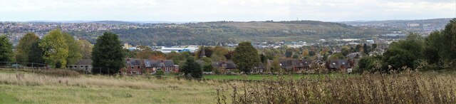
Woodside is a charming village located in the county of Yorkshire, England. Situated in the picturesque countryside, Woodside is known for its idyllic surroundings and peaceful atmosphere. The village is characterized by its quaint stone cottages, lush green fields, and winding country lanes.

Woodside is a tight-knit community with a population of around 500 residents. The village has a small primary school, a church, and a handful of local shops and cafes. The residents of Woodside are friendly and welcoming, creating a warm and inviting atmosphere for visitors.

The surrounding countryside offers plenty of opportunities for outdoor activities such as hiking, cycling, and horseback riding. The village is also located near several historic sites and attractions, including the ruins of an ancient castle and a beautiful old church.

Overall, Woodside is a peaceful and charming village that offers a tranquil escape from the hustle and bustle of city life. With its beautiful surroundings and friendly community, it is a perfect place to relax and unwind in the heart of the English countryside.

If you have any feedback on the listing, please let us know in the comments section below.
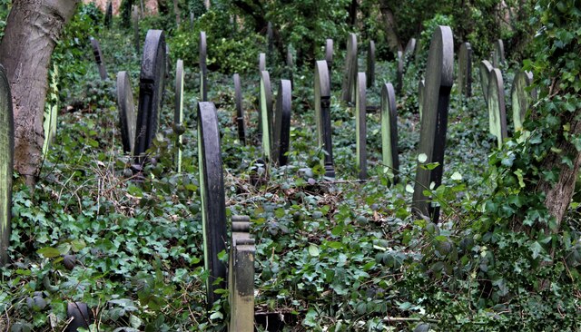
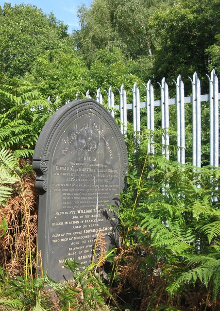
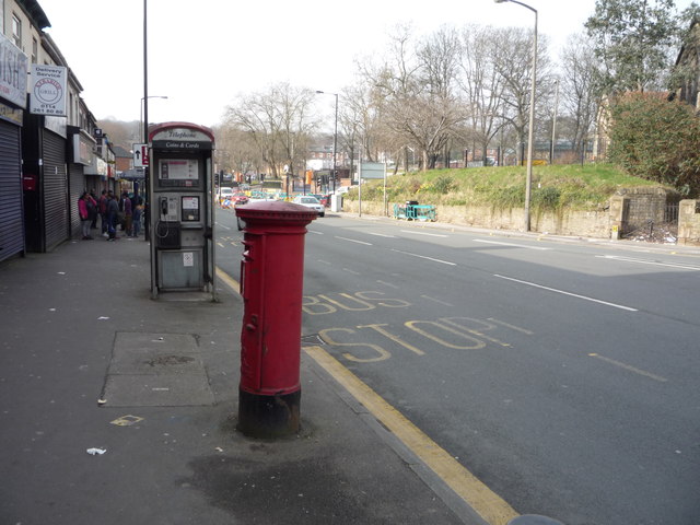
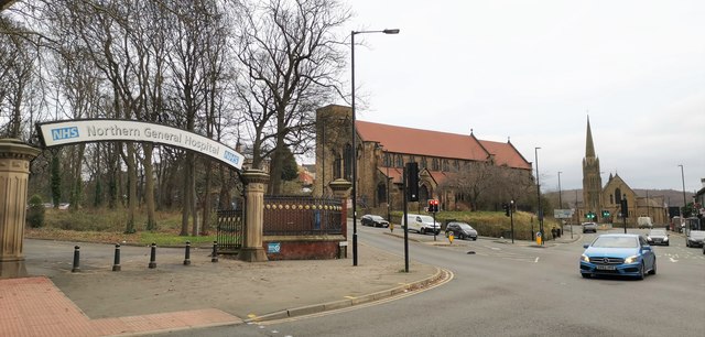
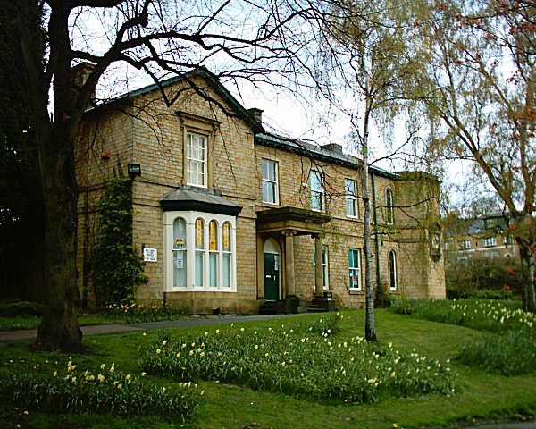
Woodside Images

Images are sourced within 2km of 53.396207/-1.4686064 or Grid Reference SK3588. Thanks to Geograph Open Source API. All images are credited.

View from Wadsley Common
Wardsend Cemetery, Sheffield
Gravestone in Wardsend Cemetery A gravestone in Wardsend Cemetery, Sheffield. It is adjacent to the train line which runs from Sheffield to Stocksbridge.
Gravestone in Wardsend Cemetery
A gravestone in Wardsend Cemetery, Sheffield. It is adjacent to the train line which runs from Sheffield to Stocksbridge.
Cypher, Elizabeth II postbox outside Firvale Post Office, Sheffield Postbox No. S5 147.

See <a href="https://www.geograph.org.uk/photo/4862629">SK3690 : Elizabeth II postbox outside Firvale Post Office, Sheffield</a> for postbox.
Cypher, Elizabeth II postbox outside Firvale Post Office, Sheffield
Detail, Elizabeth II postbox outside Firvale Post Office, Sheffield Postbox No. S5 147.

See <a href="https://www.geograph.org.uk/photo/4862629">SK3690 : Elizabeth II postbox outside Firvale Post Office, Sheffield</a> for postbox.
Detail, Elizabeth II postbox outside Firvale Post Office, Sheffield
Owler Lane (A6102), Fir Vale, Sheffield Looking west showing position of Postbox No. S5 147, outside Firvale Post Office.

See <a href="https://www.geograph.org.uk/photo/4862629">SK3690 : Elizabeth II postbox outside Firvale Post Office, Sheffield</a> for postbox.
Owler Lane (A6102), Fir Vale, Sheffield
Looking west showing position of Postbox No. S5 147, outside Firvale Post Office. See SK3690 : Elizabeth II postbox outside Firvale Post Office, Sheffield for postbox.
Hot water pipes Squeezed in a gap between two sections of the Huntsman building of the Northern General Holspital.
Hot water pipes
Squeezed in a gap between two sections of the Huntsman building of the Northern General Holspital.
Main entrance to the Huntsman Building Relatively new entrance in a semi-moderne style, emphasised by the lettering.
Main entrance to the Huntsman Building
Relatively new entrance in a semi-moderne style, emphasised by the lettering.
Norwood Road, Norwood
Northern General Hospital, Eye Centre Northern General Hospital’s new £6.7m eye centre was opened on 15th October 2018. Cataracts a speciality.
Northern General Hospital, Eye Centre
Northern General Hospital’s new £6.7m eye centre was opened on 15th October 2018. Cataracts a speciality.
Northern Perk Cafe at entrance to Northern General Hospital
Northern Perk
Cafe at entrance to Northern General Hospital
Crabtree Close The roadside swamped by cars parked for the Northern General Hospital, behind camera.
Crabtree Close
The roadside swamped by cars parked for the Northern General Hospital, behind camera.
Entrance to Northern General Hospital at Fir Vale
Waste Tip This tip is located in the Shirecliffe area of Sheffield.
Waste Tip
This tip is located in the Shirecliffe area of Sheffield.
Southey Crescent Southey Crescent on the Longley Estate in Sheffield.
Southey Crescent
Southey Crescent on the Longley Estate in Sheffield.
Northern General Hospital A & E Entrance
St Cuthberts Church- Barnsley Road
Show me another place!

Woodside is located at Grid Ref: SK3588 (Lat: 53.396207, Lng: -1.4686064)

Division: West Riding

Unitary Authority: Sheffield

Police Authority: South Yorkshire

What 3 Words

///pool.nods.peanut. Near Burngreave, South Yorkshire

Related Wikis

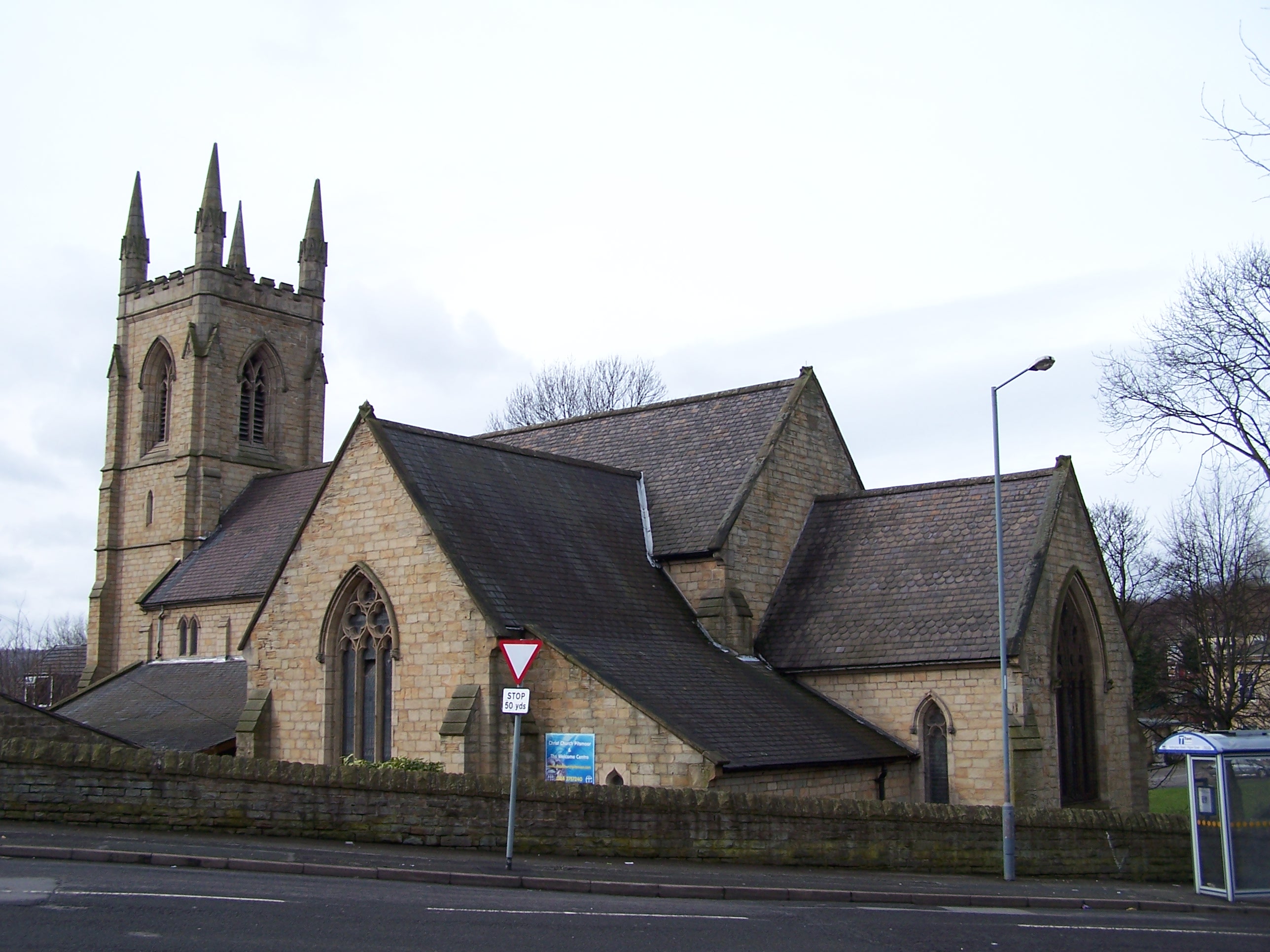
Christ Church, Pitsmoor

Christ Church is an Anglican church in the Pitsmoor district, north of Sheffield City Centre in England. It is a Grade II listed building.By the mid-19th...

Neepsend engine shed

Neepsend engine shed was an engine shed in Neepsend, Sheffield, South Yorkshire, England. It was built by the Sheffield, Ashton-under-Lyne and Manchester...

Abbeyfield Park

Abbeyfield is a park in Pitsmoor, Sheffield, South Yorkshire, England, bought by the City Corporation in 1909. The park comprises the park itself, a bowling...

King Mojo Club

The King Mojo Club, often known as the Mojo, was a nightclub in Pitsmoor, Sheffield, South Yorkshire, England located at 555 Pitsmoor Road, that operated...

Nearby Amenities

Located within 500m of 53.396207,-1.4686064
Rutland Road/Pitsmoor Road
Bus: yes
Public Transport: stop_position
Lat/Long: 53.3986112/-1.4677251
Cycleway: asl
Direction: backward
Lat/Long: 53.3944928/-1.4616331
Crossing
Button Operated: yes
Crossing: traffic_signals
Crossing Island: no
Tactile Paving: yes
Traffic Signals Sound: yes
Traffic Signals Vibration: yes
Lat/Long: 53.3970863/-1.4646897
Cycleway: asl
Direction: backward
Lat/Long: 53.398453/-1.4666972
Crossing
Traffic Calming: table
Lat/Long: 53.393841/-1.467723
Post Box
Collection Times: Mo-Fr 09:00; Sa 07:00
Post Box Type: pillar
Ref: S3 83D
Royal Cypher: EIIR
Royal Cypher Wikidata: Q33102113
Lat/Long: 53.3953181/-1.4661328
Place Of Worship
Pitsmoor Methodist Church
Addr City: Sheffield
Addr Country: GB
Addr Postcode: S3 9DG
Addr Street: Burngreave Road
Denomination: methodist
Fhrs Id: 435557
Religion: christian
Source Addr: FHRS Open Data
Lat/Long: 53.3972775/-1.4652498
Food Plus
Addr City: Sheffield
Addr Housenumber: 408
Addr Postcode: S3 9AY
Addr Street: Pitsmoor Road
Old Name: Babylon
Shop: convenience
Lat/Long: 53.3995504/-1.4658852
Doctors
Ivy Lodge Clinic
Healthcare: doctor
Lat/Long: 53.3984071/-1.4675788
Post Box
Check Date Collection Times: 2022-03-15
Collection Times: Mo-Fr 09:00; Sa 07:00
Post Box Type: pillar
Postal Code: S3
Ref: S3 1276D
Royal Cypher: EIIR
Royal Cypher Wikidata: Q33102113
Lat/Long: 53.3964921/-1.463883
Speed Camera
Lat/Long: 53.3961016/-1.4636923
Speed Camera
Lat/Long: 53.3964128/-1.4638365
Bus Stop
Burngreave Road/Pitsmoor Road
Alt Name: Burngreave Road/Pitsmoor Road
Bench: no
Bin: yes
Bus: yes
Lit: no
Naptan AltCommonName: Burngreave Road/Pitsmoor Road
Naptan AtcoCode: 370020195
Naptan Bearing: N
Naptan CommonName: Burngreave Road/Pitsmoor Road
Naptan Indicator: 20195
Naptan Landmark: Opposite Abbeyfield Park
Naptan PlusbusZoneRef: ROTHCEN
Naptan Street: Burngreave Road
Naptan Verified: no
Public Transport: platform
Shelter: no
Source: naptan_import
Tactile Paving: yes
Lat/Long: 53.3996788/-1.4651731
Bus Stop
Cooks Wood Road/Rutland Road
Bus: yes
Naptan AtcoCode: 370020202
Naptan Bearing: SE
Naptan CommonName: Cooks Wood Road/Rutland Road
Naptan Indicator: 20202
Naptan Landmark: 20202
Naptan PlusbusZoneRef: ROTHCEN
Naptan Street: Cooks Wood Road
Naptan Verified: no
Public Transport: platform
Source: naptan_import
Lat/Long: 53.3992722/-1.4687276
Bus Stop
Cooks Wood Road/Rutland Road
Bench: no
Bus: yes
Naptan AtcoCode: 370020203
Naptan Bearing: NW
Naptan CommonName: Cooks Wood Road/Rutland Road
Naptan Indicator: 20203
Naptan Landmark: 20203
Naptan PlusbusZoneRef: ROTHCEN
Naptan Street: Cooks Wood Road
Naptan Verified: no
Public Transport: platform
Shelter: no
Source: naptan_import
Lat/Long: 53.3999674/-1.4694108
Bus Stop
Rutland Road/Pitsmoor Road
Bench: no
Bin: no
Bus: yes
Naptan AtcoCode: 370020207
Naptan Bearing: E
Naptan CommonName: Rutland Road/Pitsmoor Road
Naptan Indicator: 20207
Naptan Landmark: 20207
Naptan PlusbusZoneRef: ROTHCEN
Naptan Street: Rutland Road
Naptan Verified: no
Public Transport: platform
Shelter: no
Source: naptan_import
Tactile Paving: no
Lat/Long: 53.3986655/-1.4677426
Bus Stop
Nottingham Street/Pilgrim Street
Bus: yes
Naptan AtcoCode: 370020208
Naptan Bearing: SE
Naptan CommonName: Nottingham Street/Pilgrim Street
Naptan Indicator: 20208
Naptan Landmark: Opposite Church
Naptan PlusbusZoneRef: ROTHCEN
Naptan Street: Nottingham Street
Naptan Verified: no
Public Transport: platform
Source: naptan_import
Lat/Long: 53.3970491/-1.467
Bus Stop
Burngreave Road/Melrose Road
Alt Name: Burngreave Road/Melrose Road
Bench: no
Bin: yes
Bus: yes
Naptan AltCommonName: Burngreave Road/Melrose Road
Naptan AtcoCode: 370020209
Naptan Bearing: SE
Naptan CommonName: Burngreave Road/Melrose Road
Naptan Indicator: 20209
Naptan Landmark: ST CATHERINES ROMAN CATHOLIC C
Naptan PlusbusZoneRef: ROTHCEN
Naptan Street: Burngreave Road
Naptan Verified: no
Public Transport: platform
Shelter: yes
Source: naptan_import
Tactile Paving: yes
Lat/Long: 53.3968521/-1.464246
Bus Stop
Burngreave Road/Minna Road
Bench: no
Bin: yes
Bus: yes
Lit: no
Naptan AtcoCode: 370020210
Naptan Bearing: N
Naptan CommonName: Burngreave Road/Minna Road
Naptan Indicator: 20210
Naptan Landmark: 20210
Naptan PlusbusZoneRef: ROTHCEN
Naptan Street: Burngreave Road
Naptan Verified: no
Public Transport: platform
Shelter: yes
Source: naptan_import
Tactile Paving: yes
Lat/Long: 53.3982677/-1.4650918
Bus Stop
Burngreave Road/Toll Bar
Alt Name: Burngreave Road/Toll Bar
Bench: yes
Bin: yes
Bus: yes
Naptan AltCommonName: Burngreave Road/Toll Bar
Naptan AtcoCode: 370020211
Naptan Bearing: S
Naptan CommonName: Burngreave Road/Toll Bar
Naptan Indicator: 20211
Naptan Landmark: OPP. 181/OPP. ARNOLD C CLARKE
Naptan PlusbusZoneRef: ROTHCEN
Naptan Street: Burngreave Road
Naptan Verified: no
Public Transport: platform
Shelter: yes
Source: naptan_import
Tactile Paving: yes
Lat/Long: 53.3994981/-1.4650062
Bus Stop
Pitsmoor Road/Pinfold Lane
Alt Name: Pitsmoor Road/Pinfold Lane
Bus: yes
Naptan AltCommonName: Pitsmoor Road/Pinfold Lane
Naptan AtcoCode: 370020220
Naptan Bearing: SW
Naptan CommonName: Pitsmoor Road/Pinfold Lane
Naptan Indicator: 20220
Naptan Landmark: 20220
Naptan PlusbusZoneRef: ROTHCEN
Naptan Street: Pitsmoor Road
Naptan Verified: no
Public Transport: platform
Source: naptan_import
Lat/Long: 53.3996027/-1.4662419
Bus Stop
Minna Road/Pitsmoor Road
Alt Name: Minna Road/Pitsmoor Road
Bench: yes
Bin: no
Bus: yes
Naptan AltCommonName: Minna Road/Pitsmoor Road
Naptan AtcoCode: 370020224
Naptan Bearing: NW
Naptan CommonName: Minna Road/Pitsmoor Road
Naptan Indicator: 20224
Naptan Landmark: 20224
Naptan PlusbusZoneRef: ROTHCEN
Naptan Street: Minna Road
Naptan Verified: no
Public Transport: platform
Shelter: yes
Source: naptan_import
Tactile Paving: no
Lat/Long: 53.3983096/-1.4665288
Bus Stop
Nottingham Street/Pilgrim Street
Bus: yes
Naptan AtcoCode: 370023638
Naptan Bearing: NW
Naptan CommonName: Nottingham Street/Pilgrim Street
Naptan Indicator: 23638
Naptan Landmark: Christ Church
Naptan PlusbusZoneRef: ROTHCEN
Naptan Street: Nottingham Street
Naptan Verified: no
Public Transport: platform
Source: naptan_import
Lat/Long: 53.3968467/-1.4670584
Bus Stop
Pitsmoor Road/Pye Bank Rd/Mobility Only
Alt Name: Pitsmoor Road/Pye Bank Rd/Mobility Only
Bus: yes
Naptan AltCommonName: Pitsmoor Road/Pye Bank Rd/Mobility Only
Naptan AtcoCode: 370023181
Naptan Bearing: NE
Naptan CommonName: Pitsmoor Road/Pye Bank Rd/Mobility Only
Naptan Indicator: 23181
Naptan Landmark: Outside Stanley Tools
Naptan PlusbusZoneRef: ROTHCEN
Naptan Street: Pitsmoor Road
Naptan Verified: no
Public Transport: platform
Source: naptan_import
Lat/Long: 53.3958131/-1.4691016
Bus Stop
Rock Street/Marcus Drive
Alt Name: Rock Street/Marcus Drive
Bus: yes
Naptan AltCommonName: Rock Street/Marcus Drive
Naptan AtcoCode: 370023185
Naptan Bearing: NE
Naptan CommonName: Rock Street/Marcus Drive
Naptan Indicator: 23185
Naptan Landmark: Rock Bank Houses/Opposite Denh
Naptan PlusbusZoneRef: ROTHCEN
Naptan Street: Rock Street
Naptan Verified: no
Public Transport: platform
Source: naptan_import
Lat/Long: 53.392307/-1.4669948
Bus Stop
Rock Street/Marcus Drive
Alt Name: Rock Street/Marcus Drive
Bus: yes
Naptan AltCommonName: Rock Street/Marcus Drive
Naptan AtcoCode: 370023186
Naptan Bearing: SW
Naptan CommonName: Rock Street/Marcus Drive
Naptan Indicator: 23186
Naptan Landmark: Block of Flats
Naptan PlusbusZoneRef: ROTHCEN
Naptan Street: Rock Street
Naptan Verified: no
Public Transport: platform
Source: naptan_import
Lat/Long: 53.3920555/-1.467028
Bus Stop
Nottingham Street/Rock Street
Alt Name: Nottingham Street/Rock Street
Bus: yes
Naptan AltCommonName: Nottingham Street/Rock Street
Naptan AtcoCode: 370023187
Naptan Bearing: N
Naptan CommonName: Nottingham Street/Rock Street
Naptan Indicator: 23187
Naptan Landmark: OPPOSITE NO. 165/SIDE OF PARKI
Naptan PlusbusZoneRef: ROTHCEN
Naptan Street: Nottingham Street
Naptan Verified: no
Public Transport: platform
Source: naptan_import
Lat/Long: 53.3949524/-1.4655632
Bus Stop
Nottingham Street/Fox Street
Bus: yes
Naptan AtcoCode: 370023188
Naptan Bearing: N
Naptan CommonName: Nottingham Street/Fox Street
Naptan Indicator: 23188
Naptan Landmark: Opposite Number 160/Outside Re
Naptan PlusbusZoneRef: ROTHCEN
Naptan Street: Nottingham Street
Naptan Verified: no
Public Transport: platform
Source: naptan_import
Lat/Long: 53.3956575/-1.4664567
Bus Stop
Burngreave Road/Cranworth Road
Bench: no
Bus: yes
Naptan AtcoCode: 370023234
Naptan Bearing: NW
Naptan CommonName: Burngreave Road/Catherine Street
Naptan Indicator: 23234
Naptan Landmark: 23234
Naptan PlusbusZoneRef: ROTHCEN
Naptan Street: Burngreave Road
Naptan Verified: no
Public Transport: platform
Shelter: yes
Source: naptan_import
Lat/Long: 53.3953901/-1.462941
Bus Stop
Burngreave Road/Burngreave Street
Alt Name: Burngreave Road/Burngreave Street
Bench: no
Bin: no
Bus: yes
Naptan AltCommonName: Burngreave Road/Burngreave Street
Naptan AtcoCode: 370023235
Naptan Bearing: SE
Naptan CommonName: Burngreave Road/Burngreave Street
Naptan Indicator: 23235
Naptan Landmark: 23235
Naptan PlusbusZoneRef: ROTHCEN
Naptan Street: Burngreave Road
Naptan Verified: no
Public Transport: platform
Shelter: yes
Source: naptan_import
Tactile Paving: yes
Lat/Long: 53.3951443/-1.4622673
Bus Stop
Rock Street/Andover Street
Bus: yes
Naptan AtcoCode: 370023238
Naptan Bearing: N
Naptan CommonName: Rock Street/Andover Street
Naptan Indicator: 23238
Naptan Landmark: Opposite House Number 129
Naptan PlusbusZoneRef: ROTHCEN
Naptan Street: Rock Street
Naptan Verified: no
Public Transport: platform
Source: naptan_import
Lat/Long: 53.3933088/-1.4658845
Bus Stop
Rock Street/Nottingham Street
Bus: yes
Naptan AtcoCode: 370023239
Naptan Bearing: N
Naptan CommonName: Rock Street/Nottingham Street
Naptan Indicator: 23239
Naptan Landmark: Opposite The Rock Pub
Naptan PlusbusZoneRef: ROTHCEN
Naptan Street: Rock Street
Naptan Verified: no
Public Transport: platform
Shelter: no
Source: naptan_import
Tactile Paving: yes
Lat/Long: 53.3940975/-1.4656353
Bus Stop
Pitsmoor Road/Minna Road
Bus: yes
Naptan AtcoCode: 370023859
Naptan Bearing: N
Naptan CommonName: Pitsmoor Road/Minna Road
Naptan Indicator: 23859
Naptan Landmark: Opp Working Mens Club
Naptan PlusbusZoneRef: ROTHCEN
Naptan Street: Pitsmoor Road
Naptan Verified: no
Public Transport: platform
Source: naptan_import
Lat/Long: 53.3978438/-1.4669106
Bus Stop
Pitsmoor Road/Rutland Road
Bus: yes
Naptan AtcoCode: 370023884
Naptan Bearing: N
Naptan CommonName: Pitsmoor Road/Rutland Road
Naptan Indicator: 23884
Naptan Landmark: Pitsmoor Working Mens Club
Naptan PlusbusZoneRef: ROTHCEN
Naptan Street: Pitsmoor Road
Naptan Verified: no
Public Transport: platform
Source: naptan_import
Lat/Long: 53.3980694/-1.4670883
Bus Stop
Pitsmoor Road/Pinfold Lane
Alt Name: Pitsmoor Road/Pinfold Lane
Bus: yes
Naptan AltCommonName: Pitsmoor Road/Pinfold Lane
Naptan AtcoCode: 370025219
Naptan Bearing: N
Naptan CommonName: Pitsmoor Road/Pinfold Lane
Naptan Indicator: 25219
Naptan Landmark: Outside Bay Horse Pub
Naptan PlusbusZoneRef: ROTHCEN
Naptan Street: Pitsmoor Road
Naptan Verified: no
Public Transport: platform
Source: naptan_import
Lat/Long: 53.4000334/-1.4660711
Turning Circle
Lat/Long: 53.3967413/-1.4616328
Crossing
Crossing Island: yes
Lat/Long: 53.3978335/-1.4651508
Traffic Signals
Crossing: no
Traffic Signals Direction: forward
Lat/Long: 53.3985554/-1.4681221
Cycleway: asl
Direction: forward
Lat/Long: 53.3985395/-1.4681875
Crossing
Crossing: unmarked
Crossing Island: no
Tactile Paving: yes
Lat/Long: 53.3986581/-1.4670618
Traffic Signals
Crossing: no
Traffic Signals Direction: backward
Lat/Long: 53.3984016/-1.4685383
Crossing
Crossing: unmarked
Crossing Island: no
Tactile Paving: yes
Lat/Long: 53.3985719/-1.4671168
Cycleway: asl
Direction: forward
Lat/Long: 53.398405/-1.4669473
Burngreave Road/Pitsmoor Road
Bus: yes
Public Transport: stop_position
Lat/Long: 53.3997007/-1.4651008
Give Way
Lat/Long: 53.3987053/-1.466925
Crossing
Crossing: uncontrolled
Crossing Island: no
Tactile Paving: yes
Lat/Long: 53.3966875/-1.4640341
Pitsmoor Road/Minna Road
Bus: yes
Public Transport: stop_position
Lat/Long: 53.3978502/-1.4670601
Nottingham Street/Fox Street
Bus: yes
Public Transport: stop_position
Lat/Long: 53.3956839/-1.4663756
Give Way
Direction: backward
Lat/Long: 53.3950984/-1.4641382
Crossing
Crossing: uncontrolled
Crossing Island: no
Tactile Paving: yes
Lat/Long: 53.395657/-1.4617947
Crossing
Crossing: unmarked
Crossing Island: no
Tactile Paving: yes
Traffic Calming: table
Lat/Long: 53.3935005/-1.4643769
Turning Circle
Source: Bing
Lat/Long: 53.3932138/-1.4648185
Give Way
Direction: backward
Lat/Long: 53.3935506/-1.4645334
Crossing
Crossing: unmarked
Crossing Island: no
Kerb: lowered
Tactile Paving: no
Lat/Long: 53.3933435/-1.4655908
Rock Street/Andover Street
Bus: yes
Public Transport: stop_position
Lat/Long: 53.3933195/-1.4659623
Turning Circle
Source: Bing
Lat/Long: 53.3931722/-1.4655212
Crossing
Crossing: unmarked
Crossing Island: no
Tactile Paving: yes
Lat/Long: 53.3947054/-1.4652924
Turning Circle
Source: Bing
Lat/Long: 53.3964779/-1.467959
Turning Circle
Source: Bing
Lat/Long: 53.3999099/-1.4680073
Pitsmoor Road/Pinfold Lane
Bus: yes
Public Transport: stop_position
Lat/Long: 53.4000117/-1.4660018
Noexit: yes
Lat/Long: 53.397575/-1.4657354
Boy and the Bird
Artist Name: Jason Turpin-Thomson
Artwork Type: statue
Material: metal
Source: local_knowledge
Tourism: artwork
Lat/Long: 53.3977039/-1.470059
Steers Convenience Store
Addr City: Sheffield
Addr Country: GB
Addr Housenumber: 69
Addr Postcode: S3 9DF
Addr Street: Burngreave Road
Brand: Premier
Brand Wikidata: Q7240340
Brand Wikipedia: en:Premier Stores
Fhrs Id: 557998
Shop: convenience
Website: https://www.premier-stores.co.uk/our-stores/steers-convenience-store
Lat/Long: 53.3947812/-1.4625209
Pitsmoor Off Licence
Addr City: Sheffield
Addr Country: GB
Addr Housenumber: 489
Addr Street: Pitsmoor Road
Level: 0
Shop: convenience
Lat/Long: 53.4002094/-1.4659793
Post Box
Collection Times: Mo-Fr 17:00; Sa 11:00
Post Box Type: lamp
Ref: S3 1222
Royal Cypher: EIIR
Royal Cypher Wikidata: Q33102113
Lat/Long: 53.3948868/-1.474268
Post Box
Collection Times: Mo-Fr 18:00; Sa 12:00
Post Box Type: meter
Ref: S3 1223P
Royal Cypher: no
Lat/Long: 53.3949249/-1.4743231
Dentist
Pitsmoor Dental Health Centre
Healthcare: dentist
Lat/Long: 53.3981432/-1.465396
Atm
Check Date: 2022-03-17
Lat/Long: 53.3947747/-1.4624293
Doctors
Melrose Surgery
Healthcare: doctor
Lat/Long: 53.3962993/-1.4634002
Burngreave Road/Cranworth Road
Bus: yes
Public Transport: stop_position
Lat/Long: 53.3954347/-1.4628554
Burngreave Road/Burngreave Street
Bus: yes
Public Transport: stop_position
Lat/Long: 53.3950844/-1.462458
Burngreave Road/Melrose Road
Bus: yes
Public Transport: stop_position
Lat/Long: 53.396816/-1.4644026
Burngreave Road/Minna Road
Bus: yes
Public Transport: stop_position
Lat/Long: 53.3981042/-1.4650241
Burngreave Road/Toll Bar
Bus: yes
Public Transport: stop_position
Lat/Long: 53.3995134/-1.4650924
Pitsmoor Road/Pinfold Lane
Bus: yes
Public Transport: stop_position
Lat/Long: 53.3996328/-1.4663341
Rock Street/Marcus Drive
Bus: yes
Public Transport: stop_position
Lat/Long: 53.3922658/-1.4669187
Rock Street/Marcus Drive
Bus: yes
Public Transport: stop_position
Lat/Long: 53.3921086/-1.4671522
Rock Street/Nottingham Street
Bus: yes
Public Transport: stop_position
Lat/Long: 53.3940907/-1.4655786
Nottingham Street/Rock Street
Bus: yes
Public Transport: stop_position
Lat/Long: 53.3949199/-1.4656806
Nottingham Street/Pilgrim Street
Bus: yes
Public Transport: stop_position
Lat/Long: 53.3968577/-1.4669956
Nottingham Street/Pilgrim Street
Bus: yes
Public Transport: stop_position
Lat/Long: 53.3970339/-1.4670983
Pitsmoor Road/Rutland Road
Bus: yes
Public Transport: stop_position
Lat/Long: 53.3980709/-1.4670172
Minna Road/Pitsmoor Road
Bus: yes
Public Transport: stop_position
Lat/Long: 53.3983618/-1.4664753
Cooks Wood Road/Rutland Road
Bus: yes
Public Transport: stop_position
Lat/Long: 53.3999767/-1.469312
Cooks Wood Road/Rutland Road
Bus: yes
Public Transport: stop_position
Lat/Long: 53.3992821/-1.4688683
Tourism: viewpoint
Lat/Long: 53.3984344/-1.4750448
FYI
Addr City: Sheffield
Addr Housename: FYI Studios
Addr Housenumber: 163
Addr Postcode: S3 9PT
Addr Street: Rutland Road
Office: advertising_agency
Phone: +44 330 111 3860
Website: https://wearefyi.co.uk/
Lat/Long: 53.3959335/-1.4724901
Direction: both
Surface: asphalt
Traffic Calming: hump
Lat/Long: 53.395627/-1.4648406
Generator Method: photovoltaic
Generator Output Electricity: yes
Generator Source: solar
Generator Type: solar_photovoltaic_panel
Power: generator
Lat/Long: 53.3955628/-1.4634953
Generator Method: photovoltaic
Generator Output Electricity: yes
Generator Source: solar
Generator Type: solar_photovoltaic_panel
Power: generator
Lat/Long: 53.3955644/-1.4635919
Generator Method: photovoltaic
Generator Output Electricity: yes
Generator Source: solar
Generator Type: solar_photovoltaic_panel
Power: generator
Lat/Long: 53.3954949/-1.4633411
Generator Method: photovoltaic
Generator Output Electricity: yes
Generator Source: solar
Generator Type: solar_photovoltaic_panel
Power: generator
Lat/Long: 53.3954961/-1.4634624
Generator Method: photovoltaic
Generator Output Electricity: yes
Generator Source: solar
Generator Type: solar_photovoltaic_panel
Power: generator
Lat/Long: 53.3954603/-1.4634062
Generator Method: photovoltaic
Generator Output Electricity: yes
Generator Source: solar
Generator Type: solar_photovoltaic_panel
Power: generator
Lat/Long: 53.3954548/-1.4635371
Generator Method: photovoltaic
Generator Output Electricity: yes
Generator Source: solar
Generator Type: solar_photovoltaic_panel
Power: generator
Lat/Long: 53.3954226/-1.4634739
Direction: both
Traffic Calming: hump
Lat/Long: 53.3949045/-1.4639695
Direction: both
Traffic Calming: hump
Lat/Long: 53.394888/-1.4652026
Give Way
Direction: backward
Lat/Long: 53.3951894/-1.4634982
Give Way
Direction: forward
Lat/Long: 53.3952226/-1.4627406
Give Way
Direction: forward
Lat/Long: 53.3955028/-1.4648465
Give Way
Direction: forward
Lat/Long: 53.3946595/-1.4653875
Direction: both
Traffic Calming: hump
Lat/Long: 53.3948378/-1.465607
Direction: both
Traffic Calming: hump
Lat/Long: 53.3946539/-1.4661662
Direction: both
Traffic Calming: hump
Lat/Long: 53.3942168/-1.4650625
Give Way
Direction: backward
Lat/Long: 53.3944626/-1.4652129
Give Way
Direction: forward
Lat/Long: 53.394469/-1.4653494
Crossing
Crossing: unmarked
Crossing Island: no
Tactile Paving: yes
Lat/Long: 53.3943477/-1.4651807
Give Way
Direction: backward
Lat/Long: 53.3941448/-1.4649257
Crossing
Crossing: unmarked
Crossing Island: no
Priority: backward
Tactile Paving: yes
Traffic Calming: choked_table
Lat/Long: 53.3936312/-1.4658078
Crossing
Crossing: unmarked
Crossing Island: no
Tactile Paving: yes
Lat/Long: 53.3935248/-1.4659572
Give Way
Direction: backward
Lat/Long: 53.3935184/-1.4659236
Give Way
Direction: forward
Lat/Long: 53.393503/-1.4658027
Give Way
Direction: backward
Lat/Long: 53.3934706/-1.4655735
Give Way
Direction: backward
Lat/Long: 53.3934732/-1.4648934
Crossing
Crossing: unmarked
Crossing Island: no
Tactile Paving: yes
Lat/Long: 53.3935849/-1.4645439
Give Way
Direction: forward
Lat/Long: 53.3934382/-1.4642811
Give Way
Direction: forward
Lat/Long: 53.3934929/-1.4641912
Crossing
Crossing: unmarked
Crossing Island: no
Tactile Paving: yes
Lat/Long: 53.3934264/-1.4642846
Give Way
Direction: backward
Lat/Long: 53.3932717/-1.4634566
Direction: both
Traffic Calming: hump
Lat/Long: 53.3932542/-1.463212
Generator Method: photovoltaic
Generator Output Electricity: yes
Generator Source: solar
Generator Type: solar_photovoltaic_panel
Power: generator
Lat/Long: 53.3933677/-1.4631832
Crossing
Crossing: marked
Lat/Long: 53.3927917/-1.4638356
Generator Source: solar
Power: generator
Lat/Long: 53.3968987/-1.4621432
Generator Source: solar
Power: generator
Lat/Long: 53.3968971/-1.4622364
Generator Source: solar
Power: generator
Lat/Long: 53.3969027/-1.4622995
Generator Source: solar
Power: generator
Lat/Long: 53.3968999/-1.4623611
Generator Source: solar
Power: generator
Lat/Long: 53.3969011/-1.4624336
Generator Source: solar
Power: generator
Lat/Long: 53.3968931/-1.4625181
Generator Source: solar
Power: generator
Lat/Long: 53.3968811/-1.4628708
Generator Source: solar
Power: generator
Lat/Long: 53.3968619/-1.4632134
Generator Source: solar
Power: generator
Lat/Long: 53.3968631/-1.4632832
Bench
Backrest: no
Lat/Long: 53.3975139/-1.4732829
Bench
Backrest: no
Lat/Long: 53.3990476/-1.4744562
Traffic Signals
Crossing: no
Traffic Signals Direction: forward
Lat/Long: 53.3970547/-1.4646631
Traffic Signals
Crossing: no
Traffic Signals Direction: backward
Lat/Long: 53.3971246/-1.4647208
Cycleway: asl
Direction: backward
Lat/Long: 53.3947488/-1.4616872
Traffic Signals
Crossing: no
Traffic Signals Direction: forward
Lat/Long: 53.3947576/-1.4616148
Traffic Signals
Crossing: no
Traffic Signals Direction: backward
Lat/Long: 53.3949177/-1.4622451
Crossing
Crossing: unmarked
Crossing Island: no
Tactile Paving: yes
Lat/Long: 53.3984528/-1.4669357
Crossing
Crossing: unmarked
Crossing Island: no
Tactile Paving: yes
Lat/Long: 53.3986092/-1.4668871
Traffic Signals
Crossing: no
Traffic Signals Direction: backward
Lat/Long: 53.3984273/-1.4666373
Traffic Signals
Crossing: no
Traffic Signals Direction: forward
Lat/Long: 53.3983649/-1.4669564
Traffic Signals
Crossing: no
Traffic Signals Direction: backward
Lat/Long: 53.3987023/-1.4668485
Traffic Signals
Crossing: no
Traffic Signals Direction: backward
Lat/Long: 53.3985808/-1.4671717
Cycleway: asl
Direction: backward
Lat/Long: 53.3986288/-1.4684612
Traffic Signals
Crossing: no
Traffic Signals Direction: backward
Lat/Long: 53.3986775/-1.4684947
Cycleway: asl
Direction: backward
Lat/Long: 53.3986599/-1.4668679
The Heavenly Nights Guest House
Addr City: Sheffield
Addr Country: GB
Addr Housenumber: 11
Addr Postcode: S3 9AZ
Addr Street: Minna Road
Fhrs Id: 606652
Tourism: guest_house
Lat/Long: 53.3978332/-1.4656833
Traffic Calming: choker
Lat/Long: 53.392584/-1.4692662
Crossing
Lat/Long: 53.3938669/-1.4674165
Generator Source: solar
Power: generator
Lat/Long: 53.3969111/-1.4620788
Playground: slide
Lat/Long: 53.3963186/-1.461073
Playground: sandpit
Lat/Long: 53.3966696/-1.4613077
Playground: yes
Lat/Long: 53.3964297/-1.4610837
Playground: structure
Lat/Long: 53.3965009/-1.4611347
Playground: yes
Lat/Long: 53.3965849/-1.4611132
Covered: no
Leisure: picnic_table
Operator: Pitsmoor Adventure Playground
Lat/Long: 53.3966712/-1.4611173
Covered: no
Leisure: picnic_table
Operator: Pitsmoor Adventure Playground
Lat/Long: 53.396676/-1.4611857
Covered: no
Leisure: picnic_table
Operator: Pitsmoor Adventure Playground
Lat/Long: 53.3967216/-1.461179
Pharmacy
Burngreave Pharmacy
Healthcare: pharmacy
Level: 0
Lat/Long: 53.3983961/-1.4653283
Addr City: Sheffield
Addr Country: GB
Addr Housenumber: 8
Addr Street: Coupe Road
Lat/Long: 53.396213/-1.4622787
Addr City: Sheffield
Addr Country: GB
Addr Housenumber: 10
Addr Street: Coupe Road
Lat/Long: 53.3962499/-1.46232
Addr City: Sheffield
Addr Country: GB
Addr Housenumber: 12
Addr Street: Coupe Road
Lat/Long: 53.3962923/-1.4623675
Addr City: Sheffield
Addr Country: GB
Addr Housenumber: 14
Addr Street: Coupe Road
Lat/Long: 53.3963405/-1.4624214
Addr City: Sheffield
Addr Country: GB
Addr Housenumber: 16
Addr Street: Coupe Road
Lat/Long: 53.3963797/-1.4624654
Addr City: Sheffield
Addr Country: GB
Addr Housenumber: 18
Addr Street: Coupe Road
Lat/Long: 53.3964249/-1.462516
Addr City: Sheffield
Addr Country: GB
Addr Housenumber: 6
Addr Street: Coupe Road
Lat/Long: 53.3961626/-1.4622223
Addr City: Sheffield
Addr Country: GB
Addr Housenumber: 8
Addr Street: Melrose Road
Lat/Long: 53.3966129/-1.4631531
Addr City: Sheffield
Addr Country: GB
Addr Housenumber: 3
Addr Street: Coupe Road
Lat/Long: 53.3956368/-1.4619736
Addr City: Sheffield
Addr Country: GB
Addr Housenumber: 5
Addr Street: Coupe Road
Lat/Long: 53.3956852/-1.4620287
Addr City: Sheffield
Addr Country: GB
Addr Housenumber: 7
Addr Street: Coupe Road
Lat/Long: 53.395723/-1.4620716
Addr City: Sheffield
Addr Country: GB
Addr Housenumber: 9
Addr Street: Coupe Road
Lat/Long: 53.3957702/-1.4621253
Addr City: Sheffield
Addr Country: GB
Addr Housenumber: 11
Addr Street: Coupe Road
Lat/Long: 53.3958126/-1.4621735
Addr City: Sheffield
Addr Country: GB
Addr Housenumber: 13
Addr Street: Coupe Road
Lat/Long: 53.3958534/-1.4622198
Addr City: Sheffield
Addr Country: GB
Addr Housenumber: 15
Addr Street: Coupe Road
Lat/Long: 53.3958941/-1.4622661
Addr City: Sheffield
Addr Country: GB
Addr Housenumber: 17
Addr Street: Coupe Road
Lat/Long: 53.3959375/-1.4623154
Addr City: Sheffield
Addr Country: GB
Addr Housenumber: 19
Addr Street: Coupe Road
Lat/Long: 53.3959768/-1.46236
Addr City: Sheffield
Addr Country: GB
Addr Housenumber: 21
Addr Street: Coupe Road
Lat/Long: 53.3960294/-1.4624199
Addr City: Sheffield
Addr Country: GB
Addr Housenumber: 23
Addr Street: Coupe Road
Lat/Long: 53.3960722/-1.4624685
Addr City: Sheffield
Addr Country: GB
Addr Housenumber: 25
Addr Street: Coupe Road
Lat/Long: 53.3961183/-1.4625209
Addr City: Sheffield
Addr Country: GB
Addr Housenumber: 27
Addr Street: Coupe Road
Lat/Long: 53.3961594/-1.4625677
Addr City: Sheffield
Addr Country: GB
Addr Housenumber: 29
Addr Street: Coupe Road
Lat/Long: 53.3962149/-1.4626307
Addr City: Sheffield
Addr Country: GB
Addr Housenumber: 31
Addr Street: Coupe Road
Lat/Long: 53.3962531/-1.4626741
Addr City: Sheffield
Addr Country: GB
Addr Housenumber: 33
Addr Street: Coupe Road
Lat/Long: 53.396305/-1.4627332
Addr City: Sheffield
Addr Country: GB
Addr Housenumber: 35
Addr Street: Coupe Road
Lat/Long: 53.3963473/-1.4627812
Addr City: Sheffield
Addr Country: GB
Addr Housenumber: 37
Addr Street: Coupe Road
Lat/Long: 53.3963946/-1.462835
Addr City: Sheffield
Addr Country: GB
Addr Housenumber: 39
Addr Street: Coupe Road
Lat/Long: 53.3964398/-1.4628863
Addr City: Sheffield
Addr Country: GB
Addr Housenumber: 41
Addr Street: Coupe Road
Lat/Long: 53.3964908/-1.4629444
Addr City: Sheffield
Addr Country: GB
Addr Housenumber: 43
Addr Street: Coupe Road
Lat/Long: 53.396532/-1.4629911
Addr City: Sheffield
Addr Country: GB
Addr Housenumber: 45
Addr Street: Coupe Road
Lat/Long: 53.3965801/-1.4630458
Addr City: Sheffield
Addr Country: GB
Addr Housenumber: 1
Addr Street: Coupe Road
Lat/Long: 53.3955949/-1.461926
Grit Bin
Colour: black
Lat/Long: 53.3968512/-1.4613499
Waste Basket
Colour: black
Operator: Sheffield City Council
Operator Type: government
Operator Wikidata: Q7492609
Waste: trash
Lat/Long: 53.3948488/-1.4619327
The Rock Store
Shop: convenience
Lat/Long: 53.3941786/-1.4653096
Dayar E Madina
Shop: greengrocer
Lat/Long: 53.3947494/-1.4624544
Grit Bin
Operator: Sheffield City Council
Operator Type: government
Operator Wikidata: Q7492609
Seasonal: no
Lat/Long: 53.3938209/-1.4677636
Grit Bin
Operator: Sheffield City Council
Operator Type: government
Operator Wikidata: Q7492609
Seasonal: no
Lat/Long: 53.3952135/-1.4636107
Grit Bin
Operator: Sheffield City Council
Operator Type: government
Operator Wikidata: Q7492609
Seasonal: no
Lat/Long: 53.3962471/-1.4635826
Grit Bin
Operator: Sheffield City Council
Operator Type: government
Operator Wikidata: Q7492609
Seasonal: no
Lat/Long: 53.3986874/-1.4686053
Grit Bin
Operator: Sheffield City Council
Operator Type: government
Operator Wikidata: Q7492609
Seasonal: no
Lat/Long: 53.3941996/-1.4640144
Grit Bin
Operator: Sheffield City Council
Operator Type: government
Operator Wikidata: Q7492609
Seasonal: no
Lat/Long: 53.3935551/-1.4626089
Grit Bin
Operator: Sheffield City Council
Operator Type: government
Operator Wikidata: Q7492609
Seasonal: no
Lat/Long: 53.3993384/-1.4674391
Grit Bin
Operator: Sheffield City Council
Operator Type: government
Operator Wikidata: Q7492609
Seasonal: no
Lat/Long: 53.3932255/-1.4632597
Grit Bin
Operator: Sheffield City Council
Operator Type: government
Operator Wikidata: Q7492609
Seasonal: no
Lat/Long: 53.3936153/-1.4660067
Grit Bin
Operator: Sheffield City Council
Operator Type: government
Operator Wikidata: Q7492609
Seasonal: no
Lat/Long: 53.3995448/-1.4673613
Grit Bin
Operator: Sheffield City Council
Operator Type: government
Operator Wikidata: Q7492609
Seasonal: no
Lat/Long: 53.3969497/-1.4699804
Grit Bin
Operator: Sheffield City Council
Operator Type: government
Operator Wikidata: Q7492609
Seasonal: no
Lat/Long: 53.3999157/-1.4678981
Grit Bin
Operator: Sheffield City Council
Operator Type: government
Operator Wikidata: Q7492609
Seasonal: no
Lat/Long: 53.3971936/-1.4661875
Grit Bin
Operator: Sheffield City Council
Operator Type: government
Operator Wikidata: Q7492609
Seasonal: no
Lat/Long: 53.3943392/-1.4650653
Grit Bin
Operator: Sheffield City Council
Operator Type: government
Operator Wikidata: Q7492609
Seasonal: no
Lat/Long: 53.3963657/-1.4700328
Waste Basket
Colour: black
Operator: Sheffield City Council
Operator Type: government
Operator Wikidata: Q7492609
Waste: trash
Lat/Long: 53.399486/-1.4649575
Waste Basket
Colour: black
Operator: Sheffield City Council
Operator Type: government
Operator Wikidata: Q7492609
Waste: trash
Lat/Long: 53.3980741/-1.4650909
Waste Basket
Colour: black
Operator: Sheffield City Council
Operator Type: government
Operator Wikidata: Q7492609
Waste: trash
Lat/Long: 53.3999809/-1.4651716
Waste Basket
Colour: black
Operator: Sheffield City Council
Operator Type: government
Operator Wikidata: Q7492609
Waste: trash
Lat/Long: 53.395353/-1.4629094
Waste Basket
Colour: black
Operator: Sheffield City Council
Operator Type: government
Operator Wikidata: Q7492609
Waste: trash
Lat/Long: 53.3968625/-1.464301
Waste Basket
Colour: black
Operator: Sheffield City Council
Operator Type: government
Operator Wikidata: Q7492609
Waste: trash
Lat/Long: 53.3946488/-1.4621547
Defibrillator
Access: yes
Check Date: 2023-03-09
Defibrillator Location: On outer wall of Arnold Clark
Emergency: defibrillator
Indoor: no
Level: 0
Opening Hours: 24/7
Lat/Long: 53.4001231/-1.4653421
Addr City: Sheffield
Addr Country: GB
Addr Housenumber: 18
Addr Street: Abbeyfield Road
Lat/Long: 53.3991885/-1.4638665
Bicycle Parking
Access: customers
Bicycle Parking: stands
Capacity: 4
Covered: no
Operator: Pitsmoor Surgery
Lat/Long: 53.3983953/-1.4652358
Generator Source: solar
Location: roof
Power: generator
Lat/Long: 53.3946816/-1.4644606
Generator Source: solar
Location: roof
Power: generator
Lat/Long: 53.3946928/-1.4643721
Generator Source: solar
Location: roof
Power: generator
Lat/Long: 53.394708/-1.4642622
Generator Source: solar
Location: roof
Power: generator
Lat/Long: 53.3947168/-1.4641844
Generator Source: solar
Location: roof
Power: generator
Lat/Long: 53.39472/-1.4640771
Generator Source: solar
Location: roof
Power: generator
Lat/Long: 53.3947232/-1.4639993
Generator Source: solar
Location: roof
Power: generator
Lat/Long: 53.3949847/-1.4642957
Generator Source: solar
Location: roof
Power: generator
Lat/Long: 53.3949639/-1.4643319
Generator Source: solar
Location: roof
Power: generator
Lat/Long: 53.3949119/-1.4642648
Generator Source: solar
Location: roof
Power: generator
Lat/Long: 53.3949919/-1.4637847
Generator Source: solar
Location: roof
Power: generator
Lat/Long: 53.3949927/-1.4637297
Generator Source: solar
Location: roof
Power: generator
Lat/Long: 53.3947624/-1.4635192
Generator Source: solar
Location: roof
Power: generator
Lat/Long: 53.3947648/-1.4634173
Generator Source: solar
Location: roof
Power: generator
Lat/Long: 53.3947856/-1.4632215
Generator Source: solar
Location: roof
Power: generator
Lat/Long: 53.3947888/-1.4631329
Generator Source: solar
Location: roof
Power: generator
Lat/Long: 53.3947968/-1.4629747
Generator Source: solar
Location: roof
Power: generator
Lat/Long: 53.3948032/-1.4628902
Bench
Backrest: no
Lat/Long: 53.4000394/-1.4703769
Atm
Indoor: no
Lat/Long: 53.3995006/-1.4660277
Addr City: Sheffield
Addr Country: GB
Addr Housenumber: 2
Addr Street: Burngreave Street
Disused Amenity: cafe
Level: 0
Old Name: Cafe Zara
Lat/Long: 53.3948528/-1.4615907
Addr City: Sheffield
Addr Country: GB
Addr Housenumber: 86
Addr Street: Burngreave Road
Lat/Long: 53.3953377/-1.4623266
Addr City: Sheffield
Addr Country: GB
Addr Housenumber: 84
Addr Street: Burngreave Road
Lat/Long: 53.3952995/-1.4622841
Addr City: Sheffield
Addr Country: GB
Addr Housenumber: 82
Addr Street: Burngreave Road
Lat/Long: 53.3952596/-1.4622396
Addr City: Sheffield
Addr Country: GB
Addr Housenumber: 76
Addr Street: Burngreave Road
Lat/Long: 53.3951448/-1.4621119
Addr City: Sheffield
Addr Country: GB
Addr Housenumber: 78
Addr Street: Burngreave Road
Lat/Long: 53.3951868/-1.4621586
Addr City: Sheffield
Addr Country: GB
Addr Housenumber: 80
Addr Street: Burngreave Road
Lat/Long: 53.3952241/-1.4622001
Addr City: Sheffield
Addr Country: GB
Addr Housenumber: 88
Addr Street: Burngreave Road
Lat/Long: 53.3953742/-1.4623672
Addr City: Sheffield
Addr Country: GB
Addr Housenumber: 74
Addr Street: Burngreave Road
Lat/Long: 53.3950911/-1.462052
Crossing
Button Operated: yes
Crossing: traffic_signals
Crossing Island: no
Tactile Paving: yes
Traffic Signals Vibration: yes
Lat/Long: 53.3945227/-1.4616842
Crossing
Button Operated: yes
Crossing: traffic_signals
Crossing Island: no
Tactile Paving: yes
Traffic Signals Sound: yes
Traffic Signals Vibration: yes
Lat/Long: 53.3948306/-1.4621292
Fixme: continue
Lat/Long: 53.3980818/-1.464918
Fixme: continue
Lat/Long: 53.3980914/-1.465099
Barrier: kerb
Kerb: flush
Lat/Long: 53.3977729/-1.465173
Barrier: kerb
Kerb: flush
Lat/Long: 53.3979008/-1.465126
Crossing
Crossing: unmarked
Crossing Island: no
Lat/Long: 53.3947436/-1.4617245
Crossing
Crossing: uncontrolled
Crossing Island: no
Tactile Paving: yes
Lat/Long: 53.3948497/-1.4618286
Crossing
Crossing: uncontrolled
Crossing Island: no
Tactile Paving: yes
Lat/Long: 53.3966867/-1.4629803
Addr City: Sheffield
Addr Country: GB
Addr Housenumber: 487
Addr Street: Pitsmoor Road
Lat/Long: 53.4001783/-1.4660335
Addr City: Sheffield
Addr Country: GB
Addr Housenumber: 491
Addr Street: Pitsmoor Road
Lat/Long: 53.4002545/-1.4659011
Addr City: Sheffield
Addr Country: GB
Addr Housenumber: 495
Addr Street: Pitsmoor Road
Lat/Long: 53.4002886/-1.4658417
Sales, Repairs and Spares
Addr City: Sheffield
Addr Country: GB
Addr Street: Pitsmoor Road
Contact Phone: +44 7405 447114
Level: 0
Shop: electronics
Lat/Long: 53.3997834/-1.4660646
Cafe
The PitStop
Addr City: Sheffield
Addr Country: GB
Addr Housenumber: 420
Addr Postcode: S3 9AY
Addr Street: Pitsmoor Road
Fhrs Id: 435751
Level: 0
Lat/Long: 53.3997522/-1.4660928
Addr City: Sheffield
Addr Flats: 10;16
Addr Housename: Foundry Court
Addr Housenumber: 131
Addr Postcode: S3 9DG
Addr Street: Burngreave Road
Addr Suburb: Burngreave
Entrance: home
Level: 0;1
Lat/Long: 53.3973888/-1.4651741
Addr City: Sheffield
Addr Flats: 11;17
Addr Housename: Foundry Court
Addr Housenumber: 131
Addr Postcode: S3 9DG
Addr Street: Burngreave Road
Addr Suburb: Burngreave
Entrance: home
Level: 0;1
Lat/Long: 53.3974566/-1.4652026
Addr City: Sheffield
Addr Flats: 12
Addr Housename: Foundry Court
Addr Housenumber: 131
Addr Postcode: S3 9DG
Addr Street: Burngreave Road
Addr Suburb: Burngreave
Entrance: home
Level: 0
Lat/Long: 53.3974776/-1.4652115
Addr City: Sheffield
Addr Flats: 14
Addr Housename: Foundry Court
Addr Housenumber: 131
Addr Postcode: S3 9DG
Addr Street: Burngreave Road
Addr Suburb: Burngreave
Entrance: home
Level: 0
Lat/Long: 53.3975455/-1.4652401
Addr City: Sheffield
Addr Flats: 15
Addr Housename: Foundry Court
Addr Housenumber: 131
Addr Postcode: S3 9DG
Addr Street: Burngreave Road
Addr Suburb: Burngreave
Entrance: home
Level: 0
Lat/Long: 53.3975641/-1.4652479
Addr City: Sheffield
Addr Flats: 29;31
Addr Housename: Foundry Court
Addr Housenumber: 131
Addr Postcode: S3 9DG
Addr Street: Burngreave Road
Addr Suburb: Burngreave
Entrance: home
Level: 0;1
Lat/Long: 53.3977845/-1.4654166
Addr City: Sheffield
Addr Flats: 30;32
Addr Housename: Foundry Court
Addr Housenumber: 131
Addr Postcode: S3 9DG
Addr Street: Burngreave Road
Addr Suburb: Burngreave
Entrance: home
Level: 0;1
Lat/Long: 53.3977776/-1.4654625
Entrance: staircase
Lat/Long: 53.3976095/-1.4653072
Entrance: staircase
Lat/Long: 53.3973724/-1.4651671
Addr City: Sheffield
Addr Flats: 3
Addr Housename: Foundry Court
Addr Housenumber: 131
Addr Postcode: S3 9DG
Addr Street: Burngreave Road
Addr Suburb: Burngreave
Entrance: home
Level: 0
Lat/Long: 53.3972394/-1.4654388
Addr City: Sheffield
Addr Flats: 2
Addr Housename: Foundry Court
Addr Housenumber: 131
Addr Postcode: S3 9DG
Addr Street: Burngreave Road
Addr Suburb: Burngreave
Entrance: home
Level: 0
Lat/Long: 53.3972448/-1.465511
Addr City: Sheffield
Addr Flats: 1
Addr Housename: Foundry Court
Addr Housenumber: 131
Addr Postcode: S3 9DG
Addr Street: Burngreave Road
Addr Suburb: Burngreave
Entrance: home
Level: 0
Lat/Long: 53.3972504/-1.4655866
Bicycle Parking
Covered: no
Lat/Long: 53.3981434/-1.4654879
Addr City: Sheffield
Addr Country: GB
Addr Housenumber: 36
Addr Street: Holtwood Road
Lat/Long: 53.398895/-1.463424
Addr City: Sheffield
Addr Country: GB
Addr Housenumber: 30
Addr Street: Holtwood Road
Lat/Long: 53.3989894/-1.463259
Addr City: Sheffield
Addr Country: GB
Addr Housenumber: 51
Addr Street: Holtwood Road
Lat/Long: 53.3987567/-1.4630887
205th Sheffield Don Scouts Group
Alt Name: Saint Catherine's Scout Group
Club: scout
Lat/Long: 53.3984624/-1.4633878
Bench
Backrest: no
Lat/Long: 53.3982511/-1.474676
Bench
Lat/Long: 53.3960731/-1.4696263
Bench
Backrest: yes
Lat/Long: 53.3922789/-1.4659409
Bench
Backrest: yes
Lat/Long: 53.3924597/-1.4663646
Kitchen hut
Shop: kitchen
Lat/Long: 53.3953078/-1.4727366
Bench
Backrest: no
Lat/Long: 53.3983692/-1.4728829
The data included in this document is from www.openstreetmap.org. The data is made available under ODbL.

Have you been to Woodside?

Leave your review of Woodside below (or comments, questions and feedback).