Braythorn

Settlement in Yorkshire Harrogate

England

Braythorn

Nape's Hill Stainburn A rural view near to Nape’s hill Stainburn in North Yorkshire.
Nape's Hill Stainburn Credit: Mick Melvin

Braythorn is a quaint village located in the beautiful county of Yorkshire, England. Nestled amidst rolling green hills and picturesque landscapes, this small community offers a peaceful and idyllic setting for residents and visitors alike.

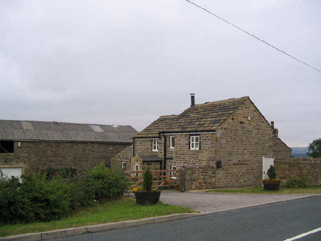
With a population of around 500 inhabitants, Braythorn exudes a strong sense of community and warmth. The village is known for its historic charm, with several well-preserved buildings dating back to the 17th and 18th centuries. The local church, St. Mary's, stands as a prominent landmark, showcasing stunning architectural features and serving as a focal point for religious and community events.

The surrounding countryside provides ample opportunities for outdoor enthusiasts to explore and enjoy nature. Lush meadows, dense woodlands, and winding footpaths offer a haven for hikers, cyclists, and nature lovers. In the spring, the fields come alive with vibrant wildflowers, creating a captivating tapestry of colors.

Despite its small size, Braythorn boasts a few amenities to cater to its residents. A cozy village pub offers a friendly atmosphere and serves as a popular meeting place for locals. A small convenience store provides essential groceries and supplies, ensuring that residents have easy access to everyday necessities.

Braythorn's close proximity to larger towns and cities allows for convenient access to additional services, employment opportunities, and cultural attractions. The village is well-connected by road, making it easily accessible to visitors who wish to explore the wider Yorkshire region.

In summary, Braythorn offers a tranquil and welcoming environment with its charming architecture, stunning natural surroundings, and tight-knit community spirit. It is a hidden gem within the Yorkshire countryside, attracting those seeking a peaceful retreat and a taste of traditional English village life.

If you have any feedback on the listing, please let us know in the comments section below.
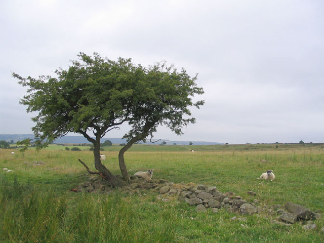
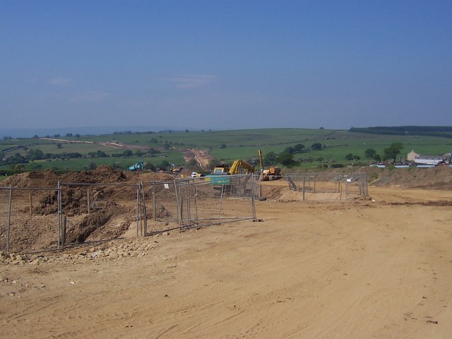
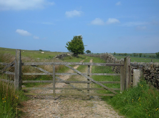
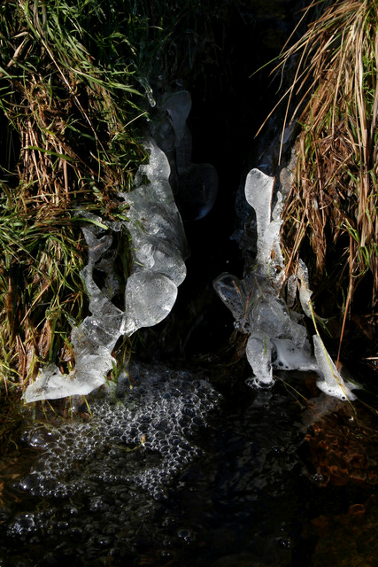
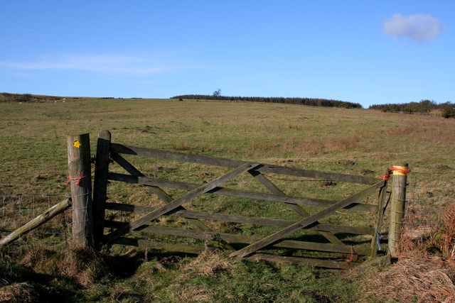
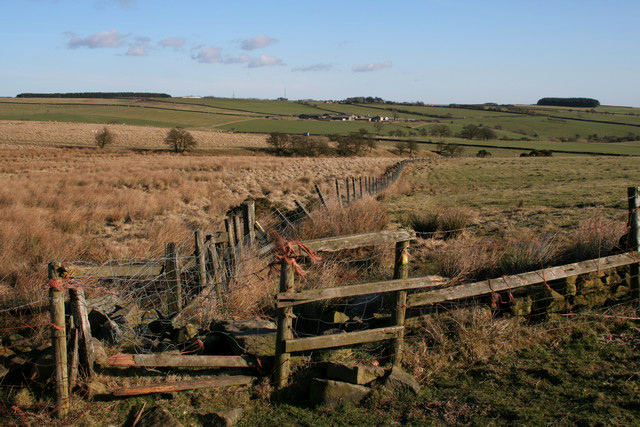
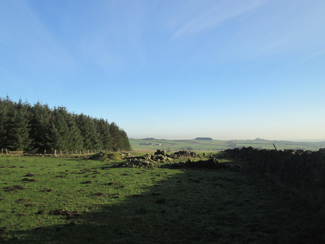
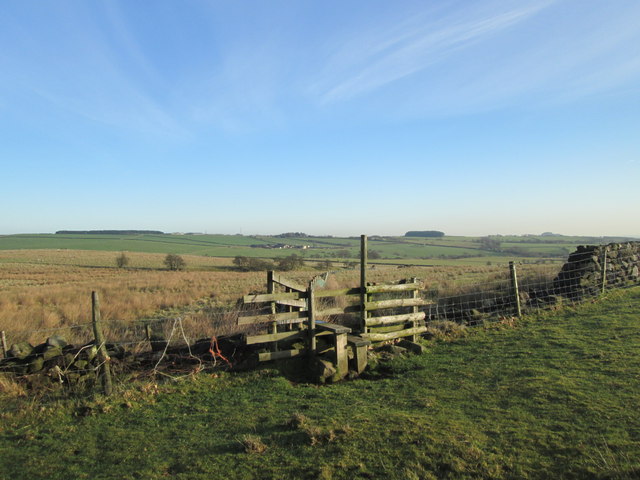
Braythorn Images

Images are sourced within 2km of 53.936542/-1.627992 or Grid Reference SE2449. Thanks to Geograph Open Source API. All images are credited.

Nape's Hill Stainburn A rural view near to Nape’s hill Stainburn in North Yorkshire.
Nape's Hill Stainburn
A rural view near to Nape’s hill Stainburn in North Yorkshire.
Pipe Laying Project crossing B6161 This is a massive project that is cutting a swathe across North Yorkshire.  Large pipes are being laid - the point in the picture is where this project crosses the B6161 Beckwithshaw/Leathley road just north of Moorside Farm.  I presume this will not be a permanent geograph
Pipe Laying Project crossing B6161
This is a massive project that is cutting a swathe across North Yorkshire. Large pipes are being laid - the point in the picture is where this project crosses the B6161 Beckwithshaw/Leathley road just north of Moorside Farm. I presume this will not be a permanent geograph
Mast near Briscoerigg Farm Following track from B6161 Beckwithshaw/Leathley Road towards Almscliff Crag that can be seen in the distance
Mast near Briscoerigg Farm
Following track from B6161 Beckwithshaw/Leathley Road towards Almscliff Crag that can be seen in the distance
Bridleway to Stainburn Moor This bridleway runs for almost 3 kilometres (1¾ miles) from the B6161 at SE236495 to the Stainburn Moor car park at SE236522. Here we are about 500 metres north of its junction with the B6161.
Bridleway to Stainburn Moor
This bridleway runs for almost 3 kilometres (1¾ miles) from the B6161 at SE236495 to the Stainburn Moor car park at SE236522. Here we are about 500 metres north of its junction with the B6161.
Beck, Lindley Moor
Beck, Lindley Moor
Bridleway, Lindley Moor Looking north along the bridleway where it crosses a beck and passes through this gate. On the horizon to the left of the gate, you can just see the outline of an abandoned digger : <a href="https://www.geograph.org.uk/photo/1686523">SE2350 : Abandoned Digger</a>
Bridleway, Lindley Moor
Looking north along the bridleway where it crosses a beck and passes through this gate. On the horizon to the left of the gate, you can just see the outline of an abandoned digger : SE2350 : Abandoned Digger
Icy Reeds Splashing water has frozen to form these interesting shapes.
Icy Reeds
Splashing water has frozen to form these interesting shapes.
Footpath to Buttoner House Farm
Broken Stile
Broken Stile
Gas Facility The signs on the fence warn against smoking. There is a smell which I can only describe as a mixture of onions and dog poo. I have no idea what goes on here.
Gas Facility
The signs on the fence warn against smoking. There is a smell which I can only describe as a mixture of onions and dog poo. I have no idea what goes on here.
Bridleway leading from Lindley Moor Bridleway running from Stainburn Forest, over Lindley Moor towards the B6161 at Hilltop Farm - on a wet day.
Bridleway leading from Lindley Moor
Bridleway running from Stainburn Forest, over Lindley Moor towards the B6161 at Hilltop Farm - on a wet day.
Farmland at Moorside Farm This is a similar view to the first geograph for this square: <a href="https://www.geograph.org.uk/photo/184453">SE2450 : Pipe Laying Project crossing B6161</a>. Now the only sign of the gas pipe is the white marker pole in the middle of the photograph.
Farmland at Moorside Farm
This is a similar view to the first geograph for this square: SE2450 : Pipe Laying Project crossing B6161. Now the only sign of the gas pipe is the white marker pole in the middle of the photograph.
Gate opposite Moor Cottage There used to be a cut bench mark on a gatepost here, but it looks like both posts have gone. Bench Mark Database: <span class="nowrap"><a title="http://www.bench-marks.org.uk/bm44803" rel="nofollow ugc noopener" href="http://www.bench-marks.org.uk/bm44803">Link</a><img style="margin-left:2px;" alt="External link" title="External link - shift click to open in new window" src="https://s1.geograph.org.uk/img/external.png" width="10" height="10"/></span>
Gate opposite Moor Cottage
There used to be a cut bench mark on a gatepost here, but it looks like both posts have gone. Bench Mark Database: LinkExternal link
Bridleway towards Greenmires Lane
Ruins by the path east of Buttoner House farm
Stile on the path to Beckbottom Farm Much better than the one shown in <a href="https://www.geograph.org.uk/photo/1686557">SE2350 : Broken Stile</a>
Stile on the path to Beckbottom Farm
Much better than the one shown in SE2350 : Broken Stile
Bridleway near Moorside Bridge Difficult/impossible for horses.  Easy to bypass the problems on foot.
Bridleway near Moorside Bridge
Difficult/impossible for horses. Easy to bypass the problems on foot.
Hilltop Farm Stainburn Hilltop Farm near Stainburn situated on the B6161 Otley to Harrogate Road
Hilltop Farm Stainburn
Hilltop Farm near Stainburn situated on the B6161 Otley to Harrogate Road
Show me another place!

Braythorn is located at Grid Ref: SE2449 (Lat: 53.936542, Lng: -1.627992)

Division: West Riding

Administrative County: North Yorkshire

District: Harrogate

Police Authority: North Yorkshire

What 3 Words

///anchovies.renting.fillings. Near Stainburn, North Yorkshire

Nearby Locations

Stainburn Braythorn

Related Wikis

Braythorn

Braythorn is a village in the Harrogate district of North Yorkshire, England.

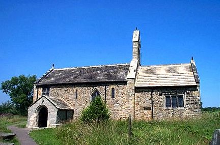
St Mary's Church, Stainburn

St Mary's Church is a redundant Anglican church in the village of Stainburn, North Yorkshire, England. It is recorded in the National Heritage List for...

Stainburn

Stainburn is a village and civil parish in the Harrogate district of North Yorkshire, England, 10 miles (16 km) north of Leeds. The population of the civil...

Lindley, North Yorkshire

Lindley is a village and civil parish in the Harrogate district of North Yorkshire, England. It is near Lindley Wood Reservoir and 1 mile north of Otley...

Leathley

Leathley is a village and civil parish in the Harrogate district of North Yorkshire, England, the parish includes the townships of both Castley and Leathley...
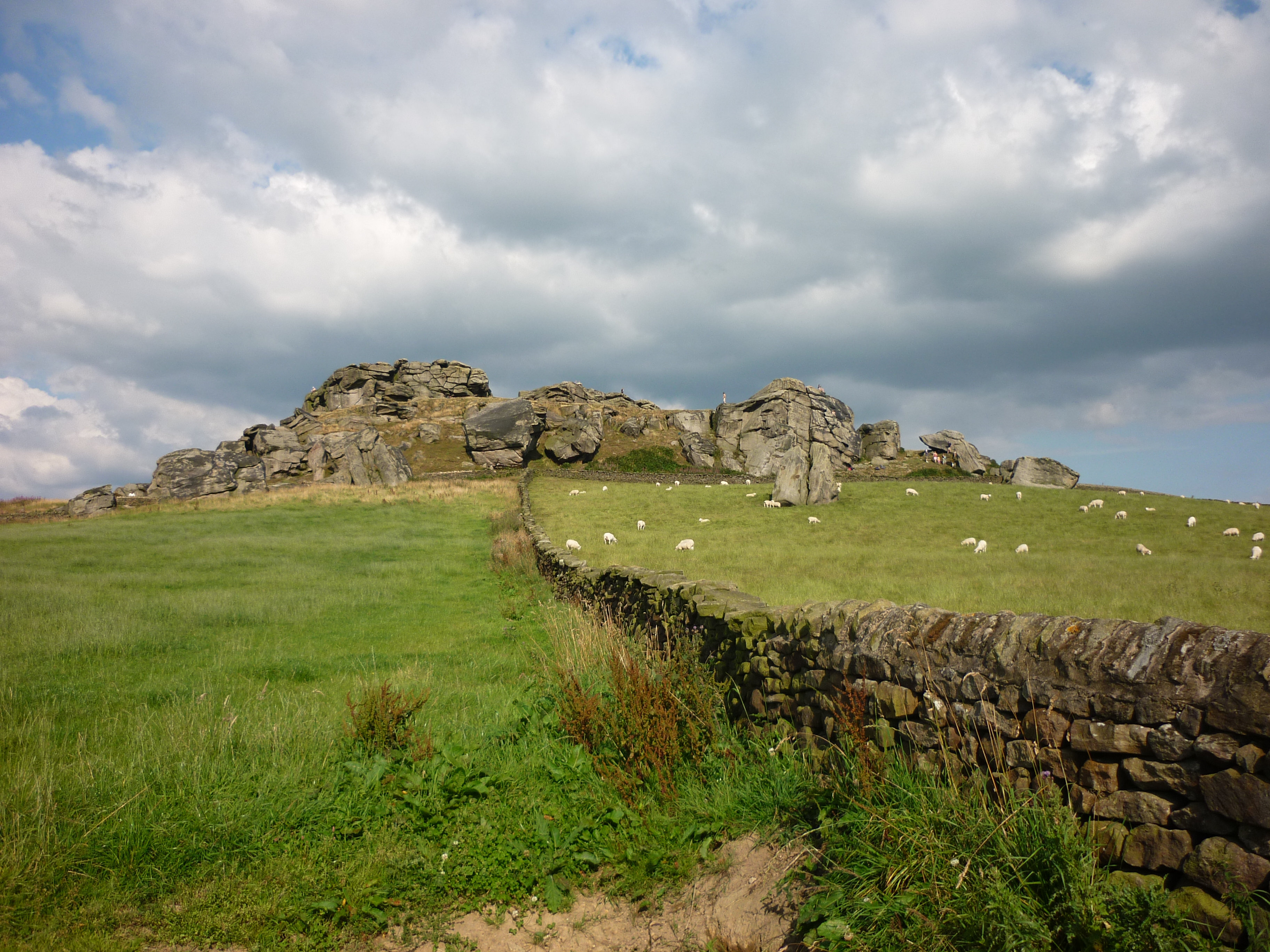
Almscliffe Crag

Almscliffe Crag, or Almscliff Crag, also known as Great Almscliff Crag to distinguish from Little Almscliff, 3 miles (5 km) north west, is a Millstone...

A658 road

The A658 is a road in Yorkshire, UK. == Route == It runs from Bradford, West Yorkshire (53.7949°N 1.7487°W / 53.7949; -1.7487 (A658 road (southwestern...

Wharfedale Rural District

Wharfedale was a rural district in the West Riding of Yorkshire from 1894 to 1974. It comprised the northern side of lower Wharfedale, the lower Washburn...

Nearby Amenities

Located within 500m of 53.936542,-1.627992
Braythorn
Is In Country Code: GB
Is In County: North Yorkshire
Is In Historic County: Yorkshire
Is In Municipality: Harrogate
Place: village
Source: NPE
Wikidata: Q4958567
Wikipedia: en:Braythorn
Lat/Long: 53.9371661/-1.6270921
Telephone
Booth: K6
Covered: booth
Lat/Long: 53.9376655/-1.6278826
Advertising: board
Board Type: notice
Lat/Long: 53.9326844/-1.6253516
Bench
Armrest: no
Backrest: no
Direction: SW
Material: wood
Source: survey
Lat/Long: 53.9326943/-1.6253763
Power: pole
Source: Bing
Lat/Long: 53.9353537/-1.6250622
Power: pole
Source: Bing
Lat/Long: 53.9361162/-1.6254404
Power: pole
Source: Bing
Lat/Long: 53.9339859/-1.6242225
The data included in this document is from www.openstreetmap.org. The data is made available under ODbL.

Have you been to Braythorn?

Leave your review of Braythorn below (or comments, questions and feedback).