Woodfield

Settlement in Oxfordshire Cherwell

England

Woodfield

London Road, Bicester
London Road, Bicester Credit: David Howard

Woodfield is a picturesque village located in the county of Oxfordshire, England. Situated approximately 15 miles northwest of Oxford, the village is nestled in the heart of the stunning Cotswolds region. With its idyllic countryside setting and close proximity to larger towns, Woodfield offers residents a perfect blend of rural charm and convenience.

The village is characterized by its traditional stone-built houses, which give it a timeless appeal. The surrounding landscape is dominated by rolling hills, lush green meadows, and patches of dense woodland, creating a stunning backdrop for outdoor activities and exploration. The village is also home to a small but vibrant community, fostering a close-knit and friendly atmosphere.

Woodfield boasts a range of amenities to cater to its residents' needs. The village features a local pub, a primary school, a post office, and a village hall, which serves as a hub for community events and gatherings. For more extensive shopping and entertainment options, residents can easily access nearby towns such as Chipping Norton or Witney.

Nature enthusiasts will find plenty to enjoy in Woodfield, as the surrounding area offers numerous walking and cycling trails. The village is also within close proximity to several nature reserves and country parks, providing opportunities for birdwatching, picnicking, and wildlife spotting.

With its stunning natural surroundings, strong sense of community, and convenient location, Woodfield is an enchanting place to live for those seeking a peaceful countryside lifestyle within reach of urban amenities.

If you have any feedback on the listing, please let us know in the comments section below.
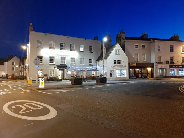
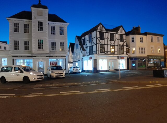
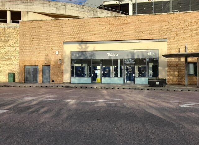
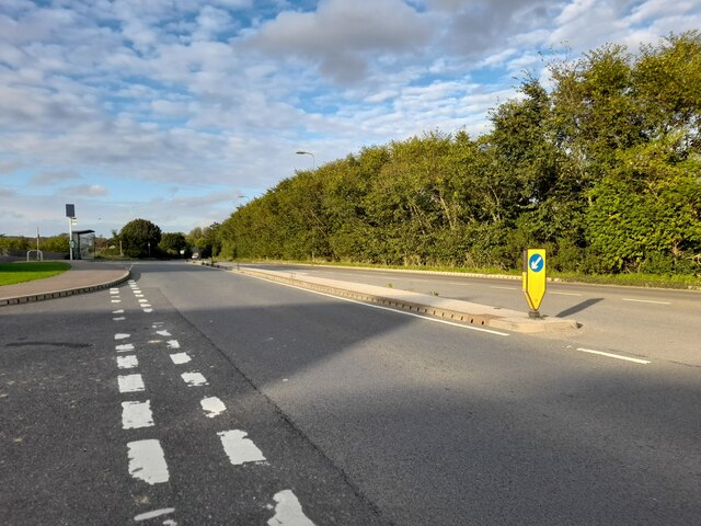
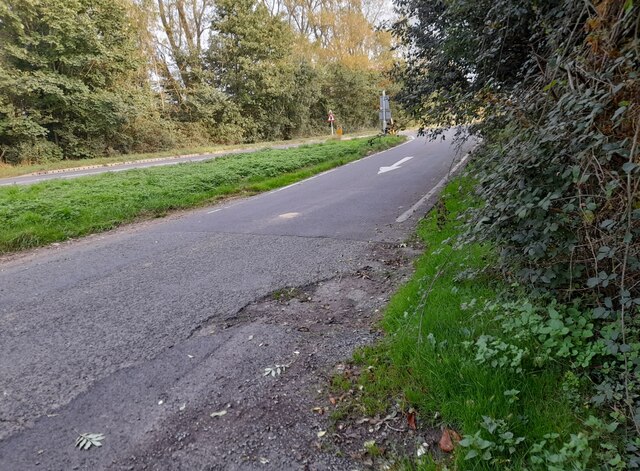
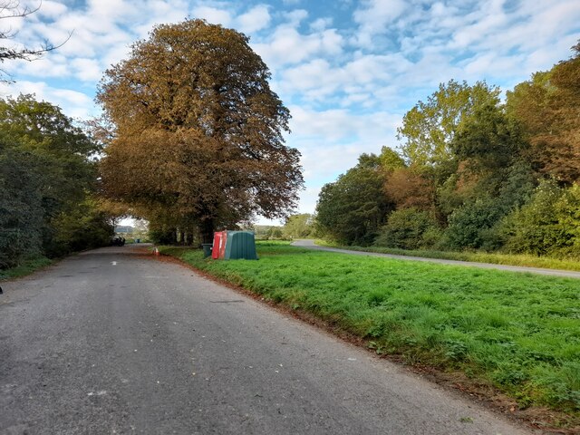
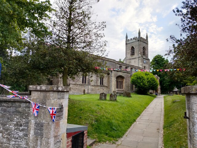
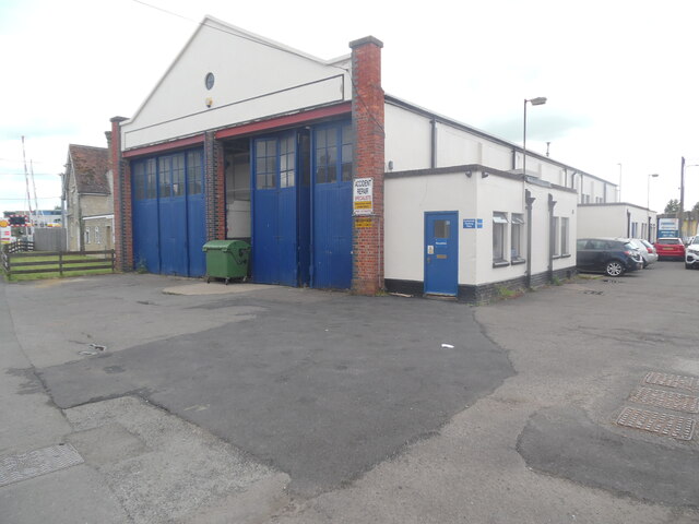
Woodfield Images

Images are sourced within 2km of 51.910735/-1.1513805 or Grid Reference SP5823. Thanks to Geograph Open Source API. All images are credited.

London Road, Bicester
Public toilets at Pioneer Square, Bicester
Banbury Road, Bicester
Parking area on Banbury Road, Caversfield
St Edburg Church, Bichester
Former Bus Depot, Bicester (1) Situated in London Road OX26 6BY, this depot formerly housed buses operated by City of Oxford Motor Services Ltd. It is now an accident repair centre.
Former Bus Depot, Bicester (1)
Situated in London Road OX26 6BY, this depot formerly housed buses operated by City of Oxford Motor Services Ltd. It is now an accident repair centre.
Former Bus Depot, Bicester (2) This former bus depot in London Road is now a crash repair centre. Stagecoach bus routes 26, 29, H5 and S5 that now operate in Bicester, have their vehicles based in Murdock Road OX26 4PP (SP5923 refers).
Former Bus Depot, Bicester (2)
This former bus depot in London Road is now a crash repair centre. Stagecoach bus routes 26, 29, H5 and S5 that now operate in Bicester, have their vehicles based in Murdock Road OX26 4PP (SP5923 refers).
Closure Notice at HSBC Bank branch, Bicester This closure notice is on the entrance door of the HSBC bank branch in Sheep Street. It has the 
 following wording:

                  We're closing 
                  this branch soon

    This branch will close permanently on Tuesday 20 June 2023
    The nearest HSBC UK branch will be:
    65 Cornmarket Street, Oxford, Oxfordshire, 
    OX1 3HY
    
   For details of the services at this branch, our other branch locations
   and the services they offer, please visit at hsbc.co.uk/branch-finder

   Or you can access your remote banking services safely, securely and
   wherever you are:
 
   • With our mobile banking app
   • On our website at hsbc.co.uk
   • Over the phone by calling:
      Personal Customers 03457 404 404
      Business Customers 03457 60 60 60

   Customers can also access some of our services at the Post Office
   20 Sheep Street, Bicester, Oxfordshire
   OX26 6TB

   HSBC UK
Closure Notice at HSBC Bank branch, Bicester
This closure notice is on the entrance door of the HSBC bank branch in Sheep Street. It has the following wording: We're closing this branch soon This branch will close permanently on Tuesday 20 June 2023 The nearest HSBC UK branch will be: 65 Cornmarket Street, Oxford, Oxfordshire, OX1 3HY For details of the services at this branch, our other branch locations and the services they offer, please visit at hsbc.co.uk/branch-finder Or you can access your remote banking services safely, securely and wherever you are: • With our mobile banking app • On our website at hsbc.co.uk • Over the phone by calling: Personal Customers 03457 404 404 Business Customers 03457 60 60 60 Customers can also access some of our services at the Post Office 20 Sheep Street, Bicester, Oxfordshire OX26 6TB HSBC UK
HSBC Bank branch, Bicester (1) Located at 1-3 Sheep Street OX26 6JA. this bank branch is due for permanent closure on Tuesday 20th June 2023. Sheep Street can be seen to the right of the photo while Market Square is to the left.
HSBC Bank branch, Bicester (1)
Located at 1-3 Sheep Street OX26 6JA. this bank branch is due for permanent closure on Tuesday 20th June 2023. Sheep Street can be seen to the right of the photo while Market Square is to the left.
HSBC Bank branch, Bicester (2) Taken from Sheep Street, this bank is one of 114 HSBC branches due for closure in 2023.
HSBC Bank branch, Bicester (2)
Taken from Sheep Street, this bank is one of 114 HSBC branches due for closure in 2023.
Inscription above HSBC Bank branch, Bicester This inscription refers to the establishing of the Birmingham and Midland Bank in 1836 which was renamed the Midland Bank in 1923.  It then became the HSBC Bank in 1999. This branch in Bicester was built in 1920 and is due for closure on Tuesday 20th June 2023.
Inscription above HSBC Bank branch, Bicester
This inscription refers to the establishing of the Birmingham and Midland Bank in 1836 which was renamed the Midland Bank in 1923. It then became the HSBC Bank in 1999. This branch in Bicester was built in 1920 and is due for closure on Tuesday 20th June 2023.
Empty units, Bicester These units are on the McKay Trading Estate; the view is from Station Approach.
Photo number 7616676.
Empty units, Bicester
These units are on the McKay Trading Estate; the view is from Station Approach. Photo number 7616676.
Empty units, Bicester These units are on the McKay Trading Estate; the view is from Station Approach: a comfortable rail replacement bus was taking us back to Leamington Spa due to track repairs (midweek!) near Banbury.
Photo number 7616687.
Empty units, Bicester
These units are on the McKay Trading Estate; the view is from Station Approach: a comfortable rail replacement bus was taking us back to Leamington Spa due to track repairs (midweek!) near Banbury. Photo number 7616687.
Gated access, Bicester This may give a rear access to Coach House Mews housing. The view is from London Road southbound, approaching a Shell petrol station.
Photo number 7616706.
Gated access, Bicester
This may give a rear access to Coach House Mews housing. The view is from London Road southbound, approaching a Shell petrol station. Photo number 7616706.
Halifax Bank branch, Bicester Located at 43-45 Sheep Street OX26 6JJ, this branch is to be closed on Wednesday 7th February 2024 as mentioned on the blue notice on the window to the left of the photo <a title="https://www.geograph.org.uk/photo/7701818" href="https://www.geograph.org.uk/photo/7701818">Link</a> refers. It is one of forty seven such branches to face closure between January and September 2024. A Victorian type gas lamp with a No Cycling sign can be seen to the right of the photo.
Halifax Bank branch, Bicester
Located at 43-45 Sheep Street OX26 6JJ, this branch is to be closed on Wednesday 7th February 2024 as mentioned on the blue notice on the window to the left of the photo Link refers. It is one of forty seven such branches to face closure between January and September 2024. A Victorian type gas lamp with a No Cycling sign can be seen to the right of the photo.
Blue Closure Notice at Halifax Bank branch, Bicester This closure notice is in the front window of the bank branch at 43-45 Sheep Street. It has the following wording:

                                           We're closing 
                                        this branch soon

                               Please come in and talk to us

                          We're here to help and support you
                           before and after this branch closes.

                   This branch will close on 7th February 2024

                    We can help you at any branch, including
                    22 Queen Street, Oxford, Oxfordshire OX1 1EP
             28-30 Market Square, Aylesbury, Buckinghamshire HP20 1TS

                For ways to bank with us, go to halifax.co.uk/branchreview
Blue Closure Notice at Halifax Bank branch, Bicester
This closure notice is in the front window of the bank branch at 43-45 Sheep Street. It has the following wording: We're closing this branch soon Please come in and talk to us We're here to help and support you before and after this branch closes. This branch will close on 7th February 2024 We can help you at any branch, including 22 Queen Street, Oxford, Oxfordshire OX1 1EP 28-30 Market Square, Aylesbury, Buckinghamshire HP20 1TS For ways to bank with us, go to halifax.co.uk/branchreview
Show me another place!

Woodfield is located at Grid Ref: SP5823 (Lat: 51.910735, Lng: -1.1513805)

Administrative County: Oxfordshire

District: Cherwell

Police Authority: Thames Valley

What 3 Words

///renew.bland.scrap. Near Bicester, Oxfordshire

Nearby Locations

Woodfield Bure Park

Related Wikis

Cooper School, Bicester

The Cooper School is a co-educational secondary school and sixth form with academy status, located in the northern side of Bicester, Oxfordshire. ��2...

Bure Park

Bure Park is a 8.4-hectare (21-acre) Local Nature Reserve in Bicester in Oxfordshire. It is owned by Bicester Town Council and managed by Cherwell District...

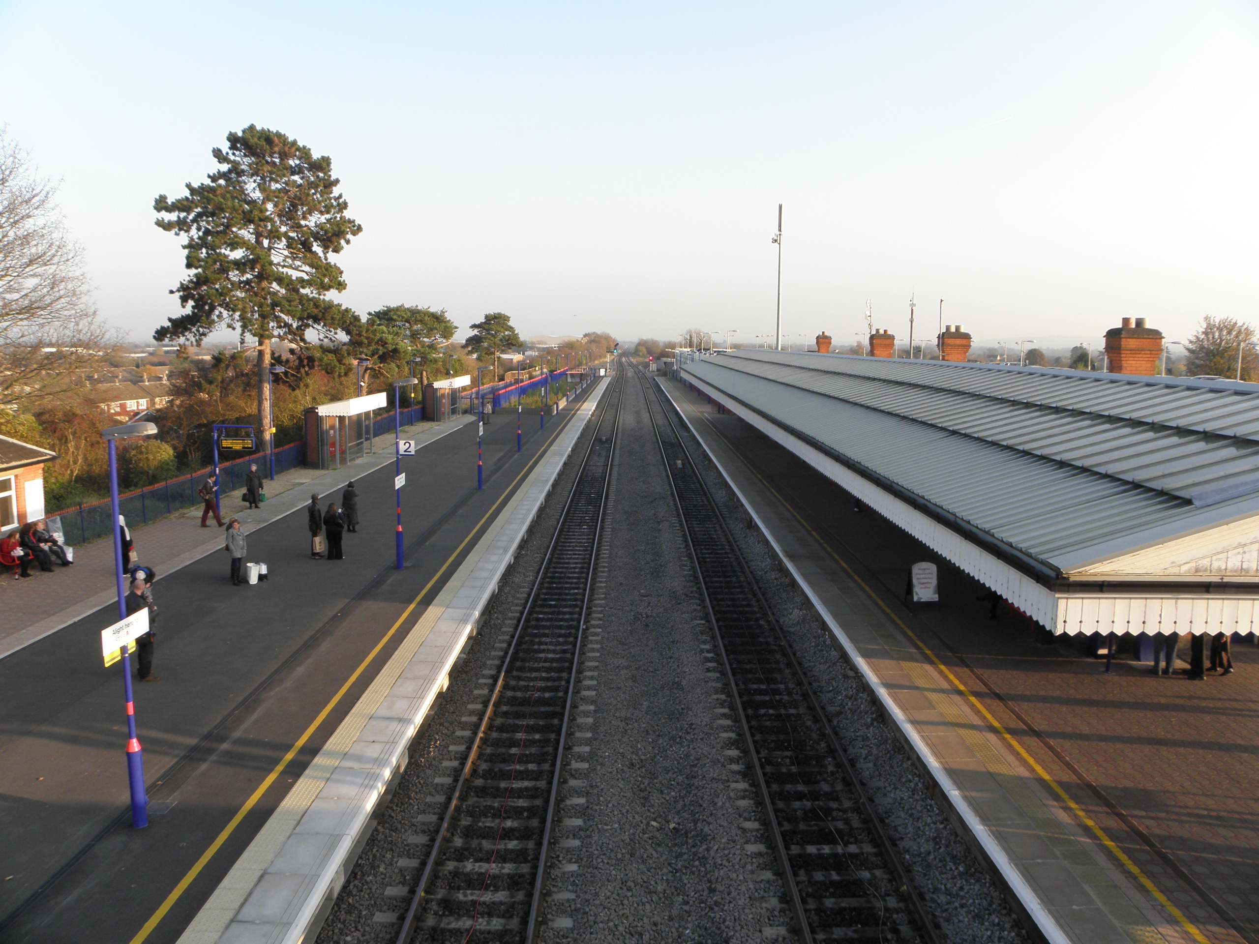
Bicester North railway station

Bicester North ( BIST-ər) is a station on the Chiltern Main Line, one of two stations serving Bicester in Oxfordshire. Services operated by Chiltern Railways...

Bicester

Bicester ( BIST-ər) is a historical market town, garden town, and civil parish in the Cherwell district of northeastern Oxfordshire in south-central England...

Nearby Amenities

Located within 500m of 51.910735,-1.1513805
Crossing
Bicycle: yes
Button Operated: yes
Crossing: traffic_signals
Crossing Ref: toucan
Tactile Paving: yes
Traffic Signals Sound: yes
Traffic Signals Vibration: no
Lat/Long: 51.9106786/-1.1551117
Noexit: yes
Lat/Long: 51.9146351/-1.1548024
Crossing
Button Operated: yes
Crossing: traffic_signals
Crossing Island: no
Crossing Markings: dots
Tactile Paving: yes
Traffic Signals Sound: yes
Traffic Signals Vibration: yes
Lat/Long: 51.9067015/-1.1504756
Noexit: yes
Lat/Long: 51.9090591/-1.154257
Turning Circle
Lat/Long: 51.9077838/-1.1563831
Crossing
Crossing: uncontrolled
Crossing Island: no
Crossing Markings: surface
Surface: paving_stones
Tactile Paving: yes
Traffic Calming: table
Lat/Long: 51.9100174/-1.1565077
Recycling
Recycling Cans: yes
Recycling Clothes: yes
Recycling Glass: yes
Recycling Paper: yes
Recycling Type: container
Lat/Long: 51.9099789/-1.1558335
Crossing
Bicycle: yes
Crossing: unmarked
Crossing Island: no
Crossing Markings: no
Tactile Paving: no
Traffic Calming: table
Lat/Long: 51.9102089/-1.1574968
Post Box
Postal Code: OX26
Ref: OX26 2600
Royal Cypher: EIIR
Lat/Long: 51.9098394/-1.1565364
Turning Circle
Lat/Long: 51.9139288/-1.154278
Turning Circle
Lat/Long: 51.9145215/-1.154234
Crossing
Crossing: unmarked
Crossing Island: no
Crossing Markings: no
Lat/Long: 51.9139898/-1.1480679
Crossing
Bicycle: yes
Crossing: unmarked
Crossing Island: no
Crossing Markings: no
Lat/Long: 51.9150075/-1.1535036
Noexit: yes
Lat/Long: 51.9124224/-1.1540245
Noexit: yes
Lat/Long: 51.9125342/-1.153052
Doctors
North Bicester Surgery
Healthcare: doctor
Lat/Long: 51.9100957/-1.1567595
Post Box
Collection Times: Mo-Fr 09:00; Sa 07:00
Post Box Type: pillar
Postal Code: OX26
Ref: OX26 926
Royal Cypher: EIIR
Royal Cypher Wikidata: Q33102113
Lat/Long: 51.9109433/-1.1479662
Crossing
Button Operated: yes
Crossing: traffic_signals
Crossing Island: no
Crossing Markings: dots
Crossing Ref: pelican
Tactile Paving: yes
Traffic Signals Sound: yes
Traffic Signals Vibration: yes
Lat/Long: 51.9113281/-1.1469172
Noexit: yes
Lat/Long: 51.9108576/-1.1450607
Noexit: yes
Lat/Long: 51.9119069/-1.1459288
Noexit: yes
Lat/Long: 51.911224/-1.1476962
Noexit: yes
Lat/Long: 51.9105256/-1.1481558
Crossing
Crossing: unmarked
Crossing Island: no
Crossing Markings: no
Lat/Long: 51.91253/-1.1509952
Recycling
Lat/Long: 51.9125375/-1.1500977
Post Box
Post Box Type: pillar
Postal Code: OX26
Ref: OX26 921
Lat/Long: 51.9123881/-1.1503468
Telephone
Booth: KX100
Covered: booth
Phone: +44 1869 323367
Postal Code: OX26 3YL
Lat/Long: 51.9122836/-1.1505283
The Co-operative Food
Addr City: Bicester
Addr Housenumber: 4
Addr Postcode: OX26 3HA
Addr Street: Barberry Place
Alt Name: Co-op Swift Shop
Brand: The Co-operative Food
Brand Wikidata: Q107617274
Fhrs Id: 222497
Fhrs Local Authority Id: 999000072565
Operator: Midcounties Co-operative
Operator Wikidata: Q6841138
Shop: supermarket
Lat/Long: 51.910183/-1.1563588
Turning Circle
Lat/Long: 51.9138916/-1.1515872
Noexit: yes
Lat/Long: 51.9131951/-1.1547255
Noexit: yes
Lat/Long: 51.9134174/-1.1547918
Noexit: yes
Lat/Long: 51.915209/-1.1506232
Crossing
Crossing: unmarked
Crossing Island: no
Crossing Markings: no
Lat/Long: 51.913871/-1.1525858
Fixme: Is this a speed table and/or crossing? #surveyme
Lat/Long: 51.9141896/-1.1510764
Crossing
Crossing: unmarked
Crossing Island: no
Tactile Paving: no
Lat/Long: 51.9136352/-1.1500457
Noexit: yes
Lat/Long: 51.9148214/-1.1529831
Noexit: yes
Lat/Long: 51.9140647/-1.1497203
Crossing
Crossing: unmarked
Crossing Island: no
Crossing Markings: no
Tactile Paving: no
Lat/Long: 51.9144816/-1.1485011
Crossing
Bicycle: yes
Crossing: unmarked
Crossing Island: no
Crossing Markings: no
Lat/Long: 51.9132259/-1.1488242
Noexit: yes
Lat/Long: 51.9138103/-1.1495086
Noexit: yes
Lat/Long: 51.9121017/-1.147991
Noexit: yes
Lat/Long: 51.9110629/-1.1499784
Noexit: yes
Lat/Long: 51.910933/-1.1545646
Crossing
Crossing: unmarked
Crossing Island: no
Crossing Markings: no
Tactile Paving: yes
Lat/Long: 51.9075496/-1.1465902
Noexit: yes
Lat/Long: 51.9086953/-1.14555
Noexit: yes
Lat/Long: 51.9092011/-1.1449142
Noexit: yes
Lat/Long: 51.9108347/-1.1466395
Noexit: yes
Lat/Long: 51.9107586/-1.1457599
Noexit: yes
Lat/Long: 51.9088846/-1.1467624
Turning Circle
Lat/Long: 51.9093547/-1.1478455
Noexit: yes
Lat/Long: 51.9102803/-1.1471145
Fuel
Gulf
Brand: Gulf
Brand Wikidata: Q1296860
Brand Wikipedia: en:Gulf Oil
Check Date: 2023-07-31
Hgv: no
Lat/Long: 51.9070766/-1.1505025
Post Box
Ref: OX26 610D
Royal Cypher: EIIR
Lat/Long: 51.9068889/-1.1502621
Noexit: yes
Lat/Long: 51.9069895/-1.1487409
Noexit: yes
Lat/Long: 51.9070177/-1.14823
Turning Circle
Lat/Long: 51.909132/-1.1566166
Crossing
Crossing: unmarked
Crossing Island: no
Tactile Paving: yes
Lat/Long: 51.9098066/-1.1562925
Noexit: yes
Lat/Long: 51.9085543/-1.1498974
Post Box
Check Date: 2023-08-21
Operator: Royal Mail
Operator Wikidata: Q638098
Post Box Type: lamp
Ref: OX26 336D
Royal Cypher: EIIR
Lat/Long: 51.9077374/-1.1545764
Noexit: yes
Lat/Long: 51.9145228/-1.1512852
Noexit: yes
Lat/Long: 51.9146643/-1.1519375
Noexit: yes
Lat/Long: 51.9066627/-1.1534243
Bus Stop
Buckingham Crescent
Bench: no
Bin: yes
Bus: yes
Naptan AtcoCode: 340001544CNR
Naptan Bearing: SW
Naptan CommonName: Buckingham Crescent
Naptan Indicator: Corner
Naptan Landmark: Buckingham Crescent
Naptan NaptanCode: oxfgdjpt
Naptan Street: Buckingham Road
Public Transport: platform
Shelter: yes
Source: naptan_import
Lat/Long: 51.9064759/-1.1505268
Bus Stop
Buckingham Crescent
Bench: no
Bin: no
Bus: yes
Lit: yes
Naptan AtcoCode: 340001544OPP
Naptan Bearing: NE
Naptan CommonName: Buckingham Crescent
Naptan Indicator: Opposite
Naptan Landmark: Buckingham Crescent
Naptan NaptanCode: oxfgdjpm
Naptan Street: Buckingham Road
Public Transport: platform
Shelter: no
Source: naptan_import
Lat/Long: 51.9064897/-1.1506862
Bus Stop
St Peters Crescent
Bench: yes
Bin: yes
Bus: yes
Naptan AtcoCode: 340001564CNR
Naptan Bearing: E
Naptan CommonName: St Peters Crescent
Naptan Indicator: Corner
Naptan Landmark: St Peters Crescent
Naptan NaptanCode: oxfgdmdj
Naptan Street: Churchill Road
Public Transport: platform
Shelter: yes
Source: naptan_import
Lat/Long: 51.9076304/-1.1481511
Bus Stop
St Peters Crescent
Bench: no
Bin: no
Bus: yes
Naptan AtcoCode: 340001564OPP
Naptan Bearing: W
Naptan CommonName: St Peters Crescent
Naptan Indicator: Opposite
Naptan Landmark: St Peters Crescent
Naptan NaptanCode: oxfawdmd
Naptan Street: Churchill Road
Public Transport: platform
Shelter: no
Source: naptan_import
Lat/Long: 51.9074297/-1.1478894
Bus Stop
Blake Road
Bench: no
Bin: no
Bus: yes
Naptan AtcoCode: 340003255CNR
Naptan Bearing: S
Naptan CommonName: Blake Road
Naptan Indicator: Corner
Naptan Landmark: Blake Road
Naptan NaptanCode: oxfawtpt
Naptan Street: Banbury Road
Public Transport: platform
Shelter: no
Source: naptan_import
Lat/Long: 51.908063/-1.1546663
Bus Stop
Blake Road
Bench: no
Bin: no
Bus: yes
Naptan AtcoCode: 340003255OPP
Naptan Bearing: N
Naptan CommonName: Blake Road
Naptan Indicator: Opposite
Naptan Landmark: Blake Road
Naptan NaptanCode: oxfawtpw
Naptan Street: Banbury Road
Public Transport: platform
Shelter: no
Source: naptan_import
Tactile Paving: no
Lat/Long: 51.9083969/-1.1548345
Bus Stop
Barberry Place Shops
Bus: yes
Naptan AtcoCode: 340003256OUT
Naptan Bearing: N
Naptan CommonName: Barberry Place Shops
Naptan Indicator: Outside
Naptan Landmark: Shops
Naptan NaptanCode: oxfawtpm
Naptan Street: Banbury Road
Naptan Verified: no
Public Transport: platform
Source: naptan_import
Lat/Long: 51.9109171/-1.1551942
Crossing
Crossing: unmarked
Tactile Paving: yes
Lat/Long: 51.9096045/-1.1550317
Crossing
Crossing: unmarked
Tactile Paving: yes
Lat/Long: 51.9095662/-1.155097
Fast Food
Millennium Dragon
Addr City: Bicester
Addr Housenumber: 7
Addr Postcode: OX26 3HA
Addr Street: Barberry Place
Cuisine: chinese
Diet Vegan: no
Diet Vegetarian: yes
Fhrs Id: 222136
Fhrs Local Authority Id: 999000072568
Takeaway: yes
Lat/Long: 51.9102898/-1.1559634
Fast Food
Barberry Fish Bar
Addr City: Bicester
Addr Housenumber: 8
Addr Postcode: OX26 3HA
Addr Street: Barberry Place
Cuisine: fish_and_chips
Fhrs Id: 222707
Fhrs Local Authority Id: 999000075269
Takeaway: yes
Lat/Long: 51.9103157/-1.1558649
Fast Food
KFC
Addr Housename: Audley House
Addr Postcode: OX26 3AH
Addr Street: Buckingham Road
Addr Unit: Unit 1
Alt Name: Kentucky Fried Chicken
Brand: KFC
Brand Wikidata: Q524757
Brand Wikipedia: en:KFC
Contact Website: https://www.kfc.co.uk/kfc-near-me/bicester-buckingham-road
Cuisine: chicken
Drive Through: no
Fhrs Id: 221997
Level: 0
Takeaway: yes
Lat/Long: 51.9073611/-1.1506691
Fast Food
Domino's
Addr City: Bicester
Addr Country: GB
Addr Housenumber: 132
Addr Postcode: OX26 4HB
Addr Street: Buckingham Crescent
Alt Name: Dominos Pizza
Brand: Domino's
Brand Wikidata: Q839466
Brand Wikipedia: en:Domino's Pizza
Check Date: 2023-07-31
Contact Website: https://www.dominos.co.uk/pizza-near-me/bicester/132-buckingham-crescent
Cuisine: pizza
Diet Vegetarian: yes
Fhrs Id: 221874
Fhrs Local Authority Id: 08/00137/C
Level: 0
Takeaway: yes
Lat/Long: 51.9066188/-1.1500691
Fast Food
Pizza Hut Delivery
Addr City: Bicester
Addr County: Oxfordshire
Addr Housename: Audley House
Addr Postcode: OX26 3AH
Addr Street: Buckingham Road
Addr Unit: 2
Brand: Pizza Hut Delivery
Brand Wikidata: Q107293079
Brand Wikipedia: en:Pizza Hut
Cuisine: pizza
Delivery: yes
Fhrs Id: 1209072
Level: 0
Source Addr: FHRS Open Data
Takeaway: only
Lat/Long: 51.9074676/-1.1505859
Pharmacy
Jardines Pharmacy
Addr City: Bicester
Addr Street: Barberry Place
Brand: NHS
Dispensing: yes
Drive Through: no
Healthcare: pharmacy
Opening Hours: Mo-Sa 08:00-18:00
Wheelchair: yes
Lat/Long: 51.9102326/-1.156192
Ladbrokes
Brand: Ladbrokes
Brand Wikidata: Q1799875
Brand Wikipedia: en:Ladbrokes Coral
Check Date: 2023-07-29
Level: 0
Shop: bookmaker
Lat/Long: 51.9074399/-1.1506075
Atm
Check Date: 2023-08-21
Operator: Bank Machine
Lat/Long: 51.9101288/-1.1562021
Noexit: yes
Lat/Long: 51.9112718/-1.158423
Noexit: yes
Lat/Long: 51.9106074/-1.1500326
Noexit: yes
Lat/Long: 51.9074647/-1.1550206
Noexit: yes
Lat/Long: 51.9072518/-1.1504878
Noexit: yes
Lat/Long: 51.9075456/-1.1512325
Noexit: yes
Lat/Long: 51.907721/-1.151101
Noexit: yes
Lat/Long: 51.907745/-1.1501947
Noexit: yes
Lat/Long: 51.9079323/-1.1508177
Noexit: yes
Lat/Long: 51.9088723/-1.1466461
Crossing
Crossing: unmarked
Crossing Island: no
Tactile Paving: yes
Lat/Long: 51.9099346/-1.1563665
Noexit: yes
Lat/Long: 51.9103422/-1.1492328
Speed Camera
Direction: 160
Maxspeed: 30 mph
Lat/Long: 51.9072775/-1.1473212
Give Way
Direction: backward
Lat/Long: 51.9082834/-1.1494784
Speed Camera
Direction: 40
Maxspeed: 30 mph
Lat/Long: 51.9101525/-1.1479931
Direction: backward
Surface: concrete
Traffic Calming: choker
Lat/Long: 51.9119299/-1.1463674
Priority: backward
Traffic Calming: choker
Lat/Long: 51.9112548/-1.1551953
Turning Circle
Noexit: yes
Lat/Long: 51.9094691/-1.155616
Turning Circle
Noexit: yes
Lat/Long: 51.9094501/-1.1553504
Noexit: yes
Lat/Long: 51.9147084/-1.152568
Mini Roundabout
Direction: clockwise
Lat/Long: 51.9082085/-1.1495276
Mini Roundabout
Direction: clockwise
Lat/Long: 51.9080626/-1.1495627
Description: Goods vehicles exceeding the maximum gross weight indicated prohibited, except for loading
Direction: forward
Maxweightrating Hgv: 7.5
Maxweightrating Hgv Conditional: none @ delivery
Traffic Sign: GB:622.1A
Lat/Long: 51.9082551/-1.1497153
Southwold
Place: neighbourhood
Lat/Long: 51.9131042/-1.1509144
Crossing
Crossing: uncontrolled
Tactile Paving: no
Lat/Long: 51.9097013/-1.1554843
Crossing
Crossing: uncontrolled
Tactile Paving: no
Lat/Long: 51.9096376/-1.155452
Crossing
Crossing: unmarked
Crossing Island: no
Crossing Markings: no
Tactile Paving: yes
Lat/Long: 51.9135585/-1.1555259
Crossing
Crossing: unmarked
Crossing Island: no
Crossing Markings: no
Tactile Paving: yes
Lat/Long: 51.9142579/-1.1555143
Barrier: kerb
Kerb: lowered
Tactile Paving: yes
Lat/Long: 51.914343/-1.1555228
Barrier: kerb
Kerb: lowered
Tactile Paving: yes
Lat/Long: 51.9141966/-1.1555074
Barrier: bollard
Bollard: fixed
Lat/Long: 51.9125053/-1.1509899
Crossing
Crossing: unmarked
Crossing Island: no
Crossing Markings: no
Tactile Paving: no
Lat/Long: 51.9076877/-1.1546051
Crossing
Crossing: unmarked
Crossing Island: no
Tactile Paving: no
Lat/Long: 51.9069104/-1.154578
Crossing
Crossing: unmarked
Crossing Island: yes
Crossing Markings: no
Tactile Paving: no
Lat/Long: 51.9079838/-1.1497031
Give Way
Direction: forward
Lat/Long: 51.9080117/-1.1496725
Noexit: yes
Lat/Long: 51.9088155/-1.1554192
Crossing
Crossing: unmarked
Crossing Island: no
Crossing Markings: no
Tactile Paving: yes
Lat/Long: 51.9066589/-1.1502858
Barrier: kerb
Kerb: lowered
Tactile Paving: yes
Lat/Long: 51.9066922/-1.1504323
Waste Basket
Waste: dog_excrement
Lat/Long: 51.9132525/-1.1520212
Waste Basket
Lat/Long: 51.913701/-1.150424
Waste Basket
Waste: dog_excrement
Lat/Long: 51.9137434/-1.1503502
Bench
Backrest: yes
Material: metal
Lat/Long: 51.9135742/-1.1510114
Crossing
Crossing: marked
Crossing Island: no
Tactile Paving: no
Traffic Calming: table
Lat/Long: 51.9119999/-1.1502617
Waste Basket
Waste: dog_excrement
Lat/Long: 51.9105622/-1.1477693
Turning Circle
Lat/Long: 51.912133/-1.1454729
Give Way
Direction: backward
Lat/Long: 51.9135147/-1.1491101
Give Way
Direction: forward
Lat/Long: 51.9141664/-1.1507294
Give Way
Direction: backward
Lat/Long: 51.9149467/-1.1513367
Give Way
Direction: forward
Lat/Long: 51.9134692/-1.1496764
Noexit: yes
Lat/Long: 51.9118097/-1.1479017
Barrier: kerb
Kerb: lowered
Tactile Paving: no
Lat/Long: 51.9144728/-1.1484616
Bicycle: designated
Direction: forward
Foot: designated
Traffic Sign: GB:957
Lat/Long: 51.9113227/-1.1470954
Barrier: kerb
Kerb: lowered
Tactile Paving: yes
Lat/Long: 51.9113472/-1.1469657
Traffic Signals
Crossing: no
Traffic Signals: pedestrian_crossing
Traffic Signals Direction: forward
Lat/Long: 51.9112995/-1.1469432
Traffic Signals
Crossing: no
Traffic Signals: pedestrian_crossing
Traffic Signals Direction: backward
Lat/Long: 51.9113595/-1.1468886
Barrier: kerb
Kerb: lowered
Tactile Paving: no
Lat/Long: 51.9107615/-1.1476156
Give Way
Direction: forward
Lat/Long: 51.9107914/-1.1474803
Crossing
Crossing: unmarked
Crossing Markings: no
Tactile Paving: no
Lat/Long: 51.9108203/-1.1475642
Barrier: kerb
Kerb: lowered
Tactile Paving: no
Lat/Long: 51.9108492/-1.1475383
Barrier: kerb
Kerb: lowered
Tactile Paving: no
Lat/Long: 51.9107913/-1.1475902
Barrier: kerb
Kerb: lowered
Tactile Paving: yes
Lat/Long: 51.9113089/-1.1468685
Give Way
Direction: forward
Lat/Long: 51.912838/-1.1453927
Crossing
Crossing: unmarked
Crossing Island: separate
Crossing Markings: no
Tactile Paving: yes
Lat/Long: 51.9128767/-1.1452128
Barrier: kerb
Kerb: lowered
Tactile Paving: yes
Lat/Long: 51.9128545/-1.1452407
Barrier: kerb
Kerb: lowered
Tactile Paving: yes
Lat/Long: 51.9128282/-1.1452738
Crossing
Crossing: unmarked
Crossing Island: separate
Crossing Markings: no
Tactile Paving: yes
Lat/Long: 51.9128037/-1.1453024
Barrier: kerb
Kerb: lowered
Tactile Paving: yes
Lat/Long: 51.9127793/-1.1453311
Barrier: kerb
Kerb: lowered
Tactile Paving: yes
Lat/Long: 51.9128989/-1.1451848
Barrier: cycle_barrier
Cycle Barrier: double
Cycle Barrier Installation: fixed
Lat/Long: 51.9114809/-1.1466674
Noexit: yes
Lat/Long: 51.9137556/-1.1486432
Barrier: kerb
Kerb: lowered
Tactile Paving: no
Lat/Long: 51.9144914/-1.1485451
Noexit: yes
Lat/Long: 51.9145639/-1.1490682
Noexit: yes
Lat/Long: 51.9143102/-1.1490905
Noexit: yes
Lat/Long: 51.9145083/-1.1492196
Noexit: yes
Lat/Long: 51.9126128/-1.1527879
Noexit: yes
Lat/Long: 51.9136018/-1.1539178
Noexit: yes
Lat/Long: 51.9143037/-1.1543497
Noexit: yes
Lat/Long: 51.914237/-1.1542407
Noexit: yes
Lat/Long: 51.9139027/-1.1550856
Give Way
Direction: forward
Lat/Long: 51.9137314/-1.1532241
Noexit: yes
Lat/Long: 51.9108/-1.1500249
Noexit: yes
Lat/Long: 51.910727/-1.1502238
Noexit: yes
Lat/Long: 51.9109673/-1.1547198
Noexit: yes
Lat/Long: 51.9114778/-1.1536275
Noexit: yes
Lat/Long: 51.9148746/-1.1519216
Noexit: yes
Lat/Long: 51.914944/-1.1521596
Noexit: yes
Lat/Long: 51.9132621/-1.1473508
Noexit: yes
Lat/Long: 51.913826/-1.1470947
Noexit: yes
Lat/Long: 51.9138016/-1.1468995
Noexit: yes
Lat/Long: 51.914972/-1.1497185
Noexit: yes
Lat/Long: 51.9098699/-1.1505389
Noexit: yes
Lat/Long: 51.9098749/-1.150728
Tactile Paving: yes
Lat/Long: 51.9074946/-1.1502889
Crossing
Crossing: unmarked
Tactile Paving: yes
Lat/Long: 51.9075705/-1.1500774
Crossing
Crossing: unmarked
Crossing Island: no
Tactile Paving: yes
Lat/Long: 51.9075045/-1.1503266
Give Way
Direction: forward
Lat/Long: 51.9076961/-1.1498343
Description: Bicester North East Health Route - 1k
Information: route_marker
Tourism: information
Lat/Long: 51.9066796/-1.1503595
Barrier: kerb
Kerb: lowered
Tactile Paving: yes
Lat/Long: 51.9066674/-1.1503256
Traffic Signals
Crossing: no
Traffic Signals: pedestrian_crossing
Traffic Signals Direction: backward
Lat/Long: 51.9067278/-1.1504619
Traffic Signals
Crossing: no
Traffic Signals: pedestrian_crossing
Traffic Signals Direction: forward
Lat/Long: 51.9066826/-1.1504865
Give Way
Direction: forward
Lat/Long: 51.9072252/-1.150144
Give Way
Direction: backward
Lat/Long: 51.9065784/-1.1504983
Barrier: kerb
Kerb: lowered
Tactile Paving: yes
Lat/Long: 51.9067107/-1.1505189
Man Made: street_cabinet
Lat/Long: 51.9066639/-1.1504041
Barrier: kerb
Kerb: lowered
Tactile Paving: no
Lat/Long: 51.9086737/-1.1492559
Barrier: kerb
Kerb: lowered
Tactile Paving: no
Lat/Long: 51.9087902/-1.1491663
Crossing
Crossing: unmarked
Crossing Island: no
Crossing Markings: no
Tactile Paving: no
Lat/Long: 51.9087344/-1.1492112
Barrier: kerb
Kerb: lowered
Tactile Paving: no
Lat/Long: 51.9082733/-1.1496238
Crossing
Crossing: unmarked
Crossing Island: no
Crossing Markings: no
Tactile Paving: no
Lat/Long: 51.9082395/-1.1496537
Fire Hydrant
Emergency: fire_hydrant
Fire Hydrant Diameter: 100
Fire Hydrant Position: green
Fire Hydrant Type: underground
Lat/Long: 51.9079743/-1.1494593
Crossing
Crossing: unmarked
Crossing Island: no
Crossing Markings: no
Tactile Paving: no
Lat/Long: 51.9079959/-1.1493356
Barrier: kerb
Kerb: lowered
Tactile Paving: no
Lat/Long: 51.9080139/-1.1497724
Buckingham Road Local Centre
Information: map
Map Size: city
Map Type: street
Tourism: information
Lat/Long: 51.9075006/-1.1501592
Barrier: kerb
Kerb: lowered
Tactile Paving: no
Lat/Long: 51.908189/-1.1496983
Give Way
Direction: backward
Lat/Long: 51.9087285/-1.1491914
Traffic Calming: island
Lat/Long: 51.9101557/-1.1479424
Give Way
Direction: backward
Lat/Long: 51.9099094/-1.1480893
Crossing
Crossing: unmarked
Crossing Markings: no
Tactile Paving: no
Lat/Long: 51.9107321/-1.1476357
Barrier: kerb
Kerb: lowered
Tactile Paving: no
Lat/Long: 51.9106794/-1.1476718
Give Way
Direction: backward
Lat/Long: 51.9071964/-1.1473384
Give Way
Direction: forward
Lat/Long: 51.9075671/-1.1482157
Give Way
Direction: backward
Lat/Long: 51.9077505/-1.1485069
Noexit: yes
Lat/Long: 51.9090577/-1.1466873
Give Way
Direction: backward
Lat/Long: 51.9071428/-1.1470192
Noexit: yes
Lat/Long: 51.9086748/-1.1457083
Noexit: yes
Lat/Long: 51.9084324/-1.1462004
Noexit: yes
Lat/Long: 51.9091777/-1.1450687
Noexit: yes
Lat/Long: 51.9100705/-1.1449596
Noexit: yes
Lat/Long: 51.9106625/-1.1457344
Noexit: yes
Lat/Long: 51.9107222/-1.146549
Noexit: yes
Lat/Long: 51.9101131/-1.1465261
Noexit: yes
Lat/Long: 51.911678/-1.1453281
Noexit: yes
Lat/Long: 51.910864/-1.1457657
Noexit: yes
Lat/Long: 51.9112178/-1.1465504
Barrier: cycle_barrier
Cycle Barrier: double
Cycle Barrier Installation: fixed
Lat/Long: 51.910231/-1.1574084
Information: guidepost
Tourism: information
Lat/Long: 51.9105995/-1.155271
Barrier: cycle_barrier
Cycle Barrier: double
Cycle Barrier Installation: fixed
Lat/Long: 51.9106557/-1.1552429
Barrier: kerb
Kerb: lowered
Tactile Paving: yes
Lat/Long: 51.9106683/-1.1551568
Barrier: kerb
Kerb: lowered
Tactile Paving: yes
Lat/Long: 51.9106958/-1.1550372
Barrier: cycle_barrier
Cycle Barrier: double
Cycle Barrier Installation: fixed
Lat/Long: 51.9101797/-1.1576385
Waste Basket
Colour: red
Waste: dog_excrement
Lat/Long: 51.9105404/-1.156254
Information: guidepost
Tourism: information
Lat/Long: 51.9095878/-1.1553983
Crossing
Crossing: unmarked
Crossing Island: yes
Tactile Paving: yes
Lat/Long: 51.9093071/-1.1570934
Crossing
Crossing: unmarked
Crossing Island: yes
Tactile Paving: yes
Lat/Long: 51.9094783/-1.1564859
Crossing
Crossing: unmarked
Crossing Island: yes
Tactile Paving: yes
Lat/Long: 51.9093808/-1.1560882
Crossing
Crossing: unmarked
Crossing Island: yes
Tactile Paving: yes
Lat/Long: 51.9096826/-1.1563483
Bure Park Local Centre
Information: map
Tourism: information
Lat/Long: 51.9100323/-1.156353
Barrier: kerb
Kerb: lowered
Tactile Paving: no
Lat/Long: 51.9062692/-1.1506858
Give Way
Direction: forward
Lat/Long: 51.9063184/-1.1506836
Description: Goods vehicles exceeding the maximum gross weight indicated prohibited, except for loading
Direction: forward
Maxweightrating Hgv: 7.5
Maxweightrating Hgv Conditional: none @ delivery
Traffic Sign: GB:622.1A
Lat/Long: 51.907686/-1.1545788
Barrier: kerb
Kerb: lowered
Tactile Paving: no
Lat/Long: 51.9076307/-1.1546005
Barrier: kerb
Kerb: lowered
Tactile Paving: no
Lat/Long: 51.9077358/-1.154609
Give Way
Direction: backward
Lat/Long: 51.9076883/-1.1546287
Give Way
Direction: backward
Lat/Long: 51.9069101/-1.1546031
Noexit: yes
Lat/Long: 51.9088949/-1.1544801
Traffic Signals
Crossing: no
Traffic Signals: pedestrian_crossing
Traffic Signals Direction: backward
Lat/Long: 51.9106329/-1.1551106
Traffic Signals
Crossing: no
Traffic Signals: pedestrian_crossing
Traffic Signals Direction: forward
Lat/Long: 51.9107136/-1.1551163
Barrier: kerb
Kerb: lowered
Tactile Paving: yes
Lat/Long: 51.9066503/-1.150246
Noexit: yes
Lat/Long: 51.906457/-1.1502037
Man Made: street_cabinet
Lat/Long: 51.9063499/-1.1505825
Bus: yes
Direction: backward
Public Transport: stop_position
Lat/Long: 51.9064141/-1.1506691
Bus: yes
Direction: forward
Public Transport: stop_position
Lat/Long: 51.9064756/-1.1506238
Barrier: kerb
Kerb: lowered
Tactile Paving: no
Lat/Long: 51.9063462/-1.1506321
Crossing
Crossing: unmarked
Crossing Island: no
Crossing Markings: no
Tactile Paving: no
Lat/Long: 51.9063101/-1.1506586
Direction: forward
Maxspeed: 30 mph
Traffic Sign: GB:670
Lat/Long: 51.9112882/-1.1551903
Direction: backward
Traffic Sign: GB:811A
Lat/Long: 51.9112211/-1.1551818
Give Way
Direction: forward
Lat/Long: 51.9112778/-1.155189
Direction: forward
Traffic Sign: GB:615
Lat/Long: 51.9112887/-1.1551904
Noexit: yes
Lat/Long: 51.9123316/-1.1546119
Noexit: yes
Lat/Long: 51.9123076/-1.1548278
Bicycle: designated
Direction: backward
Foot: designated
Traffic Sign: GB:957
Lat/Long: 51.9135501/-1.1556029
Barrier: kerb
Kerb: lowered
Tactile Paving: yes
Lat/Long: 51.9135658/-1.1554584
Barrier: kerb
Kerb: lowered
Tactile Paving: yes
Lat/Long: 51.9135527/-1.1555795
Barrier: cycle_barrier
Cycle Barrier: double
Cycle Barrier Installation: fixed
Lat/Long: 51.9135454/-1.155647
Give Way
Direction: backward
Lat/Long: 51.914256/-1.1555453
Pharmacy
Bicester Pharmacy
Addr City: Bicester
Addr Housenumber: 134
Addr Postcode: OX26 4HB
Addr Street: Buckingham Crescent
Dispensing: yes
Healthcare: pharmacy
Lat/Long: 51.9066316/-1.1499584
The data included in this document is from www.openstreetmap.org. The data is made available under ODbL.

Have you been to Woodfield?

Leave your review of Woodfield below (or comments, questions and feedback).