Woodcross

Settlement in Staffordshire

England

Woodcross

Booster Jab Queue  The view outside the Surgery in Alderwood Precinct off the Northway Estate.
The Booster Covid vaccines (Pfizer) are rollout to the over 50s in Dudley.
Booster Jab Queue Credit: Gordon Griffiths

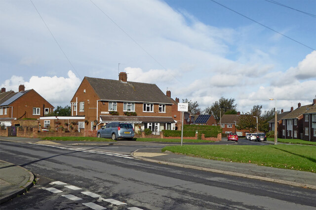
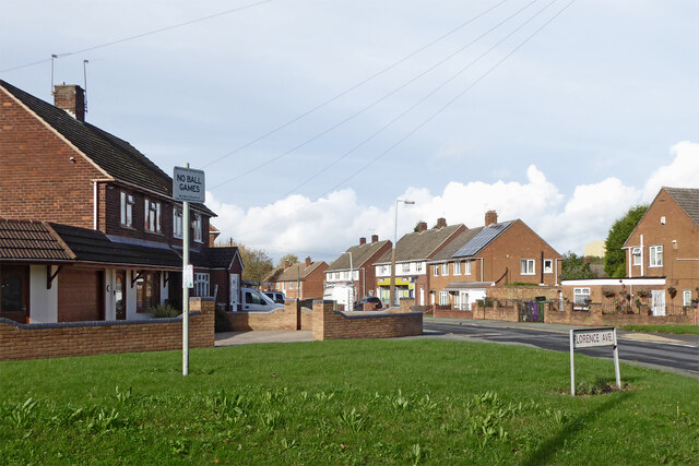
Woodcross is a charming village located in the county of Staffordshire, England. Situated just two miles southeast of the town of Wolverhampton, it falls within the South Staffordshire district. Woodcross is a predominantly residential area with a population of around 4,000 residents.

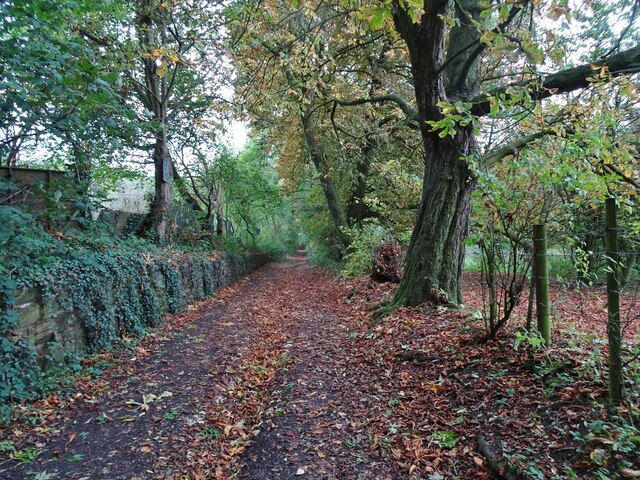
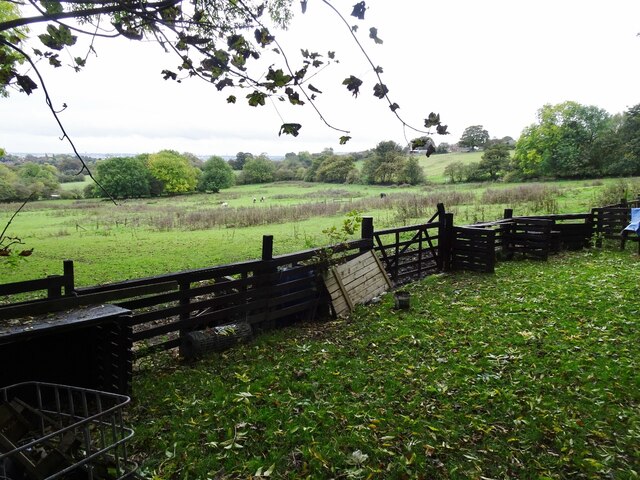
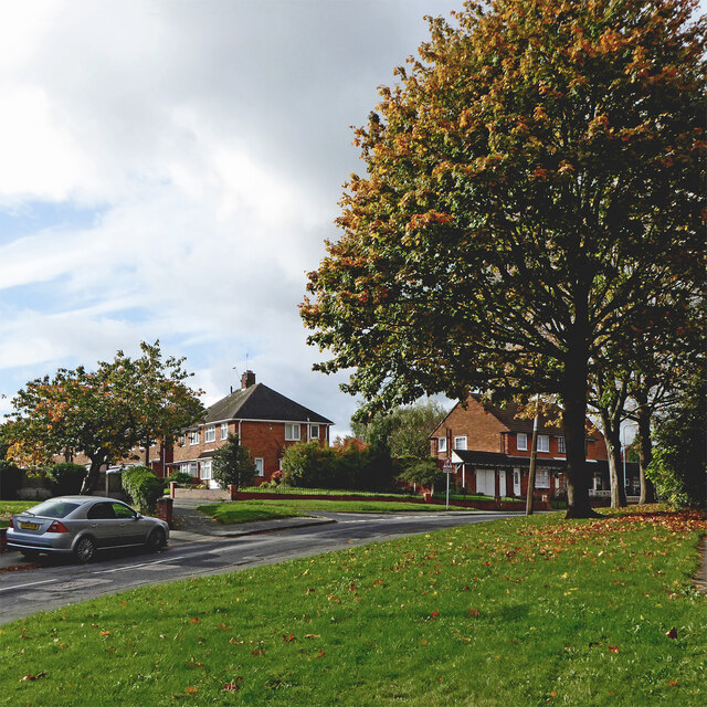
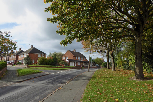
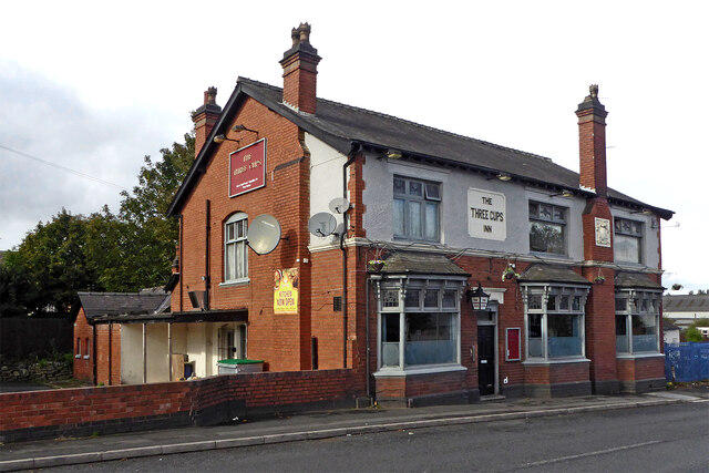
The village boasts a rich history, with evidence of settlement dating back to the medieval period. Many of the buildings in Woodcross display traditional architectural styles, adding to its character and charm. The village is surrounded by picturesque countryside, offering residents and visitors ample opportunities for outdoor activities and leisurely walks.

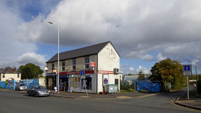
Woodcross is well-served by a range of amenities, including a primary school, a local convenience store, and a handful of small businesses. For a wider selection of shops, restaurants, and entertainment options, residents can easily access Wolverhampton, which is just a short distance away.

Transport links in Woodcross are excellent, with regular bus services connecting the village to Wolverhampton and other nearby towns. The village is also conveniently located near the M6 motorway, providing easy access to Birmingham, Stafford, and other major cities in the West Midlands.

Woodcross offers a close-knit community feel, with various local events and activities organized throughout the year. The village is surrounded by green spaces and parks, providing residents with opportunities for recreation and relaxation. Overall, Woodcross is a welcoming and peaceful place to live, with its combination of historical charm, convenient amenities, and proximity to larger urban centers.

If you have any feedback on the listing, please let us know in the comments section below.
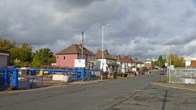
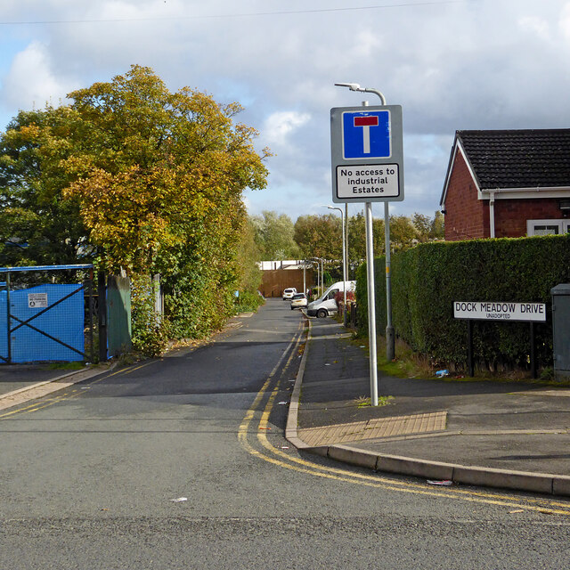
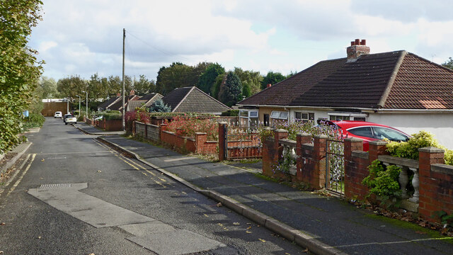
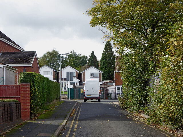
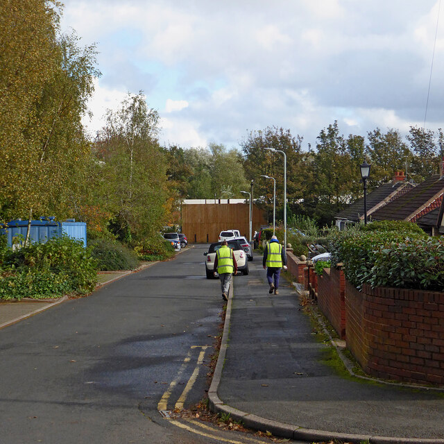
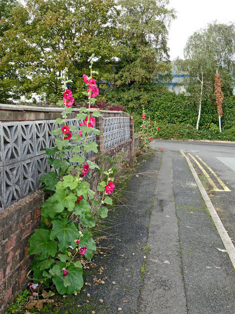
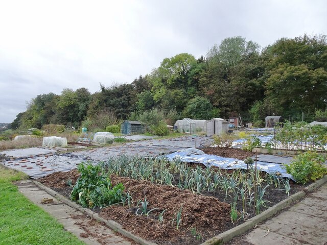
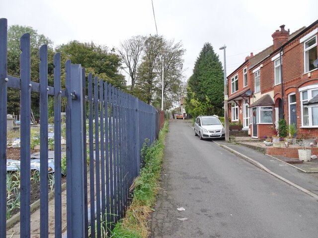
Woodcross Images

Images are sourced within 2km of 52.550424/-2.1044437 or Grid Reference SO9394. Thanks to Geograph Open Source API. All images are credited.

Booster Jab Queue  The view outside the Surgery in Alderwood Precinct off the Northway Estate.
The Booster Covid vaccines (Pfizer) are rollout to the over 50s in Dudley.
Booster Jab Queue
The view outside the Surgery in Alderwood Precinct off the Northway Estate. The Booster Covid vaccines (Pfizer) are rollout to the over 50s in Dudley.
Spring Road in Lanesfield, Wolverhampton Looking north towards Wolverhampton city centre, Spring Road is the A4126 from near Coseley, seen at the junction with Lanesfield Drive.
Spring Road in Lanesfield, Wolverhampton
Looking north towards Wolverhampton city centre, Spring Road is the A4126 from near Coseley, seen at the junction with Lanesfield Drive.
Dock Meadow Drive in Lanesfield, Wolverhampton Looking east from Spring Road.
Dock Meadow Drive in Lanesfield, Wolverhampton
Looking east from Spring Road.
Dock Meadow Drive in Lanesfield, Wolverhampton Looking east from near the junction with Spring Road. There is pedestrian access to Lanesfield Drive at the far end of this unadopted cul-de-sac.
Dock Meadow Drive in Lanesfield, Wolverhampton
Looking east from near the junction with Spring Road. There is pedestrian access to Lanesfield Drive at the far end of this unadopted cul-de-sac.
Dock Meadow Drive in Lanesfield, Wolverhampton Looking west towards the A4126 Spring Road. Dock Meadow Drive is an unadopted cul-de-sac.
Dock Meadow Drive in Lanesfield, Wolverhampton
Looking west towards the A4126 Spring Road. Dock Meadow Drive is an unadopted cul-de-sac.
Dock Meadow Drive in Lanesfield, Wolverhampton Looking east from near the junction with Court Road. There is pedestrian access to Lanesfield Drive at the far end of this unadopted cul-de-sac.
Dock Meadow Drive in Lanesfield, Wolverhampton
Looking east from near the junction with Court Road. There is pedestrian access to Lanesfield Drive at the far end of this unadopted cul-de-sac.
Pretty pavement flower display in Lanesfield Hollyhocks!
This is in Court Road, looking towards Dock Mill Drive, both unadopted roads. The garden behind the wall was considerably less "attractive".
OK, it is not a pretty pavement! ;-)
Pretty pavement flower display in Lanesfield
Hollyhocks! This is in Court Road, looking towards Dock Mill Drive, both unadopted roads. The garden behind the wall was considerably less "attractive". OK, it is not a pretty pavement! ;-)
Allotment Scene The view of the allotments of the Coseley Allotment Society off Rock Road in Hurst Hill, Sedgley.
The view in October 2006 <a href="https://www.geograph.org.uk/photo/268668">SO9293 : Last blooms of autumn</a>.
Allotment Scene
The view of the allotments of the Coseley Allotment Society off Rock Road in Hurst Hill, Sedgley. The view in October 2006 SO9293 : Last blooms of autumn.
Rock Road Scene The view alongside the allotments of the Coseley Allotment Society off Rock Road in Hurst Hill, Sedgley.
Rock Road Scene
The view alongside the allotments of the Coseley Allotment Society off Rock Road in Hurst Hill, Sedgley.
Turls Hill Leafs The view of the lane in Hurst Hill, Sedgley.
Turls Hill Leafs
The view of the lane in Hurst Hill, Sedgley.
Turls Hill Grazing  The view off the lane in Hurst Hill, Sedgley.
Turls Hill Grazing
The view off the lane in Hurst Hill, Sedgley.
Hilton Road and Norbury Crescent in Lanesfield, Wolverhampton Looking north across Hilton Road towards Norbury Crescent. Off to the left is Florence Avenue.
Hilton Road and Norbury Crescent in Lanesfield, Wolverhampton
Looking north across Hilton Road towards Norbury Crescent. Off to the left is Florence Avenue.
Housing in Lanesfield, Wolverhampton Looking north-west along Hilton Road from the junction with Florence Avenue.
Housing in Lanesfield, Wolverhampton
Looking north-west along Hilton Road from the junction with Florence Avenue.
Hilton Road in Lanesfield, Wolverhampton Looking south-west across Hilton Road towards Dresden Close from near the junction with Spring Road.
Hilton Road in Lanesfield, Wolverhampton
Looking south-west across Hilton Road towards Dresden Close from near the junction with Spring Road.
Hilton Road in Lanesfield, Wolverhampton Looking west from near the junction with Spring Road. Dresden Close leads off to the left.
Hilton Road in Lanesfield, Wolverhampton
Looking west from near the junction with Spring Road. Dresden Close leads off to the left.
Dresden Close in Lanesfield, Wolverhampton Looking south-west along this cul-de-sac from the junction with Hilton Road.
Dresden Close in Lanesfield, Wolverhampton
Looking south-west along this cul-de-sac from the junction with Hilton Road.
Corner shop and chippy in Lanesfield, Wolverhampton This is in Spring Road at the junction with Dock Meadow Drive (unadopted).
Corner shop and chippy in Lanesfield, Wolverhampton
This is in Spring Road at the junction with Dock Meadow Drive (unadopted).
The Three Cups Inn in Lanesfield, Wolverhampton This free house is on the A4126 Spring Road in Lanesfield.
The Three Cups Inn in Lanesfield, Wolverhampton
This free house is on the A4126 Spring Road in Lanesfield.
Show me another place!

Woodcross is located at Grid Ref: SO9394 (Lat: 52.550424, Lng: -2.1044437)

Unitary Authority: Wolverhampton

Police Authority: West Midlands

What 3 Words

///beans.knee.verse. Near Bilston, West Midlands

Related Wikis

Woodcross

Woodcross is a residential area of Coseley, West Midlands, England. It is set within the City of Wolverhampton, though the area traditionally existed within...

Spring Vale

Spring Vale is a ward of Wolverhampton City Council, West Midlands, England. It is situated SSE of the city centre, on the city's border with the Metropolitan...

Lanesfield

Lanesfield is a district now within the boundaries of Wolverhampton, specifically in the city council's Spring Vale ward. Lanesfield lies within the Ancient...

Coseley Urban District

Coseley Urban District was a local government district in Staffordshire which was created in 1894. It was made up of the villages of Brierley (now Bradley...

Nearby Amenities

Located within 500m of 52.550424,-2.1044437
Post Box
Operator: Royal Mail
Operator Wikidata: Q638098
Lat/Long: 52.5494115/-2.1106734
Bus Stop
Rookery Rd / Bate St
Bus: yes
Naptan AtcoCode: 43000726802
Naptan Bearing: N
Naptan BusStopType: MKD
Naptan CommonName: Bate St
Naptan Indicator: adj
Naptan NaptanCode: nwmjgmwm
Naptan PlusbusZoneRef: BHAMNWS
Naptan Status: ACT
Naptan StopType: BCT
Naptan Street: ROOKERY RD
Naptan Towards: Bilston
Naptan Verified: no
Public Transport: platform
Route Ref: 223
Source: WMCA
Lat/Long: 52.5542427/-2.1007114
Bus Stop
Rookery Rd / Woodcross Lane
Bus: yes
Naptan AtcoCode: 43000726901
Naptan Bearing: N
Naptan BusStopType: MKD
Naptan CommonName: Woodcross Lane
Naptan Indicator: opp
Naptan Landmark: Medical Centre
Naptan NaptanCode: nwmjgmwp
Naptan PlusbusZoneRef: BHAMNWS
Naptan Status: ACT
Naptan StopType: BCT
Naptan Street: ROOKERY RD
Naptan Towards: Bilston
Naptan Verified: no
Public Transport: platform
Route Ref: 223
Source: WMCA
Lat/Long: 52.552043/-2.0991836
Bus Stop
Woodcross Lane / Health Centre
Bus: yes
Naptan AtcoCode: 43000727001
Naptan Bearing: E
Naptan BusStopType: MKD
Naptan CommonName: Health Centre
Naptan Indicator: adj
Naptan NaptanCode: nwmtjpmg
Naptan PlusbusZoneRef: BHAMNWS
Naptan Status: ACT
Naptan StopType: BCT
Naptan Street: WOODCROSS LANE
Naptan Towards: Bilston
Naptan Verified: no
Public Transport: platform
Route Ref: 223
Source: WMCA
Lat/Long: 52.5516904/-2.0996704
Bus Stop
Woodcross Lane / Health Centre
Bus: yes
Naptan AtcoCode: 43000727002
Naptan Bearing: W
Naptan BusStopType: MKD
Naptan CommonName: Health Centre
Naptan Indicator: opp
Naptan NaptanCode: nwmtjpmj
Naptan PlusbusZoneRef: BHAMNWS
Naptan Status: ACT
Naptan StopType: BCT
Naptan Street: WOODCROSS LANE
Naptan Towards: Sedgley
Naptan Verified: no
Public Transport: platform
Route Ref: 223
Source: WMCA
Lat/Long: 52.5515916/-2.0996259
Bus Stop
Dovedale Rd / Camberley Crescent
NaPTANAreaCode: 43000727301
Bus: yes
Naptan AtcoCode: 43000727301
Naptan Bearing: NW
Naptan BusStopType: MKD
Naptan CommonName: Camberley Crescent
Naptan Indicator: adj
Naptan NaptanCode: nwmjgpaj
Naptan PlusbusZoneRef: BHAMNWS
Naptan Status: ACT
Naptan StopType: BCT
Naptan Street: DOVEDALE RD
Naptan Towards: Bilston, Wolverhampton
Naptan Verified: no
Public Transport: platform
Route Ref: 81;224
Shelter: yes
Shelter Ref: 104205
Source: WMCA
Lat/Long: 52.5496755/-2.1110511
Bus Stop
Dovedale Rd / Camberley Crescent
Bus: yes
Naptan AtcoCode: 43000727302
Naptan Bearing: SE
Naptan BusStopType: MKD
Naptan CommonName: Camberley Crescent
Naptan Indicator: after
Naptan NaptanCode: nwmtwtjw
Naptan PlusbusZoneRef: BHAMNWS
Naptan Status: ACT
Naptan StopType: BCT
Naptan Street: DOVEDALE RD
Naptan Towards: Coseley
Naptan Verified: no
Public Transport: platform
Route Ref: 81;224
Source: WMCA
Lat/Long: 52.550053/-2.1112143
Bus Stop
Mount Rd / Ruskin Avenue
Bus: yes
Naptan AtcoCode: 43000727402
Naptan Bearing: SW
Naptan BusStopType: MKD
Naptan CommonName: Ruskin Avenue
Naptan Indicator: adj
Naptan NaptanCode: nwmjgpap
Naptan PlusbusZoneRef: BHAMNWS
Naptan Status: ACT
Naptan StopType: BCT
Naptan Street: MOUNT RD
Naptan Towards: Sedgley, Wolverhampton
Naptan Verified: no
Public Transport: platform
Route Ref: 81;223
Source: WMCA
Lat/Long: 52.5512687/-2.1090051
Bus Stop
Mount Rd / Ruskin Avenue
Bus: yes
Naptan AtcoCode: 43000727403
Naptan Bearing: NE
Naptan BusStopType: MKD
Naptan CommonName: Ruskin Avenue
Naptan Indicator: opp
Naptan NaptanCode: nwmjgpam
Naptan PlusbusZoneRef: BHAMNWS
Naptan Status: ACT
Naptan StopType: BCT
Naptan Street: MOUNT RD
Naptan Towards: Bilston, Coseley
Naptan Verified: no
Public Transport: platform
Route Ref: 81;223
Source: WMCA
Lat/Long: 52.5512146/-2.109182
Bus Stop
Pugh Rd / Mount Rd
Bus: yes
Naptan AtcoCode: 43000727501
Naptan Bearing: SE
Naptan BusStopType: MKD
Naptan CommonName: Mount Rd
Naptan Indicator: after
Naptan NaptanCode: nwmjgpat
Naptan PlusbusZoneRef: BHAMNWS
Naptan Status: ACT
Naptan StopType: BCT
Naptan Street: PUGH RD
Naptan Towards: Bilston, Coseley
Naptan Verified: no
Public Transport: platform
Route Ref: 81;223
Source: WMCA
Lat/Long: 52.5525745/-2.1064863
Bus Stop
Pugh Rd / Mount Rd
NaPTANAreaCode: 43000727502
Bus: yes
Naptan AtcoCode: 43000727502
Naptan Bearing: NW
Naptan BusStopType: MKD
Naptan CommonName: Mount Rd
Naptan Indicator: before
Naptan NaptanCode: nwmjgpaw
Naptan PlusbusZoneRef: BHAMNWS
Naptan Status: ACT
Naptan StopType: BCT
Naptan Street: PUGH RD
Naptan Towards: Sedgley, Wolverhampton
Naptan Verified: no
Public Transport: platform
Route Ref: 81;223
Shelter: yes
Shelter Ref: 104219
Source: WMCA
Lat/Long: 52.5523759/-2.106423
Bus Stop
Pugh Rd / Dawson Avenue
Bus: yes
Naptan AtcoCode: 43000727601
Naptan Bearing: NW
Naptan BusStopType: MKD
Naptan CommonName: Dawson Avenue
Naptan Indicator: opp
Naptan NaptanCode: nwmjgpda
Naptan PlusbusZoneRef: BHAMNWS
Naptan Status: ACT
Naptan StopType: BCT
Naptan Street: PUGH RD
Naptan Towards: Sedgley, Wolverhampton
Naptan Verified: no
Public Transport: platform
Route Ref: 81;223
Source: WMCA
Lat/Long: 52.5510741/-2.1054945
Bus Stop
Pugh Rd / Dawson Avenue
NaPTANAreaCode: 43000727602
Bus: yes
Naptan AtcoCode: 43000727602
Naptan Bearing: SE
Naptan BusStopType: MKD
Naptan CommonName: Dawson Avenue
Naptan Indicator: adj
Naptan NaptanCode: nwmjgpdg
Naptan PlusbusZoneRef: BHAMNWS
Naptan Status: ACT
Naptan StopType: BCT
Naptan Street: PUGH RD
Naptan Towards: Bilston, Coseley
Naptan Verified: no
Public Transport: platform
Route Ref: 81;223
Shelter: yes
Shelter Ref: 104208
Source: WMCA
Lat/Long: 52.5508857/-2.1050516
Bus Stop
Woodcross St / Bellevue St
NaPTANAreaCode: 43000727701
Bus: yes
Naptan AtcoCode: 43000727701
Naptan Bearing: NE
Naptan BusStopType: MKD
Naptan CommonName: Bellevue St
Naptan Indicator: opp
Naptan Landmark: Bellevue Court Nursing Home
Naptan NaptanCode: nwmjgpdj
Naptan PlusbusZoneRef: BHAMNWS
Naptan Status: ACT
Naptan StopType: BCT
Naptan Street: WOODCROSS ST
Naptan Towards: Wolverhampton
Naptan Verified: no
Public Transport: platform
Route Ref: 81
Shelter: yes
Shelter Ref: 104207
Source: WMCA
Lat/Long: 52.5501123/-2.1053005
Bus Stop
Woodcross St / Bellevue St
NaPTANAreaCode: 43000727702
Bus: yes
Naptan AtcoCode: 43000727702
Naptan Bearing: SW
Naptan BusStopType: MKD
Naptan CommonName: Bellevue St
Naptan Indicator: adj
Naptan Landmark: Bellevue Court Nursing Home
Naptan NaptanCode: nwmjgpdm
Naptan PlusbusZoneRef: BHAMNWS
Naptan Status: ACT
Naptan StopType: BCT
Naptan Street: WOODCROSS ST
Naptan Towards: Coseley
Naptan Verified: no
Public Transport: platform
Route Ref: 81;223
Shelter: yes
Shelter Ref: 104222
Source: WMCA
Lat/Long: 52.5496978/-2.1063319
Bus Stop
Woodcross St / Wathan Avenue
Bus: yes
Naptan AtcoCode: 43000727801
Naptan Bearing: NE
Naptan BusStopType: MKD
Naptan CommonName: Wathan Avenue
Naptan Indicator: opp
Naptan NaptanCode: nwmjgpdp
Naptan PlusbusZoneRef: BHAMNWS
Naptan Status: ACT
Naptan StopType: BCT
Naptan Street: WOODCROSS ST
Naptan Towards: Wolverhampton
Naptan Verified: no
Public Transport: platform
Route Ref: 81;223
Source: WMCA
Lat/Long: 52.548509/-2.1086591
Bus Stop
Woodcross St / Wathan Avenue
Bus: yes
Naptan AtcoCode: 43000727802
Naptan Bearing: SW
Naptan BusStopType: MKD
Naptan CommonName: Wathan Avenue
Naptan Indicator: adj
Naptan NaptanCode: nwmjgpdt
Naptan PlusbusZoneRef: BHAMNWS
Naptan Status: ACT
Naptan StopType: BCT
Naptan Street: WOODCROSS ST
Naptan Towards: Coseley
Naptan Verified: no
Public Transport: platform
Route Ref: 81;223
Source: WMCA
Lat/Long: 52.5484186/-2.1086441
Bus Stop
Dovedale Rd / Falcon Crescent
Bus: yes
Naptan AtcoCode: 43000727902
Naptan Bearing: SE
Naptan BusStopType: MKD
Naptan CommonName: Falcon Crescent
Naptan Indicator: before
Naptan NaptanCode: nwmtawtg
Naptan PlusbusZoneRef: BHAMNWS
Naptan Status: ACT
Naptan StopType: BCT
Naptan Street: DOVEDALE RD
Naptan Towards: Sedgley
Naptan Verified: no
Public Transport: platform
Route Ref: 223;224
Source: WMCA
Lat/Long: 52.5492176/-2.1104158
Bus Stop
Hall Lane / Robert Wynd
Bus: yes
Naptan AtcoCode: 43000728101
Naptan Bearing: NW
Naptan BusStopType: MKD
Naptan CommonName: Robert Wynd
Naptan Indicator: opp
Naptan NaptanCode: nwmjgpgd
Naptan PlusbusZoneRef: BHAMNWS
Naptan Status: ACT
Naptan StopType: BCT
Naptan Street: HALL LANE
Naptan Towards: Wolverhampton
Naptan Verified: no
Public Transport: platform
Route Ref: 81;224
Source: WMCA
Lat/Long: 52.5472508/-2.1082873
Bus Stop
Hall Lane / Robert Wynd
NaPTANAreaCode: 43000728102
Bus: yes
Naptan AtcoCode: 43000728102
Naptan Bearing: SE
Naptan BusStopType: MKD
Naptan CommonName: Robert Wynd
Naptan Indicator: after
Naptan NaptanCode: nwmtwmtw
Naptan PlusbusZoneRef: BHAMNWS
Naptan Status: ACT
Naptan StopType: BCT
Naptan Street: HALL LANE
Naptan Towards: Coseley
Naptan Verified: no
Public Transport: platform
Route Ref: 81;223;224
Shelter: yes
Shelter Ref: 104223
Source: WMCA
Lat/Long: 52.5470445/-2.1076822
Bus Stop
Roberts Wynd / Hall Lane
Bus: yes
Naptan AtcoCode: 43007281001
Naptan Bearing: NE
Naptan BusStopType: MKD
Naptan CommonName: Hall Lane
Naptan Indicator: after
Naptan Landmark: The Horse and Jockey
Naptan NaptanCode: nwmtwtpd
Naptan PlusbusZoneRef: BHAMNWS
Naptan Status: ACT
Naptan StopType: BCT
Naptan Street: ROBERTS WYND
Naptan Towards: Bilston
Naptan Verified: no
Public Transport: platform
Route Ref: 223
Source: WMCA
Lat/Long: 52.5474038/-2.1080222
Bus Stop
Hurst Rd / Hall La
NaPTANAreaCode: 43007282501
Asset Ref: 104206
Bus: yes
Naptan AtcoCode: 43007282501
Naptan Bearing: E
Naptan BusStopType: MKD
Naptan CommonName: Hall La
Naptan Indicator: adj
Naptan Landmark: Adj Post Office
Naptan NaptanCode: nwmtpmdg
Naptan PlusbusZoneRef: BHAMNWS
Naptan Status: ACT
Naptan StopType: BCT
Naptan Street: HURST RD
Naptan Towards: Bilston
Public Transport: platform
Route Ref: 229
Shelter: yes
Shelter Ref: 104206
Source: WMCA
Towards: Bilston
Lat/Long: 52.5460647/-2.1040765
Bus Stop
Hall Lane / Clifton St
Bus: yes
Naptan AtcoCode: 43007752503
Naptan Bearing: SE
Naptan BusStopType: MKD
Naptan CommonName: Clifton St
Naptan Indicator: before
Naptan NaptanCode: nwmpmjda
Naptan PlusbusZoneRef: BHAMNWS
Naptan Status: ACT
Naptan StopType: BCT
Naptan Street: HALL LANE
Naptan Towards: Coseley
Naptan Verified: no
Public Transport: platform
Route Ref: 81;223;224
Source: WMCA
Lat/Long: 52.5460391/-2.1061018
Bus Stop
Mount Rd / Dovedale Rd
Bus: yes
Naptan AtcoCode: 43007753001
Naptan Bearing: NE
Naptan BusStopType: MKD
Naptan CommonName: Dovedale Rd
Naptan Indicator: after
Naptan NaptanCode: nwmpmjdg
Naptan PlusbusZoneRef: BHAMNWS
Naptan Status: ACT
Naptan StopType: BCT
Naptan Street: MOUNT RD
Naptan Towards: Bilston
Naptan Verified: no
Public Transport: platform
Route Ref: 223
Source: WMCA
Lat/Long: 52.54964/-2.1105938
Crossing
Crossing: traffic_signals
Crossing Ref: pelican
Lat/Long: 52.5459549/-2.1044229
Power: tower
Lat/Long: 52.5527125/-2.101762
Power: tower
Lat/Long: 52.5536412/-2.1074517
Turning Circle
Source: bing
Lat/Long: 52.5520734/-2.104929
Noexit: yes
Lat/Long: 52.5545549/-2.1020435
Turning Circle
Source: bing
Lat/Long: 52.5501682/-2.1030572
Turning Circle
Source: bing
Lat/Long: 52.5490489/-2.1045978
Turning Circle
Source: bing
Lat/Long: 52.5517153/-2.1039799
Post Office
Hurst Hill Post Office
Addr Country: GB
Addr Postcode: WV14 9EU
Brand: Post Office
Brand Wikidata: Q1783168
Contact Website: https://www.postoffice.co.uk/branch-finder/1842463/hurst-hill
Ref Pol Id: 5605
Lat/Long: 52.5462368/-2.1042135
Turning Circle
Source: bing
Lat/Long: 52.5483975/-2.1066755
Turning Circle
Source: bing
Lat/Long: 52.5475111/-2.1034314
Turning Circle
Source: bing
Lat/Long: 52.5475651/-2.1022251
Turning Circle
Source: bing
Lat/Long: 52.5508486/-2.0995089
Woodcross
Place: village
Source: OS_OpenData_StreetView
Lat/Long: 52.5497117/-2.1019456
Public Transport: stop_position
Lat/Long: 52.5460917/-2.1062282
Bus Stop
Dovedale Rd / Falcon Crescent
Bus: yes
Naptan AtcoCode: 43000727901
Naptan Bearing: NW
Naptan BusStopType: CUS
Naptan CommonName: Falcon Crescent
Naptan Indicator: after
Naptan NaptanCode: nwmtawtd
Naptan Status: ACT
Naptan StopType: BCT
Naptan Street: DOVEDALE RD
Naptan Towards: Bilston
Public Transport: platform
Route Ref: 223;224
Source: WMCA
Lat/Long: 52.5486493/-2.1100876
Generator Method: photovoltaic
Generator Output Electricity: yes
Generator Source: solar
Generator Type: solar_photovoltaic_panel
Location: roof
Power: generator
Lat/Long: 52.5474472/-2.1031657
Generator Method: photovoltaic
Generator Output Electricity: yes
Generator Source: solar
Generator Type: solar_photovoltaic_panel
Location: roof
Power: generator
Lat/Long: 52.5469857/-2.1044076
Generator Method: photovoltaic
Generator Output Electricity: yes
Generator Source: solar
Generator Type: solar_photovoltaic_panel
Location: roof
Power: generator
Lat/Long: 52.5492585/-2.1076235
Generator Method: photovoltaic
Generator Output Electricity: yes
Generator Source: solar
Generator Type: solar_photovoltaic_panel
Location: roof
Power: generator
Lat/Long: 52.5492626/-2.1084148
Generator Method: photovoltaic
Generator Output Electricity: yes
Generator Source: solar
Generator Type: solar_photovoltaic_panel
Location: roof
Power: generator
Lat/Long: 52.5493327/-2.1085355
Generator Method: photovoltaic
Generator Output Electricity: yes
Generator Source: solar
Generator Type: solar_photovoltaic_panel
Location: roof
Power: generator
Lat/Long: 52.5494028/-2.1086749
Generator Method: photovoltaic
Generator Output Electricity: yes
Generator Source: solar
Generator Type: solar_photovoltaic_panel
Location: roof
Power: generator
Lat/Long: 52.5494681/-2.1087903
Generator Method: photovoltaic
Generator Output Electricity: yes
Generator Source: solar
Generator Type: solar_photovoltaic_panel
Location: roof
Power: generator
Lat/Long: 52.5509131/-2.1091121
Generator Method: photovoltaic
Generator Output Electricity: yes
Generator Source: solar
Generator Type: solar_photovoltaic_panel
Location: roof
Power: generator
Lat/Long: 52.5514497/-2.1010762
Generator Method: photovoltaic
Generator Output Electricity: yes
Generator Source: solar
Generator Type: solar_photovoltaic_panel
Location: roof
Power: generator
Lat/Long: 52.5541455/-2.1003279
Generator Method: photovoltaic
Generator Output Electricity: yes
Generator Source: solar
Generator Type: solar_photovoltaic_panel
Location: roof
Power: generator
Lat/Long: 52.5536302/-2.1082136
Generator Method: photovoltaic
Generator Output Electricity: yes
Generator Source: solar
Generator Type: solar_photovoltaic_panel
Location: roof
Power: generator
Lat/Long: 52.55356/-2.1081197
Tesco Express
Addr Housenumber: 128
Addr Postcode: WV14 9EU
Addr Street: Hurst Road
Brand: Tesco Express
Brand Wikidata: Q98456772
Contact Website: https://www.tesco.com/store-locator/wolverhampton/hurst-rd
Fhrs Id: 622966
Shop: convenience
Lat/Long: 52.5460568/-2.1051001
The data included in this document is from www.openstreetmap.org. The data is made available under ODbL.

Have you been to Woodcross?

Leave your review of Woodcross below (or comments, questions and feedback).