Wivenhoe

Settlement in Essex Colchester

England

Wivenhoe

Wivenhoe, St Mary the Virgin
Wivenhoe, St Mary the Virgin Credit: Dave Kelly

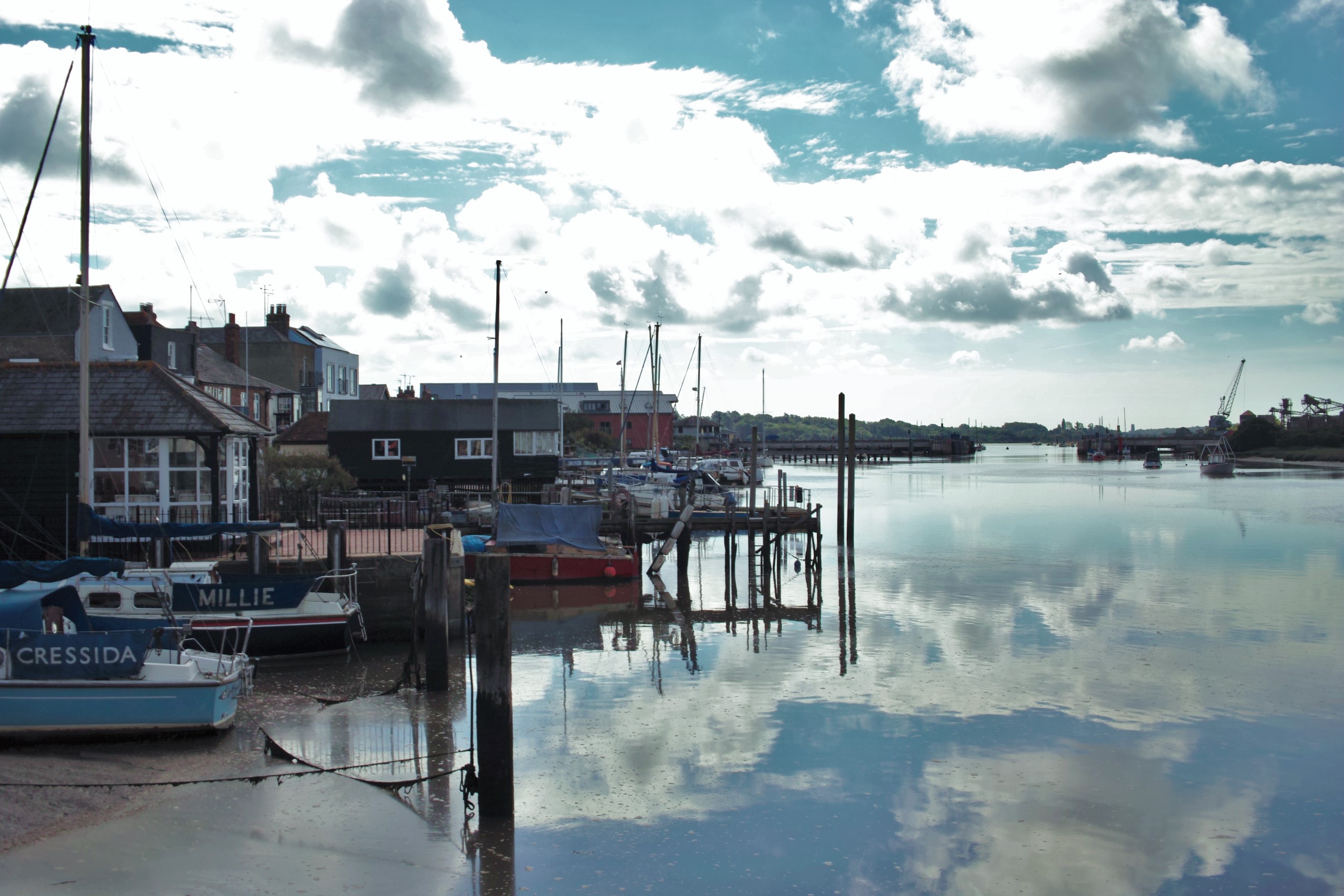
Wivenhoe is a small town and civil parish located in Essex, England. Situated on the banks of the River Colne, it lies approximately five miles southeast of the larger town of Colchester. With a population of around 8,000 people, Wivenhoe is known for its picturesque waterfront and charming atmosphere.

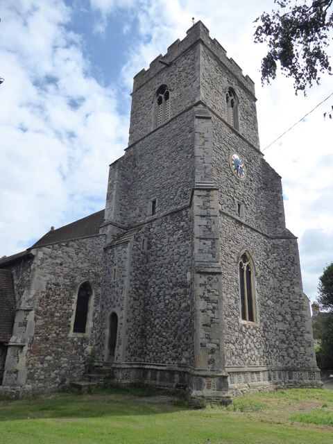
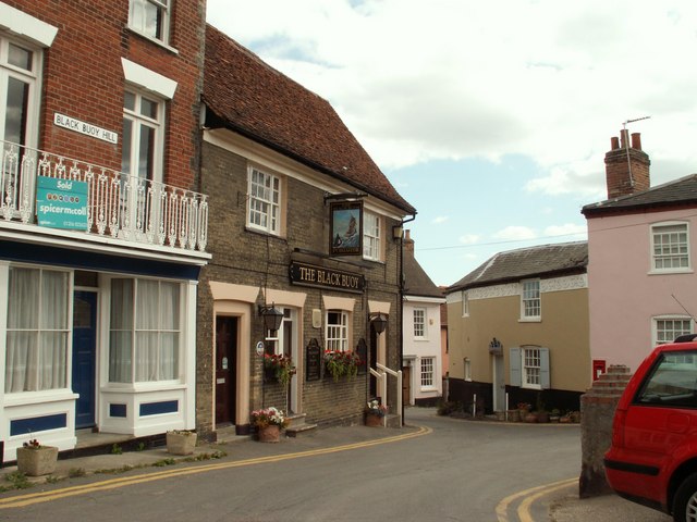
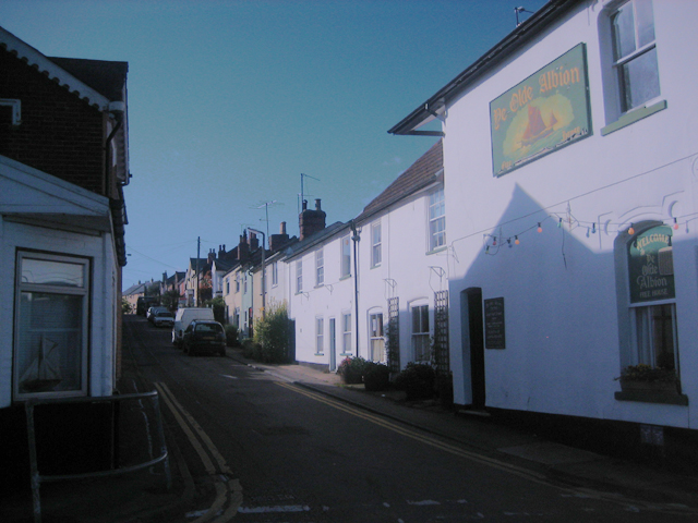
The town's history dates back to Roman times, and it is believed to have been a significant port during the medieval period. Today, Wivenhoe retains much of its historical charm, with a mix of traditional cottages, Georgian houses, and modern developments. The town's architecture reflects its rich heritage, and there are several listed buildings and structures of historical importance, such as the 17th-century Alresford Hall and the Grade II listed Wivenhoe House.

Wivenhoe is also home to the University of Essex, which has a campus located on the outskirts of the town. This adds a vibrant and youthful element to the community, with a diverse range of cultural and academic events taking place throughout the year.

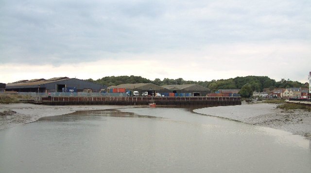
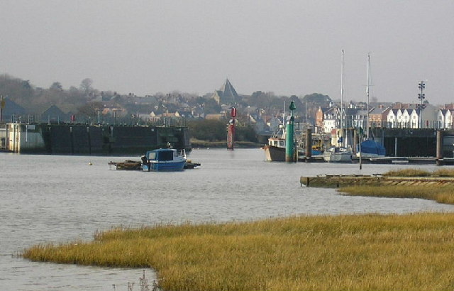
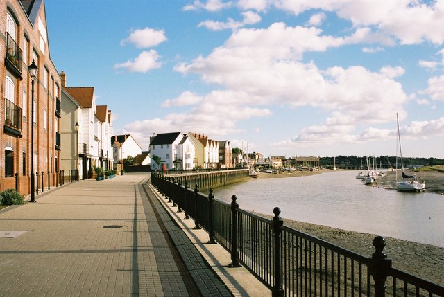
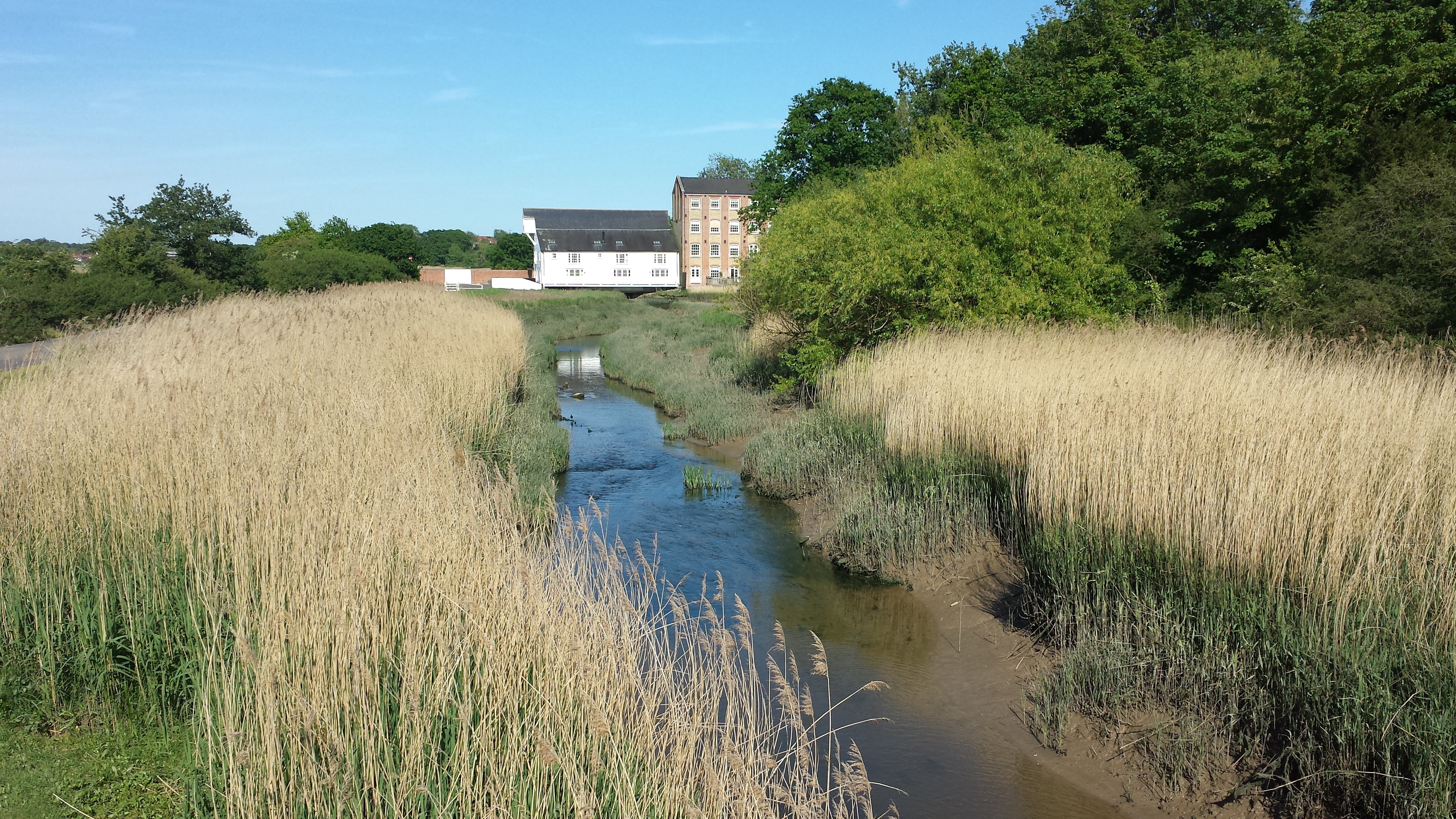
The waterfront area is one of Wivenhoe's main attractions, offering stunning views of the river and a variety of recreational activities. There are several boating clubs and marinas, making it a popular destination for sailing enthusiasts. The town also hosts an annual regatta, drawing crowds from near and far.

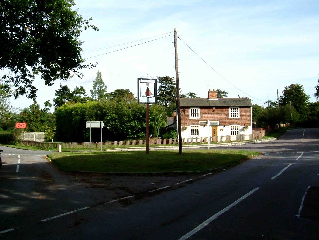
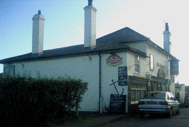
In addition to its natural beauty, Wivenhoe boasts a range of amenities, including independent shops, pubs, and restaurants. The town has a strong sense of community, with various local organizations and events that bring residents together.

Overall, Wivenhoe offers a peaceful and idyllic setting, blending history, nature, and a welcoming community atmosphere.

If you have any feedback on the listing, please let us know in the comments section below.
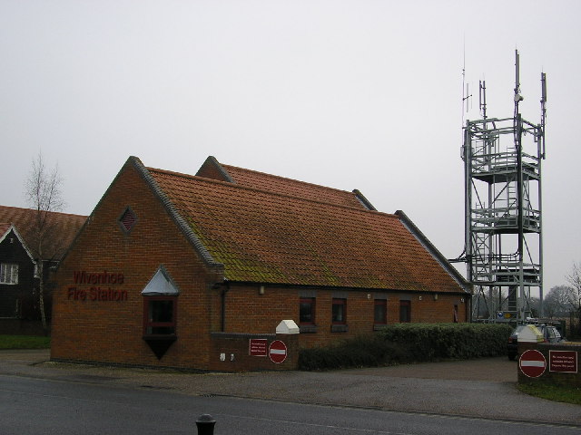
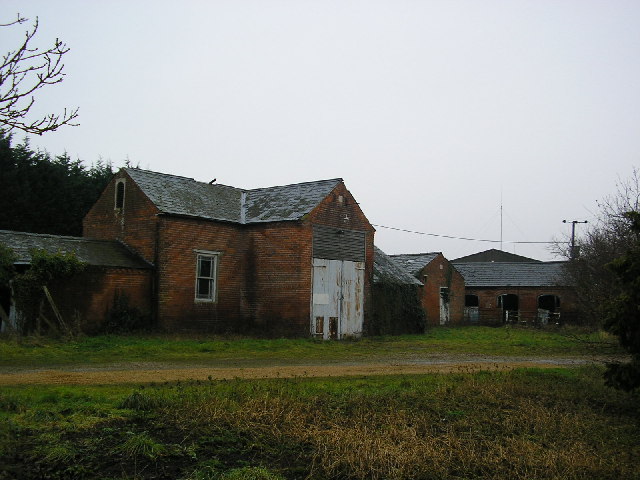
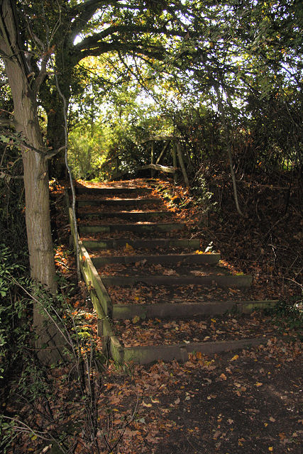
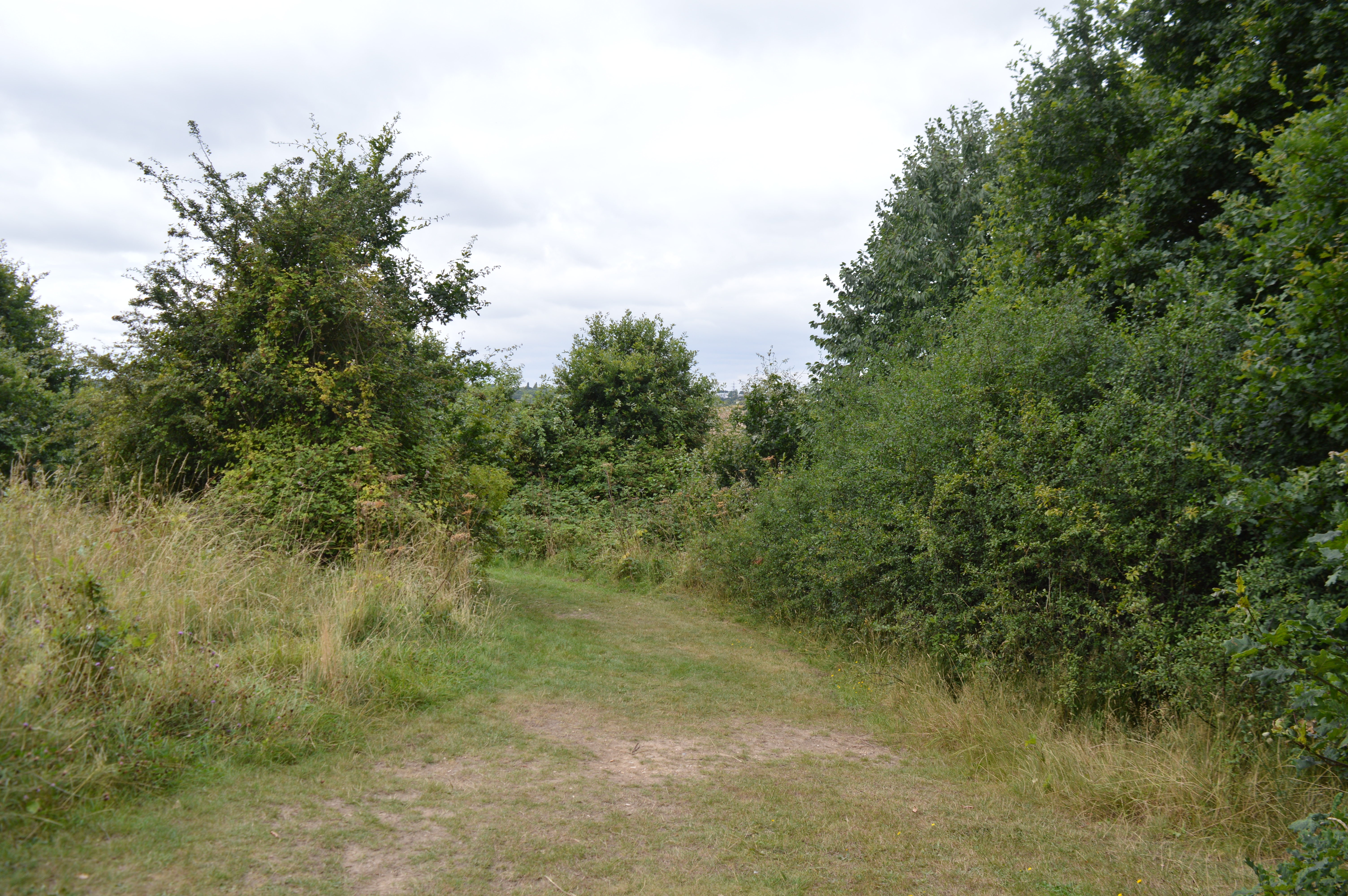
Wivenhoe Images

Images are sourced within 2km of 51.856623/0.959415 or Grid Reference TM0321. Thanks to Geograph Open Source API. All images are credited.

Wivenhoe, St Mary the Virgin
Furneaux Lane near Fingringhoe Furneaux Lane passes through a sand and gravel pit.  Looking at the map, it appears that the road has recently been rerouted.  This image shows a new section of the road.
Furneaux Lane near Fingringhoe
Furneaux Lane passes through a sand and gravel pit. Looking at the map, it appears that the road has recently been rerouted. This image shows a new section of the road.
Rowhedge Quay The quay on the River Colne is no longer in use. The photo was taken from Wivenhoe, on the opposite bank.
Rowhedge Quay
The quay on the River Colne is no longer in use. The photo was taken from Wivenhoe, on the opposite bank.
Mill on Roman River The mill has been recently restored
Mill on Roman River
The mill has been recently restored
The Whalebone & St Andrews Yet another excellent chance to get some good beer & grub after church! It is now thought the bone that was dug up in the 19th century that gave the pub its name was in fact a woolly mammoth bone. The bone on the pub sign is relatively modern.
The Whalebone & St Andrews
Yet another excellent chance to get some good beer & grub after church! It is now thought the bone that was dug up in the 19th century that gave the pub its name was in fact a woolly mammoth bone. The bone on the pub sign is relatively modern.
Not the Ipswich Arms This is a picture of the junction of the Fingeringhoe Rd (left to right) with Weir lane (photographers position) and Rectory Road Rowhedge (in front). The building was originally a Daniels Brewery Ale House, “The Ipswich Arms” this became a Truman pub. After a long period of closure the real ale revival of the early eighties enabled it to re-open as a Free House renamed the "Walnut Tree". However this too eventually closed due to the almost total lack of local trade within walking distance, it is now a private house. The Village sign is for East Donyland District.
Not the Ipswich Arms
This is a picture of the junction of the Fingeringhoe Rd (left to right) with Weir lane (photographers position) and Rectory Road Rowhedge (in front). The building was originally a Daniels Brewery Ale House, “The Ipswich Arms” this became a Truman pub. After a long period of closure the real ale revival of the early eighties enabled it to re-open as a Free House renamed the "Walnut Tree". However this too eventually closed due to the almost total lack of local trade within walking distance, it is now a private house. The Village sign is for East Donyland District.
The Edge of Rowhedge This is the point on Rowhedge Rd where Old Heath becomes Rowhedge. The photo was taken looking towards the South-East.
The Edge of Rowhedge
This is the point on Rowhedge Rd where Old Heath becomes Rowhedge. The photo was taken looking towards the South-East.
Rowhedge Quay in Snow. Rowhedge Quay side with new pontoon, early 2006 Snow cover looking up river. "River Blackwater"
Rowhedge Quay in Snow.
Rowhedge Quay side with new pontoon, early 2006 Snow cover looking up river. "River Blackwater"
Wivenhoe Winter Wivenhoe new homes in early 2006 light snow cover, viewed from Rowhedge Quay.
Wivenhoe Winter
Wivenhoe new homes in early 2006 light snow cover, viewed from Rowhedge Quay.
Sand and gravel pit
Sand and gravel pit
Wivenhoe Fire Station in Colchester Road opposite Vine Drive
Wivenhoe Fire Station
in Colchester Road opposite Vine Drive
Colne Barrier The Colne Barrier spans the River Colne just downstream from Wivenhoe. It was opened in 1993 <span class="nowrap"><a title="http://www.wivenhoe.gov.uk/Walks/Heritage%20Trail_files/Heritage%20Trail.htm" rel="nofollow ugc noopener" href="http://www.wivenhoe.gov.uk/Walks/Heritage%20Trail_files/Heritage%20Trail.htm">Link</a><img style="margin-left:2px;" alt="External link" title="External link - shift click to open in new window" src="https://s1.geograph.org.uk/img/external.png" width="10" height="10"/></span> or 1994 <span class="nowrap"><a title="http://www.environment-agency.gov.uk/commondata/acrobat/ne_floodrisk_3_1153133.pdf" rel="nofollow ugc noopener" href="http://www.environment-agency.gov.uk/commondata/acrobat/ne_floodrisk_3_1153133.pdf">Link</a><img style="margin-left:2px;" alt="External link" title="External link - shift click to open in new window" src="https://s1.geograph.org.uk/img/external.png" width="10" height="10"/></span>. It protects a stretch of river about 4 km long and extending right up to Colchester from tidal surges. Aerial views: <span class="nowrap"><a title="http://www.wivenhoe.gov.uk/About_Wivenhoe/Picture_Gallery/aerial_pictures.htm" rel="nofollow ugc noopener" href="http://www.wivenhoe.gov.uk/About_Wivenhoe/Picture_Gallery/aerial_pictures.htm">Link</a><img style="margin-left:2px;" alt="External link" title="External link - shift click to open in new window" src="https://s1.geograph.org.uk/img/external.png" width="10" height="10"/></span> .

The spire of St Lawrence's Church, Rowhedge <a href="https://www.geograph.org.uk/gridref/TM030215">TM030215</a> can be seen in the centre of the picture.
Colne Barrier
The Colne Barrier spans the River Colne just downstream from Wivenhoe. It was opened in 1993 LinkExternal link or 1994 LinkExternal link. It protects a stretch of river about 4 km long and extending right up to Colchester from tidal surges. Aerial views: LinkExternal link . The spire of St Lawrence's Church, Rowhedge TM030215 can be seen in the centre of the picture.
Keelars Tye
Keelars Tye
Wivenhoe Waterfront The Tidal Colne providing the setting for Wivenhoe.
Wivenhoe Waterfront
The Tidal Colne providing the setting for Wivenhoe.
St. Andrew's church, Fingringhoe, Essex This church has a Norman nave and the rest of the church is 14th century. The Normans used many Roman bricks in their building. It is a very attractive church and stands in a very nice setting.
St. Andrew's church, Fingringhoe, Essex
This church has a Norman nave and the rest of the church is 14th century. The Normans used many Roman bricks in their building. It is a very attractive church and stands in a very nice setting.
'The Black Buoy' inn, Wivenhoe, Essex This is one of the pretty winding streets at Wivenhoe, full of interesting buildings. 'The Black Buoy' is Wivenhoe's oldest inn and has a smugglers' tunnel running from the quay - though we are reliably informed that it is no longer in use.
'The Black Buoy' inn, Wivenhoe, Essex
This is one of the pretty winding streets at Wivenhoe, full of interesting buildings. 'The Black Buoy' is Wivenhoe's oldest inn and has a smugglers' tunnel running from the quay - though we are reliably informed that it is no longer in use.
The Anchor This public house is on the Rowhedge side of the river and faces away from the water.
The Anchor
This public house is on the Rowhedge side of the river and faces away from the water.
Albion Street This street is in the older part of Rowhedge and runsat right angles to the quay.
Albion Street
This street is in the older part of Rowhedge and runsat right angles to the quay.
Show me another place!

Wivenhoe is located at Grid Ref: TM0321 (Lat: 51.856623, Lng: 0.959415)

Administrative County: Essex

District: Colchester

Police Authority: Essex

What 3 Words

///incurs.surpassed.sprouted. Near Wivenhoe, Essex

Nearby Locations

Wivenhoe

Related Wikis

Wivenhoe railway station

Wivenhoe railway station is on the Sunshine Coast Line, a branch of the Great Eastern Main Line, in the East of England, serving the small town of Wivenhoe...

Roman River

The Roman River is a river that flows entirely through the English county of Essex. It is a tributary of the River Colne, flowing into its tidal estuary...
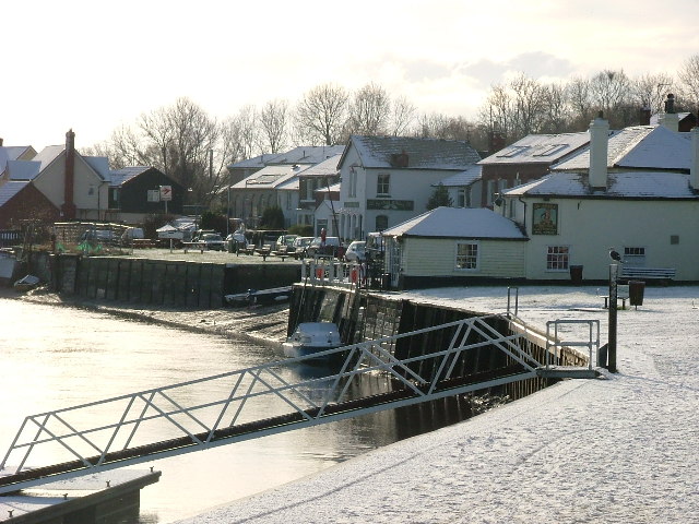
Rowhedge Ironworks

Rowhedge Ironworks was a shipyard situated on the River Colne, and in the village of Rowhedge, in the English county of Essex. It existed from 1904 to...
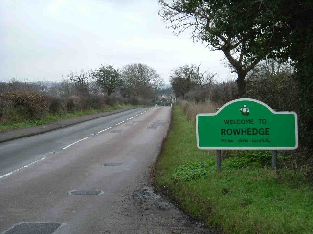
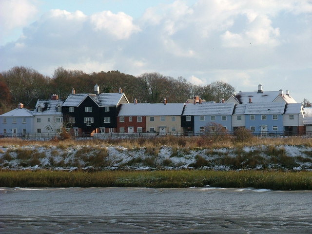
Rowhedge

Rowhedge is a village in the Colchester borough of Essex, England. It is located just over 3 miles (4.8 km) south-east of Colchester town centre and is...

East Donyland

East Donyland is a civil parish in the City of Colchester district of Essex, England. The civil parish includes the village of Rowhedge. The parish touches...

Wivenhoe

Wivenhoe ( WIV-ən-hoh) is a town and civil parish in north-eastern Essex, England, approximately 3 miles (5 km) south-east of Colchester. Historically...

Colne Local Nature Reserve

Colne Local Nature Reserve is a 34.7 hectare Local Nature Reserve in Wivenhoe in Essex. It is owned and managed by Colchester Borough Council.Most of the...
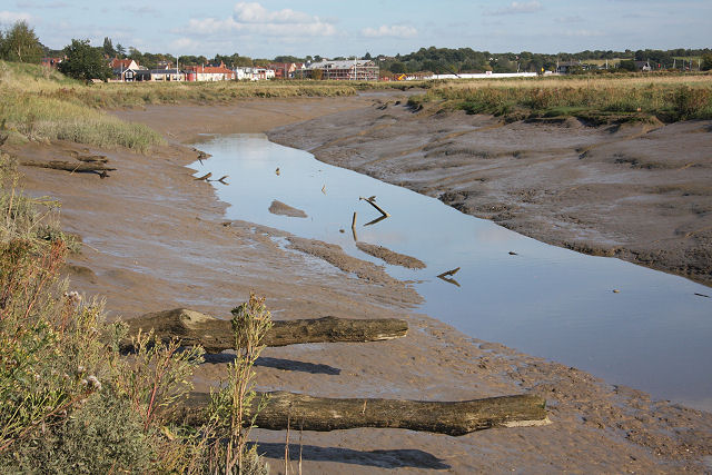
Upper Colne Marshes

Upper Colne Marshes is a 114.1-hectare (282-acre) biological Site of Special Scientific Interest south and west of Wivenhoe in Essex. It lies along stretches...

Nearby Amenities

Located within 500m of 51.856623,0.959415
Source: PGS
Lat/Long: 51.8539246/0.9542808
Source: PGS
Lat/Long: 51.8534988/0.9624661
Wivenhoe
Place: town
Wikidata: Q1757774
Wikipedia: en:Wivenhoe
Lat/Long: 51.8555328/0.9591846
Barrier: bollard
Bollard: removable
Lat/Long: 51.8568812/0.9635238
Note: signs here indicating public footpath under tunnel and adjacent to platform running south
Lat/Long: 51.8579805/0.9540354
Information: guidepost
Ncn Milepost: mills
Sustrans Ref: MP150
Tourism: information
Lat/Long: 51.857079/0.954908
Leisure: slipway
Lat/Long: 51.8533605/0.9589615
Bus Stop
Co-op
Bench: no
Bus: yes
Naptan AtcoCode: 150032002018
Naptan Bearing: S
Naptan CommonName: Park Hotel
Naptan Crossing: De Vere Lane
Naptan Indicator: Opp
Naptan Landmark: Park Hotel
Naptan NaptanCode: esxgjgmg
Naptan PlusbusZoneRef: CLCHSTR
Naptan Street: The Avenue
Naptan Verified: no
Old Name: Park Hotel
Public Transport: platform
Ref: esxgjgmg
Shelter: no
Source: survey
Lat/Long: 51.8595915/0.9597825
Bus Stop
Queens Road
Bench: no
Bus: yes
Naptan AtcoCode: 150032002020
Naptan Bearing: N
Naptan CommonName: Queens Road
Naptan Crossing: Queens Road
Naptan Indicator: Opp
Naptan Landmark: Queens Road
Naptan NaptanCode: esxgjgmp
Naptan PlusbusZoneRef: CLCHSTR
Naptan Street: High Street
Naptan Verified: no
Public Transport: platform
Ref: esxgjgmp
Shelter: no
Source: naptan_import; survey
Lat/Long: 51.8570897/0.9594905
Bus Stop
Post Office
Bench: no
Bus: yes
Naptan AtcoCode: 150032002021
Naptan Bearing: S
Naptan CommonName: Post Office
Naptan Indicator: o/s
Naptan Landmark: Post Office
Naptan NaptanCode: esxgjgmt
Naptan PlusbusZoneRef: CLCHSTR
Naptan Street: High Street
Naptan Verified: no
Public Transport: platform
Ref: esxgjgmt
Shelter: no
Source: naptan_import; survey
Lat/Long: 51.8562104/0.9592673
Bus Stop
Station Road
Bench: no
Bus: yes
Naptan AtcoCode: 150032002022
Naptan Bearing: E
Naptan CommonName: Station Road
Naptan Crossing: High Street
Naptan Indicator: E-bound
Naptan Landmark: Station Road
Naptan NaptanCode: esxgjgmw
Naptan PlusbusZoneRef: CLCHSTR
Naptan Street: Station Road
Naptan Verified: no
Note: FARE STAGE
Public Transport: platform
Ref: esxgjgmw
Shelter: no
Source: naptan_import; survey
Lat/Long: 51.8559964/0.9582017
Bus Stop
Co-op
Bench: yes
Bus: yes
Naptan AtcoCode: 1500IM1278
Naptan Bearing: N
Naptan CommonName: Park Hotel
Naptan Crossing: De Vere Lane
Naptan Indicator: o/s
Naptan Landmark: Park Hotel
Naptan NaptanCode: esxgjgmd
Naptan PlusbusZoneRef: CLCHSTR
Naptan Street: The Avenue
Naptan Verified: no
Old Name: Park Hotel
Public Transport: platform
Ref: esxgjgmd
Shelter: yes
Source: naptan_import; survey
Toilets Wheelchair: no
Wheelchair: yes
Lat/Long: 51.8596344/0.9596674
Bus Stop
Wivenhoe Railway Station
Bench: no
Bus: yes
Naptan AtcoCode: 1500IM1320
Naptan Bearing: E
Naptan CommonName: Wivenhoe Railway Station
Naptan Indicator: o/s
Naptan Landmark: Wivenhoe Railway Station
Naptan NaptanCode: esxgjgpa
Naptan PlusbusZoneRef: CLCHSTR
Naptan Street: Station Road
Naptan Verified: no
Public Transport: platform
Ref: esxgjgpa
Shelter: no
Source: naptan_import; survey
Lat/Long: 51.8564767/0.956351
Maxheight: 2.2
Lat/Long: 51.8565399/0.9583575
Post Box
Collection Times: Mo-Fr 17:15; Sa 12:00
Operator: Royal Mail
Post Box Type: pillar
Ref: CO7 3041
Royal Cypher: EIIR
Royal Cypher Wikidata: Q33102113
Source: survey
Lat/Long: 51.8562724/0.9592747
Padgets LC
Railway: crossing
Lat/Long: 51.8558259/0.9617294
Power: pole
Lat/Long: 51.8557145/0.965452
Power: pole
Lat/Long: 51.8557529/0.9639425
Barrier: bollard
Bollard: removable
Lat/Long: 51.8546384/0.9573146
Barrier: bollard
Lat/Long: 51.8550096/0.9585271
Atm
Lat/Long: 51.8597003/0.9598871
Post Box
Collection Times: Mo-Fr 17:00; Sa 10:30
Operator: Royal Mail
Post Box Type: lamp
Ref: CO7 63
Royal Cypher: EIIR
Royal Cypher Wikidata: Q33102113
Source: survey
Lat/Long: 51.8564585/0.9564056
Post Box
Collection Times: Mo-Fr 09:00; Sa 07:00
Operator: Royal Mail
Post Box Type: wall
Ref: CO7 121D
Royal Cypher: VR
Royal Cypher Wikidata: Q33102356
Source: survey
Lat/Long: 51.8545595/0.9598764
Entrance: main
Lat/Long: 51.8606439/0.9602409
Entrance: main
Lat/Long: 51.8608529/0.9599823
Entrance: main
Lat/Long: 51.8548824/0.9588885
Barrier: bollard
Source: survey; Bing
Lat/Long: 51.8573673/0.9651991
Bench
Backrest: yes
Mapillary: 2906698659649412
Survey Date: 2016-04-23
Lat/Long: 51.8543762/0.9586801
Bench
Backrest: yes
Mapillary: 2906698659649412
Survey Date: 2016-04-23
Lat/Long: 51.8543924/0.958625
Bench
Lat/Long: 51.8544121/0.9585734
Bench
Lat/Long: 51.8544268/0.9585281
Bench
Backrest: yes
Covered: yes
Mapillary: 369156144433976
Survey Date: 2016-05-20
Lat/Long: 51.854445/0.9584124
Bench
Backrest: yes
Mapillary: 492320558474937
Survey Date: 2016-05-20
Lat/Long: 51.8544455/0.9584822
Bench
Lat/Long: 51.8545564/0.9573604
Bench
Lat/Long: 51.8547676/0.955838
Fast Food
Steam
Addr City: Wivenhoe
Addr Housename: Wivenhoe Railway Station
Addr Postcode: CO7 9DJ
Addr Street: Station Road
Fhrs Id: 136601
Source: knowledge
Source Addr: fhrs
Source Name: fhrs
Lat/Long: 51.8565252/0.9561729
Wivenhoe Bowls Club
Addr Postcode: CO7 9AT
Addr Street: Woodland Way
Fhrs Id: 136580
Fixme: street conflicts with nearby street? confirm
Source: knowledge
Source Addr: fhrs
Lat/Long: 51.8597502/0.9581879
Dinners Direct
Addr Postcode: CO7 9DP
Addr Street: Brook Street
Shop: wholesale
Lat/Long: 51.855527/0.9614782
Scoffs
Addr Postcode: CO7 9DP
Addr Street: Brook Street
Shop: wholesale
Lat/Long: 51.8557109/0.9614085
Fast Food
1st Village Pizzaria
Addr Postcode: CO7 9DP
Addr Street: Brook Street
Cuisine: pizza
Fhrs Id: 142895
Lat/Long: 51.8556098/0.9615103
Recycling
Recycling Cans: yes
Recycling Clothes: yes
Recycling Glass: yes
Lat/Long: 51.8563368/0.9560924
Ferry Marsh
Information: board
Note: Colchester Borough Council, Colne Local Nature Reserve
Source: survey; gps
Tourism: information
Lat/Long: 51.8581097/0.953465
Barrier: kissing_gate
Foot: yes
Source: survey
Lat/Long: 51.8581323/0.9534387
Post Box
Collection Times: Mo-Fr 17:15; Sa 12:00
Operator: Royal Mail
Post Box Type: pillar
Ref: CO7 304
Royal Cypher: EIIR
Royal Cypher Wikidata: Q33102113
Source: survey
Lat/Long: 51.8562634/0.9592737
Barrier: bollard
Bicycle: yes
Foot: yes
Source: survey
Lat/Long: 51.8591025/0.9562805
Wivenhoe Junction
Historic Railway: junction
Railway: site
Lat/Long: 51.8555596/0.9636521
Railway: crossing
Lat/Long: 51.855805/0.9617166
Addr Housenumber: 24
Addr Street: The Avenue
Building: house
Lat/Long: 51.8607754/0.9600501
Wivenhoe
Naptan AtcoCode: 9100WIVENHO
Network: National Rail
Network Website: https://www.nationalrail.co.uk/stations/wiv/
Network Wikidata: Q26334
Railway: station
Ref Crs: WIV
Wikidata: Q2873893
Wikipedia: en:Wivenhoe railway station
Lat/Long: 51.8565976/0.9562415
Waste Basket
Source: survey
Lat/Long: 51.8579163/0.9580046
Bench
Backrest: yes
Source: survey; bing
Lat/Long: 51.8583078/0.9578892
Waste Basket
Source: survey
Lat/Long: 51.8589692/0.9580513
Waste Basket
Source: survey
Waste: dog_excrement
Lat/Long: 51.8592459/0.9579387
Waste Basket
Note: position is approximate
Source: survey
Waste: dog_excrement
Lat/Long: 51.8593188/0.9599346
Notice Board
Wivenhoe Town Council
Source: survey
Lat/Long: 51.8573073/0.9595787
Entrance: main
Lat/Long: 51.85735/0.9594993
Waste Basket
Source: survey
Lat/Long: 51.8566396/0.9592709
Bicycle Parking
Bicycle Parking: stands
Capacity: 8
Source: survey
Lat/Long: 51.8566522/0.9591839
Waste Basket
Waste: dog_excrement
Lat/Long: 51.856829/0.9584055
Wivenhoe
Public Transport: stop_position
Train: yes
Lat/Long: 51.8565444/0.9564743
Barrier: bollard
Bollard: removable
Source: gps
Lat/Long: 51.8549783/0.9529433
Taylor Lane
Office: accountant
Lat/Long: 51.8553116/0.9611698
Wivgen
Website: http://wivgen.com)
Lat/Long: 51.8555685/0.9614944
Cutting Corners
Shop: frame
Lat/Long: 51.8554227/0.9614568
Dentist
Essex Denture Centre
Lat/Long: 51.8553448/0.9611805
Approach Works
Shop: wholesale
Lat/Long: 51.8552686/0.9611537
openspace
Website: http://www.openspace.uk.com/
Lat/Long: 51.855643/0.961371
Wivenhoe Gallery
Shop: art
Lat/Long: 51.8553729/0.961438
Rocktape
Shop: wholesale
Lat/Long: 51.8555469/0.9612959
A & R Blinds
Shop: window_blind
Lat/Long: 51.8555535/0.9612369
Queens Road
Naptan AtcoCode: 150032002019
Naptan NaptanCode: esxgjgmj
Naptan Verified: no
Public Transport: platform
Source: naptan_import
Lat/Long: 51.8574831/0.9597442
Barrier: bollard
Lat/Long: 51.8546851/0.9617114
Bicycle Parking
Lat/Long: 51.8533945/0.9633945
Barrier: bollard
Foot: yes
Lat/Long: 51.8539139/0.9624403
Barrier: bollard
Lat/Long: 51.8536965/0.9625483
Bicycle Parking
Capacity: 6
Lat/Long: 51.8536895/0.9626126
Addr City: Wivenhoe
Addr Housenumber: 7
Addr Postcode: CO7 9GS
Addr Street: Pearl Walk
Lat/Long: 51.8536489/0.962226
Grit Bin
Lat/Long: 51.8535437/0.9621915
Addr City: Wivenhoe
Addr Housenumber: 6
Addr Postcode: CO7 9GS
Addr Street: Pearl Walk
Lat/Long: 51.8536479/0.9619374
Addr City: Wivenhoe
Addr Housenumber: 12-17
Addr Postcode: CO7 9GT
Addr Street: Lord Nelson Court
Lat/Long: 51.8536513/0.9619053
Addr City: Wivenhoe
Addr Housenumber: 5
Addr Postcode: CO7 9GS
Addr Street: Pearl Walk
Lat/Long: 51.8536576/0.9618475
Bench
Backrest: yes
Mapillary: 2980301768904645
Survey Date: 2017-05-04
Lat/Long: 51.8532198/0.9614774
Bench
Backrest: yes
Mapillary: 2980301768904645
Survey Date: 2017-05-04
Lat/Long: 51.8532214/0.9614378
Bench
Backrest: yes
Mapillary: 961643354577991
Survey Date: 2017-05-04
Lat/Long: 51.8533391/0.9614848
Bench
Backrest: yes
Mapillary: 577930249787971
Survey Date: 2017-05-04
Lat/Long: 51.8533399/0.9614425
Bench
Backrest: yes
Mapillary: 324107575800641
Survey Date: 2017-05-04
Lat/Long: 51.8535669/0.9621178
Bench
Lat/Long: 51.8535809/0.9619488
Bench
Lat/Long: 51.8535958/0.9617946
Bench
Backrest: yes
Mapillary: 1121115251728268
Survey Date: 2017-05-04
Lat/Long: 51.8536124/0.961635
Addr City: Wivenhoe
Addr Housenumber: 36
Addr Postcode: CO7 9FF
Addr Street: Walter Radcliffe Road
Lat/Long: 51.8538611/0.9623233
Addr City: Wivenhoe
Addr Housenumber: 30
Addr Postcode: CO7 9FF
Addr Street: Walter Radcliffe Road
Lat/Long: 51.8540717/0.9617596
Addr City: Wivenhoe
Addr Housenumber: 32
Addr Postcode: CO7 9FF
Addr Street: Walter Radcliffe Road
Lat/Long: 51.8540658/0.962024
Addr City: Wivenhoe
Addr Housenumber: 7-11
Addr Postcode: CO7 9GT
Addr Street: Lord Nelson Court
Lat/Long: 51.8537963/0.9615834
Addr City: Wivenhoe
Addr Housenumber: 3
Addr Postcode: CO7 9GS
Addr Street: Pearl Walk
Lat/Long: 51.853882/0.9616076
Addr City: Wivenhoe
Addr Housenumber: 2
Addr Postcode: CO7 9GS
Addr Street: Pearl Walk
Lat/Long: 51.8539095/0.9616153
Addr City: Wivenhoe
Addr Housenumber: 1
Addr Postcode: CO7 9GS
Addr Street: Pearl Walk
Lat/Long: 51.8539736/0.9616335
Addr City: Wivenhoe
Addr Housenumber: 1-6
Addr Postcode: CO7 9GT
Addr Street: Lord Nelson Court
Lat/Long: 51.85395/0.9616268
Addr City: Wivenhoe
Addr Housenumber: 4
Addr Postcode: CO7 9GS
Addr Street: Pearl Walk
Lat/Long: 51.8536796/0.9616444
Joan Hickson O.B.E.
Historic: memorial
Inscription: 1958 -1998 Joan Hickson O.B.E. Actress Lived Here
Memorial: blue_plaque
Lat/Long: 51.8547213/0.9592827
Defibrillator
Access: yes
Defibrillator Location: on wall of The Nottage Maritime Institute
Emergency: defibrillator
Indoor: no
Ref GB The Circuit: 00FEDC00-A701-43F8-AD57-AE1901282518
Lat/Long: 51.854489/0.9586338
Building: bunker
Bunker Type: pillbox
Military: bunker
Lat/Long: 51.8527442/0.9608697
Bicycle Parking
Bicycle Parking: stands
Capacity: 20
Covered: yes
Supervised: no
Lat/Long: 51.8566901/0.9555966
Bench
Lat/Long: 51.8540008/0.9615172
Bench
Backrest: yes
Mapillary: 455733995523765
Survey Date: 2017-05-04
Lat/Long: 51.8540422/0.9614099
Bench
Lat/Long: 51.8540256/0.9613509
Cook's Shipyard Site
Information: board
Tourism: information
Lat/Long: 51.8540272/0.9614716
Defibrillator
Access: yes
Defibrillator Location: On exterior of side wall of Co-Op (south side, or right side when facing store entrance)
Emergency: defibrillator
Indoor: no
Ref GB The Circuit: DD66DEE4-B87A-41B6-AD06-AE9700A9682B
Lat/Long: 51.8596406/0.9600254
Crossing
Crossing: marked
Crossing Island: no
Lat/Long: 51.8599258/0.9597647
The Maurice Britton Walk
Information: board
Tourism: information
Lat/Long: 51.8566632/0.9591651
Parking Space
Capacity: 2
Parking Space: disabled
Lat/Long: 51.8564921/0.955848
Access: private
Leisure: slipway
Lat/Long: 51.8543192/0.9582006
Generator Method: photovoltaic
Generator Output Electricity: yes
Generator Source: solar
Generator Type: solar_photovoltaic_panel
Location: roof
Power: generator
Lat/Long: 51.8569506/0.9587797
Generator Method: photovoltaic
Generator Output Electricity: yes
Generator Solar Modules: 10
Generator Source: solar
Generator Type: solar_photovoltaic_panel
Location: roof
Power: generator
Lat/Long: 51.8534219/0.9631182
Generator Method: photovoltaic
Generator Output Electricity: yes
Generator Solar Modules: 10
Generator Source: solar
Generator Type: solar_photovoltaic_panel
Location: roof
Power: generator
Lat/Long: 51.8549626/0.9623243
Generator Method: photovoltaic
Generator Output Electricity: yes
Generator Solar Modules: 8
Generator Source: solar
Generator Type: solar_photovoltaic_panel
Location: roof
Power: generator
Lat/Long: 51.8551308/0.9625764
Generator Method: photovoltaic
Generator Output Electricity: yes
Generator Source: solar
Generator Type: solar_photovoltaic_panel
Location: roof
Power: generator
Lat/Long: 51.8552989/0.9627964
Generator Method: photovoltaic
Generator Output Electricity: yes
Generator Source: solar
Generator Type: solar_photovoltaic_panel
Location: roof
Power: generator
Lat/Long: 51.8569465/0.9611455
Generator Method: photovoltaic
Generator Output Electricity: yes
Generator Source: solar
Generator Type: solar_photovoltaic_panel
Location: roof
Power: generator
Lat/Long: 51.8569332/0.9612125
Generator Method: photovoltaic
Generator Output Electricity: yes
Generator Solar Modules: 7
Generator Source: solar
Generator Type: solar_photovoltaic_panel
Location: roof
Power: generator
Lat/Long: 51.8575105/0.9613225
Generator Method: photovoltaic
Generator Output Electricity: yes
Generator Solar Modules: 6
Generator Source: solar
Generator Type: solar_photovoltaic_panel
Location: roof
Power: generator
Lat/Long: 51.8571047/0.9620655
Generator Method: photovoltaic
Generator Output Electricity: yes
Generator Solar Modules: 14
Generator Source: solar
Generator Type: solar_photovoltaic_panel
Location: surface
Power: generator
Lat/Long: 51.856794/0.964981
Generator Method: photovoltaic
Generator Output Electricity: yes
Generator Solar Modules: 10
Generator Source: solar
Generator Type: solar_photovoltaic_panel
Location: roof
Power: generator
Lat/Long: 51.8576861/0.9640637
Generator Method: photovoltaic
Generator Output Electricity: yes
Generator Solar Modules: 14
Generator Source: solar
Generator Type: solar_photovoltaic_panel
Location: roof
Power: generator
Lat/Long: 51.8578402/0.9641629
Generator Method: photovoltaic
Generator Output Electricity: yes
Generator Source: solar
Generator Type: solar_photovoltaic_panel
Location: roof
Power: generator
Lat/Long: 51.8573614/0.9647503
Generator Method: photovoltaic
Generator Output Electricity: yes
Generator Solar Modules: 7
Generator Source: solar
Generator Type: solar_photovoltaic_panel
Location: roof
Power: generator
Lat/Long: 51.8575321/0.964399
Generator Method: photovoltaic
Generator Output Electricity: yes
Generator Source: solar
Generator Type: solar_photovoltaic_panel
Location: roof
Power: generator
Lat/Long: 51.8575238/0.9644526
Generator Method: photovoltaic
Generator Output Electricity: yes
Generator Solar Modules: 6
Generator Source: solar
Generator Type: solar_photovoltaic_panel
Location: roof
Power: generator
Lat/Long: 51.8576265/0.9650159
Generator Method: photovoltaic
Generator Output Electricity: yes
Generator Source: solar
Generator Type: solar_photovoltaic_panel
Location: roof
Power: generator
Lat/Long: 51.8592118/0.9650655
Generator Method: photovoltaic
Generator Output Electricity: yes
Generator Source: solar
Generator Type: solar_photovoltaic_panel
Location: roof
Power: generator
Lat/Long: 51.8594379/0.9636439
Generator Method: photovoltaic
Generator Output Electricity: yes
Generator Solar Modules: 15
Generator Source: solar
Generator Type: solar_photovoltaic_panel
Location: roof
Power: generator
Lat/Long: 51.8596218/0.9641093
Generator Method: photovoltaic
Generator Output Electricity: yes
Generator Solar Modules: 8
Generator Source: solar
Generator Type: solar_photovoltaic_panel
Location: roof
Power: generator
Lat/Long: 51.8592159/0.9643641
Generator Method: photovoltaic
Generator Output Electricity: yes
Generator Solar Modules: 8
Generator Source: solar
Generator Type: solar_photovoltaic_panel
Location: roof
Power: generator
Lat/Long: 51.8592383/0.9644352
Generator Method: photovoltaic
Generator Output Electricity: yes
Generator Source: solar
Generator Type: solar_photovoltaic_panel
Location: roof
Power: generator
Lat/Long: 51.8597833/0.9608719
Generator Method: photovoltaic
Generator Output Electricity: yes
Generator Solar Modules: 7
Generator Source: solar
Generator Type: solar_photovoltaic_panel
Location: roof
Power: generator
Lat/Long: 51.859775/0.9609577
Generator Method: photovoltaic
Generator Output Electricity: yes
Generator Source: solar
Generator Type: solar_photovoltaic_panel
Location: roof
Power: generator
Lat/Long: 51.8600715/0.9631196
Generator Method: photovoltaic
Generator Output Electricity: yes
Generator Solar Modules: 18
Generator Source: solar
Generator Type: solar_photovoltaic_panel
Location: roof
Power: generator
Lat/Long: 51.8600268/0.9629372
Sir John Martin-Harvey
Historic: memorial
Inscription: Essex County Council Sir John Martin-Harvey 1863-1944 Actor - Manager lived here
Memorial: blue_plaque
Lat/Long: 51.8544099/0.9590563
Charging Station
Authentication App: yes
Capacity: 1
Fee: yes
Motorcar: yes
Network: Charge My Street
Operator: William Loveless Hall
Payment App: yes
Ref: EG-08373
Socket Type2: 1
Socket Type2 Current: 32
Socket Type2 Output: 22kW
Socket Type2 Voltage: 415
Lat/Long: 51.8577393/0.9594308
Charging Station
Authentication App: yes
Capacity: 1
Fee: yes
Motorcar: yes
Network: Charge My Street
Operator: William Loveless Hall
Payment App: yes
Ref: EG-08375
Socket Type2: 1
Socket Type2 Current: 32
Socket Type2 Output: 22kW
Socket Type2 Voltage: 415
Lat/Long: 51.857742/0.9594208
Defibrillator
Access: yes
Defibrillator Location: on front of building to right of entrance when building viewed from road
Emergency: defibrillator
Indoor: no
Ref GB The Circuit: 148DB8A4-8E62-447D-AA92-B11600E063BF
Lat/Long: 51.8573807/0.9595156
Defibrillator
Access: yes
Defibrillator Location: on front right side of building, facing building from road
Emergency: defibrillator
Indoor: no
Ref GB The Circuit: 21405235-8A1F-4882-90BB-AF08007ED32E
Lat/Long: 51.8578795/0.9594288
Waste Basket
Lat/Long: 51.8555448/0.9589987
The data included in this document is from www.openstreetmap.org. The data is made available under ODbL.

Have you been to Wivenhoe?

Leave your review of Wivenhoe below (or comments, questions and feedback).