Witcombe

Settlement in Somerset South Somerset

England

Witcombe

Town Tree Lane
Town Tree Lane Credit: Sarah Charlesworth

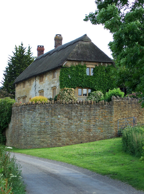
Witcombe is a charming village located in the county of Somerset, England. Situated amidst rolling hills and picturesque countryside, it is a tranquil and idyllic retreat for those seeking a peaceful escape. With a population of around 500 residents, Witcombe exudes a close-knit community atmosphere.

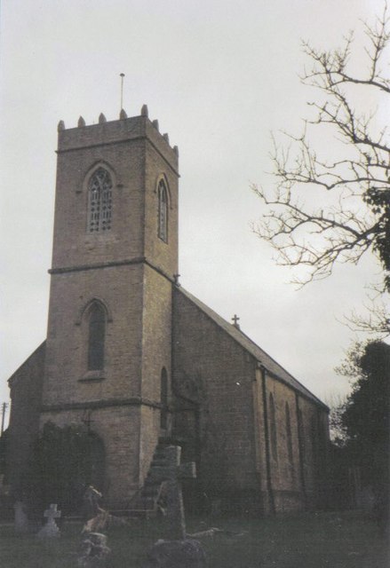
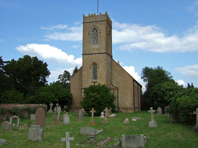
One of the notable highlights of Witcombe is its rich historical heritage. The village is home to several ancient landmarks, including St. Andrew's Church, a beautiful Grade II listed building dating back to the 12th century. The church's stunning architecture and intricate stained glass windows attract visitors from near and far.

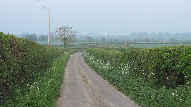
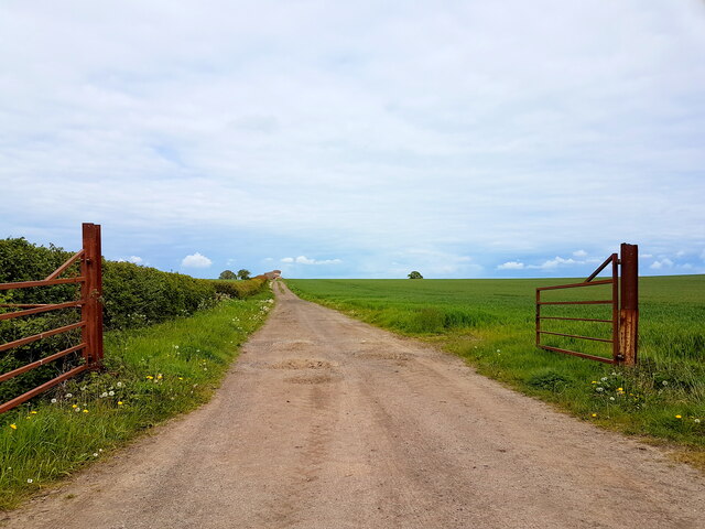
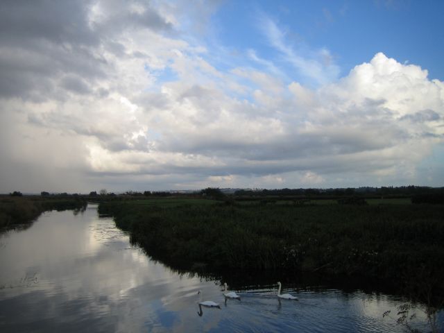
Nature enthusiasts will also find plenty to explore in Witcombe. The village is surrounded by sprawling meadows and verdant woodland, offering ample opportunities for walking, hiking, and cycling. The nearby Witcombe Reservoir is a popular spot for birdwatching and fishing, while Witcombe Cider Festival, held annually, celebrates the area's apple orchards and traditional cider production.

Witcombe enjoys a close proximity to larger towns and cities, making it an ideal base for day trips and excursions. The vibrant city of Bristol is just a short drive away, offering a multitude of cultural attractions, shopping centers, and dining options. Additionally, the Mendip Hills, an Area of Outstanding Natural Beauty, are within easy reach, providing breathtaking landscapes and an array of outdoor activities.

In summary, Witcombe is a charming village in Somerset that offers a blend of natural beauty, historical landmarks, and a warm community ambiance. Whether you seek a peaceful retreat or a starting point for exploring the surrounding area, Witcombe is a hidden gem waiting to be discovered.

If you have any feedback on the listing, please let us know in the comments section below.

Witcombe Images

Images are sourced within 2km of 50.991717/-2.745598 or Grid Reference ST4721. Thanks to Geograph Open Source API. All images are credited.

Town Tree Lane
Town Tree Lane
B3165 north of Stapleton (aka Long Load Road)
Farmland, Stapleton There is a gas pipeline marker in the hedge.
Farmland, Stapleton
There is a gas pipeline marker in the hedge.
Town Tree Lane No through road, heading down to the moors.
Town Tree Lane
No through road, heading down to the moors.
Cattle by Mare Grove Mare Grove is the lane between hedges on the far side of the field.
Cattle by Mare Grove
Mare Grove is the lane between hedges on the far side of the field.
A dense hedgerow A big hedge off Long Load Road.
A dense hedgerow
A big hedge off Long Load Road.
Christ Church, Long Load
Benchmark on Christ Church, Long Load Ordnance Survey benchmark, described on database at <span class="nowrap"><a title="http://www.bench-marks.org.uk/bm67466" rel="nofollow ugc noopener" href="http://www.bench-marks.org.uk/bm67466">Link</a><img style="margin-left:2px;" alt="External link" title="External link - shift click to open in new window" src="https://s1.geograph.org.uk/img/external.png" width="10" height="10"/></span>. See also <a href="https://www.geograph.org.uk/photo/4520613">ST4623 : Christ Church, Long Load</a>.
Benchmark on Christ Church, Long Load
Ordnance Survey benchmark, described on database at LinkExternal link. See also ST4623 : Christ Church, Long Load.
Farm Track Near Bearley Farm This farm track runs north from the main farm access track to Bearley Farm towards the Bearley Brook. The land is very flat here being on the southern edge of the Somerset Levels.
Farm Track Near Bearley Farm
This farm track runs north from the main farm access track to Bearley Farm towards the Bearley Brook. The land is very flat here being on the southern edge of the Somerset Levels.
Stoke sub Hamdon : Countryside Scenery Looking out across the countryside towards Martock from Ham Hill.
Stoke sub Hamdon : Countryside Scenery
Looking out across the countryside towards Martock from Ham Hill.
Martock The former Railway Hotel, now a public house. Martock railway station and  the Great Western Railway line from Langport to Yeovil once stood opposite the hotel.
Martock
The former Railway Hotel, now a public house. Martock railway station and the Great Western Railway line from Langport to Yeovil once stood opposite the hotel.
River Yeo Evening rainbow touching down on Milton Mead across the river Yeo upstream of Long Load.
River Yeo
Evening rainbow touching down on Milton Mead across the river Yeo upstream of Long Load.
River Yeo Thundery weather approaching.
River Yeo
Thundery weather approaching.
Ash: parish church of the Holy Trinity
Swan on the river in Long Load
Holy Trinity Church - Ash Completed by Kempthorne in 1840, with the addition of the west tower during the 2oth century.
Holy Trinity Church - Ash
Completed by Kempthorne in 1840, with the addition of the west tower during the 2oth century.
Lower Witcombe Farm - Witcombe Grade II listed C17 detached farmhouse.
Lower Witcombe Farm - Witcombe
Grade II listed C17 detached farmhouse.
Barns at Orchard Laver Farm North of Moor Lane near Long Load.
Barns at Orchard Laver Farm
North of Moor Lane near Long Load.
Show me another place!

Witcombe is located at Grid Ref: ST4721 (Lat: 50.991717, Lng: -2.745598)

Administrative County: Somerset

District: South Somerset

Police Authority: Avon and Somerset

What 3 Words

///swarm.horn.latches. Near Martock, Somerset

Nearby Locations

Ash Witcombe

Related Wikis

Nearby Amenities

Located within 500m of 50.991717,-2.745598
Witcombe
Place: hamlet
Lat/Long: 50.9913392/-2.7471372
Witcombe Bottom
Place: hamlet
Lat/Long: 50.9957016/-2.7454077
Power: pole
Source: bing
Transformer: distribution
Lat/Long: 50.99195/-2.7469294
Power: pole
Source: bing
Lat/Long: 50.9922539/-2.7506536
Power: pole
Source: bing
Lat/Long: 50.9921948/-2.7498718
Power: pole
Source: bing
Lat/Long: 50.9921306/-2.749161
Power: pole
Source: bing
Lat/Long: 50.9920386/-2.7480854
Power: pole
Source: bing
Lat/Long: 50.9923239/-2.7458538
Power: pole
Source: bing
Lat/Long: 50.9928304/-2.7444349
Power: pole
Source: bing
Lat/Long: 50.9930397/-2.7438489
Power: pole
Source: bing
Lat/Long: 50.9935479/-2.7425225
Power: pole
Source: bing
Lat/Long: 50.9941498/-2.7400477
Power: pole
Source: bing
Lat/Long: 50.9939471/-2.7408247
The data included in this document is from www.openstreetmap.org. The data is made available under ODbL.

Have you been to Witcombe?

Leave your review of Witcombe below (or comments, questions and feedback).