Brandwood
Settlement in Shropshire
England
Brandwood

Brandwood is a small village located in the county of Shropshire, England. Situated approximately 3 miles northeast of the town of Bishop's Castle, it is surrounded by picturesque countryside and offers residents and visitors a tranquil and scenic environment.
The village itself consists of a small cluster of houses and cottages, most of which are built from local stone and have retained their traditional charm and character. Brandwood is known for its quaint and idyllic atmosphere, making it an attractive destination for those seeking a peaceful retreat away from the hustle and bustle of city life.
Despite its small size, Brandwood does have some amenities to offer its residents. There is a local pub, serving both food and drinks, providing a social hub for the village. Additionally, there is a village hall where various community events and gatherings take place throughout the year. However, for more extensive facilities and services, residents often make use of the nearby town of Bishop's Castle.
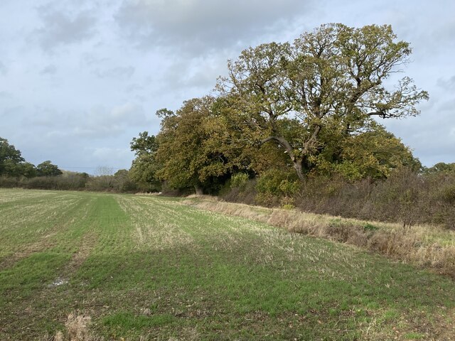
Nature enthusiasts are drawn to Brandwood for its stunning surroundings, with ample opportunities for walking, hiking, and exploring the countryside. The village is also located close to the Shropshire Hills Area of Outstanding Natural Beauty, offering further outdoor pursuits and beautiful landscapes to discover.
Overall, Brandwood is a charming and peaceful village in Shropshire, known for its serene atmosphere and natural beauty. Its small community and idyllic setting make it an appealing place for those seeking a tranquil lifestyle in the heart of the English countryside.
If you have any feedback on the listing, please let us know in the comments section below.
Brandwood Images
Images are sourced within 2km of 52.829883/-2.786622 or Grid Reference SJ4726. Thanks to Geograph Open Source API. All images are credited.


Brandwood is located at Grid Ref: SJ4726 (Lat: 52.829883, Lng: -2.786622)
Unitary Authority: Shropshire
Police Authority: West Mercia
What 3 Words
///saves.spans.looms. Near Petton, Shropshire
Nearby Locations
Related Wikis

Sleap Airfield
Sleap Airfield (pronounced "Slape") (IATA: n/a, ICAO: EGCV) is located 10 NM (19 km; 12 mi) north of Shrewsbury, Shropshire, England. Sleap Aerodrome has...
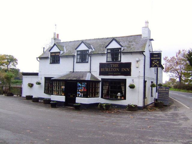
Burlton
Burlton is a hamlet in Shropshire, England. == External links == Media related to Burlton at Wikimedia Commons

Myddle, Broughton and Harmer Hill
Myddle, Broughton and Harmer Hill is a civil parish in Shropshire, England. The population of this civil parish at the 2011 Census was 1,333.The parish...
Myddle
Myddle—also formerly known as Mydle, Middle, Midle, M'dle, Meadley and Medle—is a small village and former civil parish, now in the parish of Myddle, Broughton...

Loppington
Loppington is a village and parish in Shropshire, England, situated a few miles west of Wem. The population of the parish (2001) is 576 and there are 206...

Petton, Shropshire
Petton is a small village and civil parish in Shropshire, England. It was mentioned in Domesday as "Peetone", a name probably derived from Old English...

Alderton, Shropshire
Alderton is a village in Shropshire, England. == See also == Listed buildings in Myddle and Broughton == External links == Media related to Alderton,...

Harmer Hill
Harmer Hill is a village in Shropshire, England located on the A528 south of Wem and north of Shrewsbury. The name Harmer comes from the two words "hare...
Nearby Amenities
Located within 500m of 52.829883,-2.786622Have you been to Brandwood?
Leave your review of Brandwood below (or comments, questions and feedback).