Brandon

Settlement in Suffolk / Norfolk West Suffolk

England

Brandon
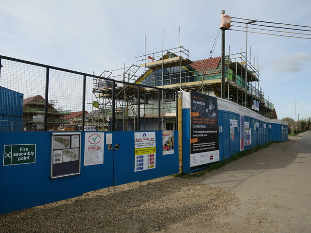
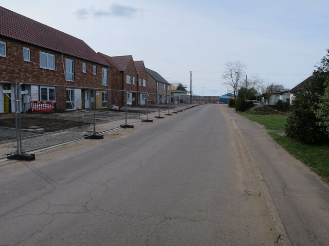
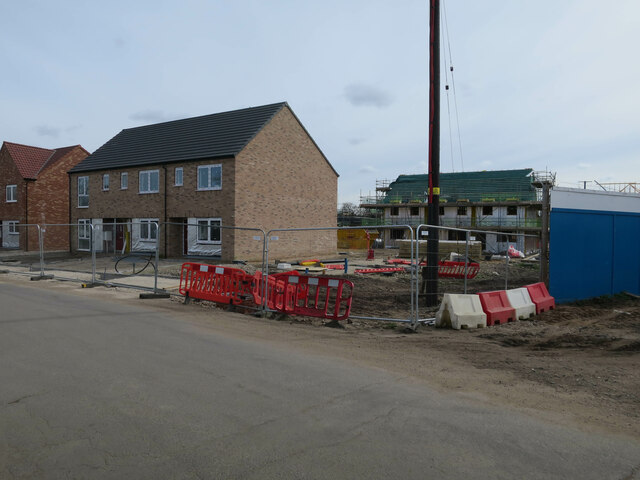
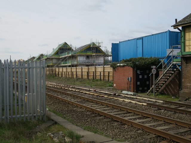
Houses under construction by Brandon Station
Houses under construction by Brandon Station Credit: Hugh Venables

Brandon is a small town located on the border of Suffolk and Norfolk counties in England. Situated in the East of England region, it lies about 18 miles northwest of Thetford and 30 miles northeast of Cambridge. The town sits on the edge of the Breckland, a heathland area characterized by sandy soils, rolling hills, and diverse wildlife.

With a population of around 9,500, Brandon has a close-knit community atmosphere. The town boasts a range of amenities, including shops, restaurants, pubs, and schools, making it a desirable place to live for families and individuals alike. The bustling high street offers a mix of local businesses and larger chain stores, providing residents with a variety of options for their daily needs.

Brandon's history dates back centuries, with evidence of settlement in the area since prehistoric times. The town grew around the thriving textile industry in the 19th century, and remnants of its industrial past can still be seen today. Brandon Country Park, encompassing over 30 hectares of woodland and trails, offers residents and visitors a tranquil retreat for leisurely walks and outdoor activities.

Transport links in Brandon are well-connected, with regular bus services to nearby towns and cities. The town also benefits from its proximity to major road networks, including the A11, A14, and A134, making it easily accessible to those traveling by car. The nearest train station is located in Thetford, providing direct links to Norwich, Cambridge, and London.

Overall, Brandon offers a charming blend of history, community spirit, and natural beauty, making it an attractive place to call home in the heart of East Anglia.

If you have any feedback on the listing, please let us know in the comments section below.

Brandon Images

Images are sourced within 2km of 52.447767/0.62465502 or Grid Reference TL7886. Thanks to Geograph Open Source API. All images are credited.
Houses under construction by Brandon Station
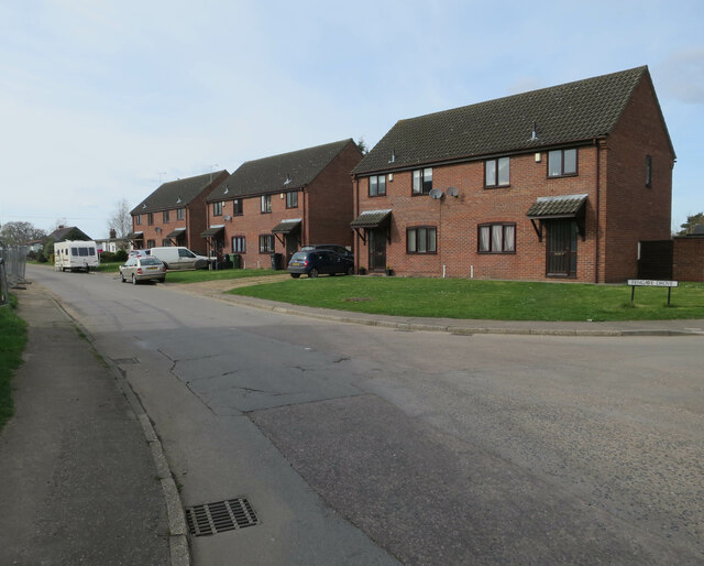
Fengate Drove, Brandon
Houses under construction by Brandon Station
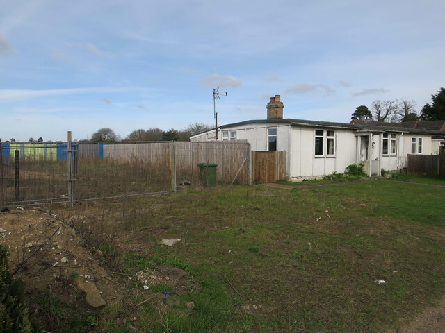
Bungalow on Fengate Drove
Houses under construction near Brandon Station
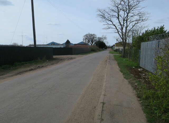
Fengate Drove
Fengate Drove
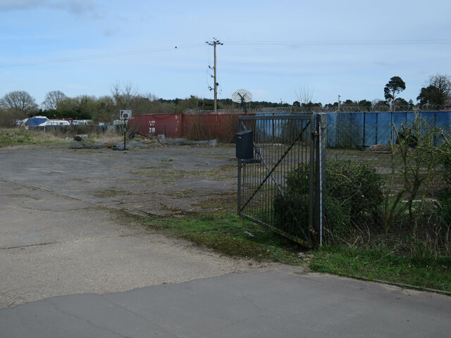
Storage area off Fengate Drove
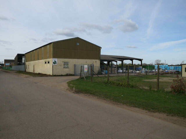
Recycling centre on Fengate Drove
Houses under construction by Brandon Station
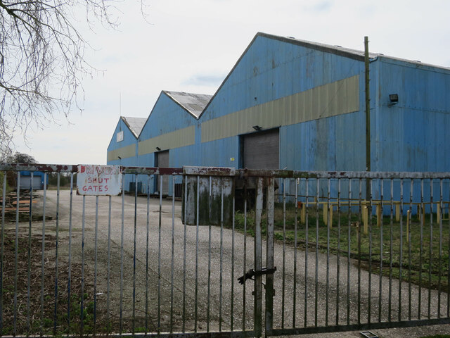
Works off Fengate Drove
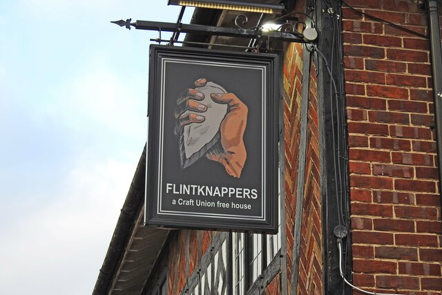
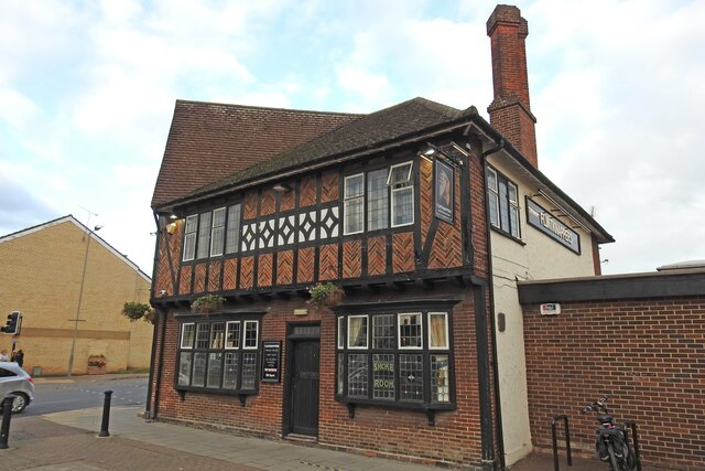
The Flintknappers public house Named after the neolithic craft of flintknapping which has a strong local link with the flint mines at Grime's Graves.
<a href="https://www.geograph.org.uk/photo/7169113">TL7886 : Sign of the Flintknappers public house</a>
The Flintknappers public house
Named after the neolithic craft of flintknapping which has a strong local link with the flint mines at Grime's Graves. TL7886 : Sign of the Flintknappers public house
Sign of the Flintknappers public house <a href="https://www.geograph.org.uk/photo/7169111">TL7886 : The Flintknappers public house</a>
Sign of the Flintknappers public house
Swallow Drive, Brandon
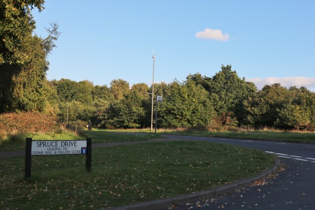
Spruce Drive at the junction of Green Road
Nightingale Road, Brandon
Green Road at the junction of Blackbird Avenue
Blackbird Avenue, Brandon
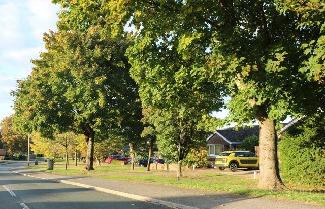
Houses on Spruce Drive, Brandon
Show me another place!

Brandon is located at Grid Ref: TL7886 (Lat: 52.447767, Lng: 0.62465502)

Administrative County: Suffolk

District: West Suffolk

Police Authority: Suffolk

What 3 Words

///protester.them.butternut. Near Weeting, Norfolk

Nearby Locations

Brandon

Related Wikis

Brandon, Suffolk

Brandon is a town and civil parish in the English county of Suffolk. Brandon is located in the Breckland area of Suffolk, close to the adjoining county...

Brandon railway station

Brandon railway station is on the Breckland Line in the East of England, serving the town of Brandon, Suffolk, although the station is actually situated...

Brandon Country Park

Brandon Country Park is a country park in Brandon, Suffolk, England. == History == In 1820 Edward Bliss bought Brandon Park house and grounds using wealth...

London Road Industrial Estate, Brandon

London Road Industrial Estate, Brandon is a 0.1-hectare (0.25-acre) biological Site of Special Scientific Interest (SSSI) in Brandon in Suffolk.This very...

Thetford Forest

Thetford Forest is the largest lowland pine forest in Britain and is located in a region straddling the north of Suffolk and the south of Norfolk in England...

Weeting

Weeting is a village in Norfolk, England. The population can be found in the civil parish of Weeting-with-Broomhill. The village's name means 'wet place...

Weeting Castle

Weeting Castle is a ruined, medieval manor house near the village of Weeting in Norfolk, England. It was built around 1180 by Hugh de Plais, and comprised...

Santon Downham

Santon Downham is a village and civil parish in the West Suffolk district of Suffolk in eastern England. In 2005 it had a population of 240. The village...

Nearby Amenities

Located within 500m of 52.447767,0.62465502
Brandon
Is In: Suffolk
Place: town
Population: 9145
Wikidata: Q2335721
Wikipedia: en:Brandon, Suffolk
Lat/Long: 52.4482313/0.6240803
Bus Stop
Old Forge Court
Naptan AtcoCode: 390020032
Naptan Bearing: NE
Naptan CommonName: Old Forge Court
Naptan Indicator: opp
Naptan Landmark: Bus Shelter
Naptan NaptanCode: sufagwtw
Naptan Street: London Road
Source: naptan_import;survey
Lat/Long: 52.4471932/0.6220435
Bus Stop
Old Forge Court
Naptan AtcoCode: 390020033
Naptan Bearing: SW
Naptan CommonName: Old Forge Court
Naptan Indicator: adj
Naptan Landmark: Old Forge Court
Naptan NaptanCode: sufajada
Naptan Street: London Road
Naptan Verified: no
Source: naptan_import
Lat/Long: 52.4471515/0.6222067
Bus Stop
Aldi
Naptan AtcoCode: 390020034
Naptan Bearing: S
Naptan CommonName: Aldi
Naptan Indicator: adj
Naptan Landmark: Aldi
Naptan NaptanCode: sufajadg
Naptan Street: High Street
Shelter: no
Source: naptan_import;survey
Lat/Long: 52.4493248/0.6235861
Bus Stop
Aldi
Naptan AtcoCode: 390020035
Naptan Bearing: N
Naptan BusStopType: CUS
Naptan CommonName: Aldi
Naptan Indicator: opp
Naptan Landmark: Aldi
Naptan NaptanCode: sufajadj
Naptan Street: High Street
Shelter: no
Source: naptan_import;survey
Lat/Long: 52.4495802/0.6234544
Bus Stop
Ladram House
Naptan AtcoCode: 390020036
Naptan Bearing: S
Naptan BusStopType: CUS
Naptan CommonName: Ladram House
Naptan Indicator: adj
Naptan Landmark: Ladram House
Naptan NaptanCode: sufajadm
Naptan Street: High Street
Shelter: no
Source: naptan_import;survey
Lat/Long: 52.4483233/0.6236316
Bus Stop
Ladram House
Check Date Shelter: 2024-02-20
Naptan AtcoCode: 390020037
Naptan Bearing: N
Naptan BusStopType: CUS
Naptan CommonName: Ladram House
Naptan Indicator: opp
Naptan Landmark: Ladram House
Naptan NaptanCode: sufajadp
Naptan Street: High Street
Shelter: no
Source: naptan_import;survey
Lat/Long: 52.4482619/0.6235149
Bus Stop
Riverside Way
Bus: yes
Naptan AtcoCode: 390020038
Naptan Bearing: N
Naptan BusStopType: CUS
Naptan CommonName: Riverside Way
Naptan Indicator: opp
Naptan Landmark: Ram Hotel
Naptan NaptanCode: sufajadt
Naptan Street: High Street
Public Transport: platform
Shelter: no
Source: naptan_import;survey
Lat/Long: 52.4519407/0.6228504
Bus Stop
Riverside Way
Bus: yes
Naptan AtcoCode: 390020039
Naptan Bearing: S
Naptan BusStopType: CUS
Naptan CommonName: Riverside Way
Naptan Indicator: adj
Naptan Landmark: Ram Hotel
Naptan NaptanCode: sufajadw
Naptan Street: High Street
Public Transport: platform
Shelter: no
Source: naptan_import;survey
Lat/Long: 52.4520709/0.6229366
Knappers Way
Naptan AtcoCode: 390020064
Naptan Bearing: NW
Naptan BusStopType: CUS
Naptan CommonName: Knappers Way
Naptan Indicator: adj
Naptan Landmark: Knappers Way
Naptan NaptanCode: sufajapj
Naptan Street: Thetford Road
Naptan Verified: no
Source: naptan_import
Lat/Long: 52.446627/0.6289012
Bus Stop
Knappers Way
Bench: no
Bin: no
Naptan AtcoCode: 390020065
Naptan Bearing: SE
Naptan BusStopType: CUS
Naptan CommonName: Knappers Way
Naptan Indicator: opp
Naptan Landmark: Knappers Way
Naptan NaptanCode: sufajapm
Naptan Street: Thetford Road
Naptan Verified: no
Public Transport: platform
Shelter: no
Source: naptan_import
Tactile Paving: no
Lat/Long: 52.4469194/0.6285169
Bus Stop
Car Park
Bench: yes
Bin: no
Lit: yes
Naptan AtcoCode: 390020066
Naptan Bearing: W
Naptan CommonName: Car Park
Naptan Indicator: adj
Naptan Landmark: Car Park
Naptan NaptanCode: sufajapt
Naptan Street: George Street
Shelter: yes
Source: naptan_import;survey
Tactile Paving: no
Lat/Long: 52.4471054/0.6252444
Bus Stop
Tesco
Naptan AtcoCode: 390020067
Naptan Bearing: SE
Naptan BusStopType: CUS
Naptan CommonName: Tesco
Naptan Indicator: opp
Naptan Landmark: Tesco
Naptan NaptanCode: sufajapw
Naptan Street: Rattlers Road
Source: naptan_import;survey
Lat/Long: 52.444802/0.6194663
Bus Stop
Tesco
Naptan AtcoCode: 390020068
Naptan Bearing: NW
Naptan BusStopType: CUS
Naptan CommonName: Tesco
Naptan Indicator: o/s
Naptan Landmark: Tesco
Naptan NaptanCode: sufajata
Naptan Street: Rattlers Road
Source: naptan_import;survey
Lat/Long: 52.4447515/0.6193851
Bus Stop
Lode Street
Naptan AtcoCode: 390020424
Naptan Bearing: E
Naptan BusStopType: CUS
Naptan CommonName: Lode Street
Naptan Indicator: adj
Naptan Landmark: Lode Street
Naptan NaptanCode: sufjpagw
Naptan Street: B1107
Naptan Verified: no
Public Transport: platform
Source: naptan_import
Lat/Long: 52.4478625/0.6254295
Bus Stop
Elizabeth Road
Naptan AtcoCode: 390020437
Naptan Bearing: NW
Naptan BusStopType: CUS
Naptan CommonName: Elizabeth Road
Naptan Indicator: opp
Naptan Landmark: Elizabeth Road
Naptan NaptanCode: sufjptpt
Naptan Street: Rattlers Road
Source: naptan_import;survey
Lat/Long: 52.4437985/0.6212716
Taxi
Pioneer Store Car Park
Naptan AtcoCode: 390029003
Naptan CommonName: Pioneer Store Car Park
Naptan Landmark: Taxi Rank
Naptan Street: Whitehart Lane
Naptan Verified: no
Source: naptan_import
Lat/Long: 52.4494811/0.625008
Traffic Signals
Crossing: traffic_signals
Lat/Long: 52.4451522/0.6187059
Telephone
Booth: KX100
Covered: booth
Phone: +44 1842 810305
Lat/Long: 52.4480851/0.6237272
Post Office
Brandon Post Office
Addr City: Brandon
Addr Housename: Spar
Addr Housenumber: 33-35
Addr Postcode: IP27 0AQ
Addr Street: High Street
Brand Wikidata: Q1783168
Opening Hours: Mo,Fr 08:30-17:30; Tu,We 09:00-17:30; Th 09:00-17:00; Sa 09:00-16:00
Ref Pol Id: 3023
Source Addr: pol_branch_list_2018-01
Source Opening Hours: pol_branch_list_2018-01
Website: https://www.postoffice.co.uk/branch-finder/1531123/brandon
Lat/Long: 52.448589/0.6230971
Post Box
Collection Times: Mo-Fr 17:30; Sa 12:00
Post Box Type: wall
Ref: IP27 3247
Royal Cypher: no
Lat/Long: 52.4480367/0.6237493
Toilets
Opening Hours: Mo,We 09:00-17:00; Tu,Th 09:00-17:30; Fr 09:00-19:00; Sa 10:00-17:00; Su 10:00-15:00
Source: local knowledge
Lat/Long: 52.446894/0.6237914
Recycling
Recycling Glass: yes
Lat/Long: 52.4462321/0.6243728
Restaurant
Jean Paul's Restaurant
Lat/Long: 52.451456/0.6228415
Camera Type: panning
Man Made: surveillance
Operator: West Suffolk Council
Source: survey
Surveillance: public
Surveillance Type: camera
Lat/Long: 52.4467869/0.6251179
Recycling
Recycling Cartons: yes
Recycling Clothes: yes
Recycling Paper: yes
Lat/Long: 52.4461922/0.6242036
Traffic Signals
Crossing: traffic_signals
Crossing Ref: pelican
Lat/Long: 52.4486129/0.6235717
Post Box
Addr City: Brandon
Addr Postcode: IP27 0EL
Addr Street: London Road
Collection Times: Mo-Fr 16:40; Sa 11:00
Post Box Type: lamp
Ref: IP27 3204
Royal Cypher: EIIR
Royal Cypher Wikidata: Q33102113
Lat/Long: 52.4461287/0.6200532
Barrier: cycle_barrier
Lat/Long: 52.4491328/0.6233433
Barrier: cycle_barrier
Lat/Long: 52.4488237/0.6216319
Old Phone: +44 1842 811108
Removed Amenity: telephone
Source: survey
Lat/Long: 52.4472477/0.6240482
Traffic Signals
Crossing: traffic_signals
Crossing Ref: pelican
Source: survey
Lat/Long: 52.4463005/0.6249065
Shelter
Note: This may be a bus stop but no NAPTAN marker
Source: survey
Lat/Long: 52.4494932/0.624155
Barrier: bollard
Bicycle: yes
Foot: yes
Source: survey
Lat/Long: 52.4470957/0.6247722
Bench
Backrest: yes
Material: wood
Lat/Long: 52.4471605/0.6219092
Bench
Backrest: yes
Material: wood
Source: survey
Lat/Long: 52.4471457/0.6239906
Brandon & The Brecks
Board Type: board
Information: board
Source: survey
Tourism: information
Lat/Long: 52.4467518/0.6242824
Barrier: kissing_gate
Foot: yes
Source: survey
Lat/Long: 52.4480377/0.61987
Barrier: kissing_gate
Foot: yes
Source: survey
Lat/Long: 52.4477029/0.6211572
Barrier: kissing_gate
Foot: yes
Source: survey
Lat/Long: 52.44809/0.617706
Addr Housenumber: 28
Addr Street: Bury Road
Lat/Long: 52.4458249/0.6245604
Addr Housenumber: 98
Addr Street: Bury Road
Lat/Long: 52.4435341/0.6256614
Addr Housenumber: 52
Addr Street: Bury Road
Lat/Long: 52.4449319/0.6241058
Addr Housenumber: 24
Addr Street: Rattlers Road
Lat/Long: 52.4443152/0.6199502
Addr Housenumber: 62
Addr Street: Bury Road
Lat/Long: 52.4445735/0.6251808
Addr Housenumber: 26
Addr Street: Bury Road
Lat/Long: 52.4458706/0.6245429
Crossing
Crossing: marked
Crossing Island: no
Crossing Ref: zebra
Kerb: lowered
Source: survey
Tactile Paving: yes
Lat/Long: 52.4466103/0.6292838
Post Box
Addr City: Brandon
Addr Postcode: IP27 0DB
Addr Street: Thetford Road
Collection Times: Mo-Fr 16:05; Sa 11:00
Post Box Type: lamp
Ref: IP27 3406
Royal Cypher: EIIR
Royal Cypher Wikidata: Q33102113
Source: survey
Lat/Long: 52.4463202/0.6302829
Brandon Local
Addr City: Brandon
Addr Housenumber: 42A
Addr Postcode: IP27 0DB
Addr Street: Thetford Road
Alcohol: yes
Fhrs Id: 1673811
Shop: convenience
Source Addr: FSA Food Hygiene Ratings Database
Lat/Long: 52.4464041/0.6295156
Addr Housenumber: 1
Addr Street: Wishing Well Close
Lat/Long: 52.4472913/0.6297835
Addr Housenumber: 89
Addr Street: Thetford Road
Lat/Long: 52.447654/0.6300386
Addr Housenumber: 91
Addr Street: Thetford Road
Lat/Long: 52.447703/0.6300655
Addr Housenumber: 2
Addr Street: Wishing Well Close
Lat/Long: 52.4474416/0.6298562
Recycling
Recycling Clothes: yes
Recycling Glass: yes
Recycling Shoes: yes
Lat/Long: 52.4500567/0.6247765
Bench
Lat/Long: 52.4499247/0.6254122
Waste Basket
Lat/Long: 52.4493201/0.6251576
Waste Basket
Lat/Long: 52.4499158/0.6254034
Bench
Lat/Long: 52.4493301/0.6251667
Molyneux Estate Agents
Addr City: Brandon
Addr Housenumber: 49A
Addr Postcode: IP27 0AQ
Addr Street: High Street
Office: estate_agent
Old Name: Brandon Motorcycles
Source: survey
Website: https://www.molyneuxestateagents.co.uk/
Lat/Long: 52.4490869/0.6233492
Crossing
Crossing: uncontrolled
Crossing Ref: zebra
Source: survey
Traffic Calming: raised_table
Lat/Long: 52.4441091/0.620756
Fast Food
Bella Pizza & Grill House
Addr City: Brandon
Addr Housenumber: 36
Addr Postcode: IP27 0BS
Addr Street: Thetford Road
Cuisine: pizza
Fhrs Id: 1673501
Source Addr: FSA Food Hygiene Ratings Database
Lat/Long: 52.4474719/0.6263385
Addr City: Brandon
Addr Housenumber: 14
Addr Postcode: IP27 0HS
Addr Street: London Road
Source: survey
Lat/Long: 52.447639/0.6229407
Waste Basket
Lat/Long: 52.4450732/0.6187529
Waste Basket
Lat/Long: 52.4463964/0.6195752
Waste Basket
Lat/Long: 52.4469145/0.6212282
Waste Basket
Check Date: 2021-07-29
Lat/Long: 52.4469804/0.6250621
Check Date: 2021-07-29
Information: map
Map Size: region
Tourism: information
Lat/Long: 52.4469897/0.6250713
Waste Basket
Source: survey
Lat/Long: 52.4471177/0.6239472
Information: guidepost
Source: survey
Tourism: information
Lat/Long: 52.4471189/0.6239366
Bicycle Parking
Bicycle Parking: stands
Capacity: 8
Covered: no
Lat/Long: 52.4472217/0.6240601
Information: map
Map Size: region
Source: survey
Tourism: information
Lat/Long: 52.4472422/0.6239748
Waste Basket
Lat/Long: 52.4472506/0.6220857
Bicycle Parking
Source: survey
Lat/Long: 52.4475264/0.6239101
Waste Basket
Source: survey
Lat/Long: 52.4475104/0.6239133
Bench
Backrest: yes
Source: survey
Lat/Long: 52.4471299/0.6240314
Waste Basket
Source: survey
Lat/Long: 52.4472218/0.6240156
Addr Housenumber: 1
Addr Street: Hall Close
Lat/Long: 52.44798/0.6221179
Addr Housenumber: 10
Addr Street: Stores Street
Source: survey
Lat/Long: 52.4469615/0.6235407
Addr City: Brandon
Addr Housenumber: 10
Addr Postcode: IP27 0HS
Addr Street: London Road
Source: survey
Source Addr Postcode: code-point_open
Lat/Long: 52.4476573/0.6230607
Addr City: Brandon
Addr Housenumber: 12
Addr Postcode: IP27 0HS
Addr Street: London Road
Source: survey
Source Addr Postcode: code-point_open
Lat/Long: 52.4476447/0.622988
Addr Housenumber: 2
Addr Street: Stores Street
Source: survey
Lat/Long: 52.4471041/0.6231085
Addr City: Brandon
Addr Housenumber: 47
Addr Postcode: IP27 0EL
Addr Street: London Road
Fixme: Check location for this housenumber
Source: survey
Source Addr Postcode: code-point_open
Lat/Long: 52.4466283/0.6214765
Addr City: Brandon
Addr Housenumber: 51;59
Addr Postcode: IP27 0EL
Addr Street: London Road
Fixme: Check location for this housenumber
Source: survey
Source Addr Postcode: code-point_open
Lat/Long: 52.4465874/0.6213841
Addr City: Brandon
Addr Housenumber: 61
Addr Postcode: IP27 0EL
Addr Street: London Road
Fixme: Check location for this housenumber
Source: survey
Source Addr Postcode: code-point_open
Lat/Long: 52.4464466/0.6210618
Addr City: Brandon
Addr Housenumber: 63
Addr Postcode: IP27 0EL
Addr Street: London Road
Fixme: Check location for this housenumber
Source: survey
Source Addr Postcode: code-point_open
Lat/Long: 52.4464134/0.6210093
Addr City: Brandon
Addr Housenumber: 65a
Addr Postcode: IP27 0EL
Addr Street: London Road
Fixme: Check location for this housenumber
Source: survey
Source Addr Postcode: code-point_open
Lat/Long: 52.4463997/0.6207861
Addr City: Brandon
Addr Housenumber: 65b
Addr Postcode: IP27 0EL
Addr Street: London Road
Fixme: Check location for this housenumber
Source: survey
Source Addr Postcode: code-point_open
Lat/Long: 52.4463443/0.6207017
Addr Housenumber: 7
Addr Street: Hall Close
Lat/Long: 52.4477632/0.6217653
Addr Housenumber: 73
Lat/Long: 52.446064/0.6209737
Addr City: Brandon
Addr Housenumber: 8
Addr Postcode: IP27 0HS
Addr Street: London Road
Source: survey
Source Addr Postcode: code-point_open
Lat/Long: 52.447667/0.6231281
Addr Housenumber: 81
Lat/Long: 52.4458023/0.6207841
Addr City: Brandon
Addr Housenumber: 89
Addr Postcode: IP27 0EL
Addr Street: London Road
Source: survey
Source Addr Postcode: code-point_open
Lat/Long: 52.4458728/0.6201449
Addr City: Brandon
Addr Housenumber: 91
Addr Postcode: IP27 0EL
Addr Street: London Road
Source: survey
Source Addr Postcode: code-point_open
Lat/Long: 52.4458067/0.6200367
Addr Housenumber: 93
Addr Postcode: IP27 0EL
Addr Street: London Road
Source: survey
Source Addr Postcode: code-point_open
Lat/Long: 52.4457063/0.6198878
Addr Housenumber: 95
Addr Postcode: IP27 0EL
Addr Street: London Road
Source: survey
Source Addr Postcode: code-point_open
Lat/Long: 52.4456453/0.6197978
Bench
Backrest: yes
Material: wood
Source: survey
Lat/Long: 52.4475701/0.6237222
Bench
Backrest: yes
Material: wood
Source: survey
Lat/Long: 52.4475734/0.6237383
Traffic Signals
Crossing: traffic_signals
Crossing Ref: pelican
Lat/Long: 52.444815/0.6252065
Information: map
Map Size: region
Source: survey
Tourism: information
Lat/Long: 52.4494117/0.6236382
Brandon town sign
Board Type: notice
Information: board
Man Made: village_sign
Lat/Long: 52.4475905/0.6237265
Traffic Signals
Crossing: no
Lat/Long: 52.4476827/0.6237145
Information: map
Map Size: region
Source: survey
Tourism: information
Lat/Long: 52.4518286/0.6228277
Barrels Super Store
Addr City: Brandon
Addr Housenumber: 33-35
Addr Postcode: IP27 0AQ
Addr Street: High Street
Fhrs Id: 1673421
Shop: convenience
Source: survey
Source Addr: FSA Food Hygiene Ratings Database
Website: https://store-locator.costcutter.co.uk/costcutter-36f722d415c2
Lat/Long: 52.448591/0.6233491
Addr Housenumber: 4
Addr Street: Church Road
Lat/Long: 52.4452797/0.6185394
Crossing
Crossing: uncontrolled
Note: Drop curbs at each side, but no other markings.
Lat/Long: 52.4469491/0.624924
Barrier: kissing_gate
Lat/Long: 52.4476203/0.6210867
Fast Food
Ali's Kebab House
Addr City: Brandon
Addr Housenumber: 54
Addr Postcode: IP27 0AU
Addr Street: High Street
Cuisine: kebab
Fhrs Id: 1673993
Phone: +44 1842815484
Source Addr: FSA Food Hygiene Ratings Database
Website: https://www.aliskebabbrandon.com/
Lat/Long: 52.4490871/0.6237222
Pharmacy
Boots
Addr City: Brandon
Addr Housenumber: 32-34
Addr Postcode: IP27 0AQ
Addr Street: High Street
Brand: Boots
Brand Wikidata: Q6123139
Brand Wikipedia: en:Boots UK
Dispensing: yes
Fhrs Id: 163878
Healthcare: pharmacy
Source: survey
Source Addr: FSA Food Hygiene Ratings Database
Website: https://www.boots.com/stores/5471-brandon-high-street-ip27-0aq
Lat/Long: 52.448535/0.623757
Brandon Day Care Appeal
Addr City: Brandon
Addr Postcode: IP27 0AU
Addr Street: High Street
Shop: charity
Source: survey
Lat/Long: 52.4492821/0.623706
Fast Food
Jean Paul's Pizzeria
Addr City: Brandon
Addr Housenumber: 28
Addr Postcode: IP27 0AQ
Addr Street: High Street
Cuisine: pizza
Fhrs Id: 1673950
Source: survey
Source Addr: FSA Food Hygiene Ratings Database
Website: https://jeanpaulspizzeria.com/
Lat/Long: 52.4484022/0.6237614
Restaurant
Brandon Tandori Restaurant
Addr City: Brandon
Addr Housenumber: 17
Addr Postcode: IP27 0EL
Addr Street: London Road
Cuisine: indian
Fhrs Id: 1673496
Source: survey
Source Addr: FSA Food Hygiene Ratings Database
Website: https://www.brandontandoori.co.uk/
Lat/Long: 52.447231/0.6226534
Chilterns
Addr City: Brandon
Addr Housenumber: 36
Addr Postcode: IP27 0AQ
Addr Street: High Street
Office: estate_agent
Source: survey
Website: https://chilterns.co/
Lat/Long: 52.4486315/0.6237436
Dee's Delites
Addr City: Brandon
Addr Housenumber: 26
Addr Postcode: IP27 0AQ
Addr Street: High Street
Old Name: All Sorts
Old Website: https://www.facebook.com/pages/category/Shopping---Retail/Allsorts-154847425161193/
Second Hand: yes
Shop: furniture
Lat/Long: 52.4483597/0.6237688
Addr City: Brandon
Addr Housenumber: 50
Addr Postcode: IP27 0AQ
Addr Street: High Street
Disused Amenity: restaurant
Old Name: Collins Restaurant
Source Addr: FSA Food Hygiene Ratings Database
Lat/Long: 52.4484931/0.6237151
Congratulations
Addr City: Brandon
Addr Housenumber: 56a
Addr Postcode: IP27 0AU
Addr Street: High Street
Description: stationery and confectionery
Shop: gift
Source: survey
Lat/Long: 52.4492155/0.6237169
Deniz Intercontinental Food
Addr City: Brandon
Addr Housenumber: 54A
Addr Postcode: IP27 0AU
Addr Street: High Street
Fhrs Id: 1673815
Shop: deli
Source: survey
Source Addr: FSA Food Hygiene Ratings Database
Lat/Long: 52.44913/0.6237194
Addr City: Brandon
Addr Housenumber: 52
Addr Postcode: IP27 0AQ
Addr Street: High Street
Check Date: 2024-02-20
Cuisine: fish_and_chips
Disused Amenity: fast_food
Old Name: Fish & Chip Take-Away
Source: survey
Lat/Long: 52.4489895/0.6237275
Flavours of Portugal
Addr City: Brandon
Addr Hamlet: High Street
Addr Housenumber: 56
Addr Postcode: IP27 0AU
Addr Street: High Street
Fhrs Id: 1673537
Shop: deli
Source: survey
Source Addr: FHRS Open Data
Lat/Long: 52.4491742/0.6237167
Cafe
No. 30 Coffee Lounge
Addr City: Brandon
Addr Housenumber: 30
Addr Postcode: IP27 0AQ
Addr Street: High Street
Facebook: https://www.facebook.com/no30coffeelounge/
Fhrs Id: 1674013
Old Name: Wilby's Home Harware
Source: survey
Source Addr Postcode: FHRS Open Data
Website: http://no30.coffee/
Lat/Long: 52.448458/0.6237604
Mac Estates
Addr City: Brandon
Addr Housenumber: 11
Addr Postcode: IP27 0EL
Addr Street: London Road
Office: estate_agent
Source: survey
Website: https://www.macestates.co.uk/
Lat/Long: 52.4473556/0.6229647
Katie's Beautique
Addr City: Brandon
Addr Housenumber: 16
Addr Postcode: IP27 0AQ
Addr Street: High Street
Contact Facebook: https://www.facebook.com/KatiesBeautiqueSuffolk/
Shop: beauty
Source: survey
Lat/Long: 52.4481263/0.6237892
The Barbers
Addr City: Brandon
Addr Housenumber: 22
Addr Postcode: IP27 0AQ
Addr Street: High Street
Contact Facebook: https://www.facebook.com/thebarbersbrandon/
Shop: hairdresser
Source: survey
Lat/Long: 52.4482472/0.6237705
Dentist
Brandon Dental Care
Addr City: Brandon
Addr Housenumber: 42
Addr Postcode: IP27 0AQ
Addr Street: High Street
Healthcare: dentist
Source: survey
Website: https://brandondentalcare.co.uk/
Lat/Long: 52.4487508/0.6237301
Total Photography
Addr City: Brandon
Addr Housenumber: 38
Addr Postcode: IP27 0AQ
Addr Street: High Street
Description: digital photo centre
Shop: photo
Source: survey
Website: https://www.total-photography.co.uk/
Lat/Long: 52.4486957/0.6237357
William H Brown
Addr City: Brandon
Addr Postcode: IP27 0AQ
Addr Street: High Street
Brand: William H. Brown
Brand Wikidata: Q81787271
Office: estate_agent
Phone: +44 1842811058
Source: survey
Website: https://www.williamhbrown.co.uk/estate-agents/brandon
Lat/Long: 52.4481771/0.6237827
A & J
Addr City: Brandon
Addr Housenumber: 55b
Addr Street: High Street
Contact Facebook: https://www.facebook.com/AJKeycutting/
Description: shoe repair, engraving, key cutting
Phone: +44 1842813522
Shop: shoe_repair;key_cutting;engraving
Source: survey
Lat/Long: 52.4493517/0.6234073
Betfred
Addr City: Brandon
Addr Housenumber: 9
Addr Postcode: IP27 0AQ
Addr Street: High Street
Brand: Betfred
Brand Wikidata: Q4897425
Brand Wikipedia: en:Betfred
Shop: bookmaker
Source: survey
Lat/Long: 52.4479268/0.62346
Bunches and Bows
Addr City: Brandon
Addr Housenumber: 57
Addr Postcode: IP27 0AU
Addr Street: High Street
Description: flowers, gifts
Shop: florist
Source: survey
Website: http://bunchesandbows.org.uk/
Lat/Long: 52.4494589/0.6234165
Restaurant
Centre Cafe & Restaurant
Addr City: Brandon
Addr Housenumber: 41-43
Addr Postcode: IP27 0AQ
Addr Street: High Street
Contact Facebook: https://www.facebook.com/brandoncentrecafe/
Fhrs Id: 1673601
Source: survey
Source Addr: FSA Food Hygiene Ratings Database
Lat/Long: 52.4487839/0.6233568
Barber Shop
Addr City: Brandon
Addr Housenumber: 11
Addr Postcode: IP27 0AQ
Addr Street: High Street
Old Name: The Hare Salon
Shop: hairdresser
Source: survey
Lat/Long: 52.4480344/0.6234375
West Suffolk Council Office
Building: public
Tourism: information
Website: https://www.westsuffolk.gov.uk/
Lat/Long: 52.4468519/0.6237976
Addr City: Brandon
Addr Housenumber: 53
Addr Street: High Street
Disused Shop: perfumery
Note: As of 2021-09, there's a new-looking fascia: "Robert's @ Florence-Jean's". Unclear what it is/will be though.
Old Name: Pecksniff's Factory Outlet
Source: survey
Lat/Long: 52.449247/0.6233826
Fast Food
Golden Fried Chicken
Addr City: Brandon
Addr Housenumber: 51
Addr Postcode: IP27 0AQ
Addr Street: High Street
Cuisine: fish_and_chips
Fhrs Id: 1674501
Source: survey
Source Addr: FSA Food Hygiene Ratings Database
Website: https://goldenfriedchickenbrandon.co.uk/
Lat/Long: 52.4491638/0.6233741
Sgt Reckless
Addr City: Brandon
Addr Housenumber: 31
Addr Postcode: IP27 0AQ
Addr Street: High Street
Contact Facebook: https://www.facebook.com/sgtrecklesstattoo/
Old Name: Custom Tattoos
Shop: tattoo
Source: survey
Lat/Long: 52.4484976/0.6233825
Ozzies
Addr City: Brandon
Addr Housenumber: 49
Addr Postcode: IP27 0AQ
Addr Street: High Street
Facebook: https://www.facebook.com/pages/category/Shopping---Retail/Ozzies-287168372103366/
Shop: gift
Source: survey
Website: https://ozziesmetaphysical.co.uk/
Lat/Long: 52.4490486/0.6233474
Fast Food
Kings Garden
Addr City: Brandon
Addr Housenumber: 37
Addr Postcode: IP27 0AQ
Addr Street: High Street
Cuisine: chinese
Fhrs Id: 1674439
Source Addr: FSA Food Hygiene Ratings Database
Website: https://www.orderkingsgarden.co.uk/
Lat/Long: 52.4486592/0.6233513
Brandon Butchers
Addr City: Brandon
Addr Housenumber: 7
Addr Postcode: IP27 0AQ
Addr Street: High Street
Old Name: Meat Market
Shop: butcher
Source: survey
Source Addr: FSA Food Hygiene Ratings Database
Lat/Long: 52.4478566/0.6234657
Nick's Tattooz
Addr City: Brandon
Addr Housenumber: 47
Addr Postcode: IP27 0AQ
Addr Street: High Street
Description: tattoo
Shop: tattoo
Source: survey
Website: http://www.nickstattooz.com/
Lat/Long: 52.4489765/0.6233498
Addr City: Brandon
Addr Street: High Street
Disused Amenity: cafe
Old Name: Nicola
Lat/Long: 52.4492963/0.6233925
Fast Food
Pagoda House
Addr City: Brandon
Addr Housenumber: 13
Addr Postcode: IP27 0AQ
Addr Street: High Street
Cuisine: chinese
Fhrs Id: 1673515
Source: survey
Source Addr: FSA Food Hygiene Ratings Database
Lat/Long: 52.4480899/0.6234311
Bride & Bloom of Brandon
Addr City: Brandon
Addr Housenumber: 21
Addr Postcode: IP27 0AQ
Addr Street: High Street
Clothes: wedding
Old Name: Poppins
Shop: clothes
Source: survey
Website: https://bridebloomofbrandon.business.site/
Lat/Long: 52.4482542/0.6234037
Mortgage Republic
Addr City: Brandon
Addr Housenumber: 23
Addr Postcode: IP27 0AQ
Addr Street: High Street
Office: financial_advisor
Website: https://mortgagerepublic.co.uk/brandon/
Lat/Long: 52.4483108/0.6233995
Fast Food
El Greco
Addr City: Brandon
Addr Housenumber: 19
Addr Postcode: IP27 0AQ
Addr Street: High Street
Cuisine: chicken;pizza;kebab;burger
Fhrs Id: 1674610
Old Name: Stagg
Source: survey
Website: https://elgrecobrandon.com/
Lat/Long: 52.4482/0.6234172
The Carpet Store
Addr City: Brandon
Addr Housenumber: 1
Addr Postcode: IP27 0AQ
Addr Street: High Street
Contact Facebook: https://www.facebook.com/Thecarpetstorebrandon/
Opening Hours: Mo,Tu,Th,Fr 09:00-17:00; We,Sa 09:00-13:00
Shop: carpet
Source: survey
Lat/Long: 52.4477936/0.6234882
Obsidian Butterfly
Addr City: Brandon
Addr Housenumber: 47A
Addr Postcode: IP27 0AQ
Addr Street: High Street
Contact Facebook: https://www.facebook.com/obsidianbutterflypiercing
Shop: body_piercing
Source: survey
Lat/Long: 52.4490148/0.623349
Restaurant
Azure
Addr City: Brandon
Addr Housenumber: 15
Addr Postcode: IP27 0AQ
Addr Street: High Street
Old Name: Tilly's Tearoom
Source: survey
Source Addr: FSA Food Hygiene Ratings Database
Lat/Long: 52.4481447/0.6234224
Baileys Blinds & Awnings
Addr City: Brandon
Addr Housenumber: 12
Addr Postcode: IP27 0HS
Addr Street: London Road
Shop: curtain
Source: survey
Website: https://www.baileysblinds.com/
Lat/Long: 52.4476259/0.6229943
Blushes
Addr City: Brandon
Addr Housenumber: 21
Addr Postcode: IP27 0AA
Addr Street: Market Hill
Contact Facebook: https://www.facebook.com/BlushesBeautyHairBoutique/
Shop: hairdresser
Source: survey;local knowledge
Source Addr Postcode: code-point_open
Lat/Long: 52.4469867/0.6241079
The Hare Salon
Addr City: Brandon
Addr Housenumber: 10
Addr Postcode: IP27 0HS
Addr Street: London Road
Old Name: Every Cloud Vape Hut
Shop: hairdresser
Source: survey;website
Lat/Long: 52.4476373/0.6230744
Addr City: Brandon
Addr Housenumber: 2-4
Addr Postcode: IP27 0HS
Addr Street: London Road
Disused Shop: yes
Source: survey
Lat/Long: 52.4477082/0.6234145
My Style Barber Shop
Addr City: Brandon
Addr Housenumber: 6
Addr Postcode: IP27 0HS
Addr Street: London Road
Contact Facebook: https://www.facebook.com/mystylebarbershops/
Male: yes
Shop: hairdresser
Source: survey;local knowledge
Source Addr Postcode: code-point_open
Lat/Long: 52.447667/0.6232438
Total Hair
Addr City: Brandon
Addr Housenumber: 14
Addr Postcode: IP27 0HS
Addr Street: London Road
Shop: hairdresser
Source: survey
Source Addr Postcode: code-point_open
Lat/Long: 52.4476173/0.6229394
Brandon Lodge
Addr City: Brandon
Addr Housenumber: 14
Addr Postcode: IP27 0AA
Addr Street: Market Hill
Source: survey
Tourism: hotel
Website: http://www.brandon-lodge.co.uk/
Lat/Long: 52.4470736/0.6234656
Cafe
Garagem Do Perisco
Addr City: Brandon
Addr Housenumber: 11
Addr Postcode: IP27 0AE
Addr Street: Stores Street
Old Name: Pedroy Dana International Coffee;The Baron
Source: survey
Source Addr: FSA Food Hygiene Ratings Database
Source Name: FHRS Open Data
Lat/Long: 52.446975/0.623592
Addr City: Brandon
Addr Housenumber: 9A
Addr Postcode: IP27 0AA
Addr Street: Market Hill
Disused Shop: convenience
Old Name: Citizens Advice;Alexes
Source: survey
Source Addr Postcode: code-point_open
Lat/Long: 52.447419/0.6240635
David R Hyam
Addr City: Brandon
Addr Housenumber: 13
Addr Postcode: IP27 0AA
Addr Street: Market Hill
Fhrs Id: 1673499
Shop: bakery
Source: survey
Source Addr: FSA Food Hygiene Ratings Database
Lat/Long: 52.447282/0.6241137
Tramps
Addr City: Brandon
Addr Housenumber: 12
Addr Postcode: IP27 0AA
Addr Street: Market Hill
Contact Facebook: https://www.facebook.com/trampshair/
Shop: hairdresser
Source: survey
Source Addr: FSA Food Hygiene Ratings Database
Lat/Long: 52.4471479/0.6236364
Addr City: Brandon
Addr Housenumber: 14
Addr Postcode: IP27 0AA
Addr Street: Market Hill
Cuisine: pizza
Disused Amenity: restaurant
Old Name: Mondragone
Source: survey
Source Addr: FSA Food Hygiene Ratings Database
Lat/Long: 52.4470788/0.6236327
Restaurant
Peach Bower
Addr City: Brandon
Addr Housenumber: 8
Addr Postcode: IP27 0AA
Addr Street: Market Hill
Cuisine: chinese
Fhrs Id: 1674265
Source: survey
Website: https://peachbower.tripod.com/
Lat/Long: 52.4472132/0.6236216
Launderette
Addr Street: Stores Street
Opening Hours: Mo-Sa 09:00-21:00; Su 09:00-18:00
Shop: laundry
Source: survey
Lat/Long: 52.4470137/0.6234034
Perfect Touch
Addr City: Brandon
Addr Housenumber: 45a
Addr Postcode: IP27 0AQ
Addr Street: High Street
Contact Facebook: https://www.facebook.com/people/Perfect-Touch/100058733724616/
Shop: beauty
Source: survey
Lat/Long: 52.4489843/0.6230775
Waste Basket
Source: survey
Lat/Long: 52.447831/0.6235702
Waste Basket
Source: survey
Lat/Long: 52.4480318/0.62371
Waste Basket
Source: survey
Lat/Long: 52.4485141/0.6236695
Waste Basket
Source: survey
Lat/Long: 52.4488109/0.6236469
Waste Basket
Source: survey
Lat/Long: 52.4489003/0.6234339
Waste Basket
Source: survey
Lat/Long: 52.4491535/0.6236109
Bench
Backrest: yes
Source: survey
Lat/Long: 52.449345/0.6236294
Waste Basket
Source: survey
Lat/Long: 52.449479/0.623474
Man Made: surveillance
Operator: West Suffolk Council
Source: survey
Surveillance: public
Surveillance Type: camera
Lat/Long: 52.4475858/0.6236964
Man Made: surveillance
Operator: West Suffolk Council
Source: survey
Surveillance: public
Surveillance Type: camera
Lat/Long: 52.4484693/0.623485
Entrance: main
Lat/Long: 52.4521475/0.6233699
Fast Food
Sea Star Fish Bar
Addr City: Brandon
Addr Housenumber: 21
Addr Postcode: IP27 0EL
Addr Street: London Road
Cuisine: fish_and_chips
Fhrs Id: 1674602
Source: survey
Source Addr: FSA Food Hygiene Ratings Database
Lat/Long: 52.4471799/0.6224786
Library
Brandon Library
Opening Hours: Tu 10:00-17:30; We 10:00-14:00; Th 10:00-17:30; Fr 10:00-19:00; Sa 10:00-13:00,14:00-17:00; Su 10:00-15:00
Source: Bing;local knowledge;survey
Wikidata: Q55113013
Lat/Long: 52.4467161/0.6238197
Police
Brandon Police Station
Alt Name: Brandon Safer Neighbourhood Team
Opening Hours: Mo-Fr 12:00-14:00; Tu off; We off
Operator: Suffolk Constabulary
Operator Wikidata: Q3076859
Source: local knowledge
Lat/Long: 52.4469659/0.6238132
Brandon House Bar
Addr City: Brandon
Addr Housenumber: 79
Addr Postcode: IP27 0AX
Addr Street: High Street
Disused Amenity: pub
Lat/Long: 52.4520402/0.6235526
Waste Basket
Waste: dog_excrement
Lat/Long: 52.4482389/0.6307073
Addr Housenumber: 13
Addr Street: Rattlers Road
Survey Date: 2016-11-25
Lat/Long: 52.4446668/0.6200953
Addr Housenumber: 11
Addr Street: Rattlers Road
Survey Date: 2016-11-25
Lat/Long: 52.4448121/0.6198157
Addr Housenumber: 35
Addr Street: Rattlers Road
Survey Date: 2016-11-25
Lat/Long: 52.4440085/0.6213516
Addr Housenumber: 7
Addr Street: Rattlers Road
Survey Date: 2016-11-25
Lat/Long: 52.4450197/0.6194161
Barrier: bollard
Bicycle: yes
Foot: yes
Material: concrete
Lat/Long: 52.4448271/0.6249535
Barrier: cycle_barrier
Bicycle: yes
Foot: yes
Lat/Long: 52.4453845/0.6214633
Addr Housenumber: 41
Addr Street: The Orchard
Lat/Long: 52.4448814/0.6203092
Addr Housenumber: 38
Addr Street: The Orchard
Lat/Long: 52.444705/0.6206266
Addr Housenumber: 37
Addr Street: The Orchard
Lat/Long: 52.4448422/0.6208943
Addr Housenumber: 32
Addr Street: The Orchard
Lat/Long: 52.4449743/0.620929
Addr Housenumber: 11
Addr Street: The Orchard
Lat/Long: 52.445384/0.6213894
Addr Housenumber: 12
Addr Street: The Orchard
Lat/Long: 52.4449461/0.6217058
Addr Housenumber: 16
Addr Street: The Orchard
Lat/Long: 52.4448533/0.6215426
Addr Housenumber: 31
Addr Street: The Orchard
Survey Date: 2016-11-28
Lat/Long: 52.445091/0.6211948
Addr Housenumber: 9
Addr Street: The Orchard
Survey Date: 2016-11-28
Lat/Long: 52.4453593/0.6211199
Addr Housenumber: 8
Addr Street: The Orchard
Survey Date: 2016-11-28
Lat/Long: 52.4452866/0.620979
Addr Housenumber: 4
Addr Street: The Orchard
Survey Date: 2016-11-28
Lat/Long: 52.4451633/0.6206128
Addr Housenumber: 40
Addr Street: The Orchard
Survey Date: 2016-11-28
Lat/Long: 52.4449578/0.6205413
Addr Housenumber: 1
Addr Street: The Orchard
Survey Date: 2016-11-28
Lat/Long: 52.4451337/0.6203245
Addr Street: The Orchard
Lat/Long: 52.4449785/0.6213224
Addr Housenumber: 26
Addr Street: The Orchard
Lat/Long: 52.444688/0.6209675
Addr Housenumber: 36
Addr Street: Bury Road
Lat/Long: 52.4451052/0.6248025
Bench
Backrest: yes
Material: wood
Lat/Long: 52.4463895/0.6195444
Barrier: chicane
Lat/Long: 52.4452157/0.6276997
Addr Housenumber: 27
Lat/Long: 52.4480717/0.6311721
Addr Housenumber: 25
Lat/Long: 52.4478233/0.6312257
Addr Housenumber: 1
Lat/Long: 52.4465841/0.6306571
Addr Housenumber: 30
Lat/Long: 52.4477775/0.6320164
Addr Housenumber: 14
Lat/Long: 52.447132/0.6314655
Barrier: block
Lat/Long: 52.4460845/0.6259097
Cafe
Cafe 27
Fhrs Id: 1673640
Website: https://www.empanda.org.uk/services/cafe-27/
Lat/Long: 52.4455783/0.626775
Entrance: main
Lat/Long: 52.4466828/0.6239317
Bicycle Parking
Bicycle Parking: stands
Capacity: 8
Covered: yes
Lat/Long: 52.4467395/0.6239901
Phone
Emergency: phone
Lat/Long: 52.4466544/0.6239006
Defibrillator
Defibrillator Location: Ask at the Brandon Centre reception desk.
Emergency: defibrillator
Indoor: yes
Opening Hours: Mo,We 09:00-17:00; Tu,Th 09:00-17:30; Fr 09:00-19:00; Sa 10:00-17:00; Su 10:00-15:00
Lat/Long: 52.4466766/0.6238859
Man Made: tower
Lat/Long: 52.4468878/0.6258045
Brandon Motorcycles
Addr City: Brandon
Addr Postcode: IP27 0AQ
Addr Street: High Street
Mot Test: yes
Shop: car_repair
Lat/Long: 52.449099/0.6230953
Shampooches
Addr City: Brandon
Addr Housenumber: 8
Addr Postcode: IP27 0HS
Addr Street: London Road
Contact Facebook: https://www.facebook.com/ShampoochesGrooming/
Pet: dog
Shop: pet_grooming
Source Addr Postcode: code-point_open
Lat/Long: 52.4476475/0.6231412
Atm
Lat/Long: 52.4491349/0.6236458
Brandon Chiropractic
Addr City: Brandon
Addr Housenumber: 6
Addr Postcode: IP27 0AQ
Addr Street: High Street
Healthcare: alternative
Healthcare Speciality: chiropractic
Website: https://www.brandonchiropractic.co.uk/
Lat/Long: 52.4478239/0.623848
Man Made: surveillance
Operator: West Suffolk Council
Source: survey
Surveillance: public
Surveillance Type: camera
Lat/Long: 52.4461794/0.624143
Man Made: surveillance
Operator: West Suffolk Council
Source: survey
Surveillance: public
Surveillance Type: camera
Lat/Long: 52.4455042/0.6260688
Waste Basket
Waste: dog_excrement
Lat/Long: 52.4518442/0.623957
Crossing
Crossing: traffic_signals
Lat/Long: 52.4477193/0.6238957
Artist Name: Mike Jones
Artwork Subject: Flintknapper
Artwork Type: sculpture
Material: wood
Start Date: 2020-03
Tourism: artwork
Lat/Long: 52.4478135/0.6241467
Grit Bin
Lat/Long: 52.4461255/0.6309367
Waste Basket
Waste: dog_excrement
Lat/Long: 52.4462195/0.6306564
Addr Housename: Quarry Cottage
Addr Housenumber: 50
Addr Street: Thetford Road
Lat/Long: 52.4462375/0.6300066
Give Way
Lat/Long: 52.4478224/0.62483
Give Way
Lat/Long: 52.4477481/0.6246483
Give Way
Lat/Long: 52.4465179/0.625047
Give Way
Lat/Long: 52.4461872/0.6249064
Give Way
Lat/Long: 52.4461713/0.6247884
Give Way
Lat/Long: 52.447108/0.624899
Crossing
Crossing: traffic_signals
Lat/Long: 52.4476288/0.6235372
Crossing
Crossing: traffic_signals
Lat/Long: 52.4478143/0.6236765
Addr City: Brandon
Addr Housenumber: 39
Addr Postcode: IP27 0AQ
Addr Street: High Street
Disused Shop: clothes
Old Name: The Green Room Boutique
Lat/Long: 52.4487207/0.623344
Bench
Lat/Long: 52.4472615/0.6262277
Charging Station
Brand: BP Pulse
Brand Wikidata: Q39057719
Capacity: 2
Ref: 14623
Socket Type2: 2
Socket Type2 Output: 32 A
Lat/Long: 52.4468959/0.6251009
Charging Station
Brand: BP Pulse
Brand Wikidata: Q39057719
Capacity: 2
Ref: 14624
Socket Type2: 2
Socket Type2 Output: 32 A
Lat/Long: 52.4469393/0.6250948
Charging Station
Brand: BP Pulse
Brand Wikidata: Q39057719
Capacity: 2
Ref: 14625
Socket Type2: 2
Socket Type2 Output: 32 A
Lat/Long: 52.4470012/0.6250814
Charging Station
Brand: BP Pulse
Brand Wikidata: Q39057719
Capacity: 2
Ref: 14626
Socket Type2: 2
Socket Type2 Output: 32 A
Lat/Long: 52.4470425/0.6250741
Fast Food
China Garden
Addr City: Brandon
Addr Housenumber: 48
Addr Postcode: IP27 0HY
Addr Street: London Road
Cuisine: chinese
Fhrs Id: 1674129
Source Addr: FHRS Open Data
Website: https://chinagardenbrandon.co.uk/
Lat/Long: 52.4467664/0.6209783
Crossing
Crossing: traffic_signals
Lat/Long: 52.4450913/0.6188261
Crossing
Lat/Long: 52.4452609/0.6188619
Addr City: Brandon
Addr Housenumber: 17
Addr Postcode: IP27 0AQ
Addr Street: High Street
Lat/Long: 52.448158/0.6234191
Brandon MG
Addr City: Brandon
Addr Street: High Street
Shop: car
Lat/Long: 52.449941/0.6236753
Bicycle Parking
Lat/Long: 52.4469131/0.6207255
Entrance: main
Lat/Long: 52.446919/0.6206905
Defibrillator
Access: yes
Defibrillator Location: On exterior wall of Church Institute, just to the left of the main entrance from the car park.
Emergency: defibrillator
Ref GB The Circuit: 3319E133-5093-4102-8DE1-AE3E00ACB39F
Lat/Long: 52.4469033/0.6206933
Crossing
Lat/Long: 52.4460447/0.6309031
Crossing: informal
Lat/Long: 52.4462432/0.630269
Crossing
Crossing Island: no
Crossing Markings: no
Crossing Signals: no
Lat/Long: 52.446689/0.6289027
Crossing: informal
Lat/Long: 52.4476428/0.6262342
Grit Bin
Lat/Long: 52.4485198/0.6251005
Recycling
Recycling Type: container
Lat/Long: 52.4484662/0.6250657
Waste Basket
Lat/Long: 52.4484657/0.6251368
Crossing
Crossing: unmarked
Lat/Long: 52.4516839/0.6231049
Give Way
Lat/Long: 52.4516753/0.6230544
Elevan Hairdressing & Beauty
Addr City: Brandon
Addr Housenumber: 11
Addr Postcode: IP27 0AA
Addr Street: Market Hill
Shop: hairdresser
Source: survey
Website: https://elevanhairdressing.co.uk/
Lat/Long: 52.4473391/0.6240872
Scrivens
Addr City: Brandon
Addr Housenumber: 9
Addr Postcode: IP27 0AA
Addr Street: Market Hill
Brand: Scrivens
Brand Wikidata: Q79424133
Shop: optician
Source: survey
Website: https://scrivens.com/branch/brandon/
Lat/Long: 52.4473825/0.624075
Communication Mobile Phone: yes
Man Made: mast
Material: metal
Operator: O2-UK;Vodafone UK
Tower Construction: freestanding
Tower Type: communication
Lat/Long: 52.4463407/0.6263521
Communication Mobile Phone: yes
Indoor: yes
Layer: 1
Man Made: mast
Material: metal
Operator: EE
Tower Construction: freestanding
Tower Type: communication
Lat/Long: 52.4477146/0.6234734
Barrier: archway
Lat/Long: 52.4465635/0.6205277
Entrance: yes
Lat/Long: 52.4466656/0.623918
Entrance: main
Lat/Long: 52.4474051/0.6236245
Defibrillator
Access: yes
Covered: yes
Defibrillator Location: Outside wall of Mr G's Bowling Centre, under the overhang near the main entrance, facing the Market Square.
Emergency: defibrillator
Indoor: no
Opening Hours: 24/7
Lat/Long: 52.4473812/0.6236364
Barrier: bollard
Lat/Long: 52.4461369/0.623999
The data included in this document is from www.openstreetmap.org. The data is made available under ODbL.

Have you been to Brandon?

Leave your review of Brandon below (or comments, questions and feedback).