Brandon

Settlement in Lincolnshire South Kesteven

England

Brandon

Brandon Chapel near sunset The oldest parts date from the twelfth century <span class="nowrap"><a title="https://historicengland.org.uk/listing/the-list/list-entry/1062416?section=official-listing" rel="nofollow ugc noopener" href="https://historicengland.org.uk/listing/the-list/list-entry/1062416?section=official-listing">Link</a><img style="margin-left:2px;" alt="External link" title="External link - shift click to open in new window" src="https://s1.geograph.org.uk/img/external.png" width="10" height="10"/></span>
Brandon Chapel near sunset Credit: Jonathan Thacker

Brandon is a small village situated in the county of Lincolnshire, England. It is located approximately 9 miles northwest of the city of Lincoln, and lies close to the River Witham. With a population of around 1,200 residents, Brandon has a close-knit community that values its rural charm and peaceful atmosphere.

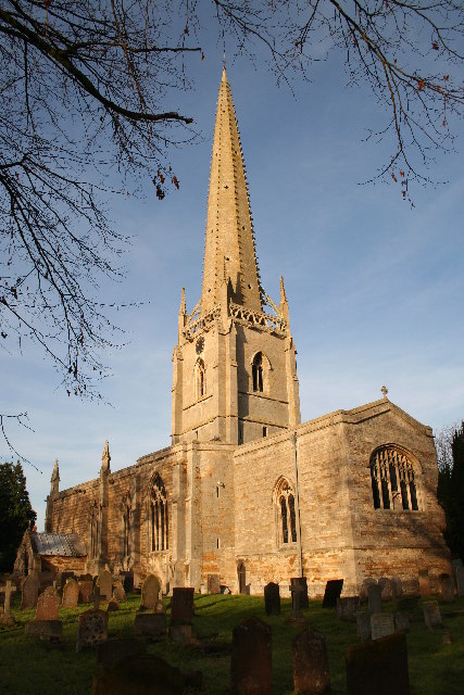
The village boasts a rich history dating back to the Roman era, as evidenced by the remains of a Roman road that passed through the area. Today, Brandon maintains its historical character through the presence of several well-preserved buildings, including St. John the Baptist Church, which dates back to the 12th century. The church is a prominent feature of the village and serves as a gathering place for religious and community events.

Brandon offers a range of amenities to its residents, including a primary school, a village hall, and a post office. The village also has a cozy pub, The Wheatsheaf, where locals and visitors can enjoy a traditional British meal or a pint of ale.

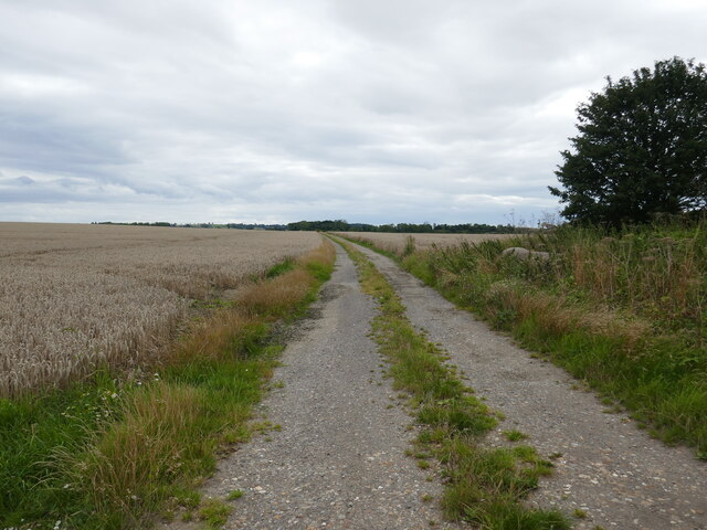
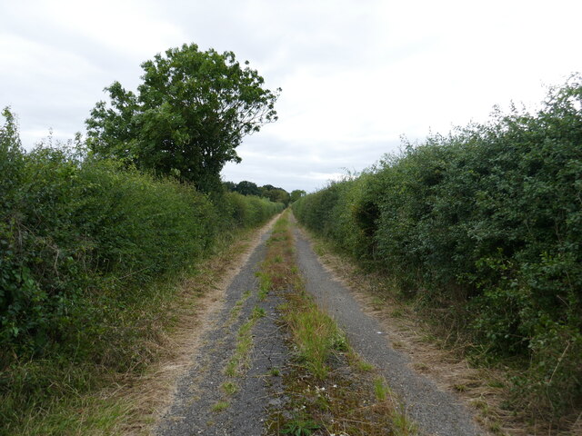
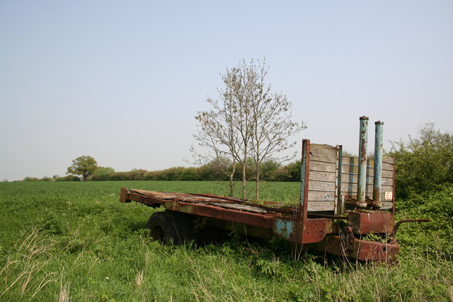
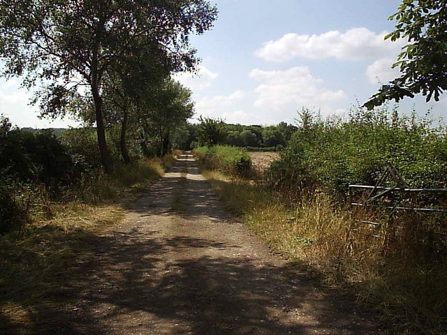
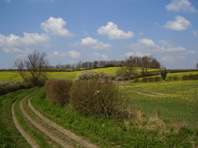
Nature lovers will appreciate Brandon's picturesque surroundings. The village is surrounded by lush green fields and farmland, providing ample opportunities for outdoor activities such as walking, cycling, and horseback riding. The nearby River Witham also offers opportunities for fishing and boating.

Overall, Brandon, Lincolnshire, is a peaceful and idyllic village that showcases the beauty of rural England. Its rich history, close-knit community, and natural surroundings make it an attractive place to live or visit for those seeking a tranquil countryside experience.

If you have any feedback on the listing, please let us know in the comments section below.

Brandon Images

Images are sourced within 2km of 53.023446/-0.653671 or Grid Reference SK9048. Thanks to Geograph Open Source API. All images are credited.

Brandon Chapel near sunset The oldest parts date from the twelfth century <span class="nowrap"><a title="https://historicengland.org.uk/listing/the-list/list-entry/1062416?section=official-listing" rel="nofollow ugc noopener" href="https://historicengland.org.uk/listing/the-list/list-entry/1062416?section=official-listing">Link</a><img style="margin-left:2px;" alt="External link" title="External link - shift click to open in new window" src="https://s1.geograph.org.uk/img/external.png" width="10" height="10"/></span>
Brandon Chapel near sunset
The oldest parts date from the twelfth century LinkExternal link
Millennium stone and Brandon Chapel
Cow and calf sculpture, Brandon
Farm track to Wheatgrass Lane, Caythorpe
Track to Shield's Gorse
Brandon Chapel Much restored by Kirk of Sleaford in 1872, but re-using earlier masonry. Norman south doorway with tympanum, tub font, decorative niche and some 15th century graffiti in the window by the pulpit.
Brandon Chapel
Much restored by Kirk of Sleaford in 1872, but re-using earlier masonry. Norman south doorway with tympanum, tub font, decorative niche and some 15th century graffiti in the window by the pulpit.
Near Gelston Grange Rural scene near Gelston Grange
Near Gelston Grange
Rural scene near Gelston Grange
Brandon Old Hall A delightful building .... dated 1637 with alternating bands of grey stone with gold and red ironstone.
Brandon Old Hall
A delightful building .... dated 1637 with alternating bands of grey stone with gold and red ironstone.
Fox Covert This track leads to the small wood in the distance called Fox Covert.
Fox Covert
This track leads to the small wood in the distance called Fox Covert.
Track to Moor Barn This farm track leads to Moor Barn at the other side of this square from here.  The barn in the picture is not Moor Barn
Track to Moor Barn
This farm track leads to Moor Barn at the other side of this square from here. The barn in the picture is not Moor Barn
Teasel and Brant This ditch is part of the upper reaches of the River Brant.  The river bed was almost dry during this last week in July.
Teasel and Brant
This ditch is part of the upper reaches of the River Brant. The river bed was almost dry during this last week in July.
Puddles! A rare sight this month but a band of rain which passed by this area left enough water to form puddles.  The track is a bridleway to Dry Doddington and was once part of the road before a sharp bend was removed.
Puddles!
A rare sight this month but a band of rain which passed by this area left enough water to form puddles. The track is a bridleway to Dry Doddington and was once part of the road before a sharp bend was removed.
Path to Court Leys This footpath crosses a dyke on its way to the nearby Court Leys.
Path to Court Leys
This footpath crosses a dyke on its way to the nearby Court Leys.
Open barn at Court Leys Farm Looking along Stragglethorpe Lane towards Brandon.
Open barn at Court Leys Farm
Looking along Stragglethorpe Lane towards Brandon.
Derelict barn on the bank of the River Brant
Weak bridge over the River Brant On Gorse Hill Lane. The flat farmland round here is called Caythorpe Low Fields.
Weak bridge over the River Brant
On Gorse Hill Lane. The flat farmland round here is called Caythorpe Low Fields.
Wheatgrass Lane near Caythorpe This green road goes from Gorse Hill Lane right into the centre of Caythorpe. It turns a right angle by the trees in the centre distance and follows the hedgerow east into the village.
Wheatgrass Lane near Caythorpe
This green road goes from Gorse Hill Lane right into the centre of Caythorpe. It turns a right angle by the trees in the centre distance and follows the hedgerow east into the village.
Farmland off Wheatgrass Lane Shield's Gorse to the left and Protection Wood the right.
Farmland off Wheatgrass Lane
Shield's Gorse to the left and Protection Wood the right.
Show me another place!

Brandon is located at Grid Ref: SK9048 (Lat: 53.023446, Lng: -0.653671)

Division: Parts of Kesteven

Administrative County: Lincolnshire

District: South Kesteven

Police Authority: Lincolnshire

What 3 Words

///oath.grunt.pampered. Near Caythorpe, Lincolnshire

Nearby Locations

Brandon

Related Wikis

Brandon, Lincolnshire

Brandon is a small village in South Kesteven, south Lincolnshire, England, part of the civil parish of Hough-on-the-Hill (where the population is listed...

Loveden

Loveden is a deanery of the Diocese of Lincoln, England, and a former wapentake.Loveden is located broadly to the North of Grantham and includes the villages...

Hough-on-the-Hill

Hough-on-the-Hill is a village and civil parish in the South Kesteven district of Lincolnshire, England. The population of the civil parish including Brandon...
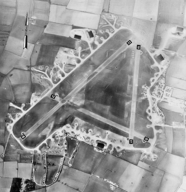
RAF Fulbeck

Royal Air Force Fulbeck or more simply RAF Fulbeck is a former Royal Air Force station located 6.3 miles (10.1 km) east of Newark-on-Trent, Nottinghamshire...

Gelston, Lincolnshire

Gelston is a village in the South Kesteven district of Lincolnshire, England. It is 2 miles (3 km) west from the A607 road, 5 miles (8 km) north from Grantham...

Stubton

Stubton is a small village and civil parish in the South Kesteven district of Lincolnshire, England. The population of the civil parish (including Fenton...

Frieston

Frieston is a village in the South Kesteven district of Lincolnshire, England. It is situated just west of the A607 road, and 7 miles (11 km) north from...

St Vincent's Church, Caythorpe

St Vincent's Church is a Grade I listed Church of England parish church in Caythorpe, Lincolnshire, England. It is at the southern edge of the Lincoln...

Nearby Amenities

Located within 500m of 53.023446,-0.653671
Brandon
Is In: Lincolnshire, England, UK
Place: hamlet
Source: NPE
Wikidata: Q4956733
Wikipedia: en:Brandon, Lincolnshire
Lat/Long: 53.0235564/-0.6538317
Created By: Merkaartor 0.12
Lat/Long: 53.0202757/-0.6577849
Bus Stop
Church Lane
Naptan AtcoCode: 270000008613
Naptan Bearing: NW
Naptan CommonName: Church Lane
Naptan Indicator: NW - bound
Naptan Landmark: Church Lane
Naptan NaptanCode: lingtjmp
Naptan Street: Hough Road
Naptan Verified: no
Source: naptan_import
Lat/Long: 53.0220941/-0.6550029
Bus Stop
Church Lane
Naptan AtcoCode: 270000008614
Naptan Bearing: SE
Naptan CommonName: Church Lane
Naptan Indicator: SE - bound
Naptan Landmark: Church Lane
Naptan NaptanCode: lingtjmt
Naptan Street: Hough Road
Naptan Verified: no
Source: naptan_import
Lat/Long: 53.0220912/-0.6547496
Stubton Road
Naptan AtcoCode: 270002701078
Naptan Bearing: NE
Naptan BusStopType: CUS
Naptan CommonName: Stubton Road
Naptan Indicator: adj
Naptan Landmark: Stubton Road
Naptan Street: Main Road
Naptan Verified: no
Source: naptan_import
Lat/Long: 53.0255709/-0.6555956
Stubton Road
Naptan AtcoCode: 270002701079
Naptan Bearing: SW
Naptan BusStopType: CUS
Naptan CommonName: Stubton Road
Naptan Indicator: opp
Naptan Landmark: Stubton Road
Naptan Street: Main Road
Naptan Verified: no
Source: naptan_import
Lat/Long: 53.0253536/-0.6554532
Hall Farm
Place: farm
Source: Bing
Lat/Long: 53.0244844/-0.6524562
Church Farm
Place: farm
Source: Bing
Lat/Long: 53.0230097/-0.6558355
Defibrillator
Booth: K6
Covered: booth
Defibrillator Location: In a converted red phone box, Brandon
Disused Amenity: telephone
Emergency: defibrillator
Man Made: telephone_box
Old Phone: +44 1636 626291
Lat/Long: 53.0226087/-0.6551658
Post Box
Post Box Type: lamp
Lat/Long: 53.0228367/-0.6549343
The data included in this document is from www.openstreetmap.org. The data is made available under ODbL.

Have you been to Brandon?

Leave your review of Brandon below (or comments, questions and feedback).