Wilburton

Settlement in Cambridgeshire East Cambridgeshire

England

Wilburton

St Peter, Wilburton: late September 2021
St Peter, Wilburton: late September 2021 Credit: Basher Eyre

Wilburton is a village located in the county of Cambridgeshire, England. Situated approximately 10 miles north of the city of Cambridge, Wilburton is nestled amidst the picturesque Fens region. With a population of around 2,000 residents, it is a tight-knit community that offers a peaceful and idyllic countryside setting.

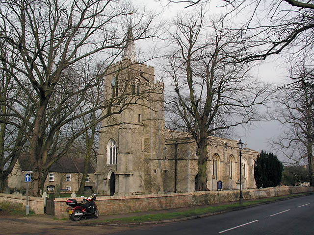
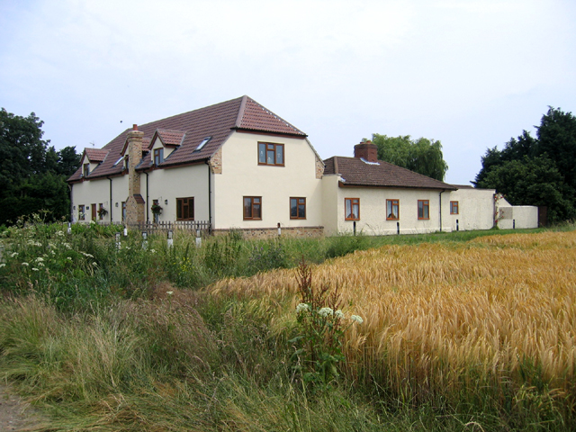
The village is renowned for its rich history, dating back to the Roman era. Evidence of this can still be seen today, with archaeological remains discovered in the area. Wilburton features a variety of architectural styles, reflecting its heritage, including traditional thatched cottages, charming farmhouses, and historic buildings.

Despite its small size, the village boasts a range of amenities, catering to the needs of its residents. These include a village shop, a post office, and a primary school, providing essential services within close proximity.

Wilburton is well-connected to nearby towns and cities. The A10 road, one of the major transport routes in the region, passes through the village, ensuring easy access to Cambridge, Ely, and London. Public transportation options are also available, with regular bus services connecting the village to surrounding areas.

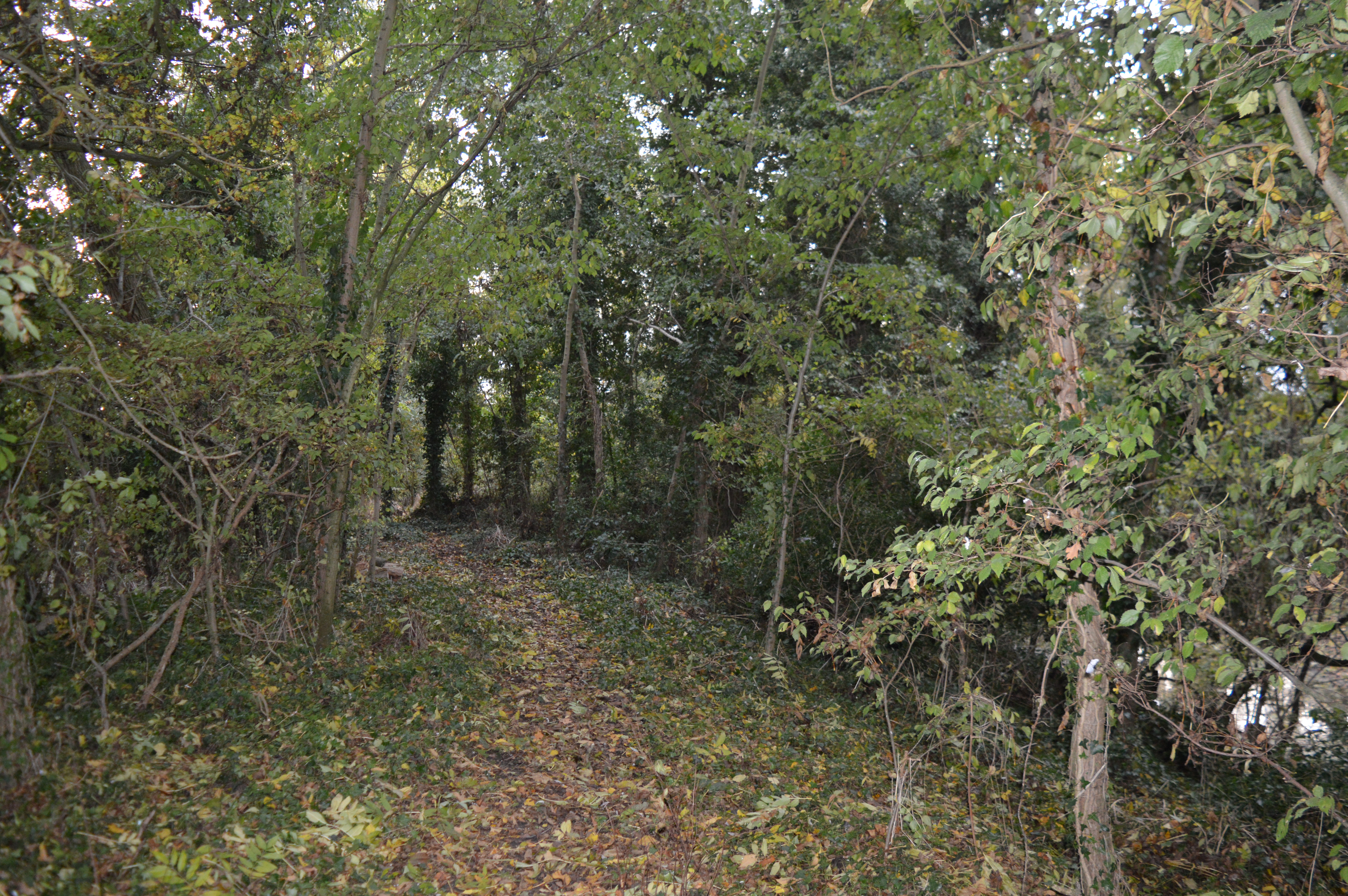
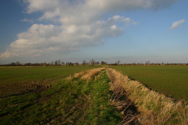
Nestled in the heart of the Cambridgeshire countryside, Wilburton offers residents and visitors alike ample opportunities for outdoor activities. The village is surrounded by vast open fields, perfect for walking, cycling, and exploring nature. Additionally, the nearby River Great Ouse provides opportunities for boating and fishing.

In summary, Wilburton is a charming village in Cambridgeshire, offering a peaceful and historic setting, a range of amenities, and easy access to nearby towns and cities.

If you have any feedback on the listing, please let us know in the comments section below.

Wilburton Images

Images are sourced within 2km of 52.351992/0.17669846 or Grid Reference TL4874. Thanks to Geograph Open Source API. All images are credited.

St Peter, Wilburton: late September 2021
St Peter, Wilburton: porch memorial Beauchamp Tyndall Pell was born in Ickenham, the son of The Rev. Beauchamp Henry St John Pell. He was educated at Wellington College and Sandhurst. He served at Gibraltar, China and India. He and his wife were married in Bengal in 1903; and his son Beauchamp Stuart Pell was born there a year later. He is buried at Zantvoorde British Cemetery in Belgium; and also listed on the Beaconsfield War Memorial <a title="https://www.geograph.org.uk/photo/3656184" href="https://www.geograph.org.uk/photo/3656184">Link</a>
St Peter, Wilburton: porch memorial
Beauchamp Tyndall Pell was born in Ickenham, the son of The Rev. Beauchamp Henry St John Pell. He was educated at Wellington College and Sandhurst. He served at Gibraltar, China and India. He and his wife were married in Bengal in 1903; and his son Beauchamp Stuart Pell was born there a year later. He is buried at Zantvoorde British Cemetery in Belgium; and also listed on the Beaconsfield War Memorial Link
St Peter, Wilburton: The Great War- those who served
St Peter, Wilburton: font
St Peter, Wilburton: war memorial Many war memorials appeared in British towns and cities after the South African War of 1899-1902 (known popularly as the Boer War), but most were constructed after the First World War, known to contemporaries as the Great War (1914-19). These were updated after the Second World War (1939-45), usually by adding a plaque with the names of those killed in that conflict. Almost every town and village in Britain has a memorial erected after the Great War, the commonest types taking the form of a cross, an obelisk or a statue of a soldier. Some occupy a prominent public space; others stand in the local cemetery or can be found inside the local church. Memorials usually commemorate the inhabitants of a particular locality, the former pupils of a school, or the members of a military unit or branch of the armed forces. Other memorials, often bronze plaques placed indoors, commemorate the employees of a private company or public institution.
St Peter, Wilburton: war memorial
Many war memorials appeared in British towns and cities after the South African War of 1899-1902 (known popularly as the Boer War), but most were constructed after the First World War, known to contemporaries as the Great War (1914-19). These were updated after the Second World War (1939-45), usually by adding a plaque with the names of those killed in that conflict. Almost every town and village in Britain has a memorial erected after the Great War, the commonest types taking the form of a cross, an obelisk or a statue of a soldier. Some occupy a prominent public space; others stand in the local cemetery or can be found inside the local church. Memorials usually commemorate the inhabitants of a particular locality, the former pupils of a school, or the members of a military unit or branch of the armed forces. Other memorials, often bronze plaques placed indoors, commemorate the employees of a private company or public institution.
St Peter, Wilburton: east window
St Peter, Wilburton: Pell Family memorial (i)
St Peter, Wilburton: Pell Family memorial (ii) For more about Sir Albert Pell see <span class="nowrap"><a title="https://en.wikisource.org/wiki/Dictionary_of_National_Biography,_1912_supplement/Pell,_Albert" rel="nofollow ugc noopener" href="https://en.wikisource.org/wiki/Dictionary_of_National_Biography,_1912_supplement/Pell,_Albert">Link</a><img style="margin-left:2px;" alt="External link" title="External link - shift click to open in new window" src="https://s1.geograph.org.uk/img/external.png" width="10" height="10"/></span>
St Peter, Wilburton: Pell Family memorial (ii)
For more about Sir Albert Pell see LinkExternal link
St Peter, Wilburton: altar window
St Peter, Wilburton: altar
St Peter, Wilburton: altar churchyard memorial I also found this, which indicates they were a prominent local family <span class="nowrap"><a title="https://wilburton.ccan.co.uk/content/catalogue_item/thomas-camps-presenting-dr-fairweather-with-a-farewell-retiring-present-from-grateful-past-patients-from-wilburton" rel="nofollow ugc noopener" href="https://wilburton.ccan.co.uk/content/catalogue_item/thomas-camps-presenting-dr-fairweather-with-a-farewell-retiring-present-from-grateful-past-patients-from-wilburton">Link</a><img style="margin-left:2px;" alt="External link" title="External link - shift click to open in new window" src="https://s1.geograph.org.uk/img/external.png" width="10" height="10"/></span>
St Peter, Wilburton: altar churchyard memorial
I also found this, which indicates they were a prominent local family LinkExternal link
St Peter, Wilburton: gravestone
St Peter's church, Wilburton
WW1 Roll of Honour inside St Peter's church, Wilburton
War memorial for Beauchamp Pell inside St Peter's church, Wilburton
War memorial window inside St Peter's church, Wilburton
Interior of St Peter's church, Wilburton
War memorials inside St Peter's church, Wilburton
Show me another place!

Wilburton is located at Grid Ref: TL4874 (Lat: 52.351992, Lng: 0.17669846)

Division: Isle of Ely

Administrative County: Cambridgeshire

District: East Cambridgeshire

Police Authority: Cambridgeshire

What 3 Words

///safest.obscuring.skin. Near Wilburton, Cambridgeshire

Related Wikis

Wilburton

Wilburton is a small village of just over 1,000 inhabitants, situated in Cambridgeshire, England. It is 6 miles south west of Ely. While nominally an agricultural...

Doghouse Grove

Doghouse Grove is a 0.8-hectare (2.0-acre) nature reserve in Wilburton in Cambridgeshire. It is managed by the Wildlife Trust for Bedfordshire, Cambridgeshire...

Wilburton railway station

Wilburton railway station was a station in Wilburton, Cambridgeshire on the Ely and St Ives Railway. It was closed to regular passenger trains in 1931...

Mereham

Mereham was a potential new town near Ely in East Cambridgeshire, England. Developer Multiplex Stannifer has not received planning permission yet. East...

Grunty Fen

Grunty Fen is a fen and former civil parish, now in the parish of Wilburton, in the East Cambridgeshire district, in Cambridgeshire, England. It is 4 miles...

Haddenham, Cambridgeshire

Haddenham is a village and civil parish in Cambridgeshire, England. In the 2001 census the parish had a population of 3,228. The 2011 census reported a...

Haddenham railway station (Cambridgeshire)

Haddenham railway station was a station in Haddenham, Cambridgeshire. It was first opened in 1866 by the Ely, Haddenham and Sutton Railway. It closed to...

North Witchford Rural District

North Witchford was a rural district in England from 1894 to 1974. It was named after the ancient hundred of North Witchford. It was formed in 1894 under...

Nearby Amenities

Located within 500m of 52.351992,0.17669846
Wilburton
Is In: Cambridgeshire, England, UK
Place: village
Wikidata: Q2224144
Lat/Long: 52.3531661/0.1777163
Fuel
Created By: Potlatch 0.9c
Lat/Long: 52.3519912/0.1780631
Turning Circle
Lat/Long: 52.3527259/0.1768556
Bus Stop
Station Road
Bus: yes
Naptan AtcoCode: 0500EWILB002
Naptan Bearing: E
Naptan CommonName: Station Road
Naptan Indicator: near
Naptan Landmark: Station Road
Naptan NaptanCode: cmbdjmga
Naptan ShortCommonName: Station Road
Naptan Street: High Street
Naptan Verified: no
Public Transport: platform
Shelter: no
Source: naptan_import
Tactile Paving: no
Lat/Long: 52.3517953/0.1806854
Bus Stop
Carpond Lane
Bench: no
Bin: no
Bus: yes
Lit: no
Naptan AtcoCode: 0500EWILB003
Naptan Bearing: E
Naptan CommonName: Carpond Lane
Naptan Indicator: near
Naptan Landmark: Carpond Lane
Naptan NaptanCode: cmbdjmgd
Naptan ShortCommonName: Carpond Lane
Naptan Street: High Street
Naptan Verified: no
Public Transport: platform
Shelter: no
Source: naptan_import
Tactile Paving: no
Lat/Long: 52.3521724/0.1763279
Bus Stop
Station Road
Bus: yes
Naptan AtcoCode: 0500EWILB005
Naptan Bearing: W
Naptan BusStopType: CUS
Naptan CommonName: Station Road
Naptan Indicator: opp
Naptan Landmark: Station Road
Naptan NaptanCode: cmbdjmgm
Naptan ShortCommonName: Station Road
Naptan Street: High Street
Naptan Verified: no
Public Transport: platform
Source: naptan_import
Lat/Long: 52.3516967/0.1806732
Bus Stop
High Street
Bus: yes
Naptan AtcoCode: 0500EWILB006
Naptan Bearing: E
Naptan CommonName: High Street
Naptan Indicator: near
Naptan Landmark: West End
Naptan NaptanCode: cmbdjmgp
Naptan ShortCommonName: High Street
Naptan Street: Church Lane
Naptan Verified: no
Public Transport: platform
Source: naptan_import
Lat/Long: 52.3530738/0.1723045
Bus Stop
Carpond Lane
Bench: no
Bin: no
Bus: yes
Lit: no
Naptan AtcoCode: 0500EWILB007
Naptan Bearing: W
Naptan CommonName: Carpond Lane
Naptan Indicator: opp
Naptan Landmark: Carpond Lane
Naptan NaptanCode: cmbdjmgt
Naptan ShortCommonName: Carpond Lane
Naptan Street: High Street
Naptan Verified: no
Public Transport: platform
Shelter: no
Source: naptan_import
Tactile Paving: no
Lat/Long: 52.3522695/0.1754516
Bus Stop
High Street
Bench: no
Bin: no
Bus: yes
Lit: yes
Naptan AtcoCode: 0500EWILB008
Naptan Bearing: W
Naptan CommonName: High Street
Naptan Indicator: o/s 57
Naptan Landmark: Clarke's Lane
Naptan NaptanCode: cmbdjmgw
Naptan ShortCommonName: High Street
Naptan Street: High Street
Naptan Verified: no
Public Transport: platform
Shelter: no
Source: naptan_import
Tactile Paving: no
Lat/Long: 52.3525772/0.1738807
Power: pole
Lat/Long: 52.350618/0.1818967
Power: pole
Lat/Long: 52.3507146/0.1801987
Material: wood
Power: pole
Lat/Long: 52.3507948/0.1783533
Power: pole
Lat/Long: 52.3505377/0.1834094
Restaurant
Applejacks Restaurant
Opening Hours: Mo-Sa 09:00-17:00; Su 10:30-16:30
Website: https://www.twentypence.co.uk/our-restaurants/applejacks-restaurant.htm
Lat/Long: 52.3498145/0.1749752
Post Box
Brand: Royal Mail
Brand Wikidata: Q638098
Brand Wikipedia: en:Royal Mail
Collection Times: Mo-Fr 17:15; Sa 10:45
Operator: Royal Mail
Operator Wikidata: Q638098
Post Box Design: type_l
Post Box Type: lamp
Ref: CB6 153
Royal Cypher: EIIR
Royal Cypher Wikidata: Q33102113
Source: survey
Lat/Long: 52.352116/0.1765415
Post Box
Collection Times: Mo-Fr 09:00; Sa 07:00
Operator: Royal Mail
Post Box Type: lamp
Ref: CB6 156
Royal Cypher: EIIR
Royal Cypher Wikidata: Q33102113
Source: survey
Lat/Long: 52.354708/0.1794127
Information: board
Sign: information
Tourism: information
Lat/Long: 52.3491793/0.1729383
Generator Method: photovoltaic
Generator Output Electricity: yes
Generator Source: solar
Generator Type: solar_photovoltaic_panel
Location: roof
Power: generator
Lat/Long: 52.3537945/0.1756284
Generator Method: photovoltaic
Generator Output Electricity: yes
Generator Source: solar
Generator Type: solar_photovoltaic_panel
Location: roof
Power: generator
Lat/Long: 52.3555409/0.1753145
Generator Method: photovoltaic
Generator Output Electricity: yes
Generator Source: solar
Generator Type: solar_photovoltaic_panel
Location: roof
Power: generator
Lat/Long: 52.3555736/0.1763204
Generator Method: photovoltaic
Generator Output Electricity: yes
Generator Source: solar
Generator Type: solar_photovoltaic_panel
Location: roof
Power: generator
Lat/Long: 52.354884/0.1778734
Generator Method: photovoltaic
Generator Output Electricity: yes
Generator Source: solar
Generator Type: solar_photovoltaic_panel
Location: roof
Power: generator
Lat/Long: 52.354861/0.1777661
Generator Method: photovoltaic
Generator Output Electricity: yes
Generator Source: solar
Generator Type: solar_photovoltaic_panel
Location: roof
Power: generator
Lat/Long: 52.3547988/0.1775113
Generator Method: photovoltaic
Generator Output Electricity: yes
Generator Source: solar
Generator Type: solar_photovoltaic_panel
Location: roof
Power: generator
Lat/Long: 52.3544744/0.1767227
Generator Method: photovoltaic
Generator Output Electricity: yes
Generator Source: solar
Generator Type: solar_photovoltaic_panel
Location: roof
Power: generator
Lat/Long: 52.354422/0.1767468
Generator Method: photovoltaic
Generator Output Electricity: yes
Generator Source: solar
Generator Type: solar_photovoltaic_panel
Location: roof
Power: generator
Lat/Long: 52.3543073/0.1768354
Generator Method: photovoltaic
Generator Output Electricity: yes
Generator Source: solar
Generator Type: solar_photovoltaic_panel
Location: roof
Power: generator
Lat/Long: 52.3542631/0.1768756
Generator Method: photovoltaic
Generator Output Electricity: yes
Generator Source: solar
Generator Type: solar_photovoltaic_panel
Location: roof
Power: generator
Lat/Long: 52.3540976/0.1769829
Generator Method: photovoltaic
Generator Output Electricity: yes
Generator Source: solar
Generator Type: solar_photovoltaic_panel
Location: roof
Power: generator
Lat/Long: 52.3539731/0.1770499
Generator Method: photovoltaic
Generator Output Electricity: yes
Generator Source: solar
Generator Type: solar_photovoltaic_panel
Location: roof
Power: generator
Lat/Long: 52.353919/0.1770687
Generator Method: photovoltaic
Generator Output Electricity: yes
Generator Source: solar
Generator Type: solar_photovoltaic_panel
Location: roof
Power: generator
Lat/Long: 52.3537159/0.1766449
Generator Method: photovoltaic
Generator Output Electricity: yes
Generator Source: solar
Generator Type: solar_photovoltaic_panel
Location: roof
Power: generator
Lat/Long: 52.3537306/0.1767442
Generator Method: photovoltaic
Generator Output Electricity: yes
Generator Source: solar
Generator Type: solar_photovoltaic_panel
Location: roof
Power: generator
Lat/Long: 52.3537601/0.1768595
Generator Method: photovoltaic
Generator Output Electricity: yes
Generator Source: solar
Generator Type: solar_photovoltaic_panel
Location: roof
Power: generator
Lat/Long: 52.3534784/0.1768675
Generator Method: photovoltaic
Generator Output Electricity: yes
Generator Source: solar
Generator Type: solar_photovoltaic_panel
Location: roof
Power: generator
Lat/Long: 52.3534734/0.1769748
Generator Method: photovoltaic
Generator Output Electricity: yes
Generator Source: solar
Generator Type: solar_photovoltaic_panel
Location: roof
Power: generator
Lat/Long: 52.3534734/0.1771009
Generator Method: photovoltaic
Generator Output Electricity: yes
Generator Source: solar
Generator Type: solar_photovoltaic_panel
Location: roof
Power: generator
Lat/Long: 52.3534685/0.1772001
Generator Method: photovoltaic
Generator Output Electricity: yes
Generator Source: solar
Generator Type: solar_photovoltaic_panel
Location: roof
Power: generator
Lat/Long: 52.3544941/0.1791099
Generator Method: photovoltaic
Generator Output Electricity: yes
Generator Source: solar
Generator Type: solar_photovoltaic_panel
Location: roof
Power: generator
Lat/Long: 52.3544498/0.1789275
Generator Method: photovoltaic
Generator Output Electricity: yes
Generator Source: solar
Generator Type: solar_photovoltaic_panel
Location: roof
Power: generator
Lat/Long: 52.3541664/0.1786325
Generator Method: photovoltaic
Generator Output Electricity: yes
Generator Source: solar
Generator Type: solar_photovoltaic_panel
Location: roof
Power: generator
Lat/Long: 52.3540485/0.1782864
Generator Method: photovoltaic
Generator Output Electricity: yes
Generator Source: solar
Generator Type: solar_photovoltaic_panel
Location: roof
Power: generator
Lat/Long: 52.3539944/0.1781309
Generator Method: photovoltaic
Generator Output Electricity: yes
Generator Source: solar
Generator Type: solar_photovoltaic_panel
Location: roof
Power: generator
Lat/Long: 52.353693/0.1774147
Generator Method: photovoltaic
Generator Output Electricity: yes
Generator Source: solar
Generator Type: solar_photovoltaic_panel
Location: roof
Power: generator
Lat/Long: 52.3536684/0.177353
Generator Method: photovoltaic
Generator Output Electricity: yes
Generator Source: solar
Generator Type: solar_photovoltaic_panel
Location: roof
Power: generator
Lat/Long: 52.3514206/0.1746038
Generator Method: photovoltaic
Generator Output Electricity: yes
Generator Source: solar
Generator Type: solar_photovoltaic_panel
Location: roof
Power: generator
Lat/Long: 52.3527133/0.1731151
Generator Method: photovoltaic
Generator Output Electricity: yes
Generator Source: solar
Generator Type: solar_photovoltaic_panel
Location: roof
Power: generator
Lat/Long: 52.3530442/0.1700172
Public Bookcase
Wilburton Book Exchange
Booth: K6
Check Date: 2023-08-21
Disused Amenity: telephone
Man Made: telephone_box
Public Bookcase Type: phone_box
Lat/Long: 52.3524304/0.1744198
Wilburton
Man Made: village_sign
Source: survey
Tourism: artwork
Lat/Long: 52.3530656/0.1720544
Cafe
Orchard Pizzeria & Coffee Bar
Opening Hours: Mo-Fr 10:30-15:00; Sa 10:00-16:00; Su 10:30-15:30
Website: https://www.twentypence.co.uk/our-restaurants/orchard-pizzeria-coffee-bar.htm
Lat/Long: 52.3496751/0.1751889
Ice Cream
Orchard Ice Cream Parlour
Opening Hours: Mo-Sa 10:30-17:00; Su 10:30-16:00
Website: https://www.twentypence.co.uk/our-restaurants/orchard-ice-cream-parlour.htm
Lat/Long: 52.3495449/0.1751446
The Putting Shed Mini Golf
Leisure: miniature_golf
Website: https://www.twentypence.co.uk/events-activities/mini-golf.htm
Lat/Long: 52.3496596/0.1756958
Leisure: playground
Lat/Long: 52.3498332/0.1758098
Advertising: board
Lat/Long: 52.352449/0.1743483
The data included in this document is from www.openstreetmap.org. The data is made available under ODbL.

Have you been to Wilburton?

Leave your review of Wilburton below (or comments, questions and feedback).