Wiganthorpe
Settlement in Yorkshire Ryedale
England
Wiganthorpe

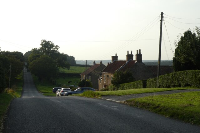
Wiganthorpe is a small village located in the county of Yorkshire, England. Situated approximately 10 miles east of the historic city of York, the village is nestled in the picturesque countryside and surrounded by rolling hills and fields. With a population of around 200 residents, Wiganthorpe exudes a sense of tranquility and charm.
The village itself is characterized by traditional stone-built houses, many of which date back to the 18th and 19th centuries, giving it a distinctive architectural style. The local church, St. Mary's, is a prominent landmark and a hub of community activities.
Despite its small size, Wiganthorpe boasts a close-knit and vibrant community. Residents often come together for various events and activities, such as the annual village fete and community garden projects. The village pub is a popular meeting spot, providing a welcoming atmosphere and serving locally sourced food and drinks.
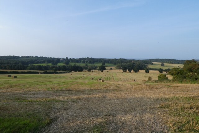
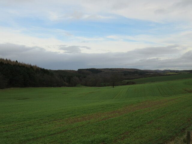
Surrounding Wiganthorpe, the countryside offers numerous opportunities for outdoor pursuits. The village is surrounded by scenic walking and cycling routes, allowing residents and visitors to explore the beauty of the Yorkshire landscape. Additionally, the nearby River Derwent is a popular spot for fishing and boating enthusiasts.
Although Wiganthorpe is a peaceful retreat, it benefits from being in close proximity to larger towns and cities. With good transport links, residents can easily access the amenities and services offered by nearby towns, while enjoying the tranquility of village life.
In summary, Wiganthorpe is a charming rural village in Yorkshire, offering a peaceful and close-knit community, stunning countryside views, and convenient access to nearby towns and cities.
If you have any feedback on the listing, please let us know in the comments section below.
Wiganthorpe Images
Images are sourced within 2km of 54.142069/-0.98781105 or Grid Reference SE6672. Thanks to Geograph Open Source API. All images are credited.


Wiganthorpe is located at Grid Ref: SE6672 (Lat: 54.142069, Lng: -0.98781105)
Division: North Riding
Administrative County: North Yorkshire
District: Ryedale
Police Authority: North Yorkshire
What 3 Words
///acre.growl.grafted. Near Sheriff Hutton, North Yorkshire
Nearby Locations
Related Wikis

Howardian Hills
The Howardian Hills are an Area of Outstanding Natural Beauty located between the Yorkshire Wolds, the North York Moors National Park, and the Vale of...

Scackleton
Scackleton is a village and civil parish in the Ryedale district of North Yorkshire, England. It is in the Howardian Hills and 2 miles (3.2 km) south-west...

Terrington
Terrington is a large village and civil parish in the Ryedale district of North Yorkshire, England. It is situated in the Howardian Hills, 4 miles (6.4...

Wath, Ryedale
Wath is a small hamlet in the civil parish of Hovingham, in North Yorkshire, England. It is situated at the northern edge of the Howardian Hills AONB,...

Hovingham
Hovingham is a large village and civil parish in the Ryedale district of North Yorkshire, England. It is on the edge of the Howardian Hills and about 7...

Hovingham Hall
Hovingham Hall is a country house built in the Palladian style in the village of Hovingham, North Yorkshire, England. It has been the seat of the Worsley...

Fryton
Fryton is a small village and civil parish in North Yorkshire, England with a population of around 50. This population remained less than 100 at the 2011...

Coulton, North Yorkshire
Coulton is a village and civil parish in the Ryedale district of North Yorkshire, England, it is about 6 miles (9.7 km) south of Helmsley. == History... ==
Nearby Amenities
Located within 500m of 54.142069,-0.98781105Have you been to Wiganthorpe?
Leave your review of Wiganthorpe below (or comments, questions and feedback).