Wickridge Street

Settlement in Gloucestershire Tewkesbury

England

Wickridge Street

Bungalow and Foscombe Hill
Bungalow and Foscombe Hill Credit: Jonathan Thacker

Wickridge Street is a charming and historic street located in the picturesque county of Gloucestershire, in southwestern England. Situated in the heart of the town, the street is renowned for its quaint architecture, cobbled paving, and traditional English atmosphere.

Lined with a mix of well-preserved Georgian and Victorian houses, Wickridge Street offers a glimpse into the region's architectural heritage. The facades often feature ornate details, such as bay windows, sash windows, and decorative ironwork. Many of the buildings have been converted into vibrant shops, restaurants, and cafes, adding to the street's lively ambiance.

The street is pedestrian-friendly, with wide sidewalks that allow visitors to stroll leisurely while taking in the sights and sounds. Flower boxes, hanging baskets, and trees further enhance the street's visual appeal, particularly during the spring and summer months when vibrant blooms add bursts of color.

Wickridge Street is also known for its thriving local businesses. Independent boutiques offer a range of unique products, from handmade crafts to vintage clothing, attracting both locals and tourists alike. The street is a haven for food lovers, with various eateries serving up delicious cuisine, including traditional British fare, international dishes, and freshly brewed coffee.

Beyond its architectural and commercial appeal, Wickridge Street is surrounded by a wealth of natural beauty. The nearby Cotswolds hills provide a picturesque backdrop, while the tranquil River Severn flows just a short distance away, offering opportunities for scenic walks and picnics.

Overall, Wickridge Street encapsulates the essence of Gloucestershire, offering a delightful blend of history, charm, and modern amenities that keep visitors coming back for more.

If you have any feedback on the listing, please let us know in the comments section below.

Wickridge Street Images

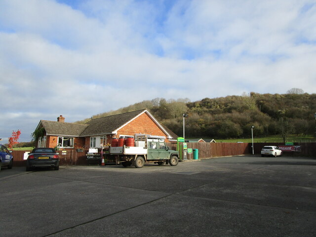
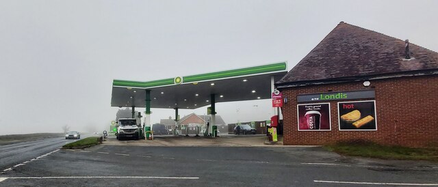
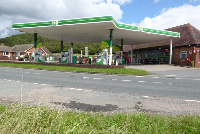
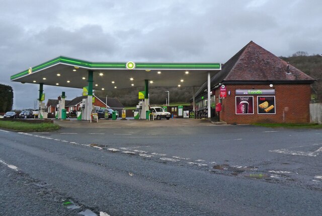
Images are sourced within 2km of 51.943356/-2.2751826 or Grid Reference SO8127. Thanks to Geograph Open Source API. All images are credited.

Bungalow and Foscombe Hill
Trees by Gloucester Road, Corse
Crosshands Filling Station
Watersmeet Public House
A BP petrol station A BP petrol station on the A417 to the north of Hartpury.
A BP petrol station
A BP petrol station on the A417 to the north of Hartpury.
Crosshands Filling Station
Country road, Hasfield Lined with pink horse chestnut trees as it heads west out of the village.
Country road, Hasfield
Lined with pink horse chestnut trees as it heads west out of the village.
Ham Road near Hasfield (2) Here lined with pollarded poplars (or possibly willows).
Ham Road near Hasfield (2)
Here lined with pollarded poplars (or possibly willows).
Rectory Farm
Rectory Farm
Ashleworth Ham Ashleworth Ham Nature Reserve (Gloucestershire Wildlife Trust), as seen from the hide in Meerend Thicket.
Ashleworth Ham
Ashleworth Ham Nature Reserve (Gloucestershire Wildlife Trust), as seen from the hide in Meerend Thicket.
Horse at Hasfield A curious horse coming to say hello in a field in Hasfield.
Horse at Hasfield
A curious horse coming to say hello in a field in Hasfield.
Access to Broadstreet Farm and footpath to Ashleworth
Bridleway to Corse Wood near Stream Farm
Grass field and hedgerow with trees Near Corner House Farm.
Grass field and hedgerow with trees
Near Corner House Farm.
Corse Wood Hill Corse Wood just showing on the left.
Corse Wood Hill
Corse Wood just showing on the left.
Footpath to Lime Kiln Farm
Entrance to Hasfield Court Grade II listed <span class="nowrap"><a title="https://historicengland.org.uk/listing/the-list/list-entry/1091402?section=official-list-entry" rel="nofollow ugc noopener" href="https://historicengland.org.uk/listing/the-list/list-entry/1091402?section=official-list-entry">Link</a><img style="margin-left:2px;" alt="External link" title="External link - shift click to open in new window" src="https://s1.geograph.org.uk/img/external.png" width="10" height="10"/></span>
Entrance to Hasfield Court
Grade II listed LinkExternal link
Lane below Corse Grove
Show me another place!

Wickridge Street is located at Grid Ref: SO8127 (Lat: 51.943356, Lng: -2.2751826)

Administrative County: Gloucestershire

District: Tewkesbury

Police Authority: Gloucestershire

What 3 Words

///trial.collides.surfacing. Near Corse, Gloucestershire

Related Wikis

Foscombe

Foscombe is a grade II* listed country house in Ashleworth, Gloucestershire. It was built around 1860 in the Gothic Revival style for the personal use...

Hasfield Court

Hasfield Court is a Grade II* listed building in Hasfield, Gloucestershire, England. Hasfield Court was the site of a medieval manor house, the home of...

Hasfield

Hasfield is a civil parish in Gloucestershire, England, and lies six miles (9.7 km) south-west of Tewkesbury and seven miles (11 km) north of Gloucester...

Ashleworth Court

Ashleworth Court is a grade I listed house close to the River Severn in Ashleworth, Gloucestershire, England. The site has revealed pottery from Roman...

Nearby Amenities

Located within 500m of 51.943356,-2.2751826
Bus Stop
Berrow Farm
Naptan AtcoCode: 1600GL5197
Naptan Bearing: NW
Naptan CommonName: Berrow Farm
Naptan NaptanCode: gloawgmp
Naptan Street: Ashleworth Rd
Naptan Verified: no
Source: naptan_import
Lat/Long: 51.9418136/-2.2715613
Bus Stop
Berrow Farm
Naptan AtcoCode: 1600GL5198
Naptan Bearing: SE
Naptan CommonName: Berrow Farm
Naptan NaptanCode: gloawgma
Naptan Street: Ashleworth Rd
Naptan Verified: no
Source: naptan_import
Lat/Long: 51.9419831/-2.2721297
Wickridge Street
Power: pole
Transformer: distribution
Voltage Primary: 11000
Lat/Long: 51.9437488/-2.2747631
Barrier: stile
Lat/Long: 51.9442773/-2.2801144
Power: pole
Lat/Long: 51.9446637/-2.2747841
Power: pole
Lat/Long: 51.9452188/-2.2747958
Power: pole
Lat/Long: 51.9458733/-2.2743876
Power: pole
Lat/Long: 51.9465609/-2.2740216
Power: pole
Lat/Long: 51.9469825/-2.2792796
Power: pole
Lat/Long: 51.9469987/-2.278517
Power: pole
Lat/Long: 51.9470175/-2.2777704
Power: pole
Lat/Long: 51.9470358/-2.2772028
Power: pole
Lat/Long: 51.9470461/-2.2762787
Power: pole
Lat/Long: 51.9470649/-2.2753637
Power: pole
Lat/Long: 51.9470819/-2.274726
Power: pole
Lat/Long: 51.9471079/-2.2737021
Power: pole
Lat/Long: 51.9471273/-2.2724569
Wickridge Cottage
Power: pole
Transformer: distribution
Voltage Primary: 11000
Lat/Long: 51.9442872/-2.2801754
Power: pole
Lat/Long: 51.9450081/-2.2808325
Wickridge Farm
Power: pole
Transformer: distribution
Voltage Primary: 11000
Lat/Long: 51.9421287/-2.2711189
Power: pole
Lat/Long: 51.9426139/-2.2718149
Power: pole
Lat/Long: 51.9430629/-2.2725928
Power: pole
Lat/Long: 51.9435506/-2.2734229
Power: pole
Lat/Long: 51.9440797/-2.2740707
The data included in this document is from www.openstreetmap.org. The data is made available under ODbL.

Have you been to Wickridge Street?

Leave your review of Wickridge Street below (or comments, questions and feedback).