Whoberley

Settlement in Warwickshire

England

Whoberley

Autumn colour at Allesley Park Looking towards Allesley village at the trees screening Pickford Way. Ridge and furrow markings visible in the field.
Autumn colour at Allesley Park Credit: E Gammie

Whoberley is a suburban area located in the city of Coventry, in the county of Warwickshire, England. It is situated approximately two miles northwest of Coventry city center. The area is primarily residential, with a mix of housing types including detached and semi-detached houses, as well as some apartment buildings.

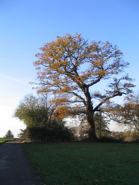
Whoberley benefits from its close proximity to local amenities and services. There are a number of schools within the area, catering to both primary and secondary education. Additionally, there are several parks and green spaces nearby, providing opportunities for outdoor recreation and leisure activities.

Transport links in Whoberley are well-developed, with regular bus services connecting the area to Coventry city center and surrounding regions. The nearby A45 road provides easy access to other major cities and towns in the region, as well as the wider motorway network.

Whoberley is a diverse and vibrant community, with a range of cultural and social activities available. The area is home to various community centers and sports clubs, offering opportunities for residents to engage in recreational pursuits and socialize with their neighbors.

Overall, Whoberley offers a pleasant and convenient place to live, with its combination of residential tranquility, access to amenities, and good transport links.

If you have any feedback on the listing, please let us know in the comments section below.

Whoberley Images

Images are sourced within 2km of 52.406239/-1.5537064 or Grid Reference SP3078. Thanks to Geograph Open Source API. All images are credited.

Autumn colour at Allesley Park Looking towards Allesley village at the trees screening Pickford Way. Ridge and furrow markings visible in the field.
Autumn colour at Allesley Park
Looking towards Allesley village at the trees screening Pickford Way. Ridge and furrow markings visible in the field.
Ridge and furrow Ridge and furrow markings at Allesley Park.
Ridge and furrow
Ridge and furrow markings at Allesley Park.
Allesley Park, autumn Looking towards Allesley village church spire and the trees edging the park.
Allesley Park, autumn
Looking towards Allesley village church spire and the trees edging the park.
Silver birch Some trees just like showing off in the autumn! Silver birch in Allesley Park, with ridge and furrow markings in foreground.
Silver birch
Some trees just like showing off in the autumn! Silver birch in Allesley Park, with ridge and furrow markings in foreground.
Allesley Hall This Hall, now a nursing home, was built on the site of a previous mansion in about 1910. Stonehouse Lane, in the foreground, leads to Allesley Village, joining the Birmingham Road by the Stone House <a href="https://www.geograph.org.uk/photo/275949">SP3080 : Stone House, Allesley</a>.

A 1979 view: <a href="https://www.geograph.org.uk/photo/5278140">SP2980 : Allesley Hall, 1979</a>
Allesley Hall
This Hall, now a nursing home, was built on the site of a previous mansion in about 1910. Stonehouse Lane, in the foreground, leads to Allesley Village, joining the Birmingham Road by the Stone House SP3080 : Stone House, Allesley. A 1979 view: SP2980 : Allesley Hall, 1979
Allesley Hall in 1972 The ha-ha in front of the house is visible, but is topped by a fence for the safety of those who would not find it amusing to fall off a ha-ha. There is now more vegetation in the Hall garden and a crazy golf course in the field in the foreground (see <a href="https://www.geograph.org.uk/photo/358720">SP2980 : Allesley Hall</a> ). The conical shape to the left of the Hall is the dovecote.
Allesley Hall in 1972
The ha-ha in front of the house is visible, but is topped by a fence for the safety of those who would not find it amusing to fall off a ha-ha. There is now more vegetation in the Hall garden and a crazy golf course in the field in the foreground (see SP2980 : Allesley Hall ). The conical shape to the left of the Hall is the dovecote.
Allesley Hall The hall was built in 1910 and is now a residential care home. Comparing this view with one taken in 1972 (see  <a href="https://www.geograph.org.uk/photo/358711">SP2980 : Allesley Hall in 1972</a> ) shows that there are now more shrubs and there is a hedge in the foreground surrounding a crazy golf course. Coventry History Centre has a picture of the previous mansion on the site, taken from a similar direction.
Allesley Hall
The hall was built in 1910 and is now a residential care home. Comparing this view with one taken in 1972 (see SP2980 : Allesley Hall in 1972 ) shows that there are now more shrubs and there is a hedge in the foreground surrounding a crazy golf course. Coventry History Centre has a picture of the previous mansion on the site, taken from a similar direction.
Allesley Park walled garden The garden was created about 200 years ago to provide fruit and vegetables for the Hall and at one time produced exotic fruits within its 1.4 acres. It was converted to an ornamental garden in the 20th century before being neglected but is now being restored as a kitchen garden by a group of volunteers. Taken from the path that runs behind Allesley Hall ( <a href="https://www.geograph.org.uk/photo/281029">SP2980 : Allesley Hall</a> ) and past the dovecote ( <a href="https://www.geograph.org.uk/photo/358741">SP2980 : Dovecote, Allesley Park</a> ).
Allesley Park walled garden
The garden was created about 200 years ago to provide fruit and vegetables for the Hall and at one time produced exotic fruits within its 1.4 acres. It was converted to an ornamental garden in the 20th century before being neglected but is now being restored as a kitchen garden by a group of volunteers. Taken from the path that runs behind Allesley Hall ( SP2980 : Allesley Hall ) and past the dovecote ( SP2980 : Dovecote, Allesley Park ).
Dovecote, Allesley Park In the centre is the conical roof of the dovecote, approximately 200 years old and now blocked to keep birds out.  To the left is Allesley Hall <a href="https://www.geograph.org.uk/photo/281029">SP2980 : Allesley Hall</a>. Taken from near the walled garden <a href="https://www.geograph.org.uk/photo/358729">SP2980 : Allesley Park walled garden</a>.
Dovecote, Allesley Park
In the centre is the conical roof of the dovecote, approximately 200 years old and now blocked to keep birds out. To the left is Allesley Hall SP2980 : Allesley Hall. Taken from near the walled garden SP2980 : Allesley Park walled garden.
Curving oak, Allesley Park Beyond it, several evergreen remnants of the Allesley Hall formal parkland.
Curving oak, Allesley Park
Beyond it, several evergreen remnants of the Allesley Hall formal parkland.
Allesley Green from Park Hill Lane A 1980s housing estate.  Just visible on the skyline is the woodland north of Meriden.
Allesley Green from Park Hill Lane
A 1980s housing estate. Just visible on the skyline is the woodland north of Meriden.
Park Hill Lane Park Hill Lane is an old lane that ran from Lower Eastern Green to Windmill Hill at the western end of Allesley village. It is now cut off by the A45 and used as a footpath and access road.
Park Hill Lane
Park Hill Lane is an old lane that ran from Lower Eastern Green to Windmill Hill at the western end of Allesley village. It is now cut off by the A45 and used as a footpath and access road.
Trees in Allesley Park In the distance can be seen the spire of All Saints church in Allesley village.
Trees in Allesley Park
In the distance can be seen the spire of All Saints church in Allesley village.
Entrance to Allesley Park Walled Garden
Allesley Park in the snow Sunday 9th December 1990, the morning after a major snowfall paralysed the roads in the area. Looking towards Pickford Way where work is under way to free vehicles that have been stuck there overnight. Coventry Hill hotel on the horizon.

A similar snow-free view taken from further south-east : <a title="https://www.geograph.org.uk/photo/613370" href="https://www.geograph.org.uk/photo/613370">Link</a>
Allesley Park in the snow
Sunday 9th December 1990, the morning after a major snowfall paralysed the roads in the area. Looking towards Pickford Way where work is under way to free vehicles that have been stuck there overnight. Coventry Hill hotel on the horizon. A similar snow-free view taken from further south-east : Link
Buildings by Allesley Hall In Allesley Park on Sunday 9th December 1990, the morning after a major snowfall. The building in the centre with a conical roof is the 200 year old dovecote.

See also: <a title="https://www.geograph.org.uk/photo/358741" href="https://www.geograph.org.uk/photo/358741">Link</a>
Buildings by Allesley Hall
In Allesley Park on Sunday 9th December 1990, the morning after a major snowfall. The building in the centre with a conical roof is the 200 year old dovecote. See also: Link
Dovecote, Allesley Hall The circular dovecote is approximately 200 years old and was contemporary with the Allesley Hall mansion which was demolished for the current Hall to be built in 1910. Inside, the brickwork has nesting cavities for up to 500 birds. As it is no longer in use for food provision, the bird entrances have been closed up to prevent pigeons colonising it.

A grade II listed building.
Dovecote, Allesley Hall
The circular dovecote is approximately 200 years old and was contemporary with the Allesley Hall mansion which was demolished for the current Hall to be built in 1910. Inside, the brickwork has nesting cavities for up to 500 birds. As it is no longer in use for food provision, the bird entrances have been closed up to prevent pigeons colonising it. A grade II listed building.
Gateway to Allesley Hall walled garden The garden was created about 200 years ago to provide fruit and vegetables for the Hall and at one time produced exotic fruits within its 1.4 acres. It was converted to an ornamental garden in the 20th century before being neglected but is now being restored as a kitchen garden by a group of volunteers. 

The garden is open once a month on average from spring to autumn.  Finding the gate open on this sunny day was an unexpected bonus.
Gateway to Allesley Hall walled garden
The garden was created about 200 years ago to provide fruit and vegetables for the Hall and at one time produced exotic fruits within its 1.4 acres. It was converted to an ornamental garden in the 20th century before being neglected but is now being restored as a kitchen garden by a group of volunteers. The garden is open once a month on average from spring to autumn. Finding the gate open on this sunny day was an unexpected bonus.
Show me another place!

Whoberley is located at Grid Ref: SP3078 (Lat: 52.406239, Lng: -1.5537064)

Unitary Authority: Coventry

Police Authority: West Midlands

What 3 Words

///studio.chase.dine. Near Coventry, West Midlands

Nearby Locations

Whoberley

Related Wikis

Whoberley

Whoberley is a residential suburb of the City of Coventry in the West Midlands, England. The population of the Coventry Ward at the 2011 census was 15...

Fletchamstead

Fletchamstead is an area of Coventry. It has a church, a pub and a business park. == References ==

Canley railway station

Canley railway station is situated in Canley, Coventry, in the West Midlands of England. The station, and all trains serving it, are operated by West...

Canley

Canley is a suburban neighbourhood located in CV4, south-west Coventry, England. Canley became part of Coventry as a result of successive encroachment...

Nearby Amenities

Located within 500m of 52.406239,-1.5537064
Crossing
Crossing: traffic_signals
Lat/Long: 52.405324/-1.5589063
Traffic Signals
Lat/Long: 52.4059324/-1.5518691
Odbl: clean
Lat/Long: 52.4035259/-1.5486279
Odbl: clean
Lat/Long: 52.4031952/-1.5491353
Odbl: clean
Lat/Long: 52.4032329/-1.5491306
Turning Circle
Lat/Long: 52.4093001/-1.5492157
Turning Circle
Lat/Long: 52.4063408/-1.5605352
Turning Circle
Lat/Long: 52.4048656/-1.5606056
Traffic Signals
Lat/Long: 52.4034226/-1.5566571
Whoberley
Created By: Potlatch 0.10f
Is In: Coventry
Place: suburb
Wikidata: Q7997486
Lat/Long: 52.4086036/-1.5538754
Traffic Signals
Lat/Long: 52.4037549/-1.5576658
Traffic Signals
Lat/Long: 52.4035712/-1.5588952
Bus Stop
Herald Avenue / Vanguard Avenue
NaPTANAreaCode: 43000027801
Bench: yes
Bin: yes
Bus: yes
Naptan AtcoCode: 43000027801
Naptan Bearing: W
Naptan BusStopType: MKD
Naptan CommonName: Vanguard Avenue
Naptan Indicator: opp
Naptan Landmark: Sainsbury's Supermarket
Naptan NaptanCode: nwmptjgm
Naptan PlusbusZoneRef: BHAMNWS
Naptan Status: ACT
Naptan StopType: BCT
Naptan Street: HERALD AVENUE
Naptan Towards: Canley, Tile Hill, University
Naptan Verified: no
Public Transport: platform
Route Ref: 5;6;6A;11;11U;18;19;47
Shelter: yes
Shelter Ref: 0027801
Source: WMCA
Tactile Paving: no
Lat/Long: 52.402576/-1.5550918
Bus Stop
Herald Avenue / Vanguard Avenue
NaPTANAreaCode: 43000027802
Bench: yes
Bin: no
Bus: yes
Lit: yes
Naptan AtcoCode: 43000027802
Naptan Bearing: E
Naptan BusStopType: MKD
Naptan CommonName: Vanguard Avenue
Naptan Indicator: adj
Naptan Landmark: Sainsburys Supermarket
Naptan NaptanCode: nwmtdpgm
Naptan PlusbusZoneRef: BHAMNWS
Naptan Status: ACT
Naptan StopType: BCT
Naptan Street: HERALD AVENUE
Naptan Towards: City Centre
Naptan Verified: no
Public Transport: platform
Route Ref: 5;11;11U;18;19;47
Shelter: yes
Shelter Ref: 711560
Source: WMCA
Tactile Paving: yes
Lat/Long: 52.4027602/-1.5557432
Bus Stop
Tile Hill Lane / Sainsburys Supermarket
NaPTANAreaCode: 43000028001
Bus: yes
Naptan AtcoCode: 43000028001
Naptan Bearing: E
Naptan BusStopType: MKD
Naptan CommonName: Sainsburys Supermarket
Naptan Indicator: opp
Naptan NaptanCode: nwmpwgdp
Naptan PlusbusZoneRef: BHAMNWS
Naptan Status: ACT
Naptan StopType: BCT
Naptan Street: TILE HILL LANE
Naptan Towards: City Centre
Naptan Verified: no
Public Transport: platform
Route Ref: 6;6A
Shelter: yes
Shelter Ref: 0028001
Source: WMCA
Lat/Long: 52.4039577/-1.5562708
Bus Stop
Tile Hill Lane / Stewart Close
NaPTANAreaCode: 43000003701
Bus: yes
Naptan AtcoCode: 43000003701
Naptan Bearing: E
Naptan BusStopType: MKD
Naptan CommonName: Stewart Close
Naptan Indicator: adj
Naptan NaptanCode: nwmpmwpt
Naptan PlusbusZoneRef: BHAMNWS
Naptan Status: ACT
Naptan StopType: BCT
Naptan Street: TILE HILL LANE
Naptan Towards: City Centre
Naptan Verified: no
Public Transport: platform
Route Ref: 6;6A
Shelter: yes
Shelter Ref: 711551
Source: WMCA
Lat/Long: 52.4039579/-1.552889
Bus Stop
Tile Hill Lane / Stewart Close
NaPTANAreaCode: 43000003702
Bus: yes
Naptan AtcoCode: 43000003702
Naptan Bearing: W
Naptan BusStopType: MKD
Naptan CommonName: Stewart Close
Naptan Indicator: opp
Naptan NaptanCode: nwmtgtda
Naptan PlusbusZoneRef: BHAMNWS
Naptan Status: ACT
Naptan StopType: BCT
Naptan Street: TILE HILL LANE
Naptan Towards: Tile Hill
Naptan Verified: no
Public Transport: platform
Route Ref: 5
Shelter: yes
Shelter Ref: 711520
Source: WMCA
Lat/Long: 52.4038745/-1.55121
Bus Stop
Herald Avenue / Business Park
NaPTANAreaCode: 43000003801
Bench: yes
Bin: yes
Bus: yes
Lit: yes
Naptan AtcoCode: 43000003801
Naptan Bearing: E
Naptan BusStopType: MKD
Naptan CommonName: Business Park
Naptan Indicator: opp
Naptan NaptanCode: nwmpmwpw
Naptan PlusbusZoneRef: BHAMNWS
Naptan Status: ACT
Naptan StopType: BCT
Naptan Street: HERALD AVENUE
Naptan Towards: City Centre
Naptan Verified: no
Public Transport: platform
Route Ref: 5;11;11U;18;19;47
Shelter: yes
Shelter Ref: 711550
Source: WMCA
Tactile Paving: yes
Lat/Long: 52.4027887/-1.5511966
Bus Stop
Herald Avenue / Business Park
NaPTANAreaCode: 43000003802
Bench: yes
Bin: yes
Bus: yes
Lit: yes
Naptan AtcoCode: 43000003802
Naptan Bearing: W
Naptan BusStopType: MKD
Naptan CommonName: Business Park
Naptan Indicator: adj
Naptan NaptanCode: nwmtgdjm
Naptan PlusbusZoneRef: BHAMNWS
Naptan Status: ACT
Naptan StopType: BCT
Naptan Street: HERALD AVENUE
Naptan Towards: Canley, Tile Hill, University
Naptan Verified: no
Public Transport: platform
Route Ref: 6;6A;11;11U;18;19;47
Shelter: yes
Shelter Ref: 713126
Source: WMCA
Tactile Paving: yes
Lat/Long: 52.4026758/-1.5512529
Bus Stop
Whoberley Ave / Glendower Avenue
Bench: no
Bin: no
Bus: yes
Naptan AtcoCode: 43000070901
Naptan Bearing: NW
Naptan BusStopType: MKD
Naptan CommonName: Glendower Avenue
Naptan Indicator: opp
Naptan NaptanCode: nwmgadaj
Naptan PlusbusZoneRef: BHAMNWS
Naptan Status: ACT
Naptan StopType: BCT
Naptan Street: WHOBERLEY AVE
Naptan Towards: Eastern Green
Naptan Verified: no
Public Transport: platform
Route Ref: 10
Shelter: no
Source: WMCA
Tactile Paving: no
Lat/Long: 52.4090125/-1.5507205
Bus Stop
Whoberley Ave / Glendower Avenue
NaPTANAreaCode: 43000070902
Bench: yes
Bin: no
Bus: yes
Naptan AtcoCode: 43000070902
Naptan Bearing: SE
Naptan BusStopType: MKD
Naptan CommonName: Glendower Avenue
Naptan Indicator: opp
Naptan NaptanCode: nwmgadam
Naptan PlusbusZoneRef: BHAMNWS
Naptan Status: ACT
Naptan StopType: BCT
Naptan Street: WHOBERLEY AVE
Naptan Towards: City Centre
Naptan Verified: no
Public Transport: platform
Route Ref: 10
Shelter: yes
Shelter Ref: 711518
Source: WMCA
Tactile Paving: no
Lat/Long: 52.40883/-1.550066
Bus Stop
Wildcroft Rd / Gorseway
NaPTANAreaCode: 43000071501
Bench: yes
Bin: no
Bus: yes
Lit: yes
Naptan AtcoCode: 43000071501
Naptan Bearing: S
Naptan BusStopType: MKD
Naptan CommonName: Gorseway
Naptan Indicator: opp
Naptan NaptanCode: nwmgadgt
Naptan PlusbusZoneRef: BHAMNWS
Naptan Status: ACT
Naptan StopType: BCT
Naptan Street: WILDCROFT RD
Naptan Towards: Eastern Green
Naptan Verified: no
Public Transport: platform
Route Ref: 10;43W
Shelter: yes
Shelter Ref: 711533
Source: WMCA
Tactile Paving: no
Lat/Long: 52.4087547/-1.5554076
Bus Stop
Wildcroft Rd / Gorseway
Bench: no
Bin: no
Bus: yes
Lit: yes
Naptan AtcoCode: 43000071502
Naptan Bearing: N
Naptan BusStopType: MKD
Naptan CommonName: Gorseway
Naptan Indicator: opp
Naptan NaptanCode: nwmtjtma
Naptan PlusbusZoneRef: BHAMNWS
Naptan Status: ACT
Naptan StopType: BCT
Naptan Street: WILDCROFT RD
Naptan Towards: City Centre
Naptan Verified: no
Public Transport: platform
Shelter: no
Source: WMCA
Tactile Paving: no
Lat/Long: 52.4087457/-1.5555345
Bus Stop
Tile Hill Lane / Broad Lane
NaPTANAreaCode: 43000071701
Bench: yes
Bin: no
Bus: yes
Layby: no
Lit: yes
Naptan AtcoCode: 43000071701
Naptan Bearing: NE
Naptan BusStopType: MKD
Naptan CommonName: Broad Lane
Naptan Indicator: opp
Naptan NaptanCode: nwmgadjd
Naptan PlusbusZoneRef: BHAMNWS
Naptan Status: ACT
Naptan StopType: BCT
Naptan Street: TILE HILL LANE
Naptan Towards: City Centre
Naptan Verified: no
Public Transport: platform
Route Ref: 6;6A;11;11U;18;19;47
Shelter: yes
Shelter Ref: 711549
Source: WMCA
Tactile Paving: yes
Lat/Long: 52.4038301/-1.5477062
Bus Stop
Broad Lane / Guphill Avenue
Bench: no
Bin: no
Bus: yes
Lit: yes
Naptan AtcoCode: 43000071802
Naptan Bearing: NW
Naptan BusStopType: MKD
Naptan CommonName: Guphill Avenue
Naptan Indicator: opp
Naptan NaptanCode: nwmgadjp
Naptan PlusbusZoneRef: BHAMNWS
Naptan Status: ACT
Naptan StopType: BCT
Naptan Street: BROAD LANE
Naptan Towards: Eastern Green
Naptan Verified: no
Public Transport: platform
Shelter: no
Source: WMCA
Tactile Paving: no
Lat/Long: 52.4054617/-1.5493258
Bus Stop
Broad Lane / Wildcroft Rd
Bench: no
Bin: yes
Bus: yes
Lit: yes
Naptan AtcoCode: 43000071901
Naptan Bearing: E
Naptan BusStopType: MKD
Naptan CommonName: Wildcroft Rd
Naptan Indicator: adj
Naptan NaptanCode: nwmgadjw
Naptan PlusbusZoneRef: BHAMNWS
Naptan Status: ACT
Naptan StopType: BCT
Naptan Street: BROAD LANE
Naptan Towards: City Centre
Naptan Verified: no
Public Transport: platform
Shelter: no
Source: WMCA
Tactile Paving: no
Lat/Long: 52.4065589/-1.5557215
Bus Stop
Broad Lane / Wildcroft Rd
Bench: no
Bin: no
Bus: yes
Image: https://storage13.openstreetcam.org/files/photo/2021/5/6/lth/3558433_573a2_60941392862e2.jpg
Lit: yes
Naptan AtcoCode: 43000071902
Naptan Bearing: W
Naptan BusStopType: MKD
Naptan CommonName: Wildcroft Rd
Naptan Indicator: opp
Naptan NaptanCode: nwmgadjt
Naptan PlusbusZoneRef: BHAMNWS
Naptan Status: ACT
Naptan StopType: BCT
Naptan Street: BROAD LANE
Naptan Towards: Eastern Green
Naptan Verified: no
Public Transport: platform
Route Ref: 10;43W
Shelter: no
Source: WMCA
Survey Date: 2021-05-06
Tactile Paving: no
Lat/Long: 52.4065676/-1.557069
Broad Lane / Glendower Avenue
Naptan AtcoCode: 43000072001
Naptan Bearing: SE
Naptan BusStopType: MKD
Naptan CommonName: Glendower Avenue
Naptan Indicator: adj
Naptan NaptanCode: nwmgadma
Naptan PlusbusZoneRef: BHAMNWS
Naptan Status: ACT
Naptan StopType: BCT
Naptan Street: BROAD LANE
Naptan Towards: City Centre
Naptan Verified: no
Note: street furniture is now removed
Source: WMCA
Lat/Long: 52.4059608/-1.551611
Bus Stop
Broad Lane / Glendower Avenue
Bench: no
Bin: no
Bus: yes
Image: https://storage13.openstreetcam.org/files/photo/2021/5/6/lth/3558433_54d29_609413b806fa4.jpg
Lit: yes
Naptan AtcoCode: 43000072002
Naptan Bearing: NW
Naptan BusStopType: MKD
Naptan CommonName: Glendower Avenue
Naptan Indicator: opp
Naptan NaptanCode: nwmgadmd
Naptan PlusbusZoneRef: BHAMNWS
Naptan Status: ACT
Naptan StopType: BCT
Naptan Street: BROAD LANE
Naptan Towards: Eastern Green
Naptan Verified: no
Public Transport: platform
Shelter: no
Source: WMCA
Survey Date: 2021-05-06
Tactile Paving: no
Lat/Long: 52.4060444/-1.5531044
Bus Stop
Broad Lane / Fletchamstead Highway
NaPTANAreaCode: 43000075001
Bench: yes
Bin: yes
Bus: yes
Lit: yes
Naptan AtcoCode: 43000075001
Naptan Bearing: E
Naptan BusStopType: MKD
Naptan CommonName: Fletchamstead Highway
Naptan Indicator: opp
Naptan NaptanCode: nwmgagmj
Naptan PlusbusZoneRef: BHAMNWS
Naptan Status: ACT
Naptan StopType: BCT
Naptan Street: BROAD LANE
Naptan Towards: City Centre
Public Transport: platform
Route Ref: 10;43W
Shelter: yes
Shelter Ref: 711539
Source: WMCA
Tactile Paving: no
Lat/Long: 52.4073101/-1.5605397
Bus Stop
Lyndale Rd / Overdale Rd
Bench: no
Bin: yes
Bus: yes
Lit: yes
Naptan AtcoCode: 43000081001
Naptan Bearing: W
Naptan BusStopType: MKD
Naptan CommonName: Overdale Rd
Naptan Indicator: opp
Naptan NaptanCode: nwmgajpg
Naptan PlusbusZoneRef: BHAMNWS
Naptan Status: ACT
Naptan StopType: BCT
Naptan Street: LYNDALE RD
Naptan Towards: Eastern Green
Naptan Verified: no
Public Transport: platform
Route Ref: 10
Shelter: no
Source: WMCA
Tactile Paving: no
Lat/Long: 52.4089822/-1.5534993
Bus Stop
Lyndale Rd / Overdale Rd
Bench: no
Bin: no
Bus: yes
Lit: yes
Naptan AtcoCode: 43000081002
Naptan Bearing: E
Naptan BusStopType: MKD
Naptan CommonName: Overdale Rd
Naptan Indicator: adj
Naptan NaptanCode: nwmgajpj
Naptan PlusbusZoneRef: BHAMNWS
Naptan Status: ACT
Naptan StopType: BCT
Naptan Street: LYNDALE RD
Naptan Towards: City Centre
Naptan Verified: no
Public Transport: platform
Route Ref: 10
Shelter: no
Source: WMCA
Tactile Paving: no
Lat/Long: 52.4090501/-1.5532914
Bus Stop
Whoberley Ave / Billing Rd
Bench: no
Bin: no
Bus: yes
Naptan AtcoCode: 43000081901
Naptan Bearing: NW
Naptan BusStopType: MKD
Naptan CommonName: Billing Rd
Naptan Indicator: opp
Naptan NaptanCode: nwmgajwg
Naptan PlusbusZoneRef: BHAMNWS
Naptan Status: ACT
Naptan StopType: BCT
Naptan Street: WHOBERLEY AVE
Naptan Towards: Eastern Green
Naptan Verified: no
Public Transport: platform
Route Ref: 10
Shelter: no
Source: WMCA
Tactile Paving: no
Lat/Long: 52.4079152/-1.5484562
Bus Stop
Whoberley Ave / Billing Rd
Bench: no
Bin: no
Bus: yes
Naptan AtcoCode: 43000081902
Naptan Bearing: SE
Naptan BusStopType: MKD
Naptan CommonName: Billing Rd
Naptan Indicator: adj
Naptan NaptanCode: nwmgajwj
Naptan PlusbusZoneRef: BHAMNWS
Naptan Status: ACT
Naptan StopType: BCT
Naptan Street: WHOBERLEY AVE
Naptan Towards: City Centre
Naptan Verified: no
Public Transport: platform
Route Ref: 10
Shelter: no
Source: WMCA
Tactile Paving: no
Lat/Long: 52.4075467/-1.5473444
Bus Stop
Wildcroft Rd / Broad Lane
Bus: yes
Naptan AtcoCode: 43001071403
Naptan Bearing: S
Naptan BusStopType: CUS
Naptan CommonName: Broad Lane
Naptan Indicator: before
Naptan NaptanCode: nwmpjpda
Naptan PlusbusZoneRef: BHAMNWS
Naptan Status: ACT
Naptan StopType: BCT
Naptan Street: WILDCROFT RD
Naptan Towards: Eastern Green
Naptan Verified: no
Physically Present: no
Public Transport: platform
Route Ref: 43W
Source: WMCA
Lat/Long: 52.4072129/-1.5557951
Bus Stop
Wildcroft Rd / Broad Lane
Bench: no
Bin: no
Bus: yes
Lit: yes
Naptan AtcoCode: 43001071404
Naptan Bearing: N
Naptan BusStopType: MKD
Naptan CommonName: Broad Lane
Naptan Indicator: after
Naptan NaptanCode: nwmdpdap
Naptan PlusbusZoneRef: BHAMNWS
Naptan Status: ACT
Naptan StopType: BCT
Naptan Street: WILDCROFT RD
Naptan Towards: City Centre
Naptan Verified: no
Public Transport: platform
Route Ref: 10;43W
Shelter: no
Source: WMCA
Tactile Paving: no
Lat/Long: 52.4071226/-1.5559723
Bus Stop
Wildcroft Rd / Lyndale Close
Bench: no
Bin: no
Bus: yes
Lit: yes
Naptan AtcoCode: 43001071501
Naptan Bearing: N
Naptan BusStopType: MKD
Naptan CommonName: Lyndale Close
Naptan Indicator: opp
Naptan NaptanCode: nwmtwjgp
Naptan PlusbusZoneRef: BHAMNWS
Naptan Status: ACT
Naptan StopType: BCT
Naptan Street: WILDCROFT RD
Naptan Towards: City Centre
Naptan Verified: no
Public Transport: platform
Shelter: no
Source: WMCA
Tactile Paving: no
Lat/Long: 52.4095127/-1.5553775
Traffic Signals
Lat/Long: 52.4038972/-1.5592881
Crossing
Crossing: traffic_signals
Lat/Long: 52.4040835/-1.5588231
Traffic Signals
Button Operated: yes
Crossing: traffic_signals
Lat/Long: 52.4036587/-1.5565497
Traffic Signals
Crossing: traffic_signals
Lat/Long: 52.403655/-1.5563334
Traffic Signals
Lat/Long: 52.4026976/-1.5566143
Traffic Signals
Crossing: traffic_signals
Tactile Paving: yes
Lat/Long: 52.4025805/-1.5563357
Traffic Signals
Lat/Long: 52.4026494/-1.5564317
Traffic Signals
Crossing: traffic_signals
Lat/Long: 52.4039524/-1.559064
Crossing
Crossing: unmarked
Tactile Paving: yes
Lat/Long: 52.4027149/-1.5536334
Crossing
Crossing: unmarked
Tactile Paving: yes
Lat/Long: 52.4027758/-1.5536308
Recycling
Location: overground
Recycling Clothes: yes
Recycling Type: container
Lat/Long: 52.4026259/-1.5580395
Collection Times: Mo-Fr 18:30; Sa 11:15
Note: pillarbox is now removed ?
Post Box Apertures: 1
Post Box Type: pillar
Ref: CV5 102
Was Amenity: post_box
Lat/Long: 52.4060058/-1.5517035
Post Box
Collection Times: Mo-Fr 17:30; Sa 12:00
Post Box Apertures: 1
Post Box Type: lamp
Ref: CV5 233
Royal Cypher: EIIR
Royal Cypher Wikidata: Q33102113
Lat/Long: 52.4040154/-1.5495334
Odbl: clean
Lat/Long: 52.4038488/-1.5546675
Traffic Signals
Crossing: traffic_signals
Tactile Paving: yes
Lat/Long: 52.4039393/-1.5591993
Traffic Signals
Lat/Long: 52.4041438/-1.5592387
Crossing
Crossing: traffic_signals
Lat/Long: 52.4040846/-1.5586802
Crossing
Crossing: uncontrolled
Lat/Long: 52.4035715/-1.5490756
Traffic Signals
Lat/Long: 52.4038336/-1.5576382
Crossing
Crossing: traffic_signals
Lat/Long: 52.4052804/-1.5591716
Traffic Signals
Source: Warwicks CC Aerial Imagery 2013
Traffic Signals: signal
Traffic Signals Direction: forward
Lat/Long: 52.4063792/-1.5562606
Traffic Signals
Crossing: traffic_signals
Lat/Long: 52.4038246/-1.5587448
Traffic Signals
Crossing: traffic_signals
Lat/Long: 52.404046/-1.5591941
Crossing
Crossing: traffic_signals
Lat/Long: 52.4041081/-1.559069
Crossing
Crossing: traffic_signals
Lat/Long: 52.4039809/-1.5587054
Crossing
Crossing: traffic_signals
Lat/Long: 52.4024808/-1.5564219
Traffic Signals
Source: bing
Lat/Long: 52.4024382/-1.5566636
Crossing
Check Date Crossing: 2022-03-13
Crossing: traffic_signals
Tactile Paving: yes
Lat/Long: 52.4036852/-1.5479042
Traffic Signals
Crossing: traffic_signals
Tactile Paving: yes
Lat/Long: 52.4027893/-1.5562481
Noexit: yes
Lat/Long: 52.4037525/-1.5545225
Noexit: yes
Lat/Long: 52.4037505/-1.5542759
Crossing
Crossing: unmarked
Crossing Island: no
Tactile Paving: no
Lat/Long: 52.4038519/-1.549354
Crossing Island: yes
Lat/Long: 52.4024743/-1.5540691
Traffic Signals
Crossing: traffic_signals
Lat/Long: 52.4024986/-1.5562804
Crossing Island: yes
Lat/Long: 52.4027111/-1.5545708
Crossing Island: yes
Lat/Long: 52.4029841/-1.5539983
Noexit: yes
Lat/Long: 52.40289/-1.5566569
Crossing
Crossing: traffic_signals
Lat/Long: 52.4068425/-1.5583088
Traffic Signals
Traffic Signals: signal
Lat/Long: 52.4071248/-1.5590349
Traffic Signals
Traffic Signals: crossing
Lat/Long: 52.4072776/-1.5592168
Traffic Signals
Traffic Signals: pedestrian_crossing
Lat/Long: 52.4071688/-1.5598717
Traffic Signals
Traffic Signals: signal
Lat/Long: 52.4072494/-1.5589583
Traffic Signals
Traffic Signals: crossing
Lat/Long: 52.4067346/-1.5589766
Traffic Signals
Traffic Signals: signal
Lat/Long: 52.406846/-1.5592776
Traffic Signals
Traffic Signals: signal
Lat/Long: 52.4069271/-1.5591598
Crossing
Crossing: uncontrolled
Kerb: lowered
Tactile Paving: yes
Lat/Long: 52.4035074/-1.5492097
Crossing Island: yes
Lat/Long: 52.4027464/-1.5536382
Entrance: yes
Lat/Long: 52.4030514/-1.5541423
Entrance: yes
Lat/Long: 52.4031095/-1.5541433
Entrance: yes
Lat/Long: 52.4032168/-1.5538366
Bus Stop
Broad Lane / Guphill Avenue
Bench: no
Bin: no
Bus: yes
Lit: no
Naptan AtcoCode: 43000071801
Naptan Bearing: SE
Naptan BusStopType: MKD
Naptan CommonName: Guphill Avenue
Naptan Indicator: adj
Naptan NaptanCode: nwmgadjm
Naptan Status: ACT
Naptan StopType: BCT
Naptan Street: BROAD LANE
Naptan Towards: City Centre
Public Transport: platform
Shelter: no
Source: WMCA
Tactile Paving: no
Lat/Long: 52.4054027/-1.5484966
Traffic Signals
Source: Warwicks CC Aerial Imagery 2013
Traffic Signals: signal
Traffic Signals Direction: forward
Lat/Long: 52.406499/-1.5557858
Traffic Signals
Source: Warwicks CC Aerial Imagery 2013
Traffic Signals: signal
Traffic Signals Direction: backward
Lat/Long: 52.4066815/-1.5560071
Traffic Signals
Source: Warwicks CC Aerial Imagery 2013
Traffic Signals: signal
Traffic Signals Direction: backward
Lat/Long: 52.4065541/-1.5563948
Pharmacy
Lloyds Pharmacy
Brand: Lloyds Pharmacy
Brand Wikidata: Q6662870
Brand Wikipedia: en:LloydsPharmacy
Healthcare: pharmacy
Name En: Lloyds Pharmacy
Lat/Long: 52.4019741/-1.555573
Fast Food
Domino's
Addr City: Coventry
Addr Housenumber: 505
Addr Postcode: CV4 9BY
Addr Street: Fletchamstead Highway
Brand: Domino's
Brand Wikidata: Q839466
Brand Wikipedia: en:Domino's Pizza
Contact Website: https://www.dominos.co.uk/pizza-near-me/coventry/505-fletchamstead-highway
Cuisine: pizza
Fhrs Id: 239920
Takeaway: yes
Lat/Long: 52.4037235/-1.5595104
Costcutter
Brand: Costcutter
Brand Wikidata: Q5175072
Brand Wikipedia: en:Costcutter
Shop: supermarket
Lat/Long: 52.4038688/-1.5596926
Soleil
Addr City: Coventry
Addr Postcode: CV4 9BY
Addr Street: Tile Hill Lane
Beauty: tanning
Shop: beauty
Lat/Long: 52.403846/-1.5598327
Any Floors
Addr City: Coventry
Addr Housenumber: 261-263
Addr Postcode: CV4 9DW
Addr Street: Tile Hill Lane
Craft: floorer
Website: https://www.anyfloors.co.uk/
Lat/Long: 52.4038646/-1.5595921
Charging Station
Capacity: 2
Operator: Rolec
Lat/Long: 52.4093623/-1.5534049
Charging Station
Capacity: 2
Operator: Rolec
Lat/Long: 52.4093598/-1.5533754
Charging Station
Capacity: 2
Operator: Rolec
Lat/Long: 52.4094428/-1.5531806
Charging Station
Capacity: 2
Operator: Rolec
Lat/Long: 52.4093559/-1.552565
Charging Station
Capacity: 2
Operator: Rolec
Lat/Long: 52.4093506/-1.5524919
Charging Station
Capacity: 2
Operator: Rolec
Lat/Long: 52.4093459/-1.5524251
Charging Station
Capacity: 2
Operator: Rolec
Lat/Long: 52.4093393/-1.5523588
Charging Station
Capacity: 2
Operator: Rolec
Lat/Long: 52.4093319/-1.5522978
Charging Station
Capacity: 2
Operator: Rolec
Lat/Long: 52.4093296/-1.5522556
Generator Method: photovoltaic
Generator Output Electricity: yes
Generator Source: solar
Generator Type: solar_photovoltaic_panel
Location: roof
Power: generator
Lat/Long: 52.4096023/-1.5525135
Generator Method: photovoltaic
Generator Output Electricity: yes
Generator Source: solar
Generator Type: solar_photovoltaic_panel
Location: roof
Power: generator
Lat/Long: 52.4091425/-1.5534657
Generator Method: photovoltaic
Generator Output Electricity: yes
Generator Source: solar
Generator Type: solar_photovoltaic_panel
Location: roof
Power: generator
Lat/Long: 52.4089478/-1.5570787
Generator Method: photovoltaic
Generator Output Electricity: yes
Generator Source: solar
Generator Type: solar_photovoltaic_panel
Location: roof
Power: generator
Lat/Long: 52.4089233/-1.5582776
Generator Method: photovoltaic
Generator Output Electricity: yes
Generator Source: solar
Generator Type: solar_photovoltaic_panel
Location: roof
Power: generator
Lat/Long: 52.4093323/-1.5585834
Generator Method: photovoltaic
Generator Output Electricity: yes
Generator Source: solar
Generator Type: solar_photovoltaic_panel
Location: roof
Power: generator
Lat/Long: 52.4096956/-1.5583447
Charging Station
Brand: char.gy
Brand Wikidata: Q113465698
Capacity: 1
Operator: Char.gy
Lat/Long: 52.4079875/-1.5518296
Charging Station
Brand: char.gy
Brand Wikidata: Q113465698
Capacity: 1
Operator: Char.gy
Lat/Long: 52.4086796/-1.5519099
Charging Station
Brand: char.gy
Brand Wikidata: Q113465698
Capacity: 1
Operator: Char.gy
Lat/Long: 52.4083201/-1.5553644
Charging Station
Brand: char.gy
Brand Wikidata: Q113465698
Capacity: 1
Operator: Char.gy
Lat/Long: 52.4092064/-1.5537854
Charging Station
Brand: char.gy
Brand Wikidata: Q113465698
Capacity: 1
Operator: Char.gy
Lat/Long: 52.4095546/-1.5537261
Generator Method: photovoltaic
Generator Output Electricity: yes
Generator Source: solar
Generator Type: solar_photovoltaic_panel
Location: roof
Power: generator
Lat/Long: 52.409986/-1.5554908
Generator Method: photovoltaic
Generator Output Electricity: yes
Generator Source: solar
Generator Type: solar_photovoltaic_panel
Location: roof
Power: generator
Lat/Long: 52.4099533/-1.5563276
Generator Method: photovoltaic
Generator Output Electricity: yes
Generator Source: solar
Generator Type: solar_photovoltaic_panel
Location: roof
Power: generator
Lat/Long: 52.409896/-1.5556611
Generator Method: photovoltaic
Generator Output Electricity: yes
Generator Source: solar
Generator Type: solar_photovoltaic_panel
Location: roof
Power: generator
Lat/Long: 52.4098706/-1.5557671
Generator Method: photovoltaic
Generator Output Electricity: yes
Generator Source: solar
Generator Type: solar_photovoltaic_panel
Location: roof
Power: generator
Lat/Long: 52.4097815/-1.5561734
Generator Method: photovoltaic
Generator Output Electricity: yes
Generator Source: solar
Generator Type: solar_photovoltaic_panel
Location: roof
Power: generator
Lat/Long: 52.4097594/-1.5562794
Generator Method: photovoltaic
Generator Output Electricity: yes
Generator Source: solar
Generator Type: solar_photovoltaic_panel
Location: roof
Power: generator
Lat/Long: 52.4094976/-1.5562257
Generator Method: photovoltaic
Generator Output Electricity: yes
Generator Source: solar
Generator Type: solar_photovoltaic_panel
Location: roof
Power: generator
Lat/Long: 52.4096653/-1.5556611
Generator Method: photovoltaic
Generator Output Electricity: yes
Generator Source: solar
Generator Type: solar_photovoltaic_panel
Location: roof
Power: generator
Lat/Long: 52.4089208/-1.5561815
Generator Method: photovoltaic
Generator Output Electricity: yes
Generator Source: solar
Generator Type: solar_photovoltaic_panel
Location: roof
Power: generator
Lat/Long: 52.4089053/-1.5565409
Generator Method: photovoltaic
Generator Output Electricity: yes
Generator Source: solar
Generator Type: solar_photovoltaic_panel
Location: roof
Power: generator
Lat/Long: 52.4089462/-1.5571886
Generator Method: photovoltaic
Generator Output Electricity: yes
Generator Source: solar
Generator Type: solar_photovoltaic_panel
Location: roof
Power: generator
Lat/Long: 52.4089306/-1.5574273
Generator Method: photovoltaic
Generator Output Electricity: yes
Generator Source: solar
Generator Type: solar_photovoltaic_panel
Location: roof
Power: generator
Lat/Long: 52.4089135/-1.5575266
Generator Method: photovoltaic
Generator Output Electricity: yes
Generator Source: solar
Generator Type: solar_photovoltaic_panel
Location: roof
Power: generator
Lat/Long: 52.4088922/-1.5576433
Generator Method: photovoltaic
Generator Output Electricity: yes
Generator Source: solar
Generator Type: solar_photovoltaic_panel
Location: roof
Power: generator
Lat/Long: 52.4088292/-1.5586706
Generator Method: photovoltaic
Generator Output Electricity: yes
Generator Source: solar
Generator Type: solar_photovoltaic_panel
Location: roof
Power: generator
Lat/Long: 52.4088693/-1.5584654
Generator Method: photovoltaic
Generator Output Electricity: yes
Generator Source: solar
Generator Type: solar_photovoltaic_panel
Location: roof
Power: generator
Lat/Long: 52.4092988/-1.5587926
Generator Method: photovoltaic
Generator Output Electricity: yes
Generator Source: solar
Generator Type: solar_photovoltaic_panel
Location: roof
Power: generator
Lat/Long: 52.4094199/-1.5581717
Generator Method: photovoltaic
Generator Output Electricity: yes
Generator Source: solar
Generator Type: solar_photovoltaic_panel
Location: roof
Power: generator
Lat/Long: 52.4093749/-1.5583809
Generator Method: photovoltaic
Generator Output Electricity: yes
Generator Source: solar
Generator Type: solar_photovoltaic_panel
Location: roof
Power: generator
Lat/Long: 52.4093585/-1.5584761
Generator Method: photovoltaic
Generator Output Electricity: yes
Generator Source: solar
Generator Type: solar_photovoltaic_panel
Location: roof
Power: generator
Lat/Long: 52.4104977/-1.5554063
Generator Method: photovoltaic
Generator Output Electricity: yes
Generator Source: solar
Generator Type: solar_photovoltaic_panel
Location: roof
Power: generator
Lat/Long: 52.4104736/-1.5555076
Generator Method: photovoltaic
Generator Output Electricity: yes
Generator Source: solar
Generator Type: solar_photovoltaic_panel
Location: roof
Power: generator
Lat/Long: 52.4104523/-1.5556001
Generator Method: photovoltaic
Generator Output Electricity: yes
Generator Source: solar
Generator Type: solar_photovoltaic_panel
Location: roof
Power: generator
Lat/Long: 52.4104277/-1.5557034
Generator Method: photovoltaic
Generator Output Electricity: yes
Generator Source: solar
Generator Type: solar_photovoltaic_panel
Location: roof
Power: generator
Lat/Long: 52.4102154/-1.5565308
Generator Method: photovoltaic
Generator Output Electricity: yes
Generator Source: solar
Generator Type: solar_photovoltaic_panel
Location: roof
Power: generator
Lat/Long: 52.4101983/-1.5566267
Generator Method: photovoltaic
Generator Output Electricity: yes
Generator Source: solar
Generator Type: solar_photovoltaic_panel
Location: roof
Power: generator
Lat/Long: 52.410357/-1.5559039
Generator Method: photovoltaic
Generator Output Electricity: yes
Generator Source: solar
Generator Type: solar_photovoltaic_panel
Location: roof
Power: generator
Lat/Long: 52.4103382/-1.5560031
Generator Method: photovoltaic
Generator Output Electricity: yes
Generator Source: solar
Generator Type: solar_photovoltaic_panel
Location: roof
Power: generator
Lat/Long: 52.405546/-1.5582226
Post Box
Brand: Royal Mail
Brand Wikidata: Q638098
Collection Plate: CP1D
Collection Times: Mo-Fr 09:00; Sa 07:00
Operator: Royal Mail
Operator Wikidata: Q638098
Post Box Type: pillar
Ref: CV5 102D
Royal Cypher: GR
Royal Cypher Wikidata: Q33102273
Source: survey
Survey Point: 2022-06-19
Lat/Long: 52.4058089/-1.5525732
The data included in this document is from www.openstreetmap.org. The data is made available under ODbL.

Have you been to Whoberley?

Leave your review of Whoberley below (or comments, questions and feedback).