Whiteley Village

Settlement in Surrey Elmbridge

England

Whiteley Village

Grassland and woodland off Queens Road (A317)
Grassland and woodland off Queens Road (A317) Credit: JThomas

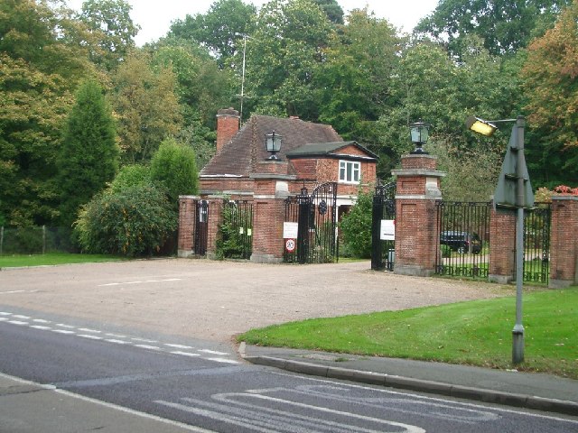
Whiteley Village is a picturesque retirement community located in Hersham, Surrey, England. Established in 1917, it was founded by William Whiteley, a successful entrepreneur and philanthropist, with the aim of providing a peaceful and supportive environment for elderly people in need.

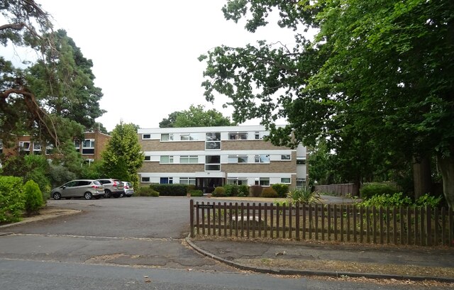
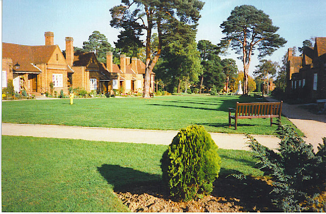
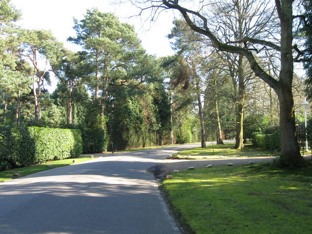
Situated on a vast 225-acre estate, the village features a collection of charming cottages and apartments, surrounded by stunning landscaped gardens and green spaces. The village's architecture showcases a mix of traditional and modern styles, reflecting its rich history and continuous development.

Whiteley Village offers a range of amenities and facilities to cater to the needs of its residents. This includes a village shop, a post office, a hair salon, a library, and a chapel. Additionally, there is a medical center and a nursing home on-site, ensuring that residents have access to healthcare services whenever required.

The community spirit is an integral part of life in Whiteley Village. Residents can engage in various social activities, clubs, and events organized by the village, encouraging a sense of belonging and companionship. The village also boasts a community center with a restaurant, where residents can socialize and enjoy delicious meals together.

Whiteley Village's serene surroundings provide an ideal setting for leisurely walks, relaxation, and outdoor activities. The village is home to a beautiful lake, several ponds, and a nature reserve, offering ample opportunities for residents to appreciate nature and wildlife.

Overall, Whiteley Village is a tranquil and inclusive retirement community that provides a safe and supportive environment for its residents, promoting a high quality of life in a picturesque setting.

If you have any feedback on the listing, please let us know in the comments section below.

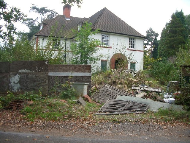
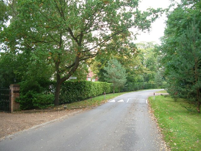
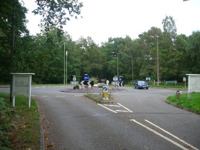
Whiteley Village Images

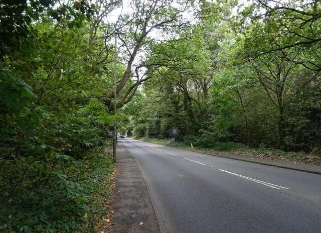
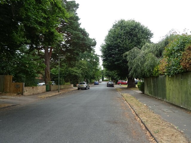
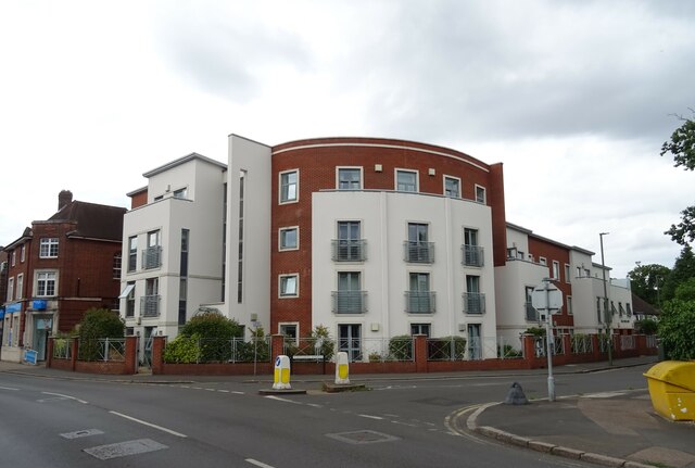
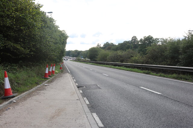
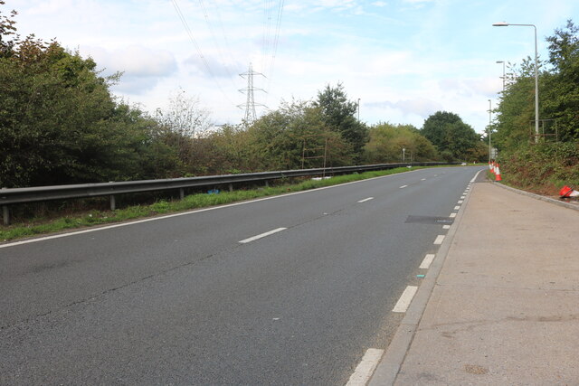
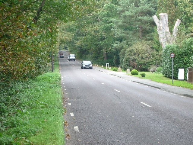
Images are sourced within 2km of 51.35156/-0.42977648 or Grid Reference TQ0962. Thanks to Geograph Open Source API. All images are credited.

Grassland and woodland off Queens Road (A317)
Woodland beside Queens Road (A317)
Queens Road (A317) Towards Weybridge.
Queens Road (A317)
Towards Weybridge.
Seven Hills Road (B365) Looking south.
Seven Hills Road (B365)
Looking south.
Holmesdale Flats On Bridgewater Road.
Holmesdale Flats
On Bridgewater Road.
Bridgewater Road, Weybridge
Apartments, Weybridge Junction of Queens Road (A317) and Oatlands Avenue.
Apartments, Weybridge
Junction of Queens Road (A317) and Oatlands Avenue.
Railway towards Weybridge Station The South West Main Line seen from the bridge on Queens Road (A317).
Railway towards Weybridge Station
The South West Main Line seen from the bridge on Queens Road (A317).
Sliproad on Portsmouth Road, Cobham
220 Brooklands Road, Weybridge A large old property recently on the market for around £1.5 million.
<span class="nowrap"><a title="https://themovemarket.com/tools/propertyprices/220-brooklands-road-weybridge-kt13-0rj" rel="nofollow ugc noopener" href="https://themovemarket.com/tools/propertyprices/220-brooklands-road-weybridge-kt13-0rj">Link</a><img style="margin-left:2px;" alt="External link" title="External link - shift click to open in new window" src="https://s1.geograph.org.uk/img/external.png" width="10" height="10"/></span>
220 Brooklands Road, Weybridge
A large old property recently on the market for around £1.5 million. LinkExternal link
Railway cutting at Weybridge looking WSW
Railway cutting at Weybridge
looking WSW
Seven Hills Road Looking north.
Seven Hills Road
Looking north.
Entrance to Whiteley Village from Seven Hills Road Looking north-east.
Entrance to Whiteley Village from Seven Hills Road
Looking north-east.
Woodlawn looking south
Woodlawn
looking south
East Road, St George's Hill, Weybridge looking NNE
East Road, St George's Hill, Weybridge
looking NNE
Roundabout on Seven Hills Road looking ENE
Roundabout on Seven Hills Road
looking ENE
Whiteley Village. An octagonally-shaped, planned, village just off the Seven Hills Road.
Whiteley Village.
An octagonally-shaped, planned, village just off the Seven Hills Road.
Show me another place!

Whiteley Village is located at Grid Ref: TQ0962 (Lat: 51.35156, Lng: -0.42977648)

Administrative County: Surrey

District: Elmbridge

Police Authority: Surrey

What 3 Words

///rescue.photo.fallen. Near Cobham, Surrey

Related Wikis

Whiteley Village

Whiteley Village, in Hersham, Surrey, England, is a retirement village, much of it designed architecturally by Arts and Crafts movement-influenced architect...

St George's Hill

St George's Hill is a 964-acre (3.9 km2) private gated community in Weybridge, Surrey, United Kingdom. The estate has golf and tennis clubs, as well as...

Notre Dame School, Surrey

Notre Dame School is an independent Catholic girls day school located in Cobham, Surrey, England. The school includes both a preparatory school and a senior...

Kenwood, St George's Hill

Kenwood is a house on the St George's Hill estate, Weybridge, Surrey, England. Originally called the Brown House, it was designed by architect T. A. Allen...

Related Videos

Stepped into a fairytale 🧚‍♀️ @painshillgarden

painshill #bridgertonlocations #bridegertonfans #painshillpark #painshillparksurrey #travel #daytrip #fantasy #awstruck ...

Nearby Amenities

Located within 500m of 51.35156,-0.42977648
Crossing
Crossing: unmarked
Lat/Long: 51.3494995/-0.4285501
Bus Stop
Whiteley Village
Naptan AtcoCode: 40004405255A
Naptan Bearing: NE
Naptan CommonName: Whiteley Village
Naptan Indicator: Just after
Naptan Landmark: Whiteley Village
Naptan NaptanCode: surajajd
Naptan Street: North Avenue
Naptan Verified: no
Public Transport: platform
Source: naptan_import
Lat/Long: 51.3528672/-0.4296314
Bus Stop
Stores
Naptan AtcoCode: 40004405255B
Naptan Bearing: SW
Naptan CommonName: Stores
Naptan Indicator: O/s
Naptan Landmark: Whiteley Village
Naptan NaptanCode: surajajg
Naptan Street: Circle Road
Naptan Verified: no
Public Transport: platform
Source: naptan_import
Lat/Long: 51.3513055/-0.430978
Addr City: Walton-on-Thames
Addr Housenumber: 2
Addr Postcode: KT12 4EQ
Addr Street: West Avenue
Addr Suburb: Whiteley Village
Addr Village: Hersham
Entrance: home
Lat/Long: 51.3510433/-0.4312989
Addr City: Walton-on-Thames
Addr Housenumber: 1
Addr Postcode: KT12 4DW
Addr Street: North Avenue
Addr Suburb: Whiteley Village
Addr Village: Hersham
Entrance: home
Lat/Long: 51.3516776/-0.4299389
Crossing
Crossing: marked
Lat/Long: 51.3523172/-0.4294682
Crossing
Crossing: unmarked
Lat/Long: 51.3523373/-0.4297108
Crossing
Crossing: unmarked
Lat/Long: 51.3502439/-0.4307859
Crossing
Crossing: unmarked
Lat/Long: 51.3513408/-0.4290439
Crossing
Crossing: unmarked
Lat/Long: 51.3502479/-0.4290409
Crossing
Crossing: unmarked
Lat/Long: 51.3501197/-0.4293055
Crossing
Crossing: marked
Lat/Long: 51.3516489/-0.4278527
Crossing
Crossing: unmarked
Lat/Long: 51.3522879/-0.4317366
Crossing
Crossing: unmarked
Lat/Long: 51.3504099/-0.4309884
Crossing
Crossing: unmarked
Lat/Long: 51.3514659/-0.4305288
Crossing
Crossing: unmarked
Lat/Long: 51.3496275/-0.4282826
Crossing
Crossing: unmarked
Lat/Long: 51.3511766/-0.4288412
Crossing
Crossing: marked
Lat/Long: 51.3518156/-0.4280552
Turning Circle
Lat/Long: 51.3553333/-0.4258924
Post Box
Collection Plate: CP7D
Collection Times: Mo-Fr 09:00; Sa 07:00
Operator: Royal Mail
Post Box Type: lamp
Ref: KT12 118D
Royal Cypher: EIIR
Royal Cypher Wikidata: Q33102113
Lat/Long: 51.3523537/-0.4294405
Golf: pin
Lat/Long: 51.3506152/-0.42383
Golf: pin
Lat/Long: 51.3486956/-0.4247427
Post Box
Brand: Royal Mail
Brand Wikidata: Q638098
Collection Plate: CP1
Collection Times: Mo-Fr 16:30; Sa 12:00
Note: I have upgraded the 'Mail Drop Box' tag.
Operator: Royal Mail
Operator Wikidata: Q638098
Post Box Design: type_b
Post Box Type: pillar
Ref: KT12 119
Royal Cypher: GR
Royal Cypher Wikidata: Q33102273
Lat/Long: 51.3511904/-0.4309164
Noexit: yes
Lat/Long: 51.3523001/-0.4288436
Crossing
Crossing: marked
Lat/Long: 51.3527418/-0.4295017
Crossing
Crossing: unmarked
Lat/Long: 51.3493572/-0.4302213
Street Lamp
Heritage: 2
Heritage Operator: Historic England
Listed Status: Grade II
Ref GB Nhle: 1030118
Wikidata: Q26281370
Lat/Long: 51.3512182/-0.4323795
Street Lamp
Heritage: 2
Heritage Operator: Historic England
Listed Status: Grade II
Ref GB Nhle: 1365889
Wikidata: Q26647536
Lat/Long: 51.3523352/-0.4292417
Street Lamp
Heritage: 2
Heritage Operator: Historic England
Listed Status: Grade II
Ref GB Nhle: 1030119
Wikidata: Q26281371
Lat/Long: 51.352184/-0.4311809
Street Lamp
Heritage: 2
Heritage Operator: Historic England
Listed Status: Grade II
Ref GB Nhle: 1030178
Wikidata: Q26281440
Lat/Long: 51.3552836/-0.4290463
Street Lamp
Heritage: 2
Heritage Operator: Historic England
Listed Status: Grade II
Ref GB Nhle: 1030179
Wikidata: Q26281441
Lat/Long: 51.3556634/-0.4288058
Street Lamp
Heritage: 2
Heritage Operator: Historic England
Listed Status: Grade II
Ref GB Nhle: 1030241
Wikidata: Q26281511
Lat/Long: 51.3500467/-0.4299737
Street Lamp
Heritage: 2
Heritage Operator: Historic England
Listed Status: Grade II
Ref GB Nhle: 1365894
Wikidata: Q26647541
Lat/Long: 51.352302/-0.4303405
Street Lamp
Heritage: 2
Heritage Operator: Historic England
Listed Status: Grade II
Ref GB Nhle: 1188509
Wikidata: Q26483647
Lat/Long: 51.3512827/-0.4290413
Street Lamp
Heritage: 2
Heritage Operator: Historic England
Listed Status: Grade II
Ref GB Nhle: 1365891
Wikidata: Q26647538
Lat/Long: 51.3507809/-0.4273657
Street Lamp
Heritage: 2
Heritage Operator: Historic England
Listed Status: Grade II
Ref GB Nhle: 1365890
Wikidata: Q26647537
Lat/Long: 51.3519186/-0.4281067
Street Lamp
Heritage: 2
Heritage Operator: Historic England
Listed Status: Grade II
Ref GB Nhle: 1294707
Wikidata: Q26582514
Lat/Long: 51.3508155/-0.4310932
Street Lamp
Heritage: 2
Heritage Operator: Historic England
Listed Status: Grade II
Ref GB Nhle: 1294696
Wikidata: Q26582504
Lat/Long: 51.3507927/-0.4287319
Street Lamp
Heritage: 2
Heritage Operator: Historic England
Listed Status: Grade II
Ref GB Nhle: 1191378
Wikidata: Q26486112
Lat/Long: 51.3491922/-0.4299508
Street Lamp
Heritage: 2
Heritage Operator: Historic England
Listed Status: Grade II
Ref GB Nhle: 1293404
Wikidata: Q26581342
Lat/Long: 51.3496581/-0.4281188
Street Lamp
Heritage: 2
Heritage Operator: Historic England
Listed Status: Grade II
Ref GB Nhle: 1030151
Wikidata: Q26281407
Lat/Long: 51.3492529/-0.4305843
Street Lamp
Heritage: 2
Heritage Operator: Historic England
Listed Status: Grade II
Ref GB Nhle: 1030084
Wikidata: Q26281336
Lat/Long: 51.3510903/-0.4330286
Street Lamp
Heritage: 2
Heritage Operator: Historic England
Listed Status: Grade II
Ref GB Nhle: 1030147
Wikidata: Q26281402
Lat/Long: 51.3503819/-0.427451
Street Lamp
Heritage: 2
Heritage Operator: Historic England
Listed Status: Grade II
Ref GB Nhle: 1188539
Wikidata: Q26483676
Lat/Long: 51.3503066/-0.4309295
Street Lamp
Heritage: 2
Heritage Operator: Historic England
Listed Status: Grade II
Ref GB Nhle: 1377443
Wikidata: Q26657903
Lat/Long: 51.3515381/-0.4298572
Street Lamp
Heritage: 2
Heritage Operator: Historic England
Listed Status: Grade II
Ref GB Nhle: 1190917
Wikidata: Q26485672
Lat/Long: 51.3509617/-0.4297359
Street Lamp
Heritage: 2
Heritage Operator: Historic England
Listed Status: Grade II
Ref GB Nhle: 1377441
Wikidata: Q26657901
Lat/Long: 51.3502407/-0.429121
Street Lamp
Heritage: 2
Heritage Operator: Historic England
Listed Status: Grade II
Ref GB Nhle: 1286630
Wikidata: Q26575211
Lat/Long: 51.3510933/-0.4339137
Street Lamp
Heritage: 2
Heritage Operator: Historic England
Listed Status: Grade II
Ref GB Nhle: 1377484
Wikidata: Q26657940
Lat/Long: 51.3519213/-0.4317274
Street Lamp
Heritage: 2
Heritage Operator: Historic England
Listed Status: Grade II
Ref GB Nhle: 1191296
Wikidata: Q26486036
Lat/Long: 51.3515941/-0.4277048
Street Lamp
Heritage: 2
Heritage Operator: Historic England
Listed Status: Grade II
Ref GB Nhle: 1377483
Wikidata: Q26657939
Lat/Long: 51.3507881/-0.4324694
Street Lamp
Heritage: 2
Heritage Operator: Historic England
Listed Status: Grade II
Ref GB Nhle: 1191038
Wikidata: Q26485784
Lat/Long: 51.3527964/-0.4294186
Street Lamp
Heritage: 2
Heritage Operator: Historic England
Listed Status: Grade II
Ref GB Nhle: 1030255
Wikidata: Q26281528
Lat/Long: 51.352395/-0.4319462
Street Lamp
Heritage: 2
Heritage Operator: Historic England
Listed Status: Grade II
Ref GB Nhle: 1030121
Wikidata: Q26281374
Lat/Long: 51.3523966/-0.4299209
Addr City: Walton-on-Thames
Addr Housenumber: 87
Addr Postcode: KT12 4DU
Addr Street: Circle Road
Addr Suburb: Whiteley Village
Addr Village: Hersham
Entrance: home
Lat/Long: 51.3516494/-0.4300481
Addr City: Walton-on-Thames
Addr Housenumber: 14
Addr Postcode: KT12 4DW
Addr Street: North Avenue
Addr Suburb: Whiteley Village
Addr Village: Hersham
Entrance: home
Lat/Long: 51.3521376/-0.4294213
Addr City: Walton-on-Thames
Addr Housenumber: 2
Addr Postcode: KT12 4DX
Addr Street: Octagon Road
Addr Suburb: Whiteley Village
Addr Village: Hersham
Entrance: home
Lat/Long: 51.352164/-0.4293115
Addr City: Walton-on-Thames
Addr Housenumber: 15
Addr Postcode: KT12 4DW
Addr Street: North Avenue
Addr Suburb: Whiteley Village
Addr Village: Hersham
Entrance: home
Lat/Long: 51.3521735/-0.4298324
Addr City: Walton-on-Thames
Addr Housenumber: 152
Addr Postcode: KT12 4DN
Addr Street: Octagon Road
Addr Suburb: Whiteley Village
Addr Village: Hersham
Entrance: home
Lat/Long: 51.352216/-0.4299277
Addr City: Walton-on-Thames
Addr Housenumber: 20
Addr Postcode: KT12 4DL
Addr Street: Chestnut Walk
Addr Suburb: Whiteley Village
Addr Village: Hersham
Entrance: home
Lat/Long: 51.3519745/-0.43097
Addr City: Walton-on-Thames
Addr Housenumber: 130
Addr Postcode: KT12 4DN
Addr Street: Octagon Road
Addr Suburb: Whiteley Village
Addr Village: Hersham
Entrance: home
Lat/Long: 51.3519892/-0.4310914
Addr City: Walton-on-Thames
Addr Housenumber: 19
Addr Postcode: KT12 4DL
Addr Street: Chestnut Walk
Addr Suburb: Whiteley Village
Addr Village: Hersham
Entrance: home
Lat/Long: 51.3517393/-0.4314651
Addr City: Walton-on-Thames
Addr Housenumber: 128
Addr Postcode: KT12 4DN
Addr Street: Octagon Road
Addr Suburb: Whiteley Village
Addr Village: Hersham
Entrance: home
Lat/Long: 51.3518162/-0.4314551
Addr City: Walton-on-Thames
Addr Housenumber: 1
Addr Postcode: KT12 4DL
Addr Street: Chestnut Walk
Addr Suburb: Whiteley Village
Addr Village: Hersham
Entrance: home
Lat/Long: 51.3514196/-0.4309516
Addr City: Walton-on-Thames
Addr Housenumber: 77
Addr Postcode: KT12 4DT
Addr Street: Circle Road
Addr Suburb: Whiteley Village
Addr Village: Hersham
Entrance: home
Lat/Long: 51.3513379/-0.4309991
Addr City: Walton-on-Thames
Addr Housenumber: 75
Addr Postcode: KT12 4DT
Addr Street: Circle Road
Addr Suburb: Whiteley Village
Addr Village: Hersham
Entrance: home
Lat/Long: 51.3511099/-0.4312095
Post Office
Whiteley Village Post Office
Addr City: Walton-on-Thames
Addr Postcode: KT12 4DT
Addr Street: Circle Road
Addr Suburb: Whiteley Village
Addr Village: Hersham
Brand: Post Office
Brand Wikidata: Q1783168
Opening Hours: Mo-Th 09:00-14:00; Fr 09:00-15:00; Sa 09:00-12:00
Ref Pol Id: 18957
Website: https://www.postoffice.co.uk/branch-finder/1270230/whiteley-village
Lat/Long: 51.3511968/-0.4311918
Whiteley Village
Place: village
Wikidata: Q7996143
Lat/Long: 51.3512635/-0.4300605
William Whiteley Memorial
Heritage: 2
Heritage Operator: Historic England
Historic: memorial
Listed Status: Grade II
Memorial: statue
Ref GB Nhle: 1030170
Subject Wikidata: Q8020296
Wikidata: Q26281430
Lat/Long: 51.3507923/-0.4299175
Crossing
Crossing: unmarked
Lat/Long: 51.3513395/-0.4307916
Traffic Calming: hump
Lat/Long: 51.3525632/-0.4295399
Street Lamp
Heritage: 2
Heritage Operator: Historic England
Listed Status: Grade II
Ref GB Nhle: 1030171
Wikidata: Q26281431
Lat/Long: 51.3505992/-0.4298173
Street Lamp
Heritage: 2
Heritage Operator: Historic England
Listed Status: Grade II
Ref GB Nhle: 1190922
Wikidata: Q26485677
Lat/Long: 51.3506214/-0.4300942
Street Lamp
Heritage: 2
Heritage Operator: Historic England
Listed Status: Grade II
Ref GB Nhle: 1030172
Wikidata: Q26281432
Lat/Long: 51.3509821/-0.4300308
Crossing
Crossing: unmarked
Lat/Long: 51.3519065/-0.42968
Street Lamp
Heritage: 2
Heritage Operator: Historic England
Listed Status: Grade II
Ref GB Nhle: 1377450
Wikidata: Q26657910
Lat/Long: 51.3536887/-0.4292299
Street Lamp
Heritage: 2
Heritage Operator: Historic England
Listed Status: Grade II
Ref GB Nhle: 1293513
Wikidata: Q26581444
Lat/Long: 51.3532552/-0.4294604
Defibrillator
Defibrillator Location: Outdoors, outside on the wall.
Emergency: defibrillator
Indoor: no
Opening Hours: 24/7
Source: survey
Lat/Long: 51.351222/-0.4311745
The data included in this document is from www.openstreetmap.org. The data is made available under ODbL.

Have you been to Whiteley Village?

Leave your review of Whiteley Village below (or comments, questions and feedback).