Whitehill

Settlement in Hampshire East Hampshire

England

Whitehill

Alexandra Park Rifle Wall Rifle Wall in Alexandra Park/Bordon Inclosure nature reserve. Easily accessible from Savile Crescent. Previously used by the Army. A small pond is located on the other side.
Alexandra Park Rifle Wall Credit: BHelas

Whitehill is a small village located in the county of Hampshire, England. Situated near the border with Surrey, it forms part of the East Hampshire district. With a population of around 2,500 residents, Whitehill is a close-knit community offering a peaceful and picturesque environment.

The village is known for its charming countryside setting, surrounded by rolling hills and lush greenery. It is located within close proximity to the South Downs National Park, providing residents with ample opportunities for outdoor activities such as hiking, cycling, and horse riding. The nearby Alice Holt Forest is also a popular destination for nature lovers.

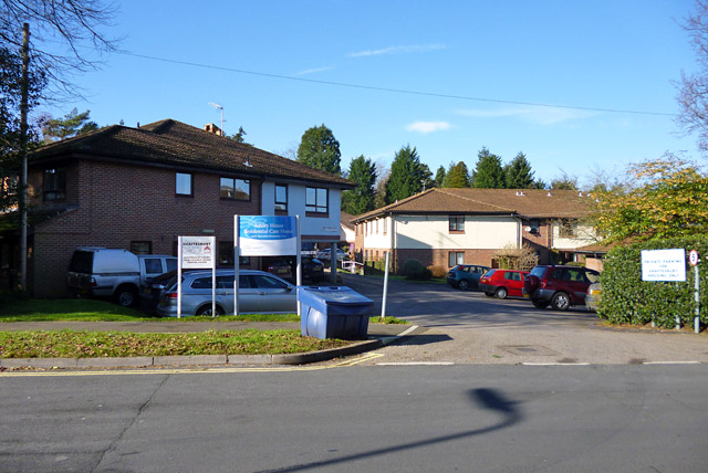
Whitehill has a range of amenities to cater to its residents' needs. The village features a primary school, a community center, and several shops, including a supermarket and local businesses. For healthcare services, the nearby town of Bordon provides a medical center and pharmacy.

Transport links in Whitehill are well-connected. The village benefits from good road connections, with the A325 running nearby, providing easy access to neighboring towns and cities. There are also regular bus services connecting Whitehill to surrounding areas.

Overall, Whitehill offers a peaceful and idyllic setting for those seeking a rural lifestyle. With its beautiful natural surroundings and community spirit, it provides a welcoming environment for residents to enjoy a quality way of life.

If you have any feedback on the listing, please let us know in the comments section below.
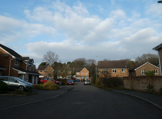
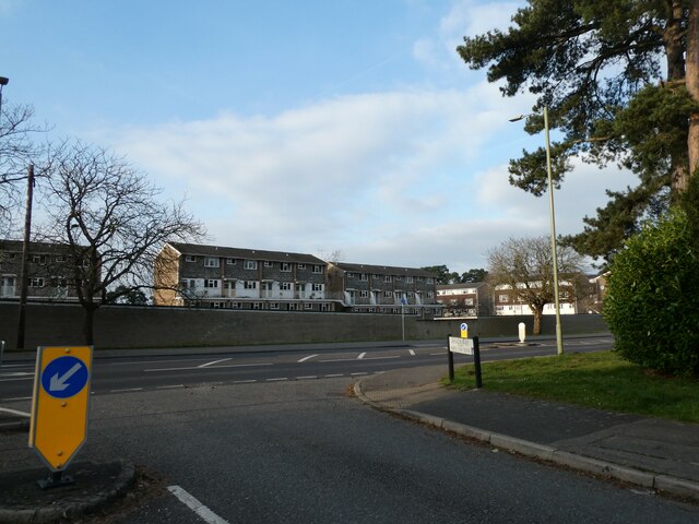
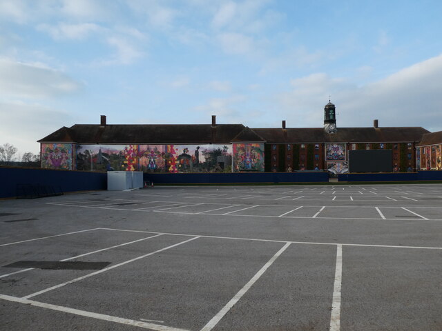
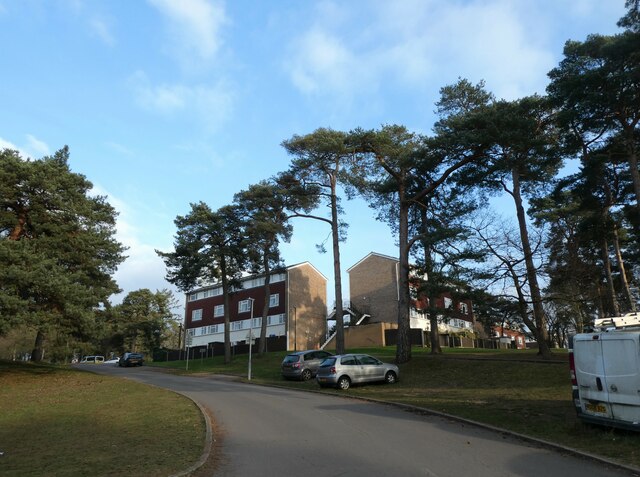
Whitehill Images

Images are sourced within 2km of 51.101489/-0.86931798 or Grid Reference SU7934. Thanks to Geograph Open Source API. All images are credited.

Alexandra Park Rifle Wall Rifle Wall in Alexandra Park/Bordon Inclosure nature reserve. Easily accessible from Savile Crescent. Previously used by the Army. A small pond is located on the other side.
Alexandra Park Rifle Wall
Rifle Wall in Alexandra Park/Bordon Inclosure nature reserve. Easily accessible from Savile Crescent. Previously used by the Army. A small pond is located on the other side.
Clearing, Alexandria Park Clearing in Alexandria Park (Bordon Inclosure) which is managed by Deadwater Valley Trust. Photo taken from footpath which runs east-west across the middle of the clearing, from near the Rifle Wall. The trees at the far end are located by the allotments on Savile Crescent.
Clearing, Alexandria Park
Clearing in Alexandria Park (Bordon Inclosure) which is managed by Deadwater Valley Trust. Photo taken from footpath which runs east-west across the middle of the clearing, from near the Rifle Wall. The trees at the far end are located by the allotments on Savile Crescent.
Lamppost in Maple Leaf Drive Road lighting predates the earliest cars by thousands of years. In the 5th century BC, people in Beijing used bamboo pipes to harness and lead natural gas from volcano leaks to their communities which they then used to ignite lamps that  lit up their thoroughfares at night. 1417 marked the first organized public street lighting system in London. Its mayor, Sir Henry Barton, ordered people to place oil lanterns outside their homes at night during the winter. In 1802, William Murdoch invented the first coal-ignited gas lighting system and in 1879 Paris produced the world’s first electric streetlight system. A year later, Thomas Edison introduced the first carbon-thread incandescent lamp. By 1965 most systems used  high-pressure sodium (HID) lamps.  Today, street lighting commonly uses high-intensity discharge lamps. Milan, Italy is the first major city to have entirely switched to LED lighting
Lamppost in Maple Leaf Drive
Road lighting predates the earliest cars by thousands of years. In the 5th century BC, people in Beijing used bamboo pipes to harness and lead natural gas from volcano leaks to their communities which they then used to ignite lamps that lit up their thoroughfares at night. 1417 marked the first organized public street lighting system in London. Its mayor, Sir Henry Barton, ordered people to place oil lanterns outside their homes at night during the winter. In 1802, William Murdoch invented the first coal-ignited gas lighting system and in 1879 Paris produced the world’s first electric streetlight system. A year later, Thomas Edison introduced the first carbon-thread incandescent lamp. By 1965 most systems used high-pressure sodium (HID) lamps. Today, street lighting commonly uses high-intensity discharge lamps. Milan, Italy is the first major city to have entirely switched to LED lighting
Looking north-northeast in Maple Leaf Drive
Looking north-northeast along Canada Way
Looking from Canada Way into Camp Road
Whitehill & Bordon Leisure Centre, Havana Way
The Shed,  Havana Way
The Shed, Havana Way
Murals on a former REME building off Budds Lane
School minibus outside Bordon Juniors
Trees in Essex Road
Trees in Essex Road
Parked cars in Essex Road
Maisonettes in Essex Road
Junction of Essex and Hampshire Roads
Junction of Budds Lane and Camp Road
Roadworks in Forest Road
Woodland path, Whitehill In the strip of MOD land between Liphook Road and the northern boundary of the danger area.
Woodland path, Whitehill
In the strip of MOD land between Liphook Road and the northern boundary of the danger area.
Entrance to Ashley House and others Ashley House is a care home run by Sanctuary Care. Other accommodation on the site is at least partly sheltered housing in three further blocks.
Entrance to Ashley House and others
Ashley House is a care home run by Sanctuary Care. Other accommodation on the site is at least partly sheltered housing in three further blocks.
Show me another place!

Whitehill is located at Grid Ref: SU7934 (Lat: 51.101489, Lng: -0.86931798)

Administrative County: Hampshire

District: East Hampshire

Police Authority: Hampshire

What 3 Words

///buckets.repelled.stockpile. Near Bordon, Hampshire

Nearby Locations

Whitehill

Related Wikis

Whitehill, Hampshire

Whitehill is a village and civil parish in the East Hampshire district of Hampshire, England, on the historic highway (now the A325) between Petersfield...

Whitehill Junction railway station

Whitehill Junction railway station is a former railway station, on the Longmoor Military Railway, which was closed along with the rest of the line in 1969...

Hogmoor Inclosure

Hogmoor Inclosure is a large area of wooded heath situated 0.5 miles (0.80 km) west from the town of Bordon and within the civil parish of Whitehill in...

Deadwater Valley

Deadwater Valley is a 35.9-hectare (89-acre) Local Nature Reserve in Bordon in Hampshire. It is owned by East Hampshire District Council and managed by...

Nearby Amenities

Located within 500m of 51.101489,-0.86931798
Bus Stop
Firgrove Road Shops
Bus: yes
Naptan AtcoCode: 1900HA020465
Naptan Bearing: W
Naptan CommonName: Firgrove Road Shops
Naptan Crossing: Fir Grove
Naptan NaptanCode: hamgtgdp
Naptan Street: Firgrove Road
Naptan Verified: no
Public Transport: platform
Source: naptan_import
Lat/Long: 51.100635/-0.8762275
Bus Stop
Firgrove Road Shops
Bus: yes
Naptan AtcoCode: 1900HA020466
Naptan Bearing: E
Naptan CommonName: Firgrove Road Shops
Naptan Crossing: Fir Grove
Naptan NaptanCode: hamgtgdt
Naptan Street: Firgrove Road
Naptan Verified: no
Public Transport: platform
Source: naptan_import
Lat/Long: 51.1007364/-0.8761365
Bus Stop
Bus Turning Circle
Bench: yes
Bus: yes
Naptan AtcoCode: 1900HA020485
Naptan Bearing: N
Naptan CommonName: Whitehill Prince of Wales
Naptan Crossing: Sutton Field
Naptan Landmark: Lay-by
Naptan NaptanCode: hamgtgpd
Naptan Street: Petersfield Road
Naptan Verified: no
Public Transport: platform
Shelter: yes
Source: naptan_import
Lat/Long: 51.1018445/-0.8694022
Bus Stop
Mayflower Road
Bus: yes
Naptan AtcoCode: 1900HAA10041
Naptan Bearing: W
Naptan CommonName: Mayflower Road
Naptan Crossing: Petersfield Road A325
Naptan NaptanCode: hamjmgdm
Naptan Street: Liphook Road
Naptan Verified: no
Public Transport: platform
Source: naptan_import
Lat/Long: 51.0996816/-0.8687524
Bus Stop
Mayflower Road
Bus: yes
Naptan AtcoCode: 1900HAA10042
Naptan Bearing: E
Naptan BusStopType: CUS
Naptan CommonName: Mayflower Road
Naptan Crossing: Petersfield Road A325
Naptan NaptanCode: hamjmgdp
Naptan Street: Liphook Road
Naptan Verified: no
Public Transport: platform
Source: naptan_import
Lat/Long: 51.0997249/-0.86858
Bus Stop
New Road
Bus: yes
Naptan AtcoCode: 1900HAA90806
Naptan Bearing: SW
Naptan CommonName: New Road
Naptan Crossing: New Road
Naptan NaptanCode: hamjgwma
Naptan Street: Forest Road
Naptan Verified: no
Public Transport: platform
Source: naptan_import
Lat/Long: 51.1014159/-0.8630541
Bus Stop
New Road
Bus: yes
Naptan AtcoCode: 1900HAA90807
Naptan Bearing: NE
Naptan CommonName: New Road
Naptan Crossing: New Road
Naptan NaptanCode: hamjgwmd
Naptan Street: Forest Road
Naptan Verified: no
Public Transport: platform
Source: naptan_import
Lat/Long: 51.1014435/-0.8631248
Bus Stop
Heather Close
Bus: yes
Naptan AtcoCode: 1900HAA90855
Naptan Bearing: E
Naptan CommonName: Heather Close
Naptan Crossing: Heather Close
Naptan NaptanCode: hamjmaga
Naptan Street: Firgrove Road
Naptan Verified: no
Public Transport: platform
Source: naptan_import
Lat/Long: 51.1004063/-0.8739621
Bus Stop
Heather Close
Bus: yes
Naptan AtcoCode: 1900HAA90856
Naptan Bearing: W
Naptan CommonName: Heather Close
Naptan Crossing: Heather Close
Naptan NaptanCode: hamjmagd
Naptan Street: Firgrove Road
Naptan Verified: no
Public Transport: platform
Source: naptan_import
Lat/Long: 51.100286/-0.873608
Turning Circle
Lat/Long: 51.10365/-0.8714575
Bicycle Parking
Bicycle Parking: stands
Capacity: 4
Covered: no
Lat/Long: 51.0999982/-0.8699818
Post Box
Check Date Collection Times: 2022-06-07
Collection Plate: CP1D
Collection Times: Mo-Fr 09:00; Sa 07:00
Old Ref: GU35 100
Operator: Royal Mail
Post Box Type: pillar
Ref: GU35 100D
Royal Cypher: EIIR
Royal Cypher Wikidata: Q33102113
Lat/Long: 51.1019572/-0.8692633
Post Box
Collection Plate: CP1
Collection Times: Mo-Fr 17:00; Sa 09:00
Operator: Royal Mail
Post Box Type: pillar
Ref: GU35 135
Royal Cypher: EIIR
Royal Cypher Wikidata: Q33102113
Lat/Long: 51.100758/-0.8760739
Man Made: mast
Lat/Long: 51.1025953/-0.8731589
Crossing
Crossing: uncontrolled
Kerb: lowered
Traffic Calming: choker
Lat/Long: 51.1004837/-0.8748062
Barrier: kerb
Kerb: lowered
Tactile Paving: yes
Lat/Long: 51.1002508/-0.870588
Barrier: kerb
Kerb: lowered
Tactile Paving: yes
Lat/Long: 51.1002599/-0.8705279
Barrier: kerb
Kerb: lowered
Tactile Paving: yes
Lat/Long: 51.1002694/-0.8704664
Tumulas
Archaeological Site: tumulus
Historic: archaeological_site
Historic Civilization: bronze-age
Source: local_knowledge
Lat/Long: 51.1025223/-0.8732294
Crossing
Crossing: uncontrolled
Kerb: lowered
Traffic Calming: choker
Lat/Long: 51.1006032/-0.8757693
Whitehill
Place: village
Lat/Long: 51.1000717/-0.8715731
Crossing
Crossing: unmarked
Crossing Island: yes
Crossing Markings: no
Tactile Paving: yes
Lat/Long: 51.1046369/-0.8719358
Crossing
Crossing: unmarked
Crossing Island: no
Crossing Markings: no
Tactile Paving: yes
Lat/Long: 51.1002557/-0.8705548
Crossing
Crossing: unmarked
Crossing Island: no
Crossing Markings: no
Tactile Paving: yes
Lat/Long: 51.1002777/-0.870418
Crossing
Crossing: unmarked
Crossing Island: no
Crossing Markings: no
Tactile Paving: yes
Lat/Long: 51.100195/-0.87011
Crossing
Crossing: unmarked
Crossing Island: no
Crossing Markings: no
Tactile Paving: yes
Lat/Long: 51.1001445/-0.8700318
Post Box
Collection Times: Mo-Fr 09:00; Sa 07:00
Drive Through: no
Operator: Royal Mail
Post Box Type: lamp
Ref: GU35 176D
Royal Cypher: EIIR
Royal Cypher Wikidata: Q33102113
Lat/Long: 51.1002064/-0.8643395
Addr Housenumber: 129
Addr Street: Forest Road
Lat/Long: 51.0997544/-0.8638547
Access: yes
Archaeological Site: tumulus
Historic: archaeological_site
Historic Civilization: bronze-age
Lat/Long: 51.1030212/-0.8699975
Access: yes
Archaeological Site: tumulus
Historic: archaeological_site
Historic Civilization: bronze-age
Lat/Long: 51.1028191/-0.8689032
Bus Stop
Forest Road
Bus: yes
Public Transport: platform
Lat/Long: 51.0992498/-0.8654241
Bus Stop
Forest Road
Bus: yes
Public Transport: platform
Lat/Long: 51.0993315/-0.865396
Crossing
Crossing: unmarked
Lat/Long: 51.1017872/-0.8693557
Traffic Signals
Traffic Signals Direction: forward
Lat/Long: 51.101693/-0.8691645
Traffic Signals
Traffic Signals Direction: backward
Lat/Long: 51.1017727/-0.86912
Crossing
Bicycle: yes
Crossing: traffic_signals
Crossing Ref: toucan
Lat/Long: 51.1017323/-0.8691411
Shared compost, raised beds, and greenhouse
Access: permit
Charge: 0
Fee: no
Garden Type: community
Leisure: garden
Operator: Woolmer Forest Timebank
Operator Type: community
Lat/Long: 51.1024126/-0.8757336
Bench
Backrest: yes
Colour: brown
Material: plastic
Seats: 3
Lat/Long: 51.1028077/-0.8688068
Station Beauty
Phone: +447583888783
Shop: beauty
Lat/Long: 51.1029428/-0.8682807
Thorne-Leggett Funeral Directors
Phone: +441420488896
Shop: funeral_directors
Lat/Long: 51.1028973/-0.8683017
Woodford Stauffer Solicitors
Office: lawyer
Lat/Long: 51.1028481/-0.8683361
Barrier: kerb
Kerb: lowered
Tactile Paving: yes
Lat/Long: 51.1021432/-0.8714733
Crossing
Crossing: unmarked
Crossing Island: yes
Crossing Markings: no
Tactile Paving: yes
Lat/Long: 51.10213/-0.8715291
Waste Basket
Colour: black
Material: metal
Waste: litter
Lat/Long: 51.1021193/-0.8716769
Defibrillator
Emergency: defibrillator
Indoor: yes
Lat/Long: 51.1031498/-0.8694944
Bus Stop
Bus: yes
Public Transport: platform
Lat/Long: 51.1013494/-0.8692647
Barrier: kerb
Kerb: lowered
Tactile Paving: yes
Lat/Long: 51.1046522/-0.8719986
Barrier: kerb
Kerb: lowered
Tactile Paving: yes
Lat/Long: 51.1046197/-0.8718731
Barrier: kerb
Kerb: lowered
Tactile Paving: yes
Lat/Long: 51.1021176/-0.8715862
Barrier: kerb
Kerb: lowered
Tactile Paving: yes
Lat/Long: 51.0996562/-0.869642
Barrier: kerb
Kerb: lowered
Tactile Paving: yes
Lat/Long: 51.0996087/-0.8696103
Barrier: kerb
Kerb: lowered
Tactile Paving: yes
Lat/Long: 51.0997181/-0.8696785
Barrier: kerb
Kerb: lowered
Tactile Paving: yes
Lat/Long: 51.0996814/-0.8696563
Crossing
Crossing: unmarked
Crossing Island: no
Crossing Markings: no
Tactile Paving: yes
Lat/Long: 51.0997/-0.8696683
Crossing
Crossing: unmarked
Crossing Island: no
Crossing Markings: no
Tactile Paving: yes
Lat/Long: 51.0996289/-0.8696237
Barrier: kerb
Kerb: lowered
Tactile Paving: yes
Lat/Long: 51.099841/-0.8694569
Barrier: kerb
Kerb: lowered
Tactile Paving: yes
Lat/Long: 51.1002852/-0.8703753
Barrier: kerb
Kerb: lowered
Tactile Paving: yes
Lat/Long: 51.1001702/-0.8700911
Barrier: kerb
Kerb: lowered
Tactile Paving: yes
Lat/Long: 51.1002323/-0.8701425
Barrier: kerb
Kerb: lowered
Tactile Paving: yes
Lat/Long: 51.1001538/-0.8700597
Barrier: kerb
Kerb: lowered
Tactile Paving: yes
Lat/Long: 51.1001359/-0.8699999
Give Way
Direction: backward
Lat/Long: 51.0997508/-0.8694137
Barrier: kerb
Kerb: lowered
Tactile Paving: yes
Lat/Long: 51.0997913/-0.8695303
Crossing
Crossing: unmarked
Crossing Island: no
Crossing Markings: no
Tactile Paving: yes
Lat/Long: 51.099813/-0.8694979
Barrier: bollard
Bicycle: yes
Foot: yes
Motor Vehicle: no
Lat/Long: 51.1008479/-0.8700122
The data included in this document is from www.openstreetmap.org. The data is made available under ODbL.

Have you been to Whitehill?

Leave your review of Whitehill below (or comments, questions and feedback).