Whitecroft

Settlement in Gloucestershire Forest of Dean

England

Whitecroft

Parkend railway station
Parkend railway station Credit: Tim Glover

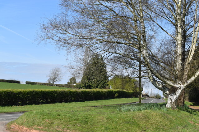
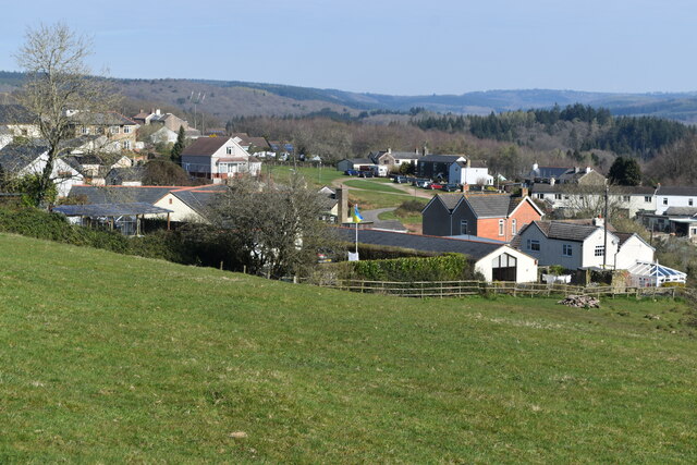
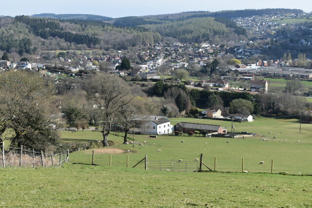
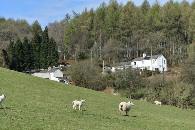
Whitecroft is a small village situated in the Forest of Dean district of Gloucestershire, England. It is located approximately 5 miles southwest of the town of Lydney and about 15 miles east of the city of Gloucester. The village is surrounded by picturesque woodland, offering residents and visitors a tranquil and scenic environment.

Whitecroft is primarily a residential area, with a population of around 1,000 people. The village features a mix of traditional stone-built cottages and more modern houses, giving it a charming and diverse architectural character.

Despite its small size, Whitecroft offers a range of amenities to cater to the needs of its residents. These include a local convenience store, a post office, a primary school, and a village hall, which serves as a community hub for various events and activities. Additionally, there are several pubs and restaurants in the nearby area, providing options for dining and socializing.

The village is well-served by public transportation, with regular bus services connecting it to neighboring towns and cities. It also benefits from its proximity to the Forest of Dean, a popular tourist destination known for its woodland walks, cycling trails, and wildlife.

Overall, Whitecroft is a charming and peaceful village, offering a sense of community and natural beauty to its residents and visitors alike.

If you have any feedback on the listing, please let us know in the comments section below.

Whitecroft Images

Images are sourced within 2km of 51.753859/-2.5519589 or Grid Reference SO6106. Thanks to Geograph Open Source API. All images are credited.

Parkend railway station
Dean Forest Railway near Upper Forge Visiting Peckett W6 'Rocket' passes Upper Forge with a single brakevan during the Dean Forest Railway's delayed 50th anniversary gala.
Dean Forest Railway near Upper Forge
Visiting Peckett W6 'Rocket' passes Upper Forge with a single brakevan during the Dean Forest Railway's delayed 50th anniversary gala.
Dean Forest Railway near Norchard Great Western 2-6-2T No. 5541 departs Norchard with a train for Parkend during the Dean Forest Railway's delayed 50th anniversary gala.
Dean Forest Railway near Norchard
Great Western 2-6-2T No. 5541 departs Norchard with a train for Parkend during the Dean Forest Railway's delayed 50th anniversary gala.
Dean Forest Railway near Parkend Class 14 No. D9521 approaches Parkend during the Dean Forest Railway's delayed 50th anniversary gala.
Dean Forest Railway near Parkend
Class 14 No. D9521 approaches Parkend during the Dean Forest Railway's delayed 50th anniversary gala.
Class 14 at Parkend Class 14 No. D9521 runs around its train at Parkend station during the Dean Forest Railway's delayed 50th anniversary gala.
Class 14 at Parkend
Class 14 No. D9521 runs around its train at Parkend station during the Dean Forest Railway's delayed 50th anniversary gala.
Dean Forest Railway at Parkend Visiting Peckett W6 'Rocket' is seen on brake-van ride duties at Parkend station during the Dean Forest Railway's delayed 50th anniversary gala.
Dean Forest Railway at Parkend
Visiting Peckett W6 'Rocket' is seen on brake-van ride duties at Parkend station during the Dean Forest Railway's delayed 50th anniversary gala.
Dean Forest Railway gala at Parkend A variety of road and other engines are seen at Parkend station during the Dean Forest Railway's delayed 50th anniversary gala.
Dean Forest Railway gala at Parkend
A variety of road and other engines are seen at Parkend station during the Dean Forest Railway's delayed 50th anniversary gala.
Wide verge beside Lyndsey Road
View over Pastor’s Hill, Bream
View over Whitecroft The station on the preserved Dean Forest Railway is in the centre of this image.
View over Whitecroft
The station on the preserved Dean Forest Railway is in the centre of this image.
Downhill view at Pastor’s Hill
Houses on hillside at Pastor’s Hill
House above lane on edge of Whitecroft Taken from the location of a former level crossing on a branch line to Princess Royal Colliery.
House above lane on edge of Whitecroft
Taken from the location of a former level crossing on a branch line to Princess Royal Colliery.
Whitecroft station On the preserved Dean Forest Railway.
Whitecroft station
On the preserved Dean Forest Railway.
Ex-GWR 2-6-2 No. 5541 at Whitecroft level crossing Hauling a non-stopping service towards Parkend.
Ex-GWR 2-6-2 No. 5541 at Whitecroft level crossing
Hauling a non-stopping service towards Parkend.
Dean Forest Railway train passing Whitecroft Hauled by Ex-GWR 2-6-2 No. 5541, just passing the level crossing northbound to Parkend.
Dean Forest Railway train passing Whitecroft
Hauled by Ex-GWR 2-6-2 No. 5541, just passing the level crossing northbound to Parkend.
Sheep grazing on the verge beside Park Hill
Show me another place!

Whitecroft is located at Grid Ref: SO6106 (Lat: 51.753859, Lng: -2.5519589)

Administrative County: Gloucestershire

District: Forest of Dean

Police Authority: Gloucestershire

What 3 Words

///drumbeat.agreeable.calendars. Near Bream, Gloucestershire

Related Wikis

Whitecroft

Whitecroft is a village in the Forest of Dean in west Gloucestershire, England. It is located in-between Bream and Yorkley. Whitecroft comes under the...

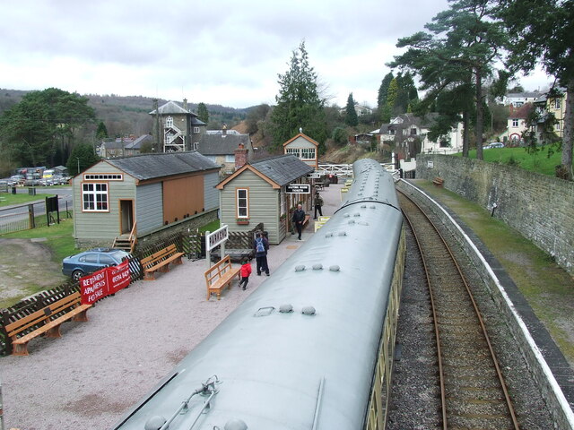
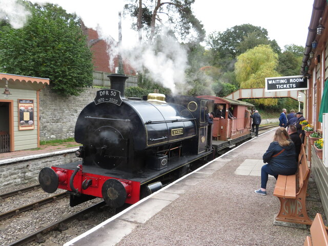
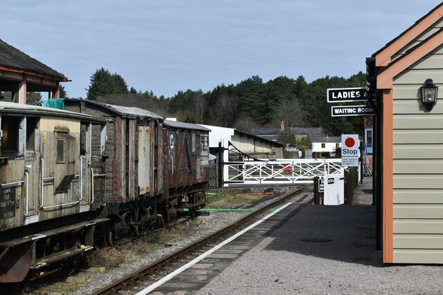
Whitecroft railway station

Whitecroft & Bream railway station is a railway station on the Dean Forest Railway. == History == The station originally opened on 23 September 1875, and...
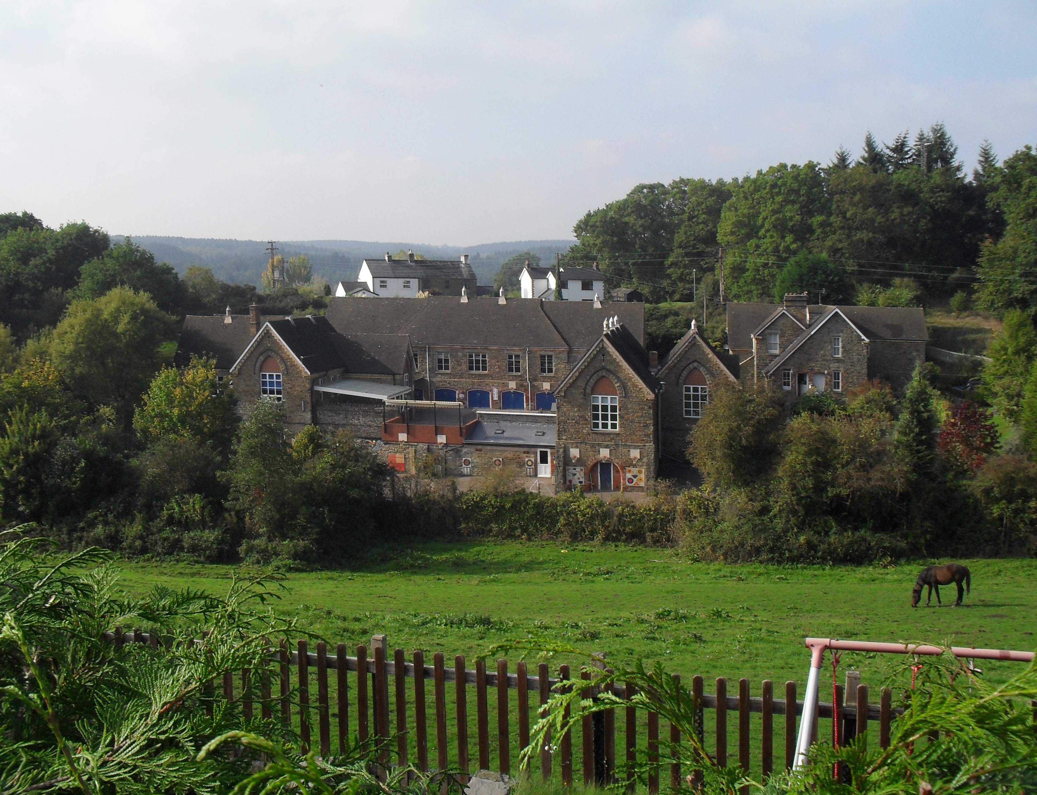
Pillowell

Pillowell is a small English village in Gloucestershire, on the south-eastern edge of the Forest of Dean. Once a mining village, much of it now lies in...
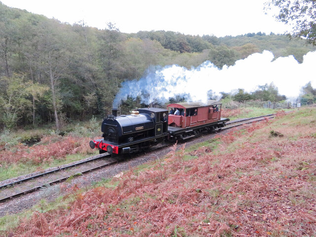
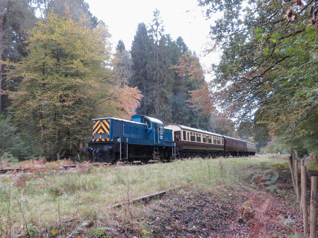
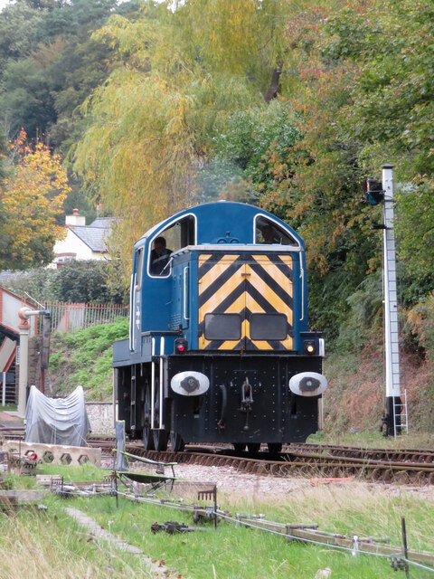
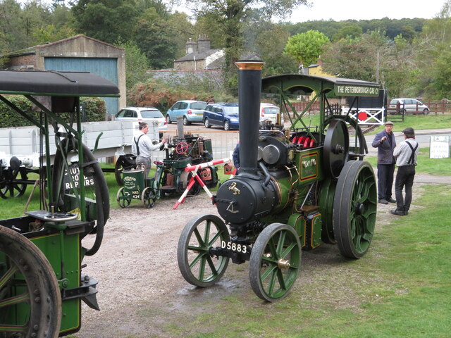
Dean Forest Railway

The Dean Forest Railway is a 4+1⁄4-mile (6.8 km) long heritage railway that runs between Lydney and Parkend in the Forest of Dean, Gloucestershire. The...

Related Videos

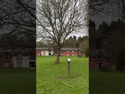
Whitemead Forest Park, Forest of Dean, Gloucestershire, Caravan Touring Pitch

Just a short video to show our pitch location and surroundings on a recent trip to Whitemead Forest Park.

7 April 2024

Whitemead forest park #Deanforent #gloucestershire.

Nearby Amenities

Located within 500m of 51.753859,-2.5519589
Whitecroft
Is In: Gloucestershire, England, UK
Place: village
Wikidata: Q7995819
Lat/Long: 51.7533406/-2.5510232
Crossing Barrier: full
Railway: level_crossing
Lat/Long: 51.7538215/-2.5522081
Railway: switch
Lat/Long: 51.7516991/-2.552019
Whitecroft
Railway: station
Usage: tourism
Wikidata: Q7995820
Lat/Long: 51.7531306/-2.5521311
Bus Stop
Post Office
Naptan AtcoCode: 1600GL2527
Naptan Bearing: SW
Naptan CommonName: Post Office
Naptan Indicator: Opp
Naptan NaptanCode: gloagpdp
Naptan Street: Pillowell Rd
Naptan Verified: no
Source: naptan_import
Lat/Long: 51.7540955/-2.5514452
Bus Stop
Post Office
Bench: no
Bin: no
Lit: no
Naptan AtcoCode: 1600GL2528
Naptan Bearing: NE
Naptan CommonName: Post Office
Naptan NaptanCode: gloagpda
Naptan Street: Pillowell Rd
Naptan Verified: no
Shelter: no
Source: naptan_import
Tactile Paving: no
Lat/Long: 51.7539494/-2.551907
Bus Stop
Park Hill
Naptan AtcoCode: 1600GL5159
Naptan Bearing: W
Naptan CommonName: Park Hill
Naptan NaptanCode: gloagmwm
Naptan Street: Park Hill
Naptan Verified: no
Source: naptan_import
Lat/Long: 51.752543/-2.5565256
Bus Stop
Park Hill
Naptan AtcoCode: 1600GL5160
Naptan Bearing: E
Naptan CommonName: Park Hill
Naptan NaptanCode: gloagmwj
Naptan Street: Park Hill
Naptan Verified: no
Source: naptan_import
Lat/Long: 51.7526234/-2.556628
Bus Stop
Wesley Rd
Bench: no
Naptan AtcoCode: 1600GLF705
Naptan Bearing: NW
Naptan CommonName: Wesley Rd
Naptan Indicator: Opp
Naptan NaptanCode: gloagpdg
Naptan Street: New Rd
Naptan Verified: no
Shelter: no
Source: naptan_import
Lat/Long: 51.7536984/-2.5517446
Bus Stop
Wesley Rd
Naptan AtcoCode: 1600GLF706
Naptan Bearing: SE
Naptan CommonName: Wesley Rd
Naptan NaptanCode: gloagpdm
Naptan Street: New Rd
Naptan Verified: no
Shelter: no
Source: naptan_import
Lat/Long: 51.7537535/-2.5514989
Bus Stop
Grove Rd
Naptan AtcoCode: 1600GLF727
Naptan Bearing: W
Naptan CommonName: Grove Rd
Naptan Indicator: Opp
Naptan NaptanCode: gloagpgw
Naptan Street: Pilowell Rd
Naptan Verified: no
Source: naptan_import
Lat/Long: 51.7556592/-2.5477698
Bus Stop
Grove Rd
Naptan AtcoCode: 1600GLF728
Naptan Bearing: E
Naptan CommonName: Grove Rd
Naptan NaptanCode: gloagpjd
Naptan Street: Pillowell Rd
Naptan Verified: no
Source: naptan_import
Lat/Long: 51.7558501/-2.547323
Bus Stop
School Rd
Naptan AtcoCode: 1600GLF729
Naptan Bearing: NW
Naptan CommonName: School Rd
Naptan Indicator: Opp
Naptan NaptanCode: gloagpmd
Naptan Street: Pillowell Rd
Naptan Verified: no
Source: naptan_import
Lat/Long: 51.7541958/-2.5453617
Bus Stop
School Rd
Naptan AtcoCode: 1600GLF730
Naptan Bearing: SE
Naptan CommonName: School Rd
Naptan NaptanCode: gloagpmg
Naptan Street: Pillowell Rd
Naptan Verified: no
Source: naptan_import
Lat/Long: 51.7541069/-2.5451288
Post Box
Post Box Type: lamp
Royal Cypher: EIIR
Royal Cypher Wikidata: Q33102113
Lat/Long: 51.7541348/-2.5514192
Pub
The Miner's Arms
Addr Postcode: GL15 4PE
Fhrs Id: 199812
Lat/Long: 51.7534281/-2.5528112
Forest of Dean Tyres
Shop: car_repair
Lat/Long: 51.7541455/-2.552621
Crossing
Lat/Long: 51.751521/-2.5569974
Parking
Lat/Long: 51.7538735/-2.5512459
Parking
Lat/Long: 51.7564847/-2.5492973
Ford: yes
Lat/Long: 51.7534036/-2.5536695
Power: pole
Lat/Long: 51.7537305/-2.5589964
Power: pole
Lat/Long: 51.7524736/-2.5586236
Power: pole
Lat/Long: 51.7516367/-2.5582749
Public Bookcase
Book Swap
Booth: K6
Disused Amenity: telephone
Man Made: telephone_box
Public Bookcase Type: phone_box
Lat/Long: 51.7541106/-2.5514813
Power: pole
Lat/Long: 51.7500782/-2.5558406
Leisure: picnic_table
Lat/Long: 51.7532901/-2.5535797
Leisure: picnic_table
Lat/Long: 51.7532437/-2.5533089
Leisure: picnic_table
Lat/Long: 51.7531854/-2.5536142
The data included in this document is from www.openstreetmap.org. The data is made available under ODbL.

Have you been to Whitecroft?

Leave your review of Whitecroft below (or comments, questions and feedback).