White Lund

Settlement in Lancashire Lancaster

England

White Lund

OS Bench Mark OS rivet bench mark from the first, 19th century, levelling, on east parapet of Oxcliffe Marsh Bridge No.3. 16.9 feet above old datum. (The camera was pointing vertically downwards.)
OS Bench Mark Credit: Phil Johnstone

White Lund is an industrial area located in Morecambe Bay, within the county of Lancashire in northwest England. Situated approximately 3 miles northeast of the city of Lancaster, White Lund is known for its significant contribution to the region's industrial development.

The area is home to a large industrial estate, which houses diverse manufacturing and distribution companies. White Lund's strategic location near the M6 motorway and the Port of Heysham has made it an attractive destination for businesses, providing excellent connectivity and easy access to national and international markets.

White Lund's industrial estate encompasses a wide range of sectors, including automotive, aerospace, food and beverage, pharmaceuticals, and logistics. The presence of major companies and their supply chains has created a thriving economic hub, generating employment opportunities for the local community.

Despite its industrial nature, White Lund also benefits from its proximity to natural landscapes. The area is bordered by the picturesque Morecambe Bay, offering stunning views and recreational activities for residents and visitors alike.

The community surrounding White Lund is supported by essential amenities such as schools, healthcare facilities, and retail outlets. The nearby city of Lancaster provides additional services and cultural attractions, including museums, theaters, and a university.

Overall, White Lund is a bustling industrial area that has played a significant role in Lancashire's economic growth. With its diverse range of businesses, excellent transport links, and access to natural beauty, White Lund continues to be an important and vibrant part of the region.

If you have any feedback on the listing, please let us know in the comments section below.

White Lund Images

Images are sourced within 2km of 54.055856/-2.856194 or Grid Reference SD4462. Thanks to Geograph Open Source API. All images are credited.

OS Bench Mark OS rivet bench mark from the first, 19th century, levelling, on east parapet of Oxcliffe Marsh Bridge No.3. 16.9 feet above old datum. (The camera was pointing vertically downwards.)
OS Bench Mark
OS rivet bench mark from the first, 19th century, levelling, on east parapet of Oxcliffe Marsh Bridge No.3. 16.9 feet above old datum. (The camera was pointing vertically downwards.)
OS Bench Mark OS cut bench mark from the 20th century levelling, on NW corner of former cinema, now a DIY store. 7.916 m above datum. This replaces an earlier bench mark on the opposite corner of the building.
OS Bench Mark
OS cut bench mark from the 20th century levelling, on NW corner of former cinema, now a DIY store. 7.916 m above datum. This replaces an earlier bench mark on the opposite corner of the building.
OS Bench Mark OS cut bench mark from the 19th century levelling, on north face of No.2 Primrose Street. 24.7 feet above old datum. Rather weathered.
OS Bench Mark
OS cut bench mark from the 19th century levelling, on north face of No.2 Primrose Street. 24.7 feet above old datum. Rather weathered.
OS Bench Mark OS cut bench mark from the 19th century levelling, on NE corner of Mona House, Deansgate. 21.3 feet above old datum. The surface of the stone has spalled, leaving only the cut arrows clearly visible.
OS Bench Mark
OS cut bench mark from the 19th century levelling, on NE corner of Mona House, Deansgate. 21.3 feet above old datum. The surface of the stone has spalled, leaving only the cut arrows clearly visible.
OS Bench Mark OS cut bench mark from the 20th century levelling, on garden wall of No.8 Highfield Crescent. 37.60 feet above datum.
OS Bench Mark
OS cut bench mark from the 20th century levelling, on garden wall of No.8 Highfield Crescent. 37.60 feet above datum.
OS Bench Mark OS cut bench mark from the 20th century levelling, on garden wall of No.40 Clarendon Road. 30.35 feet above datum.
OS Bench Mark
OS cut bench mark from the 20th century levelling, on garden wall of No.40 Clarendon Road. 30.35 feet above datum.
OS Bench Mark OS cut bench mark from the 20th century levelling, on south corner of Albert Road and Westminster Road. 32.13 feet above datum. Nicely outlined by moss.
OS Bench Mark
OS cut bench mark from the 20th century levelling, on south corner of Albert Road and Westminster Road. 32.13 feet above datum. Nicely outlined by moss.
OS Bench Mark OS cut bench mark from the 20th century levelling, on west corner of Chatsworth Road and Ellesmere Road. 27.68 feet above datum.
OS Bench Mark
OS cut bench mark from the 20th century levelling, on west corner of Chatsworth Road and Ellesmere Road. 27.68 feet above datum.
OS Bench Mark OS cut bench mark from the 20th century levelling, on north corner of Albert Road and Balmoral Road. 24.44 feet above datum.
OS Bench Mark
OS cut bench mark from the 20th century levelling, on north corner of Albert Road and Balmoral Road. 24.44 feet above datum.
OS Bench Mark OS cut bench mark from the 20th century levelling, on corner of No.4 West Road (now BUPA Dental Clinic). 22.76 feet above datum.
OS Bench Mark
OS cut bench mark from the 20th century levelling, on corner of No.4 West Road (now BUPA Dental Clinic). 22.76 feet above datum.
OS Bench Mark OS cut bench mark from the 19th century levelling, on West End Road railway bridge. 38.1 feet above old datum.
OS Bench Mark
OS cut bench mark from the 19th century levelling, on West End Road railway bridge. 38.1 feet above old datum.
OS Bench Mark OS cut bench mark from the 19th century levelling, on garden wall of No.19 Northumberland Street. 21.73 feet above datum. The house is currently undergoing renovation so the BM may not survive much longer.
OS Bench Mark
OS cut bench mark from the 19th century levelling, on garden wall of No.19 Northumberland Street. 21.73 feet above datum. The house is currently undergoing renovation so the BM may not survive much longer.
OS Bench Mark OS cut bench mark from the 19th century levelling, on corner of No.57 Edward Street. 24.8 feet above old datum. This BM appears on the 1889 25" map but not on subsequent revisions. A BM on the opposite corner of the street is marked on the 1931 and 1937 editions, but has now been destroyed. The original BM is listed in the OS database.
OS Bench Mark
OS cut bench mark from the 19th century levelling, on corner of No.57 Edward Street. 24.8 feet above old datum. This BM appears on the 1889 25" map but not on subsequent revisions. A BM on the opposite corner of the street is marked on the 1931 and 1937 editions, but has now been destroyed. The original BM is listed in the OS database.
OS Bench Mark OS cut bench mark from the 20th century levelling, on SW side of York Bridge over railway. 10.61 m above datum. Hidden by vegetation and rather shallowly cut. It replaces an earlier BM on the opposite side of the road.
OS Bench Mark
OS cut bench mark from the 20th century levelling, on SW side of York Bridge over railway. 10.61 m above datum. Hidden by vegetation and rather shallowly cut. It replaces an earlier BM on the opposite side of the road.
OS Bench Mark OS cut bench mark from the 20th century levelling, on garden wall of No.70 Devonshire Road. 18.44 feet above old datum.
OS Bench Mark
OS cut bench mark from the 20th century levelling, on garden wall of No.70 Devonshire Road. 18.44 feet above old datum.
OS Bench Mark OS cut bench mark from the 20th century levelling, on rear garden wall of No.60 Devonshire Road. 24.70 feet above old datum. Marked on 1939 25" map, but not listed in the OS database, and the arrow is upside down. Could the stone have been moved since the BM was cut?
OS Bench Mark
OS cut bench mark from the 20th century levelling, on rear garden wall of No.60 Devonshire Road. 24.70 feet above old datum. Marked on 1939 25" map, but not listed in the OS database, and the arrow is upside down. Could the stone have been moved since the BM was cut?
OS Bench Mark OS cut bench mark from the 20th century levelling, at entrance to Park Hotel car park. 26.83 feet above old datum. Obscured by peeling paint.
OS Bench Mark
OS cut bench mark from the 20th century levelling, at entrance to Park Hotel car park. 26.83 feet above old datum. Obscured by peeling paint.
OS Rivet Bench Mark OS rivet bench mark from the 19th century levelling, on garden wall of No.103 Balmoral Road. 22.2 feet above old datum.
OS Rivet Bench Mark
OS rivet bench mark from the 19th century levelling, on garden wall of No.103 Balmoral Road. 22.2 feet above old datum.
Show me another place!

White Lund is located at Grid Ref: SD4462 (Lat: 54.055856, Lng: -2.856194)

Administrative County: Lancashire

District: Lancaster

Police Authority: Lancashire

What 3 Words

///suffer.vague.twig. Near Morecambe, Lancashire

Nearby Locations

Oxcliffe Marsh White Lund

Related Wikis

Mazuma Stadium

The Mazuma Mobile Stadium (formerly known as the Globe Arena for sponsorship reasons) is a football stadium in Morecambe, Lancashire, England, which is...

Morecambe F.C.

Morecambe Football Club is a professional association football club based in Morecambe, Lancashire, England. The team competes in EFL League Two, the fourth...

Christie Park (Morecambe)

Christie Park was the home of Morecambe FC, located on the corner of Christie Avenue and Lancaster Road in Morecambe, Lancashire, England. Christie Park...

Bay Leadership Academy

Bay Leadership Academy (formerly Heysham High School/Balmoral Secondary) is a co-educational secondary school and former sixth form in Heysham (near Morecambe...

Morecambe Poulton Lane railway station

Morecambe Poulton Lane was the original terminus station of the London and North Western Railway's branch to Morecambe, Lancaster, Lancashire, England...

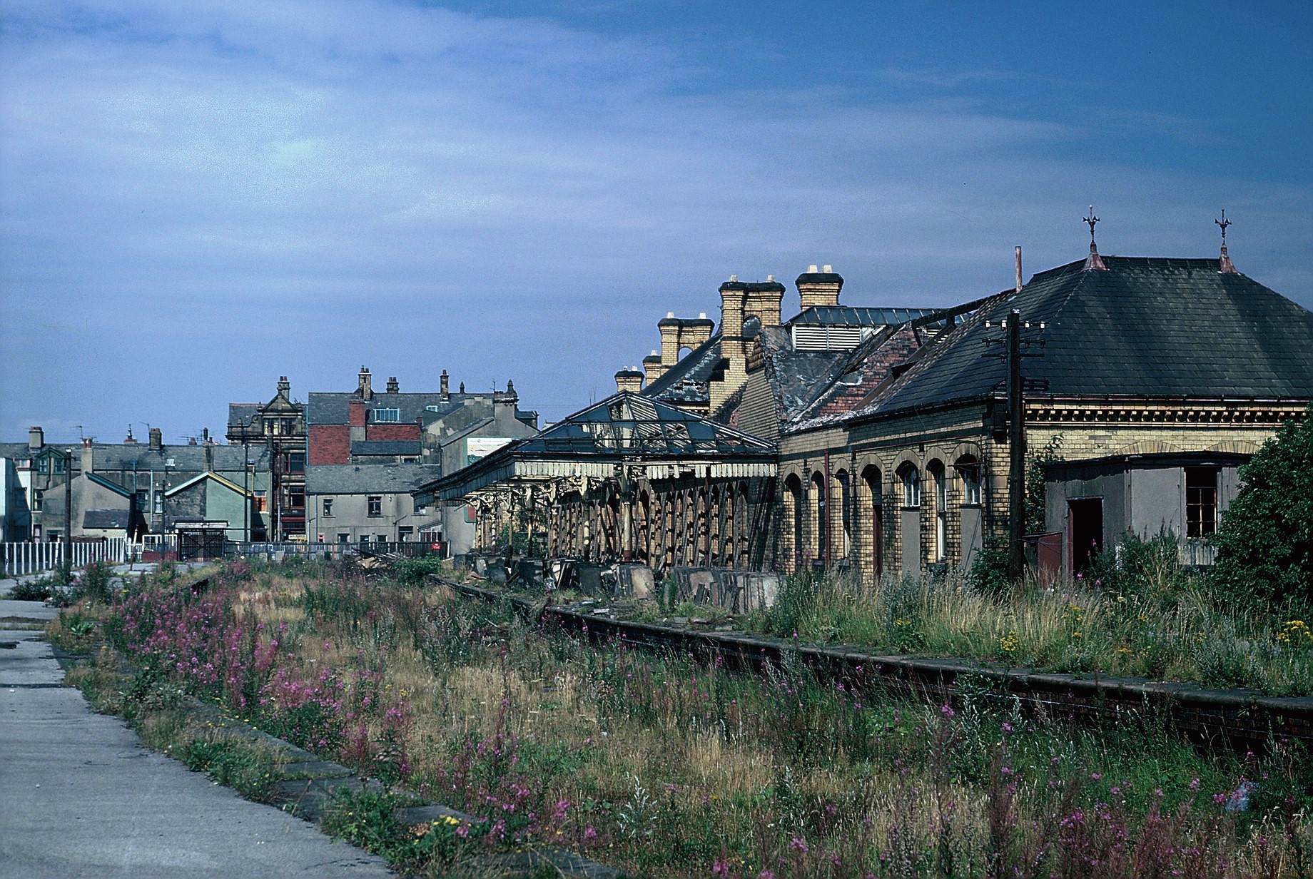
Morecambe Euston Road railway station

Morecambe Euston Road was the terminus station of the London and North Western Railway's branch line to Morecambe, in Lancashire, England. It closed in...

Morecambe Tramways

Morecambe Tramways served the town of Morecambe in Lancashire from 3 June 1887 until 24 October 1924. == History == The first section to open (1869) was...

St Barnabas' Church, Morecambe

St Barnabas' Church is in Regent Road, Morecambe, Lancashire, England. It is an active Anglican parish church in the deanery of Lancaster and Morecambe...

Related Videos

Ocean Edge Holiday Park - Heysham, Lancashire

Ocean Edge Holiday Park has all the ingredients for a memorable seaside holiday in Lancashire! Look forward to fantastic sea ...

Admiring the view over (Eric) Morecambe Bay! #lakedistrict #hiking

From the way off Wetherlam, the view over Morecame Bay is spectacular, bringing to mind that great son of Morecambe, Eric.

POV: You live in Morecambe 🏴󠁧󠁢󠁥󠁮󠁧󠁿 #travel

Morecambe Is One Of My Favourite Sea Side Town to visit in England. Have you ever been there? #england.

Nearby Amenities

Located within 500m of 54.055856,-2.856194
White Lund
Place: hamlet
Source: npe
Lat/Long: 54.0570054/-2.8559371
Post Box
Brand: Royal Mail
Brand Wikidata: Q638098
Brand Wikipedia: en:Royal Mail
Collection Times: Mo-Fr 09:00; Sa 07:00; Su off
Operator: Royal Mail
Operator Wikidata: Q638098
Post Box Type: lamp
Ref: LA3 276
Royal Cypher: EIIR
Royal Cypher Wikidata: Q33102113
Lat/Long: 54.0564333/-2.858612
Turning Circle
Lat/Long: 54.0569456/-2.8561048
Noexit: yes
Lat/Long: 54.0588488/-2.8507759
Noexit: yes
Lat/Long: 54.0584596/-2.8514578
Line Management: termination
Power: tower
Lat/Long: 54.0558699/-2.8517302
Noexit: yes
Lat/Long: 54.0580341/-2.8515111
Line Management: termination
Power: tower
Source: Bing
Lat/Long: 54.0521029/-2.8586298
Line Management: termination
Power: tower
Lat/Long: 54.0541785/-2.8548223
Noexit: yes
Lat/Long: 54.0560564/-2.8517477
Turning Circle
Lat/Long: 54.0564565/-2.8576837
Noexit: yes
Lat/Long: 54.0575735/-2.8501556
Noexit: yes
Lat/Long: 54.0566252/-2.8497431
Noexit: yes
Lat/Long: 54.0572012/-2.8494741
Give Way
Direction: backward
Lat/Long: 54.0562667/-2.8538945
Direction: both
Maxwidth: 6'6"
Traffic Calming: chicane
Lat/Long: 54.0578211/-2.8533352
Give Way
Direction: backward
Lat/Long: 54.0590636/-2.852454
Generator Method: photovoltaic
Generator Orientation: south
Generator Output Electricity: yes
Generator Solar Modules: 15
Generator Source: solar
Generator Type: solar_photovoltaic_panel
Location: roof
Power: generator
Lat/Long: 54.0600969/-2.8548372
Generator Method: photovoltaic
Generator Orientation: south
Generator Output Electricity: yes
Generator Solar Modules: 15
Generator Source: solar
Generator Type: solar_photovoltaic_panel
Location: roof
Power: generator
Lat/Long: 54.0593941/-2.8536241
Generator Method: photovoltaic
Generator Orientation: south
Generator Output Electricity: yes
Generator Solar Modules: 15
Generator Source: solar
Generator Type: solar_photovoltaic_panel
Location: roof
Power: generator
Lat/Long: 54.0601222/-2.8565568
Generator Method: photovoltaic
Generator Orientation: south
Generator Output Electricity: yes
Generator Solar Modules: 15
Generator Source: solar
Generator Type: solar_photovoltaic_panel
Location: roof
Power: generator
Lat/Long: 54.0598273/-2.8566039
Generator Method: photovoltaic
Generator Orientation: south
Generator Output Electricity: yes
Generator Solar Modules: 16
Generator Source: solar
Generator Type: solar_photovoltaic_panel
Location: roof
Power: generator
Lat/Long: 54.0598987/-2.8578209
Generator Method: photovoltaic
Generator Orientation: south
Generator Output Electricity: yes
Generator Solar Modules: 10
Generator Source: solar
Generator Type: solar_photovoltaic_panel
Location: roof
Power: generator
Lat/Long: 54.058765/-2.857817
Generator Method: photovoltaic
Generator Orientation: south
Generator Output Electricity: yes
Generator Solar Modules: 11
Generator Source: solar
Generator Type: solar_photovoltaic_panel
Location: roof
Power: generator
Lat/Long: 54.0590807/-2.8554968
Generator Method: photovoltaic
Generator Orientation: south
Generator Output Electricity: yes
Generator Solar Modules: 17
Generator Source: solar
Generator Type: solar_photovoltaic_panel
Location: roof
Power: generator
Lat/Long: 54.0580046/-2.8552927
Generator Method: photovoltaic
Generator Orientation: south
Generator Output Electricity: yes
Generator Solar Modules: 18
Generator Source: solar
Generator Type: solar_photovoltaic_panel
Location: roof
Power: generator
Lat/Long: 54.0576774/-2.8567649
Generator Method: photovoltaic
Generator Orientation: south
Generator Output Electricity: yes
Generator Solar Modules: 15
Generator Source: solar
Generator Type: solar_photovoltaic_panel
Location: roof
Power: generator
Lat/Long: 54.0574838/-2.8586689
Generator Method: photovoltaic
Generator Orientation: south
Generator Output Electricity: yes
Generator Solar Modules: 12
Generator Source: solar
Generator Type: solar_photovoltaic_panel
Location: roof
Power: generator
Lat/Long: 54.0573939/-2.8597839
Generator Method: photovoltaic
Generator Orientation: south
Generator Output Electricity: yes
Generator Solar Modules: 7
Generator Source: solar
Generator Type: solar_photovoltaic_panel
Location: roof
Power: generator
Lat/Long: 54.0574469/-2.8621905
Generator Method: photovoltaic
Generator Orientation: west
Generator Output Electricity: yes
Generator Solar Modules: 4
Generator Source: solar
Generator Type: solar_photovoltaic_panel
Location: roof
Power: generator
Lat/Long: 54.0574751/-2.862246
Generator Method: photovoltaic
Generator Orientation: south
Generator Output Electricity: yes
Generator Solar Modules: 7
Generator Source: solar
Generator Type: solar_photovoltaic_panel
Location: roof
Power: generator
Lat/Long: 54.0576308/-2.8625247
Noexit: yes
Lat/Long: 54.056673/-2.8527887
Noexit: yes
Lat/Long: 54.0566192/-2.8501463
Turning Circle
Lat/Long: 54.0564737/-2.8596716
Turning Circle
Lat/Long: 54.0565252/-2.8590957
Direction: both
Traffic Calming: rumble_strip
Lat/Long: 54.0569634/-2.859595
Turning Circle
Lat/Long: 54.0564445/-2.8575079
Direction: both
Traffic Calming: rumble_strip
Lat/Long: 54.0568745/-2.8574468
Turning Circle
Lat/Long: 54.0577214/-2.8528459
Turning Circle
Lat/Long: 54.0581731/-2.8541945
Turning Circle
Lat/Long: 54.0580886/-2.8542133
Man Made: street_cabinet
Lat/Long: 54.0564408/-2.8586213
Give Way
Direction: backward
Lat/Long: 54.0563853/-2.8587233
Fountain
Lat/Long: 54.0564612/-2.8583333
Man Made: street_cabinet
Lat/Long: 54.0569165/-2.857512
Direction: both
Traffic Calming: rumble_strip
Lat/Long: 54.0570642/-2.858011
Direction: both
Traffic Calming: rumble_strip
Lat/Long: 54.056949/-2.8562843
Direction: both
Traffic Calming: rumble_strip
Lat/Long: 54.0574517/-2.8532284
Noexit: yes
Lat/Long: 54.0577063/-2.8504749
Noexit: yes
Lat/Long: 54.0571389/-2.8506836
Noexit: yes
Lat/Long: 54.0571398/-2.8516085
Noexit: yes
Lat/Long: 54.0570997/-2.8512395
Give Way
Direction: backward
Lat/Long: 54.0569478/-2.8505301
Noexit: yes
Lat/Long: 54.0571897/-2.8516854
GVS
Addr City: Morecambe
Addr Postcode: LA3 3EN
Addr Street: Vickers Way
Man Made: works
Product: filters
Website: https://www.gvs.com/en/
Lat/Long: 54.0575/-2.8511932
Man Made: street_cabinet
Lat/Long: 54.0599761/-2.8534291
Give Way
Direction: backward
Lat/Long: 54.0592381/-2.8523992
Give Way
Direction: backward
Lat/Long: 54.0596156/-2.8533348
Man Made: street_cabinet
Lat/Long: 54.0591746/-2.852517
Natural: tree_stump
Lat/Long: 54.0595722/-2.8521097
Entrance: main
Lat/Long: 54.0556845/-2.8501573
Entrance: main
Lat/Long: 54.0555394/-2.8486405
Power: substation
Lat/Long: 54.0561715/-2.8506262
Noexit: yes
Lat/Long: 54.056341/-2.8497048
Camera Mount: pole
Man Made: surveillance
Surveillance Type: camera
Lat/Long: 54.0563633/-2.8507648
Alpha Sheet Metal
Addr Bay: 3
Addr City: Morecambe
Addr Postcode: LA3 3EN
Addr Street: Vickers Way
Addr Unit: 15
Craft: metal_construction
Website: https://alphasheetmetalltd.co.uk/
Lat/Long: 54.05661/-2.851024
TradeSignz
Addr Bay: 4
Addr City: Morecambe
Addr Postcode: LA3 3EN
Addr Street: Vickers Way
Addr Unit: 15
Craft: signmaker
Website: https://tradesignz.com/
Lat/Long: 54.0566823/-2.8510029
Raw Feeding Plus
Addr Bay: 7
Addr City: Morecambe
Addr Postcode: LA3 3EN
Addr Street: Vickers Way
Addr Unit: 15
Shop: pet
Website: https://www.rawfeedingplus.co.uk/
Lat/Long: 54.0568971/-2.8509405
Addr Bay: 6
Addr City: Morecambe
Addr Postcode: LA3 3EN
Addr Street: Vickers Way
Addr Unit: 15
Lat/Long: 54.0568239/-2.8509618
Addr Bay: 5
Addr City: Morecambe
Addr Postcode: LA3 3EN
Addr Street: Vickers Way
Addr Unit: 15
Lat/Long: 54.0567557/-2.8509816
Addr Bay: 2
Addr City: Morecambe
Addr Postcode: LA3 3EN
Addr Street: Vickers Way
Addr Unit: 15
Lat/Long: 54.0565455/-2.8510427
Addr Bay: 1
Addr City: Morecambe
Addr Postcode: LA3 3EN
Addr Street: Vickers Way
Addr Unit: 15
Lat/Long: 54.0564812/-2.8510614
Mather Signs
Addr City: Morecambe
Addr Postcode: LA3 3EN
Addr Street: Vickers Way
Addr Unit: 8A
Craft: signmaker
Website: http://mathersigns.co.uk/
Lat/Long: 54.0569575/-2.8515425
Morecambe Motor Services
Addr City: Morecambe
Addr Postcode: LA3 3EN
Addr Street: Vickers Way
Shop: car_repair
Lat/Long: 54.0570084/-2.8520423
Noexit: yes
Lat/Long: 54.0561429/-2.8510387
Entrance: main
Lat/Long: 54.0561193/-2.8513451
Give Way
Direction: backward
Lat/Long: 54.0556263/-2.8509371
Give Way
Direction: backward
Lat/Long: 54.0558425/-2.8533405
Entrance: yes
Lat/Long: 54.0553041/-2.8550101
Give Way
Direction: forward
Lat/Long: 54.0564275/-2.8629773
Direction: both
Surface: asphalt
Traffic Calming: bump
Lat/Long: 54.0567301/-2.8630502
Man Made: manhole
Lat/Long: 54.0562941/-2.8631128
Man Made: manhole
Lat/Long: 54.0562941/-2.8630579
Man Made: manhole
Lat/Long: 54.0563231/-2.863014
Man Made: street_cabinet
Lat/Long: 54.0563425/-2.8631329
Give Way
Direction: forward
Lat/Long: 54.0594075/-2.8605476
Give Way
Direction: forward
Lat/Long: 54.0595682/-2.8604554
Give Way
Direction: backward
Lat/Long: 54.0596323/-2.8590419
The data included in this document is from www.openstreetmap.org. The data is made available under ODbL.

Have you been to White Lund?

Leave your review of White Lund below (or comments, questions and feedback).