Whilton

Settlement in Northamptonshire

England

Whilton

Bridge 15 (Grand Union Canal) Bridge 15 carries the road towards the A5 on the canal at Whilton Locks.
Bridge 15 (Grand Union Canal) Credit: Ryan Griffiths

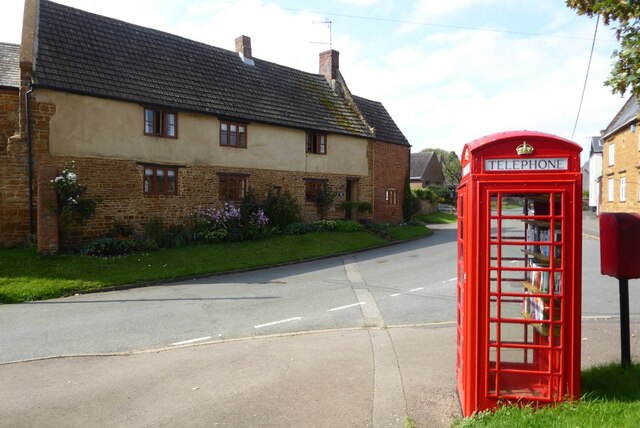
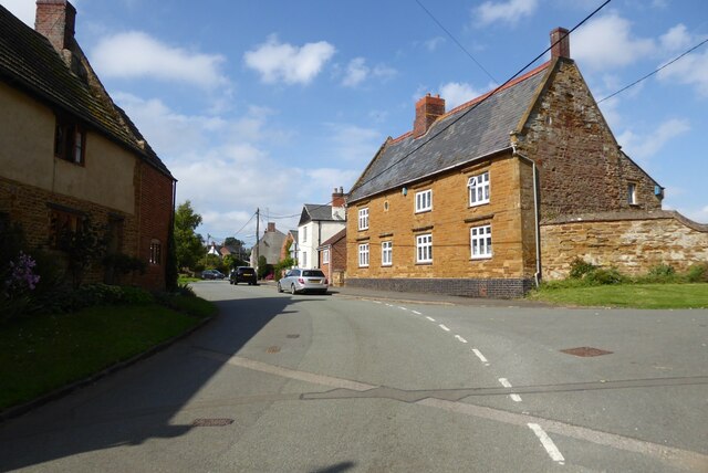
Whilton is a charming village located in the county of Northamptonshire, England. Situated approximately 7 miles west of the town of Daventry, it is nestled in the beautiful countryside that characterizes this part of the country. The village falls under the administrative district of Daventry and has a population of around 500 residents.

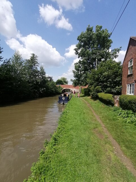
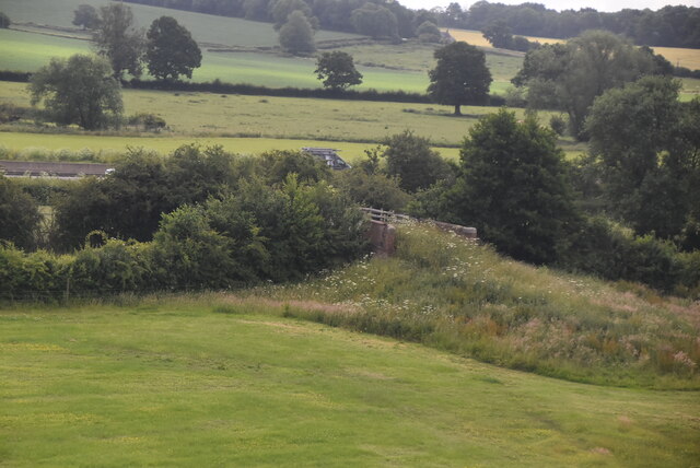
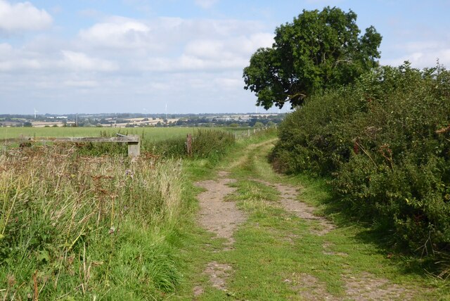
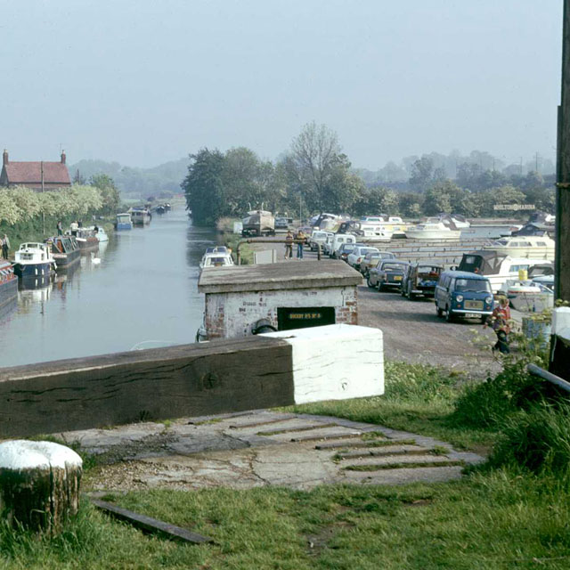
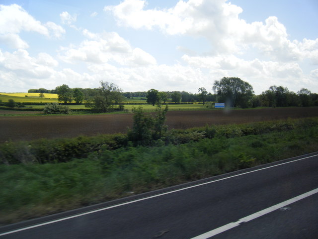
Whilton is renowned for its picturesque scenery and tranquil atmosphere. The village is surrounded by lush green fields and rolling hills, providing a peaceful and idyllic setting for its inhabitants. The Grand Union Canal flows through the village, adding to its charm and offering opportunities for leisurely walks and boat trips.

The village itself is small but offers a range of amenities for its residents. There is a local pub, The Narrow Boat, which is a popular spot for locals and visitors alike to enjoy a drink or a meal. Additionally, there is a village hall that serves as a hub for community events and gatherings.

Whilton is also home to Whilton Locks Garden Village, a popular tourist attraction. This garden center offers a wide range of plants, flowers, and gardening supplies, as well as a café and various other shops. It attracts visitors from near and far, adding a vibrant touch to the village.

Overall, Whilton is a quaint and picturesque village that attracts residents and visitors with its natural beauty, community spirit, and range of amenities. It is a hidden gem in Northamptonshire and a delightful place to visit or call home.

If you have any feedback on the listing, please let us know in the comments section below.

Whilton Images

Images are sourced within 2km of 52.277085/-1.0681852 or Grid Reference SP6364. Thanks to Geograph Open Source API. All images are credited.

Bridge 15 (Grand Union Canal) Bridge 15 carries the road towards the A5 on the canal at Whilton Locks.
Bridge 15 (Grand Union Canal)
Bridge 15 carries the road towards the A5 on the canal at Whilton Locks.
Bridge 15 (Grand Union Canal) View at Whilton Locks from Bridge 15 on the Grand Union Canal.
Bridge 15 (Grand Union Canal)
View at Whilton Locks from Bridge 15 on the Grand Union Canal.
Grand Union Canal, Northamptonshire The Grand Union Canal near Whilton Locks and bridge 15 in the distance.
Grand Union Canal, Northamptonshire
The Grand Union Canal near Whilton Locks and bridge 15 in the distance.
Grand Union Canal Bridge number 16.
Grand Union Canal
Bridge number 16.
Grand Union Canal Whilton Bottom Lock, Number 13.
Grand Union Canal
Whilton Bottom Lock, Number 13.
Access bridge, Grand Union Canal
Stored caravans
Stored caravans
Matrix Board - M1 southbound
Whilton Marina
Whilton Marina
Whilton Marina
Whilton Marina
Access bridge, Grand Union Canal
Farmland at Whilton Farmland to the west of the village of Whilton.
Farmland at Whilton
Farmland to the west of the village of Whilton.
Whilton church Whilton church is dedicated to St Andrew, the church dates back to the 13th century and is Grade II listed, see: <span class="nowrap"><a title="https://historicengland.org.uk/listing/the-list/list-entry/1076490" rel="nofollow ugc noopener" href="https://historicengland.org.uk/listing/the-list/list-entry/1076490">Link</a><img style="margin-left:2px;" alt="External link" title="External link - shift click to open in new window" src="https://s1.geograph.org.uk/img/external.png" width="10" height="10"/></span>
Whilton church
Whilton church is dedicated to St Andrew, the church dates back to the 13th century and is Grade II listed, see: LinkExternal link
Former telephone box Former telephone box in the village of Whilton, these days it is a book exchange.
Former telephone box
Former telephone box in the village of Whilton, these days it is a book exchange.
Village of Whilton Houses in the village of Whilton.
Village of Whilton
Houses in the village of Whilton.
Grand Union Canal and Whilton Marina, 1976 The building below the lock is a pump house for pumping water back up the Buckby flight of locks.
Grand Union Canal and Whilton Marina, 1976
The building below the lock is a pump house for pumping water back up the Buckby flight of locks.
Fields east of the M1
Show me another place!

Whilton is located at Grid Ref: SP6364 (Lat: 52.277085, Lng: -1.0681852)

Unitary Authority: West Northamptonshire

Police Authority: Northamptonshire

What 3 Words

///plank.waiters.jousting. Near Long Buckby, Northamptonshire

Related Wikis

Whilton

Whilton is a village and a civil parish in the English county of Northamptonshire. The population (including Slapton) at the 2011 Census was 271. The...

Brington, Northamptonshire

Brington is a civil parish in West Northamptonshire in England. At the time of the 2001 census, the parish population was 482 people, increasing to 496...

Muscott (lost settlement)

The lost village of Muscott is located within the parish of Norton in the English county of Northamptonshire. == Gallery == == References ==

Whilton Locks

Whilton Locks is the name of a flight of seven locks on the Grand Union Canal near Daventry, in the county of Northamptonshire, England. They are also...

Nearby Amenities

Located within 500m of 52.277085,-1.0681852
Whilton
Place: village
Source: NPE
Lat/Long: 52.2770079/-1.0691702
Post Box
Drive Through: no
Operator: Royal Mail
Post Box Type: lamp
Ref: NN11 52
Royal Cypher: EIIR
Royal Cypher Wikidata: Q33102113
Lat/Long: 52.2774437/-1.0689157
Barrier: stile
Lat/Long: 52.2764155/-1.0731333
Public Bookcase
HE Ref: 1281280
Booth: K6
Covered: booth
Disused Amenity: telephone
Listed Status: Grade II
Man Made: telephone_box
Old Phone: +44 1327 842397
Public Bookcase Type: phone_box
Lat/Long: 52.2774288/-1.0688848
Bench
Backrest: yes
Colour: green
Lat/Long: 52.27748/-1.0688683
Barrier: stile
Lat/Long: 52.2759571/-1.0731738
The data included in this document is from www.openstreetmap.org. The data is made available under ODbL.

Have you been to Whilton?

Leave your review of Whilton below (or comments, questions and feedback).