Whatley

Settlement in Somerset Mendip

England

Whatley

Nunney Village & Church View of the village and church of Nunney, photographed from outside the castle.
The footbridge in the photograph crosses the Nunney Brook and leads onto Church Street.
Nunney Village & Church Credit: Kevin Pearson

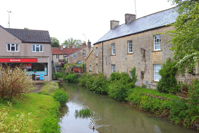
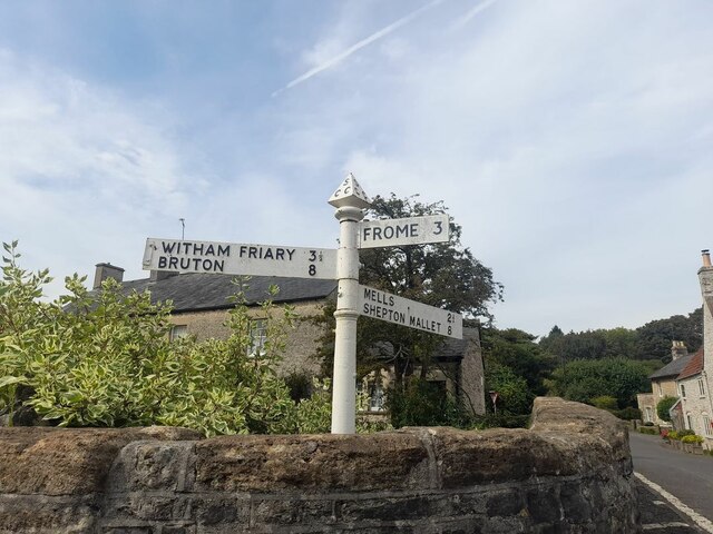
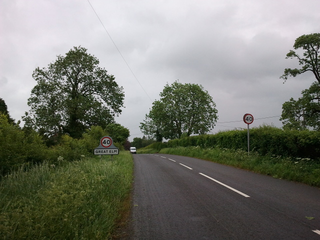
Whatley is a small village located in the county of Somerset, England. Situated in the Mendip Hills, it lies approximately 4 miles south of Frome and 12 miles east of Wells. The village is set amidst picturesque countryside, boasting rolling green hills and meandering streams.

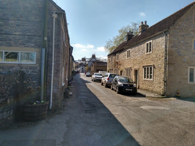
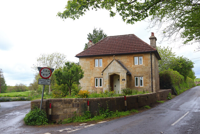
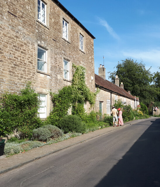
Whatley is known for its rural charm and tranquil atmosphere. The village is characterized by a collection of traditional stone cottages and farmhouses, which add to its idyllic appeal. The local community is close-knit and friendly, fostering a strong sense of camaraderie among residents.

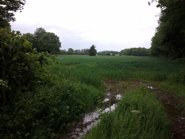
The village is surrounded by lush farmland and fields, cultivating a predominantly agricultural economy. The agricultural heritage of Whatley is evident in the presence of several working farms in the area. The landscape also offers ample opportunities for outdoor activities such as hiking, cycling, and horseback riding, attracting nature enthusiasts and visitors seeking a peaceful retreat.

Despite its small size, Whatley offers a range of amenities to its residents. These include a village hall that serves as a hub for social gatherings and community events, a primary school, and a local pub that serves as a meeting place for villagers and visitors alike.

Overall, Whatley is a charming village that embraces its rural heritage and offers a serene lifestyle in a picturesque setting. With its close-knit community and beautiful surroundings, it provides a peaceful haven for those seeking a slower pace of life in the heart of the Somerset countryside.

If you have any feedback on the listing, please let us know in the comments section below.

Whatley Images

Images are sourced within 2km of 51.226619/-2.3780873 or Grid Reference ST7347. Thanks to Geograph Open Source API. All images are credited.

Nunney Village & Church View of the village and church of Nunney, photographed from outside the castle.
The footbridge in the photograph crosses the Nunney Brook and leads onto Church Street.
Nunney Village & Church
View of the village and church of Nunney, photographed from outside the castle. The footbridge in the photograph crosses the Nunney Brook and leads onto Church Street.
Nunney Castle Nunney Castle, viewed from the eastern end of Castle Street.
Nunney Castle
Nunney Castle, viewed from the eastern end of Castle Street.
Church Street in Nunney View of Church Street in Nunney, photographed from outside the church, looking south west towards the George Inn.
Church Street in Nunney
View of Church Street in Nunney, photographed from outside the church, looking south west towards the George Inn.
Church of All Saints, Nunney The Church of All Saints in Nunney, photographed from the gate on Church Street.
Church of All Saints, Nunney
The Church of All Saints in Nunney, photographed from the gate on Church Street.
Nunney Castle <span class="nowrap"><a title="https://historicengland.org.uk/listing/the-list/list-entry/1014716?section=official-listing" rel="nofollow ugc noopener" href="https://historicengland.org.uk/listing/the-list/list-entry/1014716?section=official-listing">Link</a><img style="margin-left:2px;" alt="External link" title="External link - shift click to open in new window" src="https://s1.geograph.org.uk/img/external.png" width="10" height="10"/></span>
Nunney Castle
Lower Whatley Isolated dwelling at Lower Whatley.
Lower Whatley
Isolated dwelling at Lower Whatley.
Whatley Church Church at Whatley.
Whatley Church
Church at Whatley.
Nunney Brook Brook and buildings in Nunney.
Nunney Brook
Brook and buildings in Nunney.
Nunney Castle View from the south
Nunney Castle
View from the south
Old Milestone West of Whatley Crossroads The Milestone is located on grass verge and hedge on the South of the road.  Parish of Whatley (Mendip District). Metal plate attached to stone post, Frome square iron plate design, erected by the Frome turnpike trust in the 18th Century. An earlier photograph can be found here: <a title="https://www.geograph.org.uk/photo/6051504" href="https://www.geograph.org.uk/photo/6051504">Link</a> 

Inscription reads:-  
FROME / 3 / WELLS / 12 

Grade II listed. List Entry Number: 1295398 <span class="nowrap"><a title="https://historicengland.org.uk/listing/the-list/list-entry/1295398" rel="nofollow ugc noopener" href="https://historicengland.org.uk/listing/the-list/list-entry/1295398">Link</a><img style="margin-left:2px;" alt="External link" title="External link - shift click to open in new window" src="https://s1.geograph.org.uk/img/external.png" width="10" height="10"/></span> 

Milestone Society National ID: SO_FRWL03
Old Milestone West of Whatley Crossroads
The Milestone is located on grass verge and hedge on the South of the road.  Parish of Whatley (Mendip District). Metal plate attached to stone post, Frome square iron plate design, erected by the Frome turnpike trust in the 18th Century. An earlier photograph can be found here: Link  Inscription reads:- FROME / 3 / WELLS / 12 Grade II listed. List Entry Number: 1295398 LinkExternal link Milestone Society National ID: SO_FRWL03
Cottages in Selwood Street
Direction Sign – Signpost by the bridge in Nunney Located beside the bridge on the west side of the junction of Castle Hill, Church Street and High Street in Nunney parish. 3 arms and pyramid finial. See also <a title="https://www.geograph.org.uk/photo/6043241" href="https://www.geograph.org.uk/photo/6043241">Link</a>.

Milestone Society National ID: SO_ST7345
Direction Sign – Signpost by the bridge in Nunney
Located beside the bridge on the west side of the junction of Castle Hill, Church Street and High Street in Nunney parish. 3 arms and pyramid finial. See also Link. Milestone Society National ID: SO_ST7345
Church of St Mary Magdalene, Great Elm Looking northeast towards the Church of St Mary Magdalene at Great Elm.  Nave and chancel date from the 12th century, and the saddleback roofed tower from the 13th century.  The east window and the south nave windows are 19th century additions in the Decorated style, while the south chancel window is in the perpendicular style (presumably dating from the 15th century).  A war memorial stands just outside the south door.
Church of St Mary Magdalene, Great Elm
Looking northeast towards the Church of St Mary Magdalene at Great Elm. Nave and chancel date from the 12th century, and the saddleback roofed tower from the 13th century. The east window and the south nave windows are 19th century additions in the Decorated style, while the south chancel window is in the perpendicular style (presumably dating from the 15th century). A war memorial stands just outside the south door.
Nunney Castle and moat
Lockup, Gay Street, Mells Built in the 17C.
Lockup, Gay Street, Mells
Built in the 17C.
A wet field entrance
Houses in Mells
Houses in Mells
Approaching Great Elm from the west
Show me another place!

Whatley is located at Grid Ref: ST7347 (Lat: 51.226619, Lng: -2.3780873)

Administrative County: Somerset

District: Mendip

Police Authority: Avon and Somerset

What 3 Words

///tram.slicer.makes. Near Frome, Somerset

Nearby Locations

Whatley Whatley

Related Wikis

Whatley, Mendip

Whatley is a small rural village and civil parish about 2.5 miles (4 km) west of Frome in the English county of Somerset. The parish lies south of Mells...

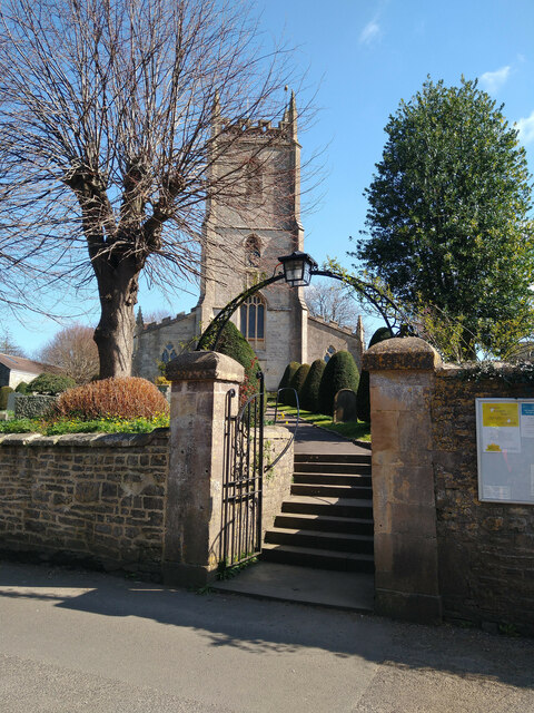
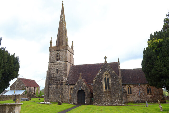
Church of St George, Whatley

The Anglican Church of St George in Whatley, within the English county of Somerset, dates from the 14th century. It is a Grade II* listed building.Parts...

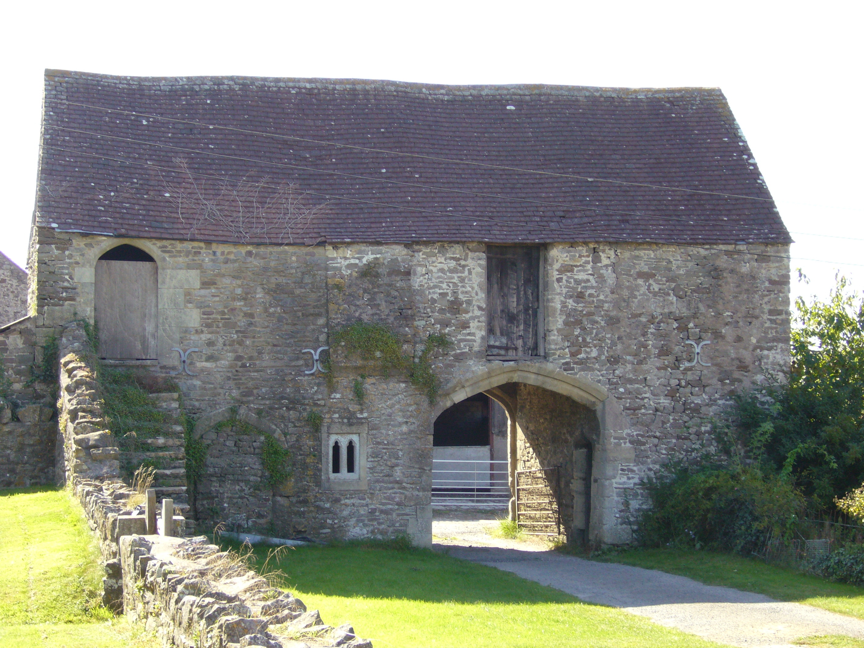
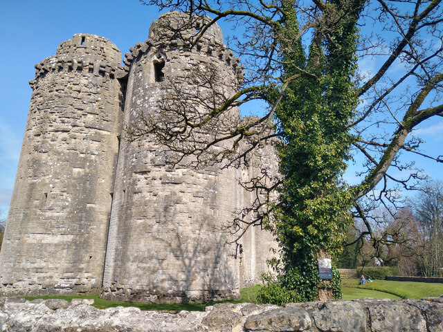
Manor Farmhouse Gatehouse, Whatley

The Manor Farmhouse Gatehouse in Whatley, Somerset, England, was built around 1500 and has been designated as a Grade I listed building.The two-storey...

Whatley Quarry

Whatley Quarry, grid reference ST731479 is a limestone quarry owned by Hanson plc, near the village of Whatley on the Mendip Hills, Somerset, England....

Nearby Amenities

Located within 500m of 51.226619,-2.3780873
Lower Whatley
Place: hamlet
Source: NPE
Lat/Long: 51.2241994/-2.3726089
Whatley
Place: hamlet
Source: NPE
Lat/Long: 51.2262008/-2.3821253
Railway: switch
Lat/Long: 51.2304202/-2.3814073
Railway: switch
Lat/Long: 51.2304656/-2.3812142
Railway: buffer_stop
Lat/Long: 51.2310039/-2.3794144
Railway: switch
Lat/Long: 51.2304337/-2.3816474
Railway: switch
Lat/Long: 51.2306344/-2.380321
Bus Stop
Summerfield Farm
Bus: yes
Naptan AtcoCode: 3600SOB21670
Naptan Bearing: S
Naptan CommonName: Summerfield Farm
Naptan Indicator: S-bound
Naptan NaptanCode: sotdjpwd
Naptan Street: unnamed rd to Frome
Naptan Verified: no
Public Transport: platform
Lat/Long: 51.2259374/-2.3829538
Bus Stop
Summerfield Farm
Bus: yes
Naptan AtcoCode: 3600SOB21669
Naptan Bearing: S
Naptan CommonName: Summerfield
Naptan Indicator: S-bound
Naptan NaptanCode: sotdjpwg
Naptan Street: Railford Hill
Naptan Verified: no
Public Transport: platform
Lat/Long: 51.2259335/-2.3833604
The data included in this document is from www.openstreetmap.org. The data is made available under ODbL.

Have you been to Whatley?

Leave your review of Whatley below (or comments, questions and feedback).