Westwell

Settlement in Kent Ashford

England

Westwell

Fields and railway line from M20
Fields and railway line from M20 Credit: Colin Pyle

Westwell is a small village located in the county of Kent, England. Situated about 5 miles north of Ashford, it falls within the borough of Ashford and the civil parish of Westwell. The village is surrounded by beautiful countryside and is known for its picturesque views and tranquil atmosphere.

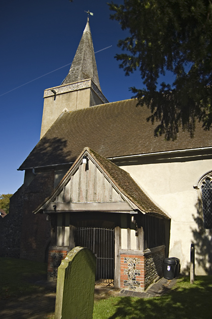
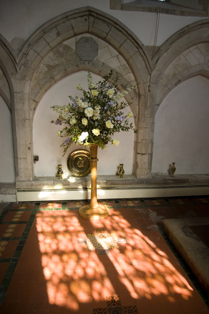
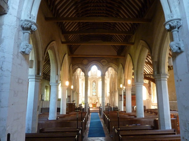
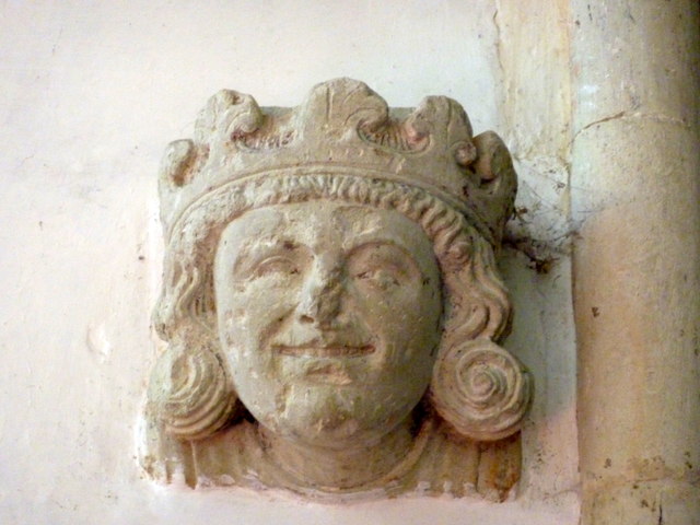
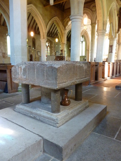
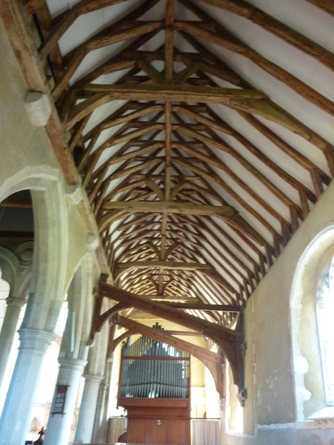
The heart of Westwell is its village green, which is a focal point for community activities and events. The green is bordered by charming historic buildings, including the 12th-century Church of St. Mary the Virgin, which is a Grade I listed structure. This ancient church features stunning architecture and is a significant landmark in the village.

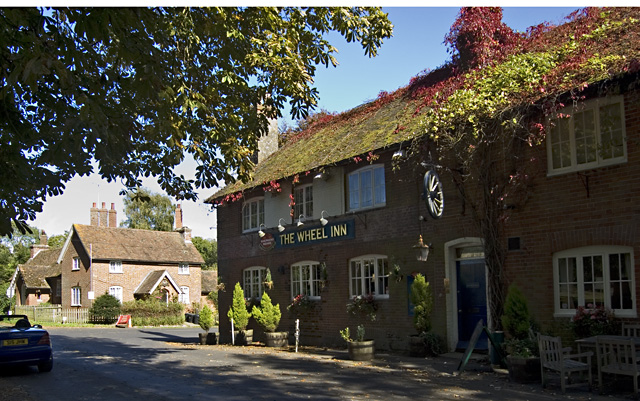
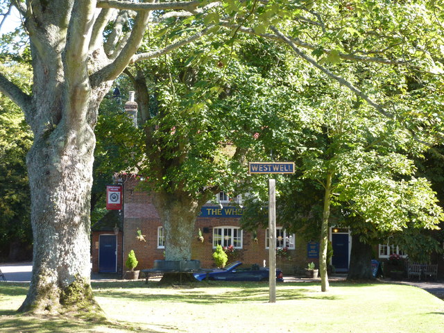
Westwell has a close-knit community and a friendly atmosphere. It is home to a population of around 600 residents, who enjoy a peaceful rural lifestyle. The village has a primary school, providing education for local children, and a traditional village pub, The Wheel Inn, which offers a warm welcome to visitors.

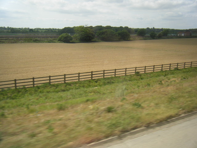
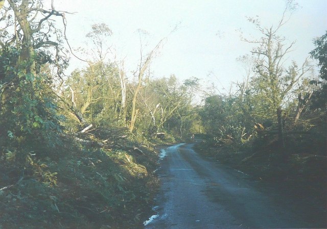
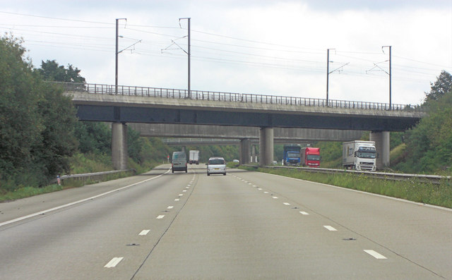
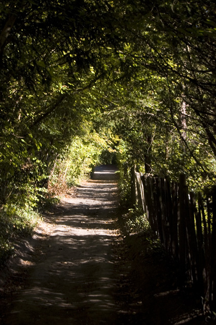
The surrounding area is ideal for outdoor enthusiasts, with plenty of opportunities for countryside walks and cycling. Westwell Leacon Nature Reserve is nearby, offering a haven for wildlife and a peaceful retreat for nature lovers. The village is also conveniently located near major road networks, providing easy access to nearby towns and cities.

Westwell is a charming village that offers a perfect balance of rural living and accessibility. Its rich history, natural beauty, and strong sense of community make it an idyllic place to reside or visit in the heart of the Kent countryside.

If you have any feedback on the listing, please let us know in the comments section below.

Westwell Images

Images are sourced within 2km of 51.190434/0.84515633 or Grid Reference TQ9847. Thanks to Geograph Open Source API. All images are credited.

Fields and railway line from M20
Watery Lane in 1987 This was taken one day after "The Great Storm" that swept in during the night of 15-16 October 1987 to devastate large swathes of Southern England.
Watery Lane in 1987
This was taken one day after "The Great Storm" that swept in during the night of 15-16 October 1987 to devastate large swathes of Southern England.
M20 railway-bridge carries CTRL The Channel Tunnel Rail Link (CTRL) has paralleled the motorway to the north for many miles but now it crosses the M20 and diverges south into Ashford. Visible underneath and beyond that bridge another carries the local railway line from Ashford to Charing.
M20 railway-bridge carries CTRL
The Channel Tunnel Rail Link (CTRL) has paralleled the motorway to the north for many miles but now it crosses the M20 and diverges south into Ashford. Visible underneath and beyond that bridge another carries the local railway line from Ashford to Charing.
Church of St Mary, Westwell, Kent Showing the 15th century porch and the tower with its brooch spire.
Church of St Mary, Westwell, Kent
Showing the 15th century porch and the tower with its brooch spire.
Stained glass, St Mary, Westwell, Kent Window on the north side of the church
Stained glass, St Mary, Westwell, Kent
Window on the north side of the church
North Downs Way, near Westwell, Kent Part of the 153-mile national trail as it passes to the north of Westwell.
North Downs Way, near Westwell, Kent
Part of the 153-mile national trail as it passes to the north of Westwell.
The Wheel Inn, Westwell, Kent Pub on the crossroads at the centre of the village; the Old School House in the background
The Wheel Inn, Westwell, Kent
Pub on the crossroads at the centre of the village; the Old School House in the background
Light in the sanctuary, St Mary's Westwell Looking towards the north wall of the sanctuary at the church's eastern end.
Light in the sanctuary, St Mary's Westwell
Looking towards the north wall of the sanctuary at the church's eastern end.
The church of St. Mary the Virgin, Westwell Grade I listed building dating from the 13th century. The chancel is separated from the nave by a screen of 3 trefoil headed arches.
The church of St. Mary the Virgin, Westwell
Grade I listed building dating from the 13th century. The chancel is separated from the nave by a screen of 3 trefoil headed arches.
Carving in the church of St. Mary, Westwell This is a 13th century carving of a king, believed to be that of Henry III.
Carving in the church of St. Mary, Westwell
This is a 13th century carving of a king, believed to be that of Henry III.
Church of St. Mary the Virgin, Westwell The 13th century font is of Purbeck marble and was recovered from a farmyard.
Church of St. Mary the Virgin, Westwell
The 13th century font is of Purbeck marble and was recovered from a farmyard.
South aisle of St. Mary's Church, Westwell Wooden buttresses support the outward thrust of the south arcade of the nave. The aisle has a collar beam and crown post roof.
South aisle of St. Mary's Church, Westwell
Wooden buttresses support the outward thrust of the south arcade of the nave. The aisle has a collar beam and crown post roof.
Westwell, Kent The village sign on the green and The Wheel Inn, a Shepherd Neame public house.
Westwell, Kent
The village sign on the green and The Wheel Inn, a Shepherd Neame public house.
Approaching Westwell from the west The houses on the right were built as council houses. Some, if not all, have been bought by the former tenants. The third house from the right was undergoing extensive rebuilding - the roof structure of an extension can be seen. The village was originally called Wells, due to the number of springs.
Approaching Westwell from the west
The houses on the right were built as council houses. Some, if not all, have been bought by the former tenants. The third house from the right was undergoing extensive rebuilding - the roof structure of an extension can be seen. The village was originally called Wells, due to the number of springs.
The green at Westwell Across the green, part of the Wheel Inn can be seen. The Shepherd Neame sign <a href="https://www.geograph.org.uk/photo/2068349">TQ9847 : The Wheel Inn, Westwell</a> hanging on the side of the pub is of a cartwheel, recalling St Catherine who was martyred bound to a wheel. To the left of the pub is the steeple of St Mary's church.
The green at Westwell
Across the green, part of the Wheel Inn can be seen. The Shepherd Neame sign TQ9847 : The Wheel Inn, Westwell hanging on the side of the pub is of a cartwheel, recalling St Catherine who was martyred bound to a wheel. To the left of the pub is the steeple of St Mary's church.
The Mill at Westwell This is a former watermill - the wheel is on the other side of the building. When I first knew the mill in the early 1970s, Mr J Hotchkiss had restored the wheel to a working order but it was stationary when I took this photo. The road to the right of the building ascends a hill to Dunn Street.
The Mill at Westwell
This is a former watermill - the wheel is on the other side of the building. When I first knew the mill in the early 1970s, Mr J Hotchkiss had restored the wheel to a working order but it was stationary when I took this photo. The road to the right of the building ascends a hill to Dunn Street.
The lane between The Mill and the crossroads
Court Lodge, Westwell Court Lodge is a grade II listed building <span class="nowrap"><a title="http://www.britishlistedbuildings.co.uk/en-181311-court-lodge-1-and-2-westwell/osmap" rel="nofollow ugc noopener" href="http://www.britishlistedbuildings.co.uk/en-181311-court-lodge-1-and-2-westwell/osmap">Link</a><img style="margin-left:2px;" alt="External link" title="External link - shift click to open in new window" src="https://s1.geograph.org.uk/img/external.png" width="10" height="10"/></span>
Court Lodge, Westwell
Court Lodge is a grade II listed building LinkExternal link
Show me another place!

Westwell is located at Grid Ref: TQ9847 (Lat: 51.190434, Lng: 0.84515633)

Administrative County: Kent

District: Ashford

Police Authority: Kent

What 3 Words

///markets.paler.enabling. Near Kennington, Kent

Nearby Locations

Westwell Westwell

Related Wikis

Westwell, Kent

Westwell is a village and relatively elevated civil parish with a population of 740 (2001), centred 4 miles (6 km) north of Ashford in Kent, England, in...

Hothfield railway station

Hothfield railway station (later Hothfield Halt) was a railway station on the Maidstone Line at Hothfield, Kent. It was situated between Ashford and Charing...

Charing Beech Hangers

Charing Beech Hangers is a 52.6-hectare (130-acre) biological Site of Special Scientific Interest north of Ashford in Kent.This steeply sloping site has...

Eastwell, Kent

Eastwell is a hamlet and civil parish about 3 miles (5 km) north of Ashford, Kent, England. The 2011 Census recorded the parish's population as 103.The...

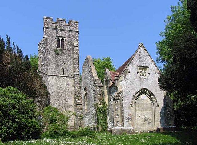
St Mary's Church, Eastwell

St Mary's Church is a ruined former Church of England parish church, in the grounds of Eastwell Park in the hamlet of Eastwell, Kent, England. It is recorded...

Hothfield Common

Hothfield Common is a 56.5-hectare (140-acre) biological Site of Special Scientific Interest north-east of Ashford in Kent. It is also a Local Nature...

Eastwell Park

Eastwell Park is a large area of parkland and a country estate in the civil parish of Eastwell, adjoining Ashford, Kent, in England. It was owned by the...

Westwell Leacon

Westwell Leacon is a hamlet in the civil parish of Charing near Ashford in Kent, England. Its most famous resident is international Cyclocross star Ian...

Related Videos

Champneys Spa day at Eastwell Manor

A lovely stay and spa day at Champneys. They have an outdoor heated pool, lots of natural grounds, and water features.

North Downs Way 4 Mile Walk to Westwell Vineyard

northdownsway #walkkent #westwellwines If you would like to try some delicious Kent wine visit Westwell Vineyard: ...

Dun street Farm bikepacking Trip

A bikepacking trip to Dun Street Farm Camping, near Westwell in Kent. A blustery NE wind which made the returm trip a chore.

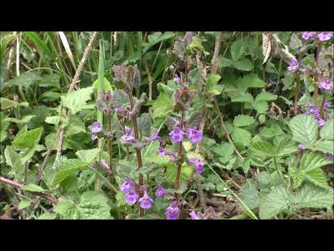
Bushcraft uses for ground ivy

Ground ivy is another useful plant for us in bushcraft as it is both edible and has herbal uses. Watch this short video to find out ...

Nearby Amenities

Located within 500m of 51.190434,0.84515633
Bus Stop
Wheel Inn
Flag: no
Naptan AtcoCode: 2400A038020A
Naptan Bearing: S
Naptan BusStopType: CUS
Naptan CommonName: Wheel Inn
Naptan Indicator: o/s
Naptan Landmark: The Wheel Ph Forecourt
Naptan NaptanCode: kntdpdmt
Naptan Street: Westwell Ln
Naptan Verified: no
Public Transport: platform
Source: naptan_import
Lat/Long: 51.1916547/0.8461776
Post Box
Ref: TN25 223
Lat/Long: 51.1902249/0.8456128
Barrier: stile
Lat/Long: 51.1875274/0.8423684
Barrier: kissing_gate
Lat/Long: 51.1898541/0.8445952
Barrier: stile
Lat/Long: 51.1909581/0.8487811
Barrier: stile
Lat/Long: 51.1865798/0.8485532
Barrier: stile
Lat/Long: 51.1865884/0.848276
Barrier: stile
Lat/Long: 51.1894639/0.8442027
Give Way
Direction: backward
Lat/Long: 51.1917201/0.8459521
Give Way
Direction: backward
Lat/Long: 51.191765/0.8460301
Give Way
Direction: backward
Lat/Long: 51.1914837/0.845857
Turning Loop
Lat/Long: 51.1908524/0.8476004
Give Way
Direction: backward
Lat/Long: 51.1911354/0.8492224
Generator Method: photovoltaic
Generator Output Electricity: yes
Generator Source: solar
Generator Type: solar_photovoltaic_panel
Location: roof
Power: generator
Lat/Long: 51.1901281/0.8446477
Generator Method: photovoltaic
Generator Output Electricity: yes
Generator Source: solar
Generator Type: solar_photovoltaic_panel
Location: roof
Power: generator
Lat/Long: 51.1900836/0.8459446
Generator Method: photovoltaic
Generator Output Electricity: yes
Generator Source: solar
Generator Type: solar_photovoltaic_panel
Location: roof
Power: generator
Lat/Long: 51.1914965/0.8440751
The data included in this document is from www.openstreetmap.org. The data is made available under ODbL.

Have you been to Westwell?

Leave your review of Westwell below (or comments, questions and feedback).