West Worthing
Settlement in Sussex Worthing
England
West Worthing

West Worthing is a suburban area located in the county of West Sussex, England. It is situated on the south coast of the country, approximately 60 miles south of London. As part of the larger town of Worthing, West Worthing benefits from its proximity to the English Channel and the stunning coastline that stretches for miles.
The area is characterized by its residential nature, with a mix of houses and apartment complexes. The architecture varies from Victorian and Edwardian properties to more modern developments. The streets are lined with well-maintained gardens and tree-lined avenues, creating a pleasant and peaceful atmosphere.
West Worthing offers an array of amenities and services to its residents. The town center is within easy reach, providing a wide range of shops, cafes, restaurants, and entertainment facilities. The area is also home to several schools, making it an attractive location for families.
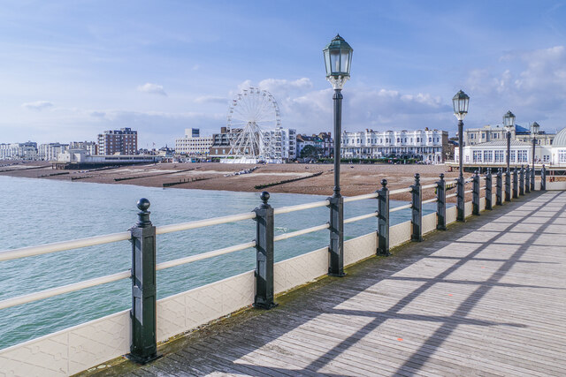
Nature enthusiasts can enjoy the nearby South Downs National Park, which offers stunning landscapes and opportunities for outdoor activities such as hiking and cycling. West Worthing is also known for its beautiful beaches, perfect for relaxing walks or water sports.
Transport links are excellent, with regular train services connecting West Worthing to other major towns and cities. The A27 road provides easy access to nearby destinations, including Brighton and Chichester.
Overall, West Worthing offers a pleasant and convenient place to live, with its coastal location, well-maintained properties, and range of amenities making it a desirable area in Sussex.
If you have any feedback on the listing, please let us know in the comments section below.
West Worthing Images
Images are sourced within 2km of 50.812025/-0.39324492 or Grid Reference TQ1302. Thanks to Geograph Open Source API. All images are credited.


West Worthing is located at Grid Ref: TQ1302 (Lat: 50.812025, Lng: -0.39324492)
Administrative County: West Sussex
District: Worthing
Police Authority: Sussex
What 3 Words
///humans.flags.happen. Near Worthing, West Sussex
Nearby Locations
Related Wikis

Worthing West (electoral division)
Worthing West is an electoral division of West Sussex in England, and returns one member to sit on West Sussex County Council. == Extent == The division...
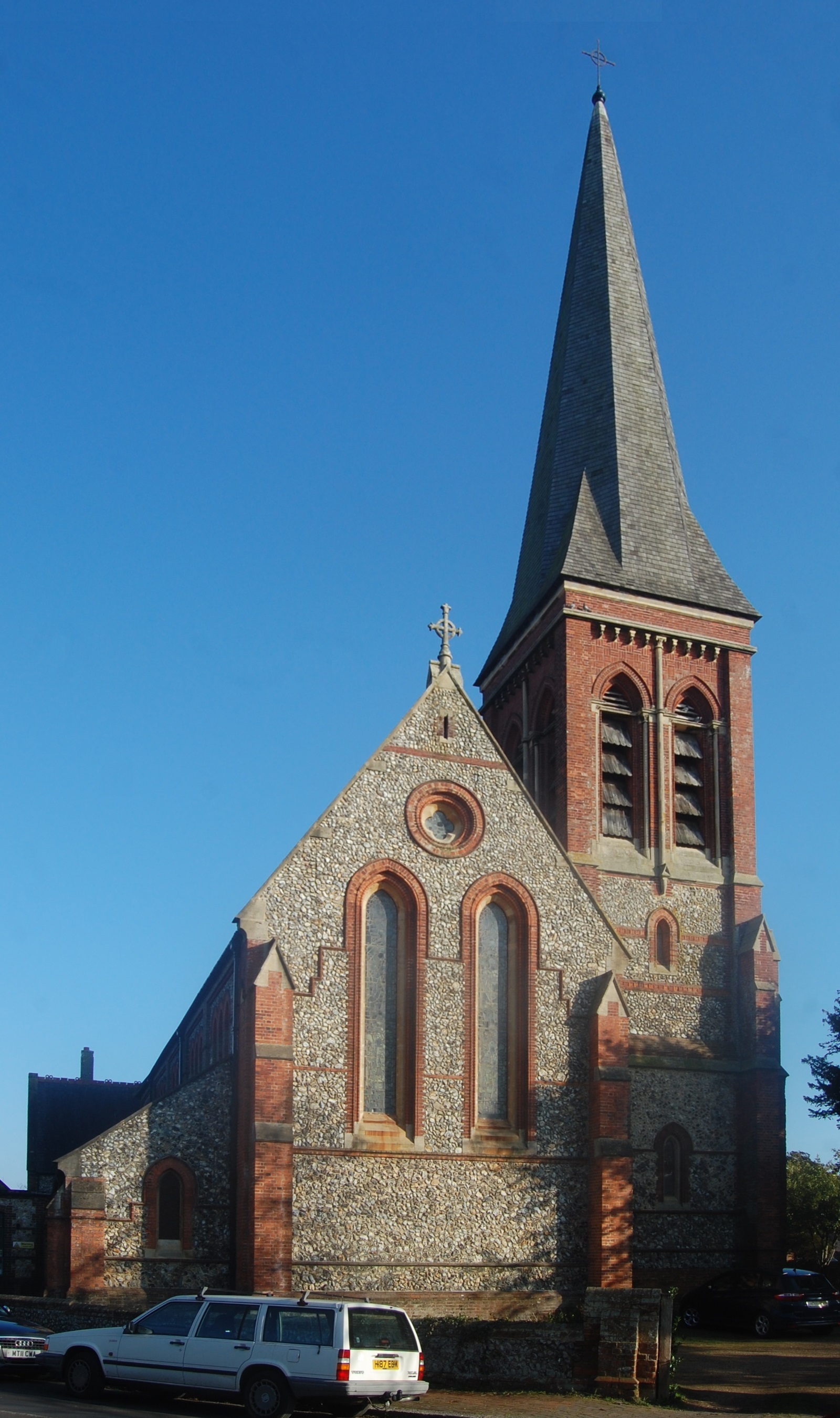
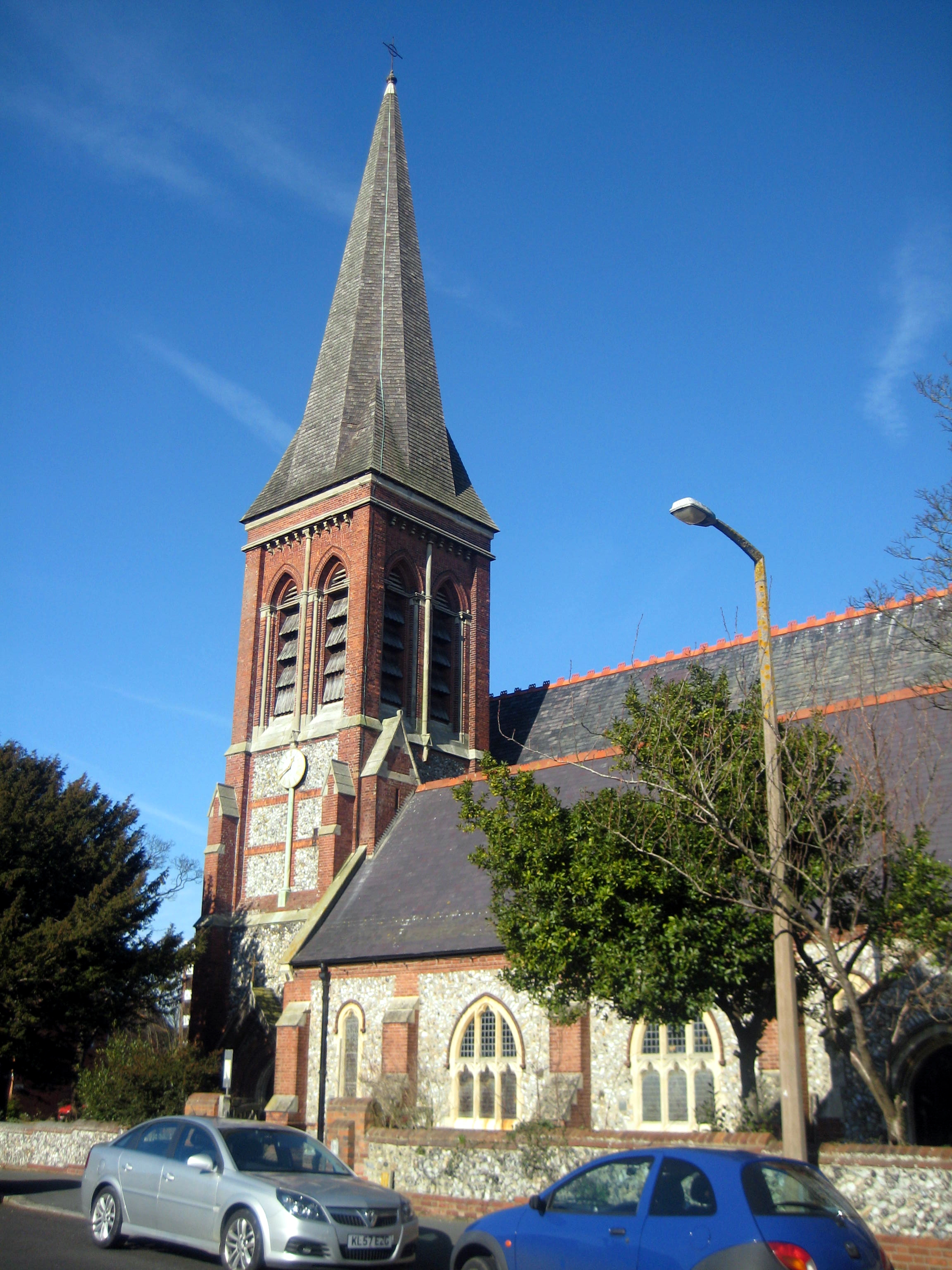
St Botolph's Church, Heene
St Botolph's Church is an Anglican church in the Heene area of the borough of Worthing, one of seven local government districts in the English county of...
West Worthing
West Worthing is a neighbourhood of Worthing in West Sussex, England that was developed within Heene and later expanded beyond Heene's boundaries. Intended...
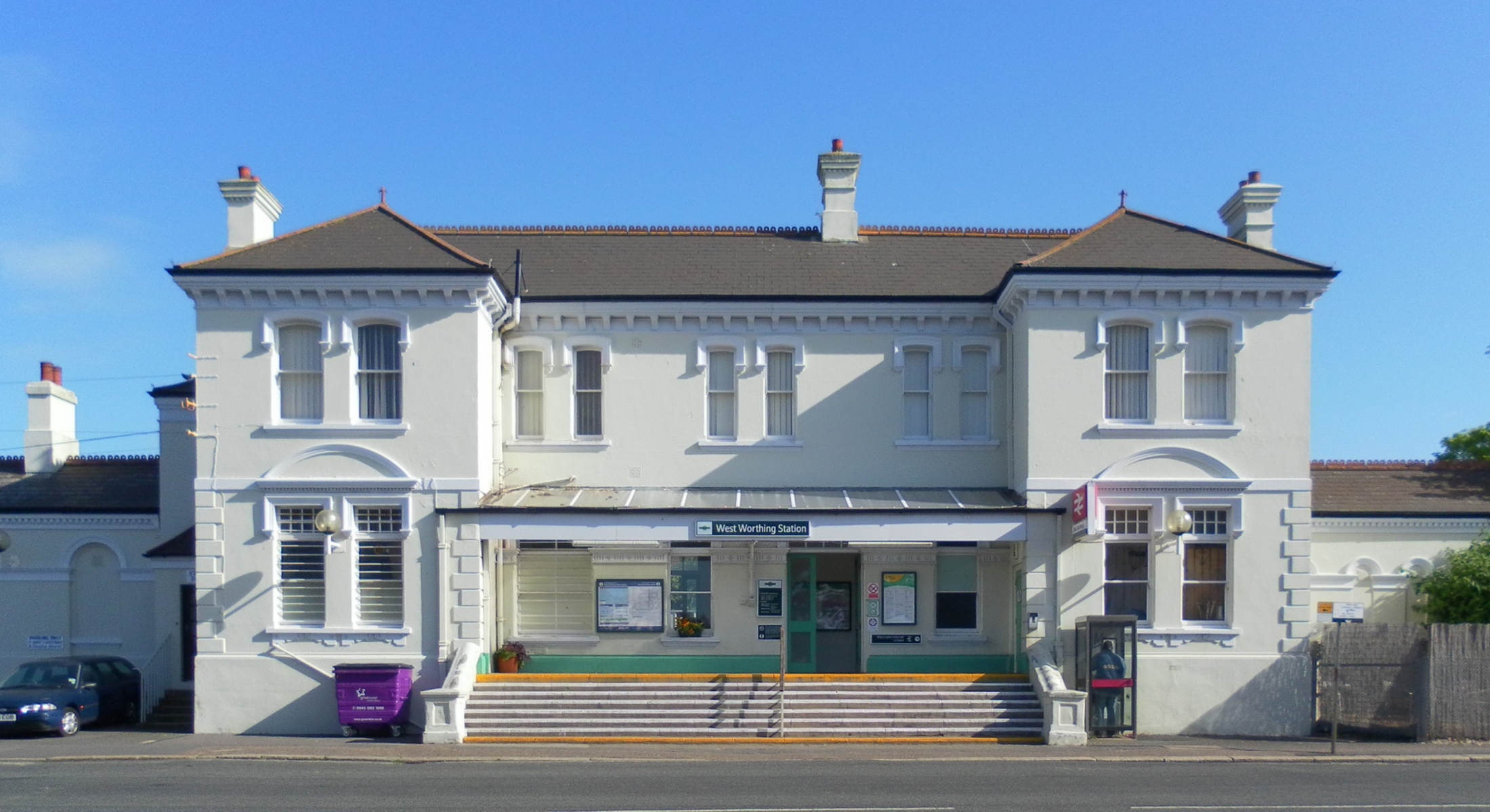
West Worthing railway station
West Worthing railway station is one of five stations serving the town of Worthing in the county of West Sussex, England. (The other stations being Worthing...
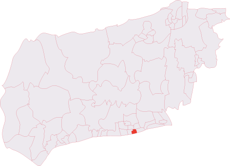
Worthing Pier (electoral division)
Worthing Pier is an electoral division of West Sussex in the United Kingdom, and returns one member to sit on West Sussex County Council. == Extent... ==
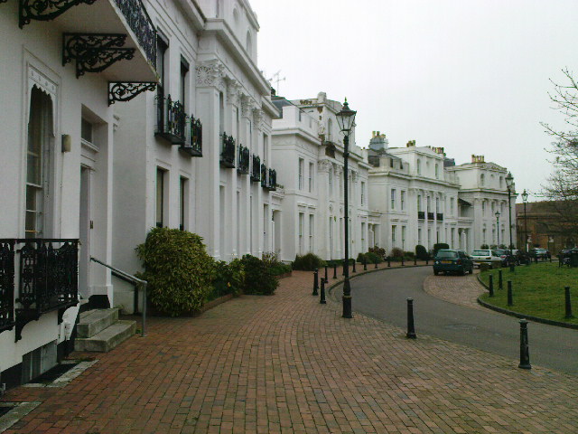
Park Crescent, Worthing
Park Crescent is an example of Georgian architecture in Worthing, England, designed in 1829 by Amon Henry Wilds, son of the architect Amon Wilds and constructed...

Worthing F.C.
Worthing Football Club is a semi-professional football club based in the West Tarring area of Worthing, West Sussex, England. They are currently members...
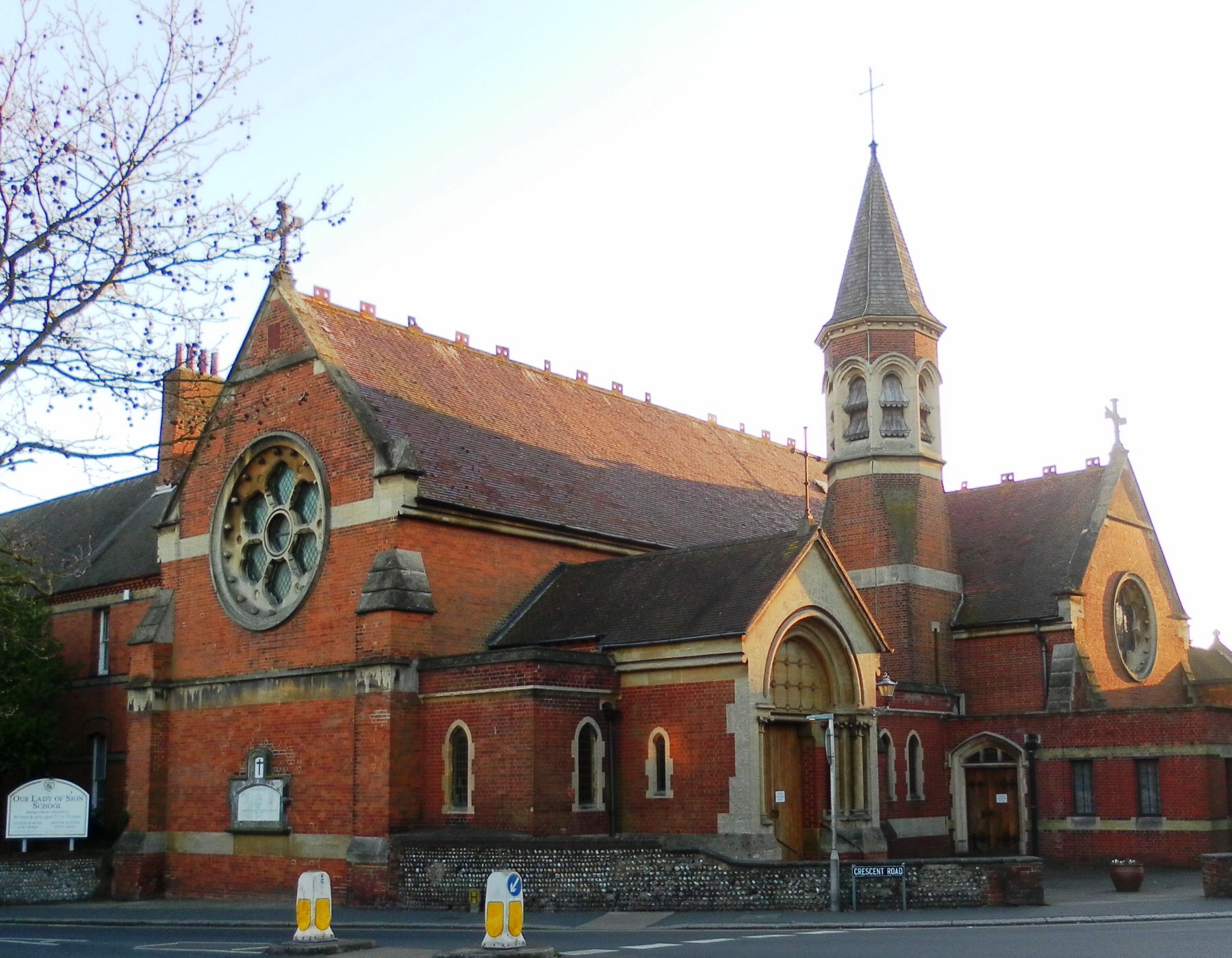
St Mary of the Angels, Worthing
The Church of St Mary of the Angels, Worthing, is in Worthing, West Sussex, England. It is a Grade II listed building and the earliest of the four Roman...
Nearby Amenities
Located within 500m of 50.812025,-0.39324492Have you been to West Worthing?
Leave your review of West Worthing below (or comments, questions and feedback).