Lutton, West

Settlement in Yorkshire Ryedale

England

Lutton, West

Looking north near Broom Farm
Looking north near Broom Farm Credit: Ian S

Lutton is a small village located in West Yorkshire, England. It is situated near the larger town of Barnsley and is part of the Metropolitan Borough of Barnsley.

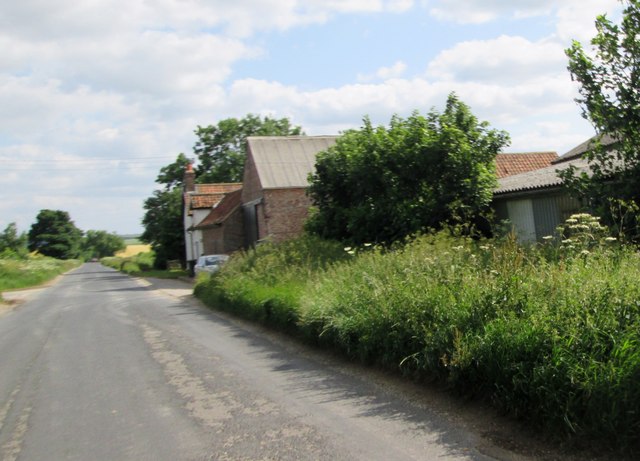
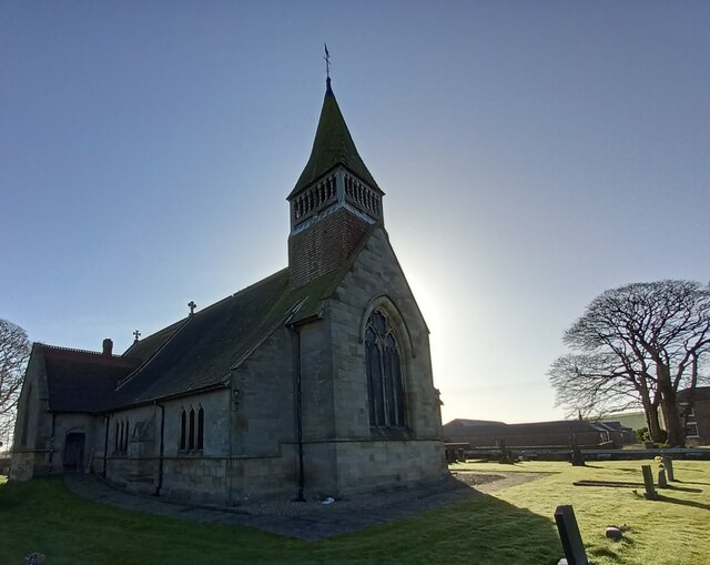
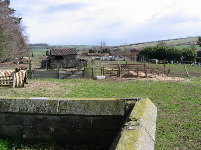
Lutton is a rural village surrounded by picturesque countryside, with rolling hills and lush green fields. The village itself is small, with a population of around 500 residents. The main focal point of the village is the historic St. Peter's Church, which dates back to the 12th century and is a popular spot for visitors interested in history and architecture.

In terms of amenities, Lutton has a small convenience store, a pub, and a primary school serving the local community. The village is well-connected to nearby towns and cities by road, with the M1 motorway just a short drive away, providing easy access to Leeds, Sheffield, and beyond.

Overall, Lutton is a quiet and peaceful village, perfect for those looking to escape the hustle and bustle of city life and enjoy the tranquility of the countryside.

If you have any feedback on the listing, please let us know in the comments section below.

Lutton, West Images

Images are sourced within 2km of 54.110751/-0.57691906 or Grid Reference SE9369. Thanks to Geograph Open Source API. All images are credited.

Looking north near Broom Farm
The road to Wintringham near West Lutton Field
Ordnance Survey  Flush Bracket G4559 This bracket can be found on a wall of a building at Broom Farm.
For more detail see : <span class="nowrap"><a title="http://www.bench-marks.org.uk/bm11663" rel="nofollow ugc noopener" href="http://www.bench-marks.org.uk/bm11663">Link</a><img style="margin-left:2px;" alt="External link" title="External link - shift click to open in new window" src="https://s1.geograph.org.uk/img/external.png" width="10" height="10"/></span>
Ordnance Survey Flush Bracket G4559
This bracket can be found on a wall of a building at Broom Farm. For more detail see : LinkExternal link
Road  to  West  Lutton  passing  Broom  Farm The junction of Green Lane is to the left
Road to West Lutton passing Broom Farm
The junction of Green Lane is to the left
Farm  access  road  alongside  potato crop Access road to Linton Wold Farm and Thirkleby Warren farm. Potatoes sprayed and foliage died back ready to harvest when required
Farm access road alongside potato crop
Access road to Linton Wold Farm and Thirkleby Warren farm. Potatoes sprayed and foliage died back ready to harvest when required
Disused  pit  in  small  wood It looks like a farmer is making use of it
Disused pit in small wood
It looks like a farmer is making use of it
Sweeping  view  over  the  East  Yorkshire  Wolds From the field track/bridleway over Thirkleby Wold near the trig point
Sweeping view over the East Yorkshire Wolds
From the field track/bridleway over Thirkleby Wold near the trig point
Two  jobs  at  once,  the  modern  tractor  can  do  it A multi furrowed plough plus on the tractors right side tilling the previously ploughed furrows, from the gate into Sheepwalk Lane, West Lutton
Two jobs at once, the modern tractor can do it
A multi furrowed plough plus on the tractors right side tilling the previously ploughed furrows, from the gate into Sheepwalk Lane, West Lutton
Croome  Dale  Lane  toward  Helperthorpe
Croome Dale Lane toward Helperthorpe
A  wet  corner  on  Croome  Dale  Lane Not worth planting anything in this field corner
A wet corner on Croome Dale Lane
Not worth planting anything in this field corner
Track  to  fields  and  barns  from  Croome  Dale  Lane Large disused pit to right now wooded
Track to fields and barns from Croome Dale Lane
Large disused pit to right now wooded
Disused  Workings  (quarry)  and  track  to  fields Off Croome Dale Lane
Disused Workings (quarry) and track to fields
Off Croome Dale Lane
Croome  Dale  Lane  toward  Helperthorpe
Croome Dale Lane toward Helperthorpe
Croome  Dale  Lane  with  High  Barn  up  to  the  left
Croome Dale Lane with High Barn up to the left
West Lutton, St Mary's church The benchmark is cut into the north face of the church.
West Lutton, St Mary's church
The benchmark is cut into the north face of the church.
West Lutton, St Mary's church There is a benchmark cut into the north face of the church, and is to the right of the drainpipe.
West Lutton, St Mary's church
There is a benchmark cut into the north face of the church, and is to the right of the drainpipe.
West Lutton, old school The OS Flush Bracket G4560 is embedded into the bottom left hand corner of the north-east face of the old school.
West Lutton, old school
The OS Flush Bracket G4560 is embedded into the bottom left hand corner of the north-east face of the old school.
West Lutton, old school The old village school is now a private residence. The OS Flush Bracket G4560 is embedded into the bottom left hand corner of the north-east face of the old school.
West Lutton, old school
The old village school is now a private residence. The OS Flush Bracket G4560 is embedded into the bottom left hand corner of the north-east face of the old school.
Show me another place!

Lutton, West is located at Grid Ref: SE9369 (Lat: 54.110751, Lng: -0.57691906)

Division: East Riding

Administrative County: North Yorkshire

District: Ryedale

Police Authority: North Yorkshire

What 3 Words

///expectant.flushes.passively. Near Fimber, East Yorkshire

Related Wikis

West Lutton

West Lutton is a village in North Yorkshire, England. It is situated approximately 9 miles (14 km) east from Malton, and within the Yorkshire Wolds. The...

East Lutton

East Lutton is a hamlet in North Yorkshire, England. It is situated approximately 9 miles (14 km) east from Malton, and within the Yorkshire Wolds. The...

Thirkleby, Kirby Grindalythe

Thirkleby is a hamlet in the civil parish of Kirby Grindalythe, Ryedale, North Yorkshire, England. Roger of Thirkleby (died 1260), a judge and Chief Justice...

Helperthorpe

Helperthorpe is a village in the civil parish of Luttons, in North Yorkshire, England. The village lies in the Great Wold Valley and the course of the...

Nearby Amenities

Located within 500m of 54.110751,-0.57691906
West Lutton
Created By: Potlatch 0.10
Place: village
Wikidata: Q9372166
Lat/Long: 54.1098314/-0.5777058
Post Box
Check Date Collection Times: 2022-08-28
Collection Times: Mo-Fr 17:45; Sa 09:30
Post Box Type: lamp
Ref: YO17 116
Royal Cypher: EIIR
Royal Cypher Wikidata: Q33102113
Lat/Long: 54.1119452/-0.5762021
Entrance: yes
Lat/Long: 54.1104221/-0.5768709
Defibrillator
Defibrillator Location: outside Three Tuns pub, Main Street, West Lutton, YO17 8TA
Emergency: defibrillator
Indoor: no
Lat/Long: 54.1104698/-0.576857
Bench
Backrest: yes
Lat/Long: 54.1107795/-0.5767369
Bench
Backrest: yes
Material: wood
Lat/Long: 54.1114868/-0.5812454
Power: pole
Lat/Long: 54.1127026/-0.5705504
Line Management: branch
Power: pole
Lat/Long: 54.1123028/-0.5719323
Power: pole
Lat/Long: 54.1117536/-0.5714301
Line Management: branch
Power: pole
Lat/Long: 54.1116973/-0.5711953
Power: pole
Lat/Long: 54.1113754/-0.570035
Power: pole
Lat/Long: 54.1110555/-0.5715237
Power: pole
Lat/Long: 54.112269/-0.5719074
Power: pole
Lat/Long: 54.112372/-0.5733641
Line Management: termination
Power: pole
Transformer: distribution
Lat/Long: 54.11241/-0.5747003
Power: pole
Lat/Long: 54.1115262/-0.5712828
Barrier: stile
Lat/Long: 54.1094256/-0.5803281
Barrier: stile
Lat/Long: 54.1094876/-0.580469
Information: guidepost
Tourism: information
Lat/Long: 54.1095662/-0.5797899
The data included in this document is from www.openstreetmap.org. The data is made available under ODbL.

Have you been to Lutton, West?

Leave your review of Lutton, West below (or comments, questions and feedback).