Bradwell Waterside
Settlement in Essex Maldon
England
Bradwell Waterside
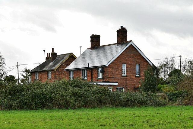
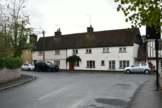
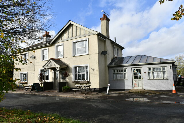
Bradwell Waterside is a picturesque village located in the county of Essex, England. Situated on the eastern coast, the village enjoys a stunning setting between the River Blackwater estuary and the North Sea. With a population of approximately 1,500 residents, Bradwell Waterside offers a peaceful and close-knit community atmosphere.
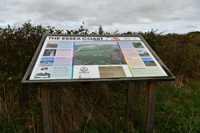
The village is renowned for its natural beauty and is surrounded by stunning landscapes, including marshes, salt flats, and coastal habitats. This makes it an ideal destination for nature lovers and outdoor enthusiasts. The area is home to an abundance of wildlife, including rare bird species, which attracts birdwatchers from near and far.
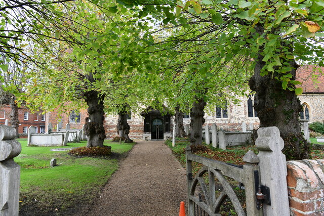
In addition to its natural attractions, Bradwell Waterside also boasts a rich history. The village is believed to have been inhabited since ancient times, with evidence of Roman settlements in the area. The nearby St. Peter-on-the-Wall, a 7th-century chapel, is a fascinating historic site that attracts visitors interested in the region's past.
Despite its tranquil atmosphere, Bradwell Waterside is well-connected to larger towns and cities. The nearby town of Southminster is just a short drive away and offers a range of amenities, including shops, restaurants, and schools. The village also benefits from good transportation links, with regular train services to London and other major cities from nearby Burnham-on-Crouch station.
In summary, Bradwell Waterside is a charming village in Essex, offering residents and visitors a peaceful and natural environment, rich in history and surrounded by stunning landscapes.
If you have any feedback on the listing, please let us know in the comments section below.
Bradwell Waterside Images
Images are sourced within 2km of 51.73413/0.892417 or Grid Reference TL9907. Thanks to Geograph Open Source API. All images are credited.

Bradwell Waterside is located at Grid Ref: TL9907 (Lat: 51.73413, Lng: 0.892417)
Administrative County: Essex
District: Maldon
Police Authority: Essex
What 3 Words
///cracks.sneezing.fabricate. Near Tollesbury, Essex
Nearby Locations
Related Wikis

Bradwell Waterside
Bradwell Waterside is a small hamlet in Essex, England. It is located about 9 km (5.6 mi) north-northeast of Southminster and is 28 km (17 mi) east from...

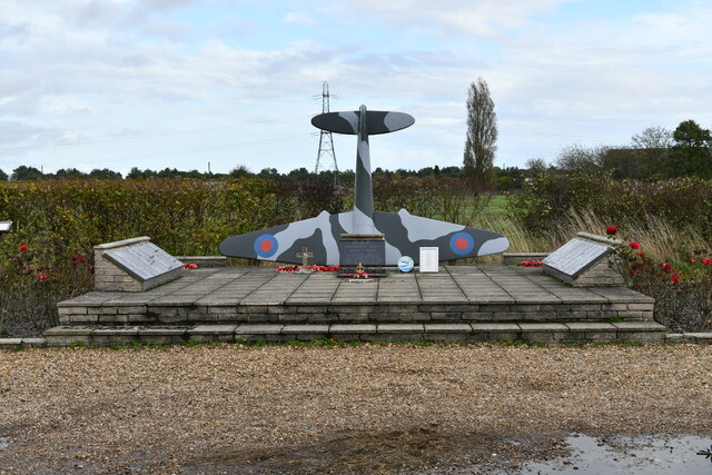
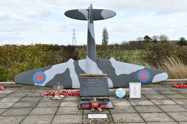
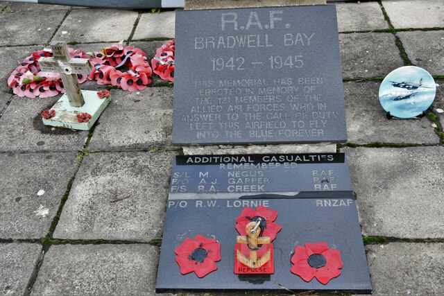
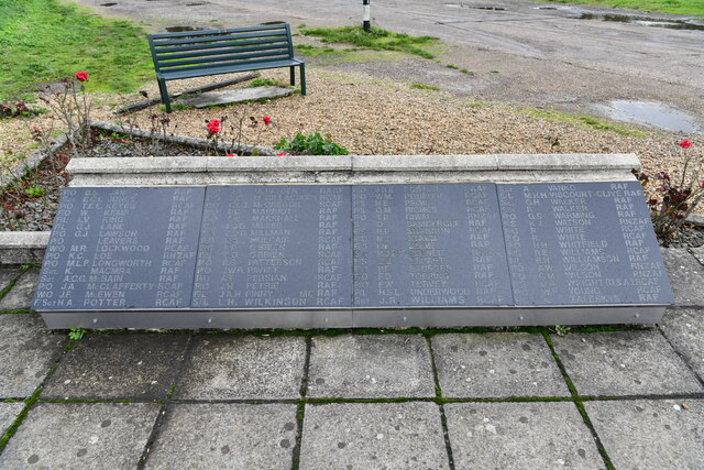
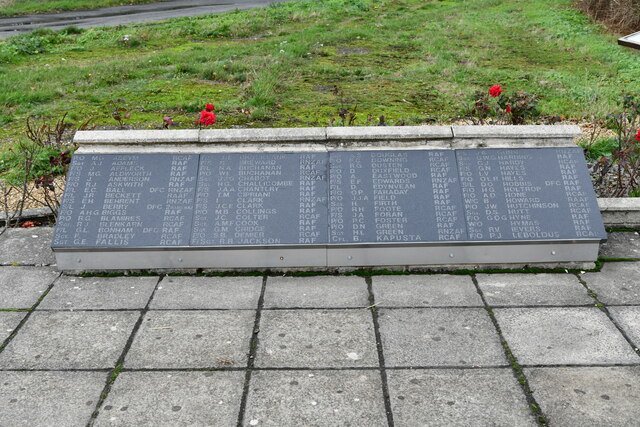
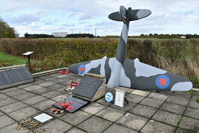
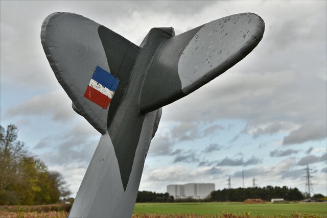
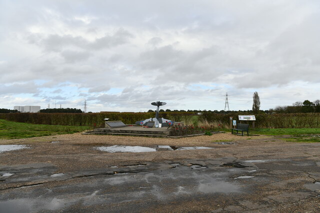
RAF Bradwell Bay
Royal Air Force Bradwell Bay or more simply RAF Bradwell Bay is a former Royal Air Force station located 9.5 miles (15.3 km) east of Maldon, Essex, England...

Pewet Island
Pewet Island (the name is sometimes spelt Pewit) lies on the south side of the estuary of the River Blackwater in the English county of Essex. Pewet Island...
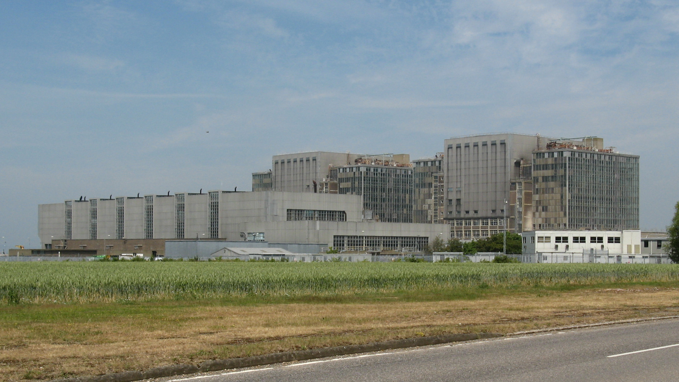
Bradwell nuclear power station
Bradwell nuclear power station is a Magnox-design nuclear power station that is undergoing decommissioning. It is located on the Dengie peninsula at the...
Bradwell B nuclear power station
Bradwell B is a proposed nuclear power station at Bradwell-on-Sea in Essex, put forward by China General Nuclear Power Group (CGN). If constructed, the...

Bradwell-on-Sea
Bradwell-on-Sea is a village and civil parish in Essex, England; it is on the Dengie peninsula. It is located 5.6 mi (9.0 km) north-north-east of Southminster...

Bradwell Lodge
Bradwell Lodge is a country house in the village of Bradwell-on-Sea, on the Dengie Peninsula in Essex, England. Originally a Tudor rectory, in the 18th...

MV Ross Revenge
MV Ross Revenge is a radio ship, the home of Radio Caroline, as well as having supported Radio Monique and various religious broadcasters. Funded by the...
Nearby Amenities
Located within 500m of 51.73413,0.892417Have you been to Bradwell Waterside?
Leave your review of Bradwell Waterside below (or comments, questions and feedback).