Leigh, West

Settlement in Somerset Somerset West and Taunton

England

Leigh, West

Pitsford Hill
Pitsford Hill Credit: Roger Cornfoot

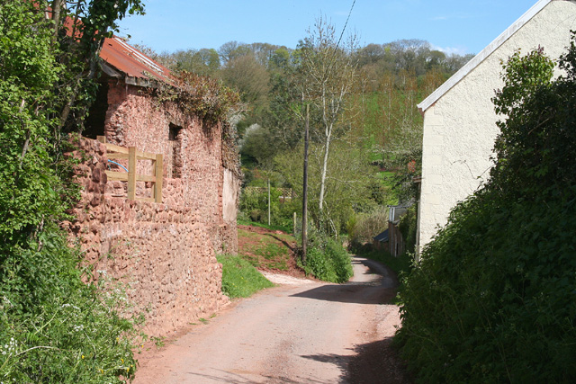
Leigh is a small village situated in the county of Somerset, in the southwestern part of England. It is located in the district of West Somerset, and is nestled within the beautiful countryside of the Quantock Hills, a designated Area of Outstanding Natural Beauty.

With a population of around 400 residents, Leigh exudes a charming, traditional English village atmosphere. It is characterized by its picturesque thatched cottages, historic buildings, and peaceful surroundings. The village is known for its strong sense of community, with various local events and gatherings that bring residents together.

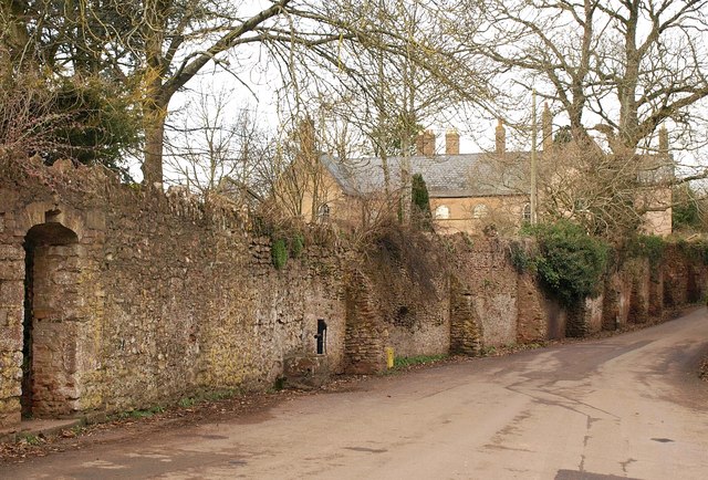
Leigh boasts a rich history dating back centuries. The parish church of St. Andrew, a Grade I listed building, stands as a testament to this history, with its medieval origins and notable architectural features. The village also has a small primary school, providing education for the local children.

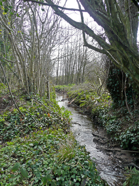
The surrounding area offers plenty of opportunities for outdoor activities and exploration. The Quantock Hills offer stunning landscapes of rolling hills, woodlands, and heathlands, perfect for hiking, cycling, and horseback riding. Additionally, the nearby coast provides access to beautiful beaches and coastal trails.

Despite its small size, Leigh benefits from its proximity to larger towns and cities. The town of Taunton is approximately 10 miles away, offering a wider range of amenities including shopping centers, restaurants, and cultural attractions.

In conclusion, Leigh is a quintessential English village situated in the idyllic countryside of West Somerset. With its historic charm, tight-knit community, and breathtaking natural surroundings, it is a hidden gem for those seeking a peaceful and picturesque place to live or visit.

If you have any feedback on the listing, please let us know in the comments section below.

Leigh, West Images

Images are sourced within 2km of 51.067075/-3.2578193 or Grid Reference ST1130. Thanks to Geograph Open Source API. All images are credited.

Pitsford Hill
Pitsford Hill
Fitzhead: north west from the village Landscape with woods and fields. Looking north towards the Quantocks
Fitzhead: north west from the village
Landscape with woods and fields. Looking north towards the Quantocks
Lydeard St Lawrence: Chapel Leigh Chapel Leigh is a hamlet consisting of two farms and a number of cottages. Looking east-north-east
Lydeard St Lawrence: Chapel Leigh
Chapel Leigh is a hamlet consisting of two farms and a number of cottages. Looking east-north-east
Fitzhead: limekiln near Burrow Hill Farm Looking south
Fitzhead: limekiln near Burrow Hill Farm
Looking south
Fitzhead: towards Pitsford Hill The field nearest the camera adjoins the lane from Fitzhead to Oakhampton Farm. In the distance is Willett Hill. Looking north-north-west
Fitzhead: towards Pitsford Hill
The field nearest the camera adjoins the lane from Fitzhead to Oakhampton Farm. In the distance is Willett Hill. Looking north-north-west
Hoccombe Farm Hoccombe Farm seen from the meadow behind it. Leat running in the foreground. Date: 22/04/2006.
Hoccombe Farm
Hoccombe Farm seen from the meadow behind it. Leat running in the foreground. Date: 22/04/2006.
Hoccombe Farm Hoccombe Farm and buildings, seen from the orchard.
Hoccombe Farm
Hoccombe Farm and buildings, seen from the orchard.
Burrow Hill Viewed from the bridge south of Moor Mill Farm.
Burrow Hill
Viewed from the bridge south of Moor Mill Farm.
Somerset stream One of the head streams of the Tone which arise from the Brendon Hills east of Exmoor.
Somerset stream
One of the head streams of the Tone which arise from the Brendon Hills east of Exmoor.
Countryside west of Fitzhead A view from footpath WG 5/1 across a large field to Tommy Brewer's Barn (left of centre). Brewer's Farm, on the right, is in <a href="https://www.geograph.org.uk/gridref/ST1128">ST1128</a>, and the hillside behind quickly crosses a northing gridline into <a href="https://www.geograph.org.uk/gridref/ST1029">ST1029</a> and <a href="https://www.geograph.org.uk/gridref/ST1129">ST1129</a>.
Countryside west of Fitzhead
A view from footpath WG 5/1 across a large field to Tommy Brewer's Barn (left of centre). Brewer's Farm, on the right, is in ST1128, and the hillside behind quickly crosses a northing gridline into ST1029 and ST1129.
Tommy Brewer's Barn A detail of the scene in <a href="https://www.geograph.org.uk/photo/1715742">ST1028 : Countryside west of Fitzhead</a>, and taken from the same place. The farm is incorrectly labelled "Brewers Farm" on the 1:25000 map.
Tommy Brewer's Barn
A detail of the scene in ST1028 : Countryside west of Fitzhead, and taken from the same place. The farm is incorrectly labelled "Brewers Farm" on the 1:25000 map.
Cottage, Chapel Leigh The cottage is on the lane south of Chapel Leigh, in a side valley of the Halse Water.
Cottage, Chapel Leigh
The cottage is on the lane south of Chapel Leigh, in a side valley of the Halse Water.
Higher Chapel Leigh Farm The attractive farmhouse is on Chapel Leigh Lane, a no through road climbing a little valley towards Sanding's Farm.
Higher Chapel Leigh Farm
The attractive farmhouse is on Chapel Leigh Lane, a no through road climbing a little valley towards Sanding's Farm.
Track and lane, Chapel Leigh This scene can be glimpsed on the left of <a href="https://www.geograph.org.uk/photo/1741956">ST1229 : Higher Chapel Leigh Farm</a>, further up Chapel Leigh Lane, with a field access track branching off the sunken lane, which continues between banks.
Track and lane, Chapel Leigh
This scene can be glimpsed on the left of ST1229 : Higher Chapel Leigh Farm, further up Chapel Leigh Lane, with a field access track branching off the sunken lane, which continues between banks.
Sheep by Sanding's Lane Sanding's Lane is a byway that twists and turns across the countryside between Chapel Leigh Lane and Hoccombe. Here, tree-lined, it runs along two sides of a sloping pentagonal field in which sheep graze. In the background, Brimball Copse, in <a href="https://www.geograph.org.uk/gridref/ST1130">ST1130</a>, overlooks the Halse Water valley.
Sheep by Sanding's Lane
Sanding's Lane is a byway that twists and turns across the countryside between Chapel Leigh Lane and Hoccombe. Here, tree-lined, it runs along two sides of a sloping pentagonal field in which sheep graze. In the background, Brimball Copse, in ST1130, overlooks the Halse Water valley.
Approaching Hoccombe Sanding's Lane approaches Hoccombe Farm.
Approaching Hoccombe
Sanding's Lane approaches Hoccombe Farm.
Cottage at Burrow Hill Footpath WG 5/4 passes by this cottage, seen from the lane to Pitsford Hill.
Cottage at Burrow Hill
Footpath WG 5/4 passes by this cottage, seen from the lane to Pitsford Hill.
Lane to Moor Mill The lane from Burrow Hill to Moor Mill descends between hedges towards a tributary of the Halse Water.
Lane to Moor Mill
The lane from Burrow Hill to Moor Mill descends between hedges towards a tributary of the Halse Water.
Show me another place!

Leigh, West is located at Grid Ref: ST1130 (Lat: 51.067075, Lng: -3.2578193)

Administrative County: Somerset

District: Somerset West and Taunton

Police Authority: Avon and Somerset

What 3 Words

///incomes.irritate.settle. Near Milverton, Somerset

Related Wikis

Gaulden Manor

Gaulden Manor (also Gavelden or Gaveldene) is a Grade II* listed country house to the southeast of Tolland, Somerset, England. It is a double storied building...

Fitzhead Court and The Manor

Fitzhead Court and The Manor in Fitzhead, Somerset, England was built in the late 16th century and has now been split into two buildings. It is a Grade...

Ruby Country

Ruby Country is the name given to the rural inland hinterland of north-west Devon, UK. It covers 45 parishes around the market towns of Holsworthy and...

Fitzhead

Fitzhead is a village and civil parish in Somerset, England, situated approximately 6 miles (9.7 km) north west of Taunton. The village has an estimated...

Lydeard St Lawrence

Lydeard St Lawrence or St Lawrence Lydiard is a village and civil parish in Somerset, England, situated 7 miles (11.3 km) north west of Taunton. The village...

Church of St James the Great, Fitzhead

The Anglican Church of St James the Great in Fitzhead, Somerset, England was built in the 15th century. It is a Grade II* listed building. == History... ==

Tolland, Somerset

Tolland is a village and civil parish in Somerset, England, situated 9 miles (14.5 km) north west of Taunton, between the Brendon Hills and Quantock Hills...

King's Castle, Wiveliscombe

King's Castle is an Iron Age Hillfort 1 kilometre (0.62 mi) east of Wiveliscombe in Somerset, England. It is surrounded by two banks with a ditch between...

Nearby Amenities

Located within 500m of 51.067075,-3.2578193
West Leigh
Place: hamlet
Lat/Long: 51.0670612/-3.2578513
Ford: yes
Lat/Long: 51.0644375/-3.2581933
Barrier: stile
Bicycle: no
Foot: yes
Material: wood
Stile: stepover
Lat/Long: 51.0680236/-3.2621183
Barrier: stile
Bicycle: no
Foot: yes
Material: wood
Stile: stepover
Lat/Long: 51.0681988/-3.2640777
Brand: National Grid
Brand Wikidata: Q1465461
Material: wood
Operator: National Grid Electricity Distribution Plc
Operator Old: Western Power Distribution
Operator Wikidata: Q7988183
Owner: National Grid Electricity Distribution (South West) Plc
Owner Wikidata: Q114397866
Power: pole
Lat/Long: 51.068664/-3.2543269
Brand: National Grid
Brand Wikidata: Q1465461
Design: h-frame
Devices: 1
Frequency: 50
Guyed: yes
Line Management: split
Material: wood
Operator: National Grid Electricity Distribution Plc
Operator Old: Western Power Distribution
Operator Wikidata: Q7988183
Owner: National Grid Electricity Distribution (South West) Plc
Owner Wikidata: Q114397866
Phases: 3
Power: pole
Transformer: distribution
Lat/Long: 51.0684124/-3.25705
Brand: National Grid
Brand Wikidata: Q1465461
Material: wood
Operator: National Grid Electricity Distribution Plc
Operator Old: Western Power Distribution
Operator Wikidata: Q7988183
Owner: National Grid Electricity Distribution (South West) Plc
Owner Wikidata: Q114397866
Power: pole
Lat/Long: 51.0685186/-3.2557411
Brand: National Grid
Brand Wikidata: Q1465461
Material: wood
Operator: National Grid Electricity Distribution Plc
Operator Old: Western Power Distribution
Operator Wikidata: Q7988183
Owner: National Grid Electricity Distribution (South West) Plc
Owner Wikidata: Q114397866
Power: pole
Lat/Long: 51.0687411/-3.2533526
Brand: National Grid
Brand Wikidata: Q1465461
Material: wood
Operator: National Grid Electricity Distribution Plc
Operator Old: Western Power Distribution
Operator Wikidata: Q7988183
Owner: National Grid Electricity Distribution (South West) Plc
Owner Wikidata: Q114397866
Power: pole
Lat/Long: 51.0688169/-3.252336
Access: private
Door: no
Entrance: yes
Motorcar: private
Lat/Long: 51.0693372/-3.2619583
Access: private
Door: no
Entrance: yes
Motorcar: private
Lat/Long: 51.0693256/-3.2619884
Access: private
Door: no
Entrance: yes
Motorcar: private
Lat/Long: 51.0693139/-3.2620185
Access: private
Door: no
Entrance: yes
Motorcar: private
Lat/Long: 51.0693022/-3.2620487
Access: private
Door: no
Entrance: yes
Motorcar: private
Lat/Long: 51.0692906/-3.2620788
Brand: National Grid
Brand Wikidata: Q1465461
Material: wood
Operator: National Grid Electricity Distribution Plc
Operator Old: Western Power Distribution
Operator Wikidata: Q7988183
Owner: National Grid Electricity Distribution (South West) Plc
Owner Wikidata: Q114397866
Power: pole
Lat/Long: 51.0646031/-3.2628027
Brand: National Grid
Brand Wikidata: Q1465461
Material: wood
Operator: National Grid Electricity Distribution Plc
Operator Old: Western Power Distribution
Operator Wikidata: Q7988183
Owner: National Grid Electricity Distribution (South West) Plc
Owner Wikidata: Q114397866
Power: pole
Lat/Long: 51.0651867/-3.2620402
Brand: National Grid
Brand Wikidata: Q1465461
Material: wood
Operator: National Grid Electricity Distribution Plc
Operator Old: Western Power Distribution
Operator Wikidata: Q7988183
Owner: National Grid Electricity Distribution (South West) Plc
Owner Wikidata: Q114397866
Power: pole
Lat/Long: 51.0660063/-3.2609734
Brand: National Grid
Brand Wikidata: Q1465461
Material: wood
Operator: National Grid Electricity Distribution Plc
Operator Old: Western Power Distribution
Operator Wikidata: Q7988183
Owner: National Grid Electricity Distribution (South West) Plc
Owner Wikidata: Q114397866
Power: pole
Lat/Long: 51.0673607/-3.2592192
Brand: National Grid
Brand Wikidata: Q1465461
Material: wood
Operator: National Grid Electricity Distribution Plc
Operator Old: Western Power Distribution
Operator Wikidata: Q7988183
Owner: National Grid Electricity Distribution (South West) Plc
Owner Wikidata: Q114397866
Power: pole
Lat/Long: 51.0667749/-3.2599729
Give Way
Direction: backward
Lat/Long: 51.0670535/-3.2578305
Guyed: yes
Material: wood
Operator: Wessex Water
Power: pole
Lat/Long: 51.0693559/-3.255908
Brand: National Grid
Brand Wikidata: Q1465461
Material: wood
Operator: National Grid Electricity Distribution Plc
Operator Old: Western Power Distribution
Operator Wikidata: Q7988183
Owner: National Grid Electricity Distribution (South West) Plc
Owner Wikidata: Q114397866
Power: pole
Lat/Long: 51.067198/-3.2578003
Brand: National Grid
Brand Wikidata: Q1465461
Material: wood
Operator: National Grid Electricity Distribution Plc
Operator Old: Western Power Distribution
Operator Wikidata: Q7988183
Owner: National Grid Electricity Distribution (South West) Plc
Owner Wikidata: Q114397866
Power: pole
Lat/Long: 51.0678343/-3.2586265
Brand: National Grid
Brand Wikidata: Q1465461
Material: wood
Operator: National Grid Electricity Distribution Plc
Operator Old: Western Power Distribution
Operator Wikidata: Q7988183
Owner: National Grid Electricity Distribution (South West) Plc
Owner Wikidata: Q114397866
Power: pole
Lat/Long: 51.0674896/-3.2578292
Brand: National Grid
Brand Wikidata: Q1465461
Guyed: yes
Material: wood
Operator: National Grid Electricity Distribution Plc
Operator Old: Western Power Distribution
Operator Wikidata: Q7988183
Owner: National Grid Electricity Distribution (South West) Plc
Owner Wikidata: Q114397866
Power: pole
Lat/Long: 51.067991/-3.2578459
Brand: National Grid
Brand Wikidata: Q1465461
Guyed: yes
Material: wood
Operator: National Grid Electricity Distribution Plc
Operator Old: Western Power Distribution
Operator Wikidata: Q7988183
Owner: National Grid Electricity Distribution (South West) Plc
Owner Wikidata: Q114397866
Power: pole
Lat/Long: 51.0682485/-3.2577433
Brand: National Grid
Brand Wikidata: Q1465461
Guyed: yes
Material: wood
Operator: National Grid Electricity Distribution Plc
Operator Old: Western Power Distribution
Operator Wikidata: Q7988183
Owner: National Grid Electricity Distribution (South West) Plc
Owner Wikidata: Q114397866
Power: pole
Lat/Long: 51.0682986/-3.2574778
Brand: National Grid
Brand Wikidata: Q1465461
Guyed: yes
Material: wood
Operator: National Grid Electricity Distribution Plc
Operator Old: Western Power Distribution
Operator Wikidata: Q7988183
Owner: National Grid Electricity Distribution (South West) Plc
Owner Wikidata: Q114397866
Power: pole
Lat/Long: 51.0683349/-3.2579754
Access: private
Entrance: yes
Lat/Long: 51.0684712/-3.2586521
The data included in this document is from www.openstreetmap.org. The data is made available under ODbL.

Have you been to Leigh, West?

Leave your review of Leigh, West below (or comments, questions and feedback).