Bradwell

Settlement in Buckinghamshire

England

Bradwell

The New Inn New Bradwell
The New Inn New Bradwell Credit: Ryan Griffiths

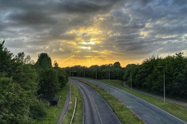
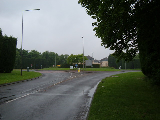
Bradwell is a small village located in the county of Buckinghamshire, England. It is situated in the northern part of the county, approximately 5 miles west of the town of Milton Keynes. The village is nestled in a rural setting, surrounded by picturesque countryside and rolling hills.

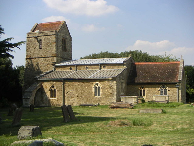
With a population of around 1,200 residents, Bradwell has a close-knit community feel. The village is known for its charming thatched cottages, historic buildings, and traditional English architecture. The local parish church, St. Lawrence's Church, is a prominent feature and dates back to the 12th century, adding to the area's historical significance.

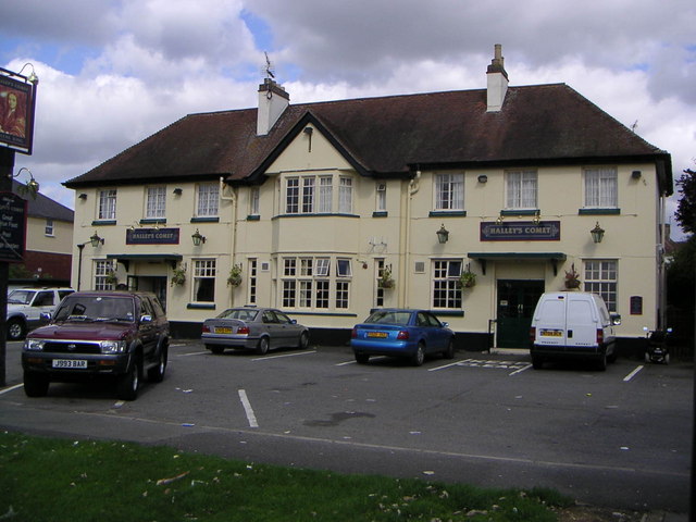
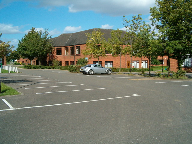
Despite its small size, Bradwell offers a range of amenities for its residents. These include a primary school, a village hall, and a local pub, which serves as a social hub for the community. The village is also well-connected, with good transport links to nearby towns and cities, making it an attractive place to live for those seeking a quieter lifestyle while still having access to urban areas.

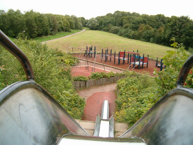
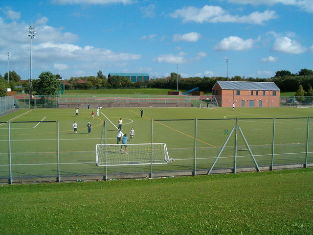
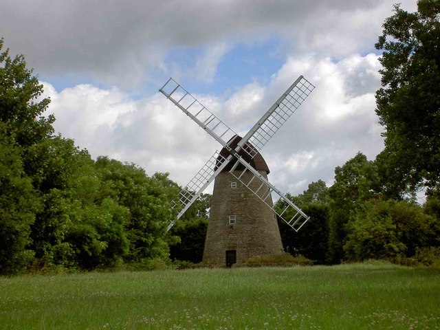
The surrounding countryside provides ample opportunities for outdoor activities such as walking, cycling, and horse riding, with many scenic trails and bridleways to explore. The nearby Grand Union Canal also offers opportunities for boating and fishing. Overall, Bradwell is a tranquil and idyllic village that offers a peaceful retreat from the hustle and bustle of city life.

If you have any feedback on the listing, please let us know in the comments section below.

Bradwell Images

Images are sourced within 2km of 52.049263/-0.78082363 or Grid Reference SP8339. Thanks to Geograph Open Source API. All images are credited.

The New Inn New Bradwell
Graft on Street from the aqueduct
The New Inn, New Bradwell
Bancroft Villa, Milton Keynes Site of a roman settlement c. AD100. Evidence of earlier occupation back to bronze age also found.
Bancroft Villa, Milton Keynes
Site of a roman settlement c. AD100. Evidence of earlier occupation back to bronze age also found.
Telecommunications Mast Near to Linford Wood in Milton Keynes
Telecommunications Mast
Near to Linford Wood in Milton Keynes
New Life Church, New Bradwell, Milton Keynes
Halleys Commet Public House Although on one of Milton Keynes estates (Bradville), this public house stands on Bradwell Road, which has been around far longer than the "grid system" of MK, as has much of Bradville.
Halleys Commet Public House
Although on one of Milton Keynes estates (Bradville), this public house stands on Bradwell Road, which has been around far longer than the "grid system" of MK, as has much of Bradville.
The BIG Slide A Play area in Downs Barn, one of over 500 in the New City.  In the background can be seen a Redway, one of the foot/cycle paths networked across Milton Keynes.
The BIG Slide
A Play area in Downs Barn, one of over 500 in the New City. In the background can be seen a Redway, one of the foot/cycle paths networked across Milton Keynes.
Stantonbury Campus Saxon Hall at Stantonbury Campus.  Stantonbury is probably the largest secondary school in Europe.
Stantonbury Campus
Saxon Hall at Stantonbury Campus. Stantonbury is probably the largest secondary school in Europe.
Stantonbury Sports Stantonbury has fantastic sports facilities, as can be seen from the astroturf pitches in the foreground and the athletics track in the midground.  On the right is the recently built pavilion for the athletics track, which is home to Milton Keynes Athletics Club.
Stantonbury Sports
Stantonbury has fantastic sports facilities, as can be seen from the astroturf pitches in the foreground and the athletics track in the midground. On the right is the recently built pavilion for the athletics track, which is home to Milton Keynes Athletics Club.
Bradwell Windmill This easily recognisable landmark proves that Milton Keynes has a long and varied history even if it is best known for its modern development.
Bradwell Windmill
This easily recognisable landmark proves that Milton Keynes has a long and varied history even if it is best known for its modern development.
Grand Union Canal, New Bradwell Taken in torrential rain. Boaters keep going in all weathers; the boat ahead has found one way of keeping dry.
Grand Union Canal, New Bradwell
Taken in torrential rain. Boaters keep going in all weathers; the boat ahead has found one way of keeping dry.
Grafton Street Aqueduct This aqueduct - the first to be built on the canal network for 50 years - was opened in 1991 and carries the Grand Union Canal over Grafton Street.
Grafton Street Aqueduct
This aqueduct - the first to be built on the canal network for 50 years - was opened in 1991 and carries the Grand Union Canal over Grafton Street.
New Bradwell aqueduct Looking down to the road below.
New Bradwell aqueduct
Looking down to the road below.
Marlborough Roundabout This roundabout is unique to Milton Keynes as it is the only one on the grid system to adjoin two "V" (vertical) roads and no "H" (horizontal), connecting the top of V8 Marlborough Street to V7 Saxon Street.  The roundabout also falls over two different grid squares, with this the view eastwards.
Marlborough Roundabout
This roundabout is unique to Milton Keynes as it is the only one on the grid system to adjoin two "V" (vertical) roads and no "H" (horizontal), connecting the top of V8 Marlborough Street to V7 Saxon Street. The roundabout also falls over two different grid squares, with this the view eastwards.
Marlborough Roundabout The view from SP8441 of the Marlborough Roundabout, which falls on the line between this square and SP8341.
Marlborough Roundabout
The view from SP8441 of the Marlborough Roundabout, which falls on the line between this square and SP8341.
Milton Keynes windmill From Nightingale Crescent.
<span class="nowrap"><a title="http://www.windmillworld.com/millid/1696.htm" rel="nofollow ugc noopener" href="http://www.windmillworld.com/millid/1696.htm">Link</a><img style="margin-left:2px;" alt="External link" title="External link - shift click to open in new window" src="https://s1.geograph.org.uk/img/external.png" width="10" height="10"/></span>
Milton Keynes windmill
From Nightingale Crescent. LinkExternal link
Telecommunications Mast Found on Linford Wood next to the BP station.
Telecommunications Mast
Found on Linford Wood next to the BP station.
Show me another place!

Bradwell is located at Grid Ref: SP8339 (Lat: 52.049263, Lng: -0.78082363)

Unitary Authority: Milton Keynes

Police Authority: Thames Valley

What 3 Words

///heaven.brimmed.wisely. Near Bradwell, Buckinghamshire

Nearby Locations

Bradwell Bradwell Heelands

Related Wikis

Bradwell, Milton Keynes

Bradwell is an ancient village and modern district in Milton Keynes, Buckinghamshire, England, situated approximately 1 mile (1.6 km) north-west of Central...
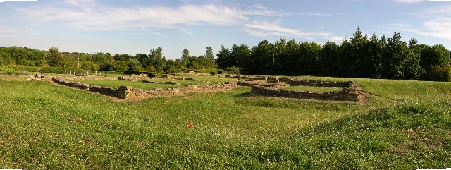
Bradwell Abbey

Bradwell Abbey or Bradwell Priory is a Scheduled Monument, urban studies site, district and former civil parish in Milton Keynes, Buckinghamshire, England...

Concrete Cows

The Concrete Cows in Milton Keynes, England are an iconic work of sculpture, created in 1978 by the American artist Liz Leyh. There are three cows and...

Badminton England

Badminton England is the national governing body for the sport of badminton in England. It aims to govern, encourage and develop the sport throughout...

Nearby Amenities

Located within 500m of 52.049263,-0.78082363
Motorway Junction
Lat/Long: 52.0518933/-0.7824933
Motorway Junction
Lat/Long: 52.0515189/-0.7823836
Heelands
Place: suburb
Lat/Long: 52.0510333/-0.7752593
Turning Circle
Turning Circle: square
Lat/Long: 52.0500952/-0.7737397
Turning Circle
Turning Circle: square
Lat/Long: 52.048715/-0.7743142
Turning Circle
Turning Circle: square
Lat/Long: 52.0485114/-0.7750429
Motorway Junction
Lat/Long: 52.0491385/-0.7804542
Heelands Meeting Place
Building: public
Lat/Long: 52.0503207/-0.7792075
Atm
Lat/Long: 52.0507272/-0.7798855
Tesco Express
Addr City: Milton Keynes
Addr Country: GB
Addr Housenumber: 8
Addr Postcode: MK13 7PN
Addr Street: Swinden Court
Addr Suburb: Heelands
Brand: Tesco Express
Brand Wikidata: Q98456772
Contact Website: https://www.tesco.com/store-locator/milton-keynes/8-swinden-court
Designation: Milton Keynes Heelands Express
Fhrs Id: 199045
Shop: convenience
Lat/Long: 52.0507315/-0.7798389
Turning Circle
Turning Circle: square
Lat/Long: 52.0526612/-0.780031
Turning Circle
Turning Circle: square
Lat/Long: 52.0531853/-0.7808763
Crossing
Crossing: unmarked
Lat/Long: 52.0517025/-0.7830287
Turning Circle
Turning Circle: square
Lat/Long: 52.0511242/-0.7873318
Turning Circle
Turning Circle: hammer
Lat/Long: 52.0469725/-0.7870985
Turning Circle
Turning Circle: oval
Lat/Long: 52.0504064/-0.7831731
Turning Circle
Turning Circle: circle
Lat/Long: 52.050344/-0.7838969
Turning Circle
Turning Circle: circle
Lat/Long: 52.0510365/-0.7847045
Telephone
Booth: KX100
Covered: booth
Lat/Long: 52.0504537/-0.7866807
Turning Circle
Turning Circle: square
Lat/Long: 52.0499355/-0.7872586
Place Of Worship
Bradwell Chapel
Religion: christian
Lat/Long: 52.0490283/-0.7866889
Pub
The Victoria Inn
Addr City: Milton Keynes
Addr Country: GB
Addr Housenumber: 6
Addr Postcode: MK13 9AQ
Addr Street: Vicarage Road
Addr Suburb: Bradwell
Fhrs Authority: Milton Keynes
Fhrs Id: 77326
Fhrs Local Authority Id: 1814
Operator: free_house
Wikidata: Q26418292
Lat/Long: 52.0486692/-0.7878977
Post Box
Ref: MK13 169
Lat/Long: 52.0484562/-0.7879943
Post Box
Ref: MK13 384
Lat/Long: 52.0484791/-0.7820237
Turning Circle
Lat/Long: 52.047527/-0.7825023
Turning Circle
Turning Circle: knuckle
Lat/Long: 52.0451853/-0.7839107
Bradwell
Is In: Milton Keynes, Buckinghamshire, England, UK
Place: suburb
Lat/Long: 52.0486947/-0.785405
Turning Circle
Turning Circle: square
Lat/Long: 52.0455069/-0.7770265
Bus Stop
Bancroft Roundabout South
Bus: yes
Naptan AtcoCode: 049003425422
Naptan Bearing: SE
Naptan CommonName: Bancroft Roundabout South
Naptan Indicator: South Eastbound
Naptan Landmark: Monks Way H3
Naptan NaptanCode: mltdjda
Naptan PlusbusZoneRef: MKNSCEN
Naptan Street: Grafton Street V6
Naptan Verified: no
Public Transport: platform
Shelter: yes
Source: naptan_import
Lat/Long: 52.0530666/-0.7841267
Bus Stop
Bancroft Roundabout South
Bus: yes
Naptan AtcoCode: 049003425426
Naptan Bearing: NW
Naptan CommonName: Bancroft Roundabout South
Naptan Indicator: North Westbound
Naptan Landmark: Monks Way H3
Naptan NaptanCode: mltdjdg
Naptan PlusbusZoneRef: MKNSCEN
Naptan Street: Grafton Street V6
Naptan Verified: no
Public Transport: platform
Shelter: yes
Source: naptan_import
Lat/Long: 52.0529391/-0.7843831
Bus Stop
Providence Place
Alt Name: Providence Place
Bus: yes
Naptan AltCommonName: Providence Place
Naptan AltStreet: Not Specified
Naptan AtcoCode: 049003825337
Naptan Bearing: S
Naptan CommonName: Providence Place
Naptan Indicator: opp Providence Place
Naptan Landmark: Providence Place
Naptan NaptanCode: mltdpgp
Naptan PlusbusZoneRef: MKNSCEN
Naptan Street: Loughton Road
Naptan Verified: no
Public Transport: platform
Shelter: yes
Source: naptan_import
Lat/Long: 52.0491391/-0.7866281
Bus Stop
Providence Place
Bus: yes
Naptan AtcoCode: 049003825339
Naptan Bearing: NE
Naptan CommonName: Providence Place
Naptan Indicator: opp Bradwell House
Naptan Landmark: Bradwell House
Naptan NaptanCode: mltadajm
Naptan PlusbusZoneRef: MKNSCEN
Naptan Street: Loughton Road
Naptan Verified: no
Public Transport: platform
Source: naptan_import
Lat/Long: 52.0492675/-0.7868726
Bus Stop
Loughton Road
Bus: yes
Naptan AtcoCode: 049003825680
Naptan Bearing: S
Naptan CommonName: Loughton Road
Naptan Indicator: o/s 12
Naptan Landmark: N
Naptan NaptanCode: mltdpgt
Naptan PlusbusZoneRef: MKNSCEN
Naptan Street: Loughton Road
Naptan Verified: no
Public Transport: platform
Shelter: yes
Source: naptan_import
Lat/Long: 52.0513194/-0.7861753
Bus Stop
Loughton Road
Bus: yes
Naptan AtcoCode: 049003825683
Naptan Bearing: N
Naptan CommonName: Loughton Road
Naptan Indicator: o/s 1
Naptan Landmark: N
Naptan NaptanCode: mltdpjd
Naptan PlusbusZoneRef: MKNSCEN
Naptan Street: Loughton Road
Naptan Verified: no
Public Transport: platform
Shelter: yes
Source: naptan_import
Lat/Long: 52.0513387/-0.786306
Bus Stop
Rooksley Roundabout East
Bus: yes
Naptan AtcoCode: 049003845655
Naptan Bearing: SW
Naptan CommonName: Rooksley Roundabout East
Naptan Indicator: Westbound
Naptan Landmark: N
Naptan NaptanCode: mltdpjw
Naptan PlusbusZoneRef: MKNSCEN
Naptan Street: Dansteed Way H4
Naptan Verified: no
Public Transport: platform
Source: naptan_import
Lat/Long: 52.0464921/-0.7777037
Bus Stop
Rooksley Roundabout East
Bus: yes
Naptan AtcoCode: 049003845662
Naptan Bearing: NE
Naptan CommonName: Rooksley Roundabout East
Naptan Indicator: Eastbound
Naptan Landmark: N
Naptan NaptanCode: mltdpma
Naptan PlusbusZoneRef: MKNSCEN
Naptan Street: Dansteed Way H4
Naptan Verified: no
Public Transport: platform
Shelter: yes
Source: naptan_import
Lat/Long: 52.0465899/-0.7777575
Bus Stop
Rooksley Roundabout North
Bus: yes
Naptan AtcoCode: 049003845667
Naptan Bearing: S
Naptan CommonName: Rooksley Roundabout North
Naptan Indicator: Southbound
Naptan Landmark: N
Naptan NaptanCode: mltdpmd
Naptan PlusbusZoneRef: MKNSCEN
Naptan Street: Grafton Street V6
Naptan Verified: no
Public Transport: platform
Shelter: yes
Source: naptan_import
Lat/Long: 52.0470178/-0.7795742
Bus Stop
Rooksley Roundabout North
Bus: yes
Naptan AtcoCode: 049003845670
Naptan Bearing: N
Naptan CommonName: Rooksley Roundabout North
Naptan Indicator: Northbound
Naptan Landmark: N
Naptan NaptanCode: mltdpmg
Naptan PlusbusZoneRef: MKNSCEN
Naptan Street: Grafton Street V6
Naptan Verified: no
Public Transport: platform
Shelter: yes
Source: naptan_import
Lat/Long: 52.0469845/-0.7799045
Bus Stop
Priory Common School
Bus: yes
Naptan AtcoCode: 049003855666
Naptan Bearing: S
Naptan CommonName: Priory Common School
Naptan Indicator: opp
Naptan Landmark: Priory County First School
Naptan NaptanCode: mltawt
Naptan PlusbusZoneRef: MKNSCEN
Naptan Street: Grafton Street V6
Naptan Verified: no
Public Transport: platform
Shelter: yes
Source: naptan_import
Lat/Long: 52.0505584/-0.7811036
Bus Stop
Priory Common School
Bus: yes
Naptan AtcoCode: 049003855671
Naptan Bearing: N
Naptan CommonName: Priory Common School
Naptan Indicator: o/s
Naptan Landmark: Priory County First School
Naptan NaptanCode: mltdad
Naptan PlusbusZoneRef: MKNSCEN
Naptan Street: Grafton Street V6
Naptan Verified: no
Public Transport: platform
Shelter: yes
Source: naptan_import
Lat/Long: 52.0500394/-0.7812377
Bus Stop
Heelands Local Centre
Bus: yes
Naptan AtcoCode: 049003865664
Naptan Bearing: N
Naptan CommonName: Heelands Local Centre
Naptan Indicator: o/s
Naptan Landmark: Heelands Centre
Naptan NaptanCode: mltdpmj
Naptan PlusbusZoneRef: MKNSCEN
Naptan Street: Glovers Lane
Naptan Verified: no
Public Transport: platform
Source: naptan_import
Lat/Long: 52.0515668/-0.779065
Bus Stop
Heelands Local Centre
Bus: yes
Naptan AtcoCode: 049003865665
Naptan Bearing: S
Naptan CommonName: Heelands Local Centre
Naptan Indicator: opp
Naptan Landmark: Heelands Centre
Naptan NaptanCode: mltdpmp
Naptan PlusbusZoneRef: MKNSCEN
Naptan Street: Glovers Lane
Naptan Verified: no
Public Transport: platform
Shelter: yes
Source: naptan_import
Lat/Long: 52.050741/-0.7789282
Post Box
Brand: Royal Mail
Brand Wikidata: Q638098
Brand Wikipedia: en:Royal Mail
Collection Times: Mo-Fr 17:30; Sa 12:00
Operator: Royal Mail
Operator Wikidata: Q638098
Post Box Type: pillar
Ref: MK13 397
Royal Cypher: EIIR
Royal Cypher Wikidata: Q33102113
Source: survey
Lat/Long: 52.0509974/-0.7790489
Post Office
Heelands Post Office
Addr City: Milton Keynes
Addr Country: GB
Addr Housenumber: 3
Addr Postcode: MK13 7PN
Addr Street: Swinden Court
Addr Suburb: Heelands
Brand: Post Office
Brand Wikidata: Q1783168
Ref Pol Id: 897
Source: local knowledge
Website: https://www.postoffice.co.uk/branch-finder/0851094/heelands
Lat/Long: 52.050757/-0.7793842
Everfresh Butchers
Addr City: Milton Keynes
Addr Country: GB
Addr Housenumber: 6
Addr Postcode: MK13 7PN
Addr Street: Swinden Court
Addr Suburb: Heelands
Fhrs Authority: Milton Keynes
Fhrs Id: 199175
Fhrs Local Authority Id: 67886
Shop: butcher
Lat/Long: 52.0507356/-0.7796981
Dutson's Bakery and Cafe
Addr City: Milton Keynes
Addr Country: GB
Addr Housenumber: 7
Addr Postcode: MK13 7PN
Addr Street: Swinden Court
Addr Suburb: Heelands
Fhrs Authority: Milton Keynes
Fhrs Id: 198933
Fhrs Local Authority Id: 64795
Shop: bakery
Lat/Long: 52.0507324/-0.7797628
Leisure: playground
Lat/Long: 52.0505855/-0.7801902
Post Box
Brand: Royal Mail
Brand Wikidata: Q638098
Brand Wikipedia: en:Royal Mail
Collection Times: Mo-Fr 17:15; Sa 12:00
Operator: Royal Mail
Operator Wikidata: Q638098
Post Box Type: lamp
Ref: MK13 402
Royal Cypher: EIIR
Royal Cypher Wikidata: Q33102113
Source: survey
Lat/Long: 52.0498533/-0.7741361
Bicycle Rental
Santander Cycles MK D/S #8801
Capacity: 6
Operator: Santander Cycles MK
Lat/Long: 52.0489438/-0.7866788
Bench
Lat/Long: 52.0469552/-0.7751797
Barrier: cycle_barrier
Lat/Long: 52.0501661/-0.7822442
Turning Circle
Turning Circle: square
Lat/Long: 52.0458467/-0.7780751
Turning Circle
Turning Circle: y-head
Lat/Long: 52.0460378/-0.7843422
Turning Circle
Turning Circle: knuckle
Lat/Long: 52.0471812/-0.7778886
T J Wines
Addr City: Milton Keynes
Addr Country: GB
Addr Housenumber: 2
Addr Postcode: MK13 7PN
Addr Street: Swinden Court
Addr Suburb: Heelands
Fhrs Authority: Milton Keynes
Fhrs Id: 198778
Fhrs Local Authority Id: 39071
Shop: wine
Lat/Long: 52.0507503/-0.7793212
Martins Florist and Greengrocers
Addr City: Milton Keynes
Addr Country: GB
Addr Housenumber: 4
Addr Postcode: MK13 7PN
Addr Street: Swinden Court
Addr Suburb: Heelands
Fhrs Authority: Milton Keynes
Fhrs Id: 199071
Fhrs Local Authority Id: 39075
Phone: +441908311004
Shop: greengrocer
Lat/Long: 52.050747/-0.7795291
Fast Food
Red Rooster
Addr City: Milton Keynes
Addr Country: GB
Addr Housenumber: 5
Addr Postcode: MK13 7PN
Addr Street: Swinden Court
Addr Suburb: Heelands
Fhrs Authority: Milton Keynes
Fhrs Id: 799439
Fhrs Local Authority Id: 7514
Lat/Long: 52.0507396/-0.7796082
Social Facility
Bellfounder House (Age UK)
Addr City: Milton Keynes
Addr Country: GB
Addr Postcode: MK13 9DR
Addr Street: Walgrave Drive
Addr Suburb: Bradwell
Fhrs Authority: Milton Keynes
Fhrs Id: 100526
Fhrs Local Authority Id: 32357
Social Facility: group_home
Social Facility For: senior
Lat/Long: 52.0496039/-0.7821885
Crossing
Crossing: unmarked
Lat/Long: 52.0490736/-0.7809308
Motorway Junction
Lat/Long: 52.0488595/-0.7806294
Destination: Hostel
Fixme: Position estimated
Information: guidepost
Tourism: information
Lat/Long: 52.0488727/-0.7864662
Pharmacy
Chapharm Ltd
Addr City: Milton Keynes
Addr Housenumber: 3
Addr Postcode: MK13 7PN
Addr Street: Swinden Court
Dispensing: yes
Healthcare: pharmacy
Opening Hours: Mo-Fr 08:30-18:30; Sa 09:00-14:00
Lat/Long: 52.0507553/-0.7794466
Give Way
Direction: forward
Lat/Long: 52.0515215/-0.7819877
Give Way
Direction: forward
Lat/Long: 52.0492494/-0.7805497
Give Way
Direction: forward
Lat/Long: 52.0492621/-0.78085
Bench
Lat/Long: 52.0504357/-0.7866931
Fixme: solar panels?
Lat/Long: 52.0463476/-0.7763828
Direction: 230
Fixme: survey for panel count
Generator Method: photovoltaic
Generator Output Electricity: yes
Generator Solar Modules: 13
Generator Source: solar
Generator Type: solar_photovoltaic_panel
Location: roof
Power: generator
Lat/Long: 52.0466717/-0.7756196
Turning Circle
Turning Circle: hammer
Lat/Long: 52.046744/-0.7759003
Direction: 245
Generator Method: photovoltaic
Generator Output Electricity: yes
Generator Solar Modules: 6
Generator Source: solar
Generator Type: solar_photovoltaic_panel
Location: roof
Power: generator
Lat/Long: 52.0528692/-0.7791245
Fixme: footpath?
Lat/Long: 52.052397/-0.7803436
Direction: 150
Generator Method: photovoltaic
Generator Output Electricity: yes
Generator Solar Modules: 12
Generator Source: solar
Generator Type: solar_photovoltaic_panel
Location: roof
Power: generator
Lat/Long: 52.0525317/-0.7765386
Direction: 265
Generator Method: photovoltaic
Generator Output Electricity: yes
Generator Solar Modules: 10
Generator Source: solar
Generator Type: solar_photovoltaic_panel
Location: roof
Power: generator
Lat/Long: 52.0516675/-0.7773483
Direction: 85
Generator Method: photovoltaic
Generator Output Electricity: yes
Generator Solar Modules: 6
Generator Source: solar
Generator Type: solar_photovoltaic_panel
Location: roof
Power: generator
Lat/Long: 52.0516706/-0.7772931
Direction: 220
Generator Method: photovoltaic
Generator Output Electricity: yes
Generator Solar Modules: 16
Generator Source: solar
Generator Type: solar_photovoltaic_panel
Location: roof
Power: generator
Lat/Long: 52.0499209/-0.7781324
Direction: 130
Generator Method: photovoltaic
Generator Output Electricity: yes
Generator Solar Modules: 7
Generator Source: solar
Generator Type: solar_photovoltaic_panel
Location: roof
Power: generator
Lat/Long: 52.0499327/-0.7772297
Fixme: footpaths?
Lat/Long: 52.0499538/-0.7784496
Direction: 205
Fixme: survey for panel count
Generator Method: photovoltaic
Generator Output Electricity: yes
Generator Solar Modules: 4
Generator Source: solar
Generator Type: solar_photovoltaic_panel
Location: roof
Power: generator
Lat/Long: 52.049237/-0.7760823
Direction: 25
Generator Method: photovoltaic
Generator Output Electricity: yes
Generator Solar Modules: 12
Generator Source: solar
Generator Type: solar_photovoltaic_panel
Location: roof
Power: generator
Lat/Long: 52.0492685/-0.7760699
Direction: 170
Fixme: survey for panel count
Generator Method: photovoltaic
Generator Output Electricity: yes
Generator Solar Modules: 15
Generator Source: solar
Generator Type: solar_photovoltaic_panel
Location: roof
Power: generator
Lat/Long: 52.050104/-0.7762821
Direction: 170
Generator Method: photovoltaic
Generator Output Electricity: yes
Generator Solar Modules: 13
Generator Source: solar
Generator Type: solar_photovoltaic_panel
Location: roof
Power: generator
Lat/Long: 52.0487563/-0.7781967
Direction: 170
Generator Method: photovoltaic
Generator Output Electricity: yes
Generator Solar Modules: 10
Generator Source: solar
Generator Type: solar_photovoltaic_panel
Location: roof
Power: generator
Lat/Long: 52.0483477/-0.7792186
Direction: 165
Generator Method: photovoltaic
Generator Output Electricity: yes
Generator Solar Modules: 12
Generator Source: solar
Generator Type: solar_photovoltaic_panel
Location: roof
Power: generator
Lat/Long: 52.048157/-0.7789453
Direction: 140
Generator Method: photovoltaic
Generator Output Electricity: yes
Generator Solar Modules: 16
Generator Source: solar
Generator Type: solar_photovoltaic_panel
Location: roof
Power: generator
Lat/Long: 52.0473466/-0.777174
Direction: 140
Fixme: survey for panel count
Generator Method: photovoltaic
Generator Output Electricity: yes
Generator Solar Modules: 32
Generator Source: solar
Generator Type: solar_photovoltaic_panel
Location: roof
Power: generator
Lat/Long: 52.0477208/-0.777218
Turning Circle
Turning Circle: knuckle
Lat/Long: 52.0485839/-0.7767861
Direction: 165
Generator Method: photovoltaic
Generator Output Electricity: yes
Generator Solar Modules: 16
Generator Source: solar
Generator Type: solar_photovoltaic_panel
Location: roof
Power: generator
Lat/Long: 52.0485054/-0.776496
Direction: 80
Fixme: survey for panel count
Generator Method: photovoltaic
Generator Output Electricity: yes
Generator Solar Modules: 20
Generator Source: solar
Generator Type: solar_photovoltaic_panel
Location: roof
Power: generator
Lat/Long: 52.0511273/-0.77685
Direction: 205
Generator Method: photovoltaic
Generator Output Electricity: yes
Generator Solar Modules: 6
Generator Source: solar
Generator Type: solar_photovoltaic_panel
Location: roof
Power: generator
Lat/Long: 52.0480208/-0.7809022
Direction: 115
Generator Method: photovoltaic
Generator Output Electricity: yes
Generator Solar Modules: 6
Generator Source: solar
Generator Type: solar_photovoltaic_panel
Location: roof
Power: generator
Lat/Long: 52.0480599/-0.7808439
Direction: 180
Generator Method: photovoltaic
Generator Output Electricity: yes
Generator Solar Modules: 10
Generator Source: solar
Generator Type: solar_photovoltaic_panel
Location: roof
Power: generator
Lat/Long: 52.0480975/-0.781811
Direction: 150
Generator Method: photovoltaic
Generator Output Electricity: yes
Generator Solar Modules: 8
Generator Source: solar
Generator Type: solar_photovoltaic_panel
Location: roof
Power: generator
Lat/Long: 52.0464301/-0.7805607
Direction: 120
Generator Method: photovoltaic
Generator Output Electricity: yes
Generator Solar Modules: 9
Generator Source: solar
Generator Type: solar_photovoltaic_panel
Location: roof
Power: generator
Lat/Long: 52.0466557/-0.78214
Direction: 175
Fixme: survey for panel count
Generator Method: photovoltaic
Generator Output Electricity: yes
Generator Solar Modules: 8
Generator Source: solar
Generator Type: solar_photovoltaic_panel
Location: roof
Power: generator
Lat/Long: 52.0466454/-0.783159
Direction: 175
Fixme: survey for panel count
Generator Method: photovoltaic
Generator Output Electricity: yes
Generator Solar Modules: 8
Generator Source: solar
Generator Type: solar_photovoltaic_panel
Location: roof
Power: generator
Lat/Long: 52.0466456/-0.7832006
Direction: 150
Generator Method: photovoltaic
Generator Output Electricity: yes
Generator Solar Modules: 6
Generator Source: solar
Generator Type: solar_photovoltaic_panel
Location: roof
Power: generator
Lat/Long: 52.045378/-0.7833944
Direction: 240
Generator Method: photovoltaic
Generator Output Electricity: yes
Generator Solar Modules: 12
Generator Source: solar
Generator Type: solar_photovoltaic_panel
Location: roof
Power: generator
Lat/Long: 52.0509266/-0.7842111
Direction: 240
Generator Method: photovoltaic
Generator Output Electricity: yes
Generator Solar Modules: 12
Generator Source: solar
Generator Type: solar_photovoltaic_panel
Location: roof
Power: generator
Lat/Long: 52.0510424/-0.78432
Direction: 195
Fixme: survey for panel count
Generator Method: photovoltaic
Generator Output Electricity: yes
Generator Solar Modules: 7
Generator Source: solar
Generator Type: solar_photovoltaic_panel
Location: roof
Power: generator
Lat/Long: 52.0506681/-0.7859197
Direction: 105
Generator Method: photovoltaic
Generator Output Electricity: yes
Generator Solar Modules: 16
Generator Source: solar
Generator Type: solar_photovoltaic_panel
Location: roof
Power: generator
Lat/Long: 52.0513073/-0.7856131
Direction: 150
Generator Method: photovoltaic
Generator Output Electricity: yes
Generator Solar Modules: 13
Generator Source: solar
Generator Type: solar_photovoltaic_panel
Location: roof
Power: generator
Lat/Long: 52.0504975/-0.7839806
Turning Circle
Turning Circle: knuckle
Lat/Long: 52.0511389/-0.7830843
Direction: 225
Generator Method: photovoltaic
Generator Output Electricity: yes
Generator Solar Modules: 12
Generator Source: solar
Generator Type: solar_photovoltaic_panel
Location: roof
Power: generator
Lat/Long: 52.0517369/-0.7847179
Direction: 190
Generator Method: photovoltaic
Generator Output Electricity: yes
Generator Solar Modules: 12
Generator Source: solar
Generator Type: solar_photovoltaic_panel
Location: roof
Power: generator
Lat/Long: 52.0521233/-0.7856189
The data included in this document is from www.openstreetmap.org. The data is made available under ODbL.

Have you been to Bradwell?

Leave your review of Bradwell below (or comments, questions and feedback).