Horrington, West

Settlement in Somerset Mendip

England

Horrington, West

Path by the rugby pitch See <a href="https://www.geograph.org.uk/photo/540254">ST5645 : Rugby ground</a>. This is footpath WS 17/12. On the right is the steep Strawberry Wood.
Path by the rugby pitch Credit: Derek Harper

Horrington is a small village located in the West Somerset district of South West England. Situated approximately 6 miles east of Wells, it is nestled within the picturesque Mendip Hills. With a population of around 500 residents, Horrington exudes a tranquil charm that attracts visitors seeking a peaceful countryside retreat.

The village is known for its rich history, dating back to the Roman times. Evidence of a Roman villa was discovered in the area, providing a fascinating glimpse into the village's past. Horrington's name is derived from the Old English words "horh" meaning "filthy" and "tun" meaning "enclosure," suggesting a connection to the nearby ancient springs that were known for their mineral-rich, muddy waters.

The village boasts a mix of architectural styles, showcasing its evolution over the centuries. Traditional thatched-roof cottages, timber-framed houses, and Victorian-era buildings can all be found within its boundaries. The local church, St. John the Baptist, is a notable landmark, featuring a striking medieval tower that adds to the village's character.

Nature enthusiasts are drawn to Horrington for its scenic landscapes and proximity to nature reserves. The nearby Mendip Hills Area of Outstanding Natural Beauty offers ample opportunities for hiking, cycling, and wildlife spotting. Additionally, the village is within easy reach of popular tourist attractions such as Wookey Hole Caves and Cheddar Gorge.

While Horrington may be small in size, its idyllic setting, historical significance, and access to natural beauty make it a charming destination for those seeking a peaceful escape in the heart of Somerset's countryside.

If you have any feedback on the listing, please let us know in the comments section below.

Horrington, West Images

Images are sourced within 2km of 51.223302/-2.6098392 or Grid Reference ST5747. Thanks to Geograph Open Source API. All images are credited.

Path by the rugby pitch See <a href="https://www.geograph.org.uk/photo/540254">ST5645 : Rugby ground</a>. This is footpath WS 17/12. On the right is the steep Strawberry Wood.
Path by the rugby pitch
See ST5645 : Rugby ground. This is footpath WS 17/12. On the right is the steep Strawberry Wood.
Wells Golf Club Crossed by footpath WS 10/45C, and, according to the map I was carrying (2004 vintage) by footpath WS 10/44, though not according to the club members I encountered en route. Above is King's Castle Wood.
Wells Golf Club
Crossed by footpath WS 10/45C, and, according to the map I was carrying (2004 vintage) by footpath WS 10/44, though not according to the club members I encountered en route. Above is King's Castle Wood.
Wells Golf Club The northwestern corner of the course, with the clubhouse visible in the distance.
Wells Golf Club
The northwestern corner of the course, with the clubhouse visible in the distance.
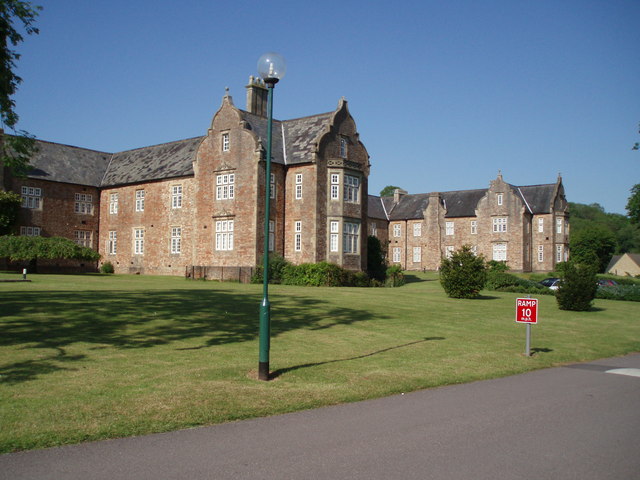
South Lodge to Mendip Hospital Another view of <a href="https://www.geograph.org.uk/photo/577090">ST5646 : Porter's Lodge, Wells</a>. Built about 1845 and described at <span class="nowrap"><a title="http://www.britishlistedbuildings.co.uk/en-268200-south-lodge-to-mendip-hospital-st-cuthbe" rel="nofollow ugc noopener" href="http://www.britishlistedbuildings.co.uk/en-268200-south-lodge-to-mendip-hospital-st-cuthbe">Link</a><img style="margin-left:2px;" alt="External link" title="External link - shift click to open in new window" src="https://s1.geograph.org.uk/img/external.png" width="10" height="10"/></span> . In the foreground is the Old Frome Road; to the left it meets the B3139 Bath Road.
South Lodge to Mendip Hospital
Another view of ST5646 : Porter's Lodge, Wells. Built about 1845 and described at LinkExternal link . In the foreground is the Old Frome Road; to the left it meets the B3139 Bath Road.
Old Frome Road near South Horrington Some of the new housing close to the road east of Wells. The road to the left is called Gilbert Scott Road, acknowledging the famous Victorian architect who jointly designed the former Mendip Hospital to which the road leads.
Old Frome Road near South Horrington
Some of the new housing close to the road east of Wells. The road to the left is called Gilbert Scott Road, acknowledging the famous Victorian architect who jointly designed the former Mendip Hospital to which the road leads.
Dry valley near South Horrington Crossed by footpath WS 10/46, which climbs the hill behind the large oak right of centre.
Dry valley near South Horrington
Crossed by footpath WS 10/46, which climbs the hill behind the large oak right of centre.
Fields near Great War Plantation A view from footpath WS 10/46, looking towards Combe Cottage between a meadow and a maize field.
Fields near Great War Plantation
A view from footpath WS 10/46, looking towards Combe Cottage between a meadow and a maize field.
Approaching The Warren Bridleway WS 4/15 converges with bridleway WS 4/16 to pass through the gate on the north side of The Warren, the wood to the right. Beyond the gate, the public road (Lyatt Lane) begins.
Approaching The Warren
Bridleway WS 4/15 converges with bridleway WS 4/16 to pass through the gate on the north side of The Warren, the wood to the right. Beyond the gate, the public road (Lyatt Lane) begins.
The woods of Stoberry Warren, with stone wall on the south side
2011 : Washingpool Farm on Chilcote Drove Looking south west to the Somerset Levels and Glastonbury Tor <a href="https://www.geograph.org.uk/gridref/ST5138">ST5138</a> seen through a mid October heat haze.
2011 : Washingpool Farm on Chilcote Drove
Looking south west to the Somerset Levels and Glastonbury Tor ST5138 seen through a mid October heat haze.
2011 : Chilcote Drove heading north Meets the Old Frome Road this side of the wood on the hill.
Washingpool Farm is behind the camera.
Two weeks ago there was hardly a sign of autumn now it is nearly over.
2011 : Chilcote Drove heading north
Meets the Old Frome Road this side of the wood on the hill. Washingpool Farm is behind the camera. Two weeks ago there was hardly a sign of autumn now it is nearly over.
2011 : Cow pasture near Washingpool Farm North west from Chilcote Drove.
"Right girls, heads down for a full belly and ignore that fool photographer looking over the gate, pretend you haven't seen him."
2011 : Cow pasture near Washingpool Farm
North west from Chilcote Drove. "Right girls, heads down for a full belly and ignore that fool photographer looking over the gate, pretend you haven't seen him."
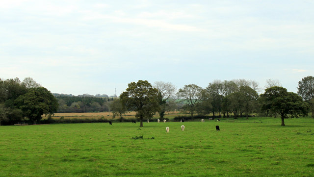
2011 : North west from Chilcote Drove Sheep dot the next pasture over.
East Horrington appears near the left hand edge. West Horrington is larger but is lost among trees in the valley further over.
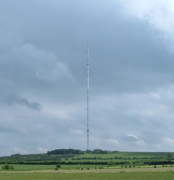
That long thing standing on the horizon right of centre is the Mendip UHF transmitter on Pen Hill <a href="https://www.geograph.org.uk/gridref/ST5648">ST5648</a>
2011 : North west from Chilcote Drove
Sheep dot the next pasture over. East Horrington appears near the left hand edge. West Horrington is larger but is lost among trees in the valley further over. That long thing standing on the horizon right of centre is the Mendip UHF transmitter on Pen Hill ST5648
2011 : Junction on Chilcote Lane Chilcote Lane enters right from East Horrington and goes straight ahead to Chilcote Manor passing a small row of cottages. The road to the left is Chilcote Drove.
2011 : Junction on Chilcote Lane
Chilcote Lane enters right from East Horrington and goes straight ahead to Chilcote Manor passing a small row of cottages. The road to the left is Chilcote Drove.
2011 : Three sheep in a field near Chilcote Manor A tractor on the other side of the wall, a mysterious device a little to the right of it, and a small barn well on its way to dilapidation.
2011 : Three sheep in a field near Chilcote Manor
A tractor on the other side of the wall, a mysterious device a little to the right of it, and a small barn well on its way to dilapidation.
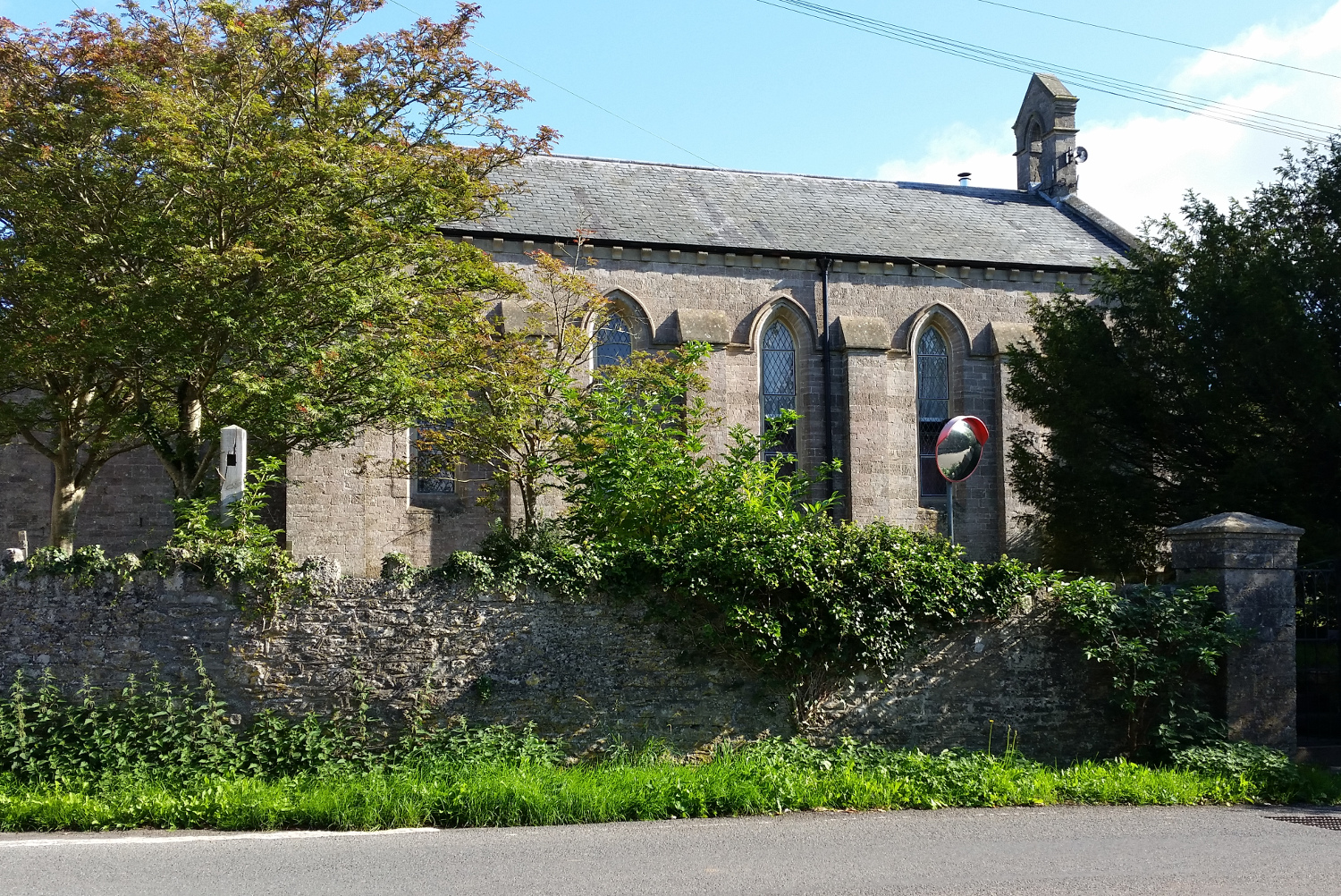
2011 : Old Frome Road, East Horrington A mile in this direction brings you to the edge of Wells.
The thing with a hat on the wall is a parish notice board.
The mirror on top of the wall is there for the benefit of traffic emerging from Veal Lane opposite.
And one man on shanks's pony.
2011 : Old Frome Road, East Horrington
A mile in this direction brings you to the edge of Wells. The thing with a hat on the wall is a parish notice board. The mirror on top of the wall is there for the benefit of traffic emerging from Veal Lane opposite. And one man on shanks's pony.
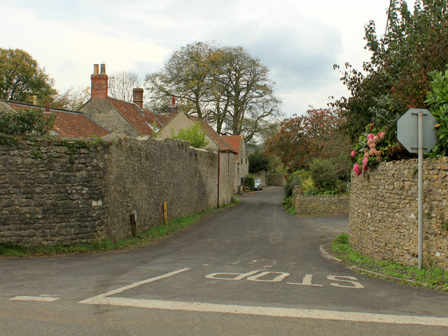
2011 : Veal Lane, East Horrington Heading West of North to West Horrington. (South Horrington is due west of here but don't moan at me, I didn't name them.)
A bunch of pink hydrangeas hang over the wall to compensate for the directionally challenged villages.
2011 : Veal Lane, East Horrington
Heading West of North to West Horrington. (South Horrington is due west of here but don't moan at me, I didn't name them.) A bunch of pink hydrangeas hang over the wall to compensate for the directionally challenged villages.
2011 : Old Frome Road at East Horrington Seventeen miles to Frome as the crow flies. The Armishaws lorry is well on its way.
2011 : Old Frome Road at East Horrington
Seventeen miles to Frome as the crow flies. The Armishaws lorry is well on its way.
Show me another place!

Horrington, West is located at Grid Ref: ST5747 (Lat: 51.223302, Lng: -2.6098392)

Administrative County: Somerset

District: Mendip

Police Authority: Avon and Somerset

What 3 Words

///quickly.expensive.oath. Near Mendip, Somerset

Related Wikis

Horrington

Horrington is a collection of three small villages (South Horrington, East Horrington and West Horrington) in the parish of St Cuthbert Out 1 mile (2 km...

St John's Church, East Horrington

St John's Church is a former Church of England church in East Horrington, Somerset, England. It was built in 1838 to the designs of Richard Carver and...

Mendip Hospital

Mendip Hospital opened in 1848 as the Somerset and Bath Pauper Lunatic Asylum at Horrington, near Wells, in the English county of Somerset. As a county...

King's Castle, Wells

King's Castle is an Iron Age enclosed hilltop settlement at the south-western edge of the Mendip Hills near Wells in Somerset, England. Though there are...

Pen Hill

Pen Hill forms part of the Mendip Hills plateau in Somerset, England. The hill is located in St Cuthbert Out civil parish in Mendip district. The name...

Mendip transmitting station

The Mendip transmitting station is a broadcasting and telecommunications facility on the summit of Pen Hill, part of the Mendip Hills range in Somerset...

Church of St Thomas, Wells

The Church of St Thomas in Wells, Somerset, England, was built in the 1850s. It is a Grade II* listed building. == History == The church was built during...

The Old Deanery, Wells

The Old Deanery of Wells Cathedral in Wells, Somerset, England, dates from the 12th century. Along with the gatehouse and boundary walls has been designated...

Nearby Amenities

Located within 500m of 51.223302,-2.6098392
West Horrington
Place: village
Source: npe
Lat/Long: 51.2255368/-2.6123818
Power: pole
Lat/Long: 51.2207479/-2.6118334
Power: pole
Lat/Long: 51.2229219/-2.6131209
Power: pole
Lat/Long: 51.2222834/-2.6127829
Power: pole
Lat/Long: 51.2242221/-2.6137914
Power: pole
Lat/Long: 51.2245648/-2.613979
Power: pole
Lat/Long: 51.2227974/-2.6126059
Power: pole
Lat/Long: 51.2217159/-2.6118252
Power: pole
Lat/Long: 51.2235922/-2.6134681
Bus Stop
West Horrington
Bus: yes
Naptan AtcoCode: 3600SOB21294
Naptan Bearing: N
Naptan CommonName: The Old Police Station
Naptan Indicator: N-bound
Naptan NaptanCode: sotdgmgm
Naptan Street: Bath Road
Naptan Verified: no
Public Transport: platform
Lat/Long: 51.2234186/-2.6098793
Bus Stop
West Horrington
Bus: yes
Naptan AtcoCode: 3600SOB21293
Naptan Bearing: SW
Naptan CommonName: The Old Police Station
Naptan Indicator: SW-bound
Naptan NaptanCode: sotdgmgw
Naptan Street: Bath Road
Naptan Verified: no
Public Transport: platform
Lat/Long: 51.2237714/-2.6090269
Public Bookcase
Booth: K6
Colour: red
Disused Amenity: telephone
Man Made: telephone_box
Public Bookcase Type: phone_box
Lat/Long: 51.2254529/-2.6121357
The data included in this document is from www.openstreetmap.org. The data is made available under ODbL.

Have you been to Horrington, West?

Leave your review of Horrington, West below (or comments, questions and feedback).