Bradnock's Marsh

Settlement in Warwickshire

England

Bradnock's Marsh

Field off Mercote Hall Lane This photo was taken near the junction of Mercote Hall Lane with Cornet End Lane.  Just visible right in the centre of the photo, above two hedges and to the left of the prominent tree, are the quarry workings which have encroached on this square and which dominate the squares north and west.
Field off Mercote Hall Lane Credit: Simon Jobson

Bradnock's Marsh is a small rural hamlet located in the county of Warwickshire, England. Situated near the town of Henley-in-Arden, it is nestled in the picturesque countryside of the West Midlands region. The settlement is named after the Bradnock family, who were historically associated with the area.

The hamlet is characterized by its tranquil and idyllic setting, with lush green fields, meandering streams, and charming cottages dotting the landscape. The surrounding countryside offers breathtaking views and is perfect for those seeking a peaceful retreat from the bustling city life.

Bradnock's Marsh is primarily an agricultural community, with farming being the main occupation of its residents. The fertile soil and favorable climate make it ideal for cultivating crops such as wheat, barley, and vegetables. Livestock farming, including cattle and sheep rearing, also forms an important part of the local economy.

Despite its small size, the hamlet boasts a strong sense of community. The residents often come together for various social events and activities, fostering a close-knit and friendly atmosphere. Amenities in Bradnock's Marsh are limited, with no shops or schools within the immediate vicinity. However, the nearby town of Henley-in-Arden provides access to a wider range of services and facilities.

In terms of tourism, Bradnock's Marsh attracts visitors who appreciate its rustic charm and picturesque surroundings. The hamlet's peaceful ambiance and scenic beauty make it a popular destination for nature lovers, hikers, and those seeking a rural escape.

If you have any feedback on the listing, please let us know in the comments section below.

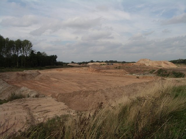
Bradnock's Marsh Images

Images are sourced within 2km of 52.411584/-1.675326 or Grid Reference SP2279. Thanks to Geograph Open Source API. All images are credited.

Field off Mercote Hall Lane This photo was taken near the junction of Mercote Hall Lane with Cornet End Lane.  Just visible right in the centre of the photo, above two hedges and to the left of the prominent tree, are the quarry workings which have encroached on this square and which dominate the squares north and west.
Field off Mercote Hall Lane
This photo was taken near the junction of Mercote Hall Lane with Cornet End Lane. Just visible right in the centre of the photo, above two hedges and to the left of the prominent tree, are the quarry workings which have encroached on this square and which dominate the squares north and west.
Berkswell Quarry, eastern end This part of the quarry working is shown on the current OS map as still being woods; some of the woods remain, visible on the left hand side of the photo.  The photo was taken facing north-west from  a bend on Mercote Hall Lane.
Berkswell Quarry, eastern end
This part of the quarry working is shown on the current OS map as still being woods; some of the woods remain, visible on the left hand side of the photo. The photo was taken facing north-west from a bend on Mercote Hall Lane.
Berkswell Quarry eastern end This part of the quarry workings falls in grid square SP2380 but the photo was taken from SP2280, from a bend on Mercote Hall Lane.
Berkswell Quarry eastern end
This part of the quarry workings falls in grid square SP2380 but the photo was taken from SP2280, from a bend on Mercote Hall Lane.
Park Farm Photo taken from Mercote Hall Lane.
Park Farm
Photo taken from Mercote Hall Lane.
Berkswell Quarry being worked This part of the quarry workings lies north of Mercote Hall Lane and east of the access road to Mercote Mill Farm.
Berkswell Quarry being worked
This part of the quarry workings lies north of Mercote Hall Lane and east of the access road to Mercote Mill Farm.
Mercote Mill Farm Surrounded by quarry workings, this old mill, now a farmhouse, is an oasis in the despoiled countryside.
Mercote Mill Farm
Surrounded by quarry workings, this old mill, now a farmhouse, is an oasis in the despoiled countryside.
Raised footway at the end of Marsh Lane Marsh Lane is gated just before reaching this point.  The footway is raised as far as the old Packhorse Bridge due to the River Blythe flooding.  This is signed as a ford on Marsh Lane.
Raised footway at the end of Marsh Lane
Marsh Lane is gated just before reaching this point. The footway is raised as far as the old Packhorse Bridge due to the River Blythe flooding. This is signed as a ford on Marsh Lane.
Railway bridge over the River Blythe This is the West Coast Main Line.  The wide expanse of water in the foreground is apparently a ford through the River Blythe forming part of Marsh Lane.
Railway bridge over the River Blythe
This is the West Coast Main Line. The wide expanse of water in the foreground is apparently a ford through the River Blythe forming part of Marsh Lane.
The old Packhorse Bridge Crossing the River Blythe, this forms part of the route of Marsh Lane though it is not accessible to vehicles (unless you are lucky with the gates either side).  There is a ford through the river in the foreground of the picture.
The old Packhorse Bridge
Crossing the River Blythe, this forms part of the route of Marsh Lane though it is not accessible to vehicles (unless you are lucky with the gates either side). There is a ford through the river in the foreground of the picture.
River Blythe flood plain This is the flood plain of the River Blythe south of Patrick Bridge and Meriden Road.
River Blythe flood plain
This is the flood plain of the River Blythe south of Patrick Bridge and Meriden Road.
The junction of Cornets End Lane and Mercote Hall Lane
Cornets End Lane at the junction with Mercote Hall Lane
Entrance to Tarmac's Meriden quarry
Entrance to Cemex's Berkswell Quarry
Entrance to Marsh Lane Nature Reserve
The end of Marsh Lane The lane here turns into a bridleway, going over the packhorse bridge, and through the Packhorse Bridge Nature Reserve.
The end of Marsh Lane
The lane here turns into a bridleway, going over the packhorse bridge, and through the Packhorse Bridge Nature Reserve.
Bridleway to the packhorse bridge
Bridges over the river A comparison of the old packhorse bridge and the more recent railway bridge, both over the same river.
Bridges over the river
A comparison of the old packhorse bridge and the more recent railway bridge, both over the same river.
Show me another place!

Bradnock's Marsh is located at Grid Ref: SP2279 (Lat: 52.411584, Lng: -1.675326)

Unitary Authority: Solihull

Police Authority: West Midlands

What 3 Words

///noun.science.scrap. Near Barston, West Midlands

Related Wikis

Berkswell Marsh

Berkswell Marsh is a 7.5 hectares (19 acres) biological site of Special Scientific Interest in the West Midlands, en. The site was notified in 1991 under...

Hampton in Arden packhorse bridge

Hampton in Arden packhorse bridge crosses the River Blythe near Hampton in Arden in the West Midlands (historically Warwickshire) of England, between Birmingham...

Berkswell Hall

Berkswell Hall is a 19th-century country house at Berkswell, formerly Warwickshire now West Midlands, now converted into residential apartments. It is...

Barston

Barston is a village and civil parish in Metropolitan Borough of Solihull in the West Midlands of England. It is approximately 4.5 miles (7 km) east of...

Related Videos

English Winter Walk in 4K - Berkswell Village Walking Tour ❄️

English Winter Walk in 4K Today's walk was a little cold but what a lovely location, Berkswell village, is a small tucked away ...

LOCKDOWN walking in WARWICKSHIRE. 20km from Barston

Well we're back in lockdown! Staying local, I headed 10minutes up the road to the village of Barston. My route ended up being ...

Midlife Adventures - Meriden Sunset Walk

Another stunning late summer sunset walk for my mid-life adventures today. I may be over 40 but I'm not over the hill yet!!! Join me ...

Nearby Amenities

Located within 500m of 52.411584,-1.675326
Kenilworth Rd / Bradnocks Marsh
Naptan AtcoCode: 43000172801
Naptan Bearing: SE
Naptan BusStopType: CUS
Naptan CommonName: Bradnocks Marsh
Naptan Indicator: on
Naptan NaptanCode: nwmdpdtj
Naptan PlusbusZoneRef: BHAMNWS
Naptan Status: ACT
Naptan StopType: BCT
Naptan Street: KENILWORTH RD
Naptan Verified: no
Source: WMCA
Lat/Long: 52.4126712/-1.673945
Kenilworth Rd / Bradnocks Marsh
Naptan AtcoCode: 43000172802
Naptan Bearing: NW
Naptan BusStopType: CUS
Naptan CommonName: Bradnocks Marsh
Naptan Indicator: on
Naptan NaptanCode: nwmtmjtg
Naptan PlusbusZoneRef: BHAMNWS
Naptan Status: ACT
Naptan StopType: BCT
Naptan Street: KENILWORTH RD
Naptan Verified: no
Source: WMCA
Lat/Long: 52.4127052/-1.6740416
Power Historic: tower
Source: OS 1:25k
Lat/Long: 52.4120889/-1.67048
Cafe
Lat/Long: 52.4102443/-1.6689621
Bus: yes
Public Transport: stop_position
Lat/Long: 52.4126935/-1.6739945
Barrier: stile
Lat/Long: 52.411273/-1.6714613
Power: pole
Lat/Long: 52.4107952/-1.6756384
Post Box
Collection Times: Mo-Fr 09:00; Sa 07:00; Su off
Note: Just north of pole
Post Box Type: lamp
Ref: B92 173D
Royal Cypher: EIIR
Royal Cypher Wikidata: Q33102113
Lat/Long: 52.4107994/-1.6756362
Power: pole
Source: Warwicks CC Aerial Imagery 2013
Lat/Long: 52.4098279/-1.6722708
Material: wood
Power: pole
Source: Warwicks CC Aerial Imagery 2013
Lat/Long: 52.4099805/-1.6719308
Material: wood
Power: pole
Source: Warwicks CC Aerial Imagery 2013
Lat/Long: 52.4101708/-1.6738119
Material: wood
Power: pole
Source: Warwicks CC Aerial Imagery 2013
Transformer: yes
Lat/Long: 52.4102529/-1.676059
Material: wood
Power: pole
Source: Warwicks CC Aerial Imagery 2013
Lat/Long: 52.4104842/-1.6752969
Material: wood
Power: pole
Source: Warwicks CC Aerial Imagery 2013
Lat/Long: 52.4091708/-1.6705144
Power: pole
Lat/Long: 52.4107653/-1.6772655
Power: pole
Lat/Long: 52.4112666/-1.6784797
Bradnock's Marsh
Place: hamlet
Source: OS_OpenData_StreetView
Lat/Long: 52.4093478/-1.6746288
Man Made: pipeline_marker
Source: survey
Lat/Long: 52.4150305/-1.6706534
Speed Camera
Maxspeed: 50 mph
Lat/Long: 52.4149392/-1.6750234
Material: wood
Power: pole
Source: bing
Lat/Long: 52.408749/-1.6697811
Material: wood
Power: pole
Source: bing
Lat/Long: 52.4105194/-1.6717646
Material: wood
Power: pole
Source: bing
Lat/Long: 52.4097046/-1.6714373
Power: pole
Source: bing
Lat/Long: 52.4130545/-1.6818121
Power: pole
Ref: 720222
Source: bing
Transformer: yes
Lat/Long: 52.412351/-1.6809806
Power: pole
Source: bing
Lat/Long: 52.4118503/-1.6798031
The Hollies Guest House
Addr City: Solihull
Addr Housename: The Hollies
Addr Postcode: B92 0LW
Addr Street: Kenilworth Road
Fhrs Id: 523252
Tourism: guest_house
Lat/Long: 52.4116025/-1.6729595
The data included in this document is from www.openstreetmap.org. The data is made available under ODbL.

Have you been to Bradnock's Marsh?

Leave your review of Bradnock's Marsh below (or comments, questions and feedback).