West End

Settlement in Berkshire

England

West End

Temple Way, Bracknell
Temple Way, Bracknell Credit: Robin Webster

West End is a charming village located in the county of Berkshire, England. Nestled within the larger civil parish of Wokingham Without, it is situated about 3 miles west of the town of Wokingham and approximately 35 miles west of central London. With a population of around 2,000 residents, West End offers a peaceful and idyllic setting.

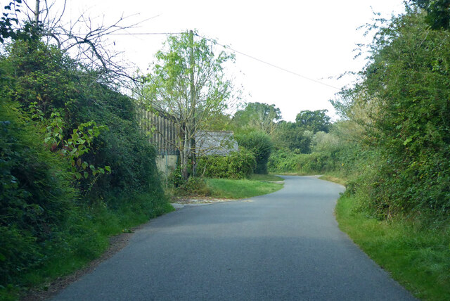
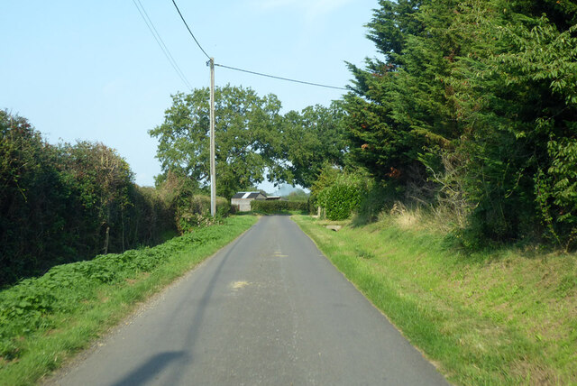
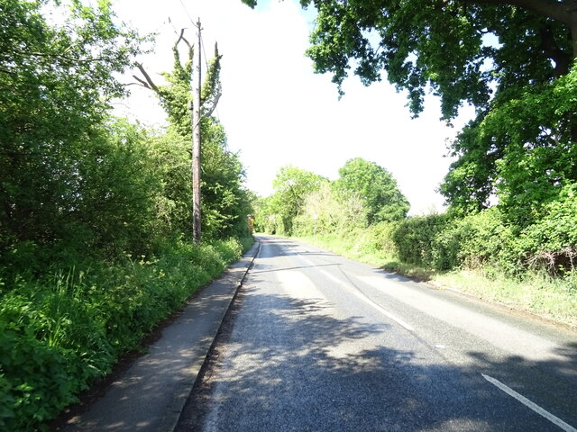
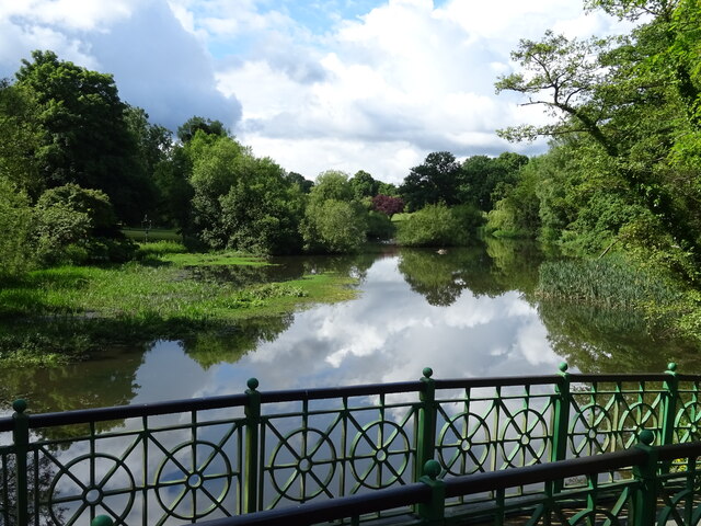
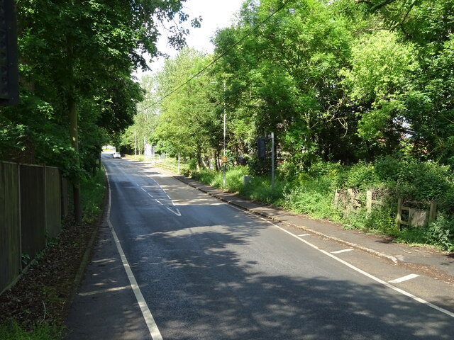
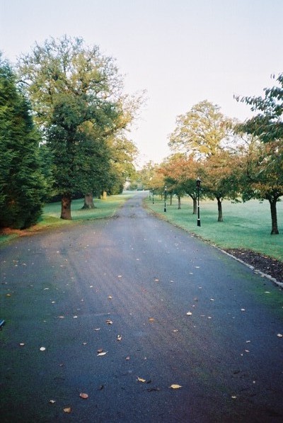
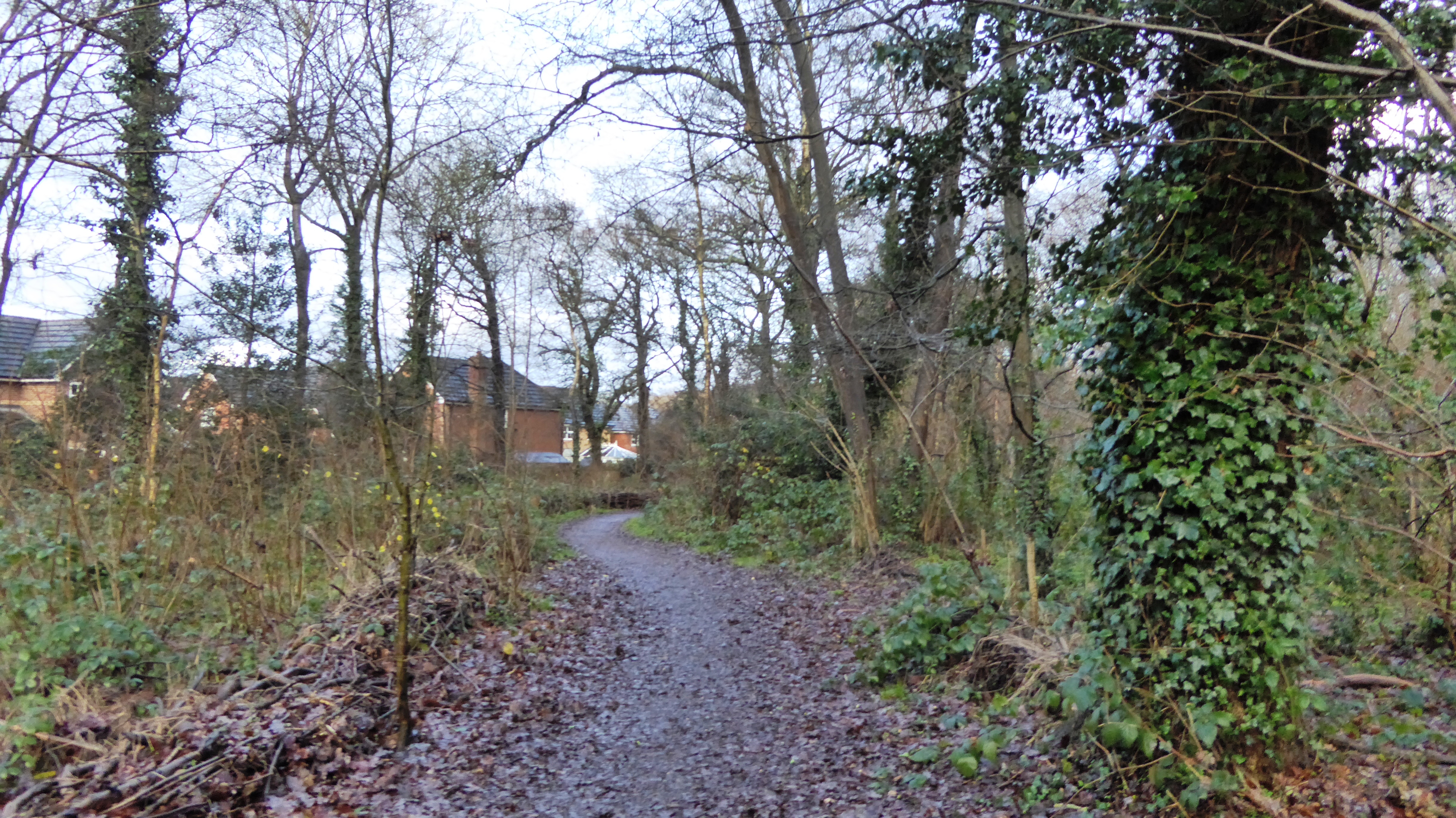
The village is known for its picturesque countryside, with rolling hills and lush green fields surrounding the area. It is a popular destination for nature lovers and outdoor enthusiasts, with plenty of walking and cycling trails to explore. West End also benefits from its proximity to the renowned Swinley Forest, a vast woodland area perfect for leisurely strolls or more adventurous activities such as mountain biking.

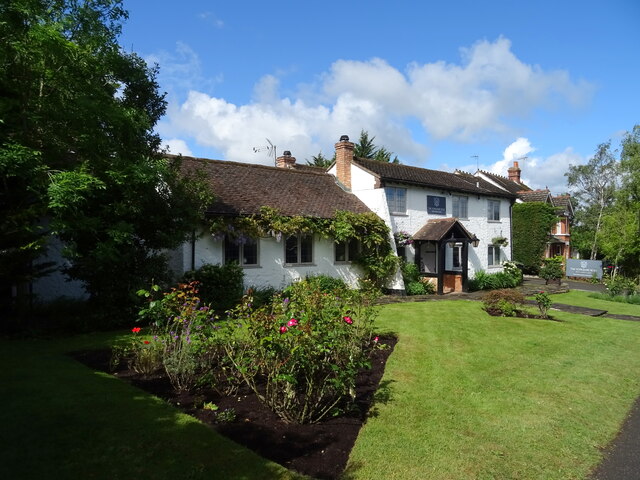
In terms of amenities, West End offers a range of facilities to cater to its residents. There is a local primary school, providing education for children in the area, as well as a village hall that hosts various community events. Additionally, the nearby town of Wokingham provides further amenities, including shops, restaurants, and leisure centers.

Transport links in West End are excellent, with easy access to major road networks such as the M4 and M3, making it convenient for commuters traveling to nearby towns and cities. The village is also served by several bus routes, connecting it to surrounding areas.

Overall, West End, Berkshire, offers a peaceful and scenic setting, making it an attractive place to live or visit for those seeking a tranquil escape from the hustle and bustle of city life.

If you have any feedback on the listing, please let us know in the comments section below.
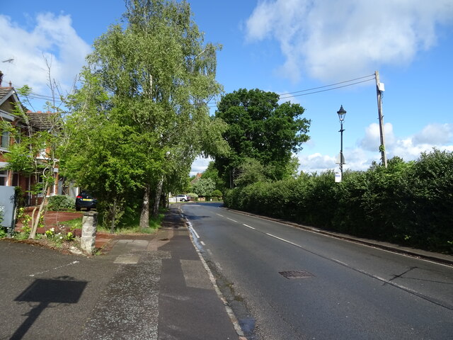
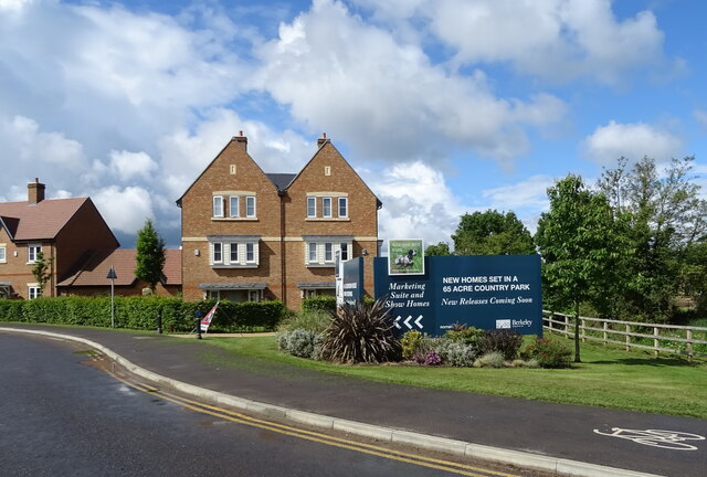
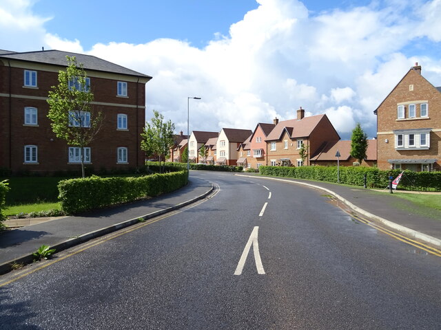
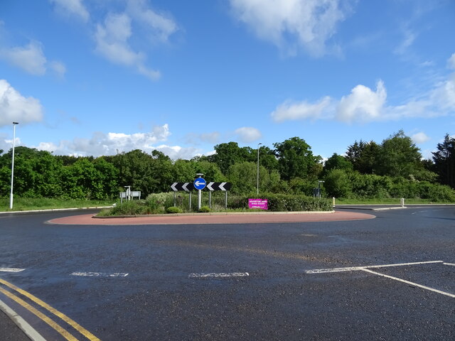
West End Images

Images are sourced within 2km of 51.434669/-0.75488485 or Grid Reference SU8671. Thanks to Geograph Open Source API. All images are credited.

Temple Way, Bracknell
Cabbage Hill Lane By Ryehurst Farm.
Cabbage Hill Lane
By Ryehurst Farm.
Ryehurst Lane Heading north in the general direction of Maidenhead.
Ryehurst Lane
Heading north in the general direction of Maidenhead.
St Michael the Archangel, Warfield: churchyard
St Michael, Warfield at twilight
Strawberry Hill, Warfield
House on the B3034
House on the B3034
B3034, Newell Green
B3034, Newell Green
House, Newell Green
House, Newell Green
The Yorkshire Rose, Newell Green
Sign for the Yorkshire Rose, Newell Green See <a href="https://www.geograph.org.uk/photo/7280477">SU8771 : The Yorkshire Rose, Newell Green</a> for context.
Sign for the Yorkshire Rose, Newell Green
Forest Road (A3095), Newell Green
Woodhurst Park New housing development, Warfield.
Woodhurst Park
New housing development, Warfield.
Woodhurst Park New housing development, Warfield.
Woodhurst Park
New housing development, Warfield.
Roundabout on the B3034
B3034 towards Binfield
The Cut, Binfield Manor
B3034 towards Binfield
Show me another place!

West End is located at Grid Ref: SU8671 (Lat: 51.434669, Lng: -0.75488485)

Unitary Authority: Bracknell Forest

Police Authority: Thames Valley

What 3 Words

///thing.device.storm. Near Warfield, Berkshire

Related Wikis

Warfield Hall

Warfield Hall is a Grade II listed building at Warfield in Berkshire. == History == Warfield Hall was originally built in the 1730s and belonged to the...

Quelm Park

Quelm Park is a suburb of Bracknell, in Berkshire, England. The settlement lies west of the A3095 road, south of the Bracknell Northern Distributor Road...

Piggy Wood

Piggy Wood is a 2.3-hectare (5.7-acre) Local Nature Reserve on the northern outskirts of Bracknell in Berkshire. It is owned and managed by Bracknell...

Lawrence Hill, Berkshire

Lawrence Hill is a northern suburb of Bracknell in the English county of Berkshire. It stands within the civil parish of Warfield. The settlement lies...

Moss End

Moss End is a hamlet in Berkshire, England, within the civil parish of Warfield. The settlement lies on the A3095 road and is approximately 2 miles (3...

Tinkers Copse

Tinkers Copse is a 1.9-hectare (4.7-acre) Local Nature Reserve on the northwestern outskirts of Bracknell in Berkshire. It is owned and managed by Bracknell...

Warfield

Warfield is a village and civil parish in the English county of Berkshire and the borough of Bracknell Forest. == History == Warfield was originally an...

Jock's Copse

Jock's Copse is a 1.5-hectare (3.7-acre) Local Nature Reserve on the northern outskirts of Bracknell in Berkshire. It is owned and managed by Bracknell...

Nearby Amenities

Located within 500m of 51.434669,-0.75488485
Restaurant
The Spice Lounge
Cuisine: indian
Website: https://www.spiceloungewarfield.com/
Lat/Long: 51.435578/-0.7495003
Created By: Merkaartor 0.10
Lat/Long: 51.4357901/-0.7498908
Created By: Merkaartor 0.10
Lat/Long: 51.4346278/-0.7547613
Ford: yes
Lat/Long: 51.4308852/-0.7522966
Power: pole
Lat/Long: 51.4369398/-0.7489559
Location Transition: yes
Power: pole
Lat/Long: 51.4359571/-0.749839
Traffic Signals
Source: guess
Traffic Signals Direction: backward
Lat/Long: 51.435944/-0.7499445
Crossing
Bicycle: yes
Crossing: unmarked
Lat/Long: 51.4310357/-0.7510336
Crossing
Bicycle: yes
Crossing: traffic_signals
Crossing Island: yes
Crossing Ref: toucan
Source: survey
Lat/Long: 51.4313257/-0.75093
Traffic Signals
Source: seen on journey
Traffic Signals Direction: backward
Lat/Long: 51.4312727/-0.7509385
Traffic Signals
Source: seen on journey
Traffic Signals Direction: forward
Lat/Long: 51.4313779/-0.7509217
Barrier: cycle_barrier
Material: wood
Lat/Long: 51.4314503/-0.7559946
Crossing
Bicycle: yes
Crossing: unmarked
Lat/Long: 51.4314423/-0.7559296
Barrier: cycle_barrier
Material: wood
Lat/Long: 51.4314335/-0.7558575
The Greenway
Bicycle: yes
Board Type: notice
Foot: yes
Information: map
Place: locality
Ref: 2
Tourism: information
Lat/Long: 51.4317343/-0.7602242
Crossing
Crossing: uncontrolled
Crossing Island: yes
Lat/Long: 51.4332881/-0.7507713
Barrier: kerb
Kerb: lowered
Tactile Paving: yes
Lat/Long: 51.4322518/-0.7509117
Crossing
Crossing: uncontrolled
Crossing Island: yes
Lat/Long: 51.4332668/-0.7508275
Barrier: kerb
Kerb: lowered
Tactile Paving: yes
Lat/Long: 51.4321408/-0.7509447
Barrier: kerb
Kerb: lowered
Tactile Paving: yes
Lat/Long: 51.4317159/-0.7509765
Barrier: kerb
Kerb: lowered
Tactile Paving: yes
Lat/Long: 51.4318209/-0.7509652
Crossing
Bicycle: yes
Crossing: unmarked
Lat/Long: 51.4317688/-0.7509708
Crossing
Crossing: marked
Lat/Long: 51.4316538/-0.7511684
Crossing
Bicycle: yes
Crossing: unmarked
Lat/Long: 51.4322065/-0.7509252
Crossing
Crossing: marked
Lat/Long: 51.4316659/-0.7514002
Traffic Signals
Source: guess
Traffic Signals Direction: forward
Lat/Long: 51.4359075/-0.7501269
Traffic Signals
Source: guess
Traffic Signals Direction: forward
Lat/Long: 51.4358339/-0.7501689
Crossing
Bicycle: yes
Crossing: uncontrolled
Crossing Island: yes
Lat/Long: 51.4350827/-0.7515749
Crossing
Bicycle: yes
Crossing: uncontrolled
Crossing Island: yes
Lat/Long: 51.4350872/-0.7515076
Traffic Signals
Traffic Signals Direction: backward
Lat/Long: 51.4356959/-0.7497405
Barrier: cycle_barrier
Lat/Long: 51.435454/-0.750101
Barrier: cycle_barrier
Lat/Long: 51.431119/-0.7507399
Bicycle: yes
Board Type: notice
Foot: yes
Information: map
Tourism: information
Lat/Long: 51.4311833/-0.7546362
Crossing
Crossing: unmarked
Kerb: lowered
Lat/Long: 51.4343259/-0.7513875
Crossing
Crossing: uncontrolled
Crossing Island: yes
Lat/Long: 51.4335504/-0.7511106
Crossing
Crossing: uncontrolled
Crossing Island: yes
Lat/Long: 51.4335197/-0.7507071
Crossing
Crossing: uncontrolled
Crossing Island: yes
Lat/Long: 51.4334788/-0.7506673
Crossing
Crossing: uncontrolled
Crossing Island: yes
Lat/Long: 51.4335878/-0.7510186
Barrier: kerb
Kerb: lowered
Tactile Paving: yes
Lat/Long: 51.4344716/-0.7516552
Barrier: cycle_barrier
Lat/Long: 51.4350971/-0.7514196
Barrier: kissing_gate
Lat/Long: 51.4333716/-0.7571566
Barrier: kerb
Kerb: lowered
Tactile Paving: yes
Lat/Long: 51.4313015/-0.7574038
Crossing
Crossing: unmarked
Kerb: lowered
Lat/Long: 51.433096/-0.7526555
Barrier: kerb
Kerb: lowered
Tactile Paving: yes
Lat/Long: 51.4338695/-0.7513348
Barrier: kerb
Kerb: lowered
Tactile Paving: yes
Lat/Long: 51.4346022/-0.7517419
Barrier: kerb
Kerb: lowered
Tactile Paving: yes
Lat/Long: 51.4340089/-0.7513969
Crossing
Bicycle: yes
Crossing: unmarked
Crossing Island: yes
Lat/Long: 51.4339387/-0.7513656
Crossing
Bicycle: yes
Crossing: unmarked
Crossing Island: yes
Lat/Long: 51.4345349/-0.7516972
Crossing
Crossing: uncontrolled
Crossing Ref: zebra
Lat/Long: 51.4335546/-0.7501337
Crossing
Bicycle: yes
Crossing: uncontrolled
Crossing Island: yes
Lat/Long: 51.4333405/-0.7511865
Crossing
Bicycle: yes
Crossing: uncontrolled
Crossing Island: yes
Lat/Long: 51.4332993/-0.7511407
Barrier: kerb
Lat/Long: 51.4329491/-0.753049
Crossing
Bicycle: yes
Crossing: unmarked
Lat/Long: 51.4313015/-0.7574496
Traffic Signals
Traffic Signals Direction: forward
Lat/Long: 51.4357412/-0.7495967
Barrier: kerb
Kerb: lowered
Tactile Paving: yes
Lat/Long: 51.4335557/-0.751085
Generator Method: photovoltaic
Generator Output Electricity: yes
Generator Solar Modules: 34
Generator Source: solar
Generator Type: solar_photovoltaic_panel
Location: roof
Power: generator
Tilted: no
Lat/Long: 51.433837/-0.7506023
Generator Method: photovoltaic
Generator Output Electricity: yes
Generator Solar Modules: 68
Generator Source: solar
Generator Type: solar_photovoltaic_panel
Location: roof
Power: generator
Tilted: no
Lat/Long: 51.4339687/-0.7509212
Generator Method: photovoltaic
Generator Output Electricity: yes
Generator Solar Modules: 40
Generator Source: solar
Generator Type: solar_photovoltaic_panel
Location: roof
Power: generator
Tilted: no
Lat/Long: 51.4341882/-0.7507662
Barrier: kerb
Kerb: lowered
Tactile Paving: yes
Lat/Long: 51.4310632/-0.7510457
Barrier: kerb
Kerb: lowered
Tactile Paving: yes
Lat/Long: 51.4310086/-0.7510216
Barrier: kerb
Kerb: lowered
Tactile Paving: yes
Lat/Long: 51.4313253/-0.7508583
Barrier: kerb
Kerb: lowered
Tactile Paving: yes
Lat/Long: 51.431326/-0.7510054
Barrier: kerb
Kerb: lowered
Tactile Paving: yes
Lat/Long: 51.4313258/-0.7509543
Barrier: kerb
Kerb: lowered
Tactile Paving: yes
Lat/Long: 51.4313256/-0.7509063
Barrier: kerb
Lat/Long: 51.4335926/-0.7483231
Crossing
Crossing: unmarked
Source: Bing
Lat/Long: 51.4333479/-0.7492757
Barrier: kerb
Kerb: lowered
Tactile Paving: no
Lat/Long: 51.4335379/-0.7502299
Barrier: kerb
Kerb: lowered
Tactile Paving: no
Lat/Long: 51.433596/-0.7501882
Barrier: kerb
Kerb: lowered
Tactile Paving: yes
Lat/Long: 51.4335777/-0.7501185
Barrier: kerb
Kerb: lowered
Tactile Paving: yes
Lat/Long: 51.4335278/-0.7501491
Barrier: kerb
Kerb: lowered
Tactile Paving: yes
Lat/Long: 51.4332479/-0.7508535
Barrier: kerb
Kerb: lowered
Tactile Paving: yes
Lat/Long: 51.433277/-0.7508134
Barrier: kerb
Kerb: lowered
Tactile Paving: yes
Lat/Long: 51.433285/-0.7507933
Barrier: kerb
Kerb: lowered
Tactile Paving: yes
Lat/Long: 51.4332961/-0.7507151
Barrier: kerb
Kerb: lowered
Tactile Paving: yes
Lat/Long: 51.4334558/-0.7506368
Barrier: kerb
Kerb: lowered
Tactile Paving: yes
Lat/Long: 51.4334907/-0.7506832
Barrier: kerb
Kerb: lowered
Tactile Paving: yes
Lat/Long: 51.4335063/-0.7507011
Barrier: kerb
Kerb: lowered
Tactile Paving: yes
Lat/Long: 51.43355/-0.7507206
Barrier: kerb
Kerb: lowered
Tactile Paving: yes
Lat/Long: 51.433573/-0.7510418
Barrier: kerb
Kerb: lowered
Tactile Paving: yes
Lat/Long: 51.4335412/-0.7511547
Barrier: kerb
Kerb: lowered
Tactile Paving: yes
Lat/Long: 51.4336011/-0.7509979
Barrier: kerb
Kerb: lowered
Tactile Paving: yes
Lat/Long: 51.433329/-0.7511693
Barrier: kerb
Kerb: lowered
Tactile Paving: yes
Lat/Long: 51.4333145/-0.7511497
Barrier: kerb
Kerb: lowered
Tactile Paving: yes
Lat/Long: 51.4332808/-0.7511299
Barrier: kerb
Kerb: lowered
Tactile Paving: yes
Lat/Long: 51.4333619/-0.7512187
Barrier: kerb
Lat/Long: 51.4334736/-0.7495918
Barrier: kerb
Kerb: lowered
Tactile Paving: yes
Lat/Long: 51.4350804/-0.7516162
Barrier: kerb
Kerb: lowered
Tactile Paving: yes
Lat/Long: 51.4350841/-0.7515535
Barrier: kerb
Kerb: lowered
Tactile Paving: yes
Lat/Long: 51.435086/-0.7515254
Barrier: kerb
Kerb: lowered
Tactile Paving: yes
Lat/Long: 51.4350922/-0.7514636
Barrier: kerb
Kerb: lowered
Tactile Paving: yes
Lat/Long: 51.4314379/-0.7558935
Barrier: kerb
Kerb: lowered
Tactile Paving: yes
Lat/Long: 51.4314475/-0.7559716
Barrier: kerb
Kerb: lowered
Tactile Paving: yes
Lat/Long: 51.4313016/-0.7574782
Barrier: cycle_barrier
Material: wood
Lat/Long: 51.4313017/-0.7575336
Barrier: cycle_barrier
Material: wood
Lat/Long: 51.4313038/-0.7573374
Bench
Lat/Long: 51.431723/-0.7598571
Bench
Lat/Long: 51.4316801/-0.7600537
Give Way
Lat/Long: 51.4318303/-0.7511219
Crossing
Crossing: marked
Lat/Long: 51.4322777/-0.7510412
The data included in this document is from www.openstreetmap.org. The data is made available under ODbL.

Have you been to West End?

Leave your review of West End below (or comments, questions and feedback).