West Ella

Settlement in Yorkshire

England

West Ella

Holiday park entrance, Raywell Entrance to the Raywell Hall Country Lodge Park <span class="nowrap"><a title="https://www.raywellhall.co.uk/" rel="nofollow ugc noopener" href="https://www.raywellhall.co.uk/">Link</a><img style="margin-left:2px;" alt="External link" title="External link - shift click to open in new window" src="https://s1.geograph.org.uk/img/external.png" width="10" height="10"/></span> on Westfield Road. This is a secondary access, to the southern portion of the site, which comprises 21 lodges called, collectively 'The Westwoods'. These opened in July 2021. 

The main entrance to the larger part of the park is on nearby Riplingham Road. The holiday park development began in 2007, initially with three lodges, expanding to its current 54.
Holiday park entrance, Raywell Credit: Paul Harrop

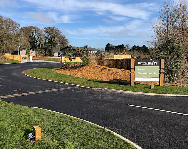
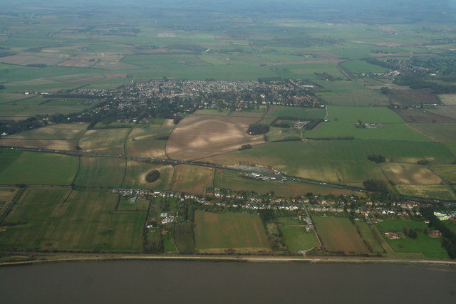
West Ella is a small village situated in the East Riding of Yorkshire, England. It is located approximately seven miles west of the city of Hull, and lies within the civil parish of Kirk Ella and West Ella. The village is part of the larger suburban area known as West Hull.

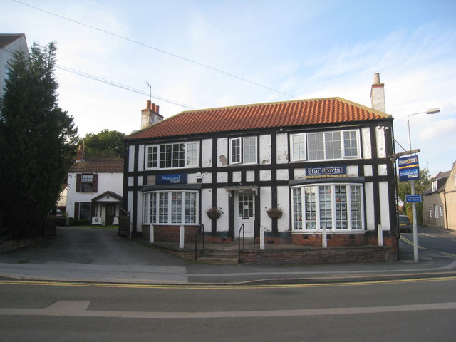
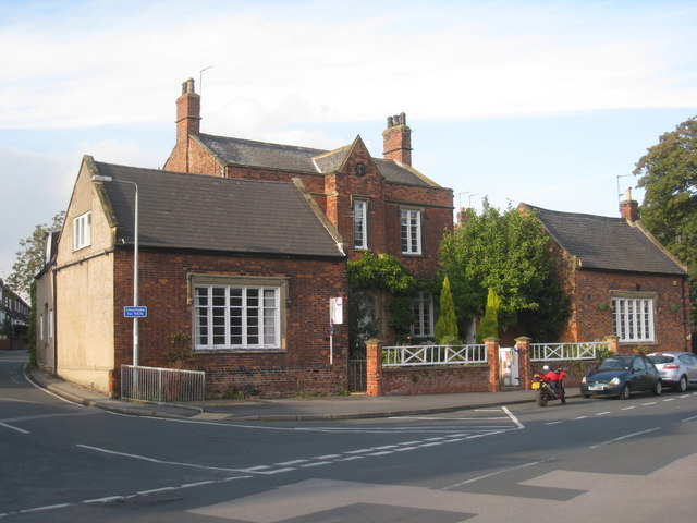
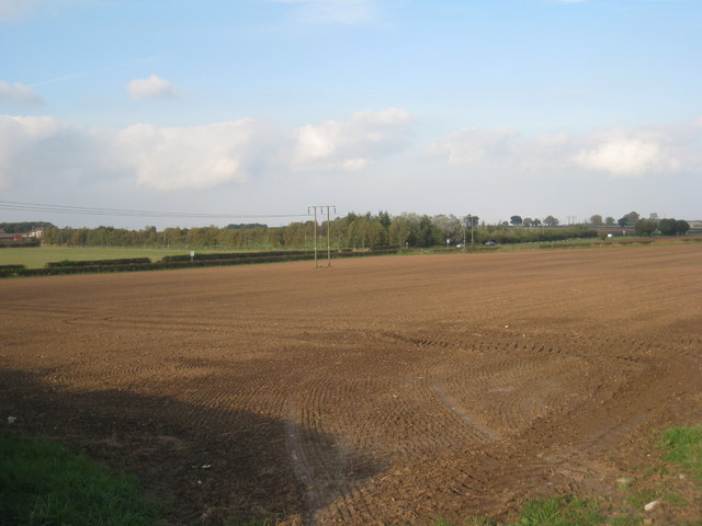
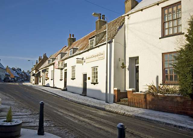
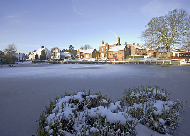
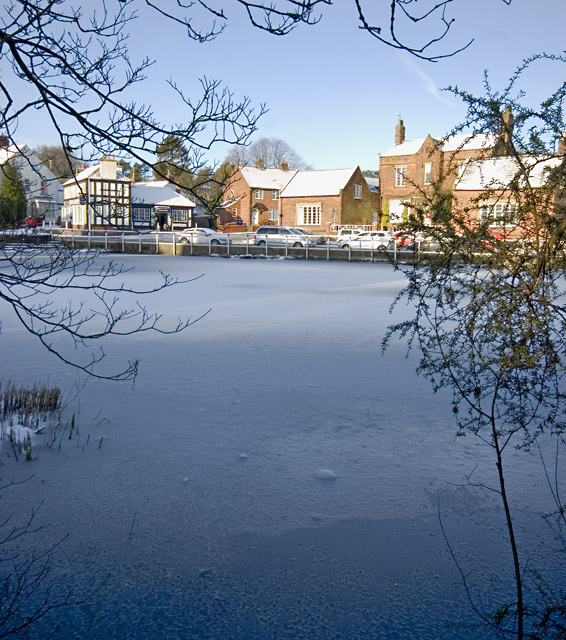
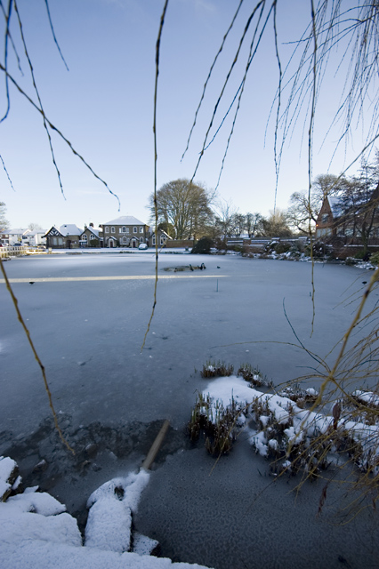
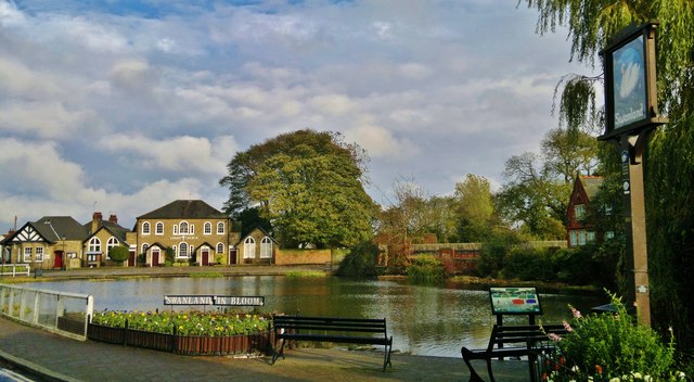
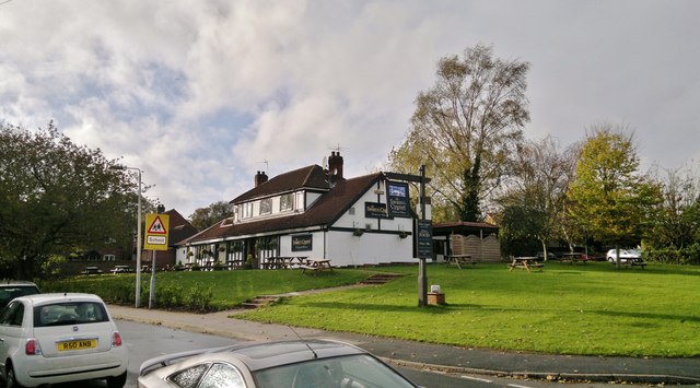
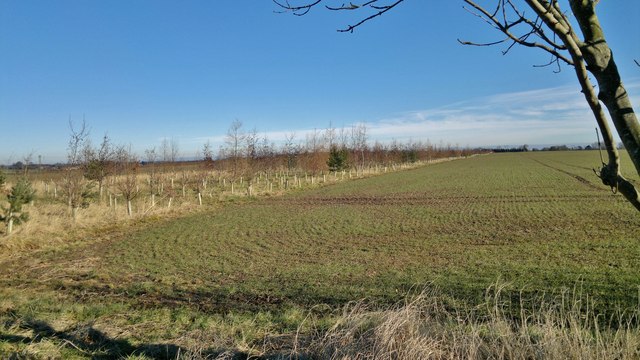
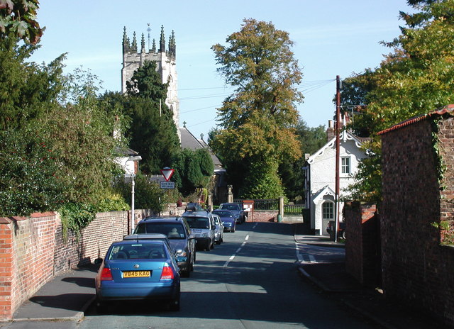
West Ella is known for its picturesque countryside and charming rural atmosphere. It is home to a close-knit community and offers a peaceful respite from the hustle and bustle of city life. The village is characterized by its traditional stone-built houses, many of which date back several centuries, giving it a timeless appeal.

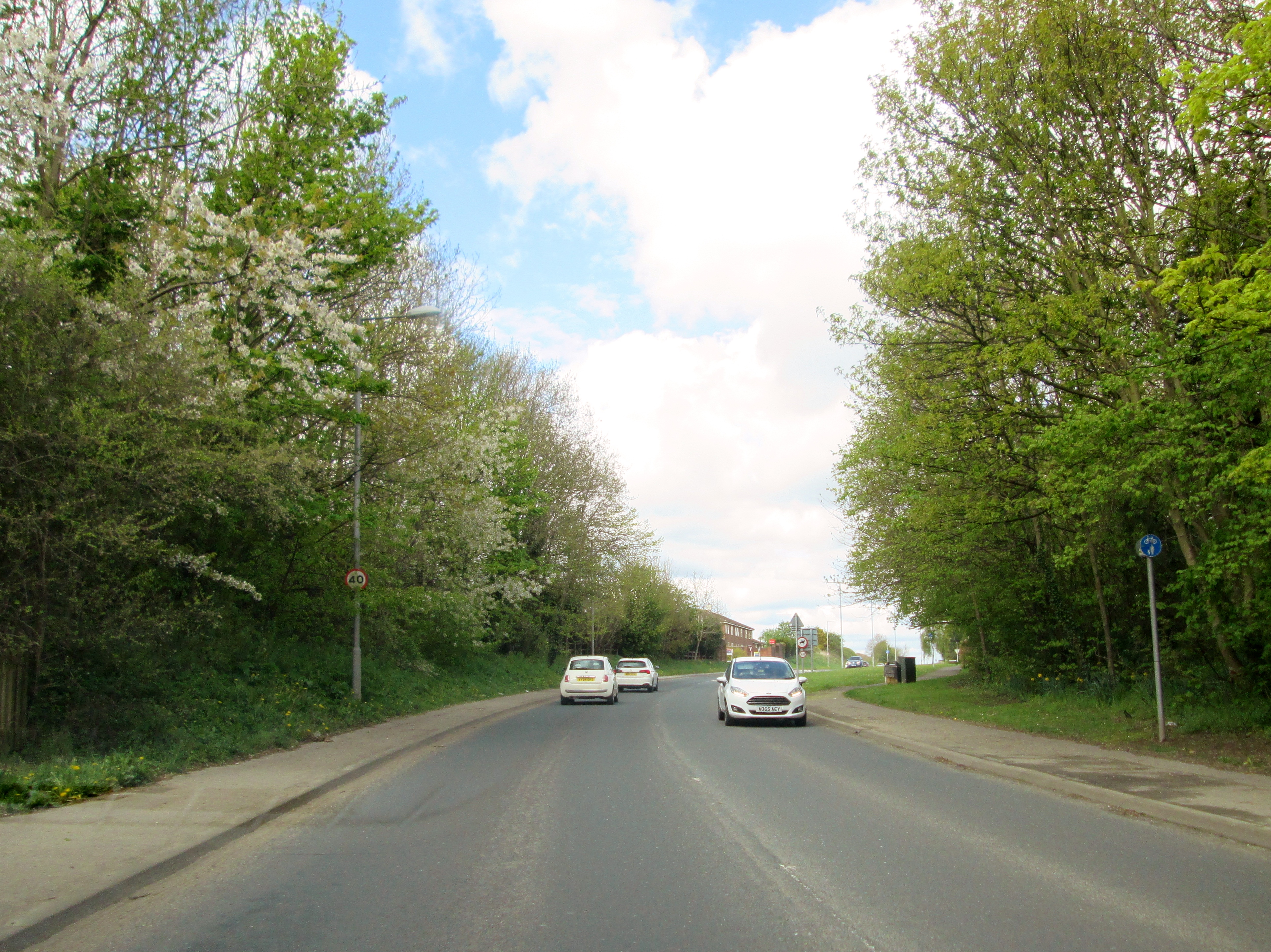
The village benefits from its proximity to the nearby cities of Hull and Beverley, which offer a range of amenities including shops, restaurants, and leisure facilities. In addition, the picturesque Yorkshire Wolds are easily accessible from West Ella, providing residents with opportunities for outdoor activities such as hiking and cycling.

West Ella is well-connected to other parts of Yorkshire and beyond, with good transport links including regular bus services and nearby railway stations. The village also benefits from a strong sense of community spirit, with various local events and activities organized throughout the year.

Overall, West Ella offers a peaceful and idyllic setting for those seeking a rural lifestyle while still being within easy reach of urban amenities. Its combination of natural beauty, historic charm, and community spirit make it a desirable place to live in the Yorkshire region.

If you have any feedback on the listing, please let us know in the comments section below.

West Ella Images

Images are sourced within 2km of 53.750424/-0.473562 or Grid Reference TA0029. Thanks to Geograph Open Source API. All images are credited.

Holiday park entrance, Raywell Entrance to the Raywell Hall Country Lodge Park <span class="nowrap"><a title="https://www.raywellhall.co.uk/" rel="nofollow ugc noopener" href="https://www.raywellhall.co.uk/">Link</a><img style="margin-left:2px;" alt="External link" title="External link - shift click to open in new window" src="https://s1.geograph.org.uk/img/external.png" width="10" height="10"/></span> on Westfield Road. This is a secondary access, to the southern portion of the site, which comprises 21 lodges called, collectively 'The Westwoods'. These opened in July 2021. 

The main entrance to the larger part of the park is on nearby Riplingham Road. The holiday park development began in 2007, initially with three lodges, expanding to its current 54.
Holiday park entrance, Raywell
Entrance to the Raywell Hall Country Lodge Park LinkExternal link on Westfield Road. This is a secondary access, to the southern portion of the site, which comprises 21 lodges called, collectively 'The Westwoods'. These opened in July 2021. The main entrance to the larger part of the park is on nearby Riplingham Road. The holiday park development began in 2007, initially with three lodges, expanding to its current 54.
Westfield Road, Raywell Looking across to the northern side of the road, over a large piece of rotten tree trunk, which presumably came from the adjacent dead tree: <a href="https://www.geograph.org.uk/photo/7108800">SE9930 : Dead tree at Raywell</a>
Westfield Road, Raywell
Looking across to the northern side of the road, over a large piece of rotten tree trunk, which presumably came from the adjacent dead tree: SE9930 : Dead tree at Raywell
Dead tree at Raywell The remains of a tree at the side of Westfield Road. I briefly thought that it might have been a victim of the consistent strong winds during February 2022, but nearby pieces of the stump looked to have been there for some time.
Dead tree at Raywell
The remains of a tree at the side of Westfield Road. I briefly thought that it might have been a victim of the consistent strong winds during February 2022, but nearby pieces of the stump looked to have been there for some time.
Snowdrops at Raywell On the verge on the southern side of Westfield Road, part of a large drift, which were probably, in early March, a bit past their prime.
Snowdrops at Raywell
On the verge on the southern side of Westfield Road, part of a large drift, which were probably, in early March, a bit past their prime.
Farm entrance, Raywell Driveway to Woodhouse Farm opening on to the north side of Westfield Road
Farm entrance, Raywell
Driveway to Woodhouse Farm opening on to the north side of Westfield Road
Estate agents in Swanland Beneath the stuck on half-timbering and the upvc windows is probably a decent nineteenth century house.
Estate agents in Swanland
Beneath the stuck on half-timbering and the upvc windows is probably a decent nineteenth century house.
Mere House, Swanland Dates from the 1840s and is one of Swanland's few listed buildings. <span class="nowrap"><a title="http://www.britishlistedbuildings.co.uk/en-164812-mere-cottage-and-attached-garden-wall-me" rel="nofollow ugc noopener" href="http://www.britishlistedbuildings.co.uk/en-164812-mere-cottage-and-attached-garden-wall-me">Link</a><img style="margin-left:2px;" alt="External link" title="External link - shift click to open in new window" src="https://s1.geograph.org.uk/img/external.png" width="10" height="10"/></span>
Mere House, Swanland
Dates from the 1840s and is one of Swanland's few listed buildings. LinkExternal link
Swanland in Bloom Looking across the mere towards Christchurch.
Swanland in Bloom
Looking across the mere towards Christchurch.
Swanland,  Village Hall and Mere The former school.
Swanland, Village Hall and Mere
The former school.
View towards Swanland Dale Taken from Dale Road.
View towards Swanland Dale
Taken from Dale Road.
West End, Swanland Looking west along the main street through the village on a snowy January morning
West End, Swanland
Looking west along the main street through the village on a snowy January morning
Swanland pond in winter Looking across the half-frozen pond towards Main Street/West End
Swanland pond in winter
Looking across the half-frozen pond towards Main Street/West End
Half-frozen Swanland pond The pond, seen from its south side towards Main Street and West End, with a covering of overnight snow on its thin ice surface.
Half-frozen Swanland pond
The pond, seen from its south side towards Main Street and West End, with a covering of overnight snow on its thin ice surface.
Swanland pond, looking east The view of the semi-frozen pond from its western edge. There were a few ducks  taking advantage of the unfrozen patch by the fountain, but no swans.
Swanland pond, looking east
The view of the semi-frozen pond from its western edge. There were a few ducks taking advantage of the unfrozen patch by the fountain, but no swans.
Swanland village pond, East Yorkshire Frequent winner of Britain in Bloom awards.
Swanland village pond, East Yorkshire
Frequent winner of Britain in Bloom awards.
Swan and Cygnet, Swanland, East Yorkshire A private house overlooking the pond until about 1980.
Swan and Cygnet, Swanland, East Yorkshire
A private house overlooking the pond until about 1980.
Swanland and the A63: aerial 2014 Plus a double line of houses on the North Ferriby Road.
Swanland and the A63: aerial 2014
Plus a double line of houses on the North Ferriby Road.
Field between Swanland and Swanland Dale Until quite recently this had been one massive field running from Dale Road to Occupation Lane, and from the crest of the hill at Swanland, where the Northfield housing development now stands, down to Swanland Lane. In more recent times this belt of trees has been planted and will provide a wind break in years to come. It also provides a path from Dale Road to Occupation Lane that doesn't, as yet, appear on the map.
Field between Swanland and Swanland Dale
Until quite recently this had been one massive field running from Dale Road to Occupation Lane, and from the crest of the hill at Swanland, where the Northfield housing development now stands, down to Swanland Lane. In more recent times this belt of trees has been planted and will provide a wind break in years to come. It also provides a path from Dale Road to Occupation Lane that doesn't, as yet, appear on the map.
Show me another place!

West Ella is located at Grid Ref: TA0029 (Lat: 53.750424, Lng: -0.473562)

Division: East Riding

Unitary Authority: East Riding of Yorkshire

Police Authority: Humberside

What 3 Words

///cuddled.merit.pulp. Near Kirk Ella, East Yorkshire

Related Wikis

West Ella

West Ella is a small village in the civil parish of Kirk Ella west of Kirk Ella settlement, within the East Riding of Yorkshire, England, on the eastern...

Kirk Ella

Kirk Ella is a village and civil parish on the western outskirts of Kingston upon Hull, approximately five miles (eight kilometres) west of the city centre...

Sculcoates Rural District

Sculcoates was a rural district in the East Riding of Yorkshire, England from 1894 to 1935.The district formed three separate areas around Kingston upon...

Swanland

Swanland is a village and civil parish in the East Riding of Yorkshire in England. The village is about seven miles (11 km) to the west of Kingston upon...

Hull Reform Synagogue

Hull Reform Synagogue, also known as Ne've Shalom, is a Reform Jewish community based in Willerby near Kingston upon Hull in the East Riding of Yorkshire...

Wolfreton School

Wolfreton School & Sixth Form College is a coeducational secondary school and sixth form located in Willerby, East Riding of Yorkshire, England. During...

Willerby and Kirk Ella railway station

Willerby and Kirk Ella railway station was a station on the Hull and Barnsley Railway, and served the villages of Willerby and Kirk Ella in the East Riding...

Tranby School

Tranby School, commonly known in the area as the 'Collegiate' or 'Tranby Croft', is a co-educational private day school in Anlaby, near Hull, in the East...

Nearby Amenities

Located within 500m of 53.750424,-0.473562
West Ella
Is In: East Riding of Yorkshire, England, UK
Is In County: East Riding of Yorkshire
Place: village
Wikidata: Q7985025
Lat/Long: 53.7495001/-0.4737446
Bus Stop
Kirk Ella West Ella Road
Naptan AtcoCode: 2200YEA00637
Naptan Bearing: SE
Naptan CommonName: Kirk Ella West Ella Road
Naptan PlusbusZoneRef: HULL
Naptan Street: West Ella Road
Note: moved to N side of road; bearing should be E
Shelter: no
Source: naptan + survey
Lat/Long: 53.7507836/-0.4671165
Bus Stop
Kirk Ella West Ella Road
Naptan AtcoCode: 2200YEA00638
Naptan Bearing: SW
Naptan CommonName: Kirk Ella West Ella Road
Naptan PlusbusZoneRef: HULL
Naptan Street: West Ella Road
Shelter: no
Source: naptan + survey
Lat/Long: 53.7498461/-0.4694486
Bus Stop
West Ella Manor Court
Naptan AtcoCode: 2200YEA00639
Naptan Bearing: W
Naptan CommonName: West Ella Manor Court
Naptan Landmark: West Ella Hall
Naptan PlusbusZoneRef: HULL
Naptan Street: West Ella Road
Shelter: no
Source: naptan + survey
Lat/Long: 53.7495326/-0.4709463
Bus Stop
West Ella Road Chapel
Naptan AtcoCode: 2200YEA00640
Naptan Bearing: E
Naptan CommonName: West Ella Road Chapel
Naptan PlusbusZoneRef: HULL
Naptan Street: West Ella Road
Note: no code on sign
Shelter: no
Source: naptan + survey
Lat/Long: 53.7496225/-0.470943
Bus Stop
Swanland Rise
Naptan AtcoCode: 2200YEA00834
Naptan Bearing: NE
Naptan CommonName: Swanland Rise
Naptan Landmark: War Memorial
Naptan Street: West Ella Road
Note: no code on sign
Shelter: no
Source: naptan + survey
Lat/Long: 53.7485686/-0.4757131
Bus Stop
Swanland Rise
Naptan AtcoCode: 2200YEA00835
Naptan Bearing: SW
Naptan CommonName: Swanland Rise
Naptan Landmark: War Memorial
Naptan Street: West Ella Road
Note: no sign, sign opp says use both sides
Shelter: no
Source: naptan + survey
Lat/Long: 53.748469/-0.475656
Power: tower
Lat/Long: 53.749771/-0.4781241
Power: tower
Lat/Long: 53.7527034/-0.4794491
Historic: memorial
Memorial: blue_plaque
Memorial Plaque Colour: blue
Openplaques Id: 8511
Lat/Long: 53.7492905/-0.4719388
The data included in this document is from www.openstreetmap.org. The data is made available under ODbL.

Have you been to West Ella?

Leave your review of West Ella below (or comments, questions and feedback).