West Drayton

Settlement in Nottinghamshire Bassetlaw

England

West Drayton

Milton Mausoleum. Alongside the lane to West Markham.
Milton Mausoleum. Credit: steven ruffles

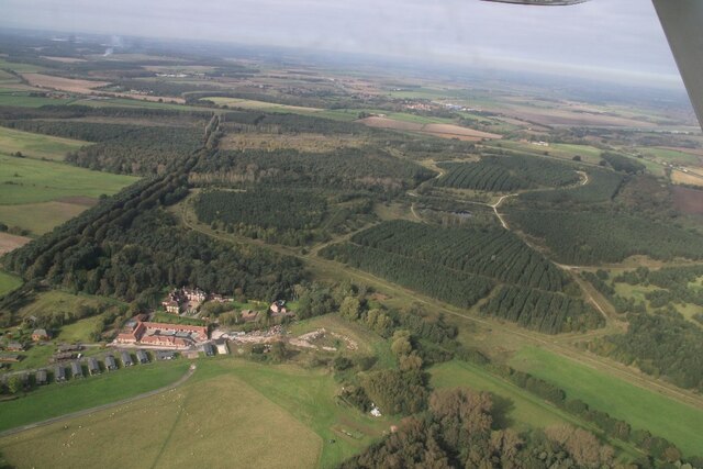
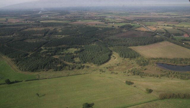
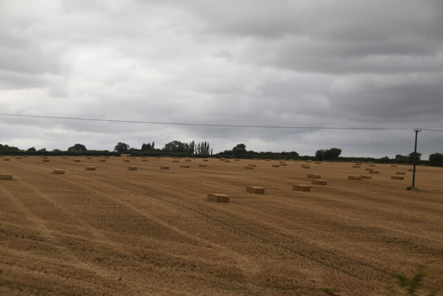
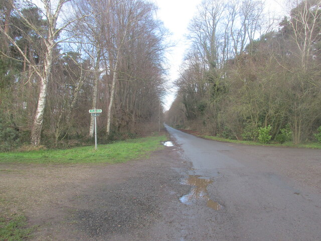
West Drayton is a small village located in the county of Nottinghamshire, England. Situated about 8 miles west of Nottingham city center, it falls within the Rushcliffe borough. The village is nestled in a picturesque rural setting, surrounded by beautiful countryside and farmland.

With a population of just over 1,000 residents, West Drayton maintains a tight-knit community atmosphere. The village features a range of housing, including charming cottages and modern developments. It offers a peaceful and tranquil environment, making it an attractive place to live for those seeking a quieter rural lifestyle.

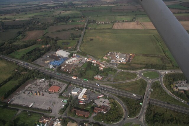
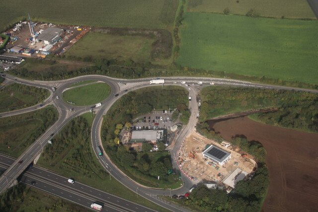
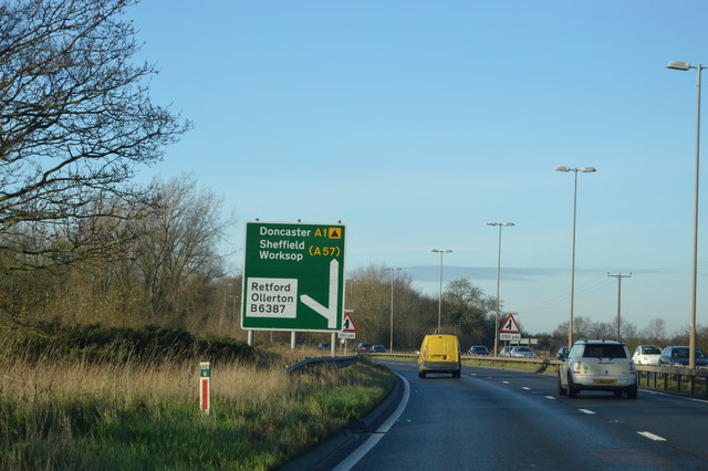
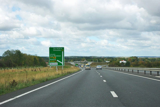
West Drayton is well-connected to neighboring areas by road and public transport. The A52 road passes through the village, providing easy access to Nottingham and nearby towns such as Derby and Grantham. There are regular bus services that connect West Drayton to Nottingham city center and other surrounding areas.

The village benefits from a few local amenities, including a primary school, a village hall, and a post office. The nearby town of Gamston, just a short drive away, provides additional amenities such as supermarkets and healthcare facilities.

For outdoor enthusiasts, West Drayton offers plenty of opportunities to explore the surrounding countryside. There are numerous footpaths and bridleways that meander through the countryside, allowing residents to enjoy walks and bike rides in the peaceful rural setting.

Overall, West Drayton offers a charming village lifestyle, with its idyllic setting, strong community spirit, and convenient location.

If you have any feedback on the listing, please let us know in the comments section below.

West Drayton Images

Images are sourced within 2km of 53.26416/-0.93909069 or Grid Reference SK7074. Thanks to Geograph Open Source API. All images are credited.

Milton Mausoleum. Alongside the lane to West Markham.
Milton Mausoleum.
Alongside the lane to West Markham.
The River Maun. The River runs alongside the village of Milton.
The River Maun.
The River runs alongside the village of Milton.
The River Maun near Lound Hall A peaceful spot.
The River Maun near Lound Hall
A peaceful spot.
A  wet  day  at  Markham  Moor  Services Exiting Starbucks onto the service road to the roundabout. The A1 beyond. The roof of Starbucks is of a Hyperbolic Paraboloid design, if you want to be even more confused look that up!!
A wet day at Markham Moor Services
Exiting Starbucks onto the service road to the roundabout. The A1 beyond. The roof of Starbucks is of a Hyperbolic Paraboloid design, if you want to be even more confused look that up!!
Lound Hall and Bevercotes Pit Wood: aerial 2023 See: <span class="nowrap"><a title="https://en.wikipedia.org/wiki/Lound_Hall" rel="nofollow ugc noopener" href="https://en.wikipedia.org/wiki/Lound_Hall">Link</a><img style="margin-left:2px;" alt="External link" title="External link - shift click to open in new window" src="https://s1.geograph.org.uk/img/external.png" width="10" height="10"/></span>
Lound Hall and Bevercotes Pit Wood: aerial 2023
See: LinkExternal link
 Bevercotes Pit Wood: aerial 2023
Bevercotes Pit Wood: aerial 2023
Markham Moor interchange, services and industry: aerial 2023 (1)
Markham Moor interchange, services and industry: aerial 2023 (2)
Bales in field
Bales in field
Path junction near Lound Hall We went left.
Path junction near Lound Hall
We went left.
National Mining Museum, Lound Hall - pumping engine This was the National Mining Museum in 1985 but it is now at Caphouse Colliery and this particular exhibit has been re-erected in the open there in 2022. This is a horizontal single cylinder Corliss valve engine by Fraser & Chalmers of Erith that drove pumps by ropes from a pulley alongside the flywheel. It was in steamable condition but I never saw it run here and I doubt that many people did. I have a feeling this building was not quite finished and we sneaked in past a barrier.
National Mining Museum, Lound Hall - pumping engine
This was the National Mining Museum in 1985 but it is now at Caphouse Colliery and this particular exhibit has been re-erected in the open there in 2022. This is a horizontal single cylinder Corliss valve engine by Fraser & Chalmers of Erith that drove pumps by ropes from a pulley alongside the flywheel. It was in steamable condition but I never saw it run here and I doubt that many people did. I have a feeling this building was not quite finished and we sneaked in past a barrier.
National Mining Museum, Lound Hall - pumping engine This was the National Coal Board's National Mining Museum before it was relocated to Chatterley Whitfield and then to Caphouse Colliery. This particular exhibit was re-erected in the open at Caphouse in 2022 after many years in storage. It is a horizontal single cylinder Corliss Valve engine that drove pumps at Ellistown Colliery.  It was built by Fraser & Chalmers at Erith. This view shows the Corliss valve drive and trip gear. Quite surprisingly it is only a single eccentric gear. This is unusual in later UK designs because the degree of cut-off is limited by the need to retain appropriate exhaust events. It was more usual to have separate steam and exhaust eccentrics. The cylinder is 13" x 3' and the flywheel 12' diameter.
National Mining Museum, Lound Hall - pumping engine
This was the National Coal Board's National Mining Museum before it was relocated to Chatterley Whitfield and then to Caphouse Colliery. This particular exhibit was re-erected in the open at Caphouse in 2022 after many years in storage. It is a horizontal single cylinder Corliss Valve engine that drove pumps at Ellistown Colliery. It was built by Fraser & Chalmers at Erith. This view shows the Corliss valve drive and trip gear. Quite surprisingly it is only a single eccentric gear. This is unusual in later UK designs because the degree of cut-off is limited by the need to retain appropriate exhaust events. It was more usual to have separate steam and exhaust eccentrics. The cylinder is 13" x 3' and the flywheel 12' diameter.
National Mining Museum, Lound Hall - pumping engine This was the National Coal Board's National Mining Museum before it was relocated to Chatterley Whitfield and then to Caphouse Colliery. This particular exhibit was re-erected in the open at Caphouse in 2022 after many years in storage. It is a horizontal single cylinder Corliss Valve engine that drove pumps at Ellistown Colliery. It was built by Fraser & Chalmers at Erith. This view shows the Corliss valve drive and trip gear. Quite surprisingly it is only a single eccentric gear. This is unusual in later UK designs because the degree of cut-off is limited by the need to retain appropriate exhaust events. It was more usual to have separate steam and exhaust eccentrics. The cylinder is 13" x 3' and the flywheel 12' diameter.
National Mining Museum, Lound Hall - pumping engine
This was the National Coal Board's National Mining Museum before it was relocated to Chatterley Whitfield and then to Caphouse Colliery. This particular exhibit was re-erected in the open at Caphouse in 2022 after many years in storage. It is a horizontal single cylinder Corliss Valve engine that drove pumps at Ellistown Colliery. It was built by Fraser & Chalmers at Erith. This view shows the Corliss valve drive and trip gear. Quite surprisingly it is only a single eccentric gear. This is unusual in later UK designs because the degree of cut-off is limited by the need to retain appropriate exhaust events. It was more usual to have separate steam and exhaust eccentrics. The cylinder is 13" x 3' and the flywheel 12' diameter.
National Mining Museum, Lound Hall - winding engine house A lot of resource was sunk into this museum by the National Coal Board, including this newly built building housing a steam winding engine from Donisthorpe Colliery. I believe this has now been scrapped although the building survives. The wooden tandem headgear from Brinsley Colliery has now been re-erected at Brinsley. A great loss.
National Mining Museum, Lound Hall - winding engine house
A lot of resource was sunk into this museum by the National Coal Board, including this newly built building housing a steam winding engine from Donisthorpe Colliery. I believe this has now been scrapped although the building survives. The wooden tandem headgear from Brinsley Colliery has now been re-erected at Brinsley. A great loss.
National Mining Museum, Lound Hall - steam winch This museum has long since closed and the kit either scrapped or moved to Caphouse Colliery, which is now the National Mining Museum for England. The big drum to the left was on the Donisthorpe steam winding engine that was being re-erected and has now, I believe, been scrapped. The big timbers are the Brinsley Colliery tandem headgear that has now been re-erected at Brinsley. The diagonal duplex, geared steam winch was, I believe, from Shirebrook Colliery and is probably now at Caphouse.
National Mining Museum, Lound Hall - steam winch
This museum has long since closed and the kit either scrapped or moved to Caphouse Colliery, which is now the National Mining Museum for England. The big drum to the left was on the Donisthorpe steam winding engine that was being re-erected and has now, I believe, been scrapped. The big timbers are the Brinsley Colliery tandem headgear that has now been re-erected at Brinsley. The diagonal duplex, geared steam winch was, I believe, from Shirebrook Colliery and is probably now at Caphouse.
National Mining Museum, Lound Hall - sorry remains The components on the flat bed wagon were from the Fraser & Chalmers horizontal duplex winding engine that was at Sherwood Colliery. This had a very rare example of Seymour's valve gear and that was probably why one cylinder and part of the crankshaft with the crank and eccentrics had been saved. I suspect they were scrapped long ago when the museum closed.
National Mining Museum, Lound Hall - sorry remains
The components on the flat bed wagon were from the Fraser & Chalmers horizontal duplex winding engine that was at Sherwood Colliery. This had a very rare example of Seymour's valve gear and that was probably why one cylinder and part of the crankshaft with the crank and eccentrics had been saved. I suspect they were scrapped long ago when the museum closed.
A1, northbound The A1 is the longest numbered road in the UK at 410 miles long. It connects London with Edinburgh, via the east of England. 
For much of its path it follows the Great North Road the old coaching route between London and Edinburgh. Several sections of the route are classified as motorway A1(M). The modern A1 bypasses the towns the Great North Road passed through and is dual carriageway for most of its route through England.
A1, northbound
The A1 is the longest numbered road in the UK at 410 miles long. It connects London with Edinburgh, via the east of England. For much of its path it follows the Great North Road the old coaching route between London and Edinburgh. Several sections of the route are classified as motorway A1(M). The modern A1 bypasses the towns the Great North Road passed through and is dual carriageway for most of its route through England.
A1 nearing junction at Markham Moor Formerly a roundabout, now a grade separated junction.
A1 nearing junction at Markham Moor
Formerly a roundabout, now a grade separated junction.
Show me another place!

West Drayton is located at Grid Ref: SK7074 (Lat: 53.26416, Lng: -0.93909069)

Administrative County: Nottinghamshire

District: Bassetlaw

Police Authority: Nottinghamshire

What 3 Words

///solder.simmer.design. Near East Markham, Nottinghamshire

Related Wikis

West Drayton, Nottinghamshire

West Drayton is a village and civil parish in the Bassetlaw district in the county of Nottinghamshire, England. It lies 24 miles (39 km) north east of...

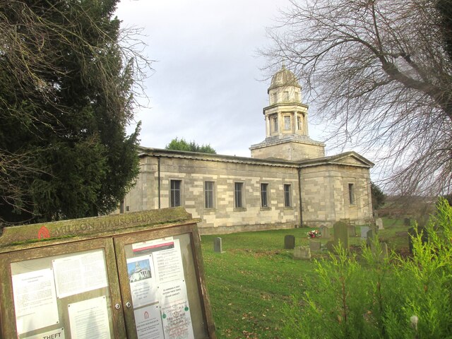
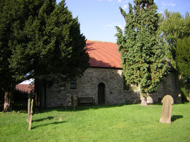
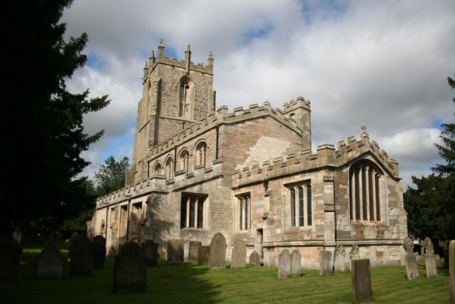
St Paul's Church, West Drayton

St Paul's Church is a Grade II* listed parish church in the Church of England in West Drayton, Nottinghamshire. == History == The church dates from the...
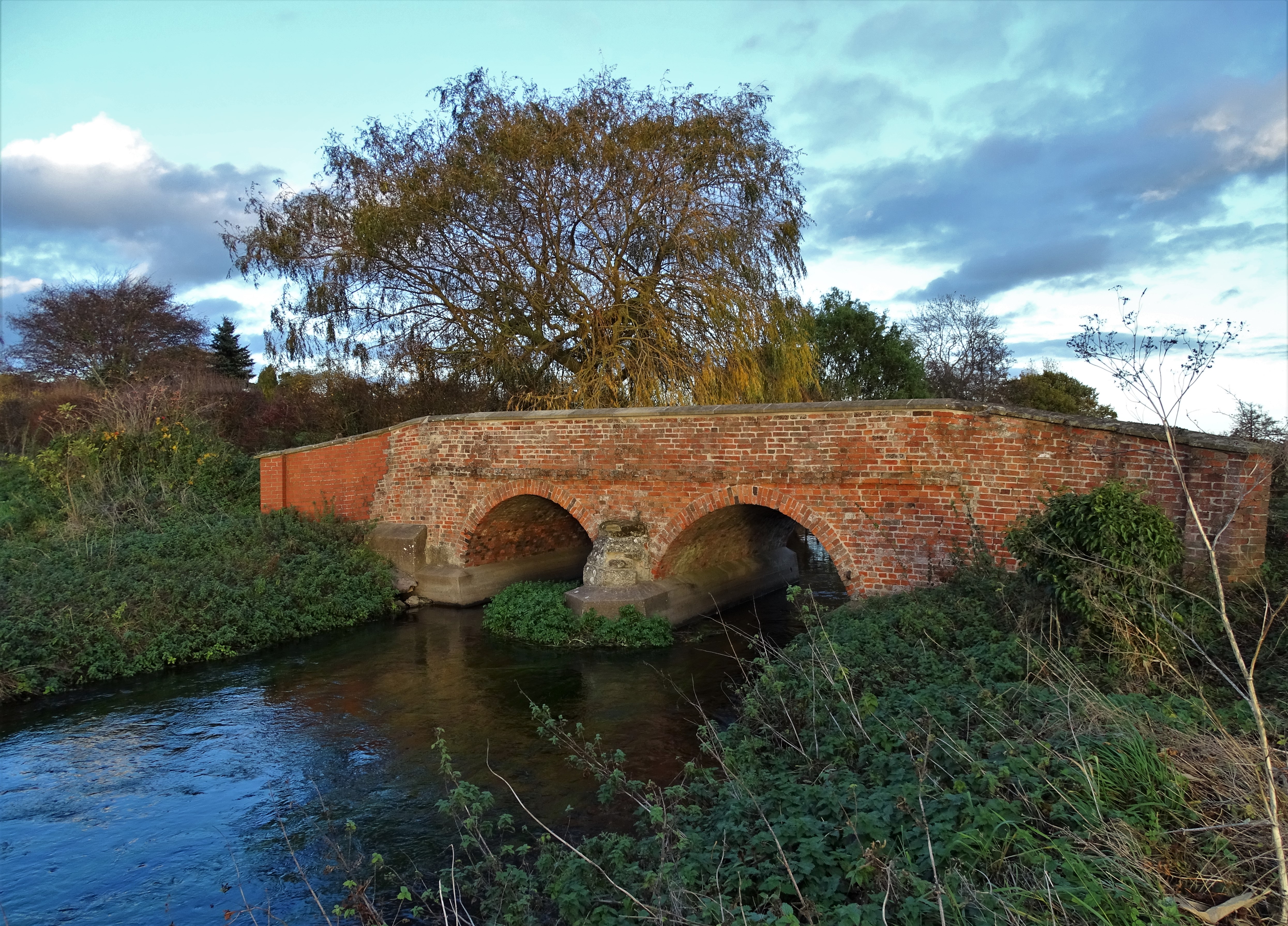
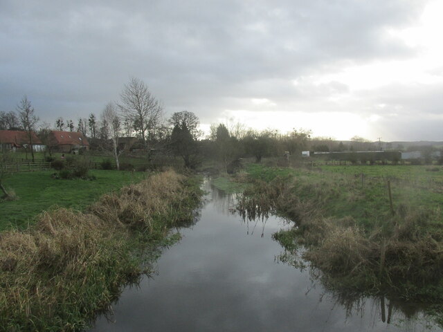
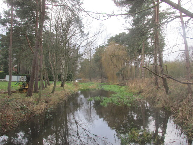
River Meden

The River Meden is a river in Nottinghamshire, England. Its source lies just north of Huthwaite, near the Derbyshire border, and from there it flows...

St Peter's Church, Gamston

St Peter's Church, Gamston is a Grade I listed parish church in the Church of England in Gamston, Bassetlaw. == History == The church dates from the 13th...

Nearby Amenities

Located within 500m of 53.26416,-0.93909069
West Drayton
Place: village
Lat/Long: 53.2638908/-0.9387169
Bus Stop
Lawson Close
Bus: yes
Naptan AtcoCode: 3300BA0250
Naptan Bearing: SE
Naptan CommonName: Lawson Close
Naptan Crossing: Lawson Close
Naptan Indicator: SE-bound
Naptan NaptanCode: ntsdptaw
Naptan Notes: none
Naptan Street: Old London Road
Naptan Verified: yes
Public Transport: platform
Source: naptan_import
Lat/Long: 53.2623332/-0.9374515
Parking
Access: yes
Fee: no
Parking: layby
Lat/Long: 53.2645166/-0.9449957
Parking
Access: yes
Ele: 13.0000000
Fee: no
Parking: layby
Lat/Long: 53.2651568/-0.9453492
Phone
Check Date: 2023-12-22
Emergency: phone
Ref: 1260 B
Lat/Long: 53.2647475/-0.9448024
Phone
Check Date: 2021-06-04
Emergency: phone
Ref: 1260 A
Lat/Long: 53.2647451/-0.9453759
Material: wood
Power: pole
Lat/Long: 53.2598422/-0.9372362
Power: pole
Lat/Long: 53.2604349/-0.938512
Material: wood
Power: pole
Lat/Long: 53.2611203/-0.9399809
Material: wood
Power: pole
Lat/Long: 53.2618334/-0.9411495
Material: wood
Power: pole
Lat/Long: 53.262588/-0.9425037
Power: pole
Lat/Long: 53.2632439/-0.9452723
Power: pole
Lat/Long: 53.2633335/-0.9452966
Power: pole
Lat/Long: 53.2633521/-0.9437554
Power: pole
Lat/Long: 53.2635674/-0.9438308
Power: pole
Lat/Long: 53.2641453/-0.9438672
Power: pole
Lat/Long: 53.2648655/-0.9439272
Power: pole
Lat/Long: 53.2658219/-0.9439964
Power: pole
Lat/Long: 53.2663332/-0.9440251
Power: pole
Lat/Long: 53.2671479/-0.9441135
Power: pole
Lat/Long: 53.2672371/-0.9401814
Power: pole
Lat/Long: 53.2672695/-0.9378412
Power: pole
Lat/Long: 53.2673302/-0.9354336
Barrier: block
Lat/Long: 53.2621031/-0.9376164
Post Box
Lat/Long: 53.2633919/-0.9386353
Direction: 170
Fixme: module count estimate
Generator Method: photovoltaic
Generator Output Electricity: yes
Generator Solar Modules: 16
Generator Source: solar
Generator Type: solar_photovoltaic_panel
Location: roof
Power: generator
Lat/Long: 53.2653754/-0.9357578
The data included in this document is from www.openstreetmap.org. The data is made available under ODbL.

Have you been to West Drayton?

Leave your review of West Drayton below (or comments, questions and feedback).