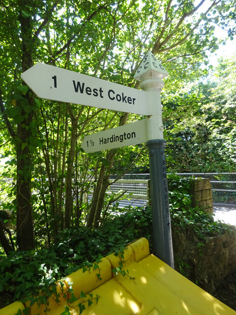
West Coker

Settlement in Somerset South Somerset

England

West Coker

Dawe's Twineworks West Coker Rescued from near collapse by grant money, the twineworks, established in the mid 19th C, is the only one in Britain with its original Victorian machinery. Not to be confused with the West of England Twine Works which was also situated  in West Coker. 

Open on the 4th Saturday of the month.
Dawe's Twineworks West Coker Credit: Sarah Smith

West Coker is a picturesque village located in the county of Somerset, England. Situated approximately 3 miles southwest of Yeovil, it is nestled in the rolling countryside of the South Somerset district. With a population of around 1,400 people, the village offers a tranquil and close-knit community atmosphere.

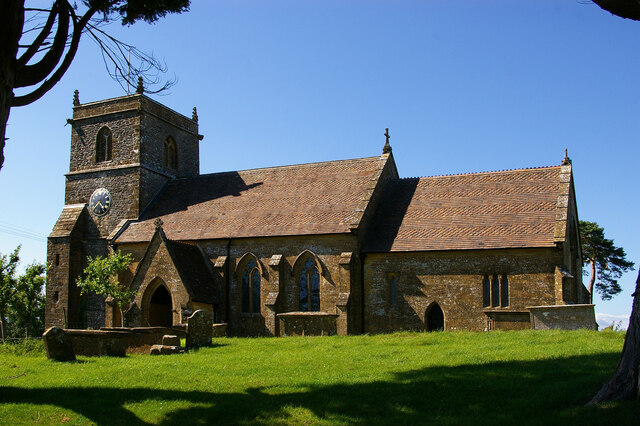
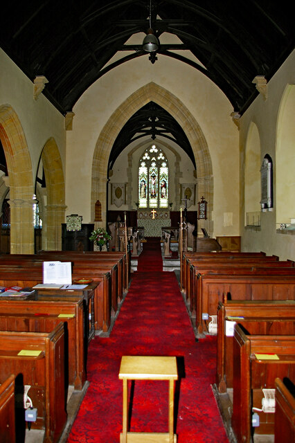
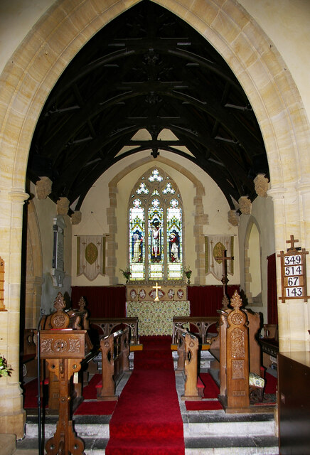
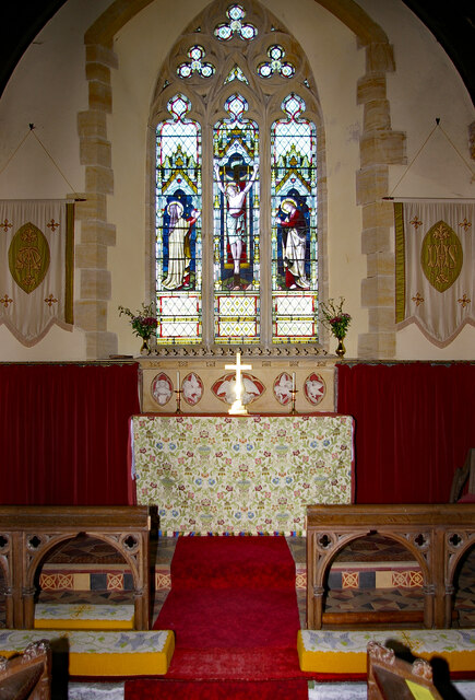
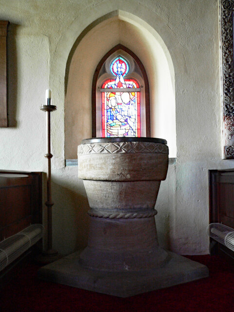
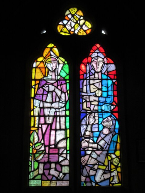
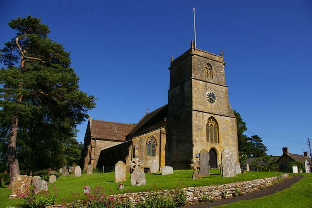
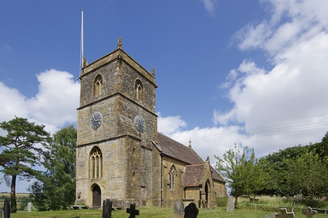
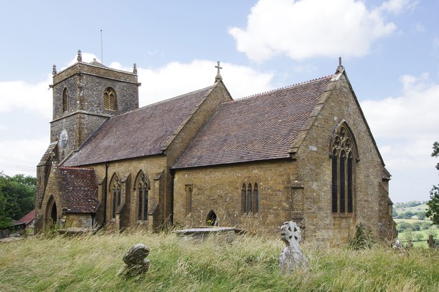
The village has a rich history dating back to the Norman era, with evidence of settlements in the area as early as the 10th century. West Coker is known for its charming thatched cottages, traditional architecture, and well-preserved historic buildings. The Grade I listed St. Martin's Church, built in the 15th century, stands as a testament to the village's heritage.

West Coker offers a range of amenities to its residents and visitors. The village boasts a primary school, a post office, a village hall, and a pub, creating a sense of community and convenience. The local economy is mainly centered around agriculture, with many residents involved in farming and other rural industries.

The village is surrounded by beautiful countryside, making it an ideal location for outdoor enthusiasts. There are numerous walking and cycling trails that provide opportunities to explore the scenic landscape. The nearby Coker Marsh Nature Reserve is a haven for wildlife and offers peaceful walks along the River Parrett.

Overall, West Coker is a quintessential English village that combines historical charm with a strong sense of community. With its idyllic setting and range of amenities, it provides a delightful place to live or visit for those seeking a tranquil rural experience in Somerset.

If you have any feedback on the listing, please let us know in the comments section below.
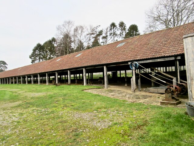
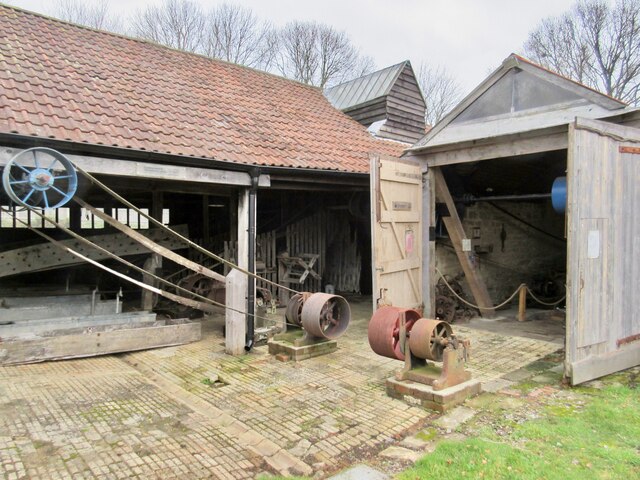
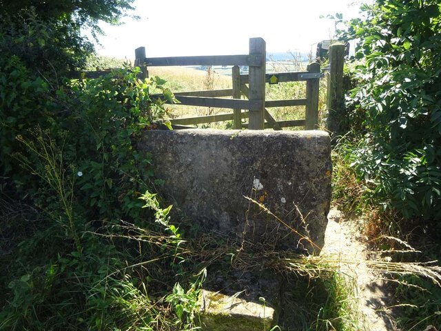
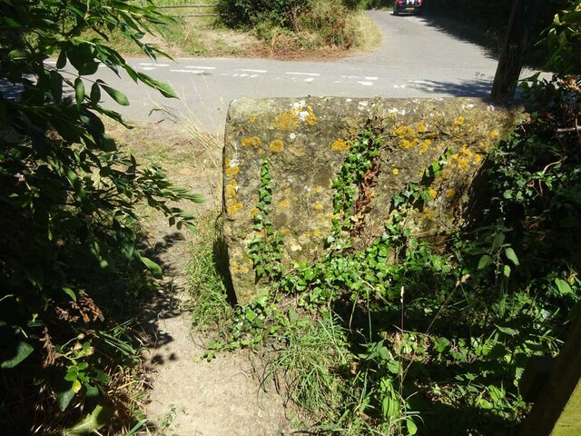
West Coker Images

Images are sourced within 2km of 50.919215/-2.6869153 or Grid Reference ST5113. Thanks to Geograph Open Source API. All images are credited.

Dawe's Twineworks West Coker Rescued from near collapse by grant money, the twineworks, established in the mid 19th C, is the only one in Britain with its original Victorian machinery. Not to be confused with the West of England Twine Works which was also situated  in West Coker. 

Open on the 4th Saturday of the month.
Dawe's Twineworks West Coker
Rescued from near collapse by grant money, the twineworks, established in the mid 19th C, is the only one in Britain with its original Victorian machinery. Not to be confused with the West of England Twine Works which was also situated in West Coker. Open on the 4th Saturday of the month.
Dawe's Twineworks West Coker (2)
Stone Stile, West Coker On Somerset footpath Y 29/13 at the junction of Ridge and Chur Lanes, looking South. The view looking towards the road is <a href="https://www.geograph.org.uk/photo/7250710">ST5113 : Stone Stile, West Coker</a>.
Stone Stile, West Coker
On Somerset footpath Y 29/13 at the junction of Ridge and Chur Lanes, looking South. The view looking towards the road is ST5113 : Stone Stile, West Coker.
Stone Stile, West Coker On Somerset footpath Y 29/13 at the junction of Ridge and Chur Lanes, looking North. The view looking from the road is <a href="https://www.geograph.org.uk/photo/7250709">ST5113 : Stone Stile, West Coker</a>.
Stone Stile, West Coker
On Somerset footpath Y 29/13 at the junction of Ridge and Chur Lanes, looking North. The view looking from the road is ST5113 : Stone Stile, West Coker.
Old Fingerpost, West Coker Hill / A30 At the junction of Collarway Lane, West Coker Hill and the A30 slip road and the bridge over the A30. An image of the makers' Inscription is <a href="https://www.geograph.org.uk/photo/7259440">ST5013 : Old Fingerpost, West Coker Hill / above A30</a>.
The context view is <a href="https://www.geograph.org.uk/photo/1180072">ST5013 : Near Coker Hill Bridge</a>.

Inscription: 1 West Coker // 1 Hardington // 
(on post) Somerset // Sheldon Wells

Milestone Society National ID: SO_ST5013A
Old Fingerpost, West Coker Hill / A30
At the junction of Collarway Lane, West Coker Hill and the A30 slip road and the bridge over the A30. An image of the makers' Inscription is ST5013 : Old Fingerpost, West Coker Hill / above A30. The context view is ST5013 : Near Coker Hill Bridge. Inscription: 1 West Coker // 1 Hardington // (on post) Somerset // Sheldon Wells Milestone Society National ID: SO_ST5013A
Old Milestone, West Coker / A30 On the NW side of the A30 in a cutting. Near the bridge carrying the West Coker Hill / Collarway Lane road. It is difficult to get to on foot, the verges are slight and the cutting long, under the bridge non-existent verges. This image was taken from a slow moving vehicle. 

Inscription: IV / Yeovil

Grade II listed see <span class="nowrap"><a title="https://historicengland.org.uk/listing/the-list/list-entry/1417785" rel="nofollow ugc noopener" href="https://historicengland.org.uk/listing/the-list/list-entry/1417785">Link</a><img style="margin-left:2px;" alt="External link" title="External link - shift click to open in new window" src="https://s1.geograph.org.uk/img/external.png" width="10" height="10"/></span>

Milestone Society National ID: SO_YVCW04
Old Milestone, West Coker / A30
On the NW side of the A30 in a cutting. Near the bridge carrying the West Coker Hill / Collarway Lane road. It is difficult to get to on foot, the verges are slight and the cutting long, under the bridge non-existent verges. This image was taken from a slow moving vehicle. Inscription: IV / Yeovil Grade II listed see LinkExternal link Milestone Society National ID: SO_YVCW04
Old Boundary Stone, West Coker / East Chinnock A curious broken stone. This was lying exactly at the position of a boundary stone (on maps up to 1962). The inscription could be interpreted signifying a "county" stone, marking the extent of responsibility for the bridge if it was C / YHD (Yeovil Hundred Division).

Inscription: C / YHI

Milestone Society National ID: SO_WCOECH01pb
Old Boundary Stone, West Coker / East Chinnock
A curious broken stone. This was lying exactly at the position of a boundary stone (on maps up to 1962). The inscription could be interpreted signifying a "county" stone, marking the extent of responsibility for the bridge if it was C / YHD (Yeovil Hundred Division). Inscription: C / YHI Milestone Society National ID: SO_WCOECH01pb
Old Fingerpost, West Coker Hill / above A30 At the junction of Collarway Lane, West Coker Hill and the A30 slip road and the bridge over the A30. The view of the fingers is <a href="https://www.geograph.org.uk/photo/7253471">ST5013 : Old Fingerpost, West Coker Hill / A30</a>.
Old Fingerpost, West Coker Hill / above A30
At the junction of Collarway Lane, West Coker Hill and the A30 slip road and the bridge over the A30. The view of the fingers is ST5013 : Old Fingerpost, West Coker Hill / A30.
The Blessed Virgin Mary, Hardington Mandeville, Somerset
The Blessed Virgin Mary, Hardington Mandeville, Somerset The Chancel.
The Blessed Virgin Mary, Hardington Mandeville, Somerset
The Chancel.
The Blessed Virgin Mary, Hardington Mandeville, Somerset The Apse.
The Blessed Virgin Mary, Hardington Mandeville, Somerset
The Apse.
The Blessed Virgin Mary, Hardington Mandeville, Somerset Circa 1123 Font.
The Blessed Virgin Mary, Hardington Mandeville, Somerset
Circa 1123 Font.
Modern church window - West Coker The window was designed and created by Stewart Bowman (1936-2019) of Buckinghamshire and installed in 2001. 

It depicts St Christina of Markyate (1096-1115).  She was born in Huntingdonshire and after a colourful life became an anchoress experiencing many visions and eventually founded the Priory at Markyate in Hertfordshire where Cell House is situated today.  She was also a skilled embroiderer and made several mitres for Pope Adrian IV.

The other is St Martin of Tours, the patron of this church.  Born in about  AD 336, he had become a Roman soldier who shared his halved cloak with a freezing beggar, which led the way to his becoming a Christian.  He performed miracles and in AD 371 became the Bishop of Tours founding a monastery at Marmoutier in France.  He became the patron saint of the Third Republic.
Modern church window - West Coker
The window was designed and created by Stewart Bowman (1936-2019) of Buckinghamshire and installed in 2001. It depicts St Christina of Markyate (1096-1115). She was born in Huntingdonshire and after a colourful life became an anchoress experiencing many visions and eventually founded the Priory at Markyate in Hertfordshire where Cell House is situated today. She was also a skilled embroiderer and made several mitres for Pope Adrian IV. The other is St Martin of Tours, the patron of this church. Born in about AD 336, he had become a Roman soldier who shared his halved cloak with a freezing beggar, which led the way to his becoming a Christian. He performed miracles and in AD 371 became the Bishop of Tours founding a monastery at Marmoutier in France. He became the patron saint of the Third Republic.
St Mary the Virgin, Hardington Mandeville, Somerset A pre-Norman church foundation, rebuilt c1123, with much restoration and alteration works in the 15th and 19th-centuries.
St Mary the Virgin, Hardington Mandeville, Somerset
A pre-Norman church foundation, rebuilt c1123, with much restoration and alteration works in the 15th and 19th-centuries.
Show me another place!

West Coker is located at Grid Ref: ST5113 (Lat: 50.919215, Lng: -2.6869153)

Administrative County: Somerset

District: South Somerset

Police Authority: Avon and Somerset

What 3 Words

///rags.effort.ruffling. Near West Coker, Somerset

Related Wikis

St Martin of Tours' Church, West Coker

St Martin of Tours' Church, West Coker is a Grade II* listed parish church in the Church of England in West Coker, Somerset. == History == The church dates...

Manor House, West Coker

The Manor House in West Coker, Somerset, England has medieval origins, however the earliest surviving portions of the current building probably date from...

West Coker

West Coker is a large village and civil parish in Somerset, England, situated 3 miles (4.8 km) south west of Yeovil in the South Somerset district. �...

Hardington Moor

Hardington Moor (grid reference ST515130) is an 8.7 hectare biological Site of Special Scientific Interest between Hardington Mandeville and West Coker...

Nearby Amenities

Located within 500m of 50.919215,-2.6869153
Post Box
Brand: Royal Mail
Brand Wikidata: Q638098
Collection Times: Mo-Fr 16:45; Sa 12:00
Operator: Royal Mail
Operator Wikidata: Q638098
Post Box Mounting: pier
Post Box Type: lamp
Ref: BA22 156
Lat/Long: 50.9190813/-2.6869534
Lanes Hotel
Tourism: hotel
Lat/Long: 50.9197542/-2.6875531
West Coker
Is In: Somerset, England, UK
Place: village
Wikidata: Q1825283
Wikipedia: en:West Coker
Lat/Long: 50.9191245/-2.6869718
Power: pole
Source: bing
Lat/Long: 50.9217945/-2.683129
Poles: bipole
Power: pole
Source: bing
Transformer: distribution
Lat/Long: 50.9213574/-2.6849583
Power: pole
Source: bing
Lat/Long: 50.9214555/-2.6864228
Power: pole
Source: bing
Transformer: distribution
Lat/Long: 50.9221986/-2.6904434
Power: pole
Source: bing
Lat/Long: 50.9217556/-2.6900424
Power: pole
Source: bing
Lat/Long: 50.9215738/-2.6877974
Power: pole
Source: bing
Lat/Long: 50.9216897/-2.6893437
Power: pole
Source: bing
Lat/Long: 50.9226732/-2.6832016
Power: pole
Source: bing
Lat/Long: 50.9224674/-2.6822841
Telephone
Booth: K6
Covered: booth
Listed Status: Grade II
Man Made: telephone_box
Lat/Long: 50.9190898/-2.6870312
Shelter
Shelter Type: public_transport
Lat/Long: 50.9192056/-2.6871907
The data included in this document is from www.openstreetmap.org. The data is made available under ODbL.

Have you been to West Coker?

Leave your review of West Coker below (or comments, questions and feedback).