West Cliffe
Settlement in Kent Dover
England
West Cliffe
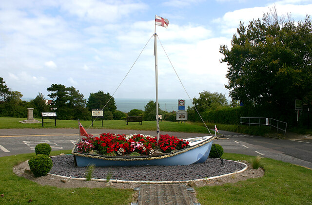
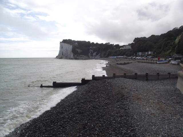
West Cliffe is a charming coastal town located in the county of Kent, in southeastern England. Situated on the eastern edge of the Isle of Thanet, it offers stunning views of the North Sea and boasts a rich history dating back to ancient times. The town is known for its picturesque sandy beaches, breathtaking cliffs, and a laid-back atmosphere, making it a popular destination for holidaymakers and locals alike.
One of the main attractions in West Cliffe is its beautiful coastline, with miles of pristine sandy beaches. Visitors can enjoy leisurely walks along the promenade, soak up the sun, or take a refreshing dip in the sea. The iconic West Cliffe Clock Tower, situated on the seafront, is a prominent landmark and a popular meeting point for locals and tourists.
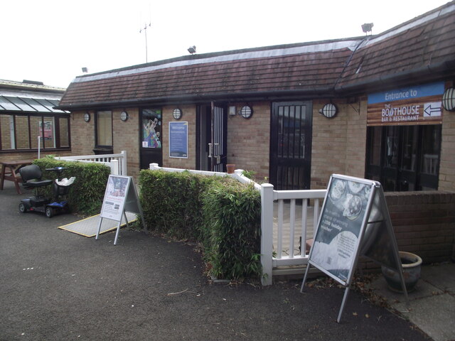
In addition to its natural beauty, West Cliffe offers a range of amenities and attractions to cater to visitors' needs. The town center features a variety of shops, cafes, and restaurants, providing plenty of options for shopping and dining. For history enthusiasts, there are several historical sites to explore, including the 12th-century St. Mary's Church and the ruins of Richborough Roman Fort, which date back to the Roman occupation of Britain.
West Cliffe is well-connected to other parts of Kent and London, with excellent transportation links. The town has its own train station, providing easy access to nearby cities and towns. Overall, West Cliffe offers a delightful blend of natural beauty, cultural heritage, and modern amenities, making it a desirable destination for a peaceful seaside getaway.
If you have any feedback on the listing, please let us know in the comments section below.
West Cliffe Images
Images are sourced within 2km of 51.153917/1.3573584 or Grid Reference TR3444. Thanks to Geograph Open Source API. All images are credited.
![A walk from St Margaretâs at Cliffe to Kingsdown and return [49] The view looking southwest from the track. The twin towers of the transmitting station at Dover are seen in the far distance.
Starting from the Dover Patrol Monument, the walk follows the long distance Saxon Shore Way along the top of the cliffs before descending to the bay at Kingsdown. Heading inland there is an ascent of Wood Hill before various rights of way run across fields to the wonderfully named Otty Bottom, then on to Free Down and a return to the starting point. A little more than 5 miles.](https://s2.geograph.org.uk/geophotos/07/08/62/7086234_feaa026b.jpg)
![A walk from St Margaretâs at Cliffe to Kingsdown and return [51] From the bridleway, this footpath runs to Old Bottom Free Down then on to Ringwould.
Starting from the Dover Patrol Monument, the walk follows the long distance Saxon Shore Way along the top of the cliffs before descending to the bay at Kingsdown. Heading inland there is an ascent of Wood Hill before various rights of way run across fields to the wonderfully named Otty Bottom, then on to Free Down and a return to the starting point. A little more than 5 miles.](https://s0.geograph.org.uk/geophotos/07/08/68/7086844_588697a9.jpg)
![A walk from St Margaretâs at Cliffe to Kingsdown and return [52] From the track, a public bridleway, this track leads to Little Banks.
Starting from the Dover Patrol Monument, the walk follows the long distance Saxon Shore Way along the top of the cliffs before descending to the bay at Kingsdown. Heading inland there is an ascent of Wood Hill before various rights of way run across fields to the wonderfully named Otty Bottom, then on to Free Down and a return to the starting point. A little more than 5 miles.](https://s1.geograph.org.uk/geophotos/07/08/68/7086845_349942ee.jpg)
![A walk from St Margaretâs at Cliffe to Kingsdown and return [53] The well surfaced track, now an 'other route with public access', continues to head towards Free Down.
Starting from the Dover Patrol Monument, the walk follows the long distance Saxon Shore Way along the top of the cliffs before descending to the bay at Kingsdown. Heading inland there is an ascent of Wood Hill before various rights of way run across fields to the wonderfully named Otty Bottom, then on to Free Down and a return to the starting point. A little more than 5 miles.](https://s2.geograph.org.uk/geophotos/07/08/68/7086846_cb6d6b13.jpg)
![A walk from St Margaretâs at Cliffe to Kingsdown and return [54] This footpath leaves the track and heads towards Bockell Hill.
Starting from the Dover Patrol Monument, the walk follows the long distance Saxon Shore Way along the top of the cliffs before descending to the bay at Kingsdown. Heading inland there is an ascent of Wood Hill before various rights of way run across fields to the wonderfully named Otty Bottom, then on to Free Down and a return to the starting point. A little more than 5 miles.](https://s3.geograph.org.uk/geophotos/07/08/68/7086847_66b904e3.jpg)
![A walk from St Margaretâs at Cliffe to Kingsdown and return [55] A view back along the track, seen from where the footpath to Bockell Hill branches off.
Starting from the Dover Patrol Monument, the walk follows the long distance Saxon Shore Way along the top of the cliffs before descending to the bay at Kingsdown. Heading inland there is an ascent of Wood Hill before various rights of way run across fields to the wonderfully named Otty Bottom, then on to Free Down and a return to the starting point. A little more than 5 miles.](https://s0.geograph.org.uk/geophotos/07/08/68/7086848_95fa9eda.jpg)
![A walk from St Margaretâs at Cliffe to Kingsdown and return [56] A view along the track, seen from where the footpath to Bockell Hill branches off.
Starting from the Dover Patrol Monument, the walk follows the long distance Saxon Shore Way along the top of the cliffs before descending to the bay at Kingsdown. Heading inland there is an ascent of Wood Hill before various rights of way run across fields to the wonderfully named Otty Bottom, then on to Free Down and a return to the starting point. A little more than 5 miles.](https://s1.geograph.org.uk/geophotos/07/08/68/7086849_4eb9e9ff.jpg)
![A walk from St Margaretâs at Cliffe to Kingsdown and return [57] The foot descends towards Bockell Hill through this area of woodland.
Starting from the Dover Patrol Monument, the walk follows the long distance Saxon Shore Way along the top of the cliffs before descending to the bay at Kingsdown. Heading inland there is an ascent of Wood Hill before various rights of way run across fields to the wonderfully named Otty Bottom, then on to Free Down and a return to the starting point. A little more than 5 miles.](https://s2.geograph.org.uk/geophotos/07/08/68/7086850_62f7cc05.jpg)
![A walk from St Margaretâs at Cliffe to Kingsdown and return [58] After passing through woodland, the path to Bockell Hill emerges into open fields.
Starting from the Dover Patrol Monument, the walk follows the long distance Saxon Shore Way along the top of the cliffs before descending to the bay at Kingsdown. Heading inland there is an ascent of Wood Hill before various rights of way run across fields to the wonderfully named Otty Bottom, then on to Free Down and a return to the starting point. A little more than 5 miles.](https://s3.geograph.org.uk/geophotos/07/08/68/7086851_b6420cae.jpg)
![A walk from St Margaretâs at Cliffe to Kingsdown and return [59] This tall concrete post is alongside the path, purpose unknown. Another of these objects is seen at <a href="https://www.geograph.org.uk/photo/7086232">TR3646 : A walk from St Margaret&rsquo;s at Cliffe to Kingsdown and return [47]</a>
Starting from the Dover Patrol Monument, the walk follows the long distance Saxon Shore Way along the top of the cliffs before descending to the bay at Kingsdown. Heading inland there is an ascent of Wood Hill before various rights of way run across fields to the wonderfully named Otty Bottom, then on to Free Down and a return to the starting point. A little more than 5 miles.](https://s0.geograph.org.uk/geophotos/07/08/68/7086852_49fac359.jpg)
![A walk from St Margaretâs at Cliffe to Kingsdown and return [62] This footpath leaves The Droveway and descends to Salisbury Road.
Starting from the Dover Patrol Monument, the walk follows the long distance Saxon Shore Way along the top of the cliffs before descending to the bay at Kingsdown. Heading inland there is an ascent of Wood Hill before various rights of way run across fields to the wonderfully named Otty Bottom, then on to Free Down and a return to the starting point. A little more than 5 miles.](https://s3.geograph.org.uk/geophotos/07/08/68/7086855_f445db2d.jpg)
![A walk from St Margaretâs at Cliffe to Kingsdown and return [63] The footpath from The Droveway ends at Salisbury Road.
Starting from the Dover Patrol Monument, the walk follows the long distance Saxon Shore Way along the top of the cliffs before descending to the bay at Kingsdown. Heading inland there is an ascent of Wood Hill before various rights of way run across fields to the wonderfully named Otty Bottom, then on to Free Down and a return to the starting point. A little more than 5 miles.](https://s0.geograph.org.uk/geophotos/07/08/68/7086856_28be4b1f.jpg)
![A walk from St Margaretâs at Cliffe to Kingsdown and return [64] The view from the junction of Granville Road and Hotel Road. Ness Point is seen in the distance.
Starting from the Dover Patrol Monument, the walk follows the long distance Saxon Shore Way along the top of the cliffs before descending to the bay at Kingsdown. Heading inland there is an ascent of Wood Hill before various rights of way run across fields to the wonderfully named Otty Bottom, then on to Free Down and a return to the starting point. A little more than 5 miles.](https://s1.geograph.org.uk/geophotos/07/08/68/7086857_cc6d2c45.jpg)
![St Margaret's at Cliffe buildings [1] Cliffe House, High Street, was built circa 1830. Constructed of painted brick with rendered quoins and a hipped slate roof. Now flats. Listed, grade II, with details at: <span class="nowrap"><a title="https://historicengland.org.uk/listing/the-list/list-entry/1101769" rel="nofollow ugc noopener" href="https://historicengland.org.uk/listing/the-list/list-entry/1101769">Link</a><img style="margin-left:2px;" alt="External link" title="External link - shift click to open in new window" src="https://s1.geograph.org.uk/img/external.png" width="10" height="10"/></span>
St Margaret’s at Cliffe is a coastal village some 3 miles northeast of Dover. The village is the place in Britain that is nearest to the coast of France, 18 miles distant. The area has been settled since Anglo-Saxon times, and the village became a high class resort in the nineteenth century. The area has always been at the front line of cross Channel conflicts.](https://s3.geograph.org.uk/geophotos/07/08/68/7086863_1b38ce43.jpg)
![St Margaret's at Cliffe buildings [2] This large building was originally a series of outbuildings to Cliffe House <a href="https://www.geograph.org.uk/photo/7086863">TR3544 : St Margaret's at Cliffe buildings [1]</a>. Constructed at various dates from the 18th century to the end of the 19th century. Constructed of brick, partly weatherboarded, partly rendered, partly painted, under a mix of slate and tile roofs. Until recently, a hotel, now holiday accommodation. Listed, for group value, grade II, with details at: <span class="nowrap"><a title="https://historicengland.org.uk/listing/the-list/list-entry/1363365" rel="nofollow ugc noopener" href="https://historicengland.org.uk/listing/the-list/list-entry/1363365">Link</a><img style="margin-left:2px;" alt="External link" title="External link - shift click to open in new window" src="https://s1.geograph.org.uk/img/external.png" width="10" height="10"/></span>
St Margaret’s at Cliffe is a coastal village some 3 miles northeast of Dover. The village is the place in Britain that is nearest to the coast of France, 18 miles distant. The area has been settled since Anglo-Saxon times, and the village became a high class resort in the nineteenth century. The area has always been at the front line of cross Channel conflicts.](https://s2.geograph.org.uk/geophotos/07/08/68/7086866_997eeb12.jpg)
West Cliffe is located at Grid Ref: TR3444 (Lat: 51.153917, Lng: 1.3573584)
Administrative County: Kent
District: Dover
Police Authority: Kent
What 3 Words
///intrigues.festivity.aquatics. Near Dover, Kent
Nearby Locations
Related Wikis

West Cliffe
West Cliffe or Westcliffe is a village and former civil parish, now in the parish of St. Margaret's At Cliffe, in the Dover district, in east Kent, England...

St Margaret's at Cliffe
St. Margaret's at Cliffe is a three-part village situated just off the coast road between Deal and Dover in Kent, England. The centre of the village is...

Dover to Kingsdown Cliffs
Dover to Kingsdown Cliffs is a 207.7-hectare (513-acre) biological and geological Site of Special Scientific Interest which runs along the Kent coast between...

South Foreland
South Foreland is a chalk headland on the Kent coast of southeast England. It presents a bold cliff to the sea, and commands views over the Strait of Dover...
Nearby Amenities
Located within 500m of 51.153917,1.3573584Have you been to West Cliffe?
Leave your review of West Cliffe below (or comments, questions and feedback).